Buffer Strip on Steep Sloping Cropland [طاجيكستان]
- تاريخ الإنشاء:
- تحديث:
- جامع المعلومات: Erik Bühlmann
- المحرر: –
- المُراجع: David Streiff
technologies_1003 - طاجيكستان
عرض الأقسام
توسيع الكل طي الكل1. معلومات عامة
1.2 تفاصيل الاتصال بالأشخاص الرئيسيين لمصدر المعلومات والمؤسسات المشاركة في تقييم وتوثيق التقنية
متخصص في الإدارة المستدامة للأراضي:
اسم المؤسسة (المؤسسات) التي سهلت توثيق/تقييم التقنية (إذا كان ذلك على صلة)
CDE Centre for Development and Environment (CDE Centre for Development and Environment) - سويسرااسم المؤسسة (المؤسسات) التي سهلت توثيق/تقييم التقنية (إذا كان ذلك على صلة)
NCCR North-South (NCCR North-South) - قرغيزستان1.3 الشروط المتعلقة باستخدام البيانات الموثقة من خلال WOCAT
متى تم تجميع البيانات (ميدانيا)؟:
16/07/2005
يوافق جامع المعلومات والشخص (لاشخاص) الرئيسي لمصدر المعلومات على الشروط المتعلقة باستخدام البيانات الموثقة من خلال WOCAT:
نعم
2. وصف تقنيةالإدارة المستدامي للأراضي
2.1 وصف مختصر للتقنية
تعريف التقنية:
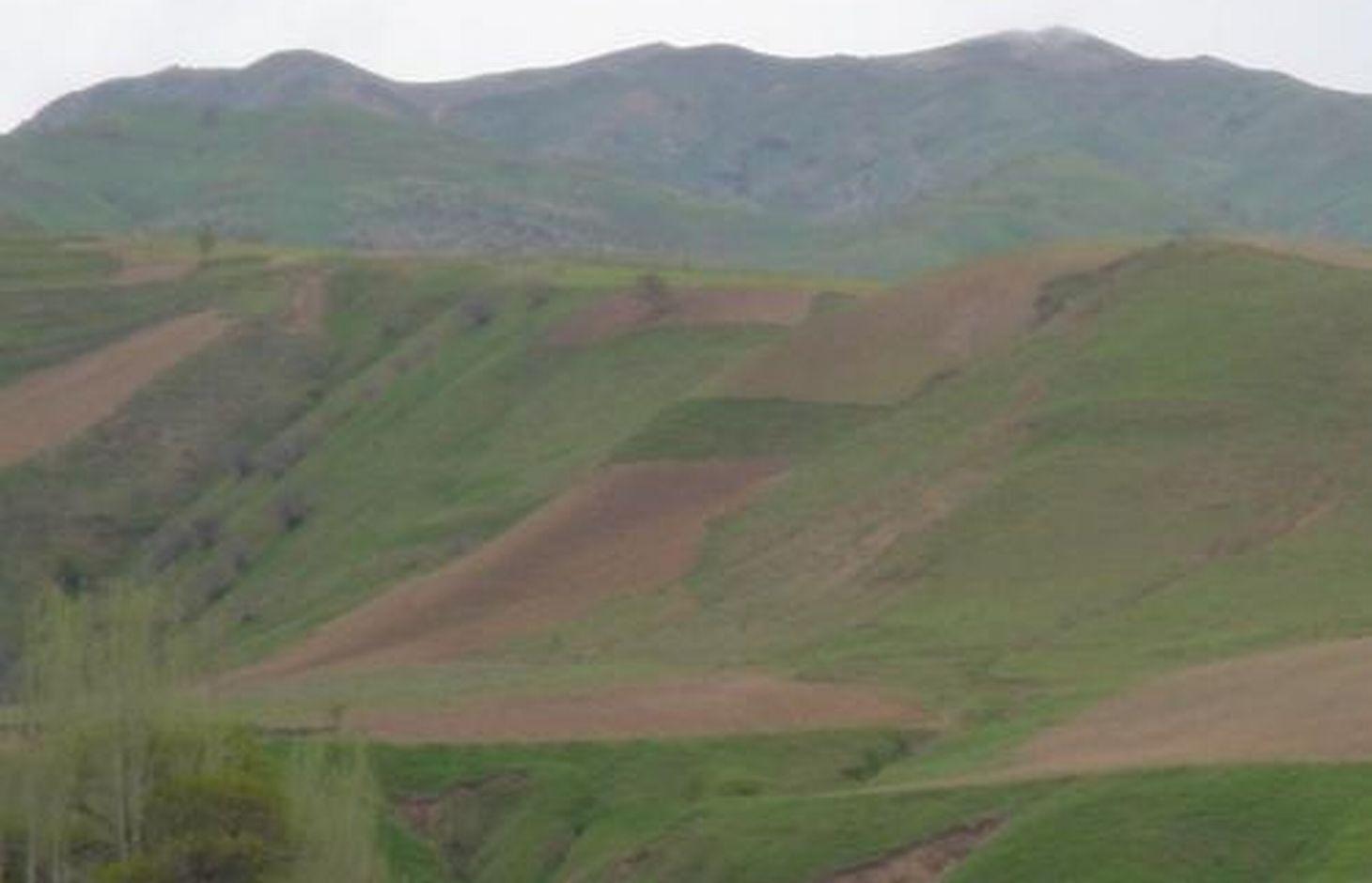
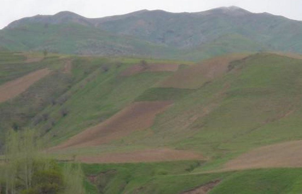
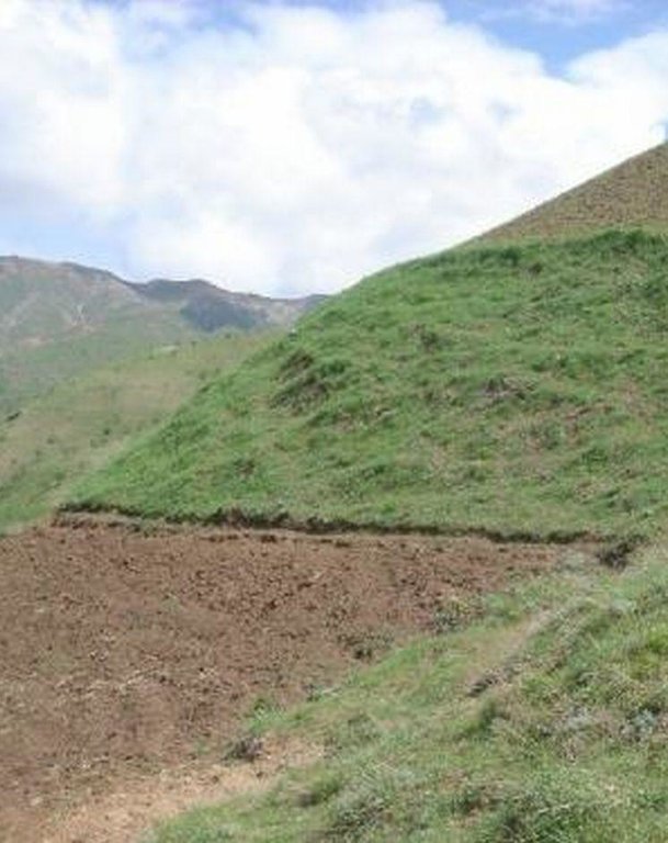
A buffer strip of grass is left uncultivated in the middle of an area of steep sloping cropland to help reduce soil erosion.
2.2 وصف تفصيلي للتقنية
الوصف:
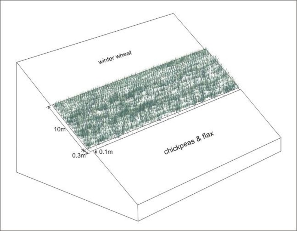
A grass strip, approximately 10m wide is left uncultivated across the upper part of the slope. This buffer strip is followed by an adjacent drainage ditch to enhance the technology’s capability of reducing run-on onto the field further down the slope. Neighbouring land users decided to implement the technology in order to reduce soil erosion on their cropland (wheat, chickpeas and flax), and to prevent disputes about land management practices. Upslope and downslope land users reported a significant reduction of observed rill development and fertility decline, emphasising that the benefits of the grass strip offset the area of crop land lost to it. The farmers paid equally for the lost cropland area.
Establishment / maintenance activities and inputs: Apart from the annual digging of the drainage ditch no establishment activities are required, since the grass strip was simply left uncultivated when the former pasture was turned into cropland. The drainage ditch needs to be cleared out of soil on a regular basis; the grass strip is cut for haymaking once during each growing season. The technology is neither cost nor labour intensive and is easy to implement. Farmers state the area lost to the grass growing as the only disadvantage. However, the grass strip alone does only reduce, not fully prevent soil erosion and should therefore be combined with other SWC technologies such as drainage ditches, terraces and/or agroforestry.
2.3 صور التقنية
2.5 البلد/المنطقة/المواقع التي تم تنفيذ التقنية فيها والتي يغطيها هذا التقييم
البلد:
طاجيكستان
المنطقة/الولاية/المحافظة:
RRS
مزيد من التفاصيل حول الموقع:
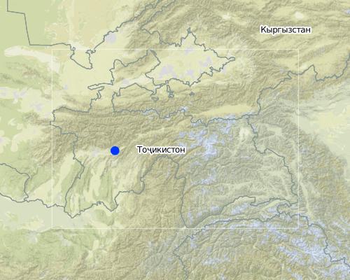
Faizabad
Map
×2.7 إدخال التقنية
حدد كيف تم إدخال التقنية:
- أثناء التجارب/الأبحاث
3. تصنيف تقنية الإدارة المستدامي للأراضي
3.1 الغرض الرئيسي ( الأغراض الرئيسية) للتقنية
- الحد من تدهور الأراضي ومنعه وعكسه
3.2 نوع (أنواع) استخدام الأراضي الحالية حيث يتم تطبيق التقنية

الأراضي الزراعية
- زراعة سنوية
المحاصيل الرئيسية (المحاصيل النقدية والغذائية):
major food crop: wheat
other: chickpeas, flax
التعليقات:
Major land use problems (compiler’s opinion): severe water erosion (rills and gullies) and subsequent fertility decline
Major land use problems (land users’ perception): fertility decline, soil erosion and washing downslope of seeds before they can sprout.
Type of cropping system and major crops comments: winter wheat and sometimes chickpeas are sown in autumn because farmers lack time for land cultivation in spring, flax and also chickpeas are cultivated in spring
3.3 مزيد من المعلومات حول استخدام الأراضي
عدد مواسم الزراعة في السنة:
- 1
حدد:
Longest growing period in days: 210Longest growing period from month to month: Mar - Aug
3.4 مجموعةالإدارة المستدامة للأراضي التي تنتمي إليها هذه التقنية
- تحسين الغطاء الأرضي/النباتي
- التدابير المتقاطعة للمنحدرات
3.5 انتشار التقنية
حدد انتشار التقنية:
- منتشرة بالتساوي على مساحة
إذا كانت التقنية منتشرة بالتساوي على منطقة ما، فحدد المنطقة التقريبية المغطاة:
- < 0.1 كم2 (10 هكتار)
3.6 التدابير التقنية في مجال إلادارة المستدامة للأراضي

التدابير الزراعية
- A1: الغطاء النباتي/التربة

التدابير النباتية
- V2: الأعشاب والنباتات العشبية المعمرة
التعليقات:
Main measures: vegetative measures
Secondary measures: agronomic measures
Type of vegetative measures: aligned: -contour
3.7 الأنواع الرئيسية من تدهور الأراضي التي تناولتها التقنية

تآكل التربة بالمياه
- الوزن(Wt): فقدان التربة السطحية/تآكل السطح
- (Wg):الانجراف الخلجاني/ الخلجان

التدهور الكيميائي للتربة
- (Cn): تراجع الخصوبة وانخفاض محتوى المادة العضوية (غير ناتج عن الانجراف)
التعليقات:
Main type of degradation addressed: Wt: loss of topsoil / surface erosion
Secondary types of degradation addressed: Wg: gully erosion / gullying, Cn: fertility decline and reduced organic matter content
3.8 منع أو حد أو عكس تدهور الأراضي
تحديد هدف التقنية فيما يتعلق بتدهور الأراضي:
- منع تدهور الأراضي
- الحد من تدهور الأراضي
التعليقات:
Main goals: mitigation / reduction of land degradation
Secondary goals: prevention of land degradation
4. المواصفات الفنية، وأنشطة التنفيذ، والمدخلات، والتكاليف
4.1 الرسم الفني للتقنية
4.2 المواصفات الفنية/شروحات الرسم الفني
Grass strip with adjacent drainage ditch on an area of steep sloping cropland
Location: Karsang. Faizabad Rayon, RRS
Date: 16.07.2005
Technical knowledge required for field staff / advisors: low
Technical knowledge required for land users: low
Main technical functions: control of dispersed runoff: impede / retard, control of concentrated runoff: impede / retard, reduction of slope length
Secondary technical functions: control of concentrated runoff: drain / divert, improvement of ground cover, increase of infiltration, increase / maintain water stored in soil
Agronomic measure: drainage ditch
Remarks: width: 0.3m, depth: 0.1m, adjacent to grass strip
Aligned: -contour
Vegetative material: G : grass
Width within rows / strips / blocks (m): 10
Slope (which determines the spacing indicated above): 60%
4.3 معلومات عامة بخصوص حساب المدخلات والتكاليف
حدد العملة المستخدمة لحساب التكاليف:
- دولار أمريكي
اذكر متوسط تكلفة أجر العمالة المستأجرة في اليوم الواحد:
3.00
4.4 أنشطة التأسيس
| النشاط | نوع التدبير | التوقيت | |
|---|---|---|---|
| 1. | no establishment activities needed as grass strip is left uncultivated | نباتية |
4.5 التكاليف والمدخلات اللازمة للتأسيس
التعليقات:
Duration of establishment phase: 0 month(s)
4.6 الصيانة/الأنشطة المتكررة
| النشاط | نوع التدبير | التوقيت/الوتيرة | |
|---|---|---|---|
| 1. | digging of drainage ditch | زراعية | sowing of crop / annual |
| 2. | clearing of drainage ditch from washed in soil | زراعية | rainy season / after every rainfall event |
| 3. | cutting of grass (haymaking) | نباتية | summer /annual |
4.7 التكاليف والمدخلات اللازمة للصيانة/للأنشطة المتكررة (سنويًا)
| تحديد المدخلات | الوحدة | الكمية | التكاليف لكل وحدة | إجمالي التكاليف لكل مدخل | % من التكاليف التي يتحملها مستخدمو الأراضي | |
|---|---|---|---|---|---|---|
| العمالة | digging of drainage ditch | ha | 1,0 | 1,0 | 1,0 | |
| العمالة | clearing of drainage ditch from washed in soil | ha | 1,0 | 3,0 | 3,0 | |
| إجمالي تكاليف صيانة التقنية | 4,0 | |||||
التعليقات:
Machinery/ tools: tools: spade, sickle
costs per hectare (including adjacent land upslope and dowslope)
4.8 أهم العوامل المؤثرة على التكاليف
قدم وصفا لأهم العوامل التي تؤثر على التكاليف:
If the technology is not established at the point of the initial cultivation of the cropland, grass clods will need to be transplanted which considerably increases the establishment costs
5. البيئة الطبيعية والبشرية
5.1 المناخ
هطول الأمطار السنوي
- < 250 مم
- 251- 500 ملم
- 501 - 750ملم
- 1,000-751 ملم
- 1,500-1,100 ملم
- 2,000-1,500 ملم
- 3,000-2,001 ملم
- 4,000-3,100 ملم
- > 4000 ملم
المنطقة المناخية الزراعية
- شبه رطبة
- شبه قاحلة
growing period 180-210 days
5.2 طوبوغرافيا
متوسط الانحدارات:
- مسطح (0-2%)
- بسيط (3-5%)
- معتدل (6-10%)
- متدحرج (11-15%)
- تلال (16-30%)
- شديدة الانحدار(31-60%)
- فائقة الانحدار (>60%)
التضاريس:
- هضاب/سهول
- أثلام مرتفعة
- المنحدرات الجبلية
- منحدرات التلال
- منحدرات في السفوح
- قاع الوادي
المنطقة الارتفاعية:
- 100-0 متر فوق سطح البحر
- 500-101 متر فوق سطح البحر
- 1,000-501 متر فوق سطح البحر
- 1,500-1,001 متر فوق سطح البحر
- 2,000-1,501 متر فوق سطح البحر
- 2,500-2,100 متر فوق سطح البحر
- 3,000-2,501 متر فوق سطح البحر
- 4,000-3,001 متر فوق سطح البحر
- > 4000 متر فوق سطح البحر
5.3 التربة
متوسط عمق التربة:
- ضحل جدًا (0-20 سم)
- ضحلة (21-50 سم)
- متوسطة العمق (51-80 سم)
- عميقة (81-120 سم)
- عميقة جدًا (> 120 سم)
قوام التربة (التربة السطحية):
- متوسط ( طميي، سلتي)
- ناعم/ثقيل (طيني)
المواد العضوية في التربة السطحية:
- متوسطة (1-3%)
- منخفضة (<1%)
إذا كان متاحًا، قم بإرفاق وصف كامل للتربة أو تحديد المعلومات المتوفرة، على سبيل المثال نوع التربة، الرقم الهيدروجيني/ درجة حموضة التربة، قدرة التبادل الكاتيوني، النيتروجين، الملوحة وما إلى ذلك.
Soil fertility: medium - high
Soil drainage / infiltration: medium - good
5.6 خصائص مستخدمي الأراضي الذين يطبقون التقنية
التوجه السوقي لنظام الإنتاج:
- الكفاف (الإمداد الذاتي)
- مختلط (كفاف/ تجاري)
الدخل من خارج المزرعة:
- >50% من إجمالي الدخل
المستوى النسبي للثروة:
- متوسط
مستوى المكننة:
- عمل يدوي
اذكر الخصائص الأخرى ذات الصلة لمستخدمي الأراضي:
75% of the land users are average wealthy and own 70% of the land (since technology requires space, poor and very poor farmers will find it difficult to implement).
Off-farm income specification: In general, all farmers (including those applying SWC technologies) are highly dependent on off-farm income, which in most cases is earned in Russia either by themselves or by their relatives.
Level of mechanization: Steep slopes do not allow cultivation by tractor or animal traction
Market orientation of production system mixed (subsistence/ commercial): Only surpluses are sold or exchanged for other goods
5.7 متوسط مساحة الأرض المملوكة أو المستأجرة من قبل مستخدمي الأراضي الذين يطبقون التقنية
- < 0.5 هكتارا
- 0.5 - 1 هكتار
- 1 -2 هكتار
- 2 - 5 هكتار
- 5 - 15 هكتار
- 15 - 50 هكتار
- 50 - 100هكتار
- 500-100 هكتار
- 1,000-500 هكتار
- 10,000-1,000 هكتار
- > 10,000 هكتار
التعليقات:
Average area of land owned or leased by land users applying the Technology also 0.5-1 ha
5.8 ملكية الأراضي، وحقوق استخدام الأراضي، وحقوق استخدام المياه
ملكية الارض:
- دولة
حقوق استخدام الأراضي:
- مؤجر
6. الآثار والتصريحات الختامية
6.1 الآثار التي أظهرتها التقنية في الموقع
الآثار الاجتماعية والاقتصادية
الإنتاج
إنتاج المحاصيل
منطقة الإنتاج
التعليقات/ حدد:
loss of land for crop production
الدخل والتكاليف
دخل المزرعة
الآثار الاجتماعية والثقافية
المؤسسات المجتمعية
الآثار الايكولوجية
التربة
رطوبة التربة
غطاء التربة
فقدان التربة
التعليقات/ حدد:
prevented formation of large rills
الآثار الايكولوجية الأخرى
soil fertility
6.2 الآثار التي أظهرتها التقنية خارج الموقع
الفيضان في اتجاه مجرى النهر
6.4 تحليل التكلفة والعائد
كيف يمكن مقارنة العوائد نسبة لتكاليف الإنشاء (من وجهة نظر مستخدمي الأراضي)؟
عوائد قصيرة الأجل:
إيجابي
عوائد طويلة الأجل:
إيجابي
كيف تتم مقارنة العوائدمع كلفة الصيانة/التكاليف المتكررة (من وجهة نظر مستخدمي الأراضي)؟
عوائد قصيرة الأجل:
إيجابي
عوائد طويلة الأجل:
إيجابي
6.5 اعتماد التقنية
- حالات فردية/تجريبية
إذا كان متاحًا، قم بتحديد الكمية (عدد الأسر المعيشية و/أو المساحةالمغطاة):
Household 1
من بين جميع الذين تبنوا التقنية، كم عدد الذين فعلوا ذلك بشكل تلقائي، أي دون تلقي أي حوافز مادية/مدفوعات؟:
- 100-90%
التعليقات:
100% of land user families have adopted the Technology without any external material support
1 land user families have adopted the Technology without any external material support
Comments on spontaneous adoption: estimates
There is no trend towards spontaneous adoption of the Technology
Comments on adoption trend: no other land users have adopted the technology so far
6.7 نقاط القوة / المزايا / الفرص التي توفرها التقنية
| نقاط القوة/ المزايا/ الفرص من وجهة نظر مستخدمي الأراضي |
|---|
| protects his land from water erosion |
| prevents downslope washing of seeds before germination |
| no conflicts about land management with neighbours upslope |
| defines field boundaries |
| نقاط القوة/ المزايا/ الفرص من وجهة نظر جامع المعلومات أو غيره من الاشخاص الرئيسيين لمصدر المعلومات |
|---|
|
effectively reduces formation of large rills on steep sloping cropland How can they be sustained / enhanced? substitution of drainage ditch with a permanent cut-off drain (graded) would enhance the technologies capability of reducing soil erosion |
| very little costs for establishment and maintainance |
| easy to implement, easy to maintain |
| helps to prevent disputes between neighbouring land users about land management practices |
6.8 نقاط ضعف / مساوىء / مخاطر التقنية وسبل التغلب عليها
| نقاط الضعف/ المساوىء/ المخاطر من وجهة نظر مستخدم الأراضي | كيف يمكن التغلب عليها؟ |
|---|---|
| loss of cropland area only disadvantage |
| نقاط الضعف/ المساوىء/ المخاطر من وجهة نظر جامع المعلومات أو غيره من الاشخاص الرئيسيين لمصدر المعلومات | كيف يمكن التغلب عليها؟ |
|---|---|
| does only reduce, not fully prevent soil erosion | combination with other SWC technologies, such as graded drainage ditches (TAJ10) |
| occupies a relatively large amount of space |
الروابط والوحدات المواضيعية
توسيع الكل طي الكلالروابط
لا يوجد روابط
الوحدات المواضيعية
لا يوجد وحدات مواضيعية


