Jessour [تونس]
- تاريخ الإنشاء:
- تحديث:
- جامع المعلومات: Mongi Ben Zaied
- المحرر: –
- المُراجع: Fabian Ottiger
Jesser, Katra, Tabias (Arabic)
technologies_1013 - تونس
عرض الأقسام
توسيع الكل طي الكل1. معلومات عامة
1.2 تفاصيل الاتصال بالأشخاص الرئيسيين لمصدر المعلومات والمؤسسات المشاركة في تقييم وتوثيق التقنية
الشخص (الأشخاص) الرئيسي لمصدر المعلومات
متخصص في الإدارة المستدامة للأراضي:
Mongi Sghaier
+216 75 633 005
Institut des Régions Arides IRA
4119 Medenine - Tunisia
تونس
متخصص في الإدارة المستدامة للأراضي:
Mongi Chniter
+21671 564 939
Commissariats Régionaux au Développement Agricole CRDA
Cité Bouchoucha - le Bardo 2000
تونس
متخصص في الإدارة المستدامة للأراضي:
Ouessar Mohammed
+216 75 633 005
Institut des Régions Arides IRA
4119 Medenine - Tunisia
تونس
اسم المؤسسة (المؤسسات) التي سهلت توثيق/تقييم التقنية (إذا كان ذلك على صلة)
Institut des Régions Arides de Médenine (Institut des Régions Arides de Médenine) - تونساسم المؤسسة (المؤسسات) التي سهلت توثيق/تقييم التقنية (إذا كان ذلك على صلة)
Commissariats Régionaux au Développement Agricole (CRDA) - تونس1.3 الشروط المتعلقة باستخدام البيانات الموثقة من خلال WOCAT
متى تم تجميع البيانات (ميدانيا)؟:
22/09/2008
يوافق جامع المعلومات والشخص (لاشخاص) الرئيسي لمصدر المعلومات على الشروط المتعلقة باستخدام البيانات الموثقة من خلال WOCAT:
نعم
2. وصف تقنيةالإدارة المستدامي للأراضي
2.1 وصف مختصر للتقنية
تعريف التقنية:
Jessour is an ancient runoff water harvesting technique widely practiced in the arid highlands
2.2 وصف تفصيلي للتقنية
الوصف:
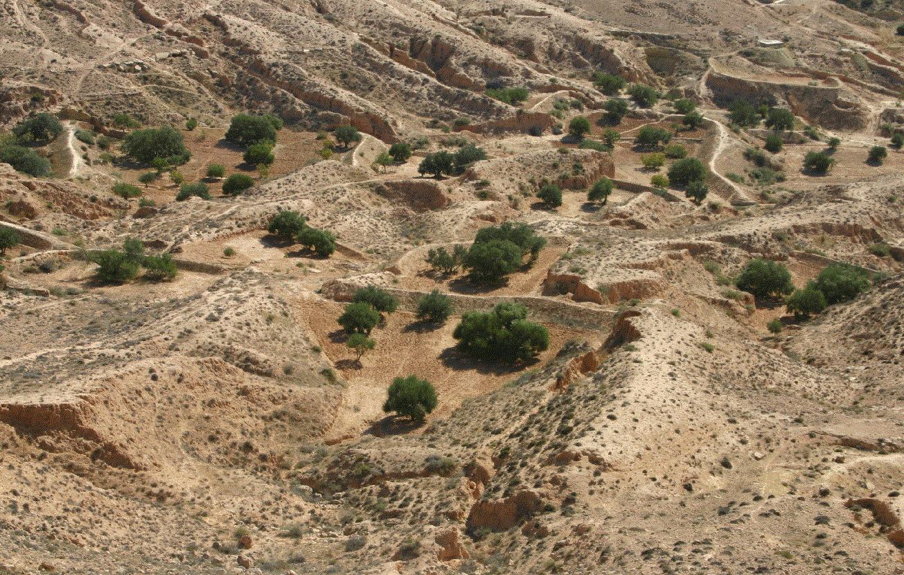
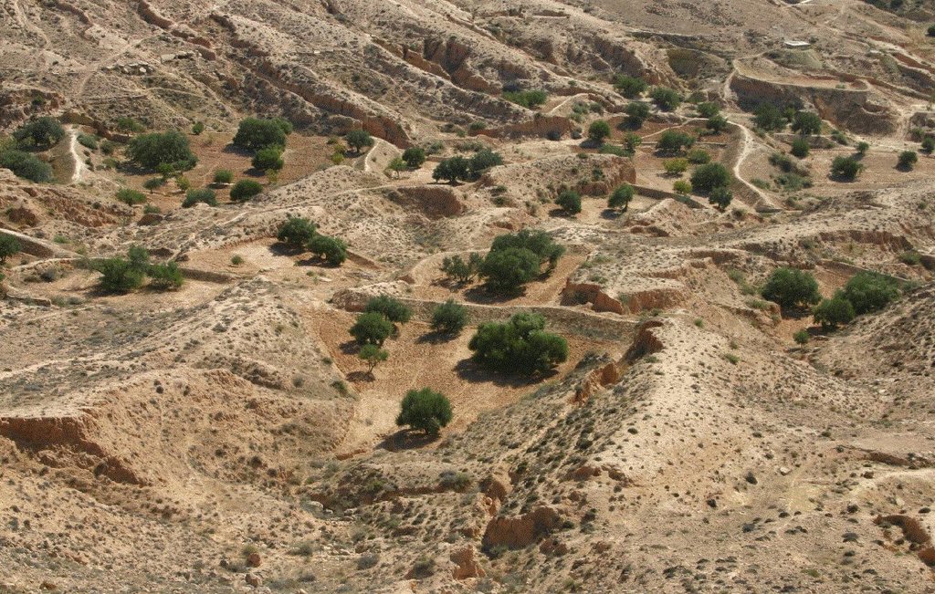
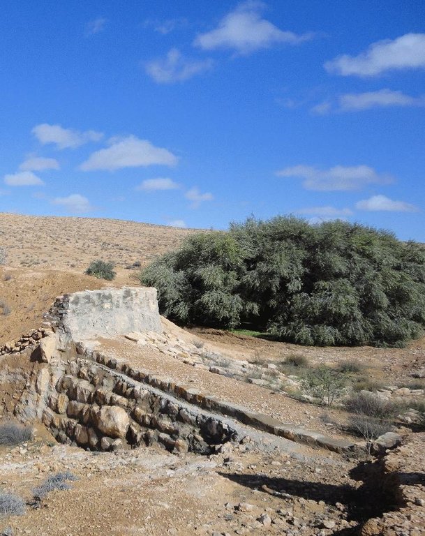
Jessour technology is generally practised in mountain dry regions (less than 200 mm annually) with medium to high slopes. This technology was behind the installation of very old olive orchards based on rainfed agriculture in rugged landscapes which allowed the local population not only to ensure self-sufficiency but also to provide neighbouring areas many agricultural produces (olive oil, dried figs, palm dates, etc.).
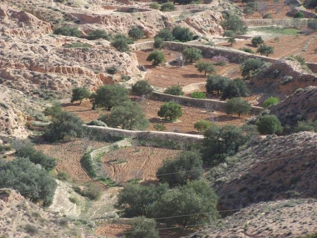
Jessour is the plural of jessr, which is a hydraulic unit made of three components: the impluvium, the terrace and the dyke. The impluvium or the catchment is the area which collects and conveys runoff water. It is bordered by a natural water divide line (a line that demarcates the boundary of a natural area or catchment, so that all the rain that falls on this area is concentrated and drained towards the same outlet). Each unit has its own impluvium, but can also receive excess water from upstream units. The terrace or cropping zone is the area in which farming is practised. It is formed progressively by the deposition of sediment. An artificial soil will then be created, which can be up to 5 m deep close to the dyke. Generally, fruit trees (e.g. olive, fig, almond, and date palm), legumes (e.g. pea, chickpeas, lentil, and faba bean) and barley and wheat are cultivated on these terraces.
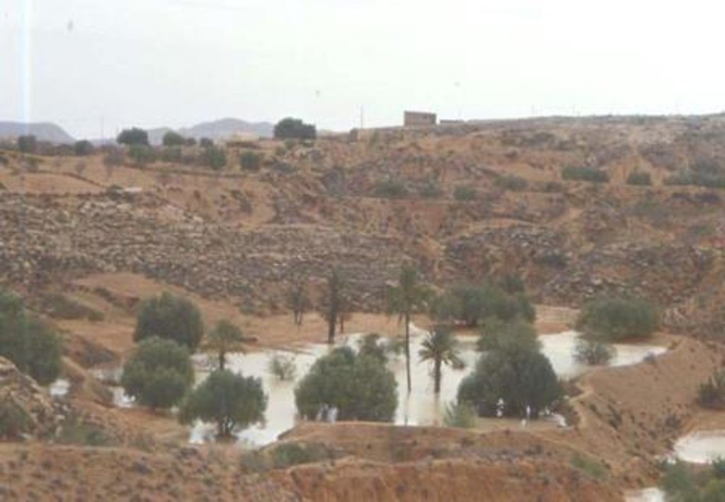
Purpose of the Technology: Although the jessour technique was developed for the production of various agricultural crops, it now also plays three additional roles: (1) aquifer recharge, via runoff water infiltration into the terraces, (2) flood control and therefore the protection of infrastructure and towns built downstream, and (3) wind erosion control, by preventing sediment from reaching the downstream plains, where windspeeds can be particularly high.
Establishment / maintenance activities and inputs: In the Jessour, a dyke (tabia, sed, katra) acts as a barrier used to hold back sediment and runoff water. Such dykes are made of earth, and are equipped with a central and/or lateral spillway (masref and/or manfes) and one or two abutments (ktef), assuring the evacuation of excess water. They are trapezoidal and measure 15-50 m in length, 1-4 m in width and 2-5 m in height. In old units, the dyke is stabilised with a covering of dry stones to overcome the erosive effects of water wave action on the front and back of the dyke. The spillway is made of stones arranged in the form of stairs, in order to dissipate the kinetic energy of the overflow.
This technology is currently encountered in the mountain ranges of Matmata of South Eastern Tunisia where the local agricultural activities are based mainly on rainfed agriculture and livestock breeding. However, high rates of migration to cities may threaten the long-term maintenance of those structures.
2.3 صور التقنية
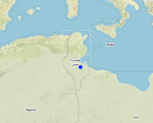
2.5 البلد/المنطقة/المواقع التي تم تنفيذ التقنية فيها والتي يغطيها هذا التقييم
البلد:
تونس
المنطقة/الولاية/المحافظة:
Medenine
مزيد من التفاصيل حول الموقع:
Beni Khedache
التعليقات:
This technology is developed mainly in the upstream areas of the study watershed (mountainous zone of Béni Khédache).
Map
×2.6 تاريخ التنفيذ
في حالة عدم معرفة السنة بالتحديد، يرجى الإشارة إلى التاريخ التقريبي:
- منذ أكثر من 50 عامًا (تقليدي)
2.7 إدخال التقنية
حدد كيف تم إدخال التقنية:
- كجزء من النظام التقليدي (> 50 عامًا)
التعليقات (نوع المشروع، الخ):
Jessour is an ancient runoff water harvesting technique widely practiced in the arid highlands, which are dominated by outcroppings of calcareous formations and depositions of quaternary calcareous silt.
3. تصنيف تقنية الإدارة المستدامي للأراضي
3.2 نوع (أنواع) استخدام الأراضي الحالية حيث يتم تطبيق التقنية

الأراضي الزراعية
- زراعة سنوية
- زراعة الأشجار والشجيرات
المحاصيل الرئيسية (المحاصيل النقدية والغذائية):
Major cash crops: Olive oil, fig, cereals
Major food crops: Olive oil, legumes, fig, other fruits
التعليقات:
Major land use problems (compiler’s opinion): Loss of surface water (runoff), problems of flooding, water erosion, soil degradation, drought
Future (final) land use (after implementation of SLM Technology): Cropland: Ct: Tree and shrub cropping
Livestock is grazing on crop residues
إذا تغير استخدام الأراضي بسبب التقنية، قم بالإشارة إلى استخدام الأرض قبل تنفيذ التقنية:
Grazing land: Ge: Extensive grazing land
3.3 مزيد من المعلومات حول استخدام الأراضي
إمدادات المياه للأرض التي يتم تنفيذ التقنية عليها:
- بعلية
التعليقات:
Water supply: rainfed, mixed rainfed - irrigated
عدد مواسم الزراعة في السنة:
- 1
حدد:
Longest growing period in days: 180Longest growing period from month to month: Oct - Mar
3.4 مجموعةالإدارة المستدامة للأراضي التي تنتمي إليها هذه التقنية
- مصد الريح/حزام حماية
- حصاد المياه
- إدارة الري (بما في ذلك إمدادات المياه والصرف الصحي)
3.5 انتشار التقنية
حدد انتشار التقنية:
- منتشرة بالتساوي على مساحة
إذا كانت التقنية منتشرة بالتساوي على منطقة ما، فحدد المنطقة التقريبية المغطاة:
- 1,000-100 كم2
التعليقات:
This technology is developed mainly in the upstream areas of the study watershed (mountainous zone of Béni Khédache). This system is based on runoff water harvesting for fruit trees cropping (mainly olives). The cropping areas are relatively small and rarely exceed 0.25 ha.
3.6 التدابير التقنية في مجال إلادارة المستدامة للأراضي

التدابير البنيوية
- الحواجز والضفاف
التعليقات:
Main measures: structural measures
3.7 الأنواع الرئيسية من تدهور الأراضي التي تناولتها التقنية

تآكل التربة بالمياه
- الوزن(Wt): فقدان التربة السطحية/تآكل السطح
- (Wg):الانجراف الخلجاني/ الخلجان
التعليقات:
Main type of degradation addressed: Wt: loss of topsoil / surface erosion
Secondary types of degradation addressed: Wg: gully erosion / gullying
Main causes of degradation: crop management (annual, perennial, tree/shrub), change of seasonal rainfall, Heavy / extreme rainfall (intensity/amounts), poverty / wealth
Secondary causes of degradation: soil management, overgrazing, land tenure
3.8 منع أو حد أو عكس تدهور الأراضي
تحديد هدف التقنية فيما يتعلق بتدهور الأراضي:
- منع تدهور الأراضي
- الحد من تدهور الأراضي
التعليقات:
Main goals: mitigation / reduction of land degradation
Secondary goals: prevention of land degradation
4. المواصفات الفنية، وأنشطة التنفيذ، والمدخلات، والتكاليف
4.1 الرسم الفني للتقنية
4.2 المواصفات الفنية/شروحات الرسم الفني
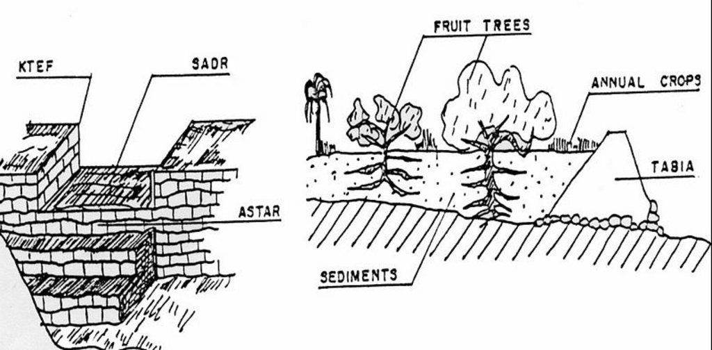
Left: Cross-section of dyke (locally called tabia) and terrace (cropping area).
The Jessour ensure the collection of both runoff water and sediments allowing creating very deep ‘artificial’ soils (terrace) which form a very good reservoir for water and nutrients to be used by fruit trees and annual crops.
Right: The spillway allows the overflow to the other Jessour downstream. It also represents the symbol of water sharing equity between different farmers in the same watershed. (Drawing adapted from El Amami (1984))
Location: Mountainous zone near Beni Khedache. Medenine
Date: 1984
Technical knowledge required for field staff / advisors: moderate
Technical knowledge required for land users: moderate
Main technical functions: increase of infiltration, sediment retention / trapping, sediment harvesting, harvesting of runoff water / water trapping
Secondary technical functions: control of concentrated runoff: retain / trap, improvement of ground cover, increase / maintain water stored in soil, increase of groundwater level / recharge of groundwater, increase of biomass (quantity)
Spillway
Height of bunds/banks/others (m): 2-5
Width of bunds/banks/others (m): 0.4-0.6
Length of bunds/banks/others (m): 2-6
Dam/ pan/ pond
Vertical interval between structures (m): 2-3
Spacing between structures (m): 30-70
Height of bunds/banks/others (m): 2-6
Width of bunds/banks/others (m): 1-5
Length of bunds/banks/others (m): 10-40
Construction material (earth): Main dyke
Construction material (stone): Spillway and in some cases the dyke (external coating)
Construction material (concrete): Occasionally for consolidation of the spillway.
Lateral gradient along the structure: <1%
Specification of dams/ pans/ ponds: Capacity 300-1000m3
Catchment area: 1-10ham2
Beneficial area: 0.01-1ham2
For water harvesting: the ratio between the area where the harvested water is applied and the total area from which water is collected is: 1:5
4.3 معلومات عامة بخصوص حساب المدخلات والتكاليف
عملة أخرى/ عملة وطنية (حدد):
TD
أشر إلى سعر الصرف من الدولار الأمريكي إلى العملة المحلية (إذا كان ذا صلة): 1 دولار أمريكي =:
1,3
اذكر متوسط تكلفة أجر العمالة المستأجرة في اليوم الواحد:
10.00
4.4 أنشطة التأسيس
| النشاط | نوع التدبير | التوقيت | |
|---|---|---|---|
| 1. | Dyke construction | بنيوية أو هيكلية | |
| 2. | Plantations | بنيوية أو هيكلية | |
| 3. | Spillway construction | بنيوية أو هيكلية |
4.5 التكاليف والمدخلات اللازمة للتأسيس
| تحديد المدخلات | الوحدة | الكمية | التكاليف لكل وحدة | إجمالي التكاليف لكل مدخل | % من التكاليف التي يتحملها مستخدمو الأراضي | |
|---|---|---|---|---|---|---|
| العمالة | Labour | ha | 1,0 | 1200,0 | 1200,0 | 100,0 |
| المواد النباتية | ha | 1,0 | 800,0 | 800,0 | 100,0 | |
| مواد البناء | ha | 1,0 | 1000,0 | 1000,0 | 100,0 | |
| إجمالي تكاليف إنشاء التقنية | 3000,0 | |||||
التعليقات:
Duration of establishment phase: 6 month(s)
4.6 الصيانة/الأنشطة المتكررة
| النشاط | نوع التدبير | التوقيت/الوتيرة | |
|---|---|---|---|
| 1. | Crop and trees maintenance | بنيوية أو هيكلية | Annually |
| 2. | Dyke and spillway maintenance | بنيوية أو هيكلية | |
| 3. | Repairs | بنيوية أو هيكلية | |
| 4. | Tillage (against soil sealing) | بنيوية أو هيكلية | |
| 5. | Tillage (against soil sealing) | بنيوية أو هيكلية | Annually and after rainy events |
4.7 التكاليف والمدخلات اللازمة للصيانة/للأنشطة المتكررة (سنويًا)
| تحديد المدخلات | الوحدة | الكمية | التكاليف لكل وحدة | إجمالي التكاليف لكل مدخل | % من التكاليف التي يتحملها مستخدمو الأراضي | |
|---|---|---|---|---|---|---|
| العمالة | Labour | ha | 1,0 | 400,0 | 400,0 | 100,0 |
| المواد النباتية | ha | 1,0 | 200,0 | 200,0 | 100,0 | |
| مواد البناء | ha | 1,0 | 300,0 | 300,0 | 100,0 | |
| إجمالي تكاليف صيانة التقنية | 900,0 | |||||
التعليقات:
Machinery/ tools: Tractor, animals and manual works.
The technology establishment and maintenance costs met by the land users are 100% if executed on a private basis, but it can range from 10 to 50% when the site is subject to a publicly-funded programme.
4.8 أهم العوامل المؤثرة على التكاليف
قدم وصفا لأهم العوامل التي تؤثر على التكاليف:
Found in inaccessible and even remote areas, labour is the most determining factors affecting the costs of this system.
5. البيئة الطبيعية والبشرية
5.1 المناخ
هطول الأمطار السنوي
- < 250 مم
- 251- 500 ملم
- 501 - 750ملم
- 1,000-751 ملم
- 1,500-1,100 ملم
- 2,000-1,500 ملم
- 3,000-2,001 ملم
- 4,000-3,100 ملم
- > 4000 ملم
المنطقة المناخية الزراعية
- قاحلة
Thermal climate class: subtropics
5.2 طوبوغرافيا
متوسط الانحدارات:
- مسطح (0-2%)
- بسيط (3-5%)
- معتدل (6-10%)
- متدحرج (11-15%)
- تلال (16-30%)
- شديدة الانحدار(31-60%)
- فائقة الانحدار (>60%)
التضاريس:
- هضاب/سهول
- أثلام مرتفعة
- المنحدرات الجبلية
- منحدرات التلال
- منحدرات في السفوح
- قاع الوادي
المنطقة الارتفاعية:
- 100-0 متر فوق سطح البحر
- 500-101 متر فوق سطح البحر
- 1,000-501 متر فوق سطح البحر
- 1,500-1,001 متر فوق سطح البحر
- 2,000-1,501 متر فوق سطح البحر
- 2,500-2,100 متر فوق سطح البحر
- 3,000-2,501 متر فوق سطح البحر
- 4,000-3,001 متر فوق سطح البحر
- > 4000 متر فوق سطح البحر
التعليقات والمواصفات الإضافية بشأن التضاريس:
Altitudinal zone: 101-500 m a.s.l. (This is the most appropriate location)
Landforms: Mountain slopes (This is the most appropriate location)
5.3 التربة
متوسط عمق التربة:
- ضحل جدًا (0-20 سم)
- ضحلة (21-50 سم)
- متوسطة العمق (51-80 سم)
- عميقة (81-120 سم)
- عميقة جدًا (> 120 سم)
قوام التربة (التربة السطحية):
- خشن / خفيف (رملي)
- متوسط ( طميي، سلتي)
المواد العضوية في التربة السطحية:
- منخفضة (<1%)
إذا كان متاحًا، قم بإرفاق وصف كامل للتربة أو تحديد المعلومات المتوفرة، على سبيل المثال نوع التربة، الرقم الهيدروجيني/ درجة حموضة التربة، قدرة التبادل الكاتيوني، النيتروجين، الملوحة وما إلى ذلك.
Soil depth: Very shallow-shallow. Very deep in particular case of loess deposits.
Soil fertility is: Very low
Soil drainage/infiltration is: Medium
Soil water storage: Medium
5.4 توافر المياه ونوعيتها
منسوب المياه الجوفية:
50-5 م
توافر المياه السطحية:
متوسط
نوعية المياه (غير المعالجة):
مياه الشرب سيئة (تتطلب معالجة)
تعليقات ومواصفات أخرى بشأن نوعية المياه وكميتها:
Water quality untreated: Poor drinking water (treatement required) (ground water better than surface water (cisterns))
5.5 التنوع البيولوجي
تنوع الأنواع:
- متوسط
5.6 خصائص مستخدمي الأراضي الذين يطبقون التقنية
التوجه السوقي لنظام الإنتاج:
- الكفاف (الإمداد الذاتي)
- مختلط (كفاف/ تجاري)
الدخل من خارج المزرعة:
- >50% من إجمالي الدخل
المستوى النسبي للثروة:
- ضعيف
- متوسط
أفراداً أو مجموعات:
- فرد/أسرة معيشية
مستوى المكننة:
- عمل يدوي
- الجر الحيواني
الجنس:
- رجال
اذكر الخصائص الأخرى ذات الصلة لمستخدمي الأراضي:
Land users applying the Technology are mainly common / average land users
Difference in the involvement of women and men: Historically, the hard work is done by men.
Population density: 10-50 persons/km2
Annual population growth: < 0.5%
10% of the land users are rich and own 20% of the land.
80% of the land users are average wealthy and own 75% of the land.
10% of the land users are poor and own 5% of the land.
Off-farm income specification: The technique is very ancient and, therefore, ALL the farmers apply this technology. The only difference is the number of the owned units.
Off-farm incomes come from migration, construction works, commerce, tourism sector, administration or informal activities.
Level of mechanization: Manual work and animal traction (Especially in remote areas with difficult access)
5.7 متوسط مساحة الأرض المملوكة أو المستأجرة من قبل مستخدمي الأراضي الذين يطبقون التقنية
- < 0.5 هكتارا
- 0.5 - 1 هكتار
- 1 -2 هكتار
- 2 - 5 هكتار
- 5 - 15 هكتار
- 15 - 50 هكتار
- 50 - 100هكتار
- 500-100 هكتار
- 1,000-500 هكتار
- 10,000-1,000 هكتار
- > 10,000 هكتار
هل يعتبر هذا نطاقًا صغيرًا أو متوسطًا أو واسعا (في إشارة إلى السياق المحلي)؟:
- على نطاق صغير
5.8 ملكية الأراضي، وحقوق استخدام الأراضي، وحقوق استخدام المياه
ملكية الارض:
- فردية، لا يوجد سند ملكية
حقوق استخدام الأراضي:
- فردي
حقوق استخدام المياه:
- فردي
التعليقات:
The communal rule applies in this region: the farmer owns the terrace (the cropping area) and its impluvium from which the runoff is harvested.
5.9 الوصول إلى الخدمات والبنية التحتية
الصحة:
- ضعيف
- معتدل
- جيد
التعليم:
- ضعيف
- معتدل
- جيد
المساعدة التقنية:
- ضعيف
- معتدل
- جيد
العمل (على سبيل المثال خارج المزرعة):
- ضعيف
- معتدل
- جيد
الأسواق:
- ضعيف
- معتدل
- جيد
الطاقة:
- ضعيف
- معتدل
- جيد
الطرق والنقل:
- ضعيف
- معتدل
- جيد
مياه الشرب وخدمات الصرف الصحي:
- ضعيف
- معتدل
- جيد
الخدمات المالية:
- ضعيف
- معتدل
- جيد
6. الآثار والتصريحات الختامية
6.1 الآثار التي أظهرتها التقنية في الموقع
الآثار الاجتماعية والاقتصادية
الإنتاج
إنتاج المحاصيل
خطر فشل الإنتاج
تنوع المنتج
منطقة الإنتاج
التعليقات/ حدد:
Reduced grazing lands
الدخل والتكاليف
دخل المزرعة
تنوع مصادر الدخل
الآثار الاجتماعية والثقافية
الأمن الغذائي / الاكتفاء الذاتي
المعرفة بالإدارة المستدامة للأراضي/تدهور الأراضي
التخفيف من حدة الصراع
وضع الفئات المحرومة اجتماعيا واقتصاديا
الآثار الايكولوجية
دورة المياه / الجريان السطحي
حصاد / جمع المياه
الجريان السطحي
مستوى المياه الجوفية/ الطبقة المائية الجوفية
التربة
فقدان التربة
6.2 الآثار التي أظهرتها التقنية خارج الموقع
توافر المياه
تدفقات مائية موثوقة ومستقرة في موسم الجفاف
الفيضان في اتجاه مجرى النهر
تراكم الطمي باتجاه مصب النهر
الضرر على البنية التحتية العامة/ الخاصة
Runoff
التعليقات/ حدد:
Reduced available runoff for downstream users
6.3 تعرض التقنية وحساسيتها لتغير المناخ التدريجي والظواهر المتطرفة/الكوارث المرتبطة بالمناخ (كما يراها مستخدمو الأراضي)
تغير مناخ تدريجي
تغير مناخ تدريجي
| الموسم | نوع التغير المناخي/ المتطرف | كيف تتعامل التقنية مع ذلك؟ | |
|---|---|---|---|
| درجة الحرارة السنوية | زيادة | جيدا |
الظواهر المتطرفة / الكوارث المرتبطة بالمناخ
الكوارث الجوية
| كيف تتعامل التقنية مع ذلك؟ | |
|---|---|
| عاصفة ممطرة محلية | جيدا |
| عاصفة هوائية محلية | جيدا |
الكوارث المناخية
| كيف تتعامل التقنية مع ذلك؟ | |
|---|---|
| جفاف | جيدا |
الكوارث الهيدرولوجية
| كيف تتعامل التقنية مع ذلك؟ | |
|---|---|
| فيضان عام (نهر) | ليس جيدا |
العواقب الأخرى المتعلقة بالمناخ
العواقب الأخرى المتعلقة بالمناخ
| كيف تتعامل التقنية مع ذلك؟ | |
|---|---|
| انخفاض فترة النمو | جيدا |
6.4 تحليل التكلفة والعائد
كيف يمكن مقارنة العوائد نسبة لتكاليف الإنشاء (من وجهة نظر مستخدمي الأراضي)؟
عوائد قصيرة الأجل:
سلبي للغاية
عوائد طويلة الأجل:
ايجابي جدا
كيف تتم مقارنة العوائدمع كلفة الصيانة/التكاليف المتكررة (من وجهة نظر مستخدمي الأراضي)؟
عوائد قصيرة الأجل:
محايد/متوازن
عوائد طويلة الأجل:
إيجابي
6.5 اعتماد التقنية
من بين جميع الذين تبنوا التقنية، كم عدد الذين فعلوا ذلك بشكل تلقائي، أي دون تلقي أي حوافز مادية/مدفوعات؟:
- 100-90%
التعليقات:
10% of land user families have adopted the Technology with external material support
90% of land user families have adopted the Technology without any external material support
Comments on spontaneous adoption: This technique is very ancient and it is therefore already fully adopted/used in the region.
There is a moderate trend towards spontaneous adoption of the Technology
6.7 نقاط القوة / المزايا / الفرص التي توفرها التقنية
| نقاط القوة/ المزايا/ الفرص من وجهة نظر مستخدمي الأراضي |
|---|
|
Well known technique by the local population How can they be sustained / enhanced? training of new generations |
| نقاط القوة/ المزايا/ الفرص من وجهة نظر جامع المعلومات أو غيره من الاشخاص الرئيسيين لمصدر المعلومات |
|---|
|
This technique allowed a expansion of cropping lands in the mountain area How can they be sustained / enhanced? encourage maintenance of existing structure |
|
Allows crop production in very dry environments (with less than 200 mm of rainfall) How can they be sustained / enhanced? encourage maintenance of existing structure |
|
Collects and accumulates water, soil and nutrients behind the tabia and makes it available to crops How can they be sustained / enhanced? encourage maintenance of existing structure |
|
Reduced damage by flooding How can they be sustained / enhanced? encourage maintenance of existing structure |
|
Well adapted technology for the ecological environment How can they be sustained / enhanced? ensure maintenance works |
6.8 نقاط ضعف / مساوىء / مخاطر التقنية وسبل التغلب عليها
| نقاط الضعف/ المساوىء/ المخاطر من وجهة نظر مستخدم الأراضي | كيف يمكن التغلب عليها؟ |
|---|---|
| Productivity of the land is very low | Development of alternative income generation activities. |
| Land ownership fragmentation | New land access |
| نقاط الضعف/ المساوىء/ المخاطر من وجهة نظر جامع المعلومات أو غيره من الاشخاص الرئيسيين لمصدر المعلومات | كيف يمكن التغلب عليها؟ |
|---|---|
| Risks related to the climatic changes | It needs to be combined with supplemental irrigation |
| Risk of local know how disappearence | Trainig of new generations |
| Land ownership fragmentation | Agrarian reform |
7. المراجع والروابط
7.2 المراجع للمنشورات المتاحة
العنوان، المؤلف، السنة، النظام القياسي الدولي لترقيم الكتب ISBN:
El Amami, S. 1984. Les aménagements hydrauliques traditionnels en Tunisie. Centre de Recherche en Génie Rural (CRGR), Tunis, Tunisia. 69 pp.
متاح من أين؟كم التكلفة؟:
ENGREF - Tunis
العنوان، المؤلف، السنة، النظام القياسي الدولي لترقيم الكتب ISBN:
Ennabli, N. 1993. Les aménagements hydrauliques et hydro-agricoles en Tunisie. Imprimerie Officielle de la République Tunisienne, Tunis, 255 pp.
متاح من أين؟كم التكلفة؟:
INAT - Tunis
العنوان، المؤلف، السنة، النظام القياسي الدولي لترقيم الكتب ISBN:
Ben Mechlia, N., Ouessar, M. 2004. Water harvesting systems in Tunisia. In: Oweis, T., Hachum, A., Bruggeman, A. (eds). Indigenous water harvesting in West Asia and North Africa, , ICARDA, Aleppo, Syria, pp: 21-41.
متاح من أين؟كم التكلفة؟:
ICARDA
العنوان، المؤلف، السنة، النظام القياسي الدولي لترقيم الكتب ISBN:
Genin, D., Guillaume, H., Ouessar, M., Ouled Belgacem, A., Romagny, B., Sghaier, M., Taamallah, H. (eds) 2006. Entre la désertification et le développement : la Jeffara tunisienne. CERES, Tunis, 351 pp.
متاح من أين؟كم التكلفة؟:
IRA; IRD
العنوان، المؤلف، السنة، النظام القياسي الدولي لترقيم الكتب ISBN:
Ouessar M. 2007. Hydrological impacts of rainwater harvesting in wadi Oum Zessar watershed (Southern Tunisia). Ph.D. thesis, Faculty of Bioscience Engineering, Ghent University, Ghent, Belgium, 154 pp.
متاح من أين؟كم التكلفة؟:
IRA
العنوان، المؤلف، السنة، النظام القياسي الدولي لترقيم الكتب ISBN:
Sghaier, M., Mahdhi, N., De Graaff, J., Ouessar, M. 2002. Economic assessment of soil and water conservation works: case of the wadi Oum Zessar watershed in south-eastern Tunisia.TRMP paper n° 40, Wageningen University, The Netherlands, pp: 101-113.
متاح من أين؟كم التكلفة؟:
IRA
الروابط والوحدات المواضيعية
توسيع الكل طي الكلالروابط
لا يوجد روابط
الوحدات المواضيعية
لا يوجد وحدات مواضيعية


