level bund with double stone walls [أثيوبيا]
- تاريخ الإنشاء:
- تحديث:
- جامع المعلومات: Sabina Erny
- المحرر: –
- المُراجع: Fabian Ottiger
cab
technologies_1061 - أثيوبيا
عرض الأقسام
توسيع الكل طي الكل1. معلومات عامة
1.2 تفاصيل الاتصال بالأشخاص الرئيسيين لمصدر المعلومات والمؤسسات المشاركة في تقييم وتوثيق التقنية
اسم المؤسسة (المؤسسات) التي سهلت توثيق/تقييم التقنية (إذا كان ذلك على صلة)
Department of Geography, University of Basel (Department of Geography, University of Basel) - سويسرا1.3 الشروط المتعلقة باستخدام البيانات الموثقة من خلال WOCAT
متى تم تجميع البيانات (ميدانيا)؟:
05/09/2003
يوافق جامع المعلومات والشخص (لاشخاص) الرئيسي لمصدر المعلومات على الشروط المتعلقة باستخدام البيانات الموثقة من خلال WOCAT:
نعم
1.5 الإشارة إلى الاستبيان (الاستبيانات) حول مناهج الإدارة المستدامة للأراضي
food-for-work programm [أثيوبيا]
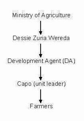
food-for-work programm with distribution of grains and oil
- جامع المعلومات: Sabina Erny
2. وصف تقنيةالإدارة المستدامي للأراضي
2.1 وصف مختصر للتقنية
تعريف التقنية:
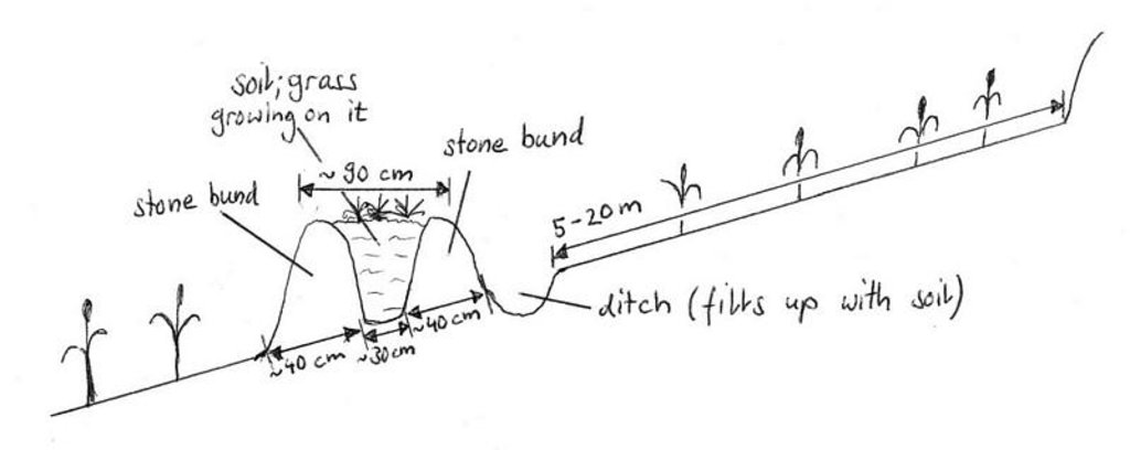
level bund with double stone walls with soil and grass to stabilize the structure
2.2 وصف تفصيلي للتقنية
الوصف:
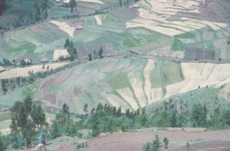
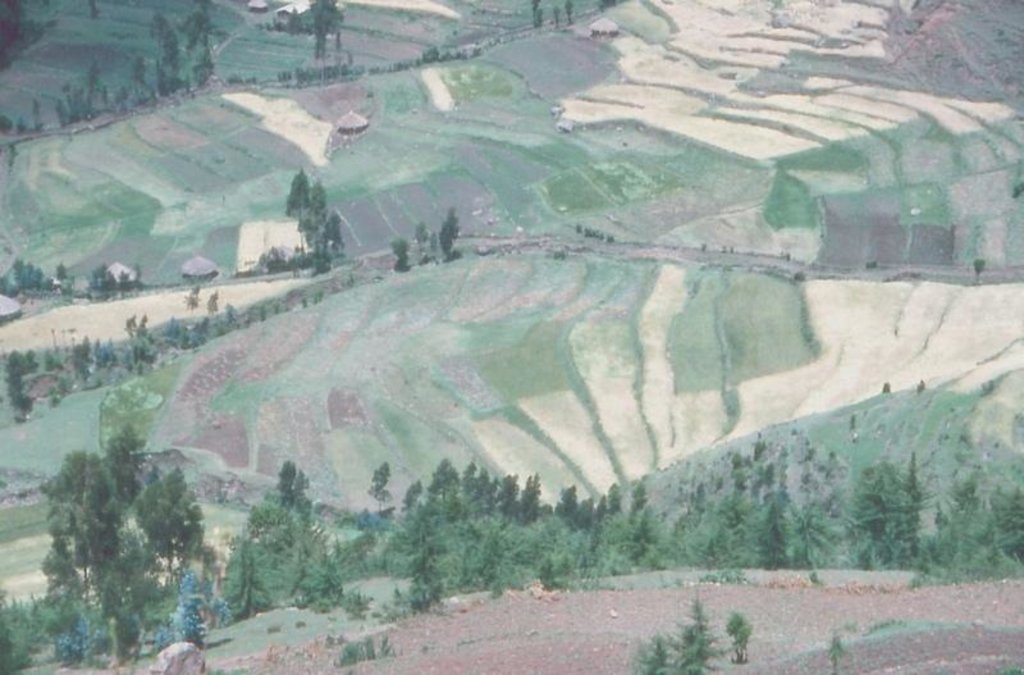
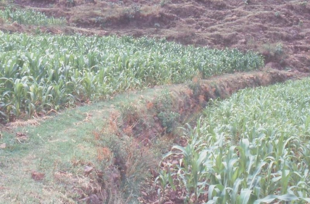
Two level rows of stones are piled up and the space between them is filled up with soil. Grass is growing on it so it can stabilize the bund. The soil can accumulate behind the bund. The land and the bunds slowly develop into terraces. It is combined with contour ploughing.
Purpose of the Technology: control runoff and soil erosion
Establishment / maintenance activities and inputs: through food-for-work program. Maintenance is up to the farmers, some maintain it regularly, throughout the year, others don't.
Natural / human environment: on gentle and steep slopes
2.3 صور التقنية
2.5 البلد/المنطقة/المواقع التي تم تنفيذ التقنية فيها والتي يغطيها هذا التقييم
البلد:
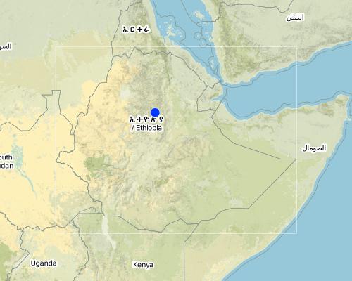
أثيوبيا
المنطقة/الولاية/المحافظة:
South Wello
Map
×2.6 تاريخ التنفيذ
في حالة عدم معرفة السنة بالتحديد، يرجى الإشارة إلى التاريخ التقريبي:
- منذ أقل من 10 سنوات (مؤخرًا)
2.7 إدخال التقنية
حدد كيف تم إدخال التقنية:
- من خلال المشاريع/ التدخلات الخارجية
التعليقات (نوع المشروع، الخ):
it was implemented by the government
3. تصنيف تقنية الإدارة المستدامي للأراضي
3.1 الغرض الرئيسي ( الأغراض الرئيسية) للتقنية
- الحد من تدهور الأراضي ومنعه وعكسه
3.2 نوع (أنواع) استخدام الأراضي الحالية حيث يتم تطبيق التقنية

الأراضي الزراعية
- زراعة سنوية

أراضي الرعي
التعليقات:
Major land use problems (compiler’s opinion): erosion, decline of soil fertility and yield decline other major SWC specialist: shortage of grazing land and of forage
Major land use problems (land users’ perception): erosion, runoff, drought, climate
Grazingland comments: area closure: only during July-October some areas are closed, otherwise no area closure any more. Make hay for the cattle to feed them in the dry season.
Type of cropping system and major crops comments: barley/wheat/emmer wheat - beans or teff - maize - barley/wheat/emmer wheat - beans or teff - maize
3.3 مزيد من المعلومات حول استخدام الأراضي
إمدادات المياه للأرض التي يتم تنفيذ التقنية عليها:
- بعلية
عدد مواسم الزراعة في السنة:
- 2
حدد:
Longest growing period in days: 150 Longest growing period from month to month: Jul - Nov Second longest growing period in days: 150 Second longest growing period from month to month: Feb - Jun
3.4 مجموعةالإدارة المستدامة للأراضي التي تنتمي إليها هذه التقنية
- تحسين الغطاء الأرضي/النباتي
- التدابير المتقاطعة للمنحدرات
3.5 انتشار التقنية
حدد انتشار التقنية:
- منتشرة بالتساوي على مساحة
إذا كانت التقنية منتشرة بالتساوي على منطقة ما، فحدد المنطقة التقريبية المغطاة:
- 0.1-1 كم2
3.6 التدابير التقنية في مجال إلادارة المستدامة للأراضي

التدابير البنيوية
- الحواجز والضفاف
التعليقات:
Main measures: structural measures
Secondary measures: vegetative measures
Type of agronomic measures: contour tillage
3.7 الأنواع الرئيسية من تدهور الأراضي التي تناولتها التقنية

تآكل التربة بالمياه
- الوزن(Wt): فقدان التربة السطحية/تآكل السطح
- (Wo:) تأثيرات التدهور من مواقع أخرى
التعليقات:
Main type of degradation addressed: Wt: loss of topsoil / surface erosion
Secondary types of degradation addressed: Wo: offsite degradation effects
4. المواصفات الفنية، وأنشطة التنفيذ، والمدخلات، والتكاليف
4.1 الرسم الفني للتقنية
4.2 المواصفات الفنية/شروحات الرسم الفني
Drawing showing a level bund with double stone walls, Maybar, Ethiopia
Location: Maybar. Wello
Technical knowledge required for field staff / advisors: moderate
Technical knowledge required for land users: low
Main technical functions: reduction of slope angle, reduction of slope length
Secondary technical functions: improvement of soil structure, increase in soil fertility
Contour tillage
Remarks: because of the design of the terraces
If the original slope has changed as a result of the Technology, the slope today is (see figure below): 10.00%
Construction material (earth): earth from the ditch just behind the structure on the upper side
Construction material (stone): normal, big stones from the field
If the original slope has changed as a result of the Technology, the slope today is: 10%
Lateral gradient along the structure: 0%
Vegetation is used for stabilisation of structures.
4.3 معلومات عامة بخصوص حساب المدخلات والتكاليف
عملة أخرى/ عملة وطنية (حدد):
birr
أشر إلى سعر الصرف من الدولار الأمريكي إلى العملة المحلية (إذا كان ذا صلة): 1 دولار أمريكي =:
8,8
اذكر متوسط تكلفة أجر العمالة المستأجرة في اليوم الواحد:
0.50
4.4 أنشطة التأسيس
| النشاط | نوع التدبير | التوقيت | |
|---|---|---|---|
| 1. | it has grown itself on the bund | نباتية | |
| 2. | measurement of fields, to know where to build the bunds | بنيوية أو هيكلية | |
| 3. | constructing the stonewalls | بنيوية أو هيكلية | December - January |
| 4. | filling the bunds in between with soils from the ditch behind the structure, on the upper side | بنيوية أو هيكلية | December - January, sometimes in November and June |
4.6 الصيانة/الأنشطة المتكررة
| النشاط | نوع التدبير | التوقيت/الوتيرة | |
|---|---|---|---|
| 1. | contour ploughing | زراعية | dry season and rainseason / several times |
| 2. | none, cattle are grazing on it | نباتية | |
| 3. | observation | بنيوية أو هيكلية | December-January/every year after harvesting |
| 4. | rebuilding the structure | بنيوية أو هيكلية | December-January/every 1-3 years |
4.8 أهم العوامل المؤثرة على التكاليف
قدم وصفا لأهم العوامل التي تؤثر على التكاليف:
the slope: the steeper, the more bunds are needed; labour is a problem if there is no food-for-work any more
5. البيئة الطبيعية والبشرية
5.1 المناخ
هطول الأمطار السنوي
- < 250 مم
- 251- 500 ملم
- 501 - 750ملم
- 1,000-751 ملم
- 1,500-1,100 ملم
- 2,000-1,500 ملم
- 3,000-2,001 ملم
- 4,000-3,100 ملم
- > 4000 ملم
حدد متوسط هطول الأمطار السنوي (إذا كان معروفًا)، بالملليمتر:
1067,00
المنطقة المناخية الزراعية
- شبه رطبة
Moist dega
5.2 طوبوغرافيا
متوسط الانحدارات:
- مسطح (0-2%)
- بسيط (3-5%)
- معتدل (6-10%)
- متدحرج (11-15%)
- تلال (16-30%)
- شديدة الانحدار(31-60%)
- فائقة الانحدار (>60%)
التضاريس:
- هضاب/سهول
- أثلام مرتفعة
- المنحدرات الجبلية
- منحدرات التلال
- منحدرات في السفوح
- قاع الوادي
المنطقة الارتفاعية:
- 100-0 متر فوق سطح البحر
- 500-101 متر فوق سطح البحر
- 1,000-501 متر فوق سطح البحر
- 1,500-1,001 متر فوق سطح البحر
- 2,000-1,501 متر فوق سطح البحر
- 2,500-2,100 متر فوق سطح البحر
- 3,000-2,501 متر فوق سطح البحر
- 4,000-3,001 متر فوق سطح البحر
- > 4000 متر فوق سطح البحر
التعليقات والمواصفات الإضافية بشأن التضاريس:
Landforms: Hill slopes (ranked1, mainly steep hills), footslopes and ridges (both ranked 2)
Slopes on average: Hilly (ranked 1), rolling (ranked 2, more than 80% of the land has a slope degree from over 13%) and steep (ranked 3)
5.3 التربة
متوسط عمق التربة:
- ضحل جدًا (0-20 سم)
- ضحلة (21-50 سم)
- متوسطة العمق (51-80 سم)
- عميقة (81-120 سم)
- عميقة جدًا (> 120 سم)
قوام التربة (التربة السطحية):
- ناعم/ثقيل (طيني)
المواد العضوية في التربة السطحية:
- عالية (>3%)
- متوسطة (1-3%)
إذا كان متاحًا، قم بإرفاق وصف كامل للتربة أو تحديد المعلومات المتوفرة، على سبيل المثال نوع التربة، الرقم الهيدروجيني/ درجة حموضة التربة، قدرة التبادل الكاتيوني، النيتروجين، الملوحة وما إلى ذلك.
Soil depth on average: Very shallow (about 40% of the area) and moderately deep (both ranked 1), shallow and deep (both ranked 2)
Soil texture: Fine/heavy (of the major soil type)
Soil fertility: Medium
Topsoil organic matter: High (ranked 1, in the major soil type) and medium (ranked 2)
Soil drainage/infiltration: Medium (ranked 1) and poor (ranked 2, somtimes there is waterlogging)
Soil water storage capacity: Low (ranked 1) and medium (ranked 2)
5.6 خصائص مستخدمي الأراضي الذين يطبقون التقنية
الدخل من خارج المزرعة:
- 10-50% من جميع الإيرادات
المستوى النسبي للثروة:
- ثري
مستوى المكننة:
- عمل يدوي
- الجر الحيواني
اذكر الخصائص الأخرى ذات الصلة لمستخدمي الأراضي:
Population density: 100-200 persons/km2
10% of the land users are rich and own 38% of the land (only rough estimates).
58% of the land users are average wealthy and own 36% of the land (only rough estimates).
32% of the land users are poor and own 26% of the land (only rough estimates).
Off-farm income specification: farmers employ others for ploughing, so they can go to the market
Level of mechanization: Animal traction (ranked 1, ploughing with oxen) and manual work (ranked 2, hacking)
5.8 ملكية الأراضي، وحقوق استخدام الأراضي، وحقوق استخدام المياه
ملكية الارض:
- دولة
حقوق استخدام الأراضي:
- فردي
6. الآثار والتصريحات الختامية
6.4 تحليل التكلفة والعائد
كيف يمكن مقارنة العوائد نسبة لتكاليف الإنشاء (من وجهة نظر مستخدمي الأراضي)؟
عوائد قصيرة الأجل:
سلبي قليلا
عوائد طويلة الأجل:
إيجابي
كيف تتم مقارنة العوائدمع كلفة الصيانة/التكاليف المتكررة (من وجهة نظر مستخدمي الأراضي)؟
عوائد قصيرة الأجل:
إيجابي قليلا
عوائد طويلة الأجل:
إيجابي
6.5 اعتماد التقنية
إذا كان متاحًا، قم بتحديد الكمية (عدد الأسر المعيشية و/أو المساحةالمغطاة):
200
من بين جميع الذين تبنوا التقنية، كم عدد الذين فعلوا ذلك بشكل تلقائي، أي دون تلقي أي حوافز مادية/مدفوعات؟:
- 10-0%
التعليقات:
100% of land user families have adopted the Technology with external material support
200 land user families have adopted the Technology with external material support
Comments on acceptance with external material support: estimates
Comments on spontaneous adoption: estimates
There is a little trend towards spontaneous adoption of the Technology
Comments on adoption trend: some farmers are building level bund with double stone wallss without any incentives
7. المراجع والروابط
7.2 المراجع للمنشورات المتاحة
العنوان، المؤلف، السنة، النظام القياسي الدولي لترقيم الكتب ISBN:
Biological soil conservation techniques for Maybar area, Ethiopia. Kassaye Goshu. 1997.
متاح من أين؟كم التكلفة؟:
CDE, Bern
العنوان، المؤلف، السنة، النظام القياسي الدولي لترقيم الكتب ISBN:
Classification of the Environment Conditions. H.-J. Krüger. 2003.
متاح من أين؟كم التكلفة؟:
CDE, Bern
العنوان، المؤلف، السنة، النظام القياسي الدولي لترقيم الكتب ISBN:
Area of Maybar, Wello, Ethiopia: Long-term Monitoring of the Agricultural Environment 1981-1994
متاح من أين؟كم التكلفة؟:
CDE, Bern
العنوان، المؤلف، السنة، النظام القياسي الدولي لترقيم الكتب ISBN:
The Use, Maintenance and Development of Soil and Water Conservation Measures by Small-Scale Farming Householfs in Different Agro-Climatic Zones of Northern Shewa and Southern Wello, Ethiopia.Yohannes Gebre Michael. 1999.
متاح من أين؟كم التكلفة؟:
CDE, Bern
الروابط والوحدات المواضيعية
توسيع الكل طي الكلالروابط

food-for-work programm [أثيوبيا]
food-for-work programm with distribution of grains and oil
- جامع المعلومات: Sabina Erny
الوحدات المواضيعية
لا يوجد وحدات مواضيعية


