Auto-Flowing Slurry Dam [الصين]
- تاريخ الإنشاء:
- تحديث:
- جامع المعلومات: Yan ZHANG
- المحرر: –
- المُراجع: David Streiff
Falling Water Dam
technologies_1364 - الصين
عرض الأقسام
توسيع الكل طي الكل1. معلومات عامة
1.2 تفاصيل الاتصال بالأشخاص الرئيسيين لمصدر المعلومات والمؤسسات المشاركة في تقييم وتوثيق التقنية
اسم المؤسسة (المؤسسات) التي سهلت توثيق/تقييم التقنية (إذا كان ذلك على صلة)
Department of Resources and Environmental Science, Beijing Normal University (Department of Resources and Environmental Science, Beijing Normal University) - الصين1.3 الشروط المتعلقة باستخدام البيانات الموثقة من خلال WOCAT
متى تم تجميع البيانات (ميدانيا)؟:
16/05/2002
يوافق جامع المعلومات والشخص (لاشخاص) الرئيسي لمصدر المعلومات على الشروط المتعلقة باستخدام البيانات الموثقة من خلال WOCAT:
نعم
1.5 الإشارة إلى الاستبيان (الاستبيانات) حول مناهج الإدارة المستدامة للأراضي
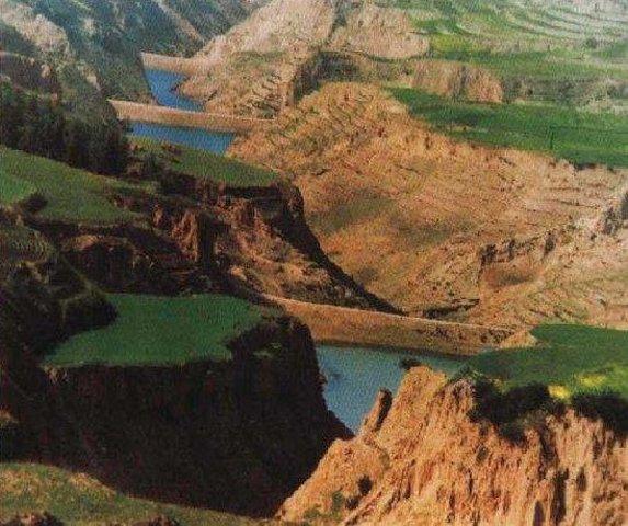
Falling Water Dam [الصين]
The falling water dams are widely built in the middle reach of the Yellow River, the typical dams are filled with dense slurry by water flow from upland. The approach is implemented mainly by government investment.
- جامع المعلومات: Yan ZHANG
2. وصف تقنيةالإدارة المستدامي للأراضي
2.1 وصف مختصر للتقنية
تعريف التقنية:
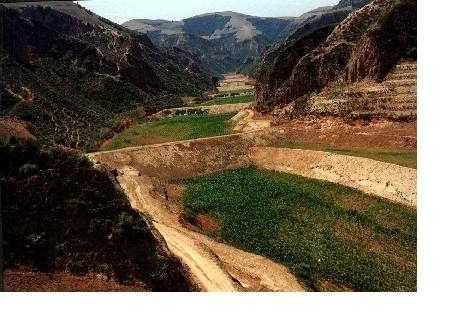
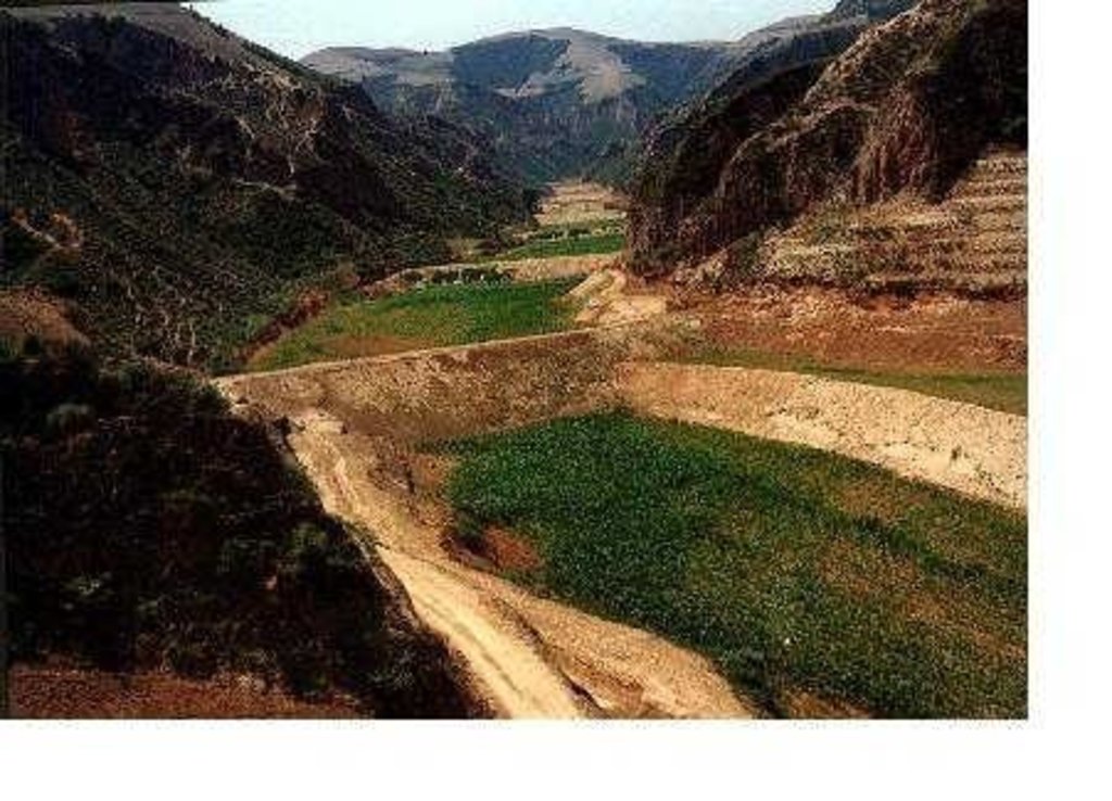
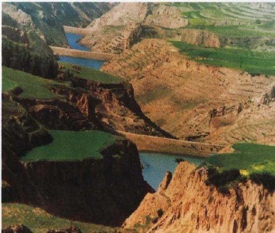
Auto-flowing slurry dams is filled with dense slurry by water flow from upland to maintain eroded soil particles and runoff.
2.2 وصف تفصيلي للتقنية
الوصف:
Falling water filled dams distribute widely in the middle reaches of the Yellow River, they are used to store water and wrap sediment which result from soil and water loss. On the Loess Plateau, in addition to the conditions of deep gully and steep slope, earth above the top of the dams can be used to build dams. First, soil is loosed with squirt guns, exploded or manually dug. Then, water is pumped up to the loose earth so as to rush the soil down along transporting ditch, turning the soil into dense mud to dam level surrounded by tamped banks. Under the press of gravity, the mud dehydrates, consolidates and becomes uniformly dense body of the dams. Compared with dams in other areas, the water power filled dams in the Yellow River basin are characterized by much denser mud, uniform particles and body texture, smaller transect of dams body, and wide applicability to soil materials such as sand soil, loess soil and weathering residue. The types of dams have widely applied to build moderate and small reservoirs and silt arresters in the middle reaches of the Yellow River, they play an important role in increase in agricultural production and reduction of sediment into the Yellow River.
2.3 صور التقنية
2.5 البلد/المنطقة/المواقع التي تم تنفيذ التقنية فيها والتي يغطيها هذا التقييم
البلد:
الصين
المنطقة/الولاية/المحافظة:
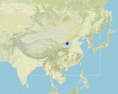
Shanxi, Shaanxi, etc.
Map
×2.6 تاريخ التنفيذ
في حالة عدم معرفة السنة بالتحديد، يرجى الإشارة إلى التاريخ التقريبي:
- منذ أكثر من 50 عامًا (تقليدي)
2.7 إدخال التقنية
حدد كيف تم إدخال التقنية:
- كجزء من النظام التقليدي (> 50 عامًا)
التعليقات (نوع المشروع، الخ):
The technology was developed by local people during the conservation practice in 1950s.
3. تصنيف تقنية الإدارة المستدامي للأراضي
3.1 الغرض الرئيسي ( الأغراض الرئيسية) للتقنية
- تحسين الإنتاج
3.2 نوع (أنواع) استخدام الأراضي الحالية حيث يتم تطبيق التقنية

الأراضي الزراعية
- زراعة سنوية
التعليقات:
Major land use problems (compiler’s opinion): 1. Slope land is used as cropland
2. Too little ground cover to protect soil from erosion
3. Over grazing in wind erosion area
Major land use problems (land users’ perception): 1. Little cropland for food supply
2. The land productivity is too low
3. The benefit of returning cropland to graze land or woodland is not definite now except the compensate from government
3.3 مزيد من المعلومات حول استخدام الأراضي
عدد مواسم الزراعة في السنة:
- 1
حدد:
Longest growing period in days: 165Longest growing period from month to month: May - Sep
3.4 مجموعةالإدارة المستدامة للأراضي التي تنتمي إليها هذه التقنية
- إدارة الري (بما في ذلك إمدادات المياه والصرف الصحي)
3.5 انتشار التقنية
حدد انتشار التقنية:
- منتشرة بالتساوي على مساحة
إذا كانت التقنية منتشرة بالتساوي على منطقة ما، فحدد المنطقة التقريبية المغطاة:
- > 10,000 كم2
التعليقات:
Total area covered by the SLM Technology is 13062 m2.
Dams filled by water power are applied mainly in the middle reach of the Yellow River, including the provinces of Shanxi, Shaanxi, Inner Mongolia, Ningxia, Gansu, Qinghai, Henan, etc. The types of dams were used since 1950s, and most the dams being used were built in 1970s.
3.6 التدابير التقنية في مجال إلادارة المستدامة للأراضي

التدابير البنيوية
- S5: السدود، الأحواض الصغيرة، البرك
التعليقات:
Main measures: structural measures
3.7 الأنواع الرئيسية من تدهور الأراضي التي تناولتها التقنية

تآكل التربة بالمياه
- الوزن(Wt): فقدان التربة السطحية/تآكل السطح
- (Wg):الانجراف الخلجاني/ الخلجان

تآكل التربة الناتج عن الرياح
- (Et): فقدان التربة السطحية

التدهور الكيميائي للتربة
- (Cn): تراجع الخصوبة وانخفاض محتوى المادة العضوية (غير ناتج عن الانجراف)

تدهور المياه
- (Ha): التجفيف
التعليقات:
Main type of degradation addressed: Wg: gully erosion / gullying, Ha: aridification
Secondary types of degradation addressed: Wt: loss of topsoil / surface erosion, Et: loss of topsoil, Cn: fertility decline and reduced organic matter content
Main causes of degradation: other natural causes (avalanches, volcanic eruptions, mud flows, highly susceptible natural resources, extreme topography, etc.) specify, poverty / wealth (Lack of captial), education, access to knowledge and support services (Lack of knowledge)
3.8 منع أو حد أو عكس تدهور الأراضي
تحديد هدف التقنية فيما يتعلق بتدهور الأراضي:
- غير قابل للتطبيق
4. المواصفات الفنية، وأنشطة التنفيذ، والمدخلات، والتكاليف
4.2 المواصفات الفنية/شروحات الرسم الفني
Technical knowledge required for field staff / advisors: low
Technical knowledge required for land users: low
Main technical functions: control of concentrated runoff: retain / trap, water harvesting / increase water supply, sediment retention / trapping, sediment harvesting
Secondary technical functions: control of raindrop splash, control of dispersed runoff: retain / trap, control of dispersed runoff: impede / retard, control of concentrated runoff: impede / retard, control of concentrated runoff: drain / divert, reduction of slope angle, reduction of slope length, improvement of ground cover, increase of surface roughness, increase in organic matter, increase of infiltration, increase / maintain water stored in soil, water spreading, reduction in wind speed, increase in soil fertility, improvement of soil structure
Construction material (earth): Loess earth
Slope (which determines the spacing indicated above): 45%
If the original slope has changed as a result of the Technology, the slope today is: 30%
Lateral gradient along the structure: 60%
For water harvesting: the ratio between the area where the harvested water is applied and the total area from which water is collected is: 1:1
4.3 معلومات عامة بخصوص حساب المدخلات والتكاليف
حدد العملة المستخدمة لحساب التكاليف:
- دولار أمريكي
اذكر متوسط تكلفة أجر العمالة المستأجرة في اليوم الواحد:
3.00
4.4 أنشطة التأسيس
| النشاط | نوع التدبير | التوقيت | |
|---|---|---|---|
| 1. | preparing earth | بنيوية أو هيكلية | n/a |
| 2. | pumping water | بنيوية أو هيكلية | n/a |
| 3. | preparing base of the dam and its perimetric banks | بنيوية أو هيكلية | n/a |
| 4. | Flushing the prepared earth with water inside the banks of the dam | بنيوية أو هيكلية | 0.1~1 |
| 5. | After dehydration and consolidation of the earth, repeat 3 and 4. | بنيوية أو هيكلية | n/a |
4.5 التكاليف والمدخلات اللازمة للتأسيس
التعليقات:
Duration of establishment phase: 540 month(s)
4.6 الصيانة/الأنشطة المتكررة
| النشاط | نوع التدبير | التوقيت/الوتيرة | |
|---|---|---|---|
| 1. | Keeping the top of the dam level and free of crevice, water or rubbish | بنيوية أو هيكلية | timely |
| 2. | Keeping the top of the dam level and free of crevice, water or rubbish | بنيوية أو هيكلية | |
| 3. | Keeping the slope of the dam compact and free of rill or weed. | بنيوية أو هيكلية | timely |
| 4. | Keeping the slope of the dam compact and free of rill or weed. | بنيوية أو هيكلية | |
| 5. | Keeping the observation equipment work in order. | بنيوية أو هيكلية | timely |
| 6. | Keeping the observation equipment work in order. | بنيوية أو هيكلية | |
| 7. | Preventing the base the dam from destroying by white ants and other animals. | بنيوية أو هيكلية | April to October/once a year |
4.7 التكاليف والمدخلات اللازمة للصيانة/للأنشطة المتكررة (سنويًا)
التعليقات:
The volume of structure.
4.8 أهم العوامل المؤثرة على التكاليف
قدم وصفا لأهم العوامل التي تؤثر على التكاليف:
Since the dam construction uses local materials, the most important factors affecting the cost are labor and equipment
5. البيئة الطبيعية والبشرية
5.1 المناخ
هطول الأمطار السنوي
- < 250 مم
- 251- 500 ملم
- 501 - 750ملم
- 1,000-751 ملم
- 1,500-1,100 ملم
- 2,000-1,500 ملم
- 3,000-2,001 ملم
- 4,000-3,100 ملم
- > 4000 ملم
المنطقة المناخية الزراعية
- شبه قاحلة
- قاحلة
5.2 طوبوغرافيا
متوسط الانحدارات:
- مسطح (0-2%)
- بسيط (3-5%)
- معتدل (6-10%)
- متدحرج (11-15%)
- تلال (16-30%)
- شديدة الانحدار(31-60%)
- فائقة الانحدار (>60%)
التضاريس:
- هضاب/سهول
- أثلام مرتفعة
- المنحدرات الجبلية
- منحدرات التلال
- منحدرات في السفوح
- قاع الوادي
المنطقة الارتفاعية:
- 100-0 متر فوق سطح البحر
- 500-101 متر فوق سطح البحر
- 1,000-501 متر فوق سطح البحر
- 1,500-1,001 متر فوق سطح البحر
- 2,000-1,501 متر فوق سطح البحر
- 2,500-2,100 متر فوق سطح البحر
- 3,000-2,501 متر فوق سطح البحر
- 4,000-3,001 متر فوق سطح البحر
- > 4000 متر فوق سطح البحر
وضح ما إذا كانت التقنية مطبقة على وجه التحديد في:
- غير ذات صلة
التعليقات والمواصفات الإضافية بشأن التضاريس:
Landform: Also plateau/plain
5.3 التربة
متوسط عمق التربة:
- ضحل جدًا (0-20 سم)
- ضحلة (21-50 سم)
- متوسطة العمق (51-80 سم)
- عميقة (81-120 سم)
- عميقة جدًا (> 120 سم)
قوام التربة (التربة السطحية):
- متوسط ( طميي، سلتي)
- ناعم/ثقيل (طيني)
المواد العضوية في التربة السطحية:
- متوسطة (1-3%)
- منخفضة (<1%)
إذا كان متاحًا، قم بإرفاق وصف كامل للتربة أو تحديد المعلومات المتوفرة، على سبيل المثال نوع التربة، الرقم الهيدروجيني/ درجة حموضة التربة، قدرة التبادل الكاتيوني، النيتروجين، الملوحة وما إلى ذلك.
Soil fertility: low
Soil drainage / infiltration: medium - good
Soil water storage capacity: high - very high
5.6 خصائص مستخدمي الأراضي الذين يطبقون التقنية
الدخل من خارج المزرعة:
- 10-50% من جميع الإيرادات
المستوى النسبي للثروة:
- متوسط
- ثري
اذكر الخصائص الأخرى ذات الصلة لمستخدمي الأراضي:
Population density: 50-100 persons/km2
Annual population growth: 0.5% - 1%
Relative level of wealth: rich, average, poor
There are almost no people very rich in the area.
Rich people are as same as average people.
40% of the land users are average wealthy and own 20% of the land (Average people in the area where the SWC is applied should offer labor for the construction.).
Poor people can offer labor for the construction.
Very poor people are relatively rare and they are often in poor health.
Off-farm income specification: Most young male farmers often go to the city or town to earn money
5.8 ملكية الأراضي، وحقوق استخدام الأراضي، وحقوق استخدام المياه
ملكية الارض:
- دولة
حقوق استخدام الأراضي:
- وصول مفتوح (غير منظم)
- مجتمعي (منظم)
6. الآثار والتصريحات الختامية
6.1 الآثار التي أظهرتها التقنية في الموقع
الآثار الايكولوجية
دورة المياه / الجريان السطحي
الجريان السطحي
الكمية قبل الإدارة المستدامة للأراضي:
43
الكمية بعد الإدارة المستدامة للأراضي:
35
التربة
فقدان التربة
الكمية قبل الإدارة المستدامة للأراضي:
80
الكمية بعد الإدارة المستدامة للأراضي:
21
6.4 تحليل التكلفة والعائد
كيف يمكن مقارنة العوائد نسبة لتكاليف الإنشاء (من وجهة نظر مستخدمي الأراضي)؟
عوائد قصيرة الأجل:
إيجابي
عوائد طويلة الأجل:
ايجابي جدا
كيف تتم مقارنة العوائدمع كلفة الصيانة/التكاليف المتكررة (من وجهة نظر مستخدمي الأراضي)؟
عوائد قصيرة الأجل:
إيجابي
عوائد طويلة الأجل:
ايجابي جدا
6.5 اعتماد التقنية
- 1-10%
إذا كان متاحًا، قم بتحديد الكمية (عدد الأسر المعيشية و/أو المساحةالمغطاة):
80'000 households (3 percent of the area)
من بين جميع الذين تبنوا التقنية، كم عدد الذين فعلوا ذلك بشكل تلقائي، أي دون تلقي أي حوافز مادية/مدفوعات؟:
- 50-10%
التعليقات:
5% of land user families have adopted the Technology with external material support
50000 land user families have adopted the Technology with external material support
Comments on acceptance with external material support: estimates
1% of land user families have adopted the Technology without any external material support
30000 land user families have adopted the Technology without any external material support
Comments on spontaneous adoption: estimates
There is a strong trend towards spontaneous adoption of the Technology
Comments on adoption trend: Although the local people adopt the SWC Technology willingly, it is usually invested, designed and constructed by the land owner, the local government.
7. المراجع والروابط
7.2 المراجع للمنشورات المتاحة
العنوان، المؤلف، السنة، النظام القياسي الدولي لترقيم الكتب ISBN:
Special Planning Of Soil And Water Conservation in Xinzhou Region , Shanxi Province. 1986-1990.
متاح من أين؟كم التكلفة؟:
Library of the Resource and Environmental Department, Beijing Normal University.
العنوان، المؤلف، السنة، النظام القياسي الدولي لترقيم الكتب ISBN:
How to design the dry masonry dam in the Hanjiachuan watershed. Tianyuzhu, Wangzuliang. Beijing. Water conservation in Beijing. 2000.
متاح من أين؟كم التكلفة؟:
Library of the Resource and Environmental Department, Beijing Normal University.
الروابط والوحدات المواضيعية
توسيع الكل طي الكلالروابط

Falling Water Dam [الصين]
The falling water dams are widely built in the middle reach of the Yellow River, the typical dams are filled with dense slurry by water flow from upland. The approach is implemented mainly by government investment.
- جامع المعلومات: Yan ZHANG
الوحدات المواضيعية
لا يوجد وحدات مواضيعية


