Permeable rock dams [بوركينا فاسو]
- تاريخ الإنشاء:
- تحديث:
- جامع المعلومات: Dieter Nill
- المحرر: –
- المُراجع: Fabian Ottiger
Digues filtrantes (French)
technologies_1617 - بوركينا فاسو
عرض الأقسام
توسيع الكل طي الكل1. معلومات عامة
1.2 تفاصيل الاتصال بالأشخاص الرئيسيين لمصدر المعلومات والمؤسسات المشاركة في تقييم وتوثيق التقنية
متخصص في الإدارة المستدامة للأراضي:
Dorlöchter-Sulser Sabine
Misereor
ألمانيا
متخصص في الإدارة المستدامة للأراضي:
Mamadou Abdou Sani
mamadou.sani@giz.de,
Programme d’Appui à l’agriculture Productive (PROMAP)/GIZ
Niamey, Niger
النيجر
اسم المشروع الذي سهّل توثيق/تقييم التقنية (إذا كان ذلك على صلة)
Manual of Good Practices in Small Scale Irrigation in the Sahel (GIZ )اسم المؤسسة (المؤسسات) التي سهلت توثيق/تقييم التقنية (إذا كان ذلك على صلة)
Deutsche Gesellschaft für Internationale Zusammenarbeit (GIZ) GmbH (GIZ) - ألمانيااسم المؤسسة (المؤسسات) التي سهلت توثيق/تقييم التقنية (إذا كان ذلك على صلة)
Misereor - ألمانيا1.3 الشروط المتعلقة باستخدام البيانات الموثقة من خلال WOCAT
متى تم تجميع البيانات (ميدانيا)؟:
01/07/2012
يوافق جامع المعلومات والشخص (لاشخاص) الرئيسي لمصدر المعلومات على الشروط المتعلقة باستخدام البيانات الموثقة من خلال WOCAT:
نعم
1.4 إعلان بشأن استدامة التقنية الموصوفة
هل التقنية الموصوفة هنا تمثل مشكلة فيما يتعلق بتدهور الأراضي، بحيث لا يمكن إعلانها تقنية مستدامة لإدارة الأراضي؟:
كلا
2. وصف تقنيةالإدارة المستدامي للأراضي
2.1 وصف مختصر للتقنية
تعريف التقنية:
Permeable rock dams serve to restore seriously degraded farmland and forest/rangeland and are used to fill in gullies and control water flow.
2.2 وصف تفصيلي للتقنية
الوصف:
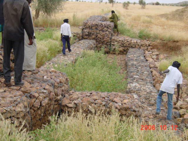
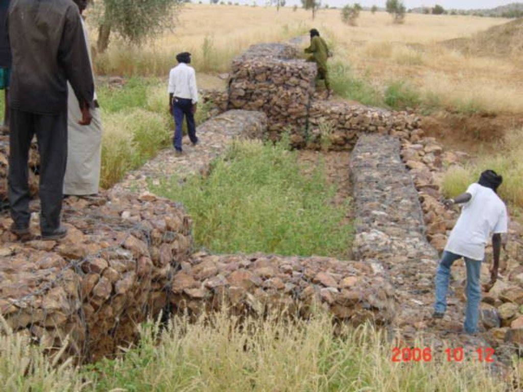
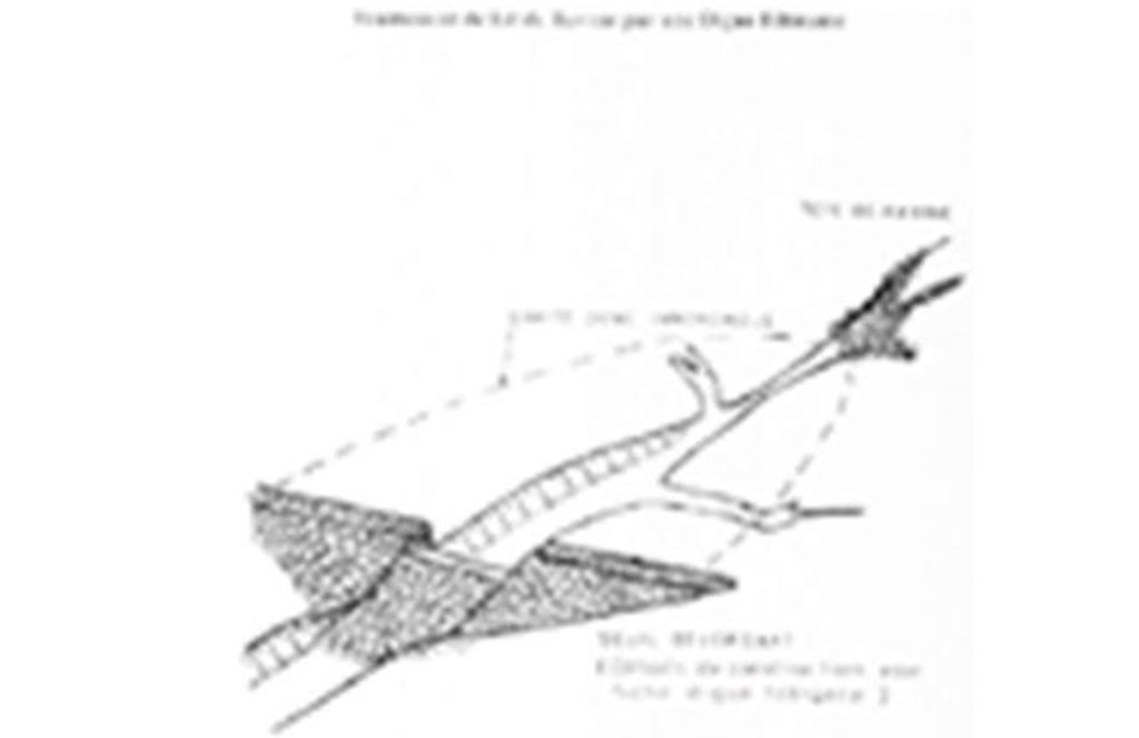
The permeable rock dam is a structure built in gullies using loose rocks and stones and sometimes reinforced with gabions. A filtering layer (blanket of gravel or small stones) is laid in a foundation trench. Further layers of medium-sized and large stones and rocks are laid on top. They are between 0.50 and 3 metres high, and the width of the foundation and the crest depends on the estimated volume of water flow. The structure built across the gully is extended to the sides with the construction of wingwalls that spread the water over a larger area to the sides of the dam. The total width of the structure is generally at least three times its height. The dams can be constructed with or without a spillway. A spillway is required when flood water flow is stronger.
Purpose of the Technology: Permeable rock dams are used to fill in gullies and control water flow. They slow the flow of floodwaters and spread the water over adjacent land. This improves infiltration, and sediment builds up behind the dams. In time, the sediment fills in the gully. This stops lateral drainage from the land on either side, increasing its productivity. High infiltration upstream of the dam contributes to recharging the groundwater system. These structures are therefore also effective in raising the water table in wells and in protecting the bottom-lands from sand filling and gully erosion. They are used in combination with other measures, such as reforestation and stone bunds, to protect and improve the surrounding area, and to increase the area of land that can be used for growing crops.
By dissipating the flow of floodwaters, they ensure better use of rainwater and are therefore important in dry periods. The conservation of water for longer periods and the fine particles of earth trapped by the structure favour the establishment of natural vegetation along it, which helps to stabilise the dam. Seeds are also trapped, favouring the spontaneous growth of grass and trees upstream and downstream, which contributes to restoring and conserving biodiversity.
Establishment / maintenance activities and inputs: The sustainability of permeable rock dams depends on the quality of construction and whether they are maintained regularly. A certain amount of expertise and good community organisation is required to repair any cracks in
the dam. Biological measures (sowing grass and planting trees) increase the stability of the structure.
The size of a permeable rock dam can vary considerably from one site to another. The cost is also affected by the distance of the site from the quarry, the topography of the terrain and the actual amount of rock carried in each lorryload. It costs less to construct this type of structure with loose stones and rocks than with gabions.
2.3 صور التقنية
2.5 البلد/المنطقة/المواقع التي تم تنفيذ التقنية فيها والتي يغطيها هذا التقييم
البلد:
بوركينا فاسو
المنطقة/الولاية/المحافظة:
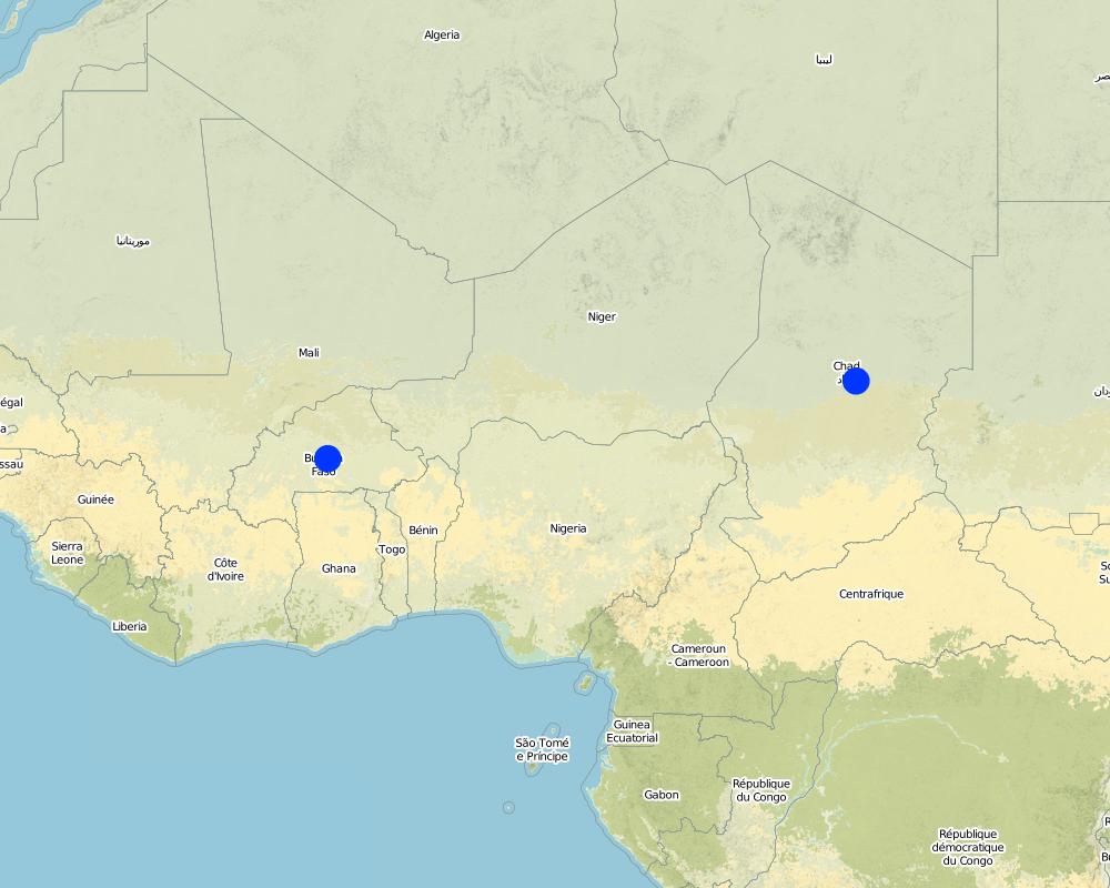
Burkina Faso, Chad
التعليقات:
Burkina Faso & Chad
Map
×2.6 تاريخ التنفيذ
في حالة عدم معرفة السنة بالتحديد، يرجى الإشارة إلى التاريخ التقريبي:
- منذ 10-50 سنة
2.7 إدخال التقنية
حدد كيف تم إدخال التقنية:
- من خلال المشاريع/ التدخلات الخارجية
التعليقات (نوع المشروع، الخ):
developed, implemented and disseminated as part of projects and programmes undertaken from the 1980s onwards to combat desertification and improve natural resource management. Implemented by GIZ (German Federal Enterprise for International Cooperation), and PATECORE (project for land development and resource conservation in Plateau Central Burkina Faso)
3. تصنيف تقنية الإدارة المستدامي للأراضي
3.1 الغرض الرئيسي ( الأغراض الرئيسية) للتقنية
- الحد من تدهور الأراضي ومنعه وعكسه
3.2 نوع (أنواع) استخدام الأراضي الحالية حيث يتم تطبيق التقنية

الأراضي الزراعية
- زراعة سنوية

أراضي الرعي
التعليقات:
Major land use problems (compiler’s opinion): soil erosion, surface runoff, unfertile land
Constraints of common grazing land
Constraints of forested government-owned land or commons
3.3 مزيد من المعلومات حول استخدام الأراضي
عدد مواسم الزراعة في السنة:
- 1
حدد:
Longest growing period in days: 120, Longest growing period from month to month: August to October
3.4 مجموعةالإدارة المستدامة للأراضي التي تنتمي إليها هذه التقنية
- التدابير المتقاطعة للمنحدرات
- تحويل المياه والصرف
- إدارة المياه السطحية (الينابيع، الأنهار، البحيرات، البحار)
3.6 التدابير التقنية في مجال إلادارة المستدامة للأراضي

التدابير البنيوية
- S5: السدود، الأحواض الصغيرة، البرك
3.7 الأنواع الرئيسية من تدهور الأراضي التي تناولتها التقنية

تآكل التربة بالمياه
- الوزن(Wt): فقدان التربة السطحية/تآكل السطح
- (Wg):الانجراف الخلجاني/ الخلجان
- (Wc): الإنجراف الساحلي

التدهور الكيميائي للتربة
- (Cn): تراجع الخصوبة وانخفاض محتوى المادة العضوية (غير ناتج عن الانجراف)

التدهور البيولوجي
- (Bc): تناقص الغطاء النباتي

تدهور المياه
- (Ha): التجفيف
- (Hg): التغير في مستوى المياه الجوفية/الطبقة المائية الجوفية
التعليقات:
Main causes of degradation: soil management (Unadapted land use methods, reduced or abandoned fallow periods), floods, droughts, population pressure (rapidly growing population increasing pressure on land), land tenure (insecure access to land)
3.8 منع أو حد أو عكس تدهور الأراضي
تحديد هدف التقنية فيما يتعلق بتدهور الأراضي:
- منع تدهور الأراضي
- اصلاح/إعادة تأهيل الأراضي المتدهورة بشدة
4. المواصفات الفنية، وأنشطة التنفيذ، والمدخلات، والتكاليف
4.1 الرسم الفني للتقنية
4.2 المواصفات الفنية/شروحات الرسم الفني
Permeable rock dam with spillway
Technical knowledge required for field staff / advisors: moderate
Technical knowledge required for land users: low
Main technical functions: control of dispersed runoff: retain / trap, control of dispersed runoff: impede / retard, control of concentrated runoff: retain / trap, control of concentrated runoff: impede / retard, control of concentrated runoff: drain / divert, stabilisation of soil (eg by tree roots against land slides), increase in nutrient availability (supply, recycling,…), increase of infiltration, increase / maintain water stored in soil, increase of groundwater level / recharge of groundwater, water harvesting / increase water supply, sediment retention / trapping, sediment harvesting
Dam/ pan/ pond
Depth of ditches/pits/dams (m): 0.5-3
Width of ditches/pits/dams (m): 9
4.8 أهم العوامل المؤثرة على التكاليف
قدم وصفا لأهم العوامل التي تؤثر على التكاليف:
The size of a permeable rock dam can vary considerably from one site to another. The cost is also affected by the distance of the site from the quarry, the topography of the terrain and the actual amount of rock carried in each lorryload. The use of gabions also increases the cost considerably.
cost items:
- Topographical surveying
- supply of quarry rock/stones: 113 m3 per 100 linear metres.
- Labour: depends on the size of the dam.
- Transportation by lorry: 23 lorryloads (skip loader – 4.5 m3 per load).
Other costs: Equipment (pickaxes, shovels, wheelbarrows, water-tube level, etc.).
5. البيئة الطبيعية والبشرية
5.1 المناخ
هطول الأمطار السنوي
- < 250 مم
- 251- 500 ملم
- 501 - 750ملم
- 1,000-751 ملم
- 1,500-1,100 ملم
- 2,000-1,500 ملم
- 3,000-2,001 ملم
- 4,000-3,100 ملم
- > 4000 ملم
المنطقة المناخية الزراعية
- شبه قاحلة
Thermal climate class: subtropics
5.2 طوبوغرافيا
متوسط الانحدارات:
- مسطح (0-2%)
- بسيط (3-5%)
- معتدل (6-10%)
- متدحرج (11-15%)
- تلال (16-30%)
- شديدة الانحدار(31-60%)
- فائقة الانحدار (>60%)
التضاريس:
- هضاب/سهول
- أثلام مرتفعة
- المنحدرات الجبلية
- منحدرات التلال
- منحدرات في السفوح
- قاع الوادي
المنطقة الارتفاعية:
- 100-0 متر فوق سطح البحر
- 500-101 متر فوق سطح البحر
- 1,000-501 متر فوق سطح البحر
- 1,500-1,001 متر فوق سطح البحر
- 2,000-1,501 متر فوق سطح البحر
- 2,500-2,100 متر فوق سطح البحر
- 3,000-2,501 متر فوق سطح البحر
- 4,000-3,001 متر فوق سطح البحر
- > 4000 متر فوق سطح البحر
التعليقات والمواصفات الإضافية بشأن التضاريس:
Slopes on average: Also moderate (6-10%), rolling (11-15%)
Landforms: Also valley floors
Altitudinal zone: Also 1000-1500 m a.s.l.
5.3 التربة
متوسط عمق التربة:
- ضحل جدًا (0-20 سم)
- ضحلة (21-50 سم)
- متوسطة العمق (51-80 سم)
- عميقة (81-120 سم)
- عميقة جدًا (> 120 سم)
قوام التربة (التربة السطحية):
- متوسط ( طميي، سلتي)
- ناعم/ثقيل (طيني)
إذا كان متاحًا، قم بإرفاق وصف كامل للتربة أو تحديد المعلومات المتوفرة، على سبيل المثال نوع التربة، الرقم الهيدروجيني/ درجة حموضة التربة، قدرة التبادل الكاتيوني، النيتروجين، الملوحة وما إلى ذلك.
Soil fertility: Medium and low
Soil drainage/infiltration: Medium and poor
Soil water storage capacity: Medium and low
5.4 توافر المياه ونوعيتها
منسوب المياه الجوفية:
50-5 م
توافر المياه السطحية:
متوسط
تعليقات ومواصفات أخرى بشأن نوعية المياه وكميتها:
5.5 التنوع البيولوجي
تنوع الأنواع:
- منخفض
5.6 خصائص مستخدمي الأراضي الذين يطبقون التقنية
المستوى النسبي للثروة:
- ضعيف جدا
- ضعيف
الجنس:
- رجال
اذكر الخصائص الأخرى ذات الصلة لمستخدمي الأراضي:
Population density: 10-50 persons/km2
Annual population growth: 3% - 4% (mostly poor households below poverty line).
Off-farm income specification: men migrate temporarily or permanently to cities for off-farm income
5.7 متوسط مساحة الأرض المملوكة أو المستأجرة من قبل مستخدمي الأراضي الذين يطبقون التقنية
- < 0.5 هكتارا
- 0.5 - 1 هكتار
- 1 -2 هكتار
- 2 - 5 هكتار
- 5 - 15 هكتار
- 15 - 50 هكتار
- 50 - 100هكتار
- 500-100 هكتار
- 1,000-500 هكتار
- 10,000-1,000 هكتار
- > 10,000 هكتار
هل يعتبر هذا نطاقًا صغيرًا أو متوسطًا أو واسعا (في إشارة إلى السياق المحلي)؟:
- على نطاق صغير
5.8 ملكية الأراضي، وحقوق استخدام الأراضي، وحقوق استخدام المياه
ملكية الارض:
- دولة
حقوق استخدام الأراضي:
- مجتمعي (منظم)
حقوق استخدام المياه:
- مجتمعي (منظم)
التعليقات:
traditional land use rights on fields, common lands on pasture and forest land
5.9 الوصول إلى الخدمات والبنية التحتية
الصحة:
- ضعيف
- معتدل
- جيد
التعليم:
- ضعيف
- معتدل
- جيد
المساعدة التقنية:
- ضعيف
- معتدل
- جيد
العمل (على سبيل المثال خارج المزرعة):
- ضعيف
- معتدل
- جيد
الأسواق:
- ضعيف
- معتدل
- جيد
الطاقة:
- ضعيف
- معتدل
- جيد
الطرق والنقل:
- ضعيف
- معتدل
- جيد
مياه الشرب وخدمات الصرف الصحي:
- ضعيف
- معتدل
- جيد
الخدمات المالية:
- ضعيف
- معتدل
- جيد
6. الآثار والتصريحات الختامية
6.1 الآثار التي أظهرتها التقنية في الموقع
الآثار الاجتماعية والاقتصادية
الإنتاج
إنتاج المحاصيل
إنتاج الأعلاف
إنتاج الخشب
منطقة الإنتاج
الدخل والتكاليف
دخل المزرعة
الآثار الاجتماعية والثقافية
الأمن الغذائي / الاكتفاء الذاتي
المعرفة بالإدارة المستدامة للأراضي/تدهور الأراضي
Improved livelihoods and human well-being
التعليقات/ حدد:
As these dams are used in valley bottoms and the beds of seasonal streams to increase infiltration, they can also contribute to raising the water table. Such sites are particularly suitable for horticulture and market gardening, which is important in the off-season. The produce supplements the food available and is an extra source of income.
الآثار الايكولوجية
دورة المياه / الجريان السطحي
حصاد / جمع المياه
الجريان السطحي
مستوى المياه الجوفية/ الطبقة المائية الجوفية
التربة
رطوبة التربة
غطاء التربة
فقدان التربة
دورة المغذيات/إعادة الشحن
التنوع البيولوجي: الغطاء النباتي، الحيوانات
التنوع النباتي
6.2 الآثار التي أظهرتها التقنية خارج الموقع
الفيضان في اتجاه مجرى النهر
تراكم الطمي باتجاه مصب النهر
6.3 تعرض التقنية وحساسيتها لتغير المناخ التدريجي والظواهر المتطرفة/الكوارث المرتبطة بالمناخ (كما يراها مستخدمو الأراضي)
تغير مناخ تدريجي
تغير مناخ تدريجي
| الموسم | نوع التغير المناخي/ المتطرف | كيف تتعامل التقنية مع ذلك؟ | |
|---|---|---|---|
| درجة الحرارة السنوية | زيادة | جيدا |
الظواهر المتطرفة / الكوارث المرتبطة بالمناخ
الكوارث الجوية
| كيف تتعامل التقنية مع ذلك؟ | |
|---|---|
| عاصفة ممطرة محلية | ليس جيدا |
| عاصفة هوائية محلية | جيدا |
الكوارث المناخية
| كيف تتعامل التقنية مع ذلك؟ | |
|---|---|
| جفاف | جيدا |
الكوارث الهيدرولوجية
| كيف تتعامل التقنية مع ذلك؟ | |
|---|---|
| فيضان عام (نهر) | ليس جيدا |
العواقب الأخرى المتعلقة بالمناخ
العواقب الأخرى المتعلقة بالمناخ
| كيف تتعامل التقنية مع ذلك؟ | |
|---|---|
| انخفاض فترة النمو | جيدا |
التعليقات:
Physical structures can be biologically stabilized through planting of grass, bushes or trees. Damages are generally small but need to be repaired quickly.
6.4 تحليل التكلفة والعائد
كيف يمكن مقارنة العوائد نسبة لتكاليف الإنشاء (من وجهة نظر مستخدمي الأراضي)؟
عوائد قصيرة الأجل:
إيجابي
عوائد طويلة الأجل:
إيجابي
كيف تتم مقارنة العوائدمع كلفة الصيانة/التكاليف المتكررة (من وجهة نظر مستخدمي الأراضي)؟
عوائد قصيرة الأجل:
إيجابي
عوائد طويلة الأجل:
ايجابي جدا
6.5 اعتماد التقنية
التعليقات:
There is a little trend towards spontaneous adoption of the Technology
Comments on adoption trend: The potential for replication depends on the type of terrain and whether there is a supply of rocks nearby.
6.7 نقاط القوة / المزايا / الفرص التي توفرها التقنية
| نقاط القوة/ المزايا/ الفرص من وجهة نظر جامع المعلومات أو غيره من الاشخاص الرئيسيين لمصدر المعلومات |
|---|
| Permeable rock dams are used to fill in gullies and control water flow. They slow the flow of floodwaters and spread the water over adjacent land. This improves infiltration, and sediment builds up behind the dams. In time, the sediment fills in the gully which favours the establishment of natural vegetation along it, which helps to stabilise the dam. Seeds are also trapped, favouring the spontaneous growth of grass and trees upstream and downstream, which contributes to restoring and conserving biodiversity. |
| By dissipating floodwater flow, they also contribute to reducing sand filling in valleys further downstream. |
| As these dams are used in valley bottoms and the beds of seasonal streams to increase infiltration, they can also contribute to raising the water table. Such sites are particularly suitable for horticulture and market gardening, which is important in the off-season. The produce supplements the food available and is an extra source of income. |
| increase the area of land that can be used for growing crops |
6.8 نقاط ضعف / مساوىء / مخاطر التقنية وسبل التغلب عليها
| نقاط الضعف/ المساوىء/ المخاطر من وجهة نظر جامع المعلومات أو غيره من الاشخاص الرئيسيين لمصدر المعلومات | كيف يمكن التغلب عليها؟ |
|---|---|
| Depending on the size of the dam, the construction of this type of structure may require a high level of engineering expertise (topographical surveying, calculation of floodwater flow).It also requires a large amount of quarry rocks, which means that the cost of the structure and the labour and transport required is significantly higher than for structures made with stones. As the data required for calculating floodwater flow is often unavailable, the dams must be observed during the first few years, so that they can be reinforced and repaired if necessary. | It is important for farmers to have access to partners providing the necessary know-how, means of transport and support for community organisation. The community must be trained to carry out repair work. |
7. المراجع والروابط
7.1 طرق جمع/مصادر المعلومات
- زيارات ميدانية، مسوحات ميدانية
- مقابلات مع مستخدمي الأراضي
7.3 روابط للمعلومات ذات الصلة المتوفرة على الإنترنت
العنوان/الوصف:
Good Practices in Soil and Water Conservation. A contribution to adaptation and farmers´ resilience towards climate change in the Sahel. Published by GIZ in 2012.
عنوان الرابط URL:
http://agriwaterpedia.info/wiki/Main_Page
الروابط والوحدات المواضيعية
توسيع الكل طي الكلالروابط
لا يوجد روابط
الوحدات المواضيعية
لا يوجد وحدات مواضيعية


