Grassland preservation [ألمانيا]
- تاريخ الإنشاء:
- تحديث:
- جامع المعلومات: Johanna Fick
- المحرر: –
- المُراجع: Fabian Ottiger
technologies_1699 - ألمانيا
عرض الأقسام
توسيع الكل طي الكل1. معلومات عامة
1.2 تفاصيل الاتصال بالأشخاص الرئيسيين لمصدر المعلومات والمؤسسات المشاركة في تقييم وتوثيق التقنية
متخصص في الإدارة المستدامة للأراضي:
Baum Sarah
+49 531 596 5237
sarah.baum@thuenen.de
Thünen Institute of Rural Studies
Bundesallee 50, D-38116 Braunschweig, Lower Saxony, Germany
ألمانيا
اسم المؤسسة (المؤسسات) التي سهلت توثيق/تقييم التقنية (إذا كان ذلك على صلة)
Thünen Institute (Thünen Institute) - ألمانيااسم المؤسسة (المؤسسات) التي سهلت توثيق/تقييم التقنية (إذا كان ذلك على صلة)
CC-LandStraD - ألمانيا1.3 الشروط المتعلقة باستخدام البيانات الموثقة من خلال WOCAT
متى تم تجميع البيانات (ميدانيا)؟:
29/07/2015
يوافق جامع المعلومات والشخص (لاشخاص) الرئيسي لمصدر المعلومات على الشروط المتعلقة باستخدام البيانات الموثقة من خلال WOCAT:
نعم
2. وصف تقنيةالإدارة المستدامي للأراضي
2.1 وصف مختصر للتقنية
تعريف التقنية:
Grassland preservation by the avoidance of ploughing up of grassland and its transformation into cropland
2.2 وصف تفصيلي للتقنية
الوصف:
Increasing demand for food, feed and bioenergy provokes an increased demand for cropland. This leads to intensification of grassland and conversion of e.g. grassland to cropland. By converting grassland to cropland the enhanced mineralization of organic soil matter leads to high emissions of the greenhouse gases CO2 and, in a much lower extent, N2O. the other way around, if cropland is converted to grassland a long-term carbon sink is established that accumulates high amounts of carbon. Nevertheless the conversion of cropland to grassland cannot compensate GHG emissions caused by conversion of grassland to cropland. Due to the soil structure and characteristics C-sequestration in the soil is higher for grassland than for cropland and within the grasslands it is substantially higher for old, humus-rich and boggy sites (e.g. fens or peatbogs) than for young grassland on mineral soils (Schuler et al. 2014). GHG emissions from converting grassland to cropland are more than 12.5 times per areaunit higher for organic than for mineral soils (own calculations after UBA 2014). Avoiding conversion of grassland into cropland avoids on average 10 tCO2-equ/ha*a considering a time-period of ten years (Osterburg et al. 2009).
Purpose of the Technology: The aim of grassland preservation is to avoid/reduce GHG emissions and maintain and develop a carbon sink. Furthermore, grassland habitats have higher biodiversity than croplands and are, in general, less intensively managed. Thus, inputs of fertilizers and pesticides are lower, which is beneficial for water quality regardless of how intensively the grassland is managed. Unlike cropland, grassland is not ploughed or harrowed annually, resulting in better soil protection and a lower risk of erosion; the latter because of the year-round vegetation cover.
Establishment / maintenance activities and inputs: During a research project, the interdependencies between climate change and land use were analysed, and different strategies for sustainable land use management in Germany were modelled. Relevant land use measures which can contribute to the reduction of GHG emissions were evaluated with respect to climate mitigation, bioenergy by biomass, environmental and biodiversity protection (www.cc-landstrad.de). Grassland preservation is one land use practice which showed multiple advantages compared to cropland (after conversion from pasture): these were higher carbon sequestration and lower GHG emissions, better soil protection against erosion, and improved water storage capacity. The disadvantages and thus trade-off of grassland preservation are foregoing production of high-yielding cash crops, higher labour demand per hectare, and lower agricultural income. However, given the importance of preserving carbon stocks accumulated under grassland, the existing pastures should be retained wherever possible. The preservation of grassland is recommended everywhere, but especially for areas with organic soils/peaty soils - as high GHG emissions are the consequence otherwise.
2.3 صور التقنية
2.5 البلد/المنطقة/المواقع التي تم تنفيذ التقنية فيها والتي يغطيها هذا التقييم
البلد:
ألمانيا
المنطقة/الولاية/المحافظة:
Germany
مزيد من التفاصيل حول الموقع:
Nationwide
التعليقات:
Boundary points of the Technology area: 54.880451; 8.944112
50.955417; 14.836034
47.483324; 13.013274
47.590007; 7.595230
50.956057; 5.884301
53.567827; 6.999686
Technology is modelled for all agricultural sites in Germany and was not implemented in a precise case.
2.6 تاريخ التنفيذ
في حالة عدم معرفة السنة بالتحديد، يرجى الإشارة إلى التاريخ التقريبي:
- منذ 10-50 سنة
2.7 إدخال التقنية
حدد كيف تم إدخال التقنية:
- من خلال المشاريع/ التدخلات الخارجية
التعليقات (نوع المشروع، الخ):
Introduction of Cross Compliance (requirement for direct payment) in 2005 in the EU for protection and preservation of grassland
Technology has been refined and increased its significance especially in the past 10 years.
3. تصنيف تقنية الإدارة المستدامي للأراضي
3.2 نوع (أنواع) استخدام الأراضي الحالية حيث يتم تطبيق التقنية

أراضي الرعي
أراضي الرعي الواسع النطاق:
- مربى ماشية محدد
الأنواع والمنتجات الحيوانية الرئيسية:
Main species: Cattle, sheep, horses
التعليقات:
Major land use problems (compiler’s opinion): Increasing demand for cropland area, and higher income options by cultivating cropland rather than grassland, thus loss of GHGs through conversion.
Major land use problems (land users’ perception): Increasing demand for cropland area. Grassland conversion into cropland might increase the farmer’s income if the soil is suitable for cropping.
Ranching: Cattle, sheep, horses
Cut-and-carry/ zero grazing: Yes
Improved pasture: Yes
3.3 مزيد من المعلومات حول استخدام الأراضي
عدد مواسم الزراعة في السنة:
- 1
حدد:
Longest growing period in days: 235
كثافة الثروة الحيوانية (إذا كانت ذات صلة):
50-100 LU /km2
3.4 مجموعةالإدارة المستدامة للأراضي التي تنتمي إليها هذه التقنية
- Carbon sink
3.5 انتشار التقنية
التعليقات:
Total area covered by the SLM Technology is 375000 m2.
Technology is modelled for all agricultural sites in Germany and was not implemented in a precise case.
3.6 التدابير التقنية في مجال إلادارة المستدامة للأراضي

التدابير الإدارية
- M2: تغيير في مستوى الإدارة/الكثافة
التعليقات:
Main measures: management measures
3.7 الأنواع الرئيسية من تدهور الأراضي التي تناولتها التقنية

تآكل التربة بالمياه
- الوزن(Wt): فقدان التربة السطحية/تآكل السطح

تآكل التربة الناتج عن الرياح
- (Et): فقدان التربة السطحية

التدهور البيولوجي
- (Bc): تناقص الغطاء النباتي
- (Bh): فقدان الموائل
- (Bs): انخفاض جودة وتركيبة الأنواع/التنوع
- (Bl): فقدان الحياة بالتربة

تدهور المياه
- (Ha): التجفيف
- (Hp): تدهور نوعية المياه السطحية
- (Hq): تدهور نوعية المياه الجوفية
- (Hw): تناقص القدرة التخفيفية للمناطق الرطبة
التعليقات:
Main type of degradation addressed: Wt: loss of topsoil / surface erosion, Et: loss of topsoil, Bc: reduction of vegetation cover, Bh: loss of habitats, Bs: quality and species composition /diversity decline, Bl: loss of soil life
Secondary types of degradation addressed: Ha: aridification, Hp: decline of surface water quality, Hq: decline of groundwater quality, Hw: reduction of the buffering capacity of wetland areas
Main causes of degradation: soil management (land use change connected with ploughing), crop management (annual, perennial, tree/shrub) (annual), increasing demand for land
3.8 منع أو حد أو عكس تدهور الأراضي
تحديد هدف التقنية فيما يتعلق بتدهور الأراضي:
- منع تدهور الأراضي
- الحد من تدهور الأراضي
التعليقات:
Main goals: prevention of land degradation
Secondary goals: mitigation / reduction of land degradation
4. المواصفات الفنية، وأنشطة التنفيذ، والمدخلات، والتكاليف
4.1 الرسم الفني للتقنية
4.2 المواصفات الفنية/شروحات الرسم الفني
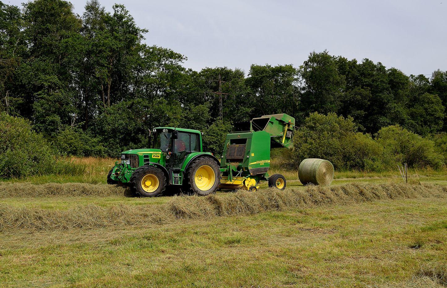
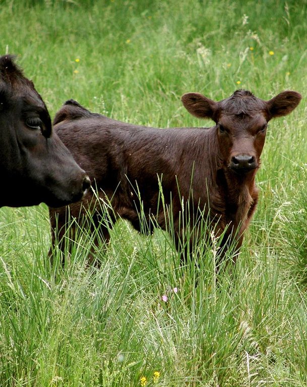
Extensive suckler cow husbandry
Location: Arnegger Ried. Ulm, Baden-Wurttemberg, Germany
Date: 30.05.2013
Technical knowledge required for field staff / advisors: low
Technical knowledge required for land users: low
Main technical functions: improvement of ground cover, stabilisation of soil (eg by tree roots against land slides), increase in organic matter
Secondary technical functions: improvement of water quality, buffering / filtering water, reduction in wind speed, promotion of vegetation species and varieties (quality, eg palatable fodder)
4.6 الصيانة/الأنشطة المتكررة
| النشاط | نوع التدبير | التوقيت/الوتيرة | |
|---|---|---|---|
| 1. | The costs depend on the intensity of the management, the more intensive the use the higher the cost (e.g. reseeding etc.) | إدارية |
4.7 التكاليف والمدخلات اللازمة للصيانة/للأنشطة المتكررة (سنويًا)
| تحديد المدخلات | الوحدة | الكمية | التكاليف لكل وحدة | إجمالي التكاليف لكل مدخل | % من التكاليف التي يتحملها مستخدمو الأراضي | |
|---|---|---|---|---|---|---|
| العمالة | Labour | ha | 1,0 | 135,0 | 135,0 | 100,0 |
| معدات | Machine use | ha | 1,0 | 100,0 | 100,0 | 100,0 |
| المواد النباتية | Seeds | ha | 1,0 | 100,0 | 100,0 | 100,0 |
| إجمالي تكاليف صيانة التقنية | 335,0 | |||||
4.8 أهم العوامل المؤثرة على التكاليف
قدم وصفا لأهم العوامل التي تؤثر على التكاليف:
There are no direct costs if grassland is not converted but managed as before but there might be opportunity costs: If a farmer would convert his grassland to cropland and cultivate arable crops he might have a higher profit than he would have from grassland cultivation.
5. البيئة الطبيعية والبشرية
5.1 المناخ
هطول الأمطار السنوي
- < 250 مم
- 251- 500 ملم
- 501 - 750ملم
- 1,000-751 ملم
- 1,500-1,100 ملم
- 2,000-1,500 ملم
- 3,000-2,001 ملم
- 4,000-3,100 ملم
- > 4000 ملم
المواصفات/التعليقات على هطول الأمطار:
Annual rainfall: 250-500 mm, 500-750 mm, 750-1000 mm, 1000-1500 mm (Annual precipitation for Germany ranges between circa 430-1275mm)
المنطقة المناخية الزراعية
- رطبة
Thermal climate class: temperate
5.2 طوبوغرافيا
متوسط الانحدارات:
- مسطح (0-2%)
- بسيط (3-5%)
- معتدل (6-10%)
- متدحرج (11-15%)
- تلال (16-30%)
- شديدة الانحدار(31-60%)
- فائقة الانحدار (>60%)
التضاريس:
- هضاب/سهول
- أثلام مرتفعة
- المنحدرات الجبلية
- منحدرات التلال
- منحدرات في السفوح
- قاع الوادي
المنطقة الارتفاعية:
- 100-0 متر فوق سطح البحر
- 500-101 متر فوق سطح البحر
- 1,000-501 متر فوق سطح البحر
- 1,500-1,001 متر فوق سطح البحر
- 2,000-1,501 متر فوق سطح البحر
- 2,500-2,100 متر فوق سطح البحر
- 3,000-2,501 متر فوق سطح البحر
- 4,000-3,001 متر فوق سطح البحر
- > 4000 متر فوق سطح البحر
التعليقات والمواصفات الإضافية بشأن التضاريس:
Slopes on average: flat (0-2%), gentle (3-5%), moderate (6-10%)
Altitudinal zone: 0-100 m a.s.l., 100-500 m a.s.l., 500-1000 m a.s.l.
5.3 التربة
متوسط عمق التربة:
- ضحل جدًا (0-20 سم)
- ضحلة (21-50 سم)
- متوسطة العمق (51-80 سم)
- عميقة (81-120 سم)
- عميقة جدًا (> 120 سم)
إذا كان متاحًا، قم بإرفاق وصف كامل للتربة أو تحديد المعلومات المتوفرة، على سبيل المثال نوع التربة، الرقم الهيدروجيني/ درجة حموضة التربة، قدرة التبادل الكاتيوني، النيتروجين، الملوحة وما إلى ذلك.
Soil depth on average: Very shallow-shallow (Aspects not relevant. Further, grasslands are distributed german-wide and thus conditions are diverse)
Soil texture (Aspects not relevant. Further, grasslands are distributed german-wide and thus conditions are diverse).
Soil fertility (Aspects not relevant. Further, grasslands are distributed german-wide and thus conditions are diverse).
Topsoil organic matter (Aspects not relevant. Further, grasslands are distributed german-wide and thus conditions are diverse).
Soil drainage/infiltration is good
Soil water storage capacity is very high
5.4 توافر المياه ونوعيتها
منسوب المياه الجوفية:
< 5 م
توافر المياه السطحية:
جيد
نوعية المياه (غير المعالجة):
للاستخدام الزراعي فقط (الري)
5.5 التنوع البيولوجي
تنوع الأنواع:
- مرتفع
التعليقات والمواصفات الإضافية بشأن التنوع البيولوجي:
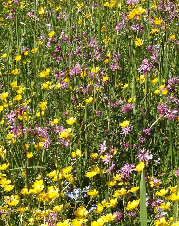
Especially extensive grassland is species rich and contains rare and specialized species
5.6 خصائص مستخدمي الأراضي الذين يطبقون التقنية
التوجه السوقي لنظام الإنتاج:
- تجاري/سوق
أفراداً أو مجموعات:
- فرد/أسرة معيشية
الجنس:
- نساء
- رجال
اذكر الخصائص الأخرى ذات الصلة لمستخدمي الأراضي:
Land users applying the Technology are mainly common / average land users
Population density: 200-500 persons/km2
Annual population growth: < 0.5%
Market orientation of production system: nature conservation
5.7 متوسط مساحة الأرض المملوكة أو المستأجرة من قبل مستخدمي الأراضي الذين يطبقون التقنية
- < 0.5 هكتارا
- 0.5 - 1 هكتار
- 1 -2 هكتار
- 2 - 5 هكتار
- 5 - 15 هكتار
- 15 - 50 هكتار
- 50 - 100هكتار
- 500-100 هكتار
- 1,000-500 هكتار
- 10,000-1,000 هكتار
- > 10,000 هكتار
التعليقات:
Average area of land owned or leased by land users applying the Technology: 5-15 ha, 5-15 ha, 15-50 ha
Size of cropland per household:
Grassland 4.700.000 ha, houshould 40.200.000
Size of grazing land per household: farms 300.000 grassland 4.700.000 ha
5.8 ملكية الأراضي، وحقوق استخدام الأراضي، وحقوق استخدام المياه
ملكية الارض:
- فردية، لا يوجد سند ملكية
- NGO
حقوق استخدام الأراضي:
- فردي
التعليقات:
human environment: Grassland per household: Grassland 4.700.000 ha, farms 300.000
6. الآثار والتصريحات الختامية
6.1 الآثار التي أظهرتها التقنية في الموقع
الآثار الاجتماعية والاقتصادية
الإنتاج
إنتاج المحاصيل
تنوع المنتج
توافر المياه ونوعيتها
توافر مياه الشرب
التعليقات/ حدد:
In areas with low precipitation
نوعية مياه الشرب
التعليقات/ حدد:
In areas with low precipitation
الطلب على مياه الري
التعليقات/ حدد:
perhaps
الدخل والتكاليف
النفقات على المدخلات الزراعية
التعليقات/ حدد:
Yes
دخل المزرعة
عبء العمل
الآثار الاجتماعية والثقافية
الفرص الترفيهية
Improved livelihoods and human well-being
التعليقات/ حدد:
Disadvantages will realised if grassland preservation won't be done.
الآثار الايكولوجية
دورة المياه / الجريان السطحي
جودة المياه
التعليقات/ حدد:
Yes: Due to fertilization, pesticides
الجريان السطحي
التربة
رطوبة التربة
غطاء التربة
فقدان التربة
تكون قشرة التربة السطحية/انسداد مسام التربة
تراص التربة
دورة المغذيات/إعادة الشحن
المادة العضوية في التربة/تحت الطبقة c
التنوع البيولوجي: الغطاء النباتي، الحيوانات
التنوع النباتي
الأنواع المفيدة
تنوع الموائل
الحد من مخاطر المناخ والكوارث
انبعاث الكربون والغازات المسببة للاحتباس الحراري
الآثار الايكولوجية الأخرى
Hazard towards adverse events
6.2 الآثار التي أظهرتها التقنية خارج الموقع
الرواسب المنقولة بواسطة الرياح
6.3 تعرض التقنية وحساسيتها لتغير المناخ التدريجي والظواهر المتطرفة/الكوارث المرتبطة بالمناخ (كما يراها مستخدمو الأراضي)
تغير مناخ تدريجي
تغير مناخ تدريجي
| الموسم | نوع التغير المناخي/ المتطرف | كيف تتعامل التقنية مع ذلك؟ | |
|---|---|---|---|
| درجة الحرارة السنوية | زيادة | جيدا |
الظواهر المتطرفة / الكوارث المرتبطة بالمناخ
الكوارث الجوية
| كيف تتعامل التقنية مع ذلك؟ | |
|---|---|
| عاصفة ممطرة محلية | جيدا |
| عاصفة هوائية محلية | جيدا |
الكوارث المناخية
| كيف تتعامل التقنية مع ذلك؟ | |
|---|---|
| جفاف | جيدا |
الكوارث الهيدرولوجية
| كيف تتعامل التقنية مع ذلك؟ | |
|---|---|
| فيضان عام (نهر) | جيدا |
العواقب الأخرى المتعلقة بالمناخ
العواقب الأخرى المتعلقة بالمناخ
| كيف تتعامل التقنية مع ذلك؟ | |
|---|---|
| انخفاض فترة النمو | جيدا |
6.4 تحليل التكلفة والعائد
كيف يمكن مقارنة العوائد نسبة لتكاليف الإنشاء (من وجهة نظر مستخدمي الأراضي)؟
عوائد قصيرة الأجل:
سلبي
عوائد طويلة الأجل:
سلبي
كيف تتم مقارنة العوائدمع كلفة الصيانة/التكاليف المتكررة (من وجهة نظر مستخدمي الأراضي)؟
عوائد قصيرة الأجل:
سلبي
عوائد طويلة الأجل:
سلبي للغاية
التعليقات:
main cost are opportunity cost of arable land use, they occur yearly.
6.5 اعتماد التقنية
التعليقات:
There is a strong trend towards spontaneous adoption of the Technology
Comments on adoption trend: Within the Common Agricultural Policy of the EU reform grassland protection is enhanced since 1 January 2015. In Germany the conversion of grassland is subject to approval and in general only permitted if the same area converted is established as grassland in the same region.
6.7 نقاط القوة / المزايا / الفرص التي توفرها التقنية
| نقاط القوة/ المزايا/ الفرص من وجهة نظر مستخدمي الأراضي |
|---|
|
Conservation/restoration of regional typically landscapes. How can they be sustained / enhanced? Grassland preservation is enhanced by legal restrictions. Financial incentives for land users make grassland preservation more attractive from an economical point of view. |
| نقاط القوة/ المزايا/ الفرص من وجهة نظر جامع المعلومات أو غيره من الاشخاص الرئيسيين لمصدر المعلومات |
|---|
|
By avoiding conversion of grassland to cropland huge amounts of GHG emissions can be avoided. Further advantages are a lower risk of soil erosion, possible flood prevention, lower levels of fertilizers and pesticides leaching into runoff waters, and higher biodiversity conservation. How can they be sustained / enhanced? Grassland preservation is enhanced by legal restrictions. Financial incentives for land users make grassland preservation more attractive from an economical point of view. |
6.8 نقاط ضعف / مساوىء / مخاطر التقنية وسبل التغلب عليها
| نقاط الضعف/ المساوىء/ المخاطر من وجهة نظر مستخدم الأراضي | كيف يمكن التغلب عليها؟ |
|---|---|
| The income from grassland might – if location factors like soil, water availability are suitable – be lower than it would be for cropland. Thus, there can be high opportunity costs of preserving grassland. | Grassland preservation can be enhanced by legal restrictions. Financial incentives for land users make grassland preservation more attractive from an economical point of view. |
7. المراجع والروابط
7.2 المراجع للمنشورات المتاحة
العنوان، المؤلف، السنة، النظام القياسي الدولي لترقيم الكتب ISBN:
UBA (2014)
متاح من أين؟كم التكلفة؟:
http://www.umweltbundesamt.de/publikationen/schwerpunkte-2014
العنوان، المؤلف، السنة، النظام القياسي الدولي لترقيم الكتب ISBN:
Osterburg B et al. (2009) Erfassung, Bewertung und Minderung von Treibhausgasemissionen des deutschen Agrar- und Ernährungssektors.
متاح من أين؟كم التكلفة؟:
Studie im Auftrag des Bundesministeriums für Ernährung, Landwirtschaft und Verbraucherschutz. Arbeitsberichte aus der vTI-Agrarökonomie 2009/03, Braunschweig, Hamburg, Trenthorst
العنوان، المؤلف، السنة، النظام القياسي الدولي لترقيم الكتب ISBN:
Schuler J et al. (2014) Instrumente zur Stärkung von Synergien zwischen Natur- und Klimaschutz im Bereich Landbewirtschaftung
متاح من أين؟كم التكلفة؟:
BfN-Skripten, pp. 187. Bonn, Bad Godesberg
متاح من أين؟كم التكلفة؟:
http://www.umweltbundesamt.de/publikationen/berichterstattung-unter-der-klimarahmenkonvention
متاح من أين؟كم التكلفة؟:
http://www.umweltbundesamt.de/publikationen/berichterstattung-unter-der-klimarahmenkonvention
7.3 روابط للمعلومات ذات الصلة المتوفرة على الإنترنت
عنوان الرابط URL:
http://www.umweltbundesamt.de/publikationen/submission-under-the-united-nations-framework
الروابط والوحدات المواضيعية
توسيع الكل طي الكلالروابط
لا يوجد روابط
الوحدات المواضيعية
لا يوجد وحدات مواضيعية


