Integrated Land and Water Management [جمهورية مولدوفا]
- تاريخ الإنشاء:
- تحديث:
- جامع المعلومات: Valentin Ciubotaru
- المحررون: Valentin Ciubotaru, UNCCD PRAIS
- المراجعون: Farrukh Nazarmavloev, William Critchley, Rima Mekdaschi Studer
Managementul integrat al solului și al apei
technologies_1817 - جمهورية مولدوفا
عرض الأقسام
توسيع الكل طي الكل1. معلومات عامة
1.2 تفاصيل الاتصال بالأشخاص الرئيسيين لمصدر المعلومات والمؤسسات المشاركة في تقييم وتوثيق التقنية
الشخص (الأشخاص) الرئيسي لمصدر المعلومات
متخصص في الإدارة المستدامة للأراضي:
Ciubotaru Valentin
+37322723372 / +37369134294
valentin.ciubotaru@yahoo.com / valentin.chiubotaru@gmail.com
NGO BIOS
11/1 Gheorghe Asachi str., ap. nr. 87
جمهورية مولدوفا
اسم المؤسسة (المؤسسات) التي سهلت توثيق/تقييم التقنية (إذا كان ذلك على صلة)
NGO BIOS (.) - جمهورية مولدوفا1.3 الشروط المتعلقة باستخدام البيانات الموثقة من خلال WOCAT
متى تم تجميع البيانات (ميدانيا)؟:
01/07/2010
يوافق جامع المعلومات والشخص (لاشخاص) الرئيسي لمصدر المعلومات على الشروط المتعلقة باستخدام البيانات الموثقة من خلال WOCAT:
نعم
1.4 إعلان بشأن استدامة التقنية الموصوفة
هل التقنية الموصوفة هنا تمثل مشكلة فيما يتعلق بتدهور الأراضي، بحيث لا يمكن إعلانها تقنية مستدامة لإدارة الأراضي؟:
كلا
2. وصف تقنيةالإدارة المستدامي للأراضي
2.1 وصف مختصر للتقنية
تعريف التقنية:
Integrated land and water management was promoted in order to improve agricultural production while reducing soil loss and nutrient discharge into water bodies. Technical assistance and financial support was provided for sustainable agricultural practices, including: nutrient management, conservation agriculture, integrated cropping management, agroforestry and wetland management.
2.2 وصف تفصيلي للتقنية
الوصف:
Integrated land and water management was promoted in order to improve agricultural production while reducing soil loss and nutrient discharge into water bodies. Technical assistance and financial support was provided for sustainable agricultural practices, including:
1. Manure Management Practices:
Organic manure was substituted for inorganic fertilizer, and eight commune/village stores were constructed together with 1200 household stores and equipment provided for manure handling and field application. A monitoring database was made available.
2. Promotion of Environment-Friendly Agricultural Practices:
A well-documented pilot was completed and evaluated for replication, and 300 farmers then trained in the application of environment-friendly agricultural practices. The capacity of extension staff significantly improved. A monitoring system to determine the impact of practices on soil quality was installed and data collected.
3. Shrub and Tree Planting:
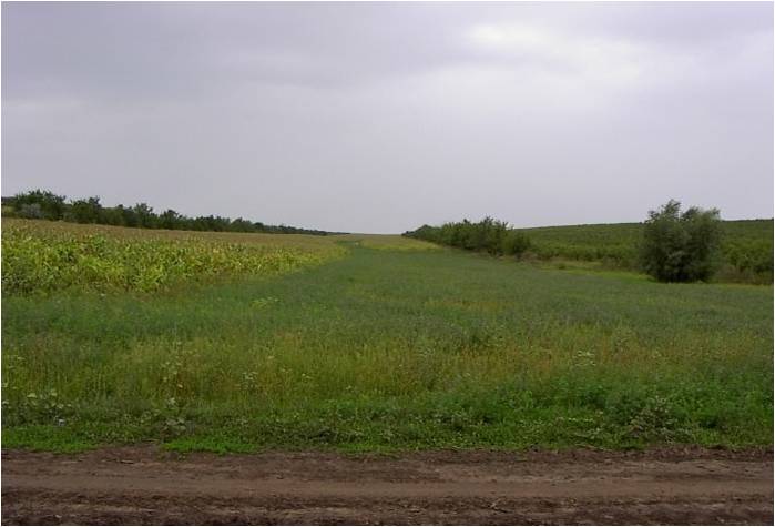
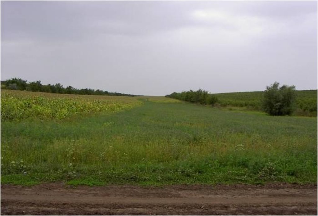
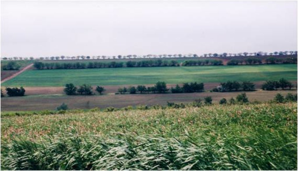
• 132 hectares of shelterbelts for water protection established; 112 hectares of improved anti-erosion forest belts set up; 50 hectares of improved pasture established; 484 hectares of the existing forests rehabilitated and properly managed; forest monitoring was incorporated into the general monitoring scheme.
4.Wetland Restoration and Promotion of Sustainable Management Practices:
The existing ecosystems were rehabilitated and ecologically well balanced. In this context two dams were built with a sluice gate system for the stabilization of water levels; three concrete bridges with adequate culvert capacity were installed for accessibility to different portions of the wetland; and 10 small wood bridges with culverts were built for access.
5 .Monitoring Soil and Water Quality and Environmental Impacts
Availability of water for downstream users and fisheries was increased, drinking water supplies was improved, there was increased quality and availability of groundwater for human and animal consumption, and simultaneously better productive lands with increased organic matter and carbon sequestration, as well as increased biodiversity.
Key Elements of the Manure Management System:
a. Segregation of inert and recyclable materials from livestock waste through the provision of a separate household waste container.
b. Improved manure stores for storage of waste at a single impermeable store at the household with enough storage for up to one month's production.
c. Transfer of waste from the farm store to a central site, using transport units then unloading it at the commune platform, to aerate the waste, promoting continued bacterial activity.
d. At the commune/village store level, the segregated inert materials deposited in designated bunkers.
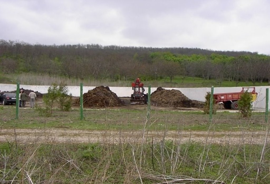
e. At the commune/village store level, management of the household manure at the main bunker involving stacking in shaped windrow heaps three metres high.
f. Store the waste deep so that the areas getting wet from rainfall is minimised. Provide impermeable walls and floor to eliminate leaching.
g. Provide storage capacity for over the winter so that matured manure will be available for use on the land.
Key Elements of facilities at the Village Platform are:
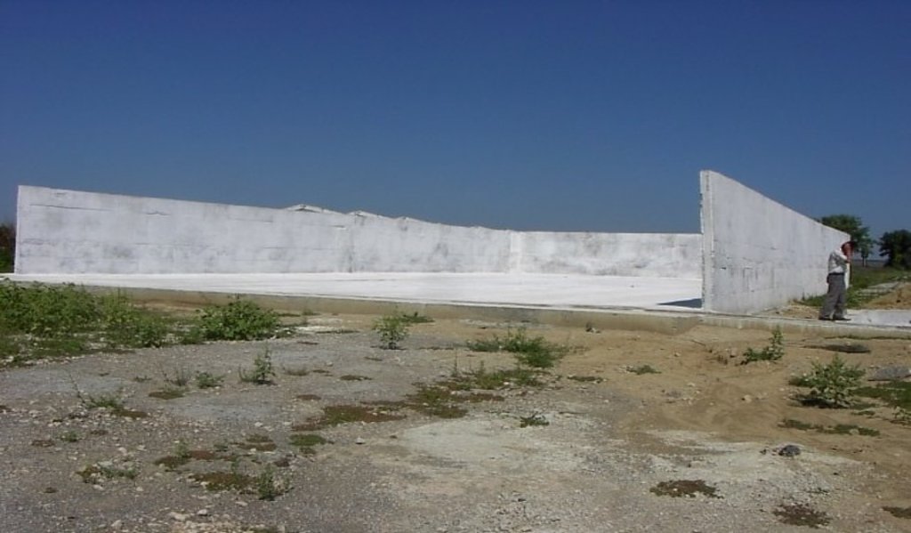
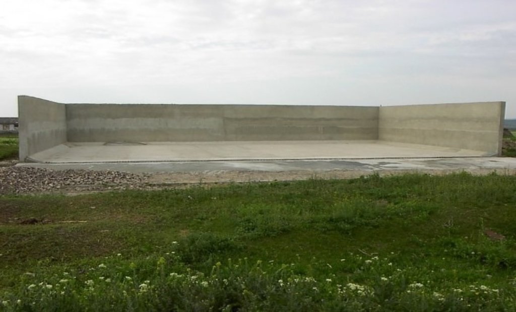
a. Concrete area for the management of the manure.
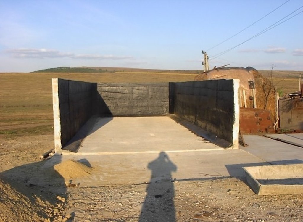
b. Bunkers for the segregated household manure.
c. Collecting channel for runoff from the platform.
d. Storage pits and tanks with impermeable base and walls.
e. Security fencing.
f. Office / Staff facilities and Landscaping. Monitoring wells to check for leakages.
Overall results show that 8,250 farmers from both the project pilot area and other regions of Moldova had adopted at least one environmentally-friendly agricultural practice promoted by the project, and had implemented these on 14,028 ha of land.
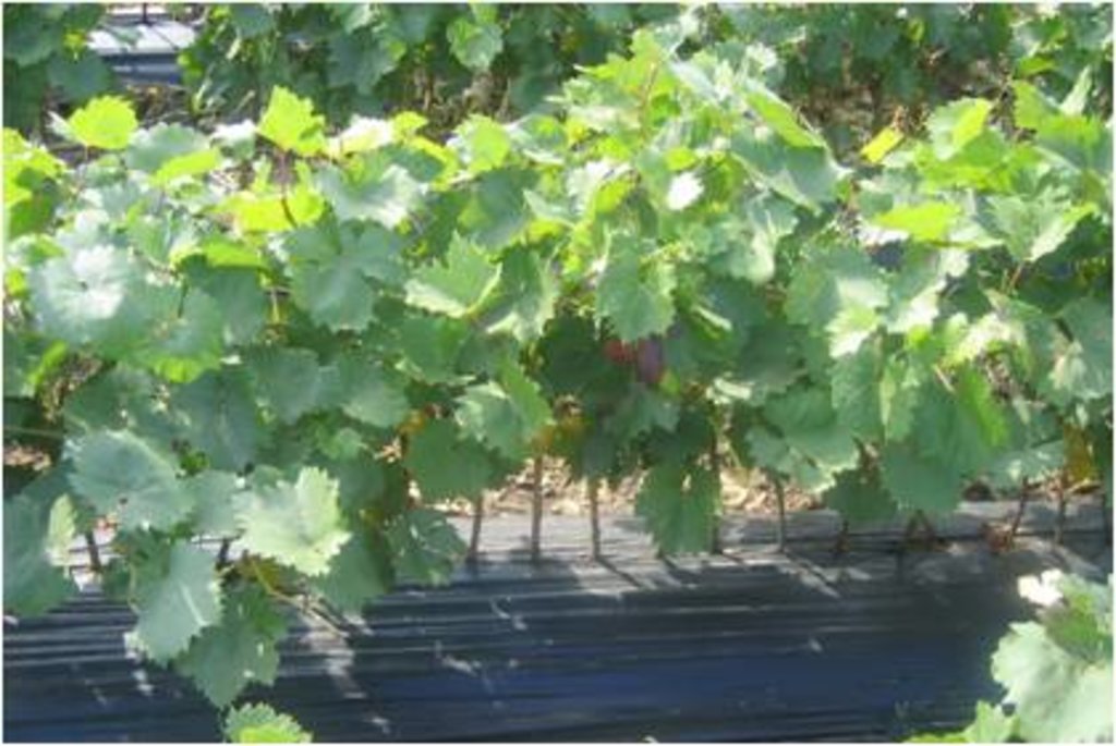
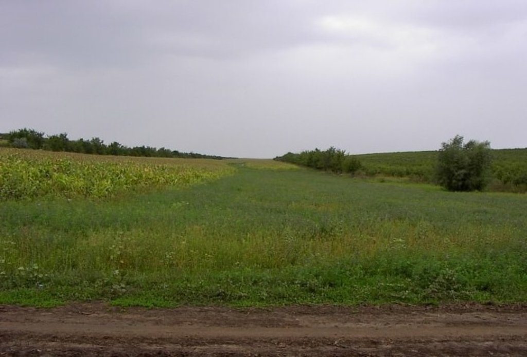
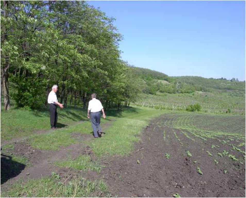
2.3 صور التقنية
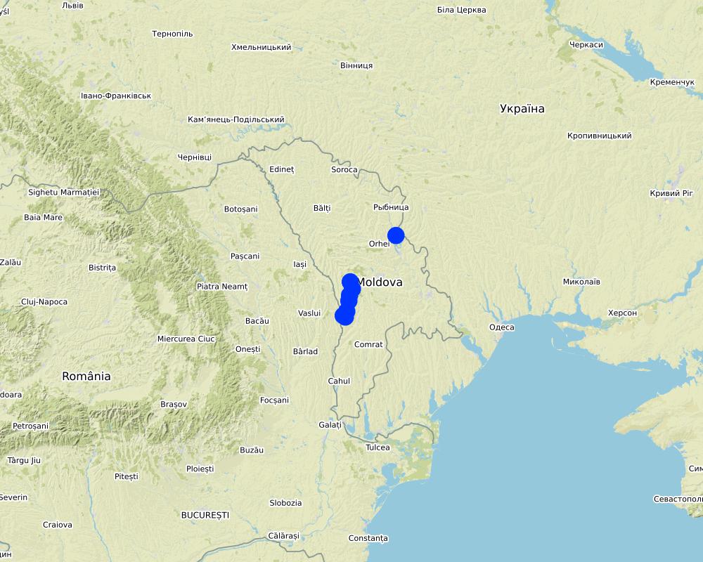
2.5 البلد/المنطقة/المواقع التي تم تنفيذ التقنية فيها والتي يغطيها هذا التقييم
البلد:
جمهورية مولدوفا
المنطقة/الولاية/المحافظة:
Hincesti and Orhei districts
مزيد من التفاصيل حول الموقع:
Negrea, Lapusna, Carpineni, Minjir communes, Hincesti district; Sarata Razesti commune, Leova district, and Jora de Mijloc, Orhei district
Map
×3. تصنيف تقنية الإدارة المستدامي للأراضي
3.1 الغرض الرئيسي ( الأغراض الرئيسية) للتقنية
- تحسين الإنتاج
- الحد من تدهور الأراضي ومنعه وعكسه
- الحفاظ على النظام البيئي
- حماية مستجمعات المياه / المناطق الواقعة في اتجاه مجرى النهر - مع تقنيات أخرى
- الحفاظ على/تحسين التنوع البيولوجي
- الحد من مخاطر الكوارث
- خلق أثر اقتصادي مفيد
3.2 نوع (أنواع) استخدام الأراضي الحالية حيث يتم تطبيق التقنية

الأراضي الزراعية
- زراعة سنوية
- زراعة معمرة (غير خشبية)
- زراعة الأشجار والشجيرات
المحاصيل الرئيسية (المحاصيل النقدية والغذائية):
Wheat, corn, sunflower, alfalfa (lucerne), vineyards, orchards, vegetables

المجاري المائية، المسطحات المائية، الأراضي الرطبة
- خطوط الصرف، الممرات المائية
- المستنقعات والأراضي الرطبة
المنتجات / الخدمات الرئيسية:
The existing ecosystems rehabilitated and ecologically well balanced; dams with a sluice gate system for the stabilization of water levels; concrete bridges with adequate culvert capacity for access to different portions of the wetland; and wooden bridges with culvert capacity for access through the zone constructed
3.3 مزيد من المعلومات حول استخدام الأراضي
إمدادات المياه للأرض التي يتم تنفيذ التقنية عليها:
- مختلط بعلي-مروي
عدد مواسم الزراعة في السنة:
- 1
حدد:
1 growing season per year for rainfed and 2 growing seasons per year for irrigated areas
3.4 مجموعةالإدارة المستدامة للأراضي التي تنتمي إليها هذه التقنية
- إدارة مزارع الغابات
- أنظمة التناوب (تعاقب المحاصيل، البور، الزراعة المتنقلة)
- الإدارة المتكاملة للمحاصيل والثروة الحيوانية
3.5 انتشار التقنية
حدد انتشار التقنية:
- منتشرة بالتساوي على مساحة
إذا كانت التقنية منتشرة بالتساوي على منطقة ما، فحدد المنطقة التقريبية المغطاة:
- > 10,000 كم2
التعليقات:
8,250 farmers from both project pilot area and other regions of Moldova that adopted at least one environmentally friendly agricultural practice promoted by the project implemented on as much as 14,028 ha of land in total.
3.6 التدابير التقنية في مجال إلادارة المستدامة للأراضي

التدابير الزراعية
- A1: الغطاء النباتي/التربة
- A2: المادة العضوية/خصوبة التربة

التدابير النباتية
- V1: غطاء من الأشجار والشجيرات
- V2: الأعشاب والنباتات العشبية المعمرة
- V4: استبدال أو إزالة الأنواع الدخيلة/الغازية

التدابير الإدارية
- M2: تغيير في مستوى الإدارة/الكثافة
- M3: التخطيط وفقا للبيئة الطبيعية والبشرية
- M5: التحكم في/تغيير تركيبة الأنواع
- M6: إدارة النفايات (إعادة التدوير أو إعادة الاستخدام أو التقليل)
3.7 الأنواع الرئيسية من تدهور الأراضي التي تناولتها التقنية

تآكل التربة بالمياه
- الوزن(Wt): فقدان التربة السطحية/تآكل السطح
- (Wg):الانجراف الخلجاني/ الخلجان
- (Wm): مجموعة كبيرة من الحركات الأرضية/انزلاقات أرضية
- (Wr):انجراف ضفة النهر
- (Wo:) تأثيرات التدهور من مواقع أخرى

التدهور الكيميائي للتربة
- (Cn): تراجع الخصوبة وانخفاض محتوى المادة العضوية (غير ناتج عن الانجراف)
- (Cp): تلوث التربة
- (Cs): التملح/ القلونة

التدهور المادي أو الفيزيائي للتربة
- (Pc) : تراص التربة
- (Pk)ظهور وتكون قشرة سطحية
- (Ps): هبوط التربة العضوية، استقرار التربة

التدهور البيولوجي
- (Bc): تناقص الغطاء النباتي
- (Bh): فقدان الموائل
- (Bq): انخفاض الكمية/الكتلة الحيوية
- (Bs): انخفاض جودة وتركيبة الأنواع/التنوع
- (Bl): فقدان الحياة بالتربة

تدهور المياه
- (Ha): التجفيف
- (Hp): تدهور نوعية المياه السطحية
- (Hq): تدهور نوعية المياه الجوفية
- (Hw): تناقص القدرة التخفيفية للمناطق الرطبة
3.8 منع أو حد أو عكس تدهور الأراضي
تحديد هدف التقنية فيما يتعلق بتدهور الأراضي:
- منع تدهور الأراضي
- اصلاح/إعادة تأهيل الأراضي المتدهورة بشدة
4. المواصفات الفنية، وأنشطة التنفيذ، والمدخلات، والتكاليف
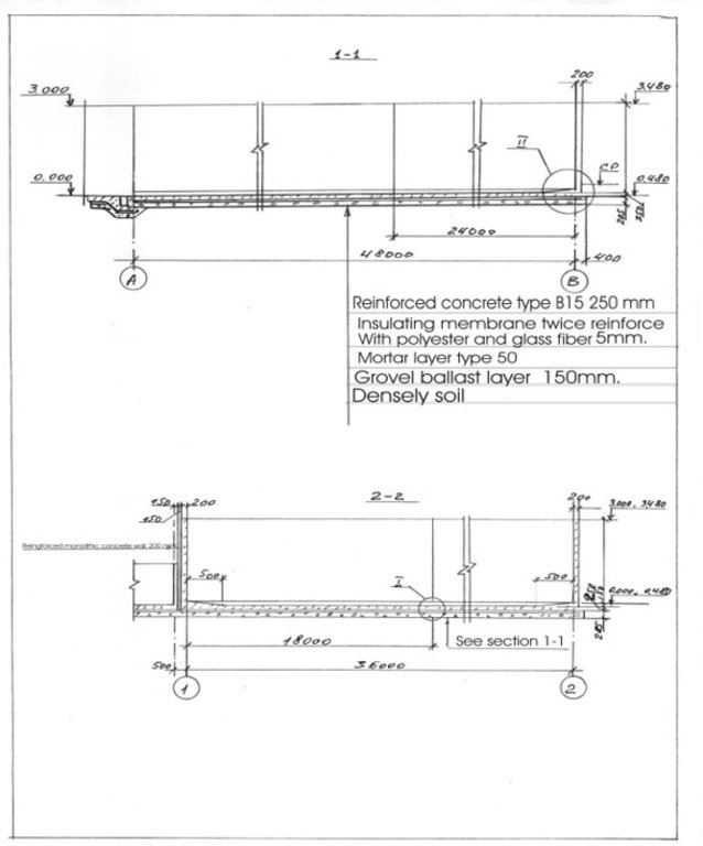
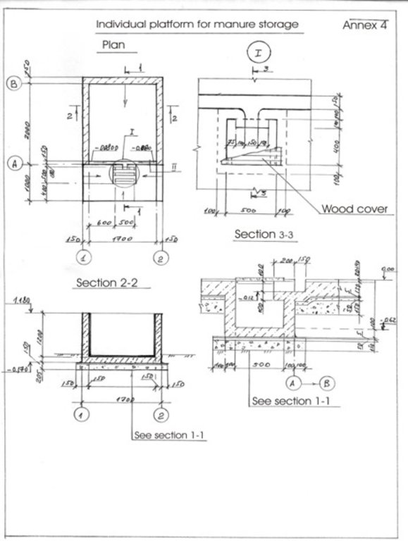
4.1 الرسم الفني للتقنية
4.2 المواصفات الفنية/شروحات الرسم الفني
Schematic structure of village platform: Length - 48 m, Width - 36 m, Height - 3 m, Capacity - 3400 tons, Storage period - 5 months
Schematic structure of household platform: Length - 2.2 m, Height - 1.2 m, Capacity - 4.8 c.m., Storage period - 1 month.
At village level, the project supported the construction of waste storage platforms of 3400 tonnes capacity and a storage period of 5 months. The platform has 48 m length and 36 m width. It is surrounded by a concrete 3 m high wall and bedded by a concrete floor with an impermeable insolating membrane. The platform is equipped with a bunker for inert material and a basin for collection of liquid fraction. The platform is built on the commune land (administrated by the Mayoralty) in full compliance with the environmental protection requirements.
At the household-level 150 platforms were built. The platforms have 2.55 m3 and a storage period of one month. The platform capacity was calculated based on estimated quantity of manure for an average household with at least two cattle, two-three pigs and a certain number of poultry. The designed platform consists of a simple open fronted store with a concrete floor and 1.5 m height walls. In front of the platform, a concrete below ground tank (125 dcm3 volume) covered by a wood lid with a plastic basket inside of 50 liters capacity for collection of liquid fraction would be equipped. A separate small capacity container (about 90 liters) for the collection of recyclable and non-recyclable household wastes was also provided.
4.4 أنشطة التأسيس
| النشاط | نوع التدبير | التوقيت | |
|---|---|---|---|
| 1. | Packages developed for manure management at village and household level and evaluated for replication | ||
| 2. | Public awareness & education | ||
| 3. | Use of good agricultural practices by farmer associations, family farms and individual farmers on cropland. | ||
| 4. | Monitoring & evaluation. |
4.7 التكاليف والمدخلات اللازمة للصيانة/للأنشطة المتكررة (سنويًا)
إذا تحمل مستخدم الأرض أقل من 100% من التكاليف، حدد من قام بتغطية التكاليف المتبقية:
The Project
5. البيئة الطبيعية والبشرية
5.1 المناخ
هطول الأمطار السنوي
- < 250 مم
- 251- 500 ملم
- 501 - 750ملم
- 1,000-751 ملم
- 1,500-1,100 ملم
- 2,000-1,500 ملم
- 3,000-2,001 ملم
- 4,000-3,100 ملم
- > 4000 ملم
حدد متوسط هطول الأمطار السنوي (إذا كان معروفًا)، بالملليمتر:
500,00
الإشارة إلى اسم محطة الأرصاد الجوية المرجعية المعنية:
Hincesti
المنطقة المناخية الزراعية
- شبه رطبة
Climate is moderately continental: the summers are warm and long, with temperatures averaging about 20°C, and the winters are relatively mild and dry, with January temperatures averaging -4°C. Annual rainfall, which ranges from around 500 millimeters; long dry spells are not unusual. The heaviest rainfall occurs in summer; heavy showers and thunderstorms are common.
5.2 طوبوغرافيا
متوسط الانحدارات:
- مسطح (0-2%)
- بسيط (3-5%)
- معتدل (6-10%)
- متدحرج (11-15%)
- تلال (16-30%)
- شديدة الانحدار(31-60%)
- فائقة الانحدار (>60%)
التضاريس:
- هضاب/سهول
- أثلام مرتفعة
- المنحدرات الجبلية
- منحدرات التلال
- منحدرات في السفوح
- قاع الوادي
المنطقة الارتفاعية:
- 100-0 متر فوق سطح البحر
- 500-101 متر فوق سطح البحر
- 1,000-501 متر فوق سطح البحر
- 1,500-1,001 متر فوق سطح البحر
- 2,000-1,501 متر فوق سطح البحر
- 2,500-2,100 متر فوق سطح البحر
- 3,000-2,501 متر فوق سطح البحر
- 4,000-3,001 متر فوق سطح البحر
- > 4000 متر فوق سطح البحر
وضح ما إذا كانت التقنية مطبقة على وجه التحديد في:
- غير ذات صلة
التعليقات والمواصفات الإضافية بشأن التضاريس:
The territory belongs to the Central Moldova Height and the Plain of Upper Prut. The landscape is hilly, very fragmented with a dense network of valleys, hollows and plains. Almost 75% of the land is situated on slopes. Water erosion processes are widespread and quite intense. The predominant length of the hillsides in Negrea pilot area is 800-900 m.
5.3 التربة
متوسط عمق التربة:
- ضحل جدًا (0-20 سم)
- ضحلة (21-50 سم)
- متوسطة العمق (51-80 سم)
- عميقة (81-120 سم)
- عميقة جدًا (> 120 سم)
قوام التربة (التربة السطحية):
- متوسط ( طميي، سلتي)
قوام التربة (> 20 سم تحت السطح):
- متوسط ( طميي، سلتي)
المواد العضوية في التربة السطحية:
- متوسطة (1-3%)
إذا كان متاحًا، قم بإرفاق وصف كامل للتربة أو تحديد المعلومات المتوفرة، على سبيل المثال نوع التربة، الرقم الهيدروجيني/ درجة حموضة التربة، قدرة التبادل الكاتيوني، النيتروجين، الملوحة وما إلى ذلك.
Chernozems (black soils) prevail in the soil composition (65% of the area) divided into argilo-illuvial and carbonate subtypes. These soils are perfectly suited for agriculture. They are friable, permeable, have good water and air saturation and are easy to till. Chernozems are rich in organic matter (3-4% humus content), however they are degraded. Alluvial soils are spread in the floodplain of the Lapusna river and its tributaries. alluvial soils are often subject to salinization and water logging.
5.4 توافر المياه ونوعيتها
منسوب المياه الجوفية:
50-5 م
توافر المياه السطحية:
متوسط
نوعية المياه (غير المعالجة):
مياه الشرب سيئة (تتطلب معالجة)
هل تعتبر ملوحة الماء مشكلة؟:
نعم
حدد:
high water mineralisation
هل تحدث فيضانات في المنطقة؟:
نعم
الإنتظام:
بشكل عرضي
5.5 التنوع البيولوجي
تنوع الأنواع:
- منخفض
تنوع الموائل:
- منخفض
5.6 خصائص مستخدمي الأراضي الذين يطبقون التقنية
مستقر أو مرتحل:
- غير المترحل
التوجه السوقي لنظام الإنتاج:
- مختلط (كفاف/ تجاري)
الدخل من خارج المزرعة:
- 10-50% من جميع الإيرادات
المستوى النسبي للثروة:
- ضعيف
- متوسط
أفراداً أو مجموعات:
- فرد/أسرة معيشية
- المجموعات/ المجتمع المحلي
مستوى المكننة:
- الجر الحيواني
- ميكانيكية/ مزودة بمحرك
الجنس:
- نساء
- رجال
عمر مستخدمي الأرضي:
- كبار السن
اذكر الخصائص الأخرى ذات الصلة لمستخدمي الأراضي:
The principal activity in the commune is agriculture. The farmers cultivate arable crops, grapes and fruits. From vegetables, pea and bean plantations, cabbage, cucumber, tomatoes, beats and carrots are most usual. Potatoes are predominantly cultivated on the households’ plots. There are two small economic units dealing with wood processing and meat production activating under the umbrella of the local farmer’s association, “SRL Negrea-Pomvit”. |
The income of the people depends much on the harvest and climatic conditions, but also on imbalances of the market, import policies, governmental purchases, etc. The estimated average income per capita in the community over the last 3 years was 45 US dollars per month.
5.7 متوسط مساحة الأرض المملوكة أو المستأجرة من قبل مستخدمي الأراضي الذين يطبقون التقنية
- < 0.5 هكتارا
- 0.5 - 1 هكتار
- 1 -2 هكتار
- 2 - 5 هكتار
- 5 - 15 هكتار
- 15 - 50 هكتار
- 50 - 100هكتار
- 500-100 هكتار
- 1,000-500 هكتار
- 10,000-1,000 هكتار
- > 10,000 هكتار
هل يعتبر هذا نطاقًا صغيرًا أو متوسطًا أو واسعا (في إشارة إلى السياق المحلي)؟:
- على نطاق متوسط
- على نطاق واسع
التعليقات:
The total number of land shares in the commune is 772. Each land share has on average 1.20 ha, including 0.70 ha of arable land, 0.15 ha of orchards and 0.35 ha of vineyards. The number of individual farms is 190. The principal landowner in the region is the association of shareholders “SRL Negrea-Pomvit”. The association manages collectively 664 ha. |
5.8 ملكية الأراضي، وحقوق استخدام الأراضي، وحقوق استخدام المياه
ملكية الارض:
- مجتمعي/قروي
- فردية، يوجد سند ملكية
حقوق استخدام الأراضي:
- مجتمعي (منظم)
- مؤجر
حقوق استخدام المياه:
- وصول مفتوح (غير منظم)
- فردي
5.9 الوصول إلى الخدمات والبنية التحتية
الصحة:
- ضعيف
- معتدل
- جيد
التعليم:
- ضعيف
- معتدل
- جيد
المساعدة التقنية:
- ضعيف
- معتدل
- جيد
العمل (على سبيل المثال خارج المزرعة):
- ضعيف
- معتدل
- جيد
الأسواق:
- ضعيف
- معتدل
- جيد
الطاقة:
- ضعيف
- معتدل
- جيد
الطرق والنقل:
- ضعيف
- معتدل
- جيد
مياه الشرب وخدمات الصرف الصحي:
- ضعيف
- معتدل
- جيد
الخدمات المالية:
- ضعيف
- معتدل
- جيد
6. الآثار والتصريحات الختامية
6.1 الآثار التي أظهرتها التقنية في الموقع
الآثار الاجتماعية والاقتصادية
الإنتاج
إنتاج المحاصيل
التعليقات/ حدد:
According to elevator (NGO BIOS), •The SROI (Social Return on Investment) ratio for the period of 2004-2009 was 3,34, or, every $US1 invested by the Project $US 3,34 worth of value (economic, social and/or environmental) was delivered to society.
إنتاج حيواني
إنتاج الخشب
إنتاج الغابات غير الخشبية
خطر فشل الإنتاج
إدارة الأراضي
توافر المياه ونوعيتها
نوعية مياه الشرب
نوعية المياه للماشية
نوعية مياه الري
الآثار الايكولوجية
دورة المياه / الجريان السطحي
الجريان السطحي
التربة
فقدان التربة
تراص التربة
دورة المغذيات/إعادة الشحن
المادة العضوية في التربة/تحت الطبقة c
التنوع البيولوجي: الغطاء النباتي، الحيوانات
الغطاء النباتي
التنوع النباتي
الأنواع الدخيلة الغازية
تنوع الموائل
6.2 الآثار التي أظهرتها التقنية خارج الموقع
تراكم الطمي باتجاه مصب النهر
تلوث المياه الجوفية/الأنهار
القدرة على التخفيف / الترشيح
الأضرار التي لحقت بحقول الجيران
الضرر على البنية التحتية العامة/ الخاصة
تعليقات بشأن تقييم الأثر:
he Social Survey indicated an improved environmental situation in LPA in comparison to other rural localities. Some problems in LPA are not so acute as there were in 2002, especially soil erosion, aquatic reservoirs pollution and quality of potable water, which demonstrates the efficiency of APCP P|
The fact that over 50 % of the respondents from Lapusnita Pilot Area consider APCP implementation has a positive impact on life, health and environment, shows that APCP contributed substantially to the improving the economic, social and ecological conditions, especially in LPA. The acknowledged impa|
It is expected that the project will be scaled up at the national level and facilities for waste management will be improved in all communities; the value of manure will be appreciated and used as fertiliser, wetlands will be restored; environment-friendly practices, including reintroducing trees wi|
The level of applied good agricultural practices in LPA is higher than in other communities of the country and has increased as compared to 2003. Farmers apply more organic fertilizers (by 13%), forest belts (10%), strip cropping (9%) and less mineral fertilizers (17%).
ACSA organized 90 seminars. People from all districts attended the training seminars. Survey data show that 90 % of the participants in seminars intended to apply GAP.
Over 3,000 farmers adopted at least 1 of GAP in Lapusnita Pilot Area and over 12,000 outside LPA. The total area, where environmentally-friendly practices were applied was 28,275 ha.
6.3 تعرض التقنية وحساسيتها لتغير المناخ التدريجي والظواهر المتطرفة/الكوارث المرتبطة بالمناخ (كما يراها مستخدمو الأراضي)
التعليقات:
Healthy organisms are adapted easily to various conditions. In this way agro-ecosystems having soils and water with improved properties (due to application of good agricultural practices) with adequate management practices will have also positively impact on climate change adaptation.
Due to the fact that Good Agricultural practices improve soil and water qualities, they create very good conditions for the development of soil biodiversity and wild biodiversity in farming landscapes. Due to the reduction of pollution landscapes become more healthy and also is very beneficial for the agricultural biodiversity.
Permanent vegetated strips established at field and stream riparian boundaries and in water courses will create conditions for the development of biodiversity.|
Conventional agriculture is the major contributor to increasing of methane and nitrous oxide concentrations in earth's atmosphere. Aforestation and soil conservation technologies are one of the main sink of carbon dioxide. In this way good agricultural practices have a positively impact on climate change mitigation.
6.4 تحليل التكلفة والعائد
كيف يمكن مقارنة العوائد نسبة لتكاليف الإنشاء (من وجهة نظر مستخدمي الأراضي)؟
عوائد قصيرة الأجل:
إيجابي قليلا
عوائد طويلة الأجل:
إيجابي
كيف تتم مقارنة العوائدمع كلفة الصيانة/التكاليف المتكررة (من وجهة نظر مستخدمي الأراضي)؟
عوائد قصيرة الأجل:
محايد/متوازن
عوائد طويلة الأجل:
إيجابي
6.5 اعتماد التقنية
- 50-10%
إذا كان متاحًا، قم بتحديد الكمية (عدد الأسر المعيشية و/أو المساحةالمغطاة):
8,250 farmers from both project pilot area and other regions of Moldova
من بين جميع الذين تبنوا التقنية، كم عدد الذين فعلوا ذلك بشكل تلقائي، أي دون تلقي أي حوافز مادية/مدفوعات؟:
- 50-10%
6.6 التكيف
هل تم تعديل التقنية مؤخرًا لتتكيف مع الظروف المتغيرة؟:
كلا
6.8 نقاط ضعف / مساوىء / مخاطر التقنية وسبل التغلب عليها
| نقاط الضعف/ المساوىء/ المخاطر من وجهة نظر مستخدم الأراضي | كيف يمكن التغلب عليها؟ |
|---|---|
| Farmers did not calculate properly expenses and benefits. | They should be provided simple instruments to calculate their inputs and to plan for future activity. |
| Agricultural literature is too difficult for rural people to understand. | Knowledge should be provided in an accessible manner. Small guides should exist for separate crops with drawings and schemes. |
7. المراجع والروابط
7.1 طرق جمع/مصادر المعلومات
- مقابلات مع مستخدمي الأراضي
300
7.2 المراجع للمنشورات المتاحة
العنوان، المؤلف، السنة، النظام القياسي الدولي لترقيم الكتب ISBN:
Guidelines for Good Agricultural Practices (Practici agricole prietenoase mediului). Îndrumar: /Ungureanu V., Cerbari V., Magdîl A., Gherman E.- Chişinău: Tipografia Centrală, 2006. – 96 p.
متاح من أين؟كم التكلفة؟:
http://www.acsa.md/album.php?l=ro&idc=152&t=/GALERIE-FOTO/Practici-agricole-prietenoase-mediului
7.3 روابط للمعلومات ذات الصلة المتوفرة على الإنترنت
العنوان/الوصف:
Moldova - Agricultural Pollution Control Project (English)
عنوان الرابط URL:
http://documents.worldbank.org/curated/en/117701468287732017/Moldova-Agricultural-Pollution-Control-Project
الروابط والوحدات المواضيعية
توسيع الكل طي الكلالروابط
لا يوجد روابط
الوحدات المواضيعية
لا يوجد وحدات مواضيعية


