Social Tenure Domain Model (STDM) [كينيا]
- تاريخ الإنشاء:
- تحديث:
- جامع المعلومات: Ken Otieno
- المحرر: –
- المراجعون: Barbara *, Hanspeter Liniger, Donia Mühlematter
STDM
technologies_3318 - كينيا
- Social Tenure Domain Model (STDM): 5 يوليو، 2018 (inactive)
- Social Tenure Domain Model (STDM): 7 مايو، 2019 (public)
- Social Tenure Domain Model (STDM): 28 يونيو، 2018 (inactive)
- Social Tenure Domain Model (STDM): 4 يونيو، 2018 (inactive)
- Social Tenure Domain Model (STDM): 19 مايو، 2018 (inactive)
- Social Tenure Domain Model (STDM): 5 مارس، 2018 (inactive)
عرض الأقسام
توسيع الكل طي الكل1. معلومات عامة
1.2 تفاصيل الاتصال بالأشخاص الرئيسيين لمصدر المعلومات والمؤسسات المشاركة في تقييم وتوثيق التقنية
الشخص (الأشخاص) الرئيسي لمصدر المعلومات
متخصص في الإدارة المستدامة للأراضي:
اسم المشروع الذي سهّل توثيق/تقييم التقنية (إذا كان ذلك على صلة)
Book project: Guidelines to Rangeland Management in Sub-Saharan Africa (Rangeland Management)1.3 الشروط المتعلقة باستخدام البيانات الموثقة من خلال WOCAT
متى تم تجميع البيانات (ميدانيا)؟:
11/12/2017
يوافق جامع المعلومات والشخص (لاشخاص) الرئيسي لمصدر المعلومات على الشروط المتعلقة باستخدام البيانات الموثقة من خلال WOCAT:
نعم
1.4 إعلان بشأن استدامة التقنية الموصوفة
هل التقنية الموصوفة هنا تمثل مشكلة فيما يتعلق بتدهور الأراضي، بحيث لا يمكن إعلانها تقنية مستدامة لإدارة الأراضي؟:
كلا
التعليقات:
The technology has demonstrated SLM.
2. وصف تقنيةالإدارة المستدامي للأراضي
2.1 وصف مختصر للتقنية
تعريف التقنية:
The Social Tenure Domain Model (STDM) is about people and their relationships with land. The tool as applied secures tenure through the recognition of tenure diversity and social contexts. In the management of land and resources use, STDM facilitates proper land use and management to minimize practices that lead to degradation.
2.2 وصف تفصيلي للتقنية
الوصف:
Technology application: The Social Tenure Domain Model is applied in order to relate natural and human environments. It is a social tool that defines the relationship of persons to natural resources such as land, their utilization of it, and sharing - for sustainable development. To realize optimal resource utilization, the tool enables the direct engagement of the resource users in a collective and participatory way. The technology allows communities to be part of a guided data collection and data entry into an STDM platform. The data includes social and economic data based on what is needed. The platform also can enable storage of information and documents such as title deeds. Names, gender, properties where the community members needs to have such information. These details can be updated and can inform planning and resource allocation by government and development partners.
Main characteristics of the technology: STDM is a relational database built on an open source GIS platform called Quontum GIS (QGIS), running on Postgres SQL. This tool was built by Global Tools Land Network (GLTN). The tool captures both spatial information related to locations of land parcels, natural resources captured in points and defined in maps. Secondly, the technology captures socio-economic aspects of a resource, and allows definition of the type of relationship that exists between the resource and the person, as well as an indication of the percentage particular tenure regime in the areas including the existing rights and how they play out. The system recognizes the different level of rights thus appreciating that they are multiple and overlaid resulting to multiple uses. Therefore the technology enables the capture of bundles of rights that people have/should enjoy in a resource. The technology allows generation of reports and performs the desired analysis by the proponents and the beneficiaries of the information stored within the databases. It is open source, thus available free -hence its sustainability.
The purposes/ functions of the STDM: The functions of the technology as have been piloted by RECONCILE and partners has focused around land tenure. It addresses security of tenure for vulnerable poor communities living within informal settlements, through participatory common resource identification, mapping and documentation, key resources including cattle dips, salt lick areas/fields and water points management has improved. This is due to the recognition of boundaries anticipatorily defined leading to revival of and establishment of community resources management committees especially around water and grazing lands. This in return has improved /increased production of both plants and animals. However, the technology can be customized to serve other purposes of information storage and management.
The major activities/ inputs needed to establish/ maintain the technology: Major inputs are needed in empowerment of local communities through building their capacity to apply the technology through their own initiative. Building community-based resource centres and equipping them with computers installed with the software ensures that the technology is centred on the day-to-day activities of the communities and institutions.
Benefits/ impacts: The technology has left better organised communities in terms of managing land and other resources. The technology has assisted local governments to manage issues of land ownership, especially within the context of customary land tenure and ownership. The county governments of Kenya, for instance, have spatial data and information that can help in planning and resources allocation. In areas where the technology has been used in the context of RECONCILE's work, better services and resources can be acquired given accurate information of Mapping land tenure, boundaries, water points and the water rights, infrastructure, different grazing lands and plans for the utilization of the grazing land and the rights of different users. It can result in improved and sustainable use of natural resources which in turn have a direct impact on production.
Small-scale dairy farmers have been able to manage grazing lands, water and salt licks to improve production of animal products. Information captured and managed by the technology has enabled communities within informal settlements to negotiate with government authorities to enable land allocation and thus security of tenure and improved livelihoods.
What do land users like / dislike about the technology?
Likes: The technology is flexible, it can be customized to capture information in any form desired. It is based on a GIS platform which is easy to manipulate and is open source.
Dislikes: Users sometimes encounter errors that are a result of incorrect information entered, and these errors are written with the programming format: thus it requires good knowledge of the technology to remedy this.
2.3 صور التقنية
ملاحظات عامة بخصوص الصور:
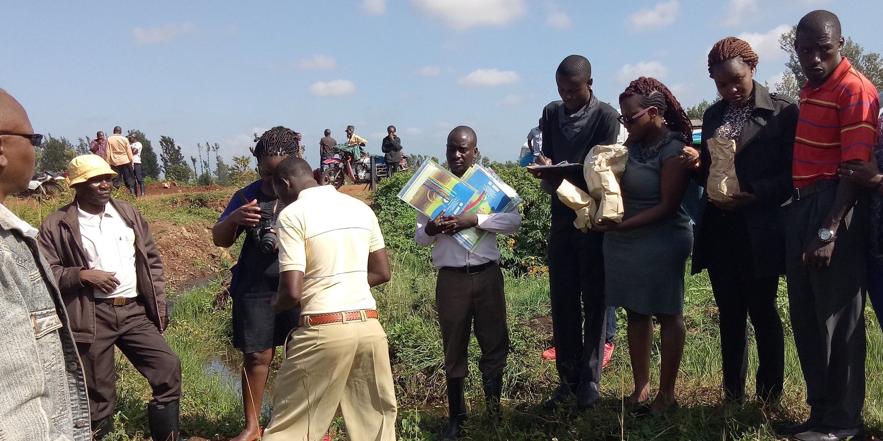
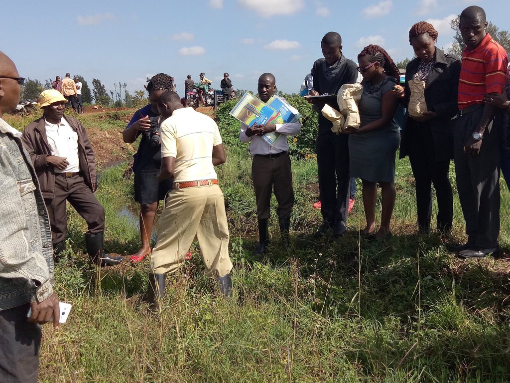
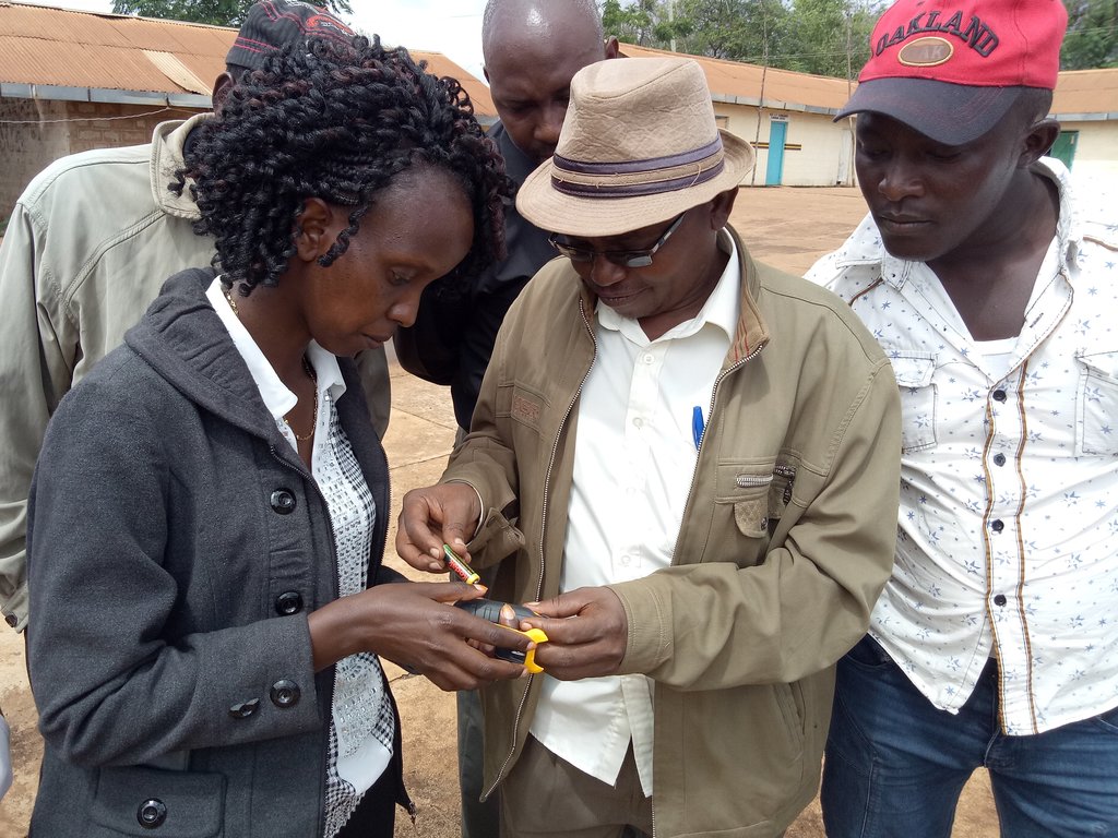
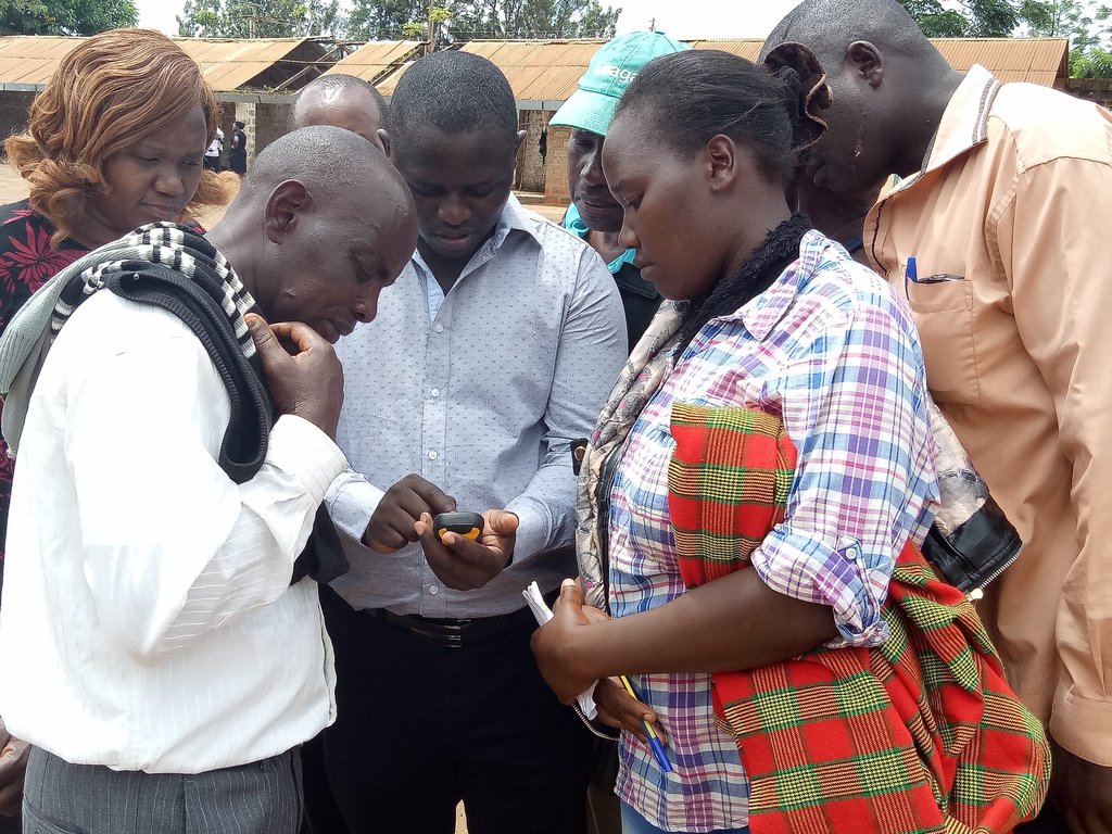
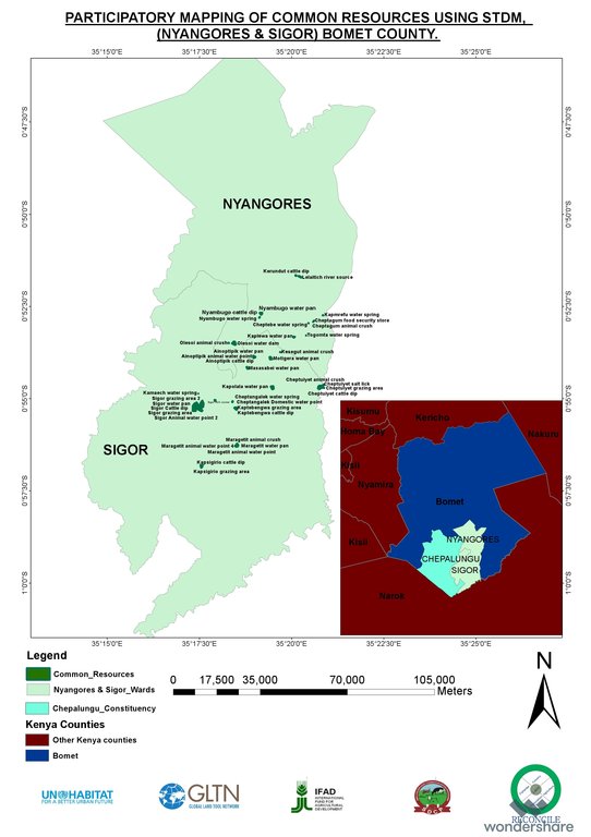
This activity was done to complement the social economic data collected and create the ability to understand the social tenure relationship between farmers and the common resources.
2.5 البلد/المنطقة/المواقع التي تم تنفيذ التقنية فيها والتي يغطيها هذا التقييم
البلد:
كينيا
المنطقة/الولاية/المحافظة:
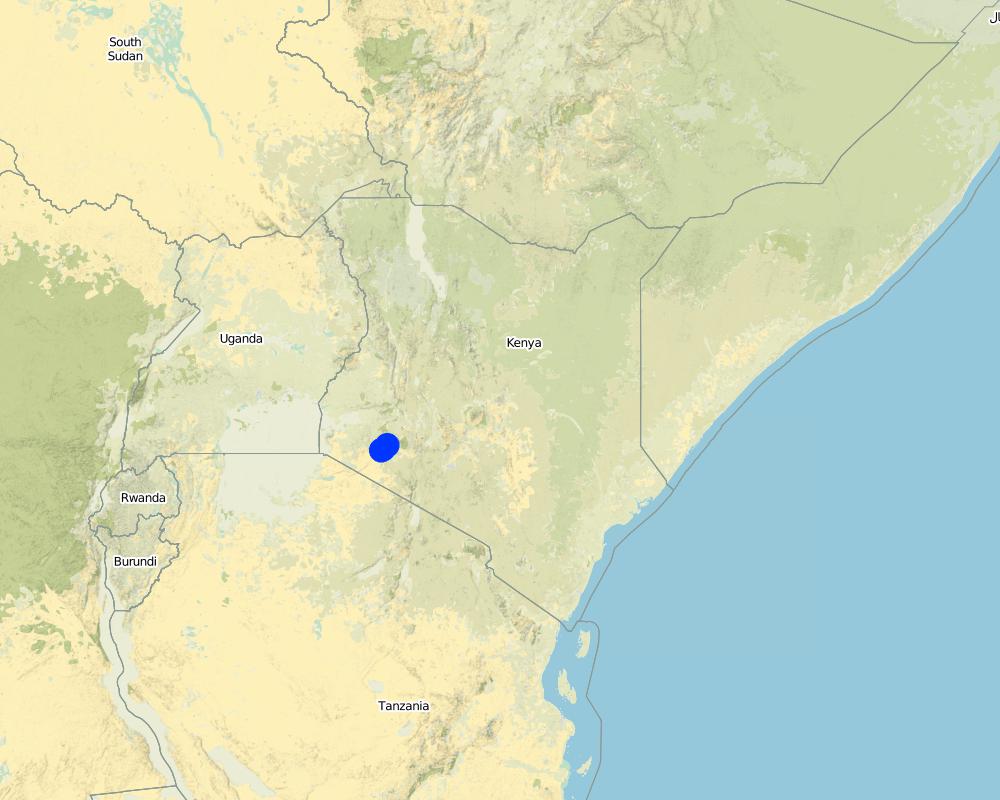
Bomet county
مزيد من التفاصيل حول الموقع:
Kembu sub-county
Map
×2.6 تاريخ التنفيذ
اذكر سنة التنفيذ:
2016
2.7 إدخال التقنية
حدد كيف تم إدخال التقنية:
- من خلال المشاريع/ التدخلات الخارجية
3. تصنيف تقنية الإدارة المستدامي للأراضي
3.1 الغرض الرئيسي ( الأغراض الرئيسية) للتقنية
- تحسين الإنتاج
- الحد من تدهور الأراضي ومنعه وعكسه
- الحفاظ على النظام البيئي
- حماية مستجمعات المياه / المناطق الواقعة في اتجاه مجرى النهر - مع تقنيات أخرى
3.2 نوع (أنواع) استخدام الأراضي الحالية حيث يتم تطبيق التقنية

أراضي الرعي
أراضي الرعي الواسع النطاق:
- رعي شبه مرتحل
الرعي المكثف/ إنتاج الأعلاف:
- قطع وحمل / صفر مرعى
الأنواع والمنتجات الحيوانية الرئيسية:
The cattle kept in Ndaraweta are mainly cross-breeds between local animals and Friesian or Ayrshire cattle. The communities are currently in an advance stage of upgrading, but they still keep some short-horned local zebu cows as well.

مختلطة (محاصيل/ رعي/ أشجار)، بما في ذلك الحراجة الزراعية
- الرعي الزراعي
المنتجات / الخدمات الرئيسية:
The cattle are kept for multiple uses including milk, meat, and hides. The communities grow hay for local use and sale within.
التعليقات:
The technology did therefore help the communities to appreciate the common resources that support the livestock keeping.
إذا تغير استخدام الأراضي بسبب التقنية، قم بالإشارة إلى استخدام الأرض قبل تنفيذ التقنية:
Before the mapping exercise, the management of most common resources were not given much attention. After participatory mapping and documenting these resources and the establishment of information on encroachment, degradation and the neglected water points, communities took up the management of the resources more seriously and therefore improved knowledge and clarity around the land tenure rights for the communities and the need for tenure security and protection of rangelands and the resources therein.
3.3 مزيد من المعلومات حول استخدام الأراضي
إمدادات المياه للأرض التي يتم تنفيذ التقنية عليها:
- بعلية
عدد مواسم الزراعة في السنة:
- 2
حدد:
April to October and November through March
كثافة الثروة الحيوانية (إذا كانت ذات صلة):
NA
3.4 مجموعةالإدارة المستدامة للأراضي التي تنتمي إليها هذه التقنية
- إدارة الغابات الطبيعية وشبه الطبيعية
- الرعي وإدارة المراعي
- الإدارة المتكاملة للمحاصيل والثروة الحيوانية
3.5 انتشار التقنية
حدد انتشار التقنية:
- منتشرة بالتساوي على مساحة
إذا كانت التقنية منتشرة بالتساوي على منطقة ما، فحدد المنطقة التقريبية المغطاة:
- 100-10 كم2
التعليقات:
The technology is applicable in both. It can be customized to fit any use. The best outcome though is total area social enumeration and spatial mapping.
3.6 التدابير التقنية في مجال إلادارة المستدامة للأراضي

التدابير الإدارية
- M1: التغيير في نوع استخدام الأراضي
- M2: تغيير في مستوى الإدارة/الكثافة
- M3: التخطيط وفقا للبيئة الطبيعية والبشرية
3.7 الأنواع الرئيسية من تدهور الأراضي التي تناولتها التقنية

تدهور المياه
- (Hs): التغيير في كمية المياه السطحية
- (Hw): تناقص القدرة التخفيفية للمناطق الرطبة

آخر
التعليقات:
Land degradation in rangelands is a problem that is being experienced and other challenges especially in the areas where agro-pastoralism is practiced include sustainable land use and management. The mapping process while not having direct response to these issues, it demonstrated that the communities can use sustainable means in land use through land use planning.
3.8 منع أو حد أو عكس تدهور الأراضي
تحديد هدف التقنية فيما يتعلق بتدهور الأراضي:
- الحد من تدهور الأراضي
- التكيف مع تدهور الأراضي
4. المواصفات الفنية، وأنشطة التنفيذ، والمدخلات، والتكاليف
4.1 الرسم الفني للتقنية
4.2 المواصفات الفنية/شروحات الرسم الفني
The overall space or measurements for the project areas were within the range of 25 to 75 square kilometres.
4.3 معلومات عامة بخصوص حساب المدخلات والتكاليف
حدد كيفية احتساب التكاليف والمدخلات:
- حسب مساحة تنفيذ التقنية
الإشارة إلى حجم ووحدة المساحة:
Each project area 25 km2 (Project areas of three Sub-Counties 75 km2)
حدد العملة المستخدمة لحساب التكاليف:
- دولار أمريكي
أشر إلى سعر الصرف من الدولار الأمريكي إلى العملة المحلية (إذا كان ذا صلة): 1 دولار أمريكي =:
101,0
اذكر متوسط تكلفة أجر العمالة المستأجرة في اليوم الواحد:
between Ksh. 2000 to 3000 depending on the kind of labour required and can go down to a compromised rate of ksh. 1000.
4.4 أنشطة التأسيس
| النشاط | نوع التدبير | التوقيت | |
|---|---|---|---|
| 1. | Enumeration of at least 1000 farmers | تدابير أخرى | 9 months |
| 2. | Mapping of communal resources water points, salt lick areas, cattle dips etc | بنيوية أو هيكلية | 9 months |
| 3. | Mapping of private resources water points within the private areas | بنيوية أو هيكلية | 9 months |
| 4. | Data Management | إدارية | 3 months |
| 5. | Preparation of data collection including testing of the tools | تدابير أخرى | 1 month |
| 6. | Dialogue sessions with community leaders | إدارية | 2 months |
| 7. | Negotiations on the methodology for data collection and the kind of information to be collected/asked | بنيوية أو هيكلية | 1 month |
| 8. | Technical reviews and reflection with project team and partners | إدارية | 1 month |
التعليقات:
The kind of tasks undertaken in this process is more project oriented combined with advocacy and policy processes.
4.5 التكاليف والمدخلات اللازمة للتأسيس
| تحديد المدخلات | الوحدة | الكمية | التكاليف لكل وحدة | إجمالي التكاليف لكل مدخل | % من التكاليف التي يتحملها مستخدمو الأراضي | |
|---|---|---|---|---|---|---|
| العمالة | Enumerators | persons | 90,0 | 50,0 | 4500,0 | |
| العمالة | Consultants | Persons | 6,0 | 1000,0 | 6000,0 | |
| العمالة | Technical Staff contribution and time | persons | 5,0 | 750,0 | 3750,0 | |
| العمالة | Data processing and management | persons | 24,0 | 60,0 | 1440,0 | |
| معدات | Data entry and analysis | persons | 20,0 | 40,0 | 800,0 | |
| معدات | GPS hiring | 120,0 | 55,0 | 6600,0 | ||
| معدات | GPS purchase | 5,0 | 320,0 | 1600,0 | ||
| معدات | Computers | 4,0 | 750,0 | 3000,0 | ||
| معدات | Conferences | 9,0 | 1500,0 | 13500,0 | ||
| غير ذلك | Administrative costs | 9 months | 9,0 | 1400,0 | 12600,0 | |
| غير ذلك | Logistical support | 36,0 | 600,0 | 21600,0 | ||
| غير ذلك | Preliminary activities including targeted dialogue etc | Travels and associated costs | 5,0 | 300,0 | 1500,0 | |
| غير ذلك | Documentation of the project (to be finalized) | Video documentary | 2,0 | 3000,0 | 6000,0 | |
| إجمالي تكاليف إنشاء التقنية | 82890,0 | |||||
إذا تحمل مستخدم الأرض أقل من 100% من التكاليف، حدد من قام بتغطية التكاليف المتبقية:
UNHABITAT, RECONCILE, Smallholder Dairy Commercialization Programme (SDCP)
التعليقات:
The project was supported by the UNHABITAT with contributions from RECONCILE and partners. the community contribution in kind is not included since it has not been tabulated in terms of cash.
4.6 الصيانة/الأنشطة المتكررة
| النشاط | نوع التدبير | التوقيت/الوتيرة | |
|---|---|---|---|
| 1. | NA | ||
| 2. | NA | ||
| 3. | NA |
التعليقات:
The project did not have physical structures developed. However, as a result of the work structures like cattle dips have been rehabilitated and are currently being maintained by the the communities themselves. This does not need recurrent costs for maintenance or otherwise by the project.
4.8 أهم العوامل المؤثرة على التكاليف
قدم وصفا لأهم العوامل التي تؤثر على التكاليف:
The technology costs are dependent on the size and number of resources targeted by the process. It will therefore define the costs accordingly.
5. البيئة الطبيعية والبشرية
5.1 المناخ
هطول الأمطار السنوي
- < 250 مم
- 251- 500 ملم
- 501 - 750ملم
- 1,000-751 ملم
- 1,500-1,100 ملم
- 2,000-1,500 ملم
- 3,000-2,001 ملم
- 4,000-3,100 ملم
- > 4000 ملم
المواصفات/التعليقات على هطول الأمطار:
The area is sub-humid.
الإشارة إلى اسم محطة الأرصاد الجوية المرجعية المعنية:
Kenya Meteorological department
المنطقة المناخية الزراعية
- رطبة
- شبه رطبة
The average temperature in Bomet is 17.5 °C. Precipitation averages 1247 mm.
5.2 طوبوغرافيا
متوسط الانحدارات:
- مسطح (0-2%)
- بسيط (3-5%)
- معتدل (6-10%)
- متدحرج (11-15%)
- تلال (16-30%)
- شديدة الانحدار(31-60%)
- فائقة الانحدار (>60%)
التضاريس:
- هضاب/سهول
- أثلام مرتفعة
- المنحدرات الجبلية
- منحدرات التلال
- منحدرات في السفوح
- قاع الوادي
المنطقة الارتفاعية:
- 100-0 متر فوق سطح البحر
- 500-101 متر فوق سطح البحر
- 1,000-501 متر فوق سطح البحر
- 1,500-1,001 متر فوق سطح البحر
- 2,000-1,501 متر فوق سطح البحر
- 2,500-2,100 متر فوق سطح البحر
- 3,000-2,501 متر فوق سطح البحر
- 4,000-3,001 متر فوق سطح البحر
- > 4000 متر فوق سطح البحر
وضح ما إذا كانت التقنية مطبقة على وجه التحديد في:
- غير ذات صلة
5.3 التربة
متوسط عمق التربة:
- ضحل جدًا (0-20 سم)
- ضحلة (21-50 سم)
- متوسطة العمق (51-80 سم)
- عميقة (81-120 سم)
- عميقة جدًا (> 120 سم)
قوام التربة (التربة السطحية):
- خشن / خفيف (رملي)
قوام التربة (> 20 سم تحت السطح):
- خشن / خفيف (رملي)
5.4 توافر المياه ونوعيتها
منسوب المياه الجوفية:
50-5 م
توافر المياه السطحية:
متوسط
5.5 التنوع البيولوجي
تنوع الأنواع:
- متوسط
تنوع الموائل:
- منخفض
5.6 خصائص مستخدمي الأراضي الذين يطبقون التقنية
مستقر أو مرتحل:
- غير المترحل
- شبه مرتحل
التوجه السوقي لنظام الإنتاج:
- مختلط (كفاف/ تجاري)
الدخل من خارج المزرعة:
- 10-50% من جميع الإيرادات
المستوى النسبي للثروة:
- متوسط
أفراداً أو مجموعات:
- المجموعات/ المجتمع المحلي
- تعاونية
مستوى المكننة:
- عمل يدوي
- الجر الحيواني
الجنس:
- نساء
- رجال
عمر مستخدمي الأرضي:
- شباب
- متوسط العمر
5.7 متوسط مساحة الأرض المملوكة أو المستأجرة من قبل مستخدمي الأراضي الذين يطبقون التقنية
- < 0.5 هكتارا
- 0.5 - 1 هكتار
- 1 -2 هكتار
- 2 - 5 هكتار
- 5 - 15 هكتار
- 15 - 50 هكتار
- 50 - 100هكتار
- 500-100 هكتار
- 1,000-500 هكتار
- 10,000-1,000 هكتار
- > 10,000 هكتار
هل يعتبر هذا نطاقًا صغيرًا أو متوسطًا أو واسعا (في إشارة إلى السياق المحلي)؟:
- على نطاق صغير
5.8 ملكية الأراضي، وحقوق استخدام الأراضي، وحقوق استخدام المياه
ملكية الارض:
- مجتمعي/قروي
- فردية، يوجد سند ملكية
حقوق استخدام الأراضي:
- مجتمعي (منظم)
- فردي
حقوق استخدام المياه:
- وصول مفتوح (غير منظم)
- مجتمعي (منظم)
5.9 الوصول إلى الخدمات والبنية التحتية
الصحة:
- ضعيف
- معتدل
- جيد
التعليم:
- ضعيف
- معتدل
- جيد
المساعدة التقنية:
- ضعيف
- معتدل
- جيد
العمل (على سبيل المثال خارج المزرعة):
- ضعيف
- معتدل
- جيد
الأسواق:
- ضعيف
- معتدل
- جيد
الطاقة:
- ضعيف
- معتدل
- جيد
الطرق والنقل:
- ضعيف
- معتدل
- جيد
مياه الشرب وخدمات الصرف الصحي:
- ضعيف
- معتدل
- جيد
الخدمات المالية:
- ضعيف
- معتدل
- جيد
6. الآثار والتصريحات الختامية
6.1 الآثار التي أظهرتها التقنية في الموقع
الآثار الاجتماعية والاقتصادية
الإنتاج
إنتاج الأعلاف
التعليقات/ حدد:
The production in the farms increased for milk
جودة العلف
التعليقات/ حدد:
The size of fodder producers also increased. the production trend is stable based on the number of farmers involved.
إنتاج حيواني
الدخل والتكاليف
دخل المزرعة
التعليقات/ حدد:
Resulting from the proper land use and increased milk production based on more pasture, costs increased.
الآثار الايكولوجية
الحد من مخاطر المناخ والكوارث
آثار الجفاف
6.2 الآثار التي أظهرتها التقنية خارج الموقع
توافر المياه
تدفقات مائية موثوقة ومستقرة في موسم الجفاف
القدرة على التخفيف / الترشيح
آثار الغازات الدفيئة
6.3 تعرض التقنية وحساسيتها لتغير المناخ التدريجي والظواهر المتطرفة/الكوارث المرتبطة بالمناخ (كما يراها مستخدمو الأراضي)
تغير مناخ تدريجي
تغير مناخ تدريجي
| الموسم | نوع التغير المناخي/ المتطرف | كيف تتعامل التقنية مع ذلك؟ | |
|---|---|---|---|
| هطول الأمطار السنوي | انخفاض | باعتدال |
العواقب الأخرى المتعلقة بالمناخ
العواقب الأخرى المتعلقة بالمناخ
| كيف تتعامل التقنية مع ذلك؟ | |
|---|---|
| انخفاض فترة النمو | باعتدال |
6.4 تحليل التكلفة والعائد
كيف يمكن مقارنة العوائد نسبة لتكاليف الإنشاء (من وجهة نظر مستخدمي الأراضي)؟
عوائد قصيرة الأجل:
إيجابي
عوائد طويلة الأجل:
ايجابي جدا
كيف تتم مقارنة العوائدمع كلفة الصيانة/التكاليف المتكررة (من وجهة نظر مستخدمي الأراضي)؟
عوائد قصيرة الأجل:
محايد/متوازن
عوائد طويلة الأجل:
إيجابي
6.5 اعتماد التقنية
- أكثر من 50%
إذا كان متاحًا، قم بتحديد الكمية (عدد الأسر المعيشية و/أو المساحةالمغطاة):
The technology covered around 500 individual farmers.
من بين جميع الذين تبنوا التقنية، كم عدد الذين فعلوا ذلك بشكل تلقائي، أي دون تلقي أي حوافز مادية/مدفوعات؟:
- 50-10%
التعليقات:
The technology application did not attract any material gains or incentives but, the process was community centered thus the adoption.
6.6 التكيف
هل تم تعديل التقنية مؤخرًا لتتكيف مع الظروف المتغيرة؟:
نعم
حدد تكيف التقنية(التصميم، المواد/الأنواع، الخ.):
The technology was more of the urban oriented tool but had to be modified to adopt to the local demands.
6.7 نقاط القوة / المزايا / الفرص التي توفرها التقنية
| نقاط القوة/ المزايا/ الفرص من وجهة نظر مستخدمي الأراضي |
|---|
|
Ability to define spatial space and common and private resources including those resources associated with milk production such as milk coolers, water points, cattle dips, food stores, grazing areas, salt licks, crushes, animal corridors, forest etc. Establishes the carrying capacity of communal shared resources. |
|
Establishment of the land tenure system of shared communal resources and issues arising. Status (management) of private resources within the rangelands. Production and income generated against household size. |
| نقاط القوة/ المزايا/ الفرص من وجهة نظر جامع المعلومات أو غيره من الاشخاص الرئيسيين لمصدر المعلومات |
|---|
|
The nature of the problem required innovative use in the mapping of the land and natural resources. The technology addressed immediate needs and provided a foundation for future updates and demands. The technology benefited from the existing data and improved delivery of output without any impediments. |
|
The technology bridged the gap through skills transfer and capacity building and in facilitating dialogue on issues affecting the community (Maps, reports). Ability to adapt the technology in a simple manner that the users can relate to, and find value in their use contributed immensely to success Introduced even a more user-friendly use of mobile and smart-phones. The “quick win” could be seen in the transformation of mobile phones into data collection tools and the data can be seen, verified and shared, replacing the tedious manual process which many were struggling with. |
|
STDM databases accommodate the inclusion of social, economic and spatial data that can be maintained, accessed and updated by the communities anytime. Provided visual representation of available resources and their distribution and people can relate to spatial information on the map. |
| Ownership of technology by local people who are now leading on data collection, customizing the template, developing reports and innovating on its use. |
6.8 نقاط ضعف / مساوىء / مخاطر التقنية وسبل التغلب عليها
| نقاط الضعف/ المساوىء/ المخاطر من وجهة نظر مستخدم الأراضي | كيف يمكن التغلب عليها؟ |
|---|---|
|
The design of the tool was more urban oriented and it took time to be adapted for rural use especially where land is communal and customary rights are key. |
Created more awareness. |
| نقاط الضعف/ المساوىء/ المخاطر من وجهة نظر جامع المعلومات أو غيره من الاشخاص الرئيسيين لمصدر المعلومات | كيف يمكن التغلب عليها؟ |
|---|---|
|
Difficult to set-up the server environment where no internet is available. Engaging other service providers may be difficult and takes time (Internet service provider need to authorize setting up additional server). Appropriate devices for capturing data may require an additional budget. |
The internet component remains a challenge Technology is evolving and needs systematic information channels between the community members. The process requires proper funding in order not to have a break in between. |
7. المراجع والروابط
7.1 طرق جمع/مصادر المعلومات
- زيارات ميدانية، مسوحات ميدانية
900
- مقابلات مع مستخدمي الأراضي
900
- مقابلات مع المتخصصين/الخبراء في الإدارة المستدامة للأراضي
2
- التجميع من التقارير والوثائق الأخرى الموجودة
7.3 روابط للمعلومات ذات الصلة المتوفرة على الإنترنت
العنوان/الوصف:
RECONCILE end of project report and other progress reports are available for sharing
العنوان/الوصف:
Food security in Bomet county
عنوان الرابط URL:
awsc.uonbi.ac.ke/sites/default/files/chss/arts/.../Bomet-final.doc
الروابط والوحدات المواضيعية
توسيع الكل طي الكلالروابط
لا يوجد روابط
الوحدات المواضيعية
لا يوجد وحدات مواضيعية


