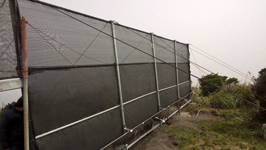
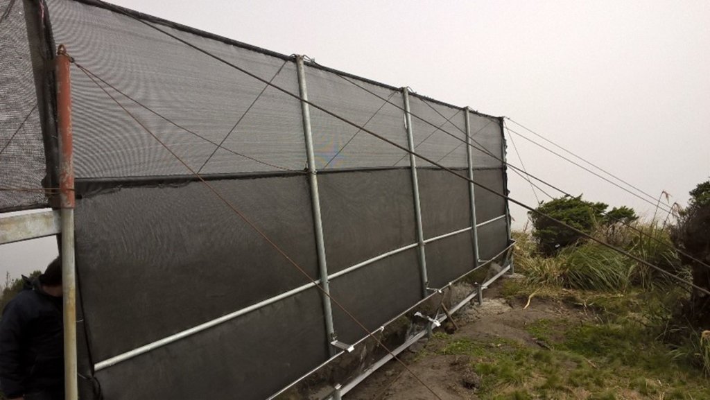
Implementation of a fog water capture system in a conservation area in the community of Shaushi. [الإكوادور]
- تاريخ الإنشاء:
- تحديث:
- جامع المعلومات: Raul Galeas
- المحرر: –
- المراجعون: Tatenda Lemann, Johanna Jacobi
Shaushi Community, La Matriz Parish, Canton Quero, Province of Tungurahua.
technologies_4050 - الإكوادور
عرض الأقسام
توسيع الكل طي الكل1. معلومات عامة
1.2 تفاصيل الاتصال بالأشخاص الرئيسيين لمصدر المعلومات والمؤسسات المشاركة في تقييم وتوثيق التقنية
الشخص (الأشخاص) الرئيسي لمصدر المعلومات
Galeas Raul
0986027084
raul12hc@gmail.com
CONDESAN
Calle Germán Alemán E12-123 y Carlos Arroyo del Río.
الإكوادور
1.3 الشروط المتعلقة باستخدام البيانات الموثقة من خلال WOCAT
متى تم تجميع البيانات (ميدانيا)؟:
01/05/2017
يوافق جامع المعلومات والشخص (لاشخاص) الرئيسي لمصدر المعلومات على الشروط المتعلقة باستخدام البيانات الموثقة من خلال WOCAT:
نعم
1.4 إعلان بشأن استدامة التقنية الموصوفة
هل التقنية الموصوفة هنا تمثل مشكلة فيما يتعلق بتدهور الأراضي، بحيث لا يمكن إعلانها تقنية مستدامة لإدارة الأراضي؟:
كلا
التعليقات:
Land management practice is intended to preserve and restore soil conditions in the area of implementation.
2. وصف تقنيةالإدارة المستدامي للأراضي
2.1 وصف مختصر للتقنية
تعريف التقنية:
The practice consists in the installation of a water capture system, coming from the fog of the Cerro Shaushi zone, that allows to cover the need of water for domestic consumption of the inhabitants of the upper zone of the Community of Shaushi.
2.2 وصف تفصيلي للتقنية
الوصف:
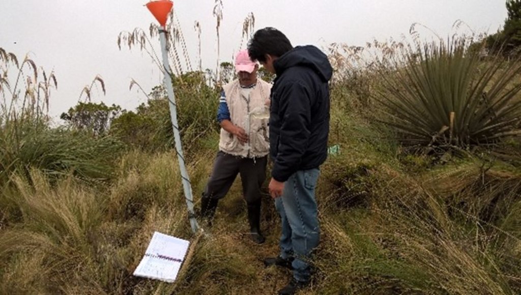
The technology was applied in the Shaushi community in La Matriz parish, Canton Quero, province of Tungurahua. It consists in the installation of fog water capture system, declaration of a conservation and protection area, and participatory monitoring of water quality and quantity. Among the purposes of the technology is to make the population aware of the sustainable use of the territory and of the environmental services it provides, and to motivate them to take an active part in the conservation and protection of natural areas and water sources. Major activities are the periodic revision of the water capture system, repair and/or replacement of deteriorated or destroyed elements, and the continuous evaluation of the functionality of the practice, and continuous monitoring of water quality and quantity. The main benefit is the availability of water for human consumption in quantity and quality, conservation of natural areas, improvement of the relationship between human beings and nature, and to have hydrometeorological information for research purposes. The users of the practice are satisfied with its implementation and the benefits perceived so far, as they have been able to demonstrate the improvements described. As an opportunity for improvement, the need to deepen the knowledge about the páramo ecosystem and its benefits within the community is established. In addition, the initiative to implement this system in other geographical points is proposed, considering its benefits and the natural conditions of the area that make possible the availability of water for the community.
2.3 صور التقنية
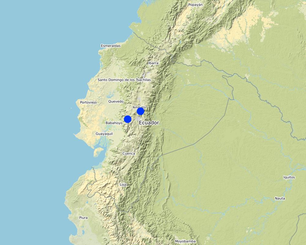
2.5 البلد/المنطقة/المواقع التي تم تنفيذ التقنية فيها والتي يغطيها هذا التقييم
البلد:
الإكوادور
المنطقة/الولاية/المحافظة:
Tungurahua
مزيد من التفاصيل حول الموقع:
Shaushi
التعليقات:
The reserve tank stores water from the fog water capture system and from the Quintina water source for domestic consumption in the Shuashi Community, with which it can supply the beneficiary population (30 families).
Map
×2.6 تاريخ التنفيذ
في حالة عدم معرفة السنة بالتحديد، يرجى الإشارة إلى التاريخ التقريبي:
- منذ أقل من 10 سنوات (مؤخرًا)
2.7 إدخال التقنية
حدد كيف تم إدخال التقنية:
- من خلال ابتكار مستخدمي الأراضي
- أثناء التجارب/الأبحاث
- من خلال المشاريع/ التدخلات الخارجية
التعليقات (نوع المشروع، الخ):
This practice was established thanks to the management carried out by the "Mancomunidda del Frente Sur Occidental", "Fondo de Páramos de Tungurahua" and "the international organization Figth Against Poverty", with the financing of cooperating entities such as "Consorcio para el Desarrollo de la Ecorregión Andina" (CONDESAN) and the Ministry of the Environment, however, it was also a decision of the community of Shaushi, who assigned the area of implementation of the practice for conservation purposes.The reserve tank stores water from the fog water capture system and from the Quintina water source for domestic consumption in the Shuashi Community, with which it can supply the beneficiary population (30 families).
3. تصنيف تقنية الإدارة المستدامي للأراضي
3.1 الغرض الرئيسي ( الأغراض الرئيسية) للتقنية
- الحد من تدهور الأراضي ومنعه وعكسه
- الحفاظ على النظام البيئي
- حماية مستجمعات المياه / المناطق الواقعة في اتجاه مجرى النهر - مع تقنيات أخرى
- الحفاظ على/تحسين التنوع البيولوجي
- خلق أثر اجتماعي مفيد
3.2 نوع (أنواع) استخدام الأراضي الحالية حيث يتم تطبيق التقنية

مختلطة (محاصيل/ رعي/ أشجار)، بما في ذلك الحراجة الزراعية
- الرعي الزراعي
المنتجات / الخدمات الرئيسية:
In the area of implementation of the practice outside the conservation area alternately develops short cycle crops mainly and livestock.

غير ذلك
حدد:
Paramo
ملاحظات:
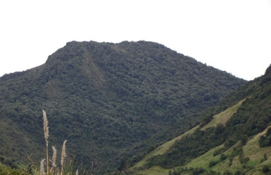
The practice was implemented in an area that preserves its natural conditions and is in recovery. This area was declared a conservation and protection area. In the area of implementation of the practice outside the conservation area alternately develops short cycle crops mainly and livestock.
إذا تغير استخدام الأراضي بسبب التقنية، قم بالإشارة إلى استخدام الأرض قبل تنفيذ التقنية:
The area where the practice was implemented was an area that was partially intervened with activities related to agriculture, grazing and forest plantations (native species and pine). Today the area is restricted under a conservation and protection agreement.
3.3 مزيد من المعلومات حول استخدام الأراضي
إمدادات المياه للأرض التي يتم تنفيذ التقنية عليها:
- مختلط بعلي-مروي
التعليقات:
The area where the practice is applied does not require irrigation since it is currently under conservation agreement. The area of direct influence, outside the conservation area, in the Shaushi community uses rainwater and the Mocha - Quero Canal irrigation system as irrigation water.
عدد مواسم الزراعة في السنة:
- 2
حدد:
In the cultivated area the crops (outside the conservation area) are rotated approximately after 4 to 6 months, depending on the product.
كثافة الثروة الحيوانية (إذا كانت ذات صلة):
In the Shaushi Community, an average of 5-7 cattle per hectare is evident.
3.4 مجموعةالإدارة المستدامة للأراضي التي تنتمي إليها هذه التقنية
- إغلاق المنطقة (إيقاف الاستخدام، دعم الاصلاح)
- حصاد المياه
- حماية/ إدارة الأراضي الرطبة
3.5 انتشار التقنية
حدد انتشار التقنية:
- يتم تطبيقها في نقاط محددة/ تتركز على مساحة صغيرة
التعليقات:
The practice of applying a water capture system, although installed in specific points, is accompanied by the declaration of the implantation zone as a conservation and protection area.
3.6 التدابير التقنية في مجال إلادارة المستدامة للأراضي

التدابير البنيوية
- S7: معدات حصاد المياه/الإمداد/الري

التدابير الإدارية
- M1: التغيير في نوع استخدام الأراضي

تدابير أخرى
التعليقات:
Monitoring of water quality and quantity. The measures chosen correspond in the first case to the water capture system and in the second case refers to the declaration of the area of implantation of the practice as a conservation area.
3.7 الأنواع الرئيسية من تدهور الأراضي التي تناولتها التقنية

التدهور المادي أو الفيزيائي للتربة
- (Pc) : تراص التربة

التدهور البيولوجي
- (Bc): تناقص الغطاء النباتي
- (Bq): انخفاض الكمية/الكتلة الحيوية
- (Bl): فقدان الحياة بالتربة

تدهور المياه
- (Ha): التجفيف
- (Hs): التغيير في كمية المياه السطحية
- (Hp): تدهور نوعية المياه السطحية
- (Hq): تدهور نوعية المياه الجوفية
- (Hw): تناقص القدرة التخفيفية للمناطق الرطبة
التعليقات:
The practice avoids that in the area of conservation and sources of water they are intervened by the inhabitants of the Community of Shaushi and by the cattle of their property, with the development of sustainable activities like the capture of fog water that does not affect the availability of the resource. The water supply for domestic use for the inhabitants of Shaushi is currently provided by the Junta de Shaushi, San Vicente and Pueblo Viejo Drinking Water System. However, service coverage is partial; the inhabitants of the upper area of the Shaushi community do not have access to the water because the population has expanded over time to higher altitudes, making it impossible for the system to provide service for technical and infrastructural reasons. However, the population could not be fully supplied and there was a risk of contamination because there was no adequate infrastructure to distribute water for the two required uses.
3.8 منع أو حد أو عكس تدهور الأراضي
تحديد هدف التقنية فيما يتعلق بتدهور الأراضي:
- منع تدهور الأراضي
- الحد من تدهور الأراضي
التعليقات:
The practice also includes the sustainable management of soil and territory with the capture of water from the fog, the declaration of this area as an area of conservation and protection that will prevent deep soil degradation.
4. المواصفات الفنية، وأنشطة التنفيذ، والمدخلات، والتكاليف
4.1 الرسم الفني للتقنية
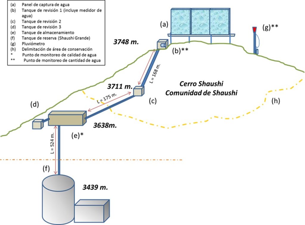
4.2 المواصفات الفنية/شروحات الرسم الفني
Dimensions
Capture Panel Review and Breakthrough Tanks
Height = 4 m. length = 1.0 m.
Length = 10 m. width = 1.0 m.
depth = 1.0 m.
Driving line storage tank
Length = 343 m. length = 3 m.
Diameter = 32 mm. width = 2 m.
depth = 2 m.
Tank capacity Overhaul and breaker tanks
Volume = 1 m3
Storage tank
Volume = 12 m3
Slope angle: Mostly the terrain of the practice implantation zone is 30-40%.
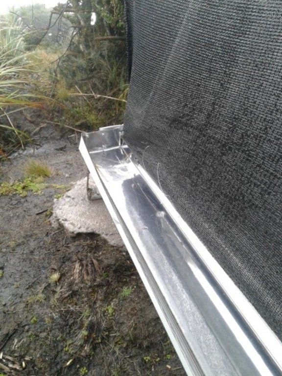
Construction material used: Galvanized steel pipes, zaran mesh, cement, stone, sand and gravel, PVC pipes, fittings (keys, elbows, valves, etc.), iron stakes for supports, tensioners, tol lids for tanks.
Area 137 ha, owned by Shaushi Community
Altitude range approx. 3400-3700 m
Slope range 30 - 40 %.
Parameters considered: pH, conductivity, total dissolved solids, water temperature, precipitation and flow.
Monitoring points water storage tank.
1) Precipitation: Nearby of the water capture screen (neblinometer).
2) Flow: to one side of the water capture panel (neblinometer).
Monthly frequency
1) Precipitation: Weekly
2) Flow: Weekly
Materials and/or equipment used
1) pH, conductivity, total dissolved solids: Multiparametric equipment.
2) Water temperature: Thermometer and/or multiparametric
equipment
1) Precipitation: Totalizer rain gauge (wooden stake, plastic bottle, mangueta, measuring probe.
2) Flow: Micrometer (water meter).
4.3 معلومات عامة بخصوص حساب المدخلات والتكاليف
حدد كيفية احتساب التكاليف والمدخلات:
- حسب مساحة تنفيذ التقنية
حدد العملة المستخدمة لحساب التكاليف:
- دولار أمريكي
اذكر متوسط تكلفة أجر العمالة المستأجرة في اليوم الواحد:
10-20
4.4 أنشطة التأسيس
| النشاط | نوع التدبير | التوقيت | |
|---|---|---|---|
| 1. | Installation of fog water capture system | بنيوية أو هيكلية | Only once the site has been identified. |
| 2. | Declaration of conservation and protection area in the area of implementation of the practice | إدارية | Only once the area of interest has been identified. |
| 3. | Participatory monitoring of water quality and quantity. | تدابير أخرى | Amount of water: weekly Water quality: monthly |
التعليقات:
The most relevant activities carried out for the implementation of the practice are considered. In the following paragraphs the declaration activity of the conservation area will not be considered due to the fact that it is an inter-institutional management activity only.
4.5 التكاليف والمدخلات اللازمة للتأسيس
إذا كان ذلك ممكنًا، قم بتفصيل تكاليف التأسيس وفقًا للجدول التالي، مع تحديد المدخلات والتكاليف لكل مدخل. إذا لم تتمكن من تفصيل التكاليف، فقدم تقديرًا للتكاليف الإجمالية لإنشاء التقنية:
33238,86
| تحديد المدخلات | الوحدة | الكمية | التكاليف لكل وحدة | إجمالي التكاليف لكل مدخل | % من التكاليف التي يتحملها مستخدمو الأراضي | |
|---|---|---|---|---|---|---|
| العمالة | Construction and installation of the elements of the water capture system. Skilled and unskilled labor. | 1 | 1,0 | 26176,33 | 26176,33 | 3,4 |
| العمالة | Water quality and quantity monitoring (measurements) | 1 | 1,0 | 500,0 | 500,0 | 100,0 |
| معدات | Miscellaneous materials for the construction and installation of the water harvesting system | 1 | 1,0 | 2012,53 | 2012,53 | |
| معدات | Materials and equipment for water quality and quantity sampling and measurements | 1 | 1,0 | 4550,0 | 4550,0 | |
| إجمالي تكاليف إنشاء التقنية | 33238,86 | |||||
إذا تحمل مستخدم الأرض أقل من 100% من التكاليف، حدد من قام بتغطية التكاليف المتبقية:
The cooperating entities for the application of the practice were: CONDESAN, Ministry of Environment MAE (Project GIDACC), FMPLPT, Autonomous Decentralized Municipal Government of the canton Santiago Quero and the Commonwealth of FSO.
التعليقات:
The costs were estimated on the basis of the information available from the cooperating entities.
4.6 الصيانة/الأنشطة المتكررة
| النشاط | نوع التدبير | التوقيت/الوتيرة | |
|---|---|---|---|
| 1. | Review of fog water capture system and additional elements for monitoring. | تدابير أخرى | weekly |
| 2. | Repair and/or replacement of deteriorated or damaged elements. | بنيوية أو هيكلية | when necessary |
4.7 التكاليف والمدخلات اللازمة للصيانة/للأنشطة المتكررة (سنويًا)
إذا كان ذلك ممكنًا، قم بتفصيل تكاليف الصيانة وفقًا للجدول التالي، مع تحديد المدخلات والتكاليف لكل مدخل. إذا لم تتمكن من تفصيل التكاليف، قدم تقديرًا للتكاليف الإجمالية لصيانة التقنية:
4900,0
إذا تحمل مستخدم الأرض أقل من 100% من التكاليف، حدد من قام بتغطية التكاليف المتبقية:
The costs so far have been assumed by the Technical Unit of the Commonwealth of Southern Western Front.
التعليقات:
It is proposed that an agreement be made with the community to establish responsibilities for the maintenance of the practice.
4.8 أهم العوامل المؤثرة على التكاليف
قدم وصفا لأهم العوامل التي تؤثر على التكاليف:
According to the perception of the beneficiaries, the most important factor that can affect the system and therefore the costs, are the environmental conditions of the area, especially the presence of strong winds that could mainly affect the water capture panel fog.
5. البيئة الطبيعية والبشرية
5.1 المناخ
هطول الأمطار السنوي
- < 250 مم
- 251- 500 ملم
- 501 - 750ملم
- 1,000-751 ملم
- 1,500-1,100 ملم
- 2,000-1,500 ملم
- 3,000-2,001 ملم
- 4,000-3,100 ملم
- > 4000 ملم
حدد متوسط هطول الأمطار السنوي (إذا كان معروفًا)، بالملليمتر:
615,00
المواصفات/التعليقات على هطول الأمطار:
In the Inter-Andean region the Rainy Period presents a bimodal distribution, presenting a Secondary Rainy Period during the months of September to November and the Main Rainy Period during the months of February to May.
الإشارة إلى اسم محطة الأرصاد الجوية المرجعية المعنية:
Querochaca and Huambalo from INAMHI
المنطقة المناخية الزراعية
- شبه رطبة
The agroclimatic zone was determined based on the information of the biophysical characterization provided in the Diagnosis of the Quero Canton in the Cubillo Paulina Grade Thesis.
5.2 طوبوغرافيا
متوسط الانحدارات:
- مسطح (0-2%)
- بسيط (3-5%)
- معتدل (6-10%)
- متدحرج (11-15%)
- تلال (16-30%)
- شديدة الانحدار(31-60%)
- فائقة الانحدار (>60%)
التضاريس:
- هضاب/سهول
- أثلام مرتفعة
- المنحدرات الجبلية
- منحدرات التلال
- منحدرات في السفوح
- قاع الوادي
المنطقة الارتفاعية:
- 100-0 متر فوق سطح البحر
- 500-101 متر فوق سطح البحر
- 1,000-501 متر فوق سطح البحر
- 1,500-1,001 متر فوق سطح البحر
- 2,000-1,501 متر فوق سطح البحر
- 2,500-2,100 متر فوق سطح البحر
- 3,000-2,501 متر فوق سطح البحر
- 4,000-3,001 متر فوق سطح البحر
- > 4000 متر فوق سطح البحر
وضح ما إذا كانت التقنية مطبقة على وجه التحديد في:
- حالات محدبة أو نتؤات
التعليقات والمواصفات الإضافية بشأن التضاريس:
The actions carried out as part of the practice are located in an area with rugged topography, mostly in convex areas.
5.3 التربة
متوسط عمق التربة:
- ضحل جدًا (0-20 سم)
- ضحلة (21-50 سم)
- متوسطة العمق (51-80 سم)
- عميقة (81-120 سم)
- عميقة جدًا (> 120 سم)
قوام التربة (التربة السطحية):
- خشن / خفيف (رملي)
- ناعم/ثقيل (طيني)
قوام التربة (> 20 سم تحت السطح):
- خشن / خفيف (رملي)
- ناعم/ثقيل (طيني)
المواد العضوية في التربة السطحية:
- عالية (>3%)
إذا كان متاحًا، قم بإرفاق وصف كامل للتربة أو تحديد المعلومات المتوفرة، على سبيل المثال نوع التربة، الرقم الهيدروجيني/ درجة حموضة التربة، قدرة التبادل الكاتيوني، النيتروجين، الملوحة وما إلى ذلك.
The soils of Quero are volcanic and are mainly differentiated by the parental material: there are soils formed in recent volcanic ash (Andosoles: northern and central soils) and soils formed in meteorized metamorphic rock (Inceptisoles: southern soils).
Specifically they are evidenced from Udic Eutrandepts soils (Hv) and their characteristics are: isothermal black; francs with fine to medium sand with clear presence of silt; 4 to 5% organic matter from 0 to 20 cm; deep (1m); friable; well drained; water retention from 10 to 20%; neutral pH; medium natural fertility.
In this area, also have an Entic Distrandepts soils (Dny) and their characteristics are: with content of coarse pumice sand in more than 35% over the whole profile. Moderate to high water retention capacity, 50 to 80%; very black; loamy pseudo-silt textures; deep; well drained.
5.4 توافر المياه ونوعيتها
منسوب المياه الجوفية:
سطحية
توافر المياه السطحية:
متوسط
نوعية المياه (غير المعالجة):
مياه الشرب سيئة (تتطلب معالجة)
هل تعتبر ملوحة الماء مشكلة؟:
كلا
هل تحدث فيضانات في المنطقة؟:
كلا
تعليقات ومواصفات أخرى بشأن نوعية المياه وكميتها:
The monitoring of the captured water is currently being carried out, with the result that up to now the water is of acceptable quality. There is no specific groundwater information available for the area. It is estimated that the soil is not very permeable and the aquifers are very localized (INAMHI, 2015).
5.5 التنوع البيولوجي
تنوع الأنواع:
- متوسط
تنوع الموائل:
- متوسط
التعليقات والمواصفات الإضافية بشأن التنوع البيولوجي:
In order to determine the diversity of the practice area, the following data are considered: The Sierra del Ecuador region is characterized for being crossed by knots and high mountain chains (with their moors), which have their own biodiversity and diversity of environments and habitats, due to isolation. The ecosystem maintains shrub and herbaceous vegetation (Mena and Medina, 2001). The moor in Quero canton has an evident fragility, due to the constant expansion of the agricultural frontier, overgrazing, burning of grasslands, deforestation, etc., so that the area destined for conservation and protection in the Community of Shaushi is only a remnant of this ecosystem (GAD Quero, 2014).
5.6 خصائص مستخدمي الأراضي الذين يطبقون التقنية
مستقر أو مرتحل:
- غير المترحل
التوجه السوقي لنظام الإنتاج:
- مختلط (كفاف/ تجاري)
الدخل من خارج المزرعة:
- أقل من % 10من كامل الدخل
أفراداً أو مجموعات:
- فرد/أسرة معيشية
- المجموعات/ المجتمع المحلي
مستوى المكننة:
- عمل يدوي
- ميكانيكية/ مزودة بمحرك
الجنس:
- نساء
- رجال
عمر مستخدمي الأرضي:
- متوسط العمر
اذكر الخصائص الأخرى ذات الصلة لمستخدمي الأراضي:
In order to determine the relative level of poverty, data are taken from the 2010 National Census conducted by INEC, which indicates that the percentage of poor due to unsatisfied basic needs in Quero canton is 84.5% (GAD Quero, 2014; SNI, 2017). The components or dimensions: (i) quality of housing, (ii) overcrowding, (iii) access to basic services, (iv) access to education and (v) economic capacity (INEC, 2016).
5.7 متوسط مساحة الأرض المملوكة أو المستأجرة من قبل مستخدمي الأراضي الذين يطبقون التقنية
- < 0.5 هكتارا
- 0.5 - 1 هكتار
- 1 -2 هكتار
- 2 - 5 هكتار
- 5 - 15 هكتار
- 15 - 50 هكتار
- 50 - 100هكتار
- 500-100 هكتار
- 1,000-500 هكتار
- 10,000-1,000 هكتار
- > 10,000 هكتار
هل يعتبر هذا نطاقًا صغيرًا أو متوسطًا أو واسعا (في إشارة إلى السياق المحلي)؟:
- على نطاق صغير
التعليقات:
The inhabitants of the Shaushi Community have an average area of less than 3 ha.
5.8 ملكية الأراضي، وحقوق استخدام الأراضي، وحقوق استخدام المياه
- mixed
- mixed
حقوق استخدام المياه:
- مجتمعي (منظم)
التعليقات:
In the area of direct influence (Shaushi Community) the lands are individual property except for the area destined for conservation and protection which is communal.
5.9 الوصول إلى الخدمات والبنية التحتية
الصحة:
- ضعيف
- معتدل
- جيد
التعليم:
- ضعيف
- معتدل
- جيد
المساعدة التقنية:
- ضعيف
- معتدل
- جيد
العمل (على سبيل المثال خارج المزرعة):
- ضعيف
- معتدل
- جيد
الأسواق:
- ضعيف
- معتدل
- جيد
الطاقة:
- ضعيف
- معتدل
- جيد
الطرق والنقل:
- ضعيف
- معتدل
- جيد
مياه الشرب وخدمات الصرف الصحي:
- ضعيف
- معتدل
- جيد
الخدمات المالية:
- ضعيف
- معتدل
- جيد
6. الآثار والتصريحات الختامية
6.1 الآثار التي أظهرتها التقنية في الموقع
الآثار الاجتماعية والاقتصادية
توافر المياه ونوعيتها
توافر مياه الشرب
نوعية مياه الشرب
الآثار الاجتماعية والثقافية
الوضع الصحي
استخدام الأراضي / حقوق المياه
المؤسسات المجتمعية
المعرفة بالإدارة المستدامة للأراضي/تدهور الأراضي
التخفيف من حدة الصراع
الآثار الايكولوجية
دورة المياه / الجريان السطحي
كمية المياه
جودة المياه
حصاد / جمع المياه
التربة
رطوبة التربة
غطاء التربة
تراص التربة
التنوع البيولوجي: الغطاء النباتي، الحيوانات
الغطاء النباتي
التنوع النباتي
الحد من مخاطر المناخ والكوارث
آثار الجفاف
انبعاث الكربون والغازات المسببة للاحتباس الحراري
المناخ الموضعي (مايكرو)
6.2 الآثار التي أظهرتها التقنية خارج الموقع
توافر المياه
تدفقات مائية موثوقة ومستقرة في موسم الجفاف
تعليقات بشأن تقييم الأثر:
Impacts that have been classified as insignificant are thus valued because they are impacts expected by the practices considering their scope, but which have not been measured or perceived by the population as opposed to the impacts valued at the time of analysis.
6.3 تعرض التقنية وحساسيتها لتغير المناخ التدريجي والظواهر المتطرفة/الكوارث المرتبطة بالمناخ (كما يراها مستخدمو الأراضي)
تغير مناخ تدريجي
تغير مناخ تدريجي
| الموسم | نوع التغير المناخي/ المتطرف | كيف تتعامل التقنية مع ذلك؟ | |
|---|---|---|---|
| درجة الحرارة السنوية | زيادة | غير معروف | |
| هطول الأمطار السنوي | زيادة | جيدا | |
| تغير مناخ تدريجي آخر | Loss of seasonality | زيادة | غير معروف |
الظواهر المتطرفة / الكوارث المرتبطة بالمناخ
الكوارث المناخية
| كيف تتعامل التقنية مع ذلك؟ | |
|---|---|
| موجة باردة | جيدا |
6.4 تحليل التكلفة والعائد
كيف يمكن مقارنة العوائد نسبة لتكاليف الإنشاء (من وجهة نظر مستخدمي الأراضي)؟
عوائد قصيرة الأجل:
ايجابي جدا
عوائد طويلة الأجل:
ايجابي جدا
كيف تتم مقارنة العوائدمع كلفة الصيانة/التكاليف المتكررة (من وجهة نظر مستخدمي الأراضي)؟
عوائد قصيرة الأجل:
ايجابي جدا
عوائد طويلة الأجل:
ايجابي جدا
التعليقات:
The most plausible benefit for the population of the Shaushi Community is the availability of water for human consumption for the inhabitants who did not have it, so the comparison in terms of costs is assumed in the case of not having the practice, which would represent carrying out a project to transport the water from another geographical point, which would be more costly. On the other hand, the perceived benefits also include environmental and health benefits, which are not quantified economically, thanks to the conservation of the area of implantation of the practice.
6.5 اعتماد التقنية
- أكثر من 50%
إذا كان متاحًا، قم بتحديد الكمية (عدد الأسر المعيشية و/أو المساحةالمغطاة):
23
من بين جميع الذين تبنوا التقنية، كم عدد الذين فعلوا ذلك بشكل تلقائي، أي دون تلقي أي حوافز مادية/مدفوعات؟:
- 100-90%
التعليقات:
The decision to adopt the practice was made within the Shaushi Community (beneficiaries) for those who did not have the service, where the villagers understood the need to allocate the area for conservation and protection considering the benefits it provides, and the advantage of having a system that would provide water for the consumption of the villagers who did not have the resource.
6.6 التكيف
هل تم تعديل التقنية مؤخرًا لتتكيف مع الظروف المتغيرة؟:
نعم
أخرى (حدد):
Climatic conditions, terrain and structure of the water capture panel.
حدد تكيف التقنية(التصميم، المواد/الأنواع، الخ.):
The dimensions of the excavations were reviewed to place the holders and turnbuckles, considering the slope and shape of the relief so that the system is stable.
6.7 نقاط القوة / المزايا / الفرص التي توفرها التقنية
| نقاط القوة/ المزايا/ الفرص من وجهة نظر مستخدمي الأراضي |
|---|
| The commitment of the inhabitants of the community to preserve the environment and specifically the protection area that provides them with water in quantity and quality. |
| The water capture system provides them with direct benefits in terms of the availability of drinking water for this zone. |
| Participatory monitoring is beneficial because it allows them to control the quality and quantity of water that the system can provide. |
| نقاط القوة/ المزايا/ الفرص من وجهة نظر جامع المعلومات أو غيره من الاشخاص الرئيسيين لمصدر المعلومات |
|---|
| Plant restoration trials can be carried out to improve knowledge in these ecosystems, which were intervened and which are subsequently destined for conservation. |
| It is possible to investigate how a natural ecosystem in conservation interacts with the areas in its surroundings that are highly intervened and how it could affect it. |
| Decrease in dependence on other water sources for sustainable management of soil and other resources. |
| Investigations can be carried out based on the measurements and analysis of water quantity and quality carried out and to be carried out. Analysis of soil moisture and other elements may be included. |
| Implementation of other practices for research and/or sustainable use of soil and water, with high community participation. |
| The community can be strengthened with respect to issues related to the conservation of these ecosystems and the services they provide, so that they can be properly managed and managed. |
6.8 نقاط ضعف / مساوىء / مخاطر التقنية وسبل التغلب عليها
| نقاط الضعف/ المساوىء/ المخاطر من وجهة نظر مستخدم الأراضي | كيف يمكن التغلب عليها؟ |
|---|---|
| Some users do not respect the rules established for the management of the area destined for conservation, and residues from past activities are still observed. | Sanctions can be established for the presence of any improper action, however, in parallel with the practice, training should continue to involve users more in the review and maintenance activities, in order to achieve a better result. |
| The environmental conditions of the site, especially the strength of the wind in the area. | It is being continuously reviewed to detect any impact on the system, especially on the water capture panel, which could break or become dislocated. |
| In the water capture panel fog, due to the height of the water collection gutter, it splashes in heavy rain events allowing soil to enter into the system from the ground. The same factor when the system becomes saturated or plugged the water overflows into the gutter, so collection is sometimes inefficient. | The functionality of the system is being reviewed, if necessary any modifications will be made in coordination with the community. |
| نقاط الضعف/ المساوىء/ المخاطر من وجهة نظر جامع المعلومات أو غيره من الاشخاص الرئيسيين لمصدر المعلومات | كيف يمكن التغلب عليها؟ |
|---|---|
| Lack of a preventive and corrective maintenance plan to maintain optimal conditions. | It is neccesary to include a preventive and corrective maintenance plan that should be agreed between the technical area of the cooperating entities and with the users of the communities for its application. |
| The practice of permanent monitoring is insufficient, because data collection is minimal. | The cooperating entities and community authorities can establish a monitoring action plan that covers several lines, including infrastructure such as monitoring for research purposes. |
7. المراجع والروابط
7.1 طرق جمع/مصادر المعلومات
- زيارات ميدانية، مسوحات ميدانية
Land users and technicians from cooperating entities were interviewed.
- مقابلات مع مستخدمي الأراضي
3 land users, one of them is the President of the Junta de Agua Potable.
- مقابلات مع المتخصصين/الخبراء في الإدارة المستدامة للأراضي
Three technicians from the cooperating entities: Mancomunidad FSO and Fondo de Páramos.
- التجميع من التقارير والوثائق الأخرى الموجودة
The documents used include technical reports prepared by the technicians of the Fondo de Páramos, reports and terms of reference prepared by the Technical Unit of the FSO.
7.2 المراجع للمنشورات المتاحة
العنوان، المؤلف، السنة، النظام القياسي الدولي لترقيم الكتب ISBN:
"Los páramos del Ecuador". Mena Vásconez Patricio y Medina Galo. 2001. Abya-Yala / Proyecto Páramo, Quito.
متاح من أين؟كم التكلفة؟:
Available for free online: https://www.portalces.org/sites/default/files/references/044_Mena%20et%20al.%20(Eds.).%20%202001.Paramos%20Ecuador%20PORTADA%2B_%2BHOJA%2BTECNICA%2BY%2BPRESENTACION.pdf
العنوان، المؤلف، السنة، النظام القياسي الدولي لترقيم الكتب ISBN:
"La biodiversidad en el Ecuador". Bravo Velásquez Elizabeth. 2014. Universidad Politécnica Salesiana. Cuenca-Ecuador.
متاح من أين؟كم التكلفة؟:
Available for free online: https://dspace.ups.edu.ec/handle/123456789/6788
العنوان، المؤلف، السنة، النظام القياسي الدولي لترقيم الكتب ISBN:
Actualización Plan de Desarrollo y Ordenamiento Territorial-Quero 2014. Gobierno Autónomo Descentralizado Municipal del Cantón Quero. 2014.
متاح من أين؟كم التكلفة؟:
Available for free online: http://app.sni.gob.ec/sni-link/sni/PORTAL_SNI/data_sigad_plus/sigadplusdiagnostico/1860000800001_PDYOT%20QUERO%20CONSOLIDADO_19-04-2015_20-19-44.pdf
العنوان، المؤلف، السنة، النظام القياسي الدولي لترقيم الكتب ISBN:
Informe de implementación de un sistema de captura de agua niebla en la comunidad de Shaushi, en el cantón Quero. Guevara Rocío. 2017. Fondo de Manejo de Páramos y Lucha contra la pobreza Tungurahua.
متاح من أين؟كم التكلفة؟:
In the archives of the Tungurahua Wetland Fund and Fight against Poverty in the GAD of the province of Tungurahua.
العنوان، المؤلف، السنة، النظام القياسي الدولي لترقيم الكتب ISBN:
Informe y base de datos de Shaushi y Llimpes, que incluye la línea base llena y estructurada de acuerdo a los lineamientos de CONDESAN. Calle Juan. 2017. CONDESAN.
متاح من أين؟كم التكلفة؟:
In the archives of the Consortium for Sustainable Development of the Andean Ecoregion CONDESAN.
العنوان، المؤلف، السنة، النظام القياسي الدولي لترقيم الكتب ISBN:
Informe final de “Construcción de un sistema de captura de agua niebla en la comunidad de Shaushi, cantón Quero”. Mancomunidad de GADs municipales “Frente Sur Occidental” de la provincia de Tungurahua. 2017.
متاح من أين؟كم التكلفة؟:
In the archives of the Technical Unit of the Mancomunidad de GADs municipales "Frente Sur Occidental" of the province of Tungurahua.
العنوان، المؤلف، السنة، النظام القياسي الدولي لترقيم الكتب ISBN:
Manual de monitoreo hídrico participativo. Calles Juan. 2016. CONDESAN.
متاح من أين؟كم التكلفة؟:
In the archives of the Consortium for Sustainable Development of the Andean Ecoregion CONDESAN.
العنوان، المؤلف، السنة، النظام القياسي الدولي لترقيم الكتب ISBN:
Reporte de Pobreza y Desigualdad. Diciembre 2016. INEC. Dirección responsable de la información estadística y contenidos: Dirección de Innovación en Métricas y Metodologías.
متاح من أين؟كم التكلفة؟:
Available for free online: https://www.ecuadorencifras.gob.ec/documentos/web-inec/POBREZA/2016/Diciembre_2016/Reporte%20pobreza%20y%20desigualdad-dic16.pdf
العنوان، المؤلف، السنة، النظام القياسي الدولي لترقيم الكتب ISBN:
Ubicación del Nuevo Relleno Sanitario en base a criterios ambientales, socioeconómicos y técnicos, y propuesta de Plan de Reciclaje en la ciudad de Quero, Cantón Quero Provincia del Tungurahua. Cubillo Paulina. 2005. Escuela Politécnica del Ejército.
متاح من أين؟كم التكلفة؟:
Available for free online: http://repositorio.espe.edu.ec/xmlui/handle/21000/722
العنوان، المؤلف، السنة، النظام القياسي الدولي لترقيم الكتب ISBN:
Introducción a la Hidrogeología del Ecuador (Segunda Versión). Burbano Napoléon, Becerra Simón, Pasquel Efrén. 2014. INAMHI
متاح من أين؟كم التكلفة؟:
Available for free online: http://www.serviciometeorologico.gob.ec/Publicaciones/Hidrologia/HIDROGEOLOGIA_2%20EDICION_2014.pdf
7.3 روابط للمعلومات ذات الصلة المتوفرة على الإنترنت
العنوان/الوصف:
Anuarios meteorológicos del Instituto Nacional de Meteorología e Hidrología INAMHI.
عنوان الرابط URL:
http://www.forosecuador.ec/forum/ecuador/educaci%C3%B3n-y-ciencia/35393-inamhi-anuarios-metereol%C3%B3gicos-en-pdf
العنوان/الوصف:
Boletín Anual del Instituto Nacional de Meteorología e Hidrología INAMHI.
عنوان الرابط URL:
http://www.serviciometeorologico.gob.ec/boletin-anual/
العنوان/الوصف:
Indicadores de pobreza del INEC 2010. Sistema Nacional de Información.
عنوان الرابط URL:
http://indestadistica.sni.gob.ec/QvAJAXZfc/opendoc.htm?document=SNI.qvw&host=QVS@kukuri&anonymous=truehttp://indestadistica.sni.gob.ec/QvAJAXZfc/opendoc.htm?document=SNI.qvw&host=QVS@kukuri&anonymous=true&bookmark=Document/BM27
العنوان/الوصف:
Sistema Nacional de Información. Página de la Secretaría Nacional de Planificación y Desarrollo del Ecuador
عنوان الرابط URL:
http://app.sni.gob.ec/web/menu/
الروابط والوحدات المواضيعية
توسيع الكل طي الكلالروابط
لا يوجد روابط
الوحدات المواضيعية
لا يوجد وحدات مواضيعية


