Longan, Plum interplanting [الصين]
- تاريخ الإنشاء:
- تحديث:
- جامع المعلومات: zhangsheng LIU
- المحرر: –
- المراجعون: David Streiff, Alexandra Gavilano
Development of Southward Fruit Trees
technologies_942 - الصين
عرض الأقسام
توسيع الكل طي الكل1. معلومات عامة
1.2 تفاصيل الاتصال بالأشخاص الرئيسيين لمصدر المعلومات والمؤسسات المشاركة في تقييم وتوثيق التقنية
اسم المؤسسة (المؤسسات) التي سهلت توثيق/تقييم التقنية (إذا كان ذلك على صلة)
Water & Soil Conservation Office of Zhaoan County (Water & Soil Conservation Office of Zhaoan County) - الصين1.3 الشروط المتعلقة باستخدام البيانات الموثقة من خلال WOCAT
يوافق جامع المعلومات والشخص (لاشخاص) الرئيسي لمصدر المعلومات على الشروط المتعلقة باستخدام البيانات الموثقة من خلال WOCAT:
نعم
1.5 الإشارة إلى الاستبيان (الاستبيانات) حول مناهج الإدارة المستدامة للأراضي (موثقة باستخدام WOCAT)
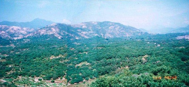
Interplanting fruit trees of Longan, Peach, Plum etc. [الصين]
Interplanting plum, peach and other fruit trees in longan orchard on level terraces in order to prevent soil and water loss and improve production of the fruit trees.
- جامع المعلومات: zhangsheng LIU
2. وصف تقنيةالإدارة المستدامي للأراضي
2.1 وصف مختصر للتقنية
تعريف التقنية:
Interplanting plum, peach in the Longan orchard to conserve soil and water and improve soil fertility.
2.2 وصف تفصيلي للتقنية
الوصف:
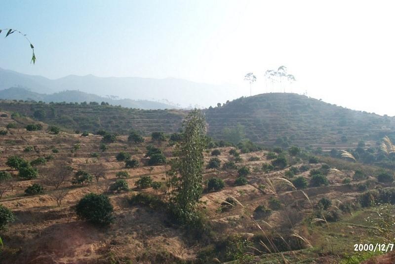
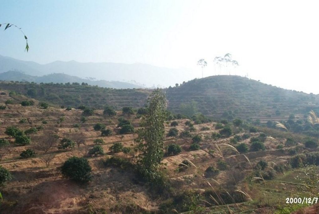
The technology is to interplant fruit trees in orchard so as to prevent water loss and soil erosion. To implement the project, local government gave financial support and SWC specialists gave technologically guide to local land users. The slope land in the hilly and mountain areas were constructed into terraces and plant trees in order to improve surface vegetation cover rate and reduce water and soil loss; the harvesting surplus rainfall in the raining season and irrigate the fruit trees in dry seasons.
2.3 صور التقنية
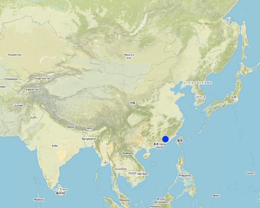
2.5 البلد/المنطقة/المواقع التي تم تنفيذ التقنية فيها والتي يغطيها هذا التقييم
البلد:
الصين
المنطقة/الولاية/المحافظة:
Fujian
حدد انتشار التقنية:
- منتشرة بالتساوي على مساحة
إذا كانت المساحة الدقيقة غير معروفة، فيرجى الإشارة إلى المنطقة التقريبية المغطاة:
- 100-10 كم2
التعليقات:
After the land users' arduously cultivating over many years, the former waste mountains have become a picture of vital force, the various growing fruit trees are very vital, water loss & soil erosion is controlled, and cultivated land can be used in a sustainable way.
Map
×2.6 تاريخ التنفيذ
في حالة عدم معرفة السنة بالتحديد، يرجى الإشارة إلى التاريخ التقريبي:
- منذ أكثر من 50 عامًا (تقليدي)
2.7 إدخال التقنية
حدد كيف تم إدخال التقنية:
- من خلال المشاريع/ التدخلات الخارجية
التعليقات (نوع المشروع، الخ):
The technology originated from Institute of Water & Soil Conservation in Taiwan and improved by the national SWC specialists.
3. تصنيف تقنية الإدارة المستدامي للأراضي
3.1 الغرض الرئيسي ( الأغراض الرئيسية) للتقنية
- الحد من تدهور الأراضي ومنعه وعكسه
3.2 نوع (أنواع) استخدام الأراضي الحالية حيث يتم تطبيق التقنية
استخدامات الأراضي مختلطة ضمن نفس وحدة الأرض:
نعم
حدد استخدام الأراضي المختلطة (المحاصيل / الرعي / الأشجار):
- الحراجة الزراعية

الأراضي الزراعية
- زراعة سنوية
- زراعة معمرة (غير خشبية)
- زراعة الأشجار والشجيرات
زراعة الأشجار والشجيرات -حدد المحاصيل:
- الفواكه ذات النواة (الخوخ، المشمش، الكرز، البرقوق، الخ)
عدد مواسم الزراعة في السنة:
- 2
حدد:
Longest growing period in days: 240Longest growing period from month to month: Mar - OctSecond longest growing period in days: 120Second longest growing period from month to month: Nov - Feb
هل يتم ممارسة الزراعة البينية؟:
نعم
إذا كانت الإجابة بنعم، حدد المحاصيل التي يتم زراعتها بشكل بيني:
Interplanting plum, peach

الغابات/ الأراضي الحرجية
منتجات وخدمات:
- الخشب
- حطب الوقود
- الفواكه والمكسرات
التعليقات:
Major land use problems (compiler’s opinion): The ground surface of the SWC application area did not plant grass and green manure. The soil in the mountaintop area is lean, where broadleaf forest could be planted.
Major land use problems (land users’ perception): Because the soil layer is thin and poor, the local farmers wouldn't like to invest in the area where water loss and soil erosion is serious.
Problems / comments regarding forest use: Commonly, supplementary planting of trees in the following Spring.
3.4 إمدادات المياه
إمدادات المياه للأرض التي يتم تنفيذ التقنية عليها:
- بعلية
3.5 مجموعةالإدارة المستدامة للأراضي التي تنتمي إليها هذه التقنية
- التدابير المتقاطعة للمنحدرات
3.6 التدابير التقنية في مجال إلادارة المستدامة للأراضي

التدابير النباتية
- V1: غطاء من الأشجار والشجيرات
التعليقات:
Type of agronomic measures: mixed cropping / intercropping, contour ridging
3.7 الأنواع الرئيسية من تدهور الأراضي التي تناولتها التقنية

تآكل التربة بالمياه
- الوزن(Wt): فقدان التربة السطحية/تآكل السطح
- (Wg):الانجراف الخلجاني/ الخلجان
التعليقات:
Main type of degradation addressed: Wt: loss of topsoil / surface erosion
Secondary types of degradation addressed: Wg: gully erosion / gullying
Main causes of degradation: over-exploitation of vegetation for domestic use (Causing land surface bare, ruderal cluster.), poverty / wealth (Lack of captial: hindering ulterior expanding of the water and soil conservation)
Secondary causes of degradation: Land subdivision (seperated land area can not be entirely developed)
3.8 منع أو حد أو عكس تدهور الأراضي
تحديد هدف التقنية فيما يتعلق بتدهور الأراضي:
- الحد من تدهور الأراضي
4. المواصفات الفنية، وأنشطة التنفيذ، والمدخلات، والتكاليف
4.1 الرسم الفني للتقنية
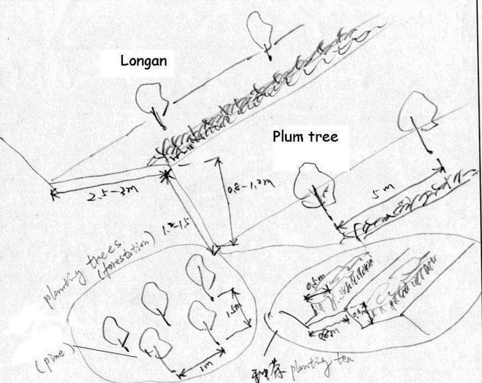
المواصفات الفنية (المتعلقة بالرسم الفني):
Technical drawing of interplanting in orchard.
Location: Zhaoan county. Fujian
Date: 1997
Technical knowledge required for field staff / advisors: moderate
Technical knowledge required for land users: low
Main technical functions: control of dispersed runoff: impede / retard
Secondary technical functions: reduction of slope angle, improvement of ground cover, wind-break
Mixed cropping / intercropping
Material/ species: Plum trees
Quantity/ density: 238
Remarks: increasing ground cover
Contour ridging
Remarks: reasonable layout
Trees/ shrubs species: jequirity tree
Perennial crops species: Plum, peach lichi trees
Slope (which determines the spacing indicated above): 30.00%
If the original slope has changed as a result of the Technology, the slope today is (see figure below): 15.00%
Gradient along the rows / strips: 60.00%
Construction material (earth): cheaper, local materials, good effect
Slope (which determines the spacing indicated above): 28.00%
If the original slope has changed as a result of the Technology, the slope today is: 13.00%
Lateral gradient along the structure: 26.00%
For water harvesting: the ratio between the area where the harvested water is applied and the total area from which water is collected is: 1:2.00
Vegetation is used for stabilisation of structures.
Change of land use practices / intensity level: Forbidding disafforest in mountain areas for 3 years.
المؤلف:
LIU Zhangsheng, Zhaoan, China
4.2 معلومات عامة بخصوص حساب المدخلات والتكاليف
حدد العملة المستخدمة لحساب التكاليف:
- دولار أمريكي USD
إذا كان ذا صلة، وضح سعر الصرف من الدولار الأمريكي إلى العملة المحلية (على سبيل المثال، 1 دولار أمريكي = 79.9 ريال برازيلي): 1 دولار أمريكي =:
8,3
اذكر متوسط تكلفة أجر العمالة المستأجرة في اليوم الواحد:
2.40
4.3 أنشطة التأسيس
| النشاط | التوقيت (الموسم) | |
|---|---|---|
| 1. | plant trees | spring |
| 2. | Level off land | winter |
| 3. | weed | winter |
| 4. | digging ditch | spring |
| 5. | Level off land | Autumn |
| 6. | costruct bank of field | winter |
| 7. | Closure and forbidding disafforest | 3 years |
4.4 التكاليف والمدخلات اللازمة للتأسيس
التعليقات:
Duration of establishment phase: 24 month(s)
4.5 الصيانة/الأنشطة المتكررة
| النشاط | التوقيت/الوتيرة | |
|---|---|---|
| 1. | digging ditch(interplant) | winter / Annually |
| 2. | irrigate | spring / Each cropping season |
| 3. | fertilization | Mar.Jun.Sep. /Annual |
| 4. | spew pesticide | Apl.Jul. /Annual |
| 5. | reinforce banks of level terrace | autumn/Annual |
| 6. | complementing seedling | spring / 1 |
| 7. | Fertilizing | Mar. Jun. / 2 |
4.6 التكاليف والمدخلات اللازمة للصيانة/للأنشطة المتكررة (سنويًا)
التعليقات:
Slope angle degree, and earth volume being moved.
4.7 أهم العوامل المؤثرة على التكاليف
قدم وصفا لأهم العوامل التي تؤثر على التكاليف:
Main factor influencing the SWC cost is steeper slope. Since the slope steeper is, much more cost needed to level off terrace. In some places, the earth needs to be moved from one place to another which will spend a lot of labor forces.
5. البيئة الطبيعية والبشرية
5.1 المناخ
هطول الأمطار السنوي
- < 250 مم
- 251- 500 ملم
- 501 - 750ملم
- 1,000-751 ملم
- 1,500-1,100 ملم
- 2,000-1,500 ملم
- 3,000-2,001 ملم
- 4,000-3,100 ملم
- > 4000 ملم
المنطقة المناخية الزراعية
- رطبة
- شبه رطبة
5.2 طوبوغرافيا
متوسط الانحدارات:
- مسطح (0-2%)
- بسيط (3-5%)
- معتدل (6-10%)
- متدحرج (11-15%)
- تلال (16-30%)
- شديدة الانحدار(31-60%)
- فائقة الانحدار (>60%)
التضاريس:
- هضاب/سهول
- أثلام مرتفعة
- المنحدرات الجبلية
- منحدرات التلال
- منحدرات في السفوح
- قاع الوادي
المنطقة الارتفاعية:
- 100-0 متر فوق سطح البحر
- 500-101 متر فوق سطح البحر
- 1,000-501 متر فوق سطح البحر
- 1,500-1,001 متر فوق سطح البحر
- 2,000-1,501 متر فوق سطح البحر
- 2,500-2,100 متر فوق سطح البحر
- 3,000-2,501 متر فوق سطح البحر
- 4,000-3,001 متر فوق سطح البحر
- > 4000 متر فوق سطح البحر
وضح ما إذا كانت التقنية مطبقة على وجه التحديد في:
- غير ذات صلة
التعليقات والمواصفات الإضافية بشأن التضاريس:
slopes on average also moderate
5.3 التربة
متوسط عمق التربة:
- ضحل جدًا (0-20 سم)
- ضحلة (21-50 سم)
- متوسطة العمق (51-80 سم)
- عميقة (81-120 سم)
- عميقة جدًا (> 120 سم)
قوام التربة (التربة السطحية):
- خشن / خفيف (رملي)
- متوسط ( طميي، سلتي)
قوام التربة (> 20 سم تحت السطح):
- خشن / خفيف (رملي)
- متوسط ( طميي، سلتي)
المواد العضوية في التربة السطحية:
- متوسطة (1-3%)
- منخفضة (<1%)
إذا كان متاحًا، قم بإرفاق وصف كامل للتربة أو تحديد المعلومات المتوفرة، على سبيل المثال نوع التربة، الرقم الهيدروجيني/ درجة حموضة التربة، قدرة التبادل الكاتيوني، النيتروجين، الملوحة وما إلى ذلك.
Soil depth als moderatly deep
Soil fertility very low - medium
Soil drainage / infiltration medium - good
Soil water storage capacity medium - high
5.6 خصائص مستخدمي الأراضي الذين يطبقون التقنية
الدخل من خارج المزرعة:
- 10-50% من جميع الإيرادات
المستوى النسبي للثروة:
- ثري
مستوى المكننة:
- عمل يدوي
- الجر الحيواني
اذكر الخصائص الأخرى ذات الصلة لمستخدمي الأراضي:
Population density: 100-200 persons/km2
Annual population growth: 0.5% - 1%
12% of the land users are very rich and own 12% of the land.
44% of the land users are rich and own 44% of the land.
35% of the land users are average wealthy and own 35% of the land.
9% of the land users are poor and own 9% of the land.
Off-farm income specification: Mainly in transport of goods and travelers, such as transport service. It needs much more idle labor forces.
5.8 ملكية الأراضي، وحقوق استخدام الأراضي، وحقوق استخدام المياه
ملكية الارض:
- دولة
- فردية، لا يوجد سند ملكية
حقوق استخدام الأراضي:
- مؤجر
6. الآثار والتصريحات الختامية
6.4 تحليل التكلفة والعائد
كيف يمكن مقارنة العوائد نسبة لتكاليف الإنشاء (من وجهة نظر مستخدمي الأراضي)؟
عوائد قصيرة الأجل:
سلبي قليلا
عوائد طويلة الأجل:
ايجابي جدا
كيف تتم مقارنة العوائدمع كلفة الصيانة/التكاليف المتكررة (من وجهة نظر مستخدمي الأراضي)؟
عوائد قصيرة الأجل:
محايد/متوازن
عوائد طويلة الأجل:
ايجابي جدا
6.5 اعتماد التقنية
- > 50%
إذا كان متاحًا، قم بتحديد الكمية (عدد الأسر المعيشية و/أو المساحةالمغطاة):
1253 households
من بين جميع الذين تبنوا التقنية، كم عدد الذين فعلوا ذلك بشكل تلقائي، أي دون تلقي أي حوافز مادية/مدفوعات؟:
- 51-90%
التعليقات:
80% of land user families have adopted the Technology with external material support
690 land user families have adopted the Technology with external material support
Comments on acceptance with external material support: survey results
20% of land user families have adopted the Technology without any external material support
563 land user families have adopted the Technology without any external material support
Comments on spontaneous adoption: survey results
There is a moderate trend towards spontaneous adoption of the Technology
Comments on adoption trend: The farmers have known that the SWC technology could produce benefits of improving agricultural production.
7. المراجع والروابط
7.1 طرق جمع/مصادر المعلومات
الروابط والوحدات المواضيعية
توسيع الكل طي الكلالروابط

Interplanting fruit trees of Longan, Peach, Plum etc. [الصين]
Interplanting plum, peach and other fruit trees in longan orchard on level terraces in order to prevent soil and water loss and improve production of the fruit trees.
- جامع المعلومات: zhangsheng LIU
الوحدات المواضيعية
لا يوجد وحدات مواضيعية


