Kitui Sand dams [كينيا]
- تاريخ الإنشاء:
- تحديث:
- جامع المعلومات: Unknown User
- المحرر: –
- المراجعون: David Streiff, Alexandra Gavilano
Mung'eeto (KIKAMBA)
technologies_1486 - كينيا
عرض الأقسام
توسيع الكل طي الكل1. معلومات عامة
1.3 الشروط المتعلقة باستخدام البيانات الموثقة من خلال WOCAT
يوافق جامع المعلومات والشخص (لاشخاص) الرئيسي لمصدر المعلومات على الشروط المتعلقة باستخدام البيانات الموثقة من خلال WOCAT:
نعم
1.5 الإشارة إلى الاستبيان (الاستبيانات) حول مناهج الإدارة المستدامة للأراضي (موثقة باستخدام WOCAT)
SASOL community approach - for sand dams in … [كينيا]
Community based water resource development
- جامع المعلومات: Donald B. Thomas
2. وصف تقنيةالإدارة المستدامي للأراضي
2.1 وصف مختصر للتقنية
تعريف التقنية:
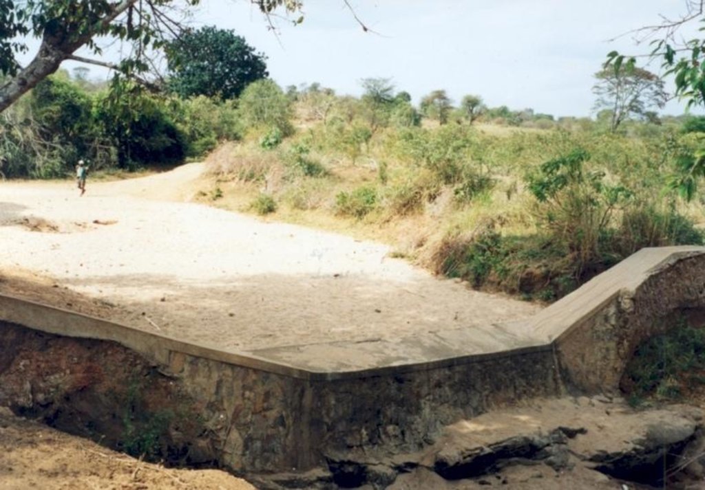
Masonry dam in seasonal watercourse or river that stores water in the sand which accumulates above it.
2.2 وصف تفصيلي للتقنية
الوصف:
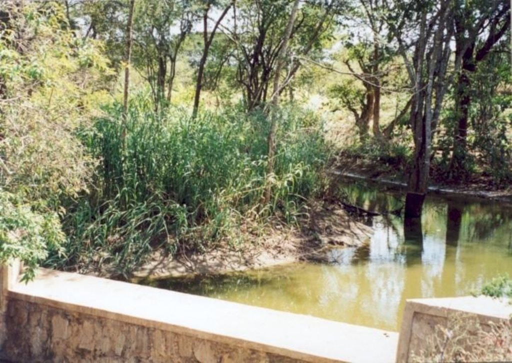
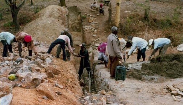
The dams are usually constructed where there is a rock bar in the river bed. The dam wall is raised 1.5 - 2.0 M above the level of sand.They fill up quickly with sand in which water is stored. The sand reduces the rate of evaporation and about 30% of the volume can store water for use in the dry season. If the dam is well constructed, maintenance is minimal. The dams are especially useful in semi-arid areas with catchments that provides plenty of coarse sand to fill up the reservoir.
2.3 صور التقنية
2.5 البلد/المنطقة/المواقع التي تم تنفيذ التقنية فيها والتي يغطيها هذا التقييم
البلد:
كينيا
المنطقة/الولاية/المحافظة:
Eastern
التعليقات:
Total area covered by the SLM Technology is 200 m2.
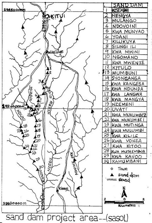
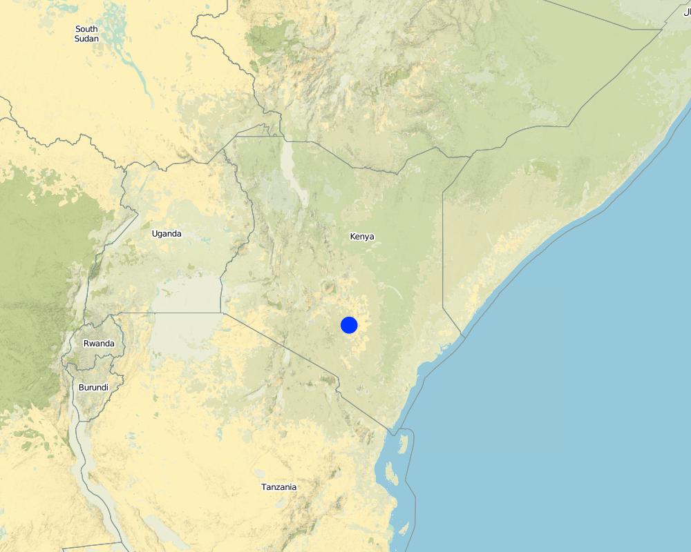
The area was selected because of the need for water in the dry season and the density of population to implement the sand dam construction
Map
×2.6 تاريخ التنفيذ
في حالة عدم معرفة السنة بالتحديد، يرجى الإشارة إلى التاريخ التقريبي:
- منذ أقل من 10 سنوات (مؤخرًا)
2.7 إدخال التقنية
حدد كيف تم إدخال التقنية:
- من خلال المشاريع/ التدخلات الخارجية
التعليقات (نوع المشروع، الخ):
Introduced in semi arid regions of kenya by the colonial government to increase water availabilty during the dry period through construction of masonary barrier across ephemeral rivers.
3. تصنيف تقنية الإدارة المستدامي للأراضي
3.1 الغرض الرئيسي ( الأغراض الرئيسية) للتقنية
- التكيف مع تغير المناخ/الظواهر المتطرفة وآثارها
3.2 نوع (أنواع) استخدام الأراضي الحالية حيث يتم تطبيق التقنية

المجاري المائية، المسطحات المائية، الأراضي الرطبة
- البرك والسدود
التعليقات:
Major land use problems (compiler’s opinion): Semi-arid conditions with frequent failure of rains and experience water availabilty problems during dry period. High incidence of both on-farm soil erosion.
Major land use problems (land users’ perception): drought , insufficient rains, water scacity.
Number of growing seasons per year: 2
Longest growing period in days: 60 Longest growing period from month to month: Oct - JanSecond longest growing period in days: 58 Second longest growing period from month to month: Mar - May
3.5 مجموعةالإدارة المستدامة للأراضي التي تنتمي إليها هذه التقنية
- حصاد المياه
3.6 التدابير التقنية في مجال إلادارة المستدامة للأراضي

التدابير البنيوية
- S5: السدود، الأحواض الصغيرة، البرك
3.7 الأنواع الرئيسية من تدهور الأراضي التي تناولتها التقنية

تآكل التربة بالمياه
- (Wg):الانجراف الخلجاني/ الخلجان
- (Wr):انجراف ضفة النهر
التعليقات:
Main type of degradation addressed: Wr: riverbank erosion
Secondary types of degradation addressed: Wg: gully erosion / gullying
Main causes of degradation: other natural causes (avalanches, volcanic eruptions, mud flows, highly susceptible natural resources, extreme topography, etc.) specify (Semi-arid climate)
Secondary causes of degradation: deforestation / removal of natural vegetation (incl. forest fires), over-exploitation of vegetation for domestic use (reduced infiltration and drying of springs), overgrazing, poverty / wealth (Lack of captial), education, access to knowledge and support services (Lack of knowledge - incidence of water borne dieseases)
4. المواصفات الفنية، وأنشطة التنفيذ، والمدخلات، والتكاليف
4.1 الرسم الفني للتقنية
المواصفات الفنية (المتعلقة بالرسم الفني):
Technical knowledge required for field staff / advisors: high
Technical knowledge required for land users: moderate
Main technical functions: water harvesting / increase water supply, sediment retention / trapping, sediment harvesting
Secondary technical functions: increase / maintain water stored in soil
Construction material (concrete): Masonry structure using rocks & stones with some reinforcing bars and wires
Construction material (other): reinforced bars and wires
Lateral gradient along the structure: 5%
4.2 معلومات عامة بخصوص حساب المدخلات والتكاليف
عملة أخرى/ عملة وطنية (حدد):
Kenya shillings
إذا كان ذا صلة، وضح سعر الصرف من الدولار الأمريكي إلى العملة المحلية (على سبيل المثال، 1 دولار أمريكي = 79.9 ريال برازيلي): 1 دولار أمريكي =:
78,0
اذكر متوسط تكلفة أجر العمالة المستأجرة في اليوم الواحد:
2.00
4.3 أنشطة التأسيس
| النشاط | التوقيت (الموسم) | |
|---|---|---|
| 1. | Digging out riverbed to reach rock bar | dryseason |
| 2. | Laying concrete foundation | dryseason |
| 3. | collection of materials (rocks, sand) | dryseason |
| 4. | construction of dam and wing walls | dryseason |
4.4 التكاليف والمدخلات اللازمة للتأسيس
التعليقات:
Duration of establishment phase: 24 month(s)
4.5 الصيانة/الأنشطة المتكررة
| النشاط | التوقيت/الوتيرة | |
|---|---|---|
| 1. | inspection of dam for leakages | after the rains/each cropping season |
4.6 التكاليف والمدخلات اللازمة للصيانة/للأنشطة المتكررة (سنويًا)
التعليقات:
depth of the foundation, valley width.
4.7 أهم العوامل المؤثرة على التكاليف
قدم وصفا لأهم العوامل التي تؤثر على التكاليف:
depth of foundation trench to the rock bar, the width of the river valley and the height of the banks.
5. البيئة الطبيعية والبشرية
5.1 المناخ
هطول الأمطار السنوي
- < 250 مم
- 251- 500 ملم
- 501 - 750ملم
- 1,000-751 ملم
- 1,500-1,100 ملم
- 2,000-1,500 ملم
- 3,000-2,001 ملم
- 4,000-3,100 ملم
- > 4000 ملم
المنطقة المناخية الزراعية
- شبه رطبة
- شبه قاحلة
5.2 طوبوغرافيا
متوسط الانحدارات:
- مسطح (0-2%)
- بسيط (3-5%)
- معتدل (6-10%)
- متدحرج (11-15%)
- تلال (16-30%)
- شديدة الانحدار(31-60%)
- فائقة الانحدار (>60%)
التضاريس:
- هضاب/سهول
- أثلام مرتفعة
- المنحدرات الجبلية
- منحدرات التلال
- منحدرات في السفوح
- قاع الوادي
المنطقة الارتفاعية:
- 100-0 متر فوق سطح البحر
- 500-101 متر فوق سطح البحر
- 1,000-501 متر فوق سطح البحر
- 1,500-1,001 متر فوق سطح البحر
- 2,000-1,501 متر فوق سطح البحر
- 2,500-2,100 متر فوق سطح البحر
- 3,000-2,501 متر فوق سطح البحر
- 4,000-3,001 متر فوق سطح البحر
- > 4000 متر فوق سطح البحر
التعليقات والمواصفات الإضافية بشأن التضاريس:
Slopes on average: Also gentle
Lanforms: In riverbeads
5.3 التربة
متوسط عمق التربة:
- ضحل جدًا (0-20 سم)
- ضحلة (21-50 سم)
- متوسطة العمق (51-80 سم)
- عميقة (81-120 سم)
- عميقة جدًا (> 120 سم)
قوام التربة (التربة السطحية):
- خشن / خفيف (رملي)
- متوسط ( طميي، سلتي)
المواد العضوية في التربة السطحية:
- منخفضة (<1%)
إذا كان متاحًا، قم بإرفاق وصف كامل للتربة أو تحديد المعلومات المتوفرة، على سبيل المثال نوع التربة، الرقم الهيدروجيني/ درجة حموضة التربة، قدرة التبادل الكاتيوني، النيتروجين، الملوحة وما إلى ذلك.
Soil depth on average: Most areas have shallow soils with unweathered rocks.
Soil fertility is low
Soil drainage / infiltration is medium and soils are prone to surface sealing
Soil water storage capacity is low - medium
5.6 خصائص مستخدمي الأراضي الذين يطبقون التقنية
الدخل من خارج المزرعة:
- >50% من إجمالي الدخل
المستوى النسبي للثروة:
- ضعيف
- متوسط
اذكر الخصائص الأخرى ذات الصلة لمستخدمي الأراضي:
Population density: 10-50 persons/km2
Annual population growth: 2% - 3%
1% of the land users are rich and own 5% of the land.
30% of the land users are average wealthy and own 35% of the land.
55% of the land users are poor and own 45% of the land.
14% of the land users are poor and own 15% of the land.
Off-farm income specification: A large proportion of the adult male population is working outside the district
5.8 ملكية الأراضي، وحقوق استخدام الأراضي، وحقوق استخدام المياه
ملكية الارض:
- فردية، لا يوجد سند ملكية
- فردية، يوجد سند ملكية
حقوق استخدام الأراضي:
- فردي
6. الآثار والتصريحات الختامية
6.4 تحليل التكلفة والعائد
كيف يمكن مقارنة العوائد نسبة لتكاليف الإنشاء (من وجهة نظر مستخدمي الأراضي)؟
عوائد قصيرة الأجل:
إيجابي
عوائد طويلة الأجل:
إيجابي
كيف تتم مقارنة العوائدمع كلفة الصيانة/التكاليف المتكررة (من وجهة نظر مستخدمي الأراضي)؟
عوائد قصيرة الأجل:
ايجابي جدا
عوائد طويلة الأجل:
ايجابي جدا
6.5 اعتماد التقنية
- > 50%
إذا كان متاحًا، قم بتحديد الكمية (عدد الأسر المعيشية و/أو المساحةالمغطاة):
23000 Households in an area of 200 sq km
من بين جميع الذين تبنوا التقنية، كم عدد الذين فعلوا ذلك بشكل تلقائي، أي دون تلقي أي حوافز مادية/مدفوعات؟:
- 10-0%
التعليقات:
70% of land user families have adopted the Technology.
23000 land user families have adopted the Technology with external material support
Comments on acceptance with external material support: survey results
Comments on spontaneous adoption: estimates
There is a moderate trend towards spontaneous adoption of the Technology
Comments on adoption trend: self help groups have started pooling together their resources for implementation of the technology especially in areas where there has never been an NGO or such a project.
7. المراجع والروابط
7.1 طرق جمع/مصادر المعلومات
7.2 المراجع للمنشورات المتاحة
العنوان، المؤلف، السنة، النظام القياسي الدولي لترقيم الكتب ISBN:
"Where there is no water" SASOL and Maji na Ufanisi 1999
متاح من أين؟كم التكلفة؟:
Maji na Ufanisi Nairobi or SASOL Kitui
الروابط والوحدات المواضيعية
توسيع الكل طي الكلالروابط

SASOL community approach - for sand dams in … [كينيا]
Community based water resource development
- جامع المعلومات: Donald B. Thomas
الوحدات المواضيعية
لا يوجد وحدات مواضيعية


