Gully plugging using check dams [النيبال]
- تاريخ الإنشاء:
- تحديث:
- جامع المعلومات: Nicole Guedel
- المحرر: –
- المراجعون: David Streiff, Alexandra Gavilano
Galchhi niyantran - Nepali
technologies_1493 - النيبال
عرض الأقسام
توسيع الكل طي الكل1. معلومات عامة
1.2 تفاصيل الاتصال بالأشخاص الرئيسيين لمصدر المعلومات والمؤسسات المشاركة في تقييم وتوثيق التقنية
متخصص في الإدارة المستدامة للأراضي:
متخصص في الإدارة المستدامة للأراضي:
اسم المشروع الذي سهّل توثيق/تقييم التقنية (إذا كان ذلك على صلة)
People and Resource Dynamics Project, Nepal (PARDYP)اسم المؤسسة (المؤسسات) التي سهلت توثيق/تقييم التقنية (إذا كان ذلك على صلة)
ICIMOD International Centre for Integrated Mountain Development (ICIMOD) - النيبال1.3 الشروط المتعلقة باستخدام البيانات الموثقة من خلال WOCAT
يوافق جامع المعلومات والشخص (لاشخاص) الرئيسي لمصدر المعلومات على الشروط المتعلقة باستخدام البيانات الموثقة من خلال WOCAT:
نعم
1.5 الإشارة إلى الاستبيان (الاستبيانات) حول مناهج الإدارة المستدامة للأراضي (موثقة باستخدام WOCAT)

Local initiatives for rehabilitating degraded communal grazing land [النيبال]
Supporting local initiatives and building local capacity for the rehabilitation of degraded communal land in the middle mountains of Nepal.
- جامع المعلومات: Madhav Dhakal
2. وصف تقنيةالإدارة المستدامي للأراضي
2.1 وصف مختصر للتقنية
تعريف التقنية:
Small dam structures constructed across erosion gullies
2.2 وصف تفصيلي للتقنية
الوصف:
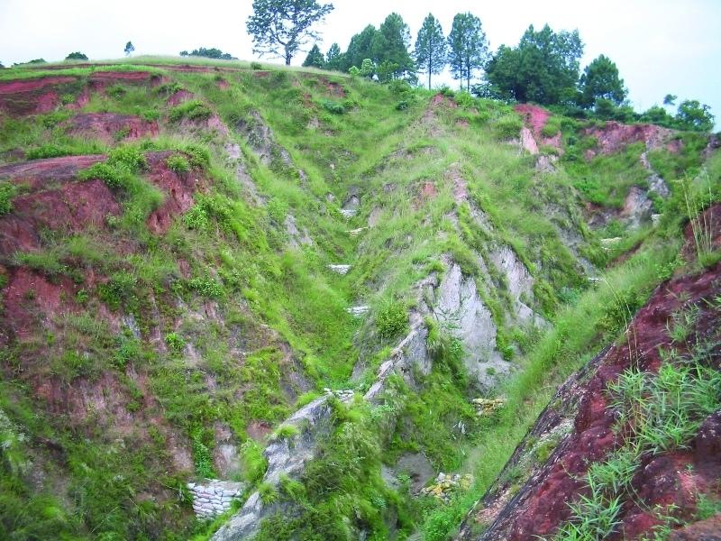
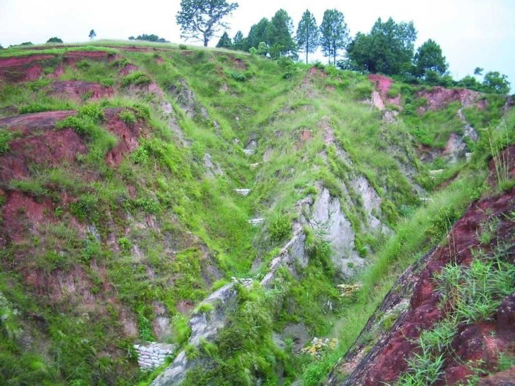
Check dams are small low structures built across a gully or a channel to prevent them from deepening further. These small dams reduce the speed of water flow and minimise the erosive power of runoff. They also promote the deposition of eroded materials to further stabilise the gullies.
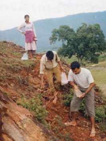
Two gullies adjacent to a degraded area of communal grazing land were controlled by constructing check dams and with vegetative measures including planting bamboo. The main purpose was to control the further development of the gullies, which were affecting the adjacent grazing land and blocking a downstream irrigation channel. The site is community land used by the 40 households (240 people) of Dhotra village in the intensively used Jhikhu Khola watershed. Irrigated cropland lies downstream from the site, whilst the site itself is bordered by grazing land, degraded sal-dominated forest, and rainfed forward-sloping terraces.
The check dams were made of old cement bags filed with soil and were 1m high with 0.5m deep foundations. The check dams were spaced so that a line joining the top of two adjacent dams had about a 3% slope gradient. Twenty-four check dams were built in the two gullies using a total of 2400 filled cement bags. Forty clumps of bamboo were planted between the dams for stabilisation.
All that is needed to maintain this technology is to inspect the condition of the check dams occasionally, especially before and after the monsoon. Displaced bags should be replaced and the water courses cleared of branches and big stones. Further planting should be carried out if needed.
The case study area has a distinct dry season from November to May and a wet monsoon period from June to October. Annual rainfall is around 1200 mm. The site has red soils that are highly weathered and, if not properly managed, are very susceptible to erosion.
2.3 صور التقنية
2.5 البلد/المنطقة/المواقع التي تم تنفيذ التقنية فيها والتي يغطيها هذا التقييم
البلد:
النيبال
المنطقة/الولاية/المحافظة:
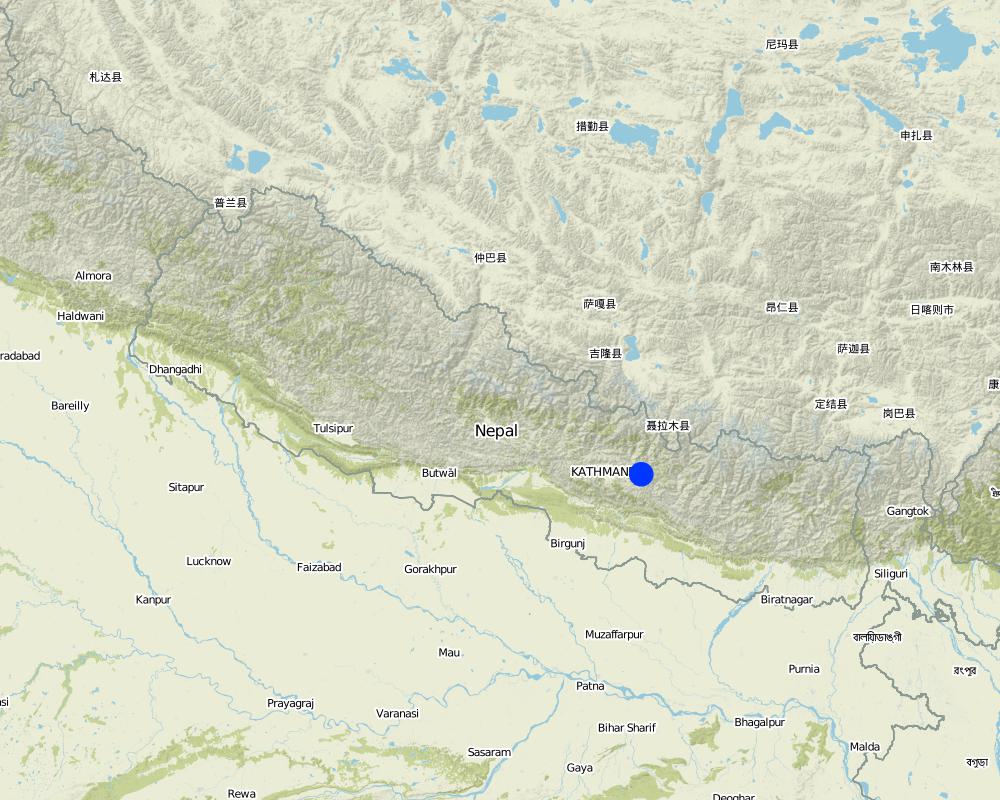
Kavre Palanchok/ Dhotra village, Jhikhu Khola watershed
حدد انتشار التقنية:
- منتشرة بالتساوي على مساحة
إذا كانت التقنيةا موزعة بالتساوي على منطقة ما، حدد المساحة المغطاة (بالكيلومتر المربع):
0,006
التعليقات:
Total area covered by the SLM Technology is 0.006 km2.
Map
×2.6 تاريخ التنفيذ
في حالة عدم معرفة السنة بالتحديد، يرجى الإشارة إلى التاريخ التقريبي:
- منذ 10-50 سنة
2.7 إدخال التقنية
حدد كيف تم إدخال التقنية:
- من خلال المشاريع/ التدخلات الخارجية
التعليقات (نوع المشروع، الخ):
The basic idea of this technology has its origin in traditional methods. However, villagers approached the People and Resource Dynamics Project (PARDYP) for advice. PARDYP assisted, based on experiences made before with rehabilitation/gully plugging experiments under similar conditions. Mainly developed according to theoretical and site specific knowledge.
3. تصنيف تقنية الإدارة المستدامي للأراضي
3.1 الغرض الرئيسي ( الأغراض الرئيسية) للتقنية
- الحد من تدهور الأراضي ومنعه وعكسه
- reduce land loss
3.2 نوع (أنواع) استخدام الأراضي الحالية حيث يتم تطبيق التقنية

أراضي الرعي
الرعي الواسع النطاق:
- مربى ماشية محدد
التعليقات:
Major land use problems (compiler’s opinion): The major land use problem is the small per capita landholding size for cropping. These holdings are mostly rainfed, have a low soil fertility status and acidity problems, and are susceptible to erosion. Intense rainfall at the beginning of the rainy season causes considerable soil loss (rill and gully erosion).
Major land use problems (land users’ perception): Overgrazing leading to lack of vegetation and gully building.
Ranching: Yes
Future (final) land use (after implementation of SLM Technology): Forests / woodlands: Fp: Plantations, afforestations
Number of growing seasons per year: 3
Longest growing period in days: 150; Longest growing period from month to month: Jun - Oct; Second longest growing period in days: 120; Second longest growing period from month to month: Nov - Feb
3.3 هل تغير استخدام الأراضي نتيجة لتنفيذ التقنية؟
هل تغير استخدام الأراضي نتيجة لتنفيذ التقنية؟:
- نعم (يرجى ملء الأسئلة أدناه فيما يتعلق باستخدام الأراضي قبل تنفيذ التقنية)

أراضي الرعي
- Extensive grazing
3.4 إمدادات المياه
إمدادات المياه للأرض التي يتم تنفيذ التقنية عليها:
- بعلية
3.5 مجموعةالإدارة المستدامة للأراضي التي تنتمي إليها هذه التقنية
- تحسين الغطاء الأرضي/النباتي
- التدابير المتقاطعة للمنحدرات
3.6 التدابير التقنية في مجال إلادارة المستدامة للأراضي

التدابير النباتية
- V1: غطاء من الأشجار والشجيرات

التدابير البنيوية
- S5: السدود، الأحواض الصغيرة، البرك
التعليقات:
Main measures: vegetative measures, structural measures
Type of vegetative measures: scattered / dispersed
3.7 الأنواع الرئيسية من تدهور الأراضي التي تناولتها التقنية

تآكل التربة بالمياه
- (Wg):الانجراف الخلجاني/ الخلجان
- (Wo:) تأثيرات التدهور من مواقع أخرى
التعليقات:
Main type of degradation addressed: Wg: gully erosion / gullying
Secondary types of degradation addressed: Wo: offsite degradation effects
Main causes of degradation: overgrazing (insufficient forage supply from the private land.), education, access to knowledge and support services (identification of appropriate SWC technologies and appropriate collaborators)
Secondary causes of degradation: deforestation / removal of natural vegetation (incl. forest fires) (for daily household needs ( litter , firewood, timber), other natural causes (avalanches, volcanic eruptions, mud flows, highly susceptible natural resources, extreme topography, etc.) specify (excessive rainfall during pre-monsoon and monsoon), poverty / wealth (to buy planting materials and for logistics), labour availability (for community level social work)
3.8 منع أو حد أو عكس تدهور الأراضي
تحديد هدف التقنية فيما يتعلق بتدهور الأراضي:
- الحد من تدهور الأراضي
4. المواصفات الفنية، وأنشطة التنفيذ، والمدخلات، والتكاليف
4.1 الرسم الفني للتقنية
المواصفات الفنية (المتعلقة بالرسم الفني):
Schematic drawing of two gullies with 24 check dams and bamboo planted below the check dams for stabilisation
Location: Dhotra. Khabre
Date: 22.6.06
Technical knowledge required for field staff / advisors: low
Technical knowledge required for land users: low
Main technical functions: control of dispersed runoff: impede / retard, sediment retention / trapping, sediment harvesting
Secondary technical functions: reduction of slope angle, increase of infiltration
Scattered / dispersed
Vegetative material: T : trees / shrubs
Number of plants per (ha): 40
Vertical interval between rows / strips / blocks (m): 4 m
Trees/ shrubs species: Bamboo
Slope (which determines the spacing indicated above): 30.00%
If the original slope has changed as a result of the Technology, the slope today is (see figure below): 25.00%
Dam/ pan/ pond
Vertical interval between structures (m): 4 m
Construction material (earth): soil resulting from digging activities from the adjacent grassland was used to fill cement bags for
Slope (which determines the spacing indicated above): 30%
If the original slope has changed as a result of the Technology, the slope today is: 25%
Vegetation is used for stabilisation of structures.
المؤلف:
I. Providoli, A.K.Thaku ICIMOD
4.2 معلومات عامة بخصوص حساب المدخلات والتكاليف
عملة أخرى/ عملة وطنية (حدد):
Nepali Rupee
إذا كان ذا صلة، وضح سعر الصرف من الدولار الأمريكي إلى العملة المحلية (على سبيل المثال، 1 دولار أمريكي = 79.9 ريال برازيلي): 1 دولار أمريكي =:
73,0
اذكر متوسط تكلفة أجر العمالة المستأجرة في اليوم الواحد:
2.00
4.3 أنشطة التأسيس
| النشاط | التوقيت (الموسم) | |
|---|---|---|
| 1. | Plantating of bamboo plants (clumps) below the check dams | before onset of monsoon (June) |
| 2. | Placing filled cement bags across gullies to form checkdams | before onset of monsoon (June) |
| 3. | Filling cement bag with soil | before onset of monsoon (June) |
| 4. | Digging trenches for dam foundations | before onset of monsoon (June) |
4.4 التكاليف والمدخلات اللازمة للتأسيس
| تحديد المدخلات | الوحدة | الكمية | التكاليف لكل وحدة | إجمالي التكاليف لكل مدخل | % من التكاليف التي يتحملها مستخدمو الأراضي | |
|---|---|---|---|---|---|---|
| العمالة | Building dams and planting bamboo | Persons/day | 18,0 | 2,0 | 36,0 | 100,0 |
| مواد البناء | Cement bags | ha | 1,0 | 73,0 | 73,0 | |
| غير ذلك | Lunch, tea for farmers | ha | 1,0 | 16,0 | 16,0 | |
| غير ذلك | Transportation | ha | 1,0 | 14,0 | 14,0 | |
| إجمالي تكاليف إنشاء التقنية | 139,0 | |||||
| إجمالي تكاليف إنشاء التقنية بالدولار الأمريكي | 1,9 | |||||
التعليقات:
Duration of establishment phase: 12 month(s)
4.5 الصيانة/الأنشطة المتكررة
| النشاط | التوقيت/الوتيرة | |
|---|---|---|
| 1. | Maintaining gullies: repair or replace damaged check dams, plant | before onset of monsoon (June) |
| 2. | Ensuring good drainage for bamboo | before onset of monsoon (June) |
| 3. | Maintaining gullies: repair or replace damaged check dams,plant more grassesor trees if needed | before onset of monsoon (June)/once a year |
4.6 التكاليف والمدخلات اللازمة للصيانة/للأنشطة المتكررة (سنويًا)
التعليقات:
Machinery/ tools: Spade, shovel, Spade, shovel
All costs and amounts were roughly estimated by the technicians and authors in 2004.
5. البيئة الطبيعية والبشرية
5.1 المناخ
هطول الأمطار السنوي
- < 250 مم
- 251- 500 ملم
- 501 - 750ملم
- 1,000-751 ملم
- 1,500-1,100 ملم
- 2,000-1,500 ملم
- 3,000-2,001 ملم
- 4,000-3,100 ملم
- > 4000 ملم
المنطقة المناخية الزراعية
- رطبة
Thermal climate class: subtropics
5.2 طوبوغرافيا
متوسط الانحدارات:
- مسطح (0-2%)
- بسيط (3-5%)
- معتدل (6-10%)
- متدحرج (11-15%)
- تلال (16-30%)
- شديدة الانحدار(31-60%)
- فائقة الانحدار (>60%)
التضاريس:
- هضاب/سهول
- أثلام مرتفعة
- المنحدرات الجبلية
- منحدرات التلال
- منحدرات في السفوح
- قاع الوادي
المنطقة الارتفاعية:
- 100-0 متر فوق سطح البحر
- 500-101 متر فوق سطح البحر
- 1,000-501 متر فوق سطح البحر
- 1,500-1,001 متر فوق سطح البحر
- 2,000-1,501 متر فوق سطح البحر
- 2,500-2,100 متر فوق سطح البحر
- 3,000-2,501 متر فوق سطح البحر
- 4,000-3,001 متر فوق سطح البحر
- > 4000 متر فوق سطح البحر
التعليقات والمواصفات الإضافية بشأن التضاريس:
Altitudinal zone: 900 m a.s.l.
Slopes on average: Also very steep
5.3 التربة
متوسط عمق التربة:
- ضحل جدًا (0-20 سم)
- ضحلة (21-50 سم)
- متوسطة العمق (51-80 سم)
- عميقة (81-120 سم)
- عميقة جدًا (> 120 سم)
قوام التربة (التربة السطحية):
- ناعم/ثقيل (طيني)
المواد العضوية في التربة السطحية:
- منخفضة (<1%)
إذا كان متاحًا، قم بإرفاق وصف كامل للتربة أو تحديد المعلومات المتوفرة، على سبيل المثال نوع التربة، الرقم الهيدروجيني/ درجة حموضة التربة، قدرة التبادل الكاتيوني، النيتروجين، الملوحة وما إلى ذلك.
Soil depth on average: Very shallow at some places parent rockmaterial is exposed but variable.
Soil texture: Red soils with high clay content
Soil fertility was very low before implementation of rehabilitation activities.
Topsoil organic matter before implementation of rehabilitation activities.
Soil drainage / infiltration was poor before implementation of rehabilitation activities.
Soil water storage capacity was very low before implementation of rehabilitation activities.
5.4 توافر المياه ونوعيتها
نوعية المياه (غير المعالجة):
مياه الشرب سيئة (تتطلب معالجة)
تعليقات ومواصفات أخرى بشأن نوعية المياه وكميتها:
Water quality: More in rainy season (June- September), less in April/May
5.6 خصائص مستخدمي الأراضي الذين يطبقون التقنية
التوجه السوقي لنظام الإنتاج:
- الكفاف (الإمداد الذاتي)
الدخل من خارج المزرعة:
- 10-50% من جميع الإيرادات
المستوى النسبي للثروة:
- ضعيف
أفراداً أو مجموعات:
- المجموعات/ المجتمع المحلي
الجنس:
- نساء
- رجال
اذكر الخصائص الأخرى ذات الصلة لمستخدمي الأراضي:
Land users applying the Technology are mainly common / average land users
Population density: 200-500 persons/km2
Annual population growth: 2% - 3%
95% of the land users are average wealthy.
3% of the land users are poor.
2% of the land users are poor.
Off-farm income specification: In most farm households, off-farm income plays at least a minor and increasingly a major role. Occasional opportunities for off-farm income present themselves in the form of daily
5.7 متوسط مساحة الأرض التي يستخدمها مستخدمو الأراضي الذين يطبقون التقنية
- < 0.5 هكتارا
- 0.5 - 1 هكتار
- 1 -2 هكتار
- 2 - 5 هكتار
- 5 - 15 هكتار
- 15 - 50 هكتار
- 50 - 100هكتار
- 500-100 هكتار
- 1,000-500 هكتار
- 10,000-1,000 هكتار
- > 10,000 هكتار
هل يعتبر هذا نطاقًا صغيرًا أو متوسطًا أو واسعا (في إشارة إلى السياق المحلي)؟:
- على نطاق صغير
التعليقات:
Only limitied grazing area for whole village.
5.8 ملكية الأراضي، وحقوق استخدام الأراضي، وحقوق استخدام المياه
ملكية الارض:
- دولة
حقوق استخدام الأراضي:
- مجتمعي (منظم)
6. الآثار والتصريحات الختامية
6.1 الآثار التي أظهرتها التقنية في الموقع
الآثار الاجتماعية والثقافية
المؤسسات المجتمعية
المعرفة بالإدارة المستدامة للأراضي/تدهور الأراضي
التخفيف من حدة الصراع
التعليقات/ حدد:
At the beginning a few people opposed the activities.
الآثار الايكولوجية
دورة المياه / الجريان السطحي
تصريف المياه الزائدة
التربة
غطاء التربة
فقدان التربة
6.2 الآثار التي أظهرتها التقنية خارج الموقع
تراكم الطمي باتجاه مصب النهر
التعليقات/ حدد:
into irrigation canal
6.3 تعرض التقنية وحساسيتها لتغير المناخ التدريجي والظواهر المتطرفة/الكوارث المرتبطة بالمناخ (كما يراها مستخدمو الأراضي)
تغير مناخ تدريجي
تغير مناخ تدريجي
| الموسم | زيادة أو نقصان | كيف تتعامل التقنية مع ذلك؟ | |
|---|---|---|---|
| درجة الحرارة السنوية | زيادة | جيدا |
الظواهر المتطرفة / الكوارث المرتبطة بالمناخ
الكوارث الجوية
| كيف تتعامل التقنية مع ذلك؟ | |
|---|---|
| عاصفة ممطرة محلية | ليس جيدا |
| عاصفة هوائية محلية | جيدا |
الكوارث المناخية
| كيف تتعامل التقنية مع ذلك؟ | |
|---|---|
| جفاف | جيدا |
الكوارث الهيدرولوجية
| كيف تتعامل التقنية مع ذلك؟ | |
|---|---|
| فيضان عام (نهر) | ليس جيدا |
العواقب الأخرى المتعلقة بالمناخ
العواقب الأخرى المتعلقة بالمناخ
| كيف تتعامل التقنية مع ذلك؟ | |
|---|---|
| انخفاض فترة النمو | جيدا |
6.4 تحليل التكلفة والعائد
كيف يمكن مقارنة العوائد نسبة لتكاليف الإنشاء (من وجهة نظر مستخدمي الأراضي)؟
عوائد قصيرة الأجل:
محايد/متوازن
عوائد طويلة الأجل:
إيجابي
كيف تتم مقارنة العوائدمع كلفة الصيانة/التكاليف المتكررة (من وجهة نظر مستخدمي الأراضي)؟
عوائد قصيرة الأجل:
محايد/متوازن
عوائد طويلة الأجل:
إيجابي
التعليقات:
Due to the high establishment costs, the short term benefit for the community only matches the costs. However, in the long-term the environmental benefit of rehabilitated land is high, and economic benefit is positive.
6.5 اعتماد التقنية
- > 50%
إذا كان متاحًا، قم بتحديد الكمية (عدد الأسر المعيشية و/أو المساحةالمغطاة):
40 households in an area of 0.006 sq km
من بين جميع الذين تبنوا التقنية، كم عدد الذين فعلوا ذلك بشكل تلقائي، أي دون تلقي أي حوافز مادية/مدفوعات؟:
- 10-0%
التعليقات:
100% of land user families have adopted the Technology with external material support
40 land user families have adopted the Technology with external material support
Comments on acceptance with external material support: survey results
Comments on spontaneous adoption: survey results
There is no trend towards spontaneous adoption of the Technology
Comments on adoption trend: No initiative could be seen in the area.
6.7 نقاط القوة / المزايا / الفرص التي توفرها التقنية
| نقاط القوة/ المزايا/ الفرص من وجهة نظر مستخدمي الأراضي |
|---|
|
Reduced soil erosion, rill erosion, and top soil loss How can they be sustained / enhanced? Regular maintenance of the structure and grasses is required |
|
The technology is easy to maintain. How can they be sustained / enhanced? As above |
| نقاط القوة/ المزايا/ الفرص من وجهة نظر جامع المعلومات أو غيره من الاشخاص الرئيسيين لمصدر المعلومات |
|---|
|
It's a low cost technology , easy to apply, little knowledge needed. How can they be sustained / enhanced? Regular maintenance of the structure and grasses is required |
|
The effect of the technology can be seen easily. How can they be sustained / enhanced? As above |
7. المراجع والروابط
7.1 طرق جمع/مصادر المعلومات
7.2 المراجع للمنشورات المتاحة
العنوان، المؤلف، السنة، النظام القياسي الدولي لترقيم الكتب ISBN:
Nakarmi, G. (2000) Soil Erosion Dynamics in the Middle Mountains of Nepal, a report submitted to PARDYP, ICIMOD, Kathmandu
متاح من أين؟كم التكلفة؟:
ICIMOD
العنوان، المؤلف، السنة، النظام القياسي الدولي لترقيم الكتب ISBN:
Schreier, H.; Brown, S.; Shah, P. B.; Shrestha, B.; Merz, J. (2002) Jhikhu Khola Watershed – Nepal, CD ROM. Vancouver: Institute for Resources and Environment, University of British Columbia.
متاح من أين؟كم التكلفة؟:
ICIMOD
العنوان، المؤلف، السنة، النظام القياسي الدولي لترقيم الكتب ISBN:
Shrestha, B. (2004) Progress Report PARDYP- Nepal. Paper presented at the PARDYP Access Mid Year Meeting, 19-22 July 2004, ICIMOD, Kathmandu
متاح من أين؟كم التكلفة؟:
ICIMOD
الروابط والوحدات المواضيعية
توسيع الكل طي الكلالروابط

Local initiatives for rehabilitating degraded communal grazing land [النيبال]
Supporting local initiatives and building local capacity for the rehabilitation of degraded communal land in the middle mountains of Nepal.
- جامع المعلومات: Madhav Dhakal
الوحدات المواضيعية
لا يوجد وحدات مواضيعية


