Sustainable land management using controlled gullying [النيبال]
- تاريخ الإنشاء:
- تحديث:
- جامع المعلومات: Shreedip Sigdel
- المحرر: –
- المراجعون: David Streiff, Alexandra Gavilano
Jagidol chetra ma kholsi sudhar dwara digo bhu bewasthapan (Main Contributor: Sabita Khanal, Kathmandu University)
technologies_1684 - النيبال
عرض الأقسام
توسيع الكل طي الكل1. معلومات عامة
1.2 تفاصيل الاتصال بالأشخاص الرئيسيين لمصدر المعلومات والمؤسسات المشاركة في تقييم وتوثيق التقنية
متخصص في الإدارة المستدامة للأراضي:
اسم المؤسسة (المؤسسات) التي سهلت توثيق/تقييم التقنية (إذا كان ذلك على صلة)
Kathmandu University (KU) - النيبالاسم المؤسسة (المؤسسات) التي سهلت توثيق/تقييم التقنية (إذا كان ذلك على صلة)
ICIMOD International Centre for Integrated Mountain Development (ICIMOD) - النيبال1.3 الشروط المتعلقة باستخدام البيانات الموثقة من خلال WOCAT
يوافق جامع المعلومات والشخص (لاشخاص) الرئيسي لمصدر المعلومات على الشروط المتعلقة باستخدام البيانات الموثقة من خلال WOCAT:
نعم
1.5 الإشارة إلى الاستبيان (الاستبيانات) حول مناهج الإدارة المستدامة للأراضي (موثقة باستخدام WOCAT)
Community-based approach in Erosion Control [أذربيجان]
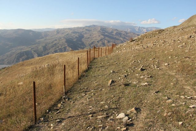
The unsustainable use of pastures and forest areas leads to erosion, degradation, desertification and loss of biodiversity in high mountain areas of the South Caucasus. In the village Ehen in the Ismayilli district in Azerbaijan, a community-based approach for erosion control was developed in a participative way. Together with village …
- جامع المعلومات: Hanns Kirchmeir
Protected gullies – a traditional sustainable land management … [النيبال]
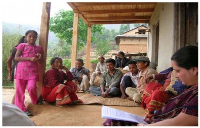
Protected gullying is a sustainable land management practice initiated and maintained by the traditional community approach; it is based on indigenous knowledge and uses only locally available materials.
- جامع المعلومات: Shreedip Sigdel
2. وصف تقنيةالإدارة المستدامي للأراضي
2.1 وصف مختصر للتقنية
تعريف التقنية:
An indigenous technology to help control channelled water during the rainy season and conserve it during the dry season
2.2 وصف تفصيلي للتقنية
الوصف:
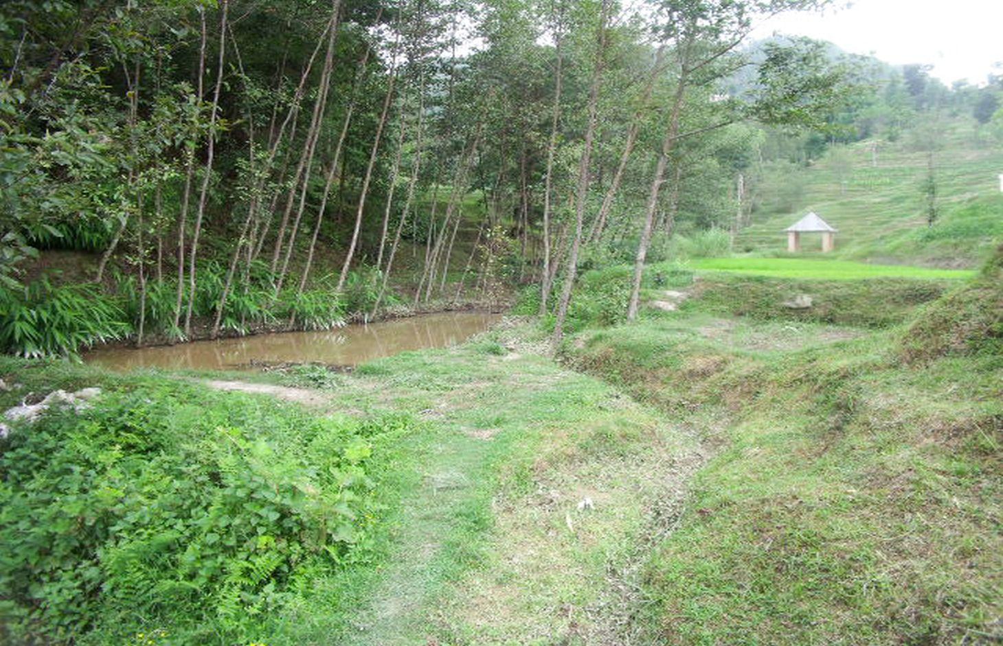
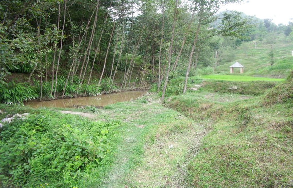
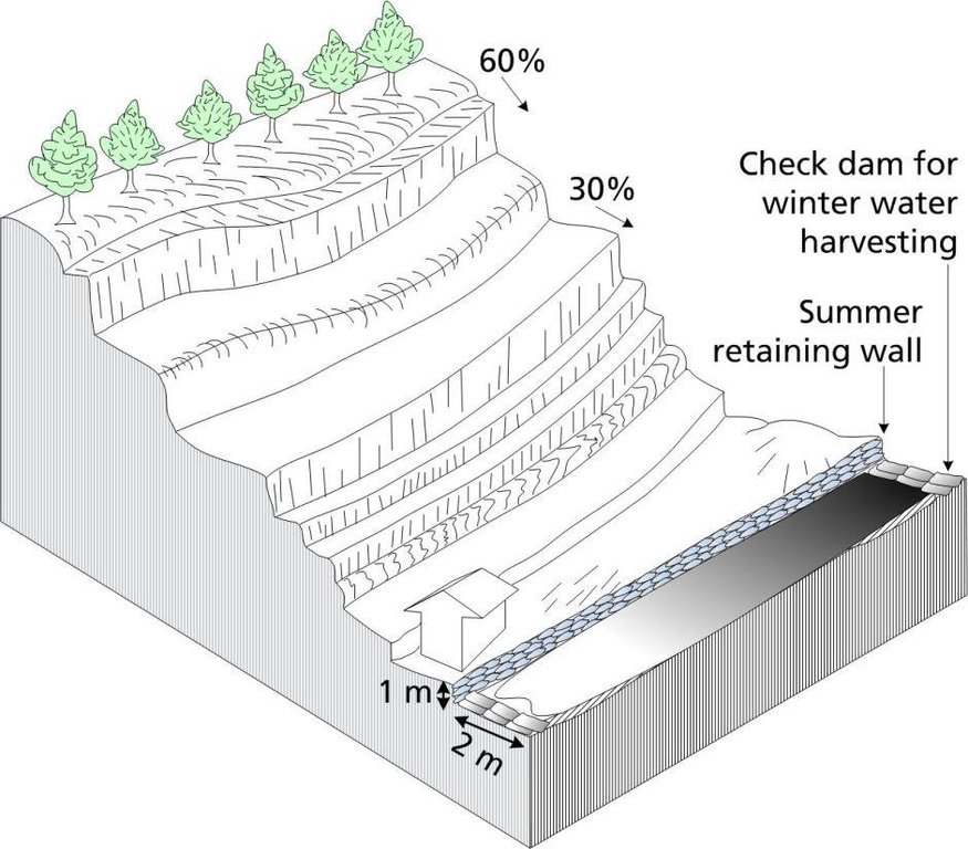
For more than two centuries, local farmers have promoted soil and water conservation by protecting the gullies which occur naturally between rice terraces; thus the land area is called ‘jagidol’ (jagi=rice, dol=gully). The small perennial streams which flow through the terraces are protected by constructing check dams and retaining walls to reduce the danger of erosion and collapse.
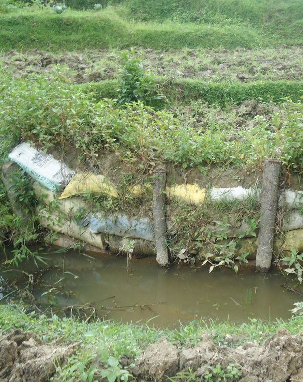
Purpose of the Technology: During the monsoon, the channels or trenches can become engorged and, since their walls are not reinforced (except for grass planted at the edges), the conduits can be easily eroded. When the erosion is severe enough, the edges of the terraces adjacent to the gullies can collapse. When many gullies collapse at once, the stability of the entire hillside is threatened with catastrophic consequences for the village situated above the planting area. Villagers have traditionally used local materials and expertise to maintain the gullies and reduce soil erosion by building retaining walls across the slope which are strengthened through plantation. The retaining walls are bio-engineered using a combination of bamboo poles, rocks, and soil-filled sacks. Bamboo poles are used for the backbone of the support structure, and rocks and soil-filled sacks are used to line the sides of the channel. Local grasses such as 'sitto' are planted on the top and, as they grow, their roots help to anchor the structure. When the channels are fortified by retaining walls and planting, they become entrenched and, over time, less maintenance is required. As a bonus, when the plants grown along the gullies mature, they provide biomass for the farm and fodder for cattle. During winter, when water is scarce, farmers modify the gully system by constructing check dams which can be used to collect water in one place. These dams are useful for irrigation during the dry season and they also help to prevent bed scouring.
2.3 صور التقنية
2.5 البلد/المنطقة/المواقع التي تم تنفيذ التقنية فيها والتي يغطيها هذا التقييم
البلد:
النيبال
مزيد من التفاصيل حول الموقع:
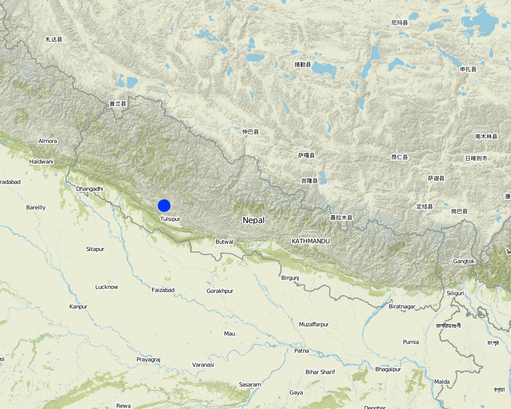
Sharada Batase VDC, Kabhrepalanchok District
حدد انتشار التقنية:
- يتم تطبيقها في نقاط محددة/ تتركز على مساحة صغيرة
التعليقات:
Total area covered by the SLM Technology is 1.1 km2.
Map
×2.6 تاريخ التنفيذ
في حالة عدم معرفة السنة بالتحديد، يرجى الإشارة إلى التاريخ التقريبي:
- منذ أكثر من 50 عامًا (تقليدي)
2.7 إدخال التقنية
حدد كيف تم إدخال التقنية:
- كجزء من النظام التقليدي (> 50 عامًا)
3. تصنيف تقنية الإدارة المستدامي للأراضي
3.1 الغرض الرئيسي ( الأغراض الرئيسية) للتقنية
- الحد من مخاطر الكوارث
3.2 نوع (أنواع) استخدام الأراضي الحالية حيث يتم تطبيق التقنية

الأراضي الزراعية
- زراعة سنوية
عدد مواسم الزراعة في السنة:
- 2
حدد:
Longest growing period in days: 200; Longest growing period from month to month: March-september; Second longest growing period in days: 120; Second longest growing period from month to month: October-January

الغابات/ الأراضي الحرجية
منتجات وخدمات:
- الخشب
- حطب الوقود
- Fodder

المجاري المائية، المسطحات المائية، الأراضي الرطبة
- خطوط الصرف، الممرات المائية
التعليقات:
Major land use problems (compiler’s opinion): As the land is continuously eroded, both farmland and inhabited areas will slowly slide downhill.
Forest products and services: timber, fuelwood
Other forest products and services: Fodder
Constraints of wastelands / deserts / glaciers / swamps
Livestock density: < 1 LU/km2
3.4 إمدادات المياه
إمدادات المياه للأرض التي يتم تنفيذ التقنية عليها:
- مختلط بعلي-مروي
3.5 مجموعةالإدارة المستدامة للأراضي التي تنتمي إليها هذه التقنية
- التدابير المتقاطعة للمنحدرات
- تحويل المياه والصرف
3.6 التدابير التقنية في مجال إلادارة المستدامة للأراضي

التدابير النباتية
- V2: الأعشاب والنباتات العشبية المعمرة

التدابير البنيوية
- S5: السدود، الأحواض الصغيرة، البرك
3.7 الأنواع الرئيسية من تدهور الأراضي التي تناولتها التقنية

تآكل التربة بالمياه
- (Wg):الانجراف الخلجاني/ الخلجان
التعليقات:
Main causes of degradation: crop management (annual, perennial, tree/shrub), deforestation / removal of natural vegetation (incl. forest fires), over-exploitation of vegetation for domestic use
3.8 منع أو حد أو عكس تدهور الأراضي
تحديد هدف التقنية فيما يتعلق بتدهور الأراضي:
- الحد من تدهور الأراضي
4. المواصفات الفنية، وأنشطة التنفيذ، والمدخلات، والتكاليف
4.1 الرسم الفني للتقنية
المواصفات الفنية (المتعلقة بالرسم الفني):
A jagidol area showing the approximate slope, bench terraces, and basic geometry of the landscape. With the shrine shown as in the photograph of the site.
Technical knowledge required for land users: moderate
Main technical functions: control of concentrated runoff: drain / divert, stabilisation of soil (eg by tree roots against land slides), water harvesting / increase water supply
Secondary technical functions: improvement of ground cover, spatial arrangement and diversification of land use
المؤلف:
Duncan Scott, A. K. Thaku
4.2 معلومات عامة بخصوص حساب المدخلات والتكاليف
حدد كيفية احتساب التكاليف والمدخلات:
- حسب مساحة تنفيذ التقنية
الإشارة إلى حجم ووحدة المساحة:
sq km
حدد العملة المستخدمة لحساب التكاليف:
- دولار أمريكي USD
اذكر متوسط تكلفة أجر العمالة المستأجرة في اليوم الواحد:
4.50
4.3 أنشطة التأسيس
| النشاط | التوقيت (الموسم) | |
|---|---|---|
| 1. | Local grasses such as utis, sito, amrisho, daleghas, and bamboo, can be planted on top of the reinforcements. | |
| 2. | Construction of dam with mud-filled sacks Construction of stone dam and spillways• Construction of retaining wall• Construction of bunds and barrier |
4.4 التكاليف والمدخلات اللازمة للتأسيس
| تحديد المدخلات | الوحدة | الكمية | التكاليف لكل وحدة | إجمالي التكاليف لكل مدخل | % من التكاليف التي يتحملها مستخدمو الأراضي | |
|---|---|---|---|---|---|---|
| العمالة | Plant grasses | persons/day/sq km | 150,0 | 4,5 | 675,0 | 100,0 |
| معدات | Equipment | sq km | 1,0 | 225,0 | 225,0 | 100,0 |
| مواد البناء | Material | sq km | 1,0 | 725,0 | 725,0 | 100,0 |
| إجمالي تكاليف إنشاء التقنية | 1625,0 | |||||
| إجمالي تكاليف إنشاء التقنية بالدولار الأمريكي | 1625,0 | |||||
4.5 الصيانة/الأنشطة المتكررة
| النشاط | التوقيت/الوتيرة | |
|---|---|---|
| 1. | Continue to reinforce by planting with local grasses or bamboo on top of the structures until the plantings are well established. |
4.6 التكاليف والمدخلات اللازمة للصيانة/للأنشطة المتكررة (سنويًا)
| تحديد المدخلات | الوحدة | الكمية | التكاليف لكل وحدة | إجمالي التكاليف لكل مدخل | % من التكاليف التي يتحملها مستخدمو الأراضي | |
|---|---|---|---|---|---|---|
| العمالة | Reinforce by planting on structure | persons/day/sq km | 50,0 | 5,0 | 250,0 | 100,0 |
| معدات | Equipment | sq km | 1,0 | 70,0 | 70,0 | 100,0 |
| مواد البناء | Material | sq km | 1,0 | 350,0 | 350,0 | 100,0 |
| إجمالي تكاليف صيانة التقنية | 670,0 | |||||
| إجمالي تكاليف صيانة التقنية بالدولار الأمريكي | 670,0 | |||||
4.7 أهم العوامل المؤثرة على التكاليف
قدم وصفا لأهم العوامل التي تؤثر على التكاليف:
The construction and maintenance of gullies demands attention during a busy agricultural calendar and can significantly add to the labour costs depending on the size and number of gullies and dams that need to be constructed and maintained.
5. البيئة الطبيعية والبشرية
5.1 المناخ
هطول الأمطار السنوي
- < 250 مم
- 251- 500 ملم
- 501 - 750ملم
- 1,000-751 ملم
- 1,500-1,100 ملم
- 2,000-1,500 ملم
- 3,000-2,001 ملم
- 4,000-3,100 ملم
- > 4000 ملم
المنطقة المناخية الزراعية
- شبه رطبة
Thermal climate class: subtropics
5.2 طوبوغرافيا
متوسط الانحدارات:
- مسطح (0-2%)
- بسيط (3-5%)
- معتدل (6-10%)
- متدحرج (11-15%)
- تلال (16-30%)
- شديدة الانحدار(31-60%)
- فائقة الانحدار (>60%)
التضاريس:
- هضاب/سهول
- أثلام مرتفعة
- المنحدرات الجبلية
- منحدرات التلال
- منحدرات في السفوح
- قاع الوادي
المنطقة الارتفاعية:
- 100-0 متر فوق سطح البحر
- 500-101 متر فوق سطح البحر
- 1,000-501 متر فوق سطح البحر
- 1,500-1,001 متر فوق سطح البحر
- 2,000-1,501 متر فوق سطح البحر
- 2,500-2,100 متر فوق سطح البحر
- 3,000-2,501 متر فوق سطح البحر
- 4,000-3,001 متر فوق سطح البحر
- > 4000 متر فوق سطح البحر
5.3 التربة
متوسط عمق التربة:
- ضحل جدًا (0-20 سم)
- ضحلة (21-50 سم)
- متوسطة العمق (51-80 سم)
- عميقة (81-120 سم)
- عميقة جدًا (> 120 سم)
قوام التربة (التربة السطحية):
- ناعم/ثقيل (طيني)
المواد العضوية في التربة السطحية:
- عالية (>3%)
إذا كان متاحًا، قم بإرفاق وصف كامل للتربة أو تحديد المعلومات المتوفرة، على سبيل المثال نوع التربة، الرقم الهيدروجيني/ درجة حموضة التربة، قدرة التبادل الكاتيوني، النيتروجين، الملوحة وما إلى ذلك.
Soil fertility is high
Soil drainage / infiltration is poor
Soil water storage capacity is medium
5.4 توافر المياه ونوعيتها
منسوب المياه الجوفية:
50-5 م
توافر المياه السطحية:
زائدة
نوعية المياه (غير المعالجة):
مياه الشرب سيئة (تتطلب معالجة)
تعليقات ومواصفات أخرى بشأن نوعية المياه وكميتها:
Water quality (untreated): Also for agricultural use only (irrigation)
Availability of surface water: During Monsoon
5.5 التنوع البيولوجي
تنوع الأنواع:
- مرتفع
5.6 خصائص مستخدمي الأراضي الذين يطبقون التقنية
التوجه السوقي لنظام الإنتاج:
- الكفاف (الإمداد الذاتي)
الدخل من خارج المزرعة:
- >50% من إجمالي الدخل
المستوى النسبي للثروة:
- متوسط
أفراداً أو مجموعات:
- فرد/أسرة معيشية
مستوى المكننة:
- عمل يدوي
- الجر الحيواني
الجنس:
- نساء
- رجال
اذكر الخصائص الأخرى ذات الصلة لمستخدمي الأراضي:
Land users applying the Technology are mainly common / average land users
Population density: 10-50 persons/km2
Annual population growth: 0.5% - 1%
90% of the land users are average wealthy.
5.7 متوسط مساحة الأرض التي يستخدمها مستخدمو الأراضي الذين يطبقون التقنية
- < 0.5 هكتارا
- 0.5 - 1 هكتار
- 1 -2 هكتار
- 2 - 5 هكتار
- 5 - 15 هكتار
- 15 - 50 هكتار
- 50 - 100هكتار
- 500-100 هكتار
- 1,000-500 هكتار
- 10,000-1,000 هكتار
- > 10,000 هكتار
هل يعتبر هذا نطاقًا صغيرًا أو متوسطًا أو واسعا (في إشارة إلى السياق المحلي)؟:
- على نطاق صغير
5.8 ملكية الأراضي، وحقوق استخدام الأراضي، وحقوق استخدام المياه
ملكية الارض:
- مجتمعي/قروي
- فردية، يوجد سند ملكية
حقوق استخدام الأراضي:
- فردي
حقوق استخدام المياه:
- وصول مفتوح (غير منظم)
5.9 الوصول إلى الخدمات والبنية التحتية
الصحة:
- ضعيف
- معتدل
- جيد
التعليم:
- ضعيف
- معتدل
- جيد
المساعدة التقنية:
- ضعيف
- معتدل
- جيد
العمل (على سبيل المثال خارج المزرعة):
- ضعيف
- معتدل
- جيد
الأسواق:
- ضعيف
- معتدل
- جيد
الطاقة:
- ضعيف
- معتدل
- جيد
الطرق والنقل:
- ضعيف
- معتدل
- جيد
مياه الشرب وخدمات الصرف الصحي:
- ضعيف
- معتدل
- جيد
الخدمات المالية:
- ضعيف
- معتدل
- جيد
6. الآثار والتصريحات الختامية
6.1 الآثار التي أظهرتها التقنية في الموقع
الآثار الاجتماعية والاقتصادية
الإنتاج
إنتاج المحاصيل
إنتاج الأعلاف
خطر فشل الإنتاج
منطقة الإنتاج
التعليقات/ حدد:
reduce risk of land degredation
توافر المياه ونوعيتها
توافر مياه الري
الدخل والتكاليف
عبء العمل
الآثار الاجتماعية والثقافية
الفرص الثقافية
التخفيف من حدة الصراع
agricultural benefits the whole community at many different levels including social-cultural
livelihood and human well-being
التعليقات/ حدد:
improved agriculture leads to food sufficiency, enhanced economic conditions, and better health throughout the community. When households have more cash income they usually invest it in education for their children
الآثار الايكولوجية
دورة المياه / الجريان السطحي
كمية المياه
الجريان السطحي
التربة
فقدان التربة
التنوع البيولوجي: الغطاء النباتي، الحيوانات
الكتلة الحيوية/ طبقة الكربون فوق التربة
تنوع الموائل
مكافحة الآفات/الأمراض
الحد من مخاطر المناخ والكوارث
آثار الفيضانات
آثار الجفاف
آثار السيكلون والعواصف المطرية
الآثار الايكولوجية الأخرى
competition for water, sunlight and nutrients
6.2 الآثار التي أظهرتها التقنية خارج الموقع
الفيضان في اتجاه مجرى النهر
Downstream Neighbor field also benefit from slop stability and soil conservation
6.3 تعرض التقنية وحساسيتها لتغير المناخ التدريجي والظواهر المتطرفة/الكوارث المرتبطة بالمناخ (كما يراها مستخدمو الأراضي)
تغير مناخ تدريجي
تغير مناخ تدريجي
| الموسم | زيادة أو نقصان | كيف تتعامل التقنية مع ذلك؟ | |
|---|---|---|---|
| درجة الحرارة السنوية | زيادة | جيدا |
الظواهر المتطرفة / الكوارث المرتبطة بالمناخ
الكوارث الجوية
| كيف تتعامل التقنية مع ذلك؟ | |
|---|---|
| عاصفة ممطرة محلية | ليس جيدا |
6.4 تحليل التكلفة والعائد
كيف يمكن مقارنة العوائد نسبة لتكاليف الإنشاء (من وجهة نظر مستخدمي الأراضي)؟
عوائد قصيرة الأجل:
إيجابي
عوائد طويلة الأجل:
ايجابي جدا
كيف تتم مقارنة العوائدمع كلفة الصيانة/التكاليف المتكررة (من وجهة نظر مستخدمي الأراضي)؟
عوائد قصيرة الأجل:
ايجابي جدا
عوائد طويلة الأجل:
ايجابي جدا
6.5 اعتماد التقنية
التعليقات:
There is a moderate trend towards spontaneous adoption of the Technology
Comments on adoption trend: Communities throughout the area have adopted these structural measures for centuries without any external support. Communities downstream are beginning to see the benefits and they are also starting to adopt these measures.
6.7 نقاط القوة / المزايا / الفرص التي توفرها التقنية
| نقاط القوة/ المزايا/ الفرص من وجهة نظر جامع المعلومات أو غيره من الاشخاص الرئيسيين لمصدر المعلومات |
|---|
|
This is a well-accepted local practice. How can they be sustained / enhanced? Continue to implement this soil conservation measure. |
|
The use of mud-filled sacs is a recent innovation. How can they be sustained / enhanced? Some advance training may be needed. |
|
Reduced risk of losing crops and agricultural land because of soil degradation. How can they be sustained / enhanced? Continue to add to mud-based structures by vegetative means. |
|
An added benefit is the production of biomass: grass, fodder for animals, wood, and fuelwood. How can they be sustained / enhanced? Continue to plant more trees. |
|
Makes water available for irrigation even during the dry season. How can they be sustained / enhanced? Encourage more check dam construction along the gully. |
6.8 نقاط ضعف / مساوىء / مخاطر التقنية وسبل التغلب عليها
| نقاط الضعف/ المساوىء/ المخاطر من وجهة نظر جامع المعلومات أو غيره من الاشخاص الرئيسيين لمصدر المعلومات | كيف يمكن التغلب عليها؟ |
|---|---|
| The traditional materials used in the construction of dams and gullies are prone to damage during flood events | The technology can be enhanced by the use of better materials and technical support. With research and funding, more robust conservation measures can be implemented. |
| In recent times, new activities such as brick making are coming to the villages; the entrepreneurs involved in these activities do not know about (and are not interested in) soil conservation measures | Increase awareness among newcomers. |
| There has never been any external support for these soil conservation activities even if downstream communities also benefit | Increase awareness among downstream communities. Explore possibilities for external support for controlled gullying. |
7. المراجع والروابط
7.1 طرق جمع/مصادر المعلومات
الروابط والوحدات المواضيعية
توسيع الكل طي الكلالروابط

Community-based approach in Erosion Control [أذربيجان]
The unsustainable use of pastures and forest areas leads to erosion, degradation, desertification and loss of biodiversity in high mountain areas of the South Caucasus. In the village Ehen in the Ismayilli district in Azerbaijan, a community-based approach for erosion control was developed in a participative way. Together with village …
- جامع المعلومات: Hanns Kirchmeir

Protected gullies – a traditional sustainable land management … [النيبال]
Protected gullying is a sustainable land management practice initiated and maintained by the traditional community approach; it is based on indigenous knowledge and uses only locally available materials.
- جامع المعلومات: Shreedip Sigdel
الوحدات المواضيعية
لا يوجد وحدات مواضيعية


