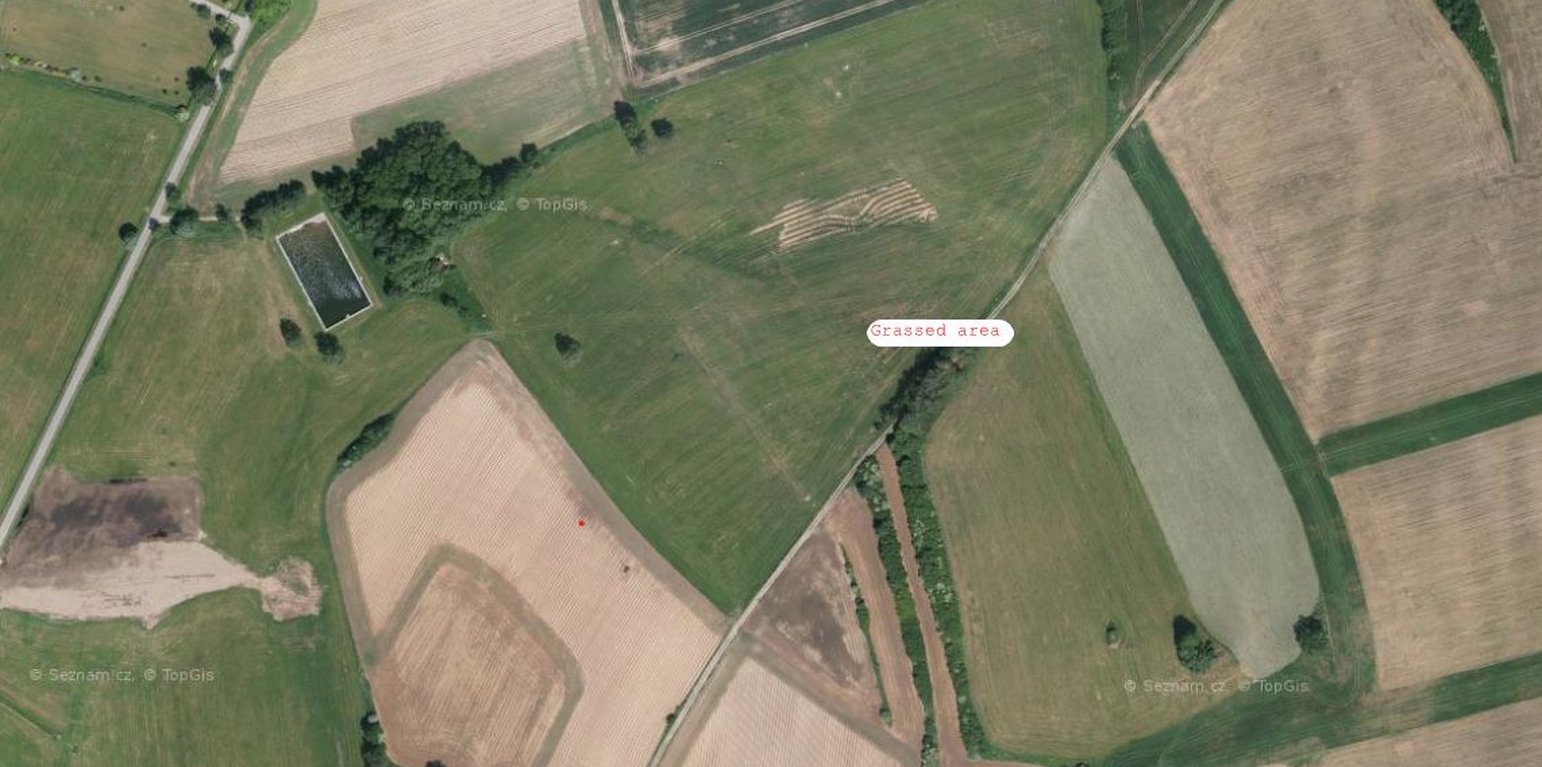
An example of a grassed recharge area (https://mapy.cz/letecka?l=0&x=15.2672000&y=49.4816142&z=17&base=ophoto)

Grassing of Recharge Areas (Czech Republic)

Zatravnění zdrojové oblasti

Description

Grassing recharge zones of agricultural drainage systems significantly improves the quality of drainage water. It can be a useful, effective and relatively cheap measure for improvement of shallow groundwater quality.

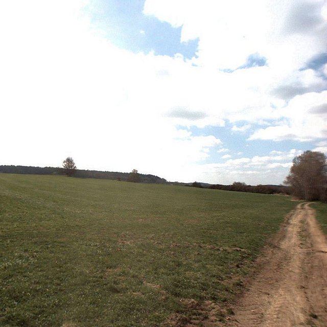
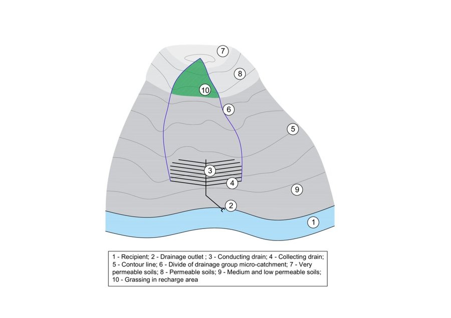
Grassing of recharge zones of agricultural drainage systems significantly improves the quality of drainage water: it can be a useful, effective and relatively cheap measure. Grassing is an effective preventative strategy to prevent nitrogen pollution. Reduction of nitrate pollution by grassland occurs mainly through grassland’s ability to absorb and use large amounts of nitrogen compared with field crops, and this capacity remains effective for a longer period of the year. Permanent grasslands cover the soil year-round and have a large stock of active subsurface biomass in the root system, which can immobilize a significant amount of soil nitrogen. Moreover, grassland has a greater amount of active soil microbes than under field crops (Griffiths et al. 2008). Besides nitrogen remedial ability, grasslands offer other regulation and supporting ecosystem service (ES) benefits (Hönigová et al., 2012) – for example carbon sequestration, erosion prevention and water flow regulation. On the other hand, used too widely, grassland can be seen as a negative ES provider, in the sense that it reduces the area of crop production (Hauck et al., 2014). That is why it is recommended to limit the use of grassing so that it acts within relatively small areas focused on the catchment area. The effectiveness of grassing has been evaluated statistically, when Fučík et al. (2008) reported that an increase in grassed area of 10% can decrease the C90 (90% probability of non-exceedance) nitrate value in the waters of streams (small water courses) by 6.4 mg/l.

Location

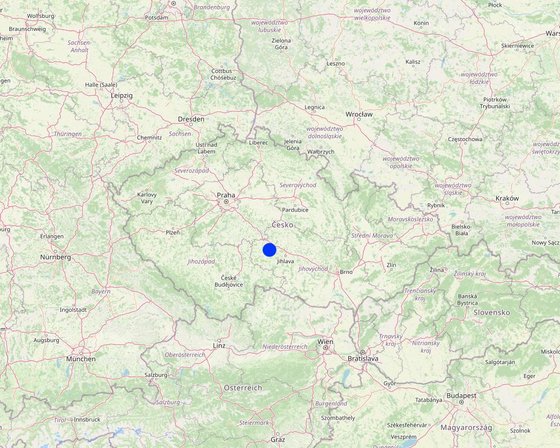
Location: Kojčice, Bohemian - Moravian Highlands, Czech Republic

No. of Technology sites analysed: single site

Geo-reference of selected sites
  • 15.26916, 49.47963

Spread of the Technology: evenly spread over an area (0.05 km²)

In a permanently protected area?: No

Date of implementation: 2006

Type of introduction
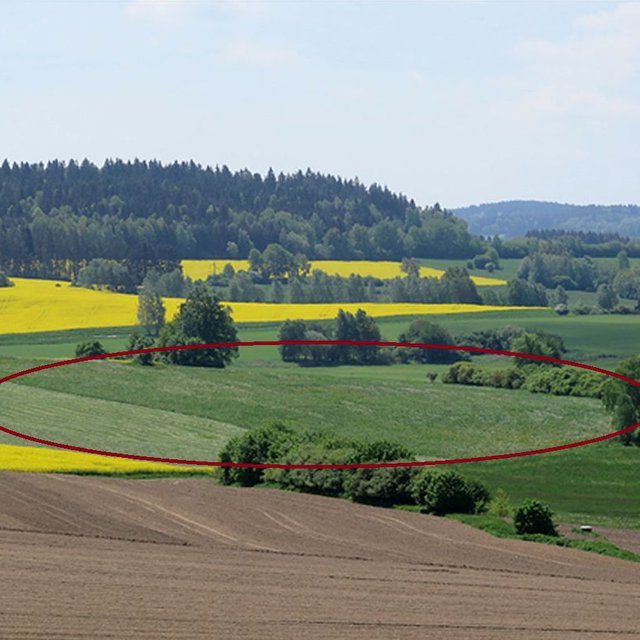
The pilot locality Dehtáře in spring 2019. The area measured is circled in red. (Antonín Zajíček)
Grassed area in the Dehtáře pilot locality (Antonín Zajíček)

Classification of the Technology

Main purpose
  • improve production
  • reduce, prevent, restore land degradation
  • conserve ecosystem
  • protect a watershed/ downstream areas – in combination with other Technologies
  • preserve/ improve biodiversity
  • reduce risk of disasters
  • adapt to climate change/ extremes and its impacts
  • mitigate climate change and its impacts
  • create beneficial economic impact
  • create beneficial social impact
Land use
Land use mixed within the same land unit: No

  • Cropland
    • Perennial (non-woody) cropping: fodder crops - grasses
    Number of growing seasons per year: 1
    Is intercropping practiced? No
    Is crop rotation practiced? Yes
Water supply
  • rainfed
  • mixed rainfed-irrigated
  • full irrigation

Purpose related to land degradation
  • prevent land degradation
  • reduce land degradation
  • restore/ rehabilitate severely degraded land
  • adapt to land degradation
  • not applicable
Degradation addressed
  • soil erosion by water - Wt: loss of topsoil/ surface erosion
  • water degradation - Hp: decline of surface water quality, Hq: decline of groundwater quality
SLM group
  • improved ground/ vegetation cover
SLM measures
  • vegetative measures - V2: Grasses and perennial herbaceous plants
  • management measures - M1: Change of land use type

Technical drawing

Technical specifications
The figure shows a model example of a drainage structure built at the bottom of a slope (3, 4). In this case, a substantial portion of the drainage runoff consists of water that infiltrates in areas with shallow soils that are highly permeable to water, nutrients, and other pollutants (7 and 8). In the case of drainage constructed in this way, the entire micro-catchment of the drainage group must be taken into account in terms of runoff generation and drainage water quality (6). The area where the microwatershed of a drainage group intersects with an area of shallow permeable soils is the source area for drainage runoff and it is to these locations that the grassed area should be directed (10).
Author: Antonín Zajíček and Tomáš Hejduk

Establishment and maintenance: activities, inputs and costs

Calculation of inputs and costs
  • Costs are calculated: per Technology area (size and area unit: 3.5 hectares)
  • Currency used for cost calculation: EUR
  • Exchange rate (to USD): 1 USD = 0.92 EUR
  • Average wage cost of hired labour per day: 60
Most important factors affecting the costs
Fuel prices, level of subsidies
Establishment activities
  1. Vulnerable area delimitation (Timing/ frequency: one year before establishment)
  2. Obtaining the consent of the owners and users of the affected land (Timing/ frequency: one year before establishment)
  3. Grass sowing (Timing/ frequency: after harvest of previous crops)
Establishment inputs and costs (per 3.5 hectares)
Specify input Unit Quantity Costs per Unit (EUR) Total costs per input (EUR) % of costs borne by land users
Labour
Work for delimitation person - days 3.0 130.0 390.0
Project and administration person - days 4.0 150.0 600.0 90.0
Manual work on the field ha 5.0 30.0 150.0 90.0
Equipment
Machinery - sowing machine, chopper ha 5.0 200.0 1000.0 89.0
Fuel ha 5.0 60.0 300.0 90.0
Plant material
Seeds ha 5.0 40.0 200.0 90.0
Fertilizers and biocides
Feritilizers (mostly urea and pig slurry digestate) ha 5.0 30.0 150.0 90.0
Biocides (only the year of establishment) ha 5.0 60.0 300.0 90.0
Other
Fixed costs ha 5.0 180.0 900.0 90.0
Total costs for establishment of the Technology 3'990.0
Total costs for establishment of the Technology in USD 4'336.96
Maintenance activities
  1. re-sowing (Timing/ frequency: before vegetation season if needed)
  2. harrowing (Timing/ frequency: if needed once per season after re-sowing)
  3. fertilising (Timing/ frequency: once or twice per season)
  4. harvesting (Timing/ frequency: twice or three times per season)
Maintenance inputs and costs (per 3.5 hectares)
Specify input Unit Quantity Costs per Unit (EUR) Total costs per input (EUR) % of costs borne by land users
Labour
Manual work on the field ha 5.0 25.0 125.0 85.0
Equipment
Machinery - sowing machine, chopper, tractor ha 5.0 200.0 1000.0 85.0
Fuel ha 5.0 60.0 300.0 85.0
Plant material
seeds ha 5.0 20.0 100.0 85.0
Fertilizers and biocides
Feritilizers (mostly urea and pig slurry digestate) ha 5.0 25.0 125.0 85.0
Biocides (when needed) ha 5.0 30.0 150.0 85.0
Other
Fixed costs ha 5.0 150.0 750.0 85.0
Total costs for maintenance of the Technology 2'550.0
Total costs for maintenance of the Technology in USD 2'771.74

Natural environment

Average annual rainfall
  • < 250 mm
  • 251-500 mm
  • 501-750 mm
  • 751-1,000 mm
  • 1,001-1,500 mm
  • 1,501-2,000 mm
  • 2,001-3,000 mm
  • 3,001-4,000 mm
  • > 4,000 mm
Agro-climatic zone
  • humid
  • sub-humid
  • semi-arid
  • arid
Specifications on climate
Average annual rainfall in mm: 666.0
Slope
  • flat (0-2%)
  • gentle (3-5%)
  • moderate (6-10%)
  • rolling (11-15%)
  • hilly (16-30%)
  • steep (31-60%)
  • very steep (>60%)
Landforms
  • plateau/plains
  • ridges
  • mountain slopes
  • hill slopes
  • footslopes
  • valley floors
Altitude
  • 0-100 m a.s.l.
  • 101-500 m a.s.l.
  • 501-1,000 m a.s.l.
  • 1,001-1,500 m a.s.l.
  • 1,501-2,000 m a.s.l.
  • 2,001-2,500 m a.s.l.
  • 2,501-3,000 m a.s.l.
  • 3,001-4,000 m a.s.l.
  • > 4,000 m a.s.l.
Technology is applied in
  • convex situations
  • concave situations
  • not relevant
Soil depth
  • very shallow (0-20 cm)
  • shallow (21-50 cm)
  • moderately deep (51-80 cm)
  • deep (81-120 cm)
  • very deep (> 120 cm)
Soil texture (topsoil)
  • coarse/ light (sandy)
  • medium (loamy, silty)
  • fine/ heavy (clay)
Soil texture (> 20 cm below surface)
  • coarse/ light (sandy)
  • medium (loamy, silty)
  • fine/ heavy (clay)
Topsoil organic matter content
  • high (>3%)
  • medium (1-3%)
  • low (<1%)
Groundwater table
  • on surface
  • < 5 m
  • 5-50 m
  • > 50 m
Availability of surface water
  • excess
  • good
  • medium
  • poor/ none
Water quality (untreated)
  • good drinking water
  • poor drinking water (treatment required)
  • for agricultural use only (irrigation)
  • unusable
Water quality refers to: both ground and surface water
Is salinity a problem?
  • Yes
  • No

Occurrence of flooding
  • Yes
  • No
Species diversity
  • high
  • medium
  • low
Habitat diversity
  • high
  • medium
  • low

Characteristics of land users applying the Technology

Market orientation
  • subsistence (self-supply)
  • mixed (subsistence/ commercial)
  • commercial/ market
Off-farm income
  • less than 10% of all income
  • 10-50% of all income
  • > 50% of all income
Relative level of wealth
  • very poor
  • poor
  • average
  • rich
  • very rich
Level of mechanization
  • manual work
  • animal traction
  • mechanized/ motorized
Sedentary or nomadic
  • Sedentary
  • Semi-nomadic
  • Nomadic
Individuals or groups
  • individual/ household
  • groups/ community
  • cooperative
  • employee (company, government)
Gender
  • women
  • men
Age
  • children
  • youth
  • middle-aged
  • elderly
Area used per household
  • < 0.5 ha
  • 0.5-1 ha
  • 1-2 ha
  • 2-5 ha
  • 5-15 ha
  • 15-50 ha
  • 50-100 ha
  • 100-500 ha
  • 500-1,000 ha
  • 1,000-10,000 ha
  • > 10,000 ha
Scale
  • small-scale
  • medium-scale
  • large-scale
Land ownership
  • state
  • company
  • communal/ village
  • group
  • individual, not titled
  • individual, titled
Land use rights
  • open access (unorganized)
  • communal (organized)
  • leased
  • individual
Water use rights
  • open access (unorganized)
  • communal (organized)
  • leased
  • individual
Access to services and infrastructure
health

poor
x
good
education

poor
x
good
technical assistance

poor
x
good
employment (e.g. off-farm)

poor
x
good
markets

poor
x
good
energy

poor
x
good
roads and transport

poor
x
good
drinking water and sanitation

poor
x
good
financial services

poor
x
good

Impacts

Socio-economic impacts
Crop production
decreased
x
increased


Farmers will lose land for growing commercially viable crops (cereals, potatoes, rape) and grass production (hay, haylage) will increase.

Socio-cultural impacts
SLM/ land degradation knowledge
reduced
x
improved


Permanent grassland in the recharge area will protect the shallow soils especially from accelerated erosion.

Ecological impacts
water quantity
decreased
x
increased


This measure will reduce the intensity of surface and subsurface runoff from the catchment.

water quality
decreased
x
increased

surface runoff
increased
x
decreased


Grassing will slowdwn the surface runoff especially during intensive rainfall-runoff events.

soil cover
reduced
x
improved


Permanent grasslands cover the soil year round.

soil loss
increased
x
decreased


This measure prevents soil loss from the accelerated erosion.

soil organic matter/ below ground C
decreased
x
increased


Permanent grasslands have a big stock of active subsurface biomass in the root system, which can immobilize a significant amount of soil nitrogen. Moreover, it has bigger amount and increased activity of soil microbes supporting e.g. carbon sequestration.

vegetation cover
decreased
x
increased


Unlike arable land, permanent grassland provides full land cover even in the non-growing season.

animal diversity
decreased
x
increased


Properly managed grasslans will increase biodiversity (compared to the arable lands), especially amount of insect.

Off-site impacts
groundwater/ river pollution
increased
x
reduced


In intensively drained catchments, drainage structures have a significant contribution to total runoff and water pollution.Grassing in recharge zone will significantly mitigate water pollution, especially nutrients and pesticides loads.

damage on neighbours' fields
increased
x
reduced


Decrease in rapid erosive runoff will reduce the risk of sediment input to lower lying lands.

damage on public/ private infrastructure
increased
x
reduced


Decrease in rapid erosive runoff will reduce the risk of sediment input into the intravilane of lower lying villages or public roads.

Cost-benefit analysis

Benefits compared with establishment costs
Short-term returns
very negative
x
very positive

Long-term returns
very negative
x
very positive

Benefits compared with maintenance costs
Short-term returns
very negative
x
very positive

Long-term returns
very negative
x
very positive

From an economic point of view, the increase in the area of grasslands will clearly reduce the turnover of the agricultural entity. The fall in costs and income will also lead to a reduction in profits, which is partly offset by higher subsidies for permanent grasslands. However, the increase in dependence on subsidies is dangerous in terms of the long-term stability of the farming entity, as the amount and focus of subsidies can change from year to year. It is also important to note that the production of grass biomass only make sense if the farmer also runs livestock production or a biogas plant, taking into account the amount of grass that the farmer is able to process.

Climate change

Gradual climate change
seasonal rainfall increase

not well at all
x
very well
Season: summer

Adoption and adaptation

Percentage of land users in the area who have adopted the Technology
  • single cases/ experimental
  • 1-10%
  • 11-50%
  • > 50%
Of all those who have adopted the Technology, how many have done so without receiving material incentives?
  • 0-10%
  • 11-50%
  • 51-90%
  • 91-100%
Has the Technology been modified recently to adapt to changing conditions?
  • Yes
  • No
To which changing conditions?
  • climatic change/ extremes
  • changing markets
  • labour availability (e.g. due to migration)

Conclusions and lessons learnt

Strengths: land user's view
  • A relatively low-cost measure in terms of finance and agricultural management
Strengths: compiler’s or other key resource person’s view
  • grassing focused to the proper catchment area (recharge zone) can be a useful, effective and relatively cheap measure for improvement of shallow groundwater quality, or optionally the quality of local drinking water sources
  • stabilise of catchment area with shallow soils - can lead to decrease in soil erosion.
Weaknesses/ disadvantages/ risks: land user's viewhow to overcome
  • Increasing areas of grasslands would lead to decrease of landscape productive service, farm turnover and profit and the bigger dependence on subsidies. The grassing should be applied in small, precisely defined parts of the catchment, which are real recharge (infiltration) areas.
  • Possible sudden change in the subsidy system It is necessary to consider the non-productive functions of grasslands also as public service, taking into account the saves in water cleaning costs and the price of increased water retention
  • Excess amout of grass or hay, especially for farms without livestock production Balanced share of grasslands and arablale lands in cultivated field blocks, support for livestock production
Weaknesses/ disadvantages/ risks: compiler’s or other key resource person’s viewhow to overcome
  • An incorrectly defined source area will lead to ineffective measures Careful preparation
  • Unwillingness of conservative companies and farmers to adopt this measure Properly set up subsidy policy

References

Compiler
  • Antonín Zajíček
Editors
Reviewer
  • William Critchley
  • Rima Mekdaschi Studer
Date of documentation: June 22, 2021
Last update: March 25, 2024
Resource persons
Full description in the WOCAT database
Linked SLM data
Documentation was faciliated by
Institution Project
Key references
  • Kvítek, T.; Zajíček, A.; Dostál, T.; Fučík, P.; Krása, J.; Bauer, M.; Jáchymová, B.; Kulhavý, Z.; Pavel, M. Slowing Down Quick Runoff—A New Approach for the Delineation and Assessment of Critical Points, Contributing Areas, and Proposals of Measures to Reduce Non-Point Water Pollution from Agricultural Land. Water 2023, 15, 1247.: https://doi.org/10.3390/w15061247
  • Zajíček, A., Hejduk, T., Sychra, L., Vybíral, T., Fučík, P. (2022): How to Select a Location and a Design of Measures on Land Drainage – A Case Study from the Czech Republic. Journal of Ecological Engineering 2022, 23(4), 43–57. ISSN 2299–8993.: https://doi.org/10.12911/22998993/146270
  • ZAJÍČEK, A., FUČÍK, P., DUFFKOVÁ, R., MAXOVÁ, J. 2018. How does targeted grassing of arable land influence drainage water quality and farm economic indicators? Int. J. Environ. Impacts, 1(3): 344–352.: DOI 10.2495/EI-V1-N3-344-352
  • Fučík P., Zajíček A., Kaplická M., Duffková R., Peterková J., Maxová J., Takáčová Š. 2017. Incorporating rainfall-runoff events into nitrate-nitrogen and phosphorus load assessments for small tile-drained catchments. Water, 9, 712; (ISSN Print:2575-1867 ISSN Online: 2575-1875): doi:10.3390/w9090712
  • Janglová R., Kvítek T., Novák P. 2003. Soil infiltration capacity categorization based on geoinformatic processing of soil survey data. Soil and Water Scientific Studies, 2, 61–81.:
Links to relevant information which is available online
  • ZAJÍČEK, A., SYCHRA, L., VYBÍRAL, T., HEJDUK, T., ČMELÍK, M., FUČÍK, P., KAPLICKÁ, M. 2021: Design of the Revitalization measures on the Main drainage facilities and hydrologically related Detailed drainage facilities (In Czech): DOI: 10.13140/RG.2.2.34421.50403
This work is licensed under Creative Commons Attribution-NonCommercial-ShareaAlike 4.0 International