Grassing of Recharge Areas [Czech Republic]
- Creation:
- Update:
- Compiler: Antonín Zajíček
- Editor: –
- Reviewers: William Critchley, Rima Mekdaschi Studer
Zatravnění zdrojové oblasti
technologies_5934 - Czech Republic
View sections
Expand all Collapse all1. General information
1.2 Contact details of resource persons and institutions involved in the assessment and documentation of the Technology
land user:
Name of project which facilitated the documentation/ evaluation of the Technology (if relevant)
OPtimal strategies to retAIN and re-use water and nutrients in small agricultural catchments across different soil-climatic regions in Europe (OPTAIN)Name of project which facilitated the documentation/ evaluation of the Technology (if relevant)
New approaches to the revitalization of main drainage facilities in relation to drainage systems in terms of water retention in the landscape (TH02030397)Name of project which facilitated the documentation/ evaluation of the Technology (if relevant)
Approaches for design and realization of complex effective measures for tile drained agricultural catchments by land consolidations (QK21010341)Name of the institution(s) which facilitated the documentation/ evaluation of the Technology (if relevant)
Research Institute for Soil and Water Conservation (VUMOP) - Czech Republic1.3 Conditions regarding the use of data documented through WOCAT
The compiler and key resource person(s) accept the conditions regarding the use of data documented through WOCAT:
Yes
1.4 Declaration on sustainability of the described Technology
Is the Technology described here problematic with regard to land degradation, so that it cannot be declared a sustainable land management technology?
No
1.5 Reference to Questionnaire(s) on SLM Approaches (documented using WOCAT)
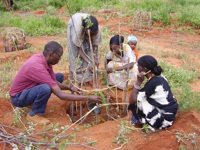
Catchment Approach [Kenya]
A focused approach to integrated land and water management, including soil and water conservation, where the active participation of the villagers - often organised through common interest groups - is central.
- Compiler: James Gatero Njuki
2. Description of the SLM Technology
2.1 Short description of the Technology
Definition of the Technology:
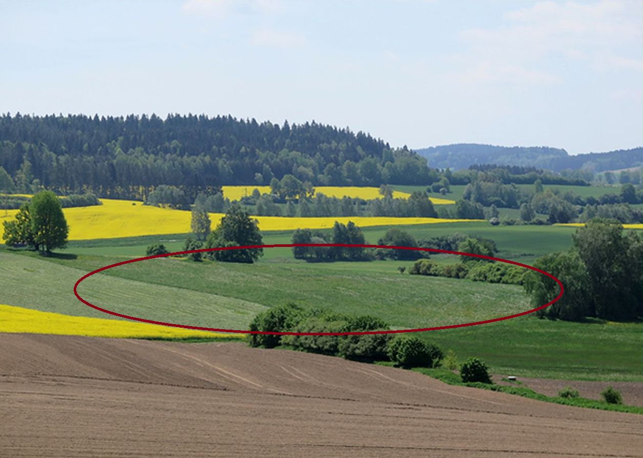
Grassing recharge zones of agricultural drainage systems significantly improves the quality of drainage water. It can be a useful, effective and relatively cheap measure for improvement of shallow groundwater quality.
2.2 Detailed description of the Technology
Description:
Grassing of recharge zones of agricultural drainage systems significantly improves the quality of drainage water: it can be a useful, effective and relatively cheap measure. Grassing is an effective preventative strategy to prevent nitrogen pollution. Reduction of nitrate pollution by grassland occurs mainly through grassland’s ability to absorb and use large amounts of nitrogen compared with field crops, and this capacity remains effective for a longer period of the year. Permanent grasslands cover the soil year-round and have a large stock of active subsurface biomass in the root system, which can immobilize a significant amount of soil nitrogen. Moreover, grassland has a greater amount of active soil microbes than under field crops (Griffiths et al. 2008). Besides nitrogen remedial ability, grasslands offer other regulation and supporting ecosystem service (ES) benefits (Hönigová et al., 2012) – for example carbon sequestration, erosion prevention and water flow regulation. On the other hand, used too widely, grassland can be seen as a negative ES provider, in the sense that it reduces the area of crop production (Hauck et al., 2014). That is why it is recommended to limit the use of grassing so that it acts within relatively small areas focused on the catchment area. The effectiveness of grassing has been evaluated statistically, when Fučík et al. (2008) reported that an increase in grassed area of 10% can decrease the C90 (90% probability of non-exceedance) nitrate value in the waters of streams (small water courses) by 6.4 mg/l.
2.3 Photos of the Technology
Media Gallery
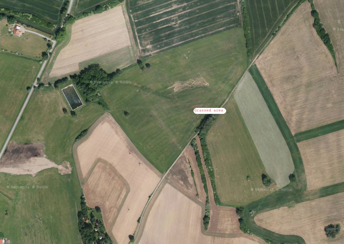
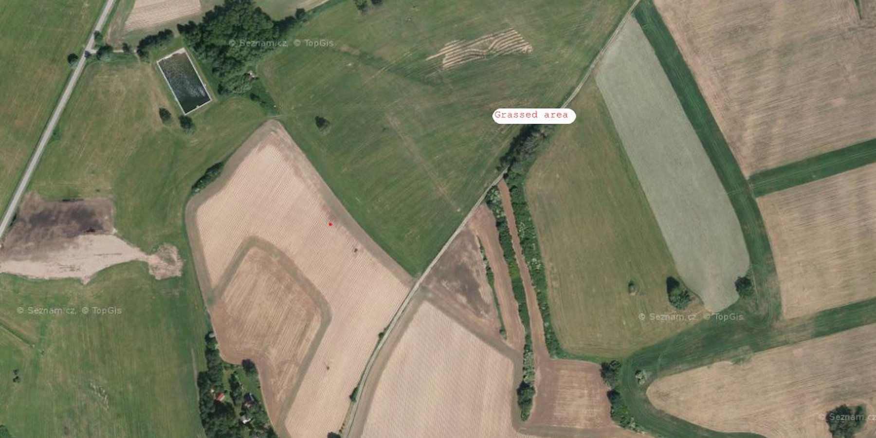
2.5 Country/ region/ locations where the Technology has been applied and which are covered by this assessment
Country:
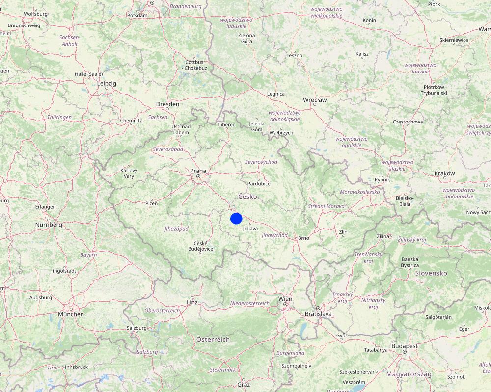
Czech Republic
Region/ State/ Province:
Bohemian - Moravian Highlands
Further specification of location:
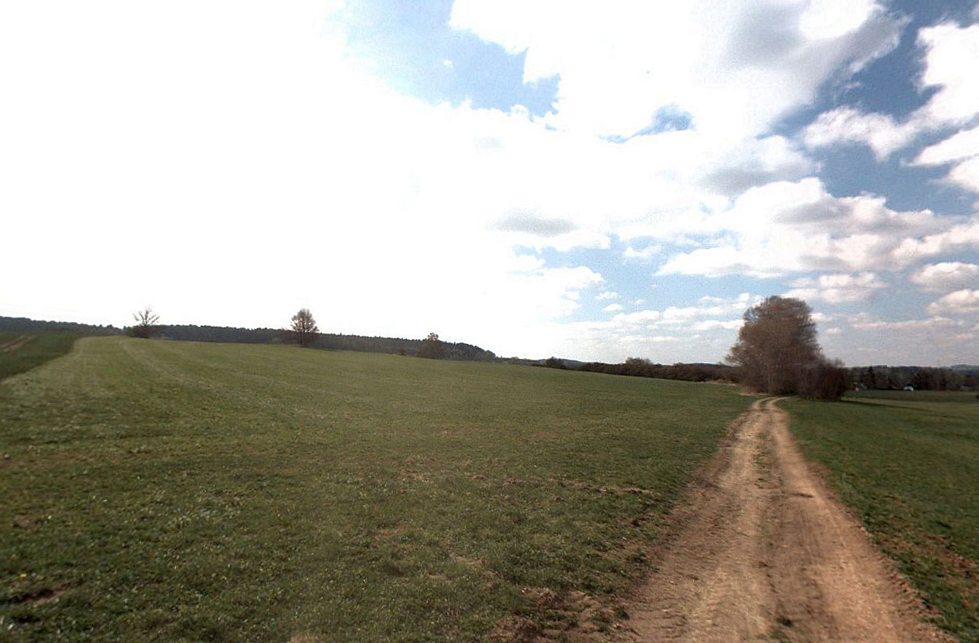
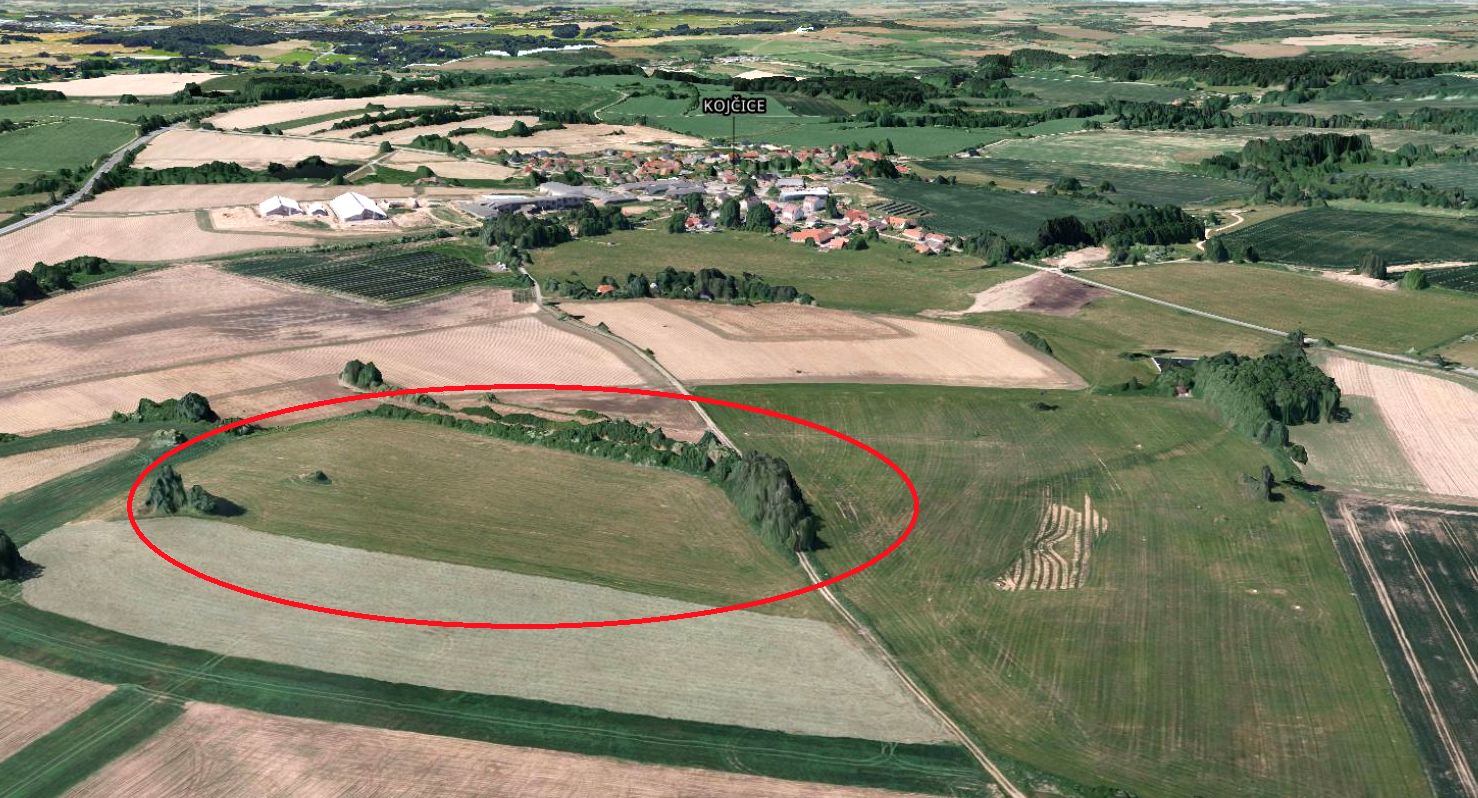
Kojčice
Specify the spread of the Technology:
- evenly spread over an area
If the Technology is evenly spread over an area, specify area covered (in km2):
0.05
If precise area is not known, indicate approximate area covered:
- < 0.1 km2 (10 ha)
Is/are the technology site(s) located in a permanently protected area?
No
Map
×2.6 Date of implementation
Indicate year of implementation:
2006
2.7 Introduction of the Technology
Specify how the Technology was introduced:
- during experiments/ research
- through projects/ external interventions
Comments (type of project, etc.):
Linking of the land use in the source areas to drainage water quality has been tested in several research projects since the first decade of the 21st Century. The methodology for defining source areas has been developed by the Research Institute for Soil and Water Conservation for a long time. Nowadays this measure has become part of the Czech Ministry of Agriculture subsidy and farmers can use it themselves.
3. Classification of the SLM Technology
3.1 Main purpose(s) of the Technology
- reduce, prevent, restore land degradation
- protect a watershed/ downstream areas – in combination with other Technologies
- adapt to climate change/ extremes and its impacts
3.2 Current land use type(s) where the Technology is applied
Land use mixed within the same land unit:
No

Cropland
- Perennial (non-woody) cropping
Perennial (non-woody) cropping - Specify crops:
- fodder crops - grasses
Number of growing seasons per year:
- 1
Is intercropping practiced?
No
Is crop rotation practiced?
Yes
3.3 Has land use changed due to the implementation of the Technology?
Has land use changed due to the implementation of the Technology?
- Yes (Please fill out the questions below with regard to the land use before implementation of the Technology)
Land use mixed within the same land unit:
No
Cropland
- Annual cropping
Annual cropping - Specify crops:
- cereals - barley
- cereals - maize
- cereals - wheat (winter)
- oilseed crops - sunflower, rapeseed, other
- root/tuber crops - potatoes
Is intercropping practiced?
Yes
If yes, specify which crops are intercropped:
In some seasons, spring cereal mix, legume-cereal mix or undersown clover is used as an intercrop
Is crop rotation practiced?
Yes
If yes, specify:
five-year or seven-year crop rotation with winter cereals, spring cereals, potatoes, red clover, oil seed rape and maize
3.4 Water supply
Water supply for the land on which the Technology is applied:
- rainfed
3.5 SLM group to which the Technology belongs
- improved ground/ vegetation cover
3.6 SLM measures comprising the Technology

vegetative measures
- V2: Grasses and perennial herbaceous plants

management measures
- M1: Change of land use type
3.7 Main types of land degradation addressed by the Technology

soil erosion by water
- Wt: loss of topsoil/ surface erosion

water degradation
- Hp: decline of surface water quality
- Hq: decline of groundwater quality
3.8 Prevention, reduction, or restoration of land degradation
Specify the goal of the Technology with regard to land degradation:
- reduce land degradation
4. Technical specifications, implementation activities, inputs, and costs
4.1 Technical drawing of the Technology
Technical specifications (related to technical drawing):
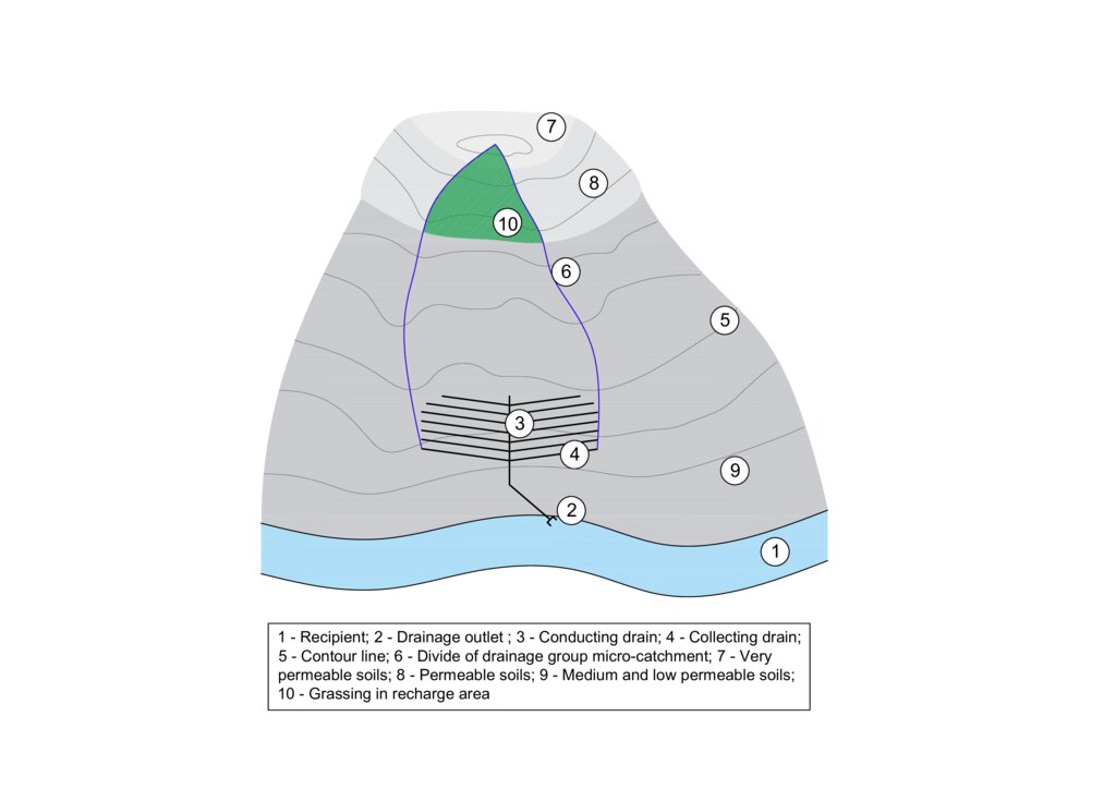
The figure shows a model example of a drainage structure built at the bottom of a slope (3, 4). In this case, a substantial portion of the drainage runoff consists of water that infiltrates in areas with shallow soils that are highly permeable to water, nutrients, and other pollutants (7 and 8). In the case of drainage constructed in this way, the entire micro-catchment of the drainage group must be taken into account in terms of runoff generation and drainage water quality (6). The area where the microwatershed of a drainage group intersects with an area of shallow permeable soils is the source area for drainage runoff and it is to these locations that the grassed area should be directed (10).
Author:
Antonín Zajíček and Tomáš Hejduk
Date:
12/10/2022
4.2 General information regarding the calculation of inputs and costs
Specify how costs and inputs were calculated:
- per Technology area
Indicate size and area unit:
3.5 hectares
other/ national currency (specify):
EUR
If relevant, indicate exchange rate from USD to local currency (e.g. 1 USD = 79.9 Brazilian Real): 1 USD =:
0.92
Indicate average wage cost of hired labour per day:
60
4.3 Establishment activities
| Activity | Timing (season) | |
|---|---|---|
| 1. | Vulnerable area delimitation | one year before establishment |
| 2. | Obtaining the consent of the owners and users of the affected land | one year before establishment |
| 3. | Grass sowing | after harvest of previous crops |
4.4 Costs and inputs needed for establishment
| Specify input | Unit | Quantity | Costs per Unit | Total costs per input | % of costs borne by land users | |
|---|---|---|---|---|---|---|
| Labour | Work for delimitation | person - days | 3.0 | 130.0 | 390.0 | |
| Labour | Project and administration | person - days | 4.0 | 150.0 | 600.0 | 90.0 |
| Labour | Manual work on the field | ha | 5.0 | 30.0 | 150.0 | 90.0 |
| Equipment | Machinery - sowing machine, chopper | ha | 5.0 | 200.0 | 1000.0 | 89.0 |
| Equipment | Fuel | ha | 5.0 | 60.0 | 300.0 | 90.0 |
| Plant material | Seeds | ha | 5.0 | 40.0 | 200.0 | 90.0 |
| Fertilizers and biocides | Feritilizers (mostly urea and pig slurry digestate) | ha | 5.0 | 30.0 | 150.0 | 90.0 |
| Fertilizers and biocides | Biocides (only the year of establishment) | ha | 5.0 | 60.0 | 300.0 | 90.0 |
| Other | Fixed costs | ha | 5.0 | 180.0 | 900.0 | 90.0 |
| Total costs for establishment of the Technology | 3990.0 | |||||
| Total costs for establishment of the Technology in USD | 4336.96 | |||||
If land user bore less than 100% of costs, indicate who covered the remaining costs:
Czech Ministry of Agriculture
Comments:
The amount of agricultural subsidies in the Czech Republic is currently (2024) variable depending on the size of the farm. For a farm with an average size of 1500 ha, the subsidy is approximately EUR 160. For the conversion of arable land to permanent grassland in vulnerable areas, an additional subsidy of approximately EUR 310 per hectare is available from the Ministry of Agriculture.
4.5 Maintenance/ recurrent activities
| Activity | Timing/ frequency | |
|---|---|---|
| 1. | re-sowing | before vegetation season if needed |
| 2. | harrowing | if needed once per season after re-sowing |
| 3. | fertilising | once or twice per season |
| 4. | harvesting | twice or three times per season |
4.6 Costs and inputs needed for maintenance/ recurrent activities (per year)
| Specify input | Unit | Quantity | Costs per Unit | Total costs per input | % of costs borne by land users | |
|---|---|---|---|---|---|---|
| Labour | Manual work on the field | ha | 5.0 | 25.0 | 125.0 | 85.0 |
| Equipment | Machinery - sowing machine, chopper, tractor | ha | 5.0 | 200.0 | 1000.0 | 85.0 |
| Equipment | Fuel | ha | 5.0 | 60.0 | 300.0 | 85.0 |
| Plant material | seeds | ha | 5.0 | 20.0 | 100.0 | 85.0 |
| Fertilizers and biocides | Feritilizers (mostly urea and pig slurry digestate) | ha | 5.0 | 25.0 | 125.0 | 85.0 |
| Fertilizers and biocides | Biocides (when needed) | ha | 5.0 | 30.0 | 150.0 | 85.0 |
| Other | Fixed costs | ha | 5.0 | 150.0 | 750.0 | 85.0 |
| Total costs for maintenance of the Technology | 2550.0 | |||||
| Total costs for maintenance of the Technology in USD | 2771.74 | |||||
If land user bore less than 100% of costs, indicate who covered the remaining costs:
Czech Ministry of Agriculture
4.7 Most important factors affecting the costs
Describe the most determinate factors affecting the costs:
Fuel prices, level of subsidies
5. Natural and human environment
5.1 Climate
Annual rainfall
- < 250 mm
- 251-500 mm
- 501-750 mm
- 751-1,000 mm
- 1,001-1,500 mm
- 1,501-2,000 mm
- 2,001-3,000 mm
- 3,001-4,000 mm
- > 4,000 mm
Specify average annual rainfall (if known), in mm:
666.00
Agro-climatic zone
- sub-humid
5.2 Topography
Slopes on average:
- flat (0-2%)
- gentle (3-5%)
- moderate (6-10%)
- rolling (11-15%)
- hilly (16-30%)
- steep (31-60%)
- very steep (>60%)
Landforms:
- plateau/plains
- ridges
- mountain slopes
- hill slopes
- footslopes
- valley floors
Altitudinal zone:
- 0-100 m a.s.l.
- 101-500 m a.s.l.
- 501-1,000 m a.s.l.
- 1,001-1,500 m a.s.l.
- 1,501-2,000 m a.s.l.
- 2,001-2,500 m a.s.l.
- 2,501-3,000 m a.s.l.
- 3,001-4,000 m a.s.l.
- > 4,000 m a.s.l.
Indicate if the Technology is specifically applied in:
- not relevant
5.3 Soils
Soil depth on average:
- very shallow (0-20 cm)
- shallow (21-50 cm)
- moderately deep (51-80 cm)
- deep (81-120 cm)
- very deep (> 120 cm)
Soil texture (topsoil):
- coarse/ light (sandy)
Topsoil organic matter:
- medium (1-3%)
If available, attach full soil description or specify the available information, e.g. soil type, soil PH/ acidity, Cation Exchange Capacity, nitrogen, salinity etc.
The substrate is formed by partially migmatized paragneiss in various degrees of degradation.
Quaternary sediments are represented by slope sands and loams reaching 1–2 m thickness. The representation of soils (according to the World Reference Base for Soil Resources
2006) is variable, with Gleyed Cambisols, Gleysols, and sporadically Histosols. In the recharge area, the soil cover is more homogenous, with prevailing Modal, Ranker and Arenic Cambisols.
5.4 Water availability and quality
Ground water table:
< 5 m
Availability of surface water:
medium
Water quality (untreated):
for agricultural use only (irrigation)
Water quality refers to:
both ground and surface water
Is water salinity a problem?
No
Is flooding of the area occurring?
No
Comments and further specifications on water quality and quantity:
Water quality from agricultural drainage systems
(both tiles and ditches) has been discussed by the studies which draw attention to the reduced
quality of drainage waters caused by elevated concentrations of nutrients (N, P, C) and/or
pesticides.
5.5 Biodiversity
Species diversity:
- medium
Habitat diversity:
- medium
5.6 Characteristics of land users applying the Technology
Sedentary or nomadic:
- Sedentary
Market orientation of production system:
- commercial/ market
Off-farm income:
- less than 10% of all income
Relative level of wealth:
- average
Individuals or groups:
- cooperative
Level of mechanization:
- mechanized/ motorized
Gender:
- women
- men
Age of land users:
- middle-aged
5.7 Average area of land used by land users applying the Technology
- < 0.5 ha
- 0.5-1 ha
- 1-2 ha
- 2-5 ha
- 5-15 ha
- 15-50 ha
- 50-100 ha
- 100-500 ha
- 500-1,000 ha
- 1,000-10,000 ha
- > 10,000 ha
Is this considered small-, medium- or large-scale (referring to local context)?
- medium-scale
Comments:
The Czech Republic is characterised by a significant size of agricultural holdings. During the socialist era (1948-1989), large agricultural cooperatives were established. Today, most agricultural land is still farmed by similar enterprises, whether in the form of cooperatives, limited liability companies or joint stock companies.
5.8 Land ownership, land use rights, and water use rights
Land ownership:
- company
- individual, not titled
Land use rights:
- leased
- individual
Water use rights:
- open access (unorganized)
Are land use rights based on a traditional legal system?
No
5.9 Access to services and infrastructure
health:
- poor
- moderate
- good
education:
- poor
- moderate
- good
technical assistance:
- poor
- moderate
- good
employment (e.g. off-farm):
- poor
- moderate
- good
markets:
- poor
- moderate
- good
energy:
- poor
- moderate
- good
roads and transport:
- poor
- moderate
- good
drinking water and sanitation:
- poor
- moderate
- good
financial services:
- poor
- moderate
- good
6. Impacts and concluding statements
6.1 On-site impacts the Technology has shown
Socio-economic impacts
Production
crop production
Comments/ specify:
Farmers will lose land for growing commercially viable crops (cereals, potatoes, rape) and grass production (hay, haylage) will increase.
Socio-cultural impacts
SLM/ land degradation knowledge
Comments/ specify:
Permanent grassland in the recharge area will protect the shallow soils especially from accelerated erosion.
Ecological impacts
Water cycle/ runoff
water quantity
Comments/ specify:
This measure will reduce the intensity of surface and subsurface runoff from the catchment.
water quality
surface runoff
Comments/ specify:
Grassing will slowdwn the surface runoff especially during intensive rainfall-runoff events.
Soil
soil moisture
Comments/ specify:
Reducing surface runoff will promote infiltration of rainwater into the soil profile and increase soil moisture.
soil cover
Comments/ specify:
Permanent grasslands cover the soil year round.
soil loss
Comments/ specify:
This measure prevents soil loss from the accelerated erosion.
soil organic matter/ below ground C
Comments/ specify:
Permanent grasslands have a big stock of active subsurface biomass in the root system, which can immobilize a significant amount of soil nitrogen. Moreover, it has bigger amount and increased activity of soil microbes supporting e.g. carbon sequestration.
Biodiversity: vegetation, animals
Vegetation cover
Comments/ specify:
Unlike arable land, permanent grassland provides full land cover even in the non-growing season.
animal diversity
Comments/ specify:
Properly managed grasslans will increase biodiversity (compared to the arable lands), especially amount of insect.
6.2 Off-site impacts the Technology has shown
groundwater/ river pollution
Comments/ specify:
In intensively drained catchments, drainage structures have a significant contribution to total runoff and water pollution.Grassing in recharge zone will significantly mitigate water pollution, especially nutrients and pesticides loads.
damage on neighbours' fields
Comments/ specify:
Decrease in rapid erosive runoff will reduce the risk of sediment input to lower lying lands.
damage on public/ private infrastructure
Comments/ specify:
Decrease in rapid erosive runoff will reduce the risk of sediment input into the intravilane of lower lying villages or public roads.
6.3 Exposure and sensitivity of the Technology to gradual climate change and climate-related extremes/ disasters (as perceived by land users)
Gradual climate change
Gradual climate change
| Season | increase or decrease | How does the Technology cope with it? | |
|---|---|---|---|
| seasonal rainfall | summer | increase | well |
Comments:
Gradual climatic has been causing changes in precipitation distribution in course of year. In winter, the period with snow cover shortens and in summer, precipitation often takes the form of rapid and intense episodes. Permanent grassland will mitigate these rainfall extremes by its ability to slow down both surface and subsurface runoff and to increase water retention in agricultural catchments.
6.4 Cost-benefit analysis
How do the benefits compare with the establishment costs (from land users’ perspective)?
Short-term returns:
slightly negative
Long-term returns:
slightly negative
How do the benefits compare with the maintenance/ recurrent costs (from land users' perspective)?
Short-term returns:
neutral/ balanced
Long-term returns:
neutral/ balanced
Comments:
From an economic point of view, the increase in the area of grasslands will clearly reduce the turnover of the agricultural entity. The fall in costs and income will also lead to a reduction in profits, which is partly offset by higher subsidies for permanent grasslands. However, the increase in dependence on subsidies is dangerous in terms of the long-term stability of the farming entity, as the amount and focus of subsidies can change from year to year. It is also important to note that the production of grass biomass only make sense if the farmer also runs livestock production or a biogas plant, taking into account the amount of grass that the farmer is able to process.
6.5 Adoption of the Technology
- single cases/ experimental
Of all those who have adopted the Technology, how many did so spontaneously, i.e. without receiving any material incentives/ payments?
- 91-100%
6.6 Adaptation
Has the Technology been modified recently to adapt to changing conditions?
No
6.7 Strengths/ advantages/ opportunities of the Technology
| Strengths/ advantages/ opportunities in the land user’s view |
|---|
| A relatively low-cost measure in terms of finance and agricultural management |
| Strengths/ advantages/ opportunities in the compiler’s or other key resource person’s view |
|---|
| grassing focused to the proper catchment area (recharge zone) can be a useful, effective and relatively cheap measure for improvement of shallow groundwater quality, or optionally the quality of local drinking water sources |
| stabilise of catchment area with shallow soils - can lead to decrease in soil erosion. |
6.8 Weaknesses/ disadvantages/ risks of the Technology and ways of overcoming them
| Weaknesses/ disadvantages/ risks in the land user’s view | How can they be overcome? |
|---|---|
| Increasing areas of grasslands would lead to decrease of landscape productive service, farm turnover and profit and the bigger dependence on subsidies. | The grassing should be applied in small, precisely defined parts of the catchment, which are real recharge (infiltration) areas. |
| Possible sudden change in the subsidy system | It is necessary to consider the non-productive functions of grasslands also as public service, taking into account the saves in water cleaning costs and the price of increased water retention |
| Excess amout of grass or hay, especially for farms without livestock production | Balanced share of grasslands and arablale lands in cultivated field blocks, support for livestock production |
| Weaknesses/ disadvantages/ risks in the compiler’s or other key resource person’s view | How can they be overcome? |
|---|---|
| An incorrectly defined source area will lead to ineffective measures | Careful preparation |
| Unwillingness of conservative companies and farmers to adopt this measure | Properly set up subsidy policy |
7. References and links
7.1 Methods/ sources of information
- field visits, field surveys
The effectiveness of this measure was tested withim the long-term survey(2006-2016) at the pilot site of Dehtáře (Bohemian-Moravian Highlands, Czech Republic). During the research, drainage water quality indicators, meteorological and hydrological characteristics of the experimental site and agricultural management were monitored.
- interviews with land users
The research was primarily carried out in cooperation with one agricultural cooperative; the implementation of the measures is being carried out in discussions with more than thirty agricultural enterprises, mainly in the catchment area of the Švihov reservoir on Želivka - the largest potable water reservoir in the central Europe.
When were the data compiled (in the field)?
2016
7.2 References to available publications
Title, author, year, ISBN:
Kvítek, T.; Zajíček, A.; Dostál, T.; Fučík, P.; Krása, J.; Bauer, M.; Jáchymová, B.; Kulhavý, Z.; Pavel, M. Slowing Down Quick Runoff—A New Approach for the Delineation and Assessment of Critical Points, Contributing Areas, and Proposals of Measures to Reduce Non-Point Water Pollution from Agricultural Land. Water 2023, 15, 1247.
Available from where? Costs?
https://doi.org/10.3390/w15061247
Title, author, year, ISBN:
Zajíček, A., Hejduk, T., Sychra, L., Vybíral, T., Fučík, P. (2022): How to Select a Location and a Design of Measures on Land Drainage – A Case Study from the Czech Republic. Journal of Ecological Engineering 2022, 23(4), 43–57. ISSN 2299–8993.
Available from where? Costs?
https://doi.org/10.12911/22998993/146270
Title, author, year, ISBN:
ZAJÍČEK, A., FUČÍK, P., DUFFKOVÁ, R., MAXOVÁ, J. 2018. How does targeted grassing of arable land influence drainage water quality and farm economic indicators? Int. J. Environ. Impacts, 1(3): 344–352.
Available from where? Costs?
DOI 10.2495/EI-V1-N3-344-352
Title, author, year, ISBN:
Fučík P., Zajíček A., Kaplická M., Duffková R., Peterková J., Maxová J., Takáčová Š. 2017. Incorporating rainfall-runoff events into nitrate-nitrogen and phosphorus load assessments for small tile-drained catchments. Water, 9, 712; (ISSN Print:2575-1867 ISSN Online: 2575-1875)
Available from where? Costs?
doi:10.3390/w9090712
Title, author, year, ISBN:
Janglová R., Kvítek T., Novák P. 2003. Soil infiltration capacity categorization based on geoinformatic processing of soil survey data. Soil and Water Scientific Studies, 2, 61–81.
7.3 Links to relevant online information
Title/ description:
ZAJÍČEK, A., SYCHRA, L., VYBÍRAL, T., HEJDUK, T., ČMELÍK, M., FUČÍK, P., KAPLICKÁ, M. 2021: Design of the Revitalization measures on the Main drainage facilities and hydrologically related Detailed drainage facilities (In Czech)
URL:
DOI: 10.13140/RG.2.2.34421.50403
7.4 General comments
Grassing focused on the catchment area (recharge zone) can be a useful, effective and relatively cheap measure for improvement of shallow groundwater quality, or optionally the quality of local drinking water sources.
Links and modules
Expand all Collapse allLinks
Catchment Approach [Kenya]
A focused approach to integrated land and water management, including soil and water conservation, where the active participation of the villagers - often organised through common interest groups - is central.
- Compiler: James Gatero Njuki
Modules
No modules