Grassing of Recharge Areas [สาธารณรัฐเช็ก]
- ผู้สร้างสรรค์:
- การอัพเดท:
- ผู้รวบรวม: Antonín Zajíček
- ผู้เรียบเรียง: –
- ผู้ตรวจสอบ: William Critchley, Rima Mekdaschi Studer
Zatravnění zdrojové oblasti
technologies_5934 - สาธารณรัฐเช็ก
ดูส่วนย่อย
ขยายทั้งหมด ย่อทั้งหมด1. ข้อมูลทั่วไป
1.2 รายละเอียดที่ติดต่อได้ของผู้รวบรวมและองค์กรที่เกี่ยวข้องในการประเมินและการจัดเตรียมทำเอกสารของเทคโนโลยี
ผู้ใช้ที่ดิน:
ชื่อของโครงการซึ่งอำนวยความสะดวกในการทำเอกสารหรือการประเมินเทคโนโลยี (ถ้าเกี่ยวข้อง)
OPtimal strategies to retAIN and re-use water and nutrients in small agricultural catchments across different soil-climatic regions in Europe (OPTAIN)ชื่อของโครงการซึ่งอำนวยความสะดวกในการทำเอกสารหรือการประเมินเทคโนโลยี (ถ้าเกี่ยวข้อง)
New approaches to the revitalization of main drainage facilities in relation to drainage systems in terms of water retention in the landscape (TH02030397)ชื่อของโครงการซึ่งอำนวยความสะดวกในการทำเอกสารหรือการประเมินเทคโนโลยี (ถ้าเกี่ยวข้อง)
Approaches for design and realization of complex effective measures for tile drained agricultural catchments by land consolidations (QK21010341)ชื่อขององค์กรซึ่งอำนวยความสะดวกในการทำเอกสารหรือการประเมินเทคโนโลยี (ถ้าเกี่ยวข้อง)
Research Institute for Soil and Water Conservation (VUMOP) - สาธารณรัฐเช็ก1.3 เงื่อนไขการใช้ข้อมูลที่ได้บันทึกผ่านทาง WOCAT
ผู้รวบรวมและวิทยากรหลักยอมรับเงื่อนไขเกี่ยวกับการใช้ข้อมูลที่ถูกบันทึกผ่านทาง WOCAT:
ใช่
1.4 การเปิดเผยเรื่องความยั่งยืนของเทคโนโลยีที่ได้อธิบายไว้
เทคโนโลยีที่ได้อธิบายไว้นี้เป็นปัญหาของความเสื่อมโทรมโทรมของที่ดินหรือไม่ จึงไม่ได้รับการยอมรับว่าเป็นเทคโนโลยีเพื่อการจัดการที่ดินอย่างยั่งยืน:
ไม่ใช่
1.5 Reference to Questionnaire(s) on SLM Approaches (documented using WOCAT)
Catchment Approach [เคนยา]
A focused approach to integrated land and water management, including soil and water conservation, where the active participation of the villagers - often organised through common interest groups - is central.
- ผู้รวบรวม: James Gatero Njuki
2. การอธิบายลักษณะของเทคโนโลยี SLM
2.1 การอธิบายแบบสั้น ๆ ของเทคโนโลยี
คำจำกัดความของเทคโนโลยี:
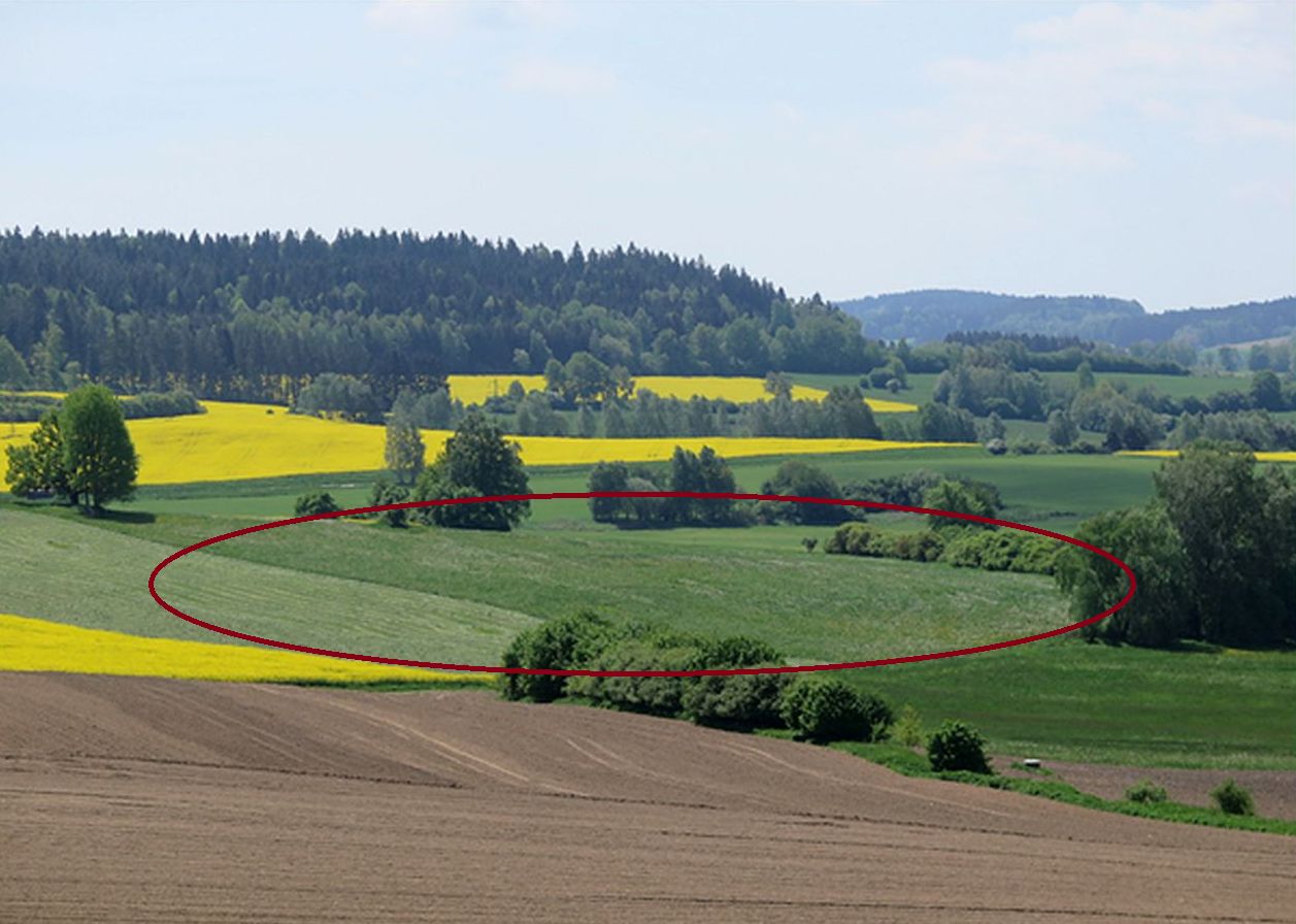
Grassing recharge zones of agricultural drainage systems significantly improves the quality of drainage water. It can be a useful, effective and relatively cheap measure for improvement of shallow groundwater quality.
2.2 การอธิบายแบบละเอียดของเทคโนโลยี
คำอธิบาย:
Grassing of recharge zones of agricultural drainage systems significantly improves the quality of drainage water: it can be a useful, effective and relatively cheap measure. Grassing is an effective preventative strategy to prevent nitrogen pollution. Reduction of nitrate pollution by grassland occurs mainly through grassland’s ability to absorb and use large amounts of nitrogen compared with field crops, and this capacity remains effective for a longer period of the year. Permanent grasslands cover the soil year-round and have a large stock of active subsurface biomass in the root system, which can immobilize a significant amount of soil nitrogen. Moreover, grassland has a greater amount of active soil microbes than under field crops (Griffiths et al. 2008). Besides nitrogen remedial ability, grasslands offer other regulation and supporting ecosystem service (ES) benefits (Hönigová et al., 2012) – for example carbon sequestration, erosion prevention and water flow regulation. On the other hand, used too widely, grassland can be seen as a negative ES provider, in the sense that it reduces the area of crop production (Hauck et al., 2014). That is why it is recommended to limit the use of grassing so that it acts within relatively small areas focused on the catchment area. The effectiveness of grassing has been evaluated statistically, when Fučík et al. (2008) reported that an increase in grassed area of 10% can decrease the C90 (90% probability of non-exceedance) nitrate value in the waters of streams (small water courses) by 6.4 mg/l.
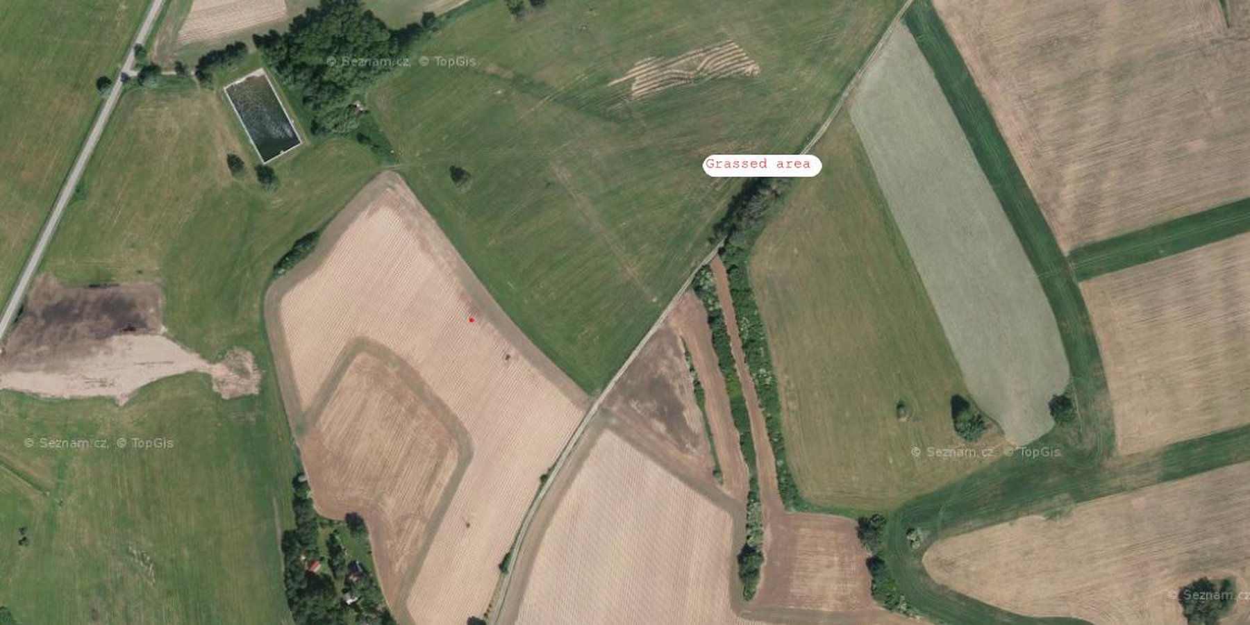
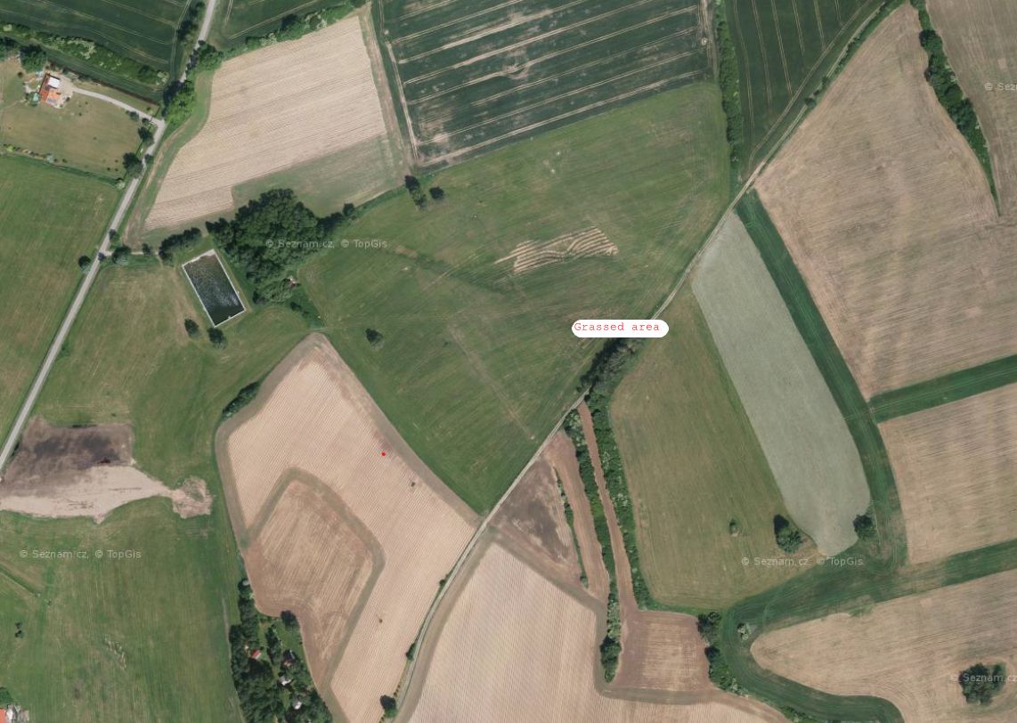
2.3 รูปภาพของเทคโนโลยี
อัลบั้มสื่อบันทึก
2.5 ประเทศภูมิภาค หรือสถานที่ตั้งที่เทคโนโลยีได้นำไปใช้และได้รับการครอบคลุมโดยการประเมินนี้
ประเทศ:
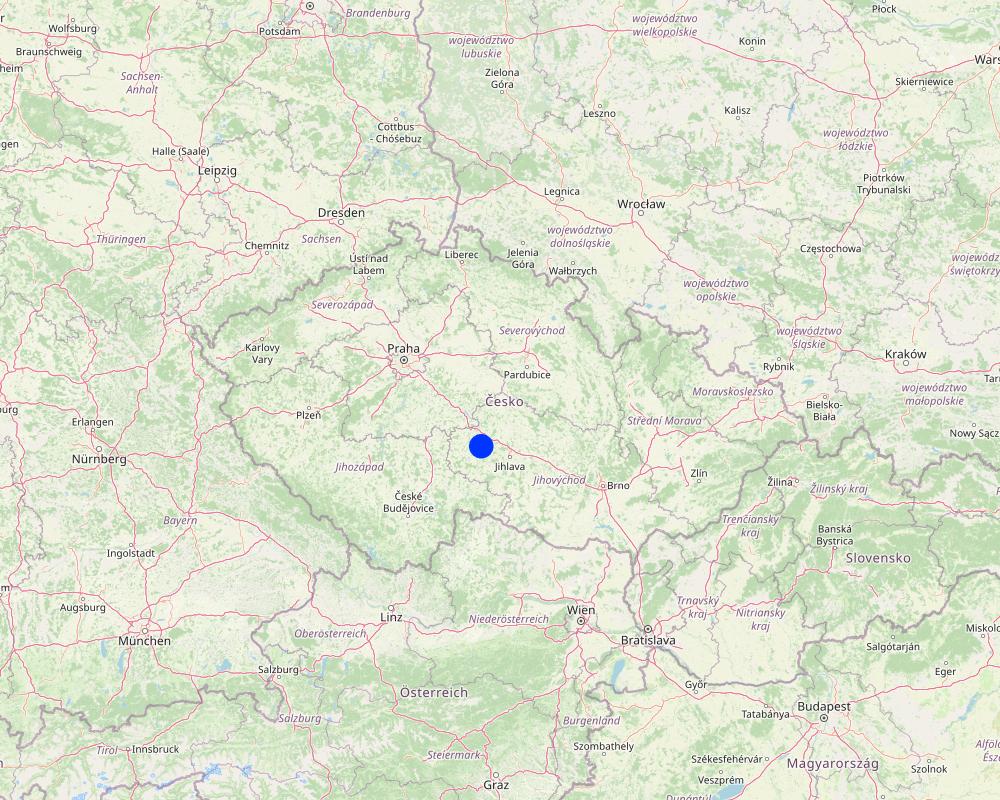
สาธารณรัฐเช็ก
ภูมิภาค/รัฐ/จังหวัด:
Bohemian - Moravian Highlands
ข้อมูลจำเพาะเพิ่มเติมของสถานที่ตั้ง :
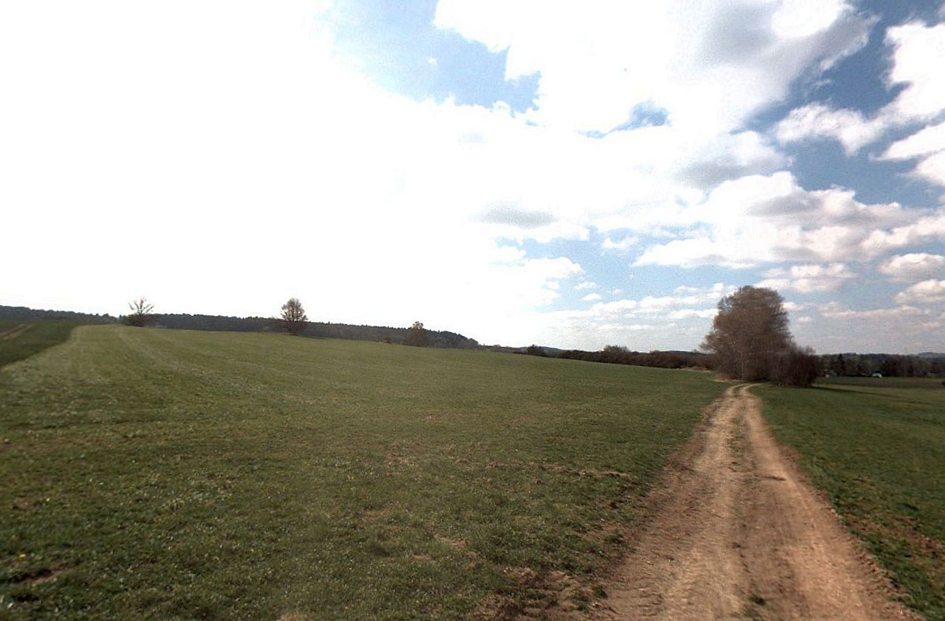
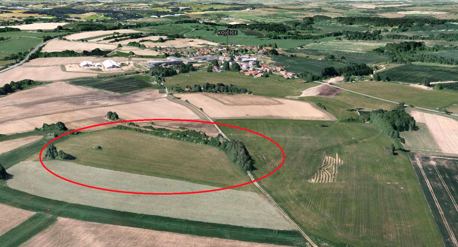
Kojčice
ระบุการกระจายตัวของเทคโนโลยี:
- กระจายไปอย่างสม่ำเสมอในพื้นที่
If the Technology is evenly spread over an area, specify area covered (in km2):
0.05
If precise area is not known, indicate approximate area covered:
- < 0.1 ตร.กม.(10 เฮกตาร์)
Is/are the technology site(s) located in a permanently protected area?
ไม่ใช่
Map
×2.6 วันที่การดำเนินการ
ระบุปีที่ใช้:
2006
2.7 คำแนะนำของเทคโนโลยี
ให้ระบุว่าเทคโนโลยีถูกแนะนำเข้ามาอย่างไร:
- ในช่วงการทดลองหรือการทำวิจัย
- ทางโครงการหรือจากภายนอก
ความคิดเห็น (ประเภทของโครงการ เป็นต้น) :
Linking of the land use in the source areas to drainage water quality has been tested in several research projects since the first decade of the 21st Century. The methodology for defining source areas has been developed by the Research Institute for Soil and Water Conservation for a long time. Nowadays this measure has become part of the Czech Ministry of Agriculture subsidy and farmers can use it themselves.
3. การจัดประเภทของเทคโนโลยี SLM
3.1 วัตถุประสงค์หลักของเทคโนโลยี
- ลด ป้องกัน ฟื้นฟู การเสื่อมโทรมของที่ดิน
- ป้องกันพื้นที่ลุ่มน้ำ/บริเวณท้ายน้ำ โดยร่วมกับเทคโนโลยีอื่นๆ
- ปรับตัวเข้ากับการเปลี่ยนแปลงภูมิอากาศของโลก สภาพภูมิอากาศที่รุนแรงและผลกระทบ
3.2 ประเภทของการใช้ที่ดินในปัจจุบันที่ได้นำเทคโนโลยีไปใช้
Land use mixed within the same land unit:
ไม่ใช่

พื้นที่ปลูกพืช
- การปลูกพืชยืนต้นที่ไม่มีเนื้อไม้
Perennial (non-woody) cropping - Specify crops:
- fodder crops - grasses
จำนวนของฤดูเพาะปลูกต่อปี:
- 1
Is intercropping practiced?
ไม่ใช่
Is crop rotation practiced?
ใช่
3.3 Has land use changed due to the implementation of the Technology?
Has land use changed due to the implementation of the Technology?
- Yes (Please fill out the questions below with regard to the land use before implementation of the Technology)
Land use mixed within the same land unit:
ไม่ใช่
พื้นที่ปลูกพืช
- การปลูกพืชล้มลุกอายุปีเดียว
Annual cropping - Specify crops:
- cereals - barley
- cereals - maize
- cereals - wheat (winter)
- oilseed crops - sunflower, rapeseed, other
- root/tuber crops - potatoes
Is intercropping practiced?
ใช่
If yes, specify which crops are intercropped:
In some seasons, spring cereal mix, legume-cereal mix or undersown clover is used as an intercrop
Is crop rotation practiced?
ใช่
ถ้าใช่ ระบุ:
five-year or seven-year crop rotation with winter cereals, spring cereals, potatoes, red clover, oil seed rape and maize
3.4 การใช้น้ำ
การใช้น้ำของที่ดินที่มีการใช้เทคโนโลยีอยู่:
- จากน้ำฝน
3.5 กลุ่ม SLM ที่ตรงกับเทคโนโลยีนี้
- การปรับปรุงดิน / พืชคลุมดิน
3.6 มาตรการ SLM ที่ประกอบกันเป็นเทคโนโลยี

มาตรการอนุรักษ์ด้วยวิธีพืช
- V2: หญ้าและไม้ยืนต้น

มาตรการอนุรักษ์ด้วยการจัดการ
- M1: การเปลี่ยนรูปแบบของการใช้ประโยชน์ที่ดิน
3.7 รูปแบบหลักของการเสื่อมโทรมของที่ดินที่ได้รับการแก้ไขโดยเทคโนโลยี

การกัดกร่อนของดินโดยน้ำ
- Wt (Loss of topsoil): การสูญเสียดินชั้นบนหรือการกัดกร่อนที่ผิวดิน

การเสื่อมโทรมของน้ำ
- Hp (Decline of surface water quality): การลดลงของคุณภาพน้ำที่ผิวดิน
- Hq (Decline of groundwater quality): การลดลงของคุณภาพน้ำบาดาล
3.8 การป้องกัน การลดลง หรือการฟื้นฟูความเสื่อมโทรมของที่ดิน
ระบุเป้าหมายของเทคโนโลยีกับความเสื่อมโทรมของที่ดิน:
- ลดความเสื่อมโทรมของดิน
4. ข้อมูลจำเพาะด้านเทคนิค กิจกรรมการนำไปปฏิบัติใช้ ปัจจัยนำเข้า และค่าใช้จ่าย
4.1 แบบแปลนทางเทคนิคของเทคโนโลยี
ข้อมูลจำเพาะด้านเทคนิค (แบบแปลนทางเทคนิคของเทคโนโลยี):
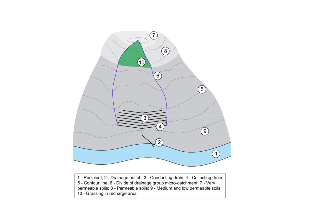
The figure shows a model example of a drainage structure built at the bottom of a slope (3, 4). In this case, a substantial portion of the drainage runoff consists of water that infiltrates in areas with shallow soils that are highly permeable to water, nutrients, and other pollutants (7 and 8). In the case of drainage constructed in this way, the entire micro-catchment of the drainage group must be taken into account in terms of runoff generation and drainage water quality (6). The area where the microwatershed of a drainage group intersects with an area of shallow permeable soils is the source area for drainage runoff and it is to these locations that the grassed area should be directed (10).
ผู้เขียน:
Antonín Zajíček and Tomáš Hejduk
วันที่:
12/10/2022
4.2 ข้อมูลทั่วไปเกี่ยวกับการคำนวณปัจจัยนำเข้าและค่าใช้จ่าย
ให้ระบุว่าค่าใช้จ่ายและปัจจัยนำเข้าได้รับการคำนวณอย่างไร:
- ต่อพื้นที่ที่ใช้เทคโนโลยี
ระบุขนาดและหน่วยพื้นที่:
3.5 hectares
อื่นๆ หรือสกุลเงินประจำชาติ (ระบุ):
EUR
If relevant, indicate exchange rate from USD to local currency (e.g. 1 USD = 79.9 Brazilian Real): 1 USD =:
0.92
ระบุค่าเฉลี่ยของค่าจ้างในการจ้างแรงงานต่อวัน:
60
4.3 กิจกรรมเพื่อการจัดตั้ง
| กิจกรรม | Timing (season) | |
|---|---|---|
| 1. | Vulnerable area delimitation | one year before establishment |
| 2. | Obtaining the consent of the owners and users of the affected land | one year before establishment |
| 3. | Grass sowing | after harvest of previous crops |
4.4 ค่าใช้จ่ายของปัจจัยนำเข้าที่จำเป็นสำหรับการจัดตั้ง
| ปัจจัยนำเข้า | หน่วย | ปริมาณ | ค่าใช้จ่ายต่อหน่วย | ค่าใช้จ่ายทั้งหมดต่อปัจจัยนำเข้า | %ของค่าใช้จ่ายที่ก่อให้เกิดขึ้นโดยผู้ใช้ที่ดิน | |
|---|---|---|---|---|---|---|
| แรงงาน | Work for delimitation | person - days | 3.0 | 130.0 | 390.0 | |
| แรงงาน | Project and administration | person - days | 4.0 | 150.0 | 600.0 | 90.0 |
| แรงงาน | Manual work on the field | ha | 5.0 | 30.0 | 150.0 | 90.0 |
| อุปกรณ์ | Machinery - sowing machine, chopper | ha | 5.0 | 200.0 | 1000.0 | 89.0 |
| อุปกรณ์ | Fuel | ha | 5.0 | 60.0 | 300.0 | 90.0 |
| วัสดุด้านพืช | Seeds | ha | 5.0 | 40.0 | 200.0 | 90.0 |
| ปุ๋ยและสารฆ่า/ยับยั้งการเจริญเติบโตของสิ่งมีชีวิต (ไบโอไซด์) | Feritilizers (mostly urea and pig slurry digestate) | ha | 5.0 | 30.0 | 150.0 | 90.0 |
| ปุ๋ยและสารฆ่า/ยับยั้งการเจริญเติบโตของสิ่งมีชีวิต (ไบโอไซด์) | Biocides (only the year of establishment) | ha | 5.0 | 60.0 | 300.0 | 90.0 |
| อื่น ๆ | Fixed costs | ha | 5.0 | 180.0 | 900.0 | 90.0 |
| ค่าใช้จ่ายทั้งหมดของการจัดตั้งเทคโนโลยี | 3990.0 | |||||
| Total costs for establishment of the Technology in USD | 4336.96 | |||||
ถ้าผู้ใช้ที่ดินรับภาระน้อยกว่า 100% ของค่าใช้จ่าย ให้ระบุว่าใครเป็นผู้รับผิดชอบส่วนที่เหลือ:
Czech Ministry of Agriculture
แสดงความคิดเห็น:
The amount of agricultural subsidies in the Czech Republic is currently (2024) variable depending on the size of the farm. For a farm with an average size of 1500 ha, the subsidy is approximately EUR 160. For the conversion of arable land to permanent grassland in vulnerable areas, an additional subsidy of approximately EUR 310 per hectare is available from the Ministry of Agriculture.
4.5 การบำรุงรักษาสภาพหรือกิจกรรมที่เกิดขึ้นเป็นประจำ
| กิจกรรม | ช่วงระยะเวลา/ความถี่ | |
|---|---|---|
| 1. | re-sowing | before vegetation season if needed |
| 2. | harrowing | if needed once per season after re-sowing |
| 3. | fertilising | once or twice per season |
| 4. | harvesting | twice or three times per season |
4.6 ค่าใช้จ่ายของปัจจัยนำเข้าและกิจกรรมที่เกิดขึ้นเป็นประจำที่ต้องการการบำรุงรักษา (ต่อปี)
| ปัจจัยนำเข้า | หน่วย | ปริมาณ | ค่าใช้จ่ายต่อหน่วย | ค่าใช้จ่ายทั้งหมดต่อปัจจัยนำเข้า | %ของค่าใช้จ่ายที่ก่อให้เกิดขึ้นโดยผู้ใช้ที่ดิน | |
|---|---|---|---|---|---|---|
| แรงงาน | Manual work on the field | ha | 5.0 | 25.0 | 125.0 | 85.0 |
| อุปกรณ์ | Machinery - sowing machine, chopper, tractor | ha | 5.0 | 200.0 | 1000.0 | 85.0 |
| อุปกรณ์ | Fuel | ha | 5.0 | 60.0 | 300.0 | 85.0 |
| วัสดุด้านพืช | seeds | ha | 5.0 | 20.0 | 100.0 | 85.0 |
| ปุ๋ยและสารฆ่า/ยับยั้งการเจริญเติบโตของสิ่งมีชีวิต (ไบโอไซด์) | Feritilizers (mostly urea and pig slurry digestate) | ha | 5.0 | 25.0 | 125.0 | 85.0 |
| ปุ๋ยและสารฆ่า/ยับยั้งการเจริญเติบโตของสิ่งมีชีวิต (ไบโอไซด์) | Biocides (when needed) | ha | 5.0 | 30.0 | 150.0 | 85.0 |
| อื่น ๆ | Fixed costs | ha | 5.0 | 150.0 | 750.0 | 85.0 |
| ค่าใช้จ่ายทั้งหมดของการบำรุงรักษาสภาพเทคโนโลยี | 2550.0 | |||||
| Total costs for maintenance of the Technology in USD | 2771.74 | |||||
ถ้าผู้ใช้ที่ดินรับภาระน้อยกว่า 100% ของค่าใช้จ่าย ให้ระบุว่าใครเป็นผู้รับผิดชอบส่วนที่เหลือ:
Czech Ministry of Agriculture
4.7 ปัจจัยสำคัญที่สุดที่มีผลกระทบต่อค่าใช้จ่าย
ปัจจัยสำคัญที่สุดที่มีผลกระทบต่อค่าใช้จ่ายต่างๆ:
Fuel prices, level of subsidies
5. สิ่งแวดล้อมทางธรรมชาติและของมนุษย์
5.1 ภูมิอากาศ
ฝนประจำปี
- < 250 ม.ม.
- 251-500 ม.ม.
- 501-750 ม.ม.
- 751-1,000 ม.ม.
- 1,001-1,500 ม.ม.
- 1,501-2,000 ม.ม.
- 2,001-3,000 ม.ม.
- 3,001-4,000 ม.ม.
- > 4,000 ม.ม.
ระบุปริมาณน้ำฝนเฉลี่ยรายปี (ถ้ารู้) :หน่วย ม.ม.
666.00
เขตภูมิอากาศเกษตร
- กึ่งชุ่มชื้น
5.2 สภาพภูมิประเทศ
ค่าเฉลี่ยความลาดชัน:
- ราบเรียบ (0-2%)
- ลาดที่ไม่ชัน (3-5%)
- ปานกลาง (6-10%)
- เป็นลูกคลื่น (11-15%)
- เป็นเนิน (16-30%)
- ชัน (31-60%)
- ชันมาก (>60%)
ธรณีสัณฐาน:
- ที่ราบสูง/ที่ราบ
- สันเขา
- ไหล่เขา
- ไหล่เนินเขา
- ตีนเนิน
- หุบเขา
ระดับความสูง:
- 0-100 เมตร
- 101-500 เมตร
- 501-1,000 เมตร
- 1,001-1,500 เมตร
- 1,501-2,000 เมตร
- 2,001-2,500 เมตร
- 2,501-3,000 เมตร
- 3,001-4,000 เมตร
- > 4,000 เมตร
ให้ระบุถ้าเทคโนโลยีได้ถูกนำไปใช้:
- ไม่เกี่ยวข้อง
5.3 ดิน
ค่าเฉลี่ยความลึกของดิน:
- ตื้นมาก (0-20 ซ.ม.)
- ตื้น (21-50 ซ.ม.)
- ลึกปานกลาง (51-80 ซ.ม.)
- ลึก (81-120 ซ.ม.)
- ลึกมาก (>120 ซ.ม.)
เนื้อดิน (ดินชั้นบน):
- หยาบ/เบา (ดินทราย)
อินทรียวัตถุในดิน:
- ปานกลาง (1-3%)
(ถ้ามี) ให้แนบคำอธิบายเรื่องดินแบบเต็มหรือระบุข้อมูลที่มีอยู่ เช่น ชนิดของดิน ค่า pH ของดินหรือความเป็นกรดของดิน ความสามารถในการแลกเปลี่ยนประจุบวก ไนโตรเจน ความเค็ม เป็นต้น:
The substrate is formed by partially migmatized paragneiss in various degrees of degradation.
Quaternary sediments are represented by slope sands and loams reaching 1–2 m thickness. The representation of soils (according to the World Reference Base for Soil Resources
2006) is variable, with Gleyed Cambisols, Gleysols, and sporadically Histosols. In the recharge area, the soil cover is more homogenous, with prevailing Modal, Ranker and Arenic Cambisols.
5.4 ความเป็นประโยชน์และคุณภาพของน้ำ
ระดับน้ำใต้ดิน:
<5 เมตร
น้ำไหลบ่าที่ผิวดิน:
ปานกลาง
คุณภาพน้ำ (ที่ยังไม่ได้บำบัด):
เป็นน้ำใช้เพื่อการเกษตรเท่านั้น (การชลประทาน)
Water quality refers to:
both ground and surface water
ความเค็มของน้ำเป็นปัญหาหรือไม่:
ไม่ใช่
กำลังเกิดน้ำท่วมในพื้นที่หรือไม่:
ไม่ใช่
ความคิดเห็นและข้อมูลจำเพาะเพิ่มเติมเรื่องคุณภาพและปริมาณน้ำ:
Water quality from agricultural drainage systems
(both tiles and ditches) has been discussed by the studies which draw attention to the reduced
quality of drainage waters caused by elevated concentrations of nutrients (N, P, C) and/or
pesticides.
5.5 ความหลากหลายทางชีวภาพ
ความหลากหลายทางชนิดพันธุ์:
- ปานกลาง
ความหลากหลายของแหล่งที่อยู่:
- ปานกลาง
5.6 ลักษณะของผู้ใช้ที่ดินที่นำเทคโนโลยีไปปฏิบัติใช้
อยู่กับที่หรือเร่ร่อน:
- อยู่กับที่
แนวทางการตลาดของระบบการผลิต:
- ทำการค้า/การตลาด
รายได้ที่มาจากนอกฟาร์ม:
- < 10% ของรายได้ทั้งหมด
ระดับของความมั่งคั่งโดยเปรียบเทียบ:
- พอมีพอกิน
เป็นรายบุคคล/ครัวเรือน:
- สหกรณ์
ระดับของการใช้เครื่องจักรกล:
- การใช้เครื่องจักรหรือเครื่องยนต์
เพศ:
- หญิง
- ชาย
อายุของผู้ใช้ที่ดิน:
- วัยกลางคน
5.7 Average area of land used by land users applying the Technology
- < 0.5 เฮกตาร์
- 0.5-1 เฮกตาร์
- 1-2 เฮกตาร์
- 2-5 เฮกตาร์
- 5-15 เฮกตาร์
- 15-50 เฮกตาร์
- 50-100 เฮกตาร์
- 100-500 เฮกตาร์
- 500-1,000 เฮกตาร์
- 1,000-10,000 เฮกตาร์
- >10,000 เฮกตาร์
พิจารณาว่าเป็นขนาดเล็ก กลาง หรือขนาดใหญ่ (ซึ่งอ้างอิงถึงบริบทระดับท้องถิ่น):
- ขนาดกลาง
แสดงความคิดเห็น:
The Czech Republic is characterised by a significant size of agricultural holdings. During the socialist era (1948-1989), large agricultural cooperatives were established. Today, most agricultural land is still farmed by similar enterprises, whether in the form of cooperatives, limited liability companies or joint stock companies.
5.8 กรรมสิทธิ์ในที่ดิน สิทธิในการใช้ที่ดินและสิทธิในการใช้น้ำ
กรรมสิทธิ์ในที่ดิน:
- บริษัท
- รายบุคคล ไม่ได้รับสิทธิครอบครอง
สิทธิในการใช้ที่ดิน:
- เช่า
- รายบุคคล
สิทธิในการใช้น้ำ:
- เข้าถึงได้แบบเปิด (ไม่ได้จัดระเบียบ)
Are land use rights based on a traditional legal system?
ไม่ใช่
5.9 การเข้าถึงบริการและโครงสร้างพื้นฐาน
สุขภาพ:
- จน
- ปานกลาง
- ดี
การศึกษา:
- จน
- ปานกลาง
- ดี
ความช่วยเหลือทางด้านเทคนิค:
- จน
- ปานกลาง
- ดี
การจ้างงาน (เช่น ภายนอกฟาร์ม):
- จน
- ปานกลาง
- ดี
ตลาด:
- จน
- ปานกลาง
- ดี
พลังงาน:
- จน
- ปานกลาง
- ดี
ถนนและการขนส่ง:
- จน
- ปานกลาง
- ดี
น้ำดื่มและการสุขาภิบาล:
- จน
- ปานกลาง
- ดี
บริการด้านการเงิน:
- จน
- ปานกลาง
- ดี
6. ผลกระทบและสรุปคำบอกกล่าว
6.1 ผลกระทบในพื้นที่ดำเนินการ (On-site) จากการใช้เทคโนโลยี
ผลกระทบทางด้านเศรษฐกิจและสังคม
การผลิต
การผลิตพืชผล
แสดงความคิดเห็น/ระบุ:
Farmers will lose land for growing commercially viable crops (cereals, potatoes, rape) and grass production (hay, haylage) will increase.
ผลกระทบด้านสังคมวัฒนธรรมอื่น ๆ
SLM หรือความรู้เรื่องความเสื่อมโทรมของที่ดิน
แสดงความคิดเห็น/ระบุ:
Permanent grassland in the recharge area will protect the shallow soils especially from accelerated erosion.
ผลกระทบด้านนิเวศวิทยา
วัฐจักรน้ำหรือน้ำบ่า
ปริมาณน้ำ
แสดงความคิดเห็น/ระบุ:
This measure will reduce the intensity of surface and subsurface runoff from the catchment.
คุณภาพน้ำ
น้ำไหลบ่าที่ผิวดิน
แสดงความคิดเห็น/ระบุ:
Grassing will slowdwn the surface runoff especially during intensive rainfall-runoff events.
ดิน
ความชื้นในดิน
แสดงความคิดเห็น/ระบุ:
Reducing surface runoff will promote infiltration of rainwater into the soil profile and increase soil moisture.
สิ่งปกคลุมดิน
แสดงความคิดเห็น/ระบุ:
Permanent grasslands cover the soil year round.
การสูญเสียดิน
แสดงความคิดเห็น/ระบุ:
This measure prevents soil loss from the accelerated erosion.
อินทรียวัตถุในดิน/ต่ำกว่าดินชั้น C
แสดงความคิดเห็น/ระบุ:
Permanent grasslands have a big stock of active subsurface biomass in the root system, which can immobilize a significant amount of soil nitrogen. Moreover, it has bigger amount and increased activity of soil microbes supporting e.g. carbon sequestration.
ความหลากหลายทางชีวภาพของพืชและสัตว์
การปกคลุมด้วยพืช
แสดงความคิดเห็น/ระบุ:
Unlike arable land, permanent grassland provides full land cover even in the non-growing season.
ความหลากหลายทางชีวภาพของสัตว์
แสดงความคิดเห็น/ระบุ:
Properly managed grasslans will increase biodiversity (compared to the arable lands), especially amount of insect.
6.2 ผลกระทบนอกพื้นที่ดำเนินการ (Off-site) จากการใช้เทคโนโลยี
การเกิดมลพิษในน้ำบาดาลหรือแม่น้ำ
แสดงความคิดเห็น/ระบุ:
In intensively drained catchments, drainage structures have a significant contribution to total runoff and water pollution.Grassing in recharge zone will significantly mitigate water pollution, especially nutrients and pesticides loads.
ความเสียหายต่อพื้นที่เพาะปลูกของเพื่อนบ้าน
แสดงความคิดเห็น/ระบุ:
Decrease in rapid erosive runoff will reduce the risk of sediment input to lower lying lands.
ความเสียหายต่อโครงสร้างพื้นฐานของรัฐหรือของเอกชน
แสดงความคิดเห็น/ระบุ:
Decrease in rapid erosive runoff will reduce the risk of sediment input into the intravilane of lower lying villages or public roads.
6.3 การเผชิญและความตอบสนองของเทคโนโลยีต่อการเปลี่ยนแปลงสภาพภูมิอากาศที่ค่อยเป็นค่อยไป และสภาพรุนแรงของภูมิอากาศ / ภัยพิบัติ (ที่รับรู้ได้โดยผู้ใช้ที่ดิน)
การเปลี่ยนแปลงสภาพภูมิอากาศที่ค่อยเป็นค่อยไป
การเปลี่ยนแปลงสภาพภูมิอากาศที่ค่อยเป็นค่อยไป
| ฤดู | increase or decrease | เทคโนโลยีมีวิธีการรับมืออย่างไร | |
|---|---|---|---|
| ฝนตามฤดู | ฤดูร้อน | เพิ่มขึ้น | ดี |
แสดงความคิดเห็น:
Gradual climatic has been causing changes in precipitation distribution in course of year. In winter, the period with snow cover shortens and in summer, precipitation often takes the form of rapid and intense episodes. Permanent grassland will mitigate these rainfall extremes by its ability to slow down both surface and subsurface runoff and to increase water retention in agricultural catchments.
6.4 การวิเคราะห์ค่าใช้จ่ายและผลประโยชน์ที่ได้รับ
ผลประโยชน์ที่ได้รับเปรียบเทียบกับค่าใช้จ่ายในการจัดตั้งเป็นอย่างไร (จากมุมมองของผู้ใช้ที่ดิน)
ผลตอบแทนระยะสั้น:
ด้านลบเล็กน้อย
ผลตอบแทนระยะยาว:
ด้านลบเล็กน้อย
ผลประโยชน์ที่ได้รับเปรียบเทียบกับค่าใช้จ่ายในการบำรุงรักษาหรือต้นทุนที่เกิดขึ้นซ้ำอีก เป็นอย่างไร (จากมุมมองของผู้ใช้ที่ดิน)
ผลตอบแทนระยะสั้น:
เป็นกลางหรือสมดุล
ผลตอบแทนระยะยาว:
เป็นกลางหรือสมดุล
แสดงความคิดเห็น:
From an economic point of view, the increase in the area of grasslands will clearly reduce the turnover of the agricultural entity. The fall in costs and income will also lead to a reduction in profits, which is partly offset by higher subsidies for permanent grasslands. However, the increase in dependence on subsidies is dangerous in terms of the long-term stability of the farming entity, as the amount and focus of subsidies can change from year to year. It is also important to note that the production of grass biomass only make sense if the farmer also runs livestock production or a biogas plant, taking into account the amount of grass that the farmer is able to process.
6.5 การปรับตัวของเทคโนโลยี
- ครั้งเดียวหรือเป็นการทดลอง
Of all those who have adopted the Technology, how many did so spontaneously, i.e. without receiving any material incentives/ payments?
- 91-100%
6.6 การปรับตัว
เทคโนโลยีได้รับการปรับเปลี่ยนเมื่อเร็วๆนี้ เพื่อให้ปรับตัวเข้ากับสภาพที่กำลังเปลี่ยนแปลงหรือไม่:
ไม่ใช่
6.7 จุดแข็ง / ข้อได้เปรียบ / โอกาสของเทคโนโลยี
| จุดแข็ง / ข้อได้เปรียบ / โอกาสในทัศนคติของผู้ใช้ที่ดิน |
|---|
| A relatively low-cost measure in terms of finance and agricultural management |
| จุดแข็ง / ข้อได้เปรียบ / โอกาสในทัศนคติของผู้รวบรวมหรือวิทยากรหลัก |
|---|
| grassing focused to the proper catchment area (recharge zone) can be a useful, effective and relatively cheap measure for improvement of shallow groundwater quality, or optionally the quality of local drinking water sources |
| stabilise of catchment area with shallow soils - can lead to decrease in soil erosion. |
6.8 จุดอ่อน / ข้อเสียเปรียบ / ความเสี่ยงของเทคโนโลยีและวิธีการแก้ไข
| จุดอ่อน / ข้อเสียเปรียบ / ความเสี่ยงในทัศนคติของผู้ใช้ที่ดิน | มีวิธีการแก้ไขได้อย่างไร |
|---|---|
| Increasing areas of grasslands would lead to decrease of landscape productive service, farm turnover and profit and the bigger dependence on subsidies. | The grassing should be applied in small, precisely defined parts of the catchment, which are real recharge (infiltration) areas. |
| Possible sudden change in the subsidy system | It is necessary to consider the non-productive functions of grasslands also as public service, taking into account the saves in water cleaning costs and the price of increased water retention |
| Excess amout of grass or hay, especially for farms without livestock production | Balanced share of grasslands and arablale lands in cultivated field blocks, support for livestock production |
| จุดอ่อน / ข้อเสียเปรียบ / ความเสี่ยงในทัศนคติของผู้รวบรวมหรือวิทยากรหลัก | มีวิธีการแก้ไขได้อย่างไร |
|---|---|
| An incorrectly defined source area will lead to ineffective measures | Careful preparation |
| Unwillingness of conservative companies and farmers to adopt this measure | Properly set up subsidy policy |
7. การอ้างอิงและการเชื่อมต่อ
7.1 วิธีการและแหล่งข้อมูล
- ไปเยี่ยมชมภาคสนาม การสำรวจพื้นที่ภาคสนาม
The effectiveness of this measure was tested withim the long-term survey(2006-2016) at the pilot site of Dehtáře (Bohemian-Moravian Highlands, Czech Republic). During the research, drainage water quality indicators, meteorological and hydrological characteristics of the experimental site and agricultural management were monitored.
- การสัมภาษณ์กับผู้ใช้ที่ดิน
The research was primarily carried out in cooperation with one agricultural cooperative; the implementation of the measures is being carried out in discussions with more than thirty agricultural enterprises, mainly in the catchment area of the Švihov reservoir on Želivka - the largest potable water reservoir in the central Europe.
วันที่เก็บรวบรวมข้อมูล(ภาคสนาม) :
2016
7.2 การอ้างอิงถึงสิ่งตีพิมพ์
หัวข้อ, ผู้เขียน, ปี, หมายเลข ISBN:
Kvítek, T.; Zajíček, A.; Dostál, T.; Fučík, P.; Krása, J.; Bauer, M.; Jáchymová, B.; Kulhavý, Z.; Pavel, M. Slowing Down Quick Runoff—A New Approach for the Delineation and Assessment of Critical Points, Contributing Areas, and Proposals of Measures to Reduce Non-Point Water Pollution from Agricultural Land. Water 2023, 15, 1247.
ชื่อเรื่อง ผู้เขียน ปี ISBN:
https://doi.org/10.3390/w15061247
หัวข้อ, ผู้เขียน, ปี, หมายเลข ISBN:
Zajíček, A., Hejduk, T., Sychra, L., Vybíral, T., Fučík, P. (2022): How to Select a Location and a Design of Measures on Land Drainage – A Case Study from the Czech Republic. Journal of Ecological Engineering 2022, 23(4), 43–57. ISSN 2299–8993.
ชื่อเรื่อง ผู้เขียน ปี ISBN:
https://doi.org/10.12911/22998993/146270
หัวข้อ, ผู้เขียน, ปี, หมายเลข ISBN:
ZAJÍČEK, A., FUČÍK, P., DUFFKOVÁ, R., MAXOVÁ, J. 2018. How does targeted grassing of arable land influence drainage water quality and farm economic indicators? Int. J. Environ. Impacts, 1(3): 344–352.
ชื่อเรื่อง ผู้เขียน ปี ISBN:
DOI 10.2495/EI-V1-N3-344-352
หัวข้อ, ผู้เขียน, ปี, หมายเลข ISBN:
Fučík P., Zajíček A., Kaplická M., Duffková R., Peterková J., Maxová J., Takáčová Š. 2017. Incorporating rainfall-runoff events into nitrate-nitrogen and phosphorus load assessments for small tile-drained catchments. Water, 9, 712; (ISSN Print:2575-1867 ISSN Online: 2575-1875)
ชื่อเรื่อง ผู้เขียน ปี ISBN:
doi:10.3390/w9090712
หัวข้อ, ผู้เขียน, ปี, หมายเลข ISBN:
Janglová R., Kvítek T., Novák P. 2003. Soil infiltration capacity categorization based on geoinformatic processing of soil survey data. Soil and Water Scientific Studies, 2, 61–81.
7.3 Links to relevant online information
ชื่อเรื่องหรือคำอธิบาย:
ZAJÍČEK, A., SYCHRA, L., VYBÍRAL, T., HEJDUK, T., ČMELÍK, M., FUČÍK, P., KAPLICKÁ, M. 2021: Design of the Revitalization measures on the Main drainage facilities and hydrologically related Detailed drainage facilities (In Czech)
URL:
DOI: 10.13140/RG.2.2.34421.50403
7.4 General comments
Grassing focused on the catchment area (recharge zone) can be a useful, effective and relatively cheap measure for improvement of shallow groundwater quality, or optionally the quality of local drinking water sources.
ลิงก์และโมดูล
ขยายทั้งหมด ย่อทั้งหมดลิงก์
Catchment Approach [เคนยา]
A focused approach to integrated land and water management, including soil and water conservation, where the active participation of the villagers - often organised through common interest groups - is central.
- ผู้รวบรวม: James Gatero Njuki
โมดูล
ไม่มีโมดูล