Land Degradation Neutrality Transformative Projects and Programmes (LDN-TPP) for sustainable agriculture and rural development [Georgia]
- Creation:
- Update:
- Compiler: Daniel Zollner
- Editors: Anneliese Fuchs, Michael Huber
- Reviewers: William Critchley, Rima Mekdaschi Studer
LDN-TPP in Georgia
approaches_5902 - Georgia
View sections
Expand all Collapse all1. General information
1.2 Contact details of resource persons and institutions involved in the assessment and documentation of the Approach
SLM specialist:
SLM specialist:
Zumbulidze Maia
REC Caucasus
Georgia
Name of project which facilitated the documentation/ evaluation of the Approach (if relevant)
Generating Economic and Environmental Benefits from Sustainable Land Management for Vulnerable Rural Communities of Georgia (GREENLANDS)Name of the institution(s) which facilitated the documentation/ evaluation of the Approach (if relevant)
Global Environment Facility Georgia (GEF Georgia) - Georgia1.3 Conditions regarding the use of data documented through WOCAT
When were the data compiled (in the field)?
04/11/2019
The compiler and key resource person(s) accept the conditions regarding the use of data documented through WOCAT:
Yes
1.4 Reference(s) to Questionnaire(s) on SLM Technologies
Remote Sensing as a Tool for Land Degradation … [Georgia]
Land degradation contributes to biodiversity loss and the impoverishment of rural livelihoods in Tusheti. Above all, however, land degradation are triggered by climate change as traditional land use practise might not be adapted to new climate conditions which can cause or speed up degradation processes significantly. On the other hand, …
- Compiler: Hanns Kirchmeir
Community Land Use Planning in Arkhiloskalo [Georgia]
Unsustainable land use practices, such as deforestation, overgrazing and improper agricultural management systems are triggering the loss and degradation of valuable land resources in Georgia. Land use planning is one of the measures among others to contribute to support the integration of good Landscape and Sustainable Land Management (L-SLM) principles …
- Compiler: Hanns Kirchmeir
2. Description of the SLM Approach
2.1 Short description of the Approach
In the framework of the project ‘Generating Economic and Environmental Benefits from Sustainable Land Management for Vulnerable Rural Communities of Georgia’, Land Degradation Neutrality Transformative Projects and Programmes (LDN-TPP) were developed to implement the LDN targets at municipal level.
The approach defines the process to break down global and international LDN targets and to translate these into local contributions from the municipalities of Gori, Kareli, Kvareli and Sagarejo.
2.2 Detailed description of the Approach
Detailed description of the Approach:
The three-year project ‘Generating Economic and Environmental Benefits from Sustainable Land Management for Vulnerable Rural Communities of Georgia' funded by the Global Environment Facility (GEF), is implemented by the United Nations Environment Programme (UNEP) and executed by the Regional Environmental Centre for the Caucasus (RECC). The initiator and beneficiary of the project is the Ministry of Environmental Protection and Agriculture of Georgia. Within this framework, Land Degradation Neutrality Transformative Projects and Programmes (LDN-TPP) were developed to implement the LDN targets at municipal level.
The project aims to create an enabling environment at the community level to achieve the country's goal of Gender Responsive Land Degradation Neutrality (LDN). The project supports local farmers to apply sustainable land management and climate-smart agricultural practices to promote food security and resilience in order to reduce the impacts of erosion, salinisation and soil fertility reduction in Sagarejo, Kvareli, Gori and Kareli on 20,000 ha of pilot land. As a result, it is expected that there will be an improved understanding of the economics of land degradation and integrated land use planning at national and sub-national levels. In the preceding approach recorded under WOCAT, namely ‘Integrated Land Use Plans (ILUPs) for sustainable agriculture and rural development with special emphasis on SLM, CSA and LDN in four municipalities [Georgia]’, ILUPs were developed for four municipalities providing a detailed spatial basis. A separate study (Ballesteros et al. 2020) compiled baseline information about LDN indicators.
This approach complements the ILUP. It combines the spatial information elaborated for land use planning, the LDN baseline information with national LDN targets, UNCCD principles for LDN and municipal stakeholder priorities to come up with a concrete plan for the municipal contribution to (inter)national targets. Thus, this approach serves to operationalise the national LDN targets at municipal level. At the time of documentation of this apporach, planning was completed and the participatory process for validation and decision-making for concrete targets had been initiated.
Taking this into account, a targeted programme was designed, which breaks down national targets into municipal targets with related activities and spatially explicit priority areas for implementation. This approach serves to operationalise LDN-related recommendations and proposed actions as presented and defined in the Integrated Land Use Plan. It seeks to define the contribution of the municipalities Gori, Kareli, Kvareli and Sagarejo to the achievement of national and global LDN targets.
The output is intended to serve as a starting point for local discussion (especially with the LDN Working Group) to further specify and prioritise the objectives and measures proposed. It provides a solid basis for discussing (a) concrete measures and (b) the areas best suited for these measures. The approach is documented in a consolidated document on how the municipality can contribute to the national LDN goals, based on the specific situation and potentials of the municipality.
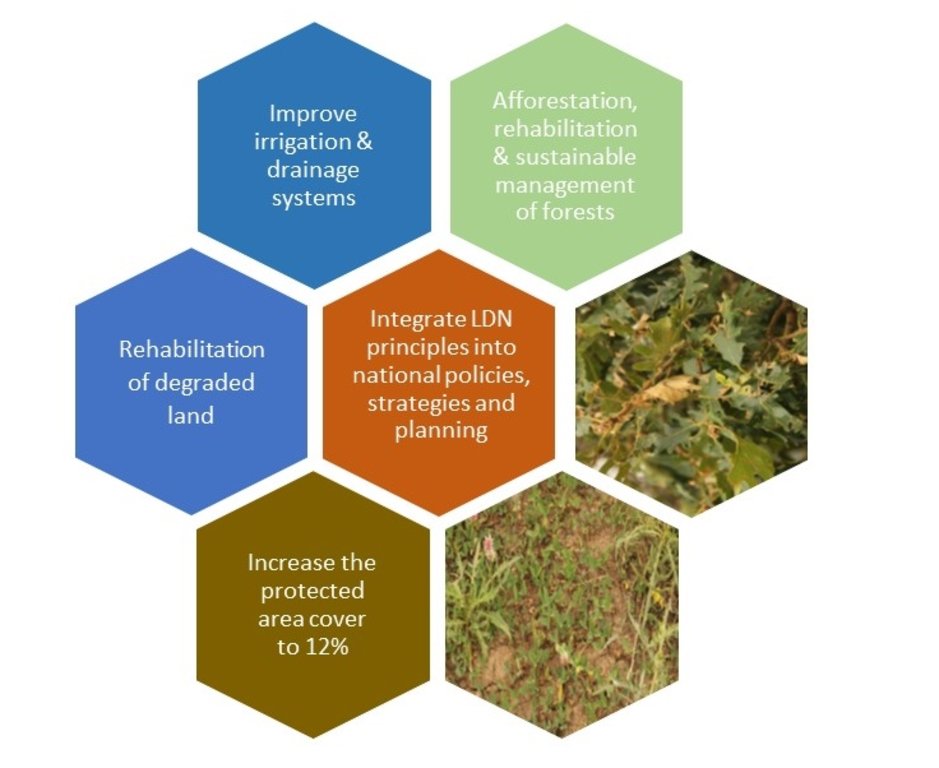
The LDN TPP focuses on specific objectives and actions in the area of the municipality and its various functional land units in a pro-active, forward-looking and visionary manner as a contribution to the nationally set LDN objectives and the overall LDN vision. It presents possible and recommended development pathways and focuses predominantly on LDN implementation options through the application and adoption of various SLM and CSA practices.
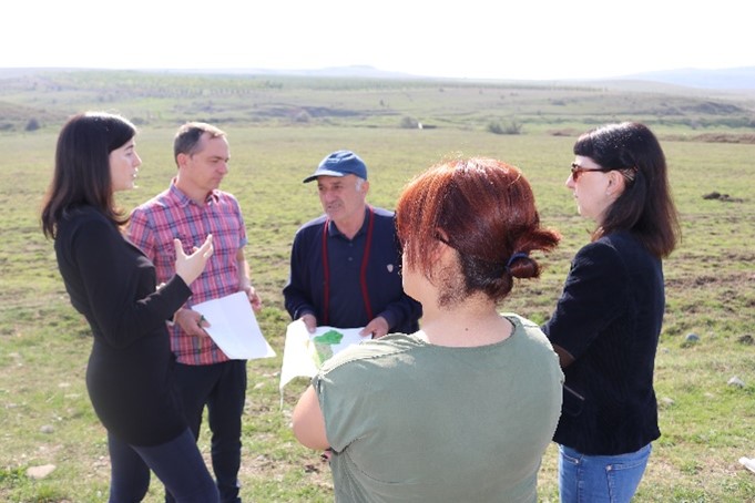
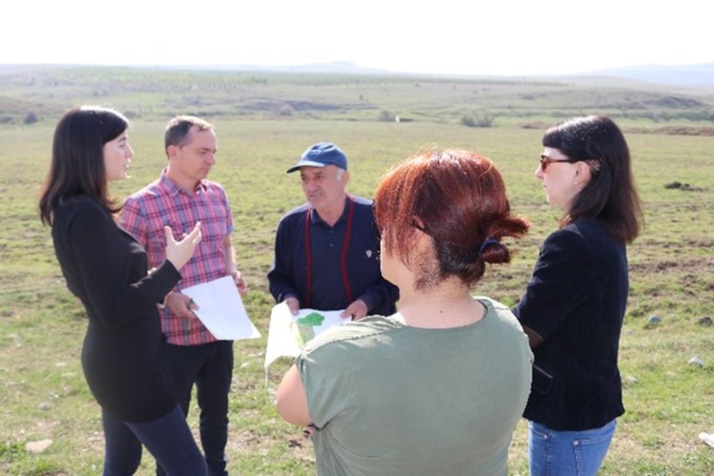
2.3 Photos of the Approach
2.5 Country/ region/ locations where the Approach has been applied
Country:
Georgia
Region/ State/ Province:
Shida Kartlii and Kakheti
Further specification of location:
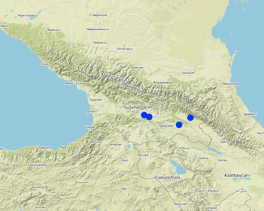
Gori, Kareli, Kvareli and Sagarejo
Comments:
The points are located within the four municipalities of Gori, Kareli, Kvareli and Sagarejo. The land use plan was prepared for the entire territory of the four municipalities.
Map
×2.6 Dates of initiation and termination of the Approach
Indicate year of initiation:
2019
2.7 Type of Approach
- project/ programme based
2.8 Main aims/ objectives of the Approach
The approach seeks to define the local contribution of the municipalities Gori, Kareli, Kvareli and Sagarejo to the achievement of national and global LDN targets whilst meeting local needs and priorities
2.9 Conditions enabling or hindering implementation of the Technology/ Technologies applied under the Approach
social/ cultural/ religious norms and values
- enabling
There is a recognised need to improve land use planning and to counter land degradation as agricultural production is declining
availability/ access to financial resources and services
- hindering
Even though funding is provided through the project, the resources available at the municipality are very limited.
institutional setting
- enabling
The establishment of Municipal LDN Working groups allows for a concrete discussion of LDN with adequate municipal participation. It also allows for including local knowledge in the planning process
- hindering
Currently, municipalities have very limited capacities for land use planning.
collaboration/ coordination of actors
- enabling
REC has a very strong presence and links to the municipalities through previous and ongoing projects.
- hindering
This was very challenging due to COVID-19 restrictions. Fewer meetings were held than foreseen delaying the process of discussion of municipal targets and activities.
legal framework (land tenure, land and water use rights)
- hindering
For the strategic planning, land tenure was only a minor topic. However, in general, when it comes to the specific location of measures, land tenure will be amongst the key issues.
policies
- enabling
Well-supported through municipal involvement.
land governance (decision-making, implementation and enforcement)
- enabling
Municipal LDN group as municipal sounding board was a big plus.
knowledge about SLM, access to technical support
- enabling
There are several successful previous projects already providing a good set of measures and creating awareness amongst land users for SLM
3. Participation and roles of stakeholders involved
3.1 Stakeholders involved in the Approach and their roles
- local land users/ local communities
Various farmers
Visits to the fields with the local farmers, discussions about the type of cultivation
- researchers
Tbilisi State University
Contribution of expert knowledge during meetings to interpret findings in a municipal context; provision of relevant scientific data;
- NGO
REC Caucasus
Supervisors, consultants, GIS analyses, participation in the LDN Working Group Meeting
- local government
Executive Office of the Gori Municipal Council
I Mayor’s City Hall (formerly Municipal Administration“Gamgeoba”), Municipality of Gori
I Mayor’s City Hall (formerly Municipal Administration“Gamgeoba”), Municipality of Kareli
I Mayor’s City Hall (formerly Municipal Administration“Gamgeoba”), Municipality of Kvareli
I Mayor’s City Hall (formerly Municipal Administration“Gamgeoba”), Municipality of Sagarejo
Participation in the LDN Working Group Meeting
- national government (planners, decision-makers)
Agricultural and Rural Development Agency (ARDA)
Ministry of Environmental Protection and Agriculture of Georgia (MEPA)
Participation in the LDN Working Group Meeting
3.2 Involvement of local land users/ local communities in the different phases of the Approach
| Involvement of local land users/ local communities | Specify who was involved and describe activities | |
|---|---|---|
| initiation/ motivation | none | |
| planning | passive | Local land users were consulted to gain experience and insight into the situation of agriculture in the different areas. The interviews were then incorporated in the preparation of the maps and land use plans. Stakeholder priorities formulated during the meetings were the basis for the setting of the municipal targets. Due to COVID 19 the related participatory process to validate the proposed targets, activities and locations has only started recently. Thus, finally the classification would rather refer to "interactive planning". |
| implementation | none | |
| monitoring/ evaluation | none | M&E will be provided in a later stage once the decisions are made regarding the final activities and priorities |
3.4 Decision-making on the selection of SLM Technology/ Technologies
Specify who decided on the selection of the Technology/ Technologies to be implemented:
- mainly SLM specialists, following consultation with land users
Explain:
After initial consultations, the plan was prepared based on scientific and GIS-based information translating it into a muncipal programme. The process will be concluded once the programme is validated and discussed with land users and municipal administration (ongoing process).
Specify on what basis decisions were made:
- evaluation of well-documented SLM knowledge (evidence-based decision-making)
- research findings
- personal experience and opinions (undocumented)
4. Technical support, capacity building, and knowledge management
4.1 Capacity building/ training
Was training provided to land users/ other stakeholders?
No
4.2 Advisory service
Do land users have access to an advisory service?
No
4.3 Institution strengthening (organizational development)
Have institutions been established or strengthened through the Approach?
- yes, a little
Specify the level(s) at which institutions have been strengthened or established:
- local
Describe institution, roles and responsibilities, members, etc.
Within the framework of the project, municipal Land Degradation Neutrality Groups were established comprising municipal stakeholders and land users. This board serves to discuss LDN issues, define priorities and provide knowledge about local phenomena of land degradation (e.g. participatory mapping of degradation)
Specify type of support:
- capacity building/ training
Give further details:
Basically, these groups were consulted for the identification of priorities and land-degradation mapping in the municipality. In a follow-up step, these groups will play a crucial role in decision-making and implementation of the programme.
4.4 Monitoring and evaluation
Is monitoring and evaluation part of the Approach?
No
Comments:
The current approach designed a LDN-TPP at municipal level. Once the municipality decides about the final priorities and measures to be taken, a monitoring plan will be included.
4.5 Research
Was research part of the Approach?
Yes
Specify topics:
- sociology
- ecology
- technology
Give further details and indicate who did the research:
The designed programme builds on 3 main elements: (1) local knowledge through project-based experiences and implicit knowledge of land users and the LDN group, (2) a spatial analysis of land use within the frame of the land-use planning process (see Zollner, 2021, separate approach recorded under Wocat) and (3) a LDN baseline study about the three global LDN indicators (land cover, net primary production and soil organic carbon) (Ballesteros et al. 2020).
5. Financing and external material support
5.1 Annual budget for the SLM component of the Approach
If precise annual budget is not known, indicate range:
- 10,000-100,000
Comments (e.g. main sources of funding/ major donors):
This amount covers the elaboration of four programmes for four municipalities excluding the final implementation. Depending on the funding source and the final political decisions, the implementation of the programmes ranges from 500,000 - 4,000,000 USD. The costs for this process were funded by GEF via UNDP.
5.2 Financial/ material support provided to land users
Did land users receive financial/ material support for implementing the Technology/ Technologies?
No
5.3 Subsidies for specific inputs (including labour)
- none
5.4 Credit
Was credit provided under the Approach for SLM activities?
No
5.5 Other incentives or instruments
Were other incentives or instruments used to promote implementation of SLM Technologies?
No
6. Impact analysis and concluding statements
6.1 Impacts of the Approach
Did the Approach enable evidence-based decision-making?
- No
- Yes, little
- Yes, moderately
- Yes, greatly
It provides hard facts and spatial information about degradation, priority areas and potential measures for decision-makers
Did the Approach help land users to implement and maintain SLM Technologies?
- No
- Yes, little
- Yes, moderately
- Yes, greatly
Not yet. As it is a plan.
Did the Approach improve coordination and cost-effective implementation of SLM?
- No
- Yes, little
- Yes, moderately
- Yes, greatly
It links the land-use planning process (and its results) with scientific information and translates it into actions - it builds on existing knowledge.
Did the Approach mobilize/ improve access to financial resources for SLM implementation?
- No
- Yes, little
- Yes, moderately
- Yes, greatly
By linking local priorities with (inter)national obligations, it is expected that it will help to mobilise additional resources.
Did the Approach improve knowledge and capacities of land users to implement SLM?
- No
- Yes, little
- Yes, moderately
- Yes, greatly
It provides solid condensed and local information to the Municipal LDN group
Did the Approach improve knowledge and capacities of other stakeholders?
- No
- Yes, little
- Yes, moderately
- Yes, greatly
Close cooperation with international experts and local consultants increased the GIS-mapping capabilities of the national expert.
Did the Approach build/ strengthen institutions, collaboration between stakeholders?
- No
- Yes, little
- Yes, moderately
- Yes, greatly
The municipal LDN group is a cross-institutional group of municipal stakeholders dealing with land degradation at municipal level.
Did the Approach mitigate conflicts?
- No
- Yes, little
- Yes, moderately
- Yes, greatly
This is expected to happen as together with land use planning it identifies priorities, challenges and needs.
Did the Approach empower socially and economically disadvantaged groups?
- No
- Yes, little
- Yes, moderately
- Yes, greatly
Not yet, as these groups have not yet been involved - but will be involved (particularly land-users) who are the final beneficiaries of the measures.
Did the Approach improve gender equality and empower women and girls?
- No
- Yes, little
- Yes, moderately
- Yes, greatly
It was not a major consideration. Work was only with the Municipal LDN group (which included women).
Did the Approach encourage young people/ the next generation of land users to engage in SLM?
- No
- Yes, little
- Yes, moderately
- Yes, greatly
It was not a major consideration. Work was only with the Municipal LDN group
Did the Approach improve issues of land tenure/ user rights that hindered implementation of SLM Technologies?
- No
- Yes, little
- Yes, moderately
- Yes, greatly
It addresses and highlights some of the pressing issues.
Did the Approach lead to improved food security/ improved nutrition?
- No
- Yes, little
- Yes, moderately
- Yes, greatly
Not yet, but if implemented, it will make a major contribution.
Did the Approach improve access to markets?
- No
- Yes, little
- Yes, moderately
- Yes, greatly
Not yet, but if implemented, it will make a major contribution.
Did the Approach lead to improved access to water and sanitation?
- No
- Yes, little
- Yes, moderately
- Yes, greatly
Not yet, but if implemented, it will make a significant contribution as water security , sustainable irrigation, and protection of water resources are key topics.
Did the Approach lead to more sustainable use/ sources of energy?
- No
- Yes, little
- Yes, moderately
- Yes, greatly
Not a priority.
Did the Approach improve the capacity of the land users to adapt to climate changes/ extremes and mitigate climate related disasters?
- No
- Yes, little
- Yes, moderately
- Yes, greatly
Not yet, but if implemented, this is supposed to be one of the major contributions of the programme.
Did the Approach lead to employment, income opportunities?
- No
- Yes, little
- Yes, moderately
- Yes, greatly
Not yet, but it seeks to enhance and secure incomes of farmers in the muncipality and outlines alternative income opportunities
6.2 Main motivation of land users to implement SLM
- increased production
- increased profit(ability), improved cost-benefit-ratio
- reduced land degradation
- reduced risk of disasters
- affiliation to movement/ project/ group/ networks
6.3 Sustainability of Approach activities
Can the land users sustain what has been implemented through the Approach (without external support)?
- yes
If yes, describe how:
The programme seeks agricultural transformation and a change in agricultural practice both reducing land degradation and increasing land productivity
6.4 Strengths/ advantages of the Approach
| Strengths/ advantages/ opportunities in the land user’s view |
|---|
| Allows for a discussion based on maps displaying degradation challenges. This makes it easier to concretly agree on measures and priorities |
| Strengths/ advantages/ opportunities in the compiler’s or other key resource person’s view |
|---|
| Combination of stakeholder priorities, local conditions, scientific baseline information and spatially very clear maps |
| Linking different plans and strategies with (inter)national obligations and targets at local level. This is a good basis for attracting funding and targeted interventions |
| Comprehensive, intersectoral and local approach connecting climate change, agricultural development, ecological and social aspects |
6.5 Weaknesses/ disadvantages of the Approach and ways of overcoming them
| Weaknesses/ disadvantages/ risks in the land user’s view | How can they be overcome? |
|---|---|
| Local capacities are rather low and require external funding | Increased capacity building of the Muncipal LDN Group as key resource |
| Weaknesses/ disadvantages/ risks in the compiler’s or other key resource person’s view | How can they be overcome? |
|---|---|
| Due to COVID 19 a more participatory discussion of targets and exact location and scope of measures is still required (but planned) | The planning process can be extended to enable the participatory process |
| Without a capable local lead, it will be challenging | With REC which has been involved for a long time in the region, capable support and exact knowledge of local capacities is available. |
7. References and links
7.1 Methods/ sources of information
- field visits, field surveys
One field visit of the international consultant (Meeting with LDN Municipal Group, participatory mapping, onsite visit, consultations with stakeholders) and several visits of the RECC.
- interviews with land users
During the field visit
- compilation from reports and other existing documentation
7.2 References to available publications
Title, author, year, ISBN:
Ballesteros Canovas, J.A., Da Silva Correia, G., Schlechten, J., Zumbulidze, M. & Stoffel, M. 2020: Report. Generating Economic and Environmental Benefits from Sustainable Land Management for Vulnerable Rural Communities of Georgia. University of Geneva
Available from where? Costs?
REC Caucasus
Title, author, year, ISBN:
Huber, M., Zollner, D., Zumbulidze, M., 2021: Sagarejo Land Degradation Neutrality Transformative Programme (LDN-TPP Sagarejo) for sustainable agriculture and rural development with special emphasis on SLM, CSA and LDN (Part B – LDN TPP Sagarejo). Version 2.0. Klagenfurt, Tbilisi, Sagarejo. 56 p.
Available from where? Costs?
REC Caucasus
Title, author, year, ISBN:
Huber, M., Zollner, D., Zumbulidze, M., 2021: Kareli Land Degradation Neutrality Transformative Programme (LDN-TPP Kareli) for sustainable agriculture and rural development with special emphasis on SLM, CSA and LDN (Part B – LDN-TPP Kareli). Version 2.0. Klagenfurt, Tbilisi, Kareli. 61 p.
Available from where? Costs?
REC Caucasus
Title, author, year, ISBN:
Huber, M., Zollner, D., Zumbulidze, M., 2021: Gori Land Degradation Neutrality Transformative Programme (LDN-TPP Gori) for sustainable agriculture and rural development with special emphasis on SLM,CSA and LDN (Part B – LDN-TPP Gori). Version 2.0. Klagenfurt, Tbilisi, Gori. 55 p.
Available from where? Costs?
REC Caucasus
Title, author, year, ISBN:
Huber, M., Zollner, D., Zumbulidze, M., 2021: Kvareli Land Degradation Neutrality Transformative Programme (LDN-TPP Kvareli) for sustainable agriculture and rural development with special emphasis on SLM, CSA and LDN (Part B – ILUP Kvareli). Version 2.0. Klagenfurt, Tbilisi, Kvareli. 54 p.
Available from where? Costs?
REC Caucasus
Title, author, year, ISBN:
Zollner, D., Zumbulidze, M., Kirchmeir, H., Fuchs, A. und Huber, M. 2021: Gori Integrated Land Use Plan (ILUP Gori) for sustainable agriculture and rural development with special emphasis on SLM, CSA and LDN. Part A – ILUP Gori. Version 2.0. Klagenfurt, Tbilisi, Gori. 80 p. + documentation volume/ annex.: REC Caucasus, E.C.O- Institute of Ecology
Available from where? Costs?
REC Caucasus
Title, author, year, ISBN:
Zollner, D., Zumbulidze, M., Kirchmeir, H., Fuchs, A. und Huber, M. 2021: Kareli Integrated Land Use Plan (ILUP Gori) for sustainable agriculture and rural development with special emphasis on SLM, CSA and LDN. Part A – ILUP Gori. Version 2.0. Klagenfurt, Tbilisi, Gori. 80 p. + documentation volume/ annex.: REC Caucasus, E.C.O- Institute of Ecology
Available from where? Costs?
REC Caucasus
Title, author, year, ISBN:
Zollner, D., Zumbulidze, M., Kirchmeir, H., Fuchs, A. und Huber, M. 2021: Kvareli Integrated Land Use Plan (ILUP Gori) for sustainable agriculture and rural development with special emphasis on SLM, CSA and LDN. Part A – ILUP Gori. Version 2.0. Klagenfurt, Tbilisi, Gori. 80 p. + documentation volume/ annex.:REC Caucasus, E.C.O- Institute of Ecology
Available from where? Costs?
REC Caucasus
Title, author, year, ISBN:
Zollner, D., Zumbulidze, M., Kirchmeir, H., Fuchs, A. und Huber, M. 2021: Sagarejo Integrated Land Use Plan (ILUP Gori) for sustainable agriculture and rural development with special emphasis on SLM, CSA and LDN. Part A – ILUP Gori. Version 2.0. Klagenfurt, Tbilisi, Gori. 80 p. + documentation volume/ annex.: REC Caucasus, E.C.O- Institute of Ecology
Available from where? Costs?
REC Caucasus
7.3 Links to relevant information which is available online
Title/ description:
UNCCD Checklist for Land Degradation Neutrality Transformative Projects and Programmes (LDN TPP)
URL:
https://knowledge.unccd.int/sites/default/files/2018-09/LDN%20TPP%20checklist%20final%20draft%20040918.pdf
Title/ description:
UNCCD Land Degradation Neutrality Transformative Projects and Programmes: Operational Guidance for Country Support
URL:
https://www.unccd.int/publications/land-degradation-neutrality-transformative-projects-and-programmes-operational
Links and modules
Expand all Collapse allLinks

Remote Sensing as a Tool for Land Degradation … [Georgia]
Land degradation contributes to biodiversity loss and the impoverishment of rural livelihoods in Tusheti. Above all, however, land degradation are triggered by climate change as traditional land use practise might not be adapted to new climate conditions which can cause or speed up degradation processes significantly. On the other hand, …
- Compiler: Hanns Kirchmeir

Community Land Use Planning in Arkhiloskalo [Georgia]
Unsustainable land use practices, such as deforestation, overgrazing and improper agricultural management systems are triggering the loss and degradation of valuable land resources in Georgia. Land use planning is one of the measures among others to contribute to support the integration of good Landscape and Sustainable Land Management (L-SLM) principles …
- Compiler: Hanns Kirchmeir
Modules
No modules


