Arboriculture in interdunal depression [Senegal]
- Creation:
- Update:
- Compiler: Julie Zähringer
- Editor: –
- Reviewer: Fabian Ottiger
Verger (français)
technologies_1168 - Senegal
View sections
Expand all Collapse all1. General information
1.2 Contact details of resource persons and institutions involved in the assessment and documentation of the Technology
SLM specialist:
Name of the institution(s) which facilitated the documentation/ evaluation of the Technology (if relevant)
CDE Centre for Development and Environment (CDE Centre for Development and Environment) - SwitzerlandName of the institution(s) which facilitated the documentation/ evaluation of the Technology (if relevant)
CSE (CSE) - Senegal1.3 Conditions regarding the use of data documented through WOCAT
When were the data compiled (in the field)?
12/10/2013
The compiler and key resource person(s) accept the conditions regarding the use of data documented through WOCAT:
Yes
2. Description of the SLM Technology
2.1 Short description of the Technology
Definition of the Technology:
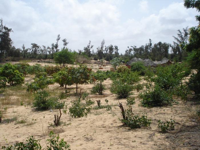
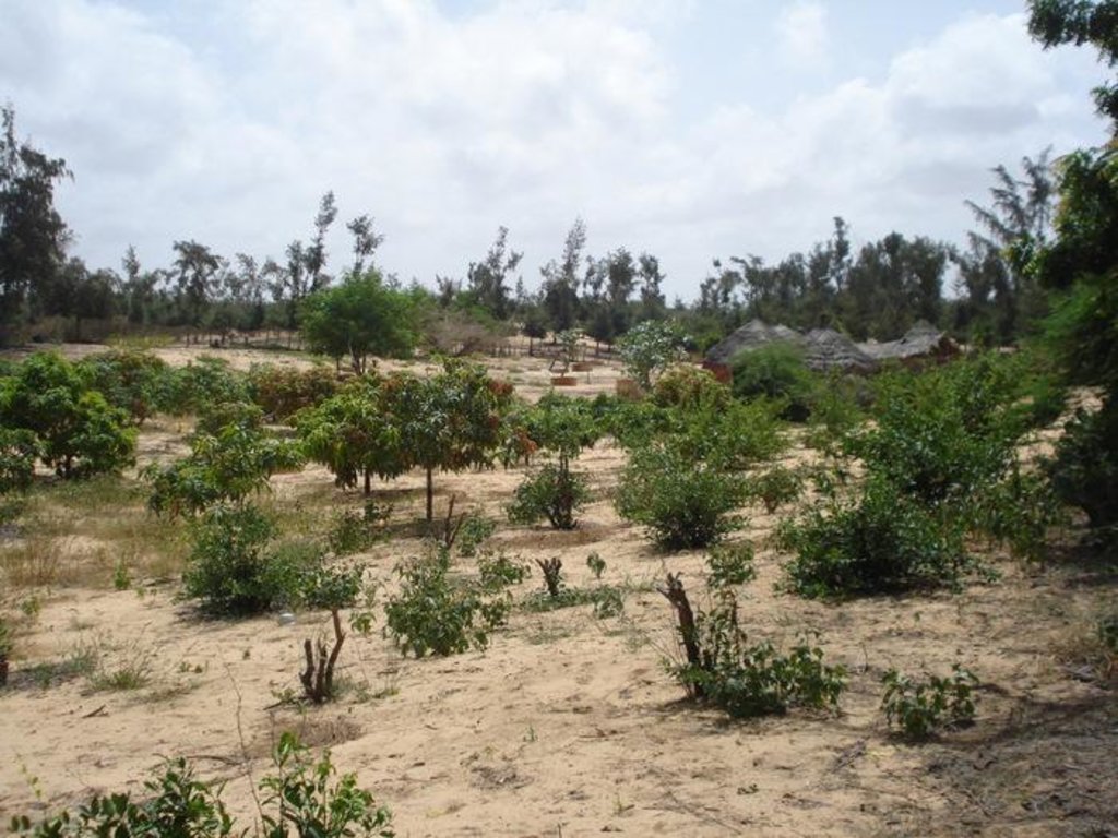
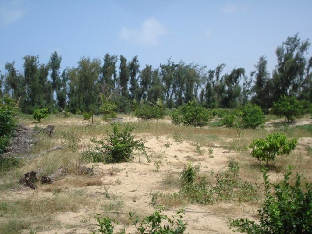
A small fruit orchard in between fixed wandering dunes mainly with Citrus lemon and Mangifera indica trees
2.2 Detailed description of the Technology
Description:
This fruit orchard, mainly containing Mango (Mangifera indica) and Citrus (Citrus lemon) trees, is located in the hamlet of Thioukoun which is part of the village of Lompoul-sur-mer. The surface accounts for about 0.46 ha. Long before the establishment of the orchard, land cover consisted of denuded or sparsely covered white wandering sand dunes threatening agricultural production and villages alike. For some years vegetable production took place on this piece of land and later the orchard was established. Fruits are aimed at sale on the local market but production is insufficient for commercial purposes due to a pest and senescence of fruit trees. Citrus fruits are used by the cultivator and his family for pharmaceutical purposes. Inorganic fertilizers and organic manure are both used in order to improve soil fertility. Irrigation with water from one of the 8-9 m deep wells is practiced for a few Cocos nucifera plants but not for the other species. Labor is done by employees with whom the assigned caretaker of the orchard shares the little revenues from selling fruits on the market. The orchard is protected by a hedge made of dead Balanites aegyptiaca and Acacia raddiana branches and contains a small number of living individuals of other species.
Natural / human environment: The Niayes, located between Dakar and St. Louis, constitute a territory of 5-30 km width covering a surface of 4’200 km2. The region profits from a cool, humid climate, caused by the northern maritime winds (alizés) during the the dry season, while the rest of Senegal experiences the dry and hot Harmattan winds from the East. This results in favorable conditions for vegetable production during the dry season. Sand dunes cover the entire territory being categorized as white or wandering dunes, yellow semi-fixed dunes and as a system of continental fixed red dunes. The continental sand dunes support a shrub savanna which has been used as grazing ground by Fulbe pastoralists for centuries. The near-surface groundwater is the key that allows for cultivation of the zone, however considering the decline in rainfall during the last 60 years, the future of this water source remains uncertain. Lack of rainfall was one of the causes that led to the retreat of natural vegetation which therefore was not sufficient to stabilize the dunes any longer. Migration of sand dunes could now attain up to 10-12 m a year. However, deforestation at the beginning of the 19th century as well as overgrazing were important factors causing gradual desertification in this system.
2.3 Photos of the Technology
2.5 Country/ region/ locations where the Technology has been applied and which are covered by this assessment
Country:
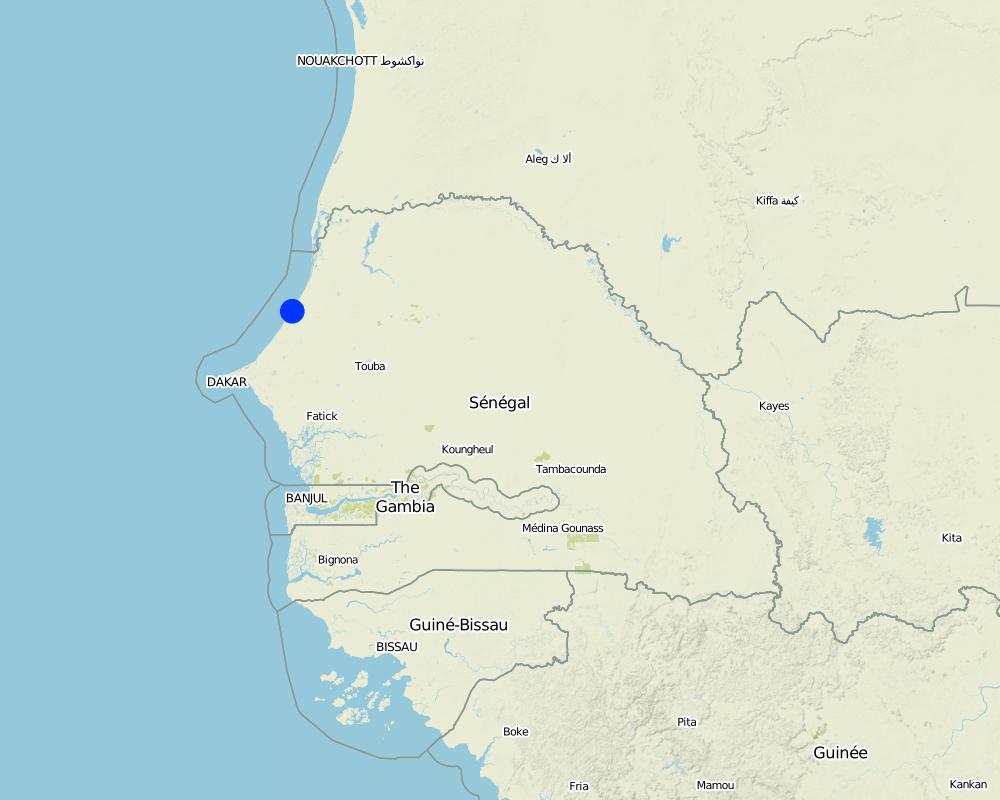
Senegal
Region/ State/ Province:
Department of Kébémer
Further specification of location:
Thioukun
Map
×2.6 Date of implementation
If precise year is not known, indicate approximate date:
- less than 10 years ago (recently)
2.7 Introduction of the Technology
Specify how the Technology was introduced:
- through land users' innovation
3. Classification of the SLM Technology
3.1 Main purpose(s) of the Technology
- improve production
- create beneficial economic impact
- create beneficial social impact
3.2 Current land use type(s) where the Technology is applied

Cropland
- Tree and shrub cropping
Main crops (cash and food crops):
Major casch crop: Mango, lemon
Major food crop: Mango, lemon
Other crops: Cocos
Comments:
Major land use problems (compiler’s opinion): wind erosion
If land use has changed due to the implementation of the Technology, indicate land use before implementation of the Technology:
Other: Oo: Other: wastelands, deserts, glaciers, swamps, recreation areas, etc
3.3 Further information about land use
Water supply for the land on which the Technology is applied:
- mixed rainfed-irrigated
Specify:
Longest growing period in days: 90 Longest growing period from month to month: Jul-Sept
3.4 SLM group to which the Technology belongs
- improved ground/ vegetation cover
3.5 Spread of the Technology
Specify the spread of the Technology:
- evenly spread over an area
If the Technology is evenly spread over an area, indicate approximate area covered:
- < 0.1 km2 (10 ha)
3.6 SLM measures comprising the Technology

agronomic measures
- A1: Vegetation/ soil cover
Comments:
Main measures: agronomic measures
Type of agronomic measures: retaining more vegetation cover, manure / compost / residues, mineral (inorganic) fertilizers
3.7 Main types of land degradation addressed by the Technology

soil erosion by wind
- Et: loss of topsoil

biological degradation
- Bc: reduction of vegetation cover
Comments:
Main type of degradation addressed: Et: loss of topsoil, Bc: reduction of vegetation cover
Main causes of degradation: deforestation / removal of natural vegetation (incl. forest fires), other natural causes (avalanches, volcanic eruptions, mud flows, highly susceptible natural resources, extreme topography, etc.) specify (topography, dunes)
3.8 Prevention, reduction, or restoration of land degradation
Specify the goal of the Technology with regard to land degradation:
- prevent land degradation
- restore/ rehabilitate severely degraded land
4. Technical specifications, implementation activities, inputs, and costs
4.2 Technical specifications/ explanations of technical drawing
Technical knowledge required for land users: moderate
Main technical functions: stabilisation of soil (eg by tree roots against land slides)
Retaining more vegetation cover
Material/ species: trees
Quantity/ density: 340 / ha
Manure / compost / residues
Material/ species: cattle manure
Mineral (inorganic) fertilizers
Material/ species: fertilizer 10-10-20
5. Natural and human environment
5.1 Climate
Annual rainfall
- < 250 mm
- 251-500 mm
- 501-750 mm
- 751-1,000 mm
- 1,001-1,500 mm
- 1,501-2,000 mm
- 2,001-3,000 mm
- 3,001-4,000 mm
- > 4,000 mm
Specifications/ comments on rainfall:
300 mm, dry season 9 months with occasional showers
Agro-climatic zone
- semi-arid
Thermal climate class: tropics
5.2 Topography
Slopes on average:
- flat (0-2%)
- gentle (3-5%)
- moderate (6-10%)
- rolling (11-15%)
- hilly (16-30%)
- steep (31-60%)
- very steep (>60%)
Landforms:
- plateau/plains
- ridges
- mountain slopes
- hill slopes
- footslopes
- valley floors
Altitudinal zone:
- 0-100 m a.s.l.
- 101-500 m a.s.l.
- 501-1,000 m a.s.l.
- 1,001-1,500 m a.s.l.
- 1,501-2,000 m a.s.l.
- 2,001-2,500 m a.s.l.
- 2,501-3,000 m a.s.l.
- 3,001-4,000 m a.s.l.
- > 4,000 m a.s.l.
Comments and further specifications on topography:
Landforms: Footslopes (sanddunes)
5.3 Soils
Soil depth on average:
- very shallow (0-20 cm)
- shallow (21-50 cm)
- moderately deep (51-80 cm)
- deep (81-120 cm)
- very deep (> 120 cm)
Soil texture (topsoil):
- coarse/ light (sandy)
Topsoil organic matter:
- low (<1%)
If available, attach full soil description or specify the available information, e.g. soil type, soil PH/ acidity, Cation Exchange Capacity, nitrogen, salinity etc.
Soil fertility: Low
Soil drainage/infiltration: Good
Soil water storage capacity: Very low
5.4 Water availability and quality
Ground water table:
5-50 m
Availability of surface water:
poor/ none
Water quality (untreated):
good drinking water
5.5 Biodiversity
Species diversity:
- medium
Comments and further specifications on biodiversity:
Relic species from guinean ecozone present
5.6 Characteristics of land users applying the Technology
Market orientation of production system:
- mixed (subsistence/ commercial
Off-farm income:
- 10-50% of all income
Relative level of wealth:
- average
Individuals or groups:
- individual/ household
Level of mechanization:
- manual work
Gender:
- men
Indicate other relevant characteristics of the land users:
Land users applying the Technology are mainly common / average land users
Population density: 50-100 persons/km2
Annual population growth: 2% - 3%
Market orientation: Mixed (commercialisation difficult because of loss of production due to pest)
5.7 Average area of land owned or leased by land users applying the Technology
- < 0.5 ha
- 0.5-1 ha
- 1-2 ha
- 2-5 ha
- 5-15 ha
- 15-50 ha
- 50-100 ha
- 100-500 ha
- 500-1,000 ha
- 1,000-10,000 ha
- > 10,000 ha
Is this considered small-, medium- or large-scale (referring to local context)?
- small-scale
5.8 Land ownership, land use rights, and water use rights
Land ownership:
- state
- individual, not titled
Land use rights:
- communal (organized)
Water use rights:
- communal (organized)
5.9 Access to services and infrastructure
health:
- poor
- moderate
- good
education:
- poor
- moderate
- good
technical assistance:
- poor
- moderate
- good
employment (e.g. off-farm):
- poor
- moderate
- good
markets:
- poor
- moderate
- good
energy:
- poor
- moderate
- good
roads and transport:
- poor
- moderate
- good
drinking water and sanitation:
- poor
- moderate
- good
financial services:
- poor
- moderate
- good
6. Impacts and concluding statements
6.1 On-site impacts the Technology has shown
Socio-economic impacts
Production
crop production
Water availability and quality
demand for irrigation water
Income and costs
farm income
diversity of income sources
Socio-cultural impacts
food security/ self-sufficiency
Improved livelihoods and human well-being
Ecological impacts
Soil
soil loss
Biodiversity: vegetation, animals
biomass/ above ground C
plant diversity
pest/ disease control
Comments/ specify:
The mango fly
6.2 Off-site impacts the Technology has shown
wind transported sediments
6.4 Cost-benefit analysis
How do the benefits compare with the establishment costs (from land users’ perspective)?
Short-term returns:
slightly negative
Long-term returns:
slightly positive
How do the benefits compare with the maintenance/ recurrent costs (from land users' perspective)?
Short-term returns:
neutral/ balanced
Long-term returns:
slightly positive
6.5 Adoption of the Technology
Comments:
There is a little trend towards spontaneous adoption of the Technology
6.7 Strengths/ advantages/ opportunities of the Technology
| Strengths/ advantages/ opportunities in the land user’s view |
|---|
| Increased fruit availability |
| Maintenance of property rights of this piece of land (would be lost if uncultivated) |
| Strengths/ advantages/ opportunities in the compiler’s or other key resource person’s view |
|---|
|
Increased vegetation cover How can they be sustained / enhanced? renew senescing stand of mango and lemon trees |
|
Soil stabilization How can they be sustained / enhanced? maintain vegetation cover |
|
Increased product diversification How can they be sustained / enhanced? plant more different fruit trees, e.g. Ziziphus mauritiana, Neocarya macrophylla |
6.8 Weaknesses/ disadvantages/ risks of the Technology and ways of overcoming them
| Weaknesses/ disadvantages/ risks in the land user’s view | How can they be overcome? |
|---|---|
| Pest | Subsidies for fertilizers |
| Lacking soil fertility and humidity |
| Weaknesses/ disadvantages/ risks in the compiler’s or other key resource person’s view | How can they be overcome? |
|---|---|
| Problems with infestation of mangos - "mouche blanche" | Pest management |
| Senescense of fruit tree stands | Renewal of fruit tree stands |
| Lacking soil fertility and humidity | Use improved compost and manure, leave land for fallow, increase vegetation cover |
Links and modules
Expand all Collapse allLinks
No links
Modules
No modules


