Rational use of empty and narrow parts along roads as well as the very in stony and unproductive areas of the floodplains by planting willow trees (considering the land shortage problems) [Tajikistan]
- Creation:
- Update:
- Compiler: Gulniso Nekushoeva
- Editor: –
- Reviewers: Deborah Niggli, Alexandra Gavilano
technologies_1525 - Tajikistan
- Full summary as PDF
- Full summary as PDF for print
- Full summary in the browser
- Full summary (unformatted)
- Rational use of empty and narrow parts along roads as well as the very in stony and unproductive areas of the floodplains by planting willow trees (considering the land shortage problems): Jan. 4, 2017 (inactive)
- Rational use of empty and narrow parts along roads as well as the very in stony and unproductive areas of the floodplains by planting willow trees (considering the land shortage problems): July 31, 2017 (inactive)
- Rational use of empty and narrow parts along roads as well as the very in stony and unproductive areas of the floodplains by planting willow trees (considering the land shortage problems): Aug. 20, 2019 (public)
View sections
Expand all Collapse all1. General information
1.2 Contact details of resource persons and institutions involved in the assessment and documentation of the Technology
Name of project which facilitated the documentation/ evaluation of the Technology (if relevant)
Sustainable Land Management in the High Pamir and Pamir-Alai Mountains (PALM Project / NCCR)Name of the institution(s) which facilitated the documentation/ evaluation of the Technology (if relevant)
Tajik Soil Insitute (Tajik Soil Institute) - Tajikistan1.3 Conditions regarding the use of data documented through WOCAT
The compiler and key resource person(s) accept the conditions regarding the use of data documented through WOCAT:
Yes
1.4 Declaration on sustainability of the described Technology
Is the Technology described here problematic with regard to land degradation, so that it cannot be declared a sustainable land management technology?
No
2. Description of the SLM Technology
2.1 Short description of the Technology
Definition of the Technology:
Planting fast-growing willow trees along roads and in very stony areas in the floodplains of the small rivers in the arid highlands of Western Pamirs
2.2 Detailed description of the Technology
Description:
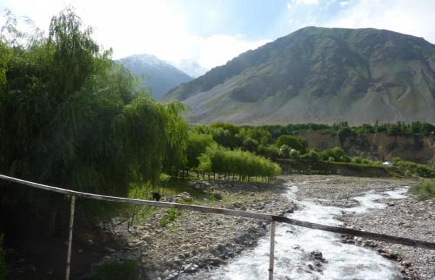
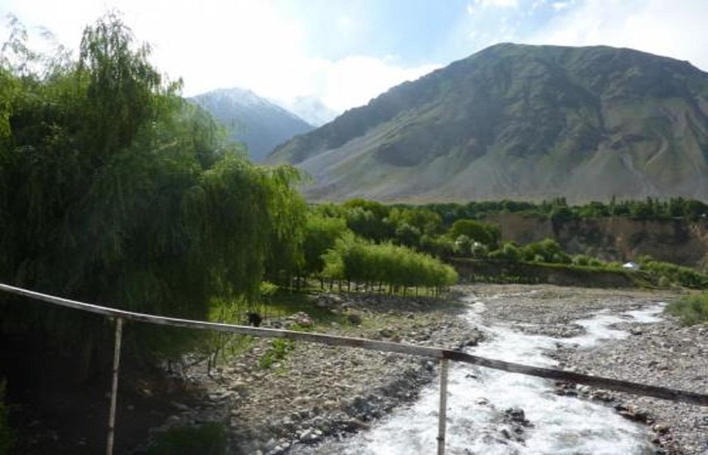
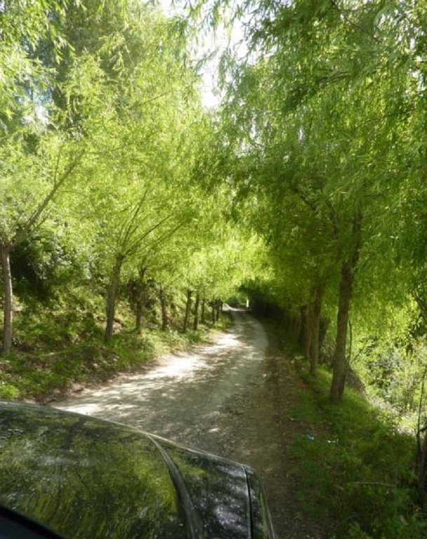
This technology is easy to implement: seedlings (2-3 years old willows’ branches) are planted along both sides of the roads (along the very narrow earth lines), as well as in the very stony floodplains or along the small canals in Vanch rayon. They can be planted in several rows or as a group and needs small, not deep and narrow irrigation canals. Electricity is provided only for couple of hours per day, which is not enough to prepare food and to heat houses during the cold months (4-5 months). People do not have enough money to buy gas and coal. Mainly kizak and tree branches are used and petrol is used for lighting (which not also not cheap). This condition forced people to cut down trees in the area (especially floodplain forest) within the last 18 years. All arable lands in the village are occupied. 74 years old retired Narzulloev Daut is physically incapable to go far away in search for wood, therefore, he decided to “produce” wood not far from his house. He planted trees along the roads and in the stony floodplains of the small river. He has been doing it for 10-15 years and continues planting additional seedlings every year. This technology reduces pressure to environment.
Planting willow trees to ensure cheep woods for households for cooking, backing bread (2-3 times per week), heating and other purposes
Seedlings are prepared by farmers for free. 3-4 years old willow-trees’ branches are cut (2-2.5 m) and after cutting tops of them, they are planted into mist soil along the narrow, not deep irrigation canals. Manure is placed into the planting holes. At the beginning it needs every day watering, after some time, every second day. Next year ones a week watering is sufficient. Irrigation is also not difficult: river water flows first through the main canal irrigating trees planted along the roads then further to all trees in the floodplain. Seedlings grow fast, their trunks surrounded by branches or fenced with thorns to protect them from goats. Planting willow-trees along the roads allow to reduce air pollution by exhaust gases (CO2 is absorbed during photosynthesis). Willow trees planted in the floodplain, protects the soil. At the same time this technology does not interfere with other technologies (do not make shade) connected with gardening or using arable lands. Moreover, already after 4-5 years, farmers consistently provided with firewood.
Chihoh and Ravgad villages, Teharv district, Vanch region. 86% of the region’s territory is not suitable either as arable land or pasture land. There is no available land to plant trees and leshoz does not allow cutting down its trees. Electricity is provided only for couple of hours. Lezshoz in Vanch is incapable to provide the villages with wood. Each your leshoz must prepare 200m3 od ire wood for schools and hospitals and can sell only 400m3 wood to villagers in the autumn. Families receive wood, branches for goats in spring when there is very few fodder available. Rods, diameters of which are up to 1sm, are used for weaving baskets, which are necessary in the household. They are also used as a construction material or to fence the gardens. Obtaining cheap wood quickly: Many farmers are interested in implementing this technology because of its cheapness and easiness. Willow requires a lot of water, but other than that there are few work needs to be done.
2.3 Photos of the Technology
2.5 Country/ region/ locations where the Technology has been applied and which are covered by this assessment
Country:
Tajikistan
Region/ State/ Province:
Tajikistan
Further specification of location:
GBAO, Vanch, Chihoh
2.7 Introduction of the Technology
Specify how the Technology was introduced:
- through projects/ external interventions
Comments (type of project, etc.):
16-18 years
3. Classification of the SLM Technology
3.1 Main purpose(s) of the Technology
- reduce, prevent, restore land degradation
- reduce risk of disasters
3.2 Current land use type(s) where the Technology is applied

Grazing land
Extensive grazing land:
- Nomadism

Forest/ woodlands
(Semi-)natural forests/ woodlands:
- Selective felling
- Clear felling
Tree plantation, afforestation:
- Monoculture local variety
Products and services:
- Timber
- Fuelwood
- Fruits and nuts
- Grazing/ browsing
- Nature conservation/ protection
- Recreation/ tourism
- Protection against natural hazards
Comments:
Major land use problems (compiler’s opinion): Lack of lands: agricultural lands are limited as the overwhelming majority of the territory consists of mountain ranges, steep slopes and stony soil. The area has arid climate with a little rainfall, which also limits the possibilities to develop the agriculture.
Major land use problems (land users’ perception): Laxk of land and water
There are natural floodlain forest with sea-buckthorn and willow trees. Every year 200m3 of wood is prepared for organizationd and schools and 400m3 for selling to people
Clear felling of (semi-)natural forests: it was happening between 1992-1993 (after collapse of the Soviet Union)
Plantation forestry: Today, Leshoz work on protecting forest and reforestation is well oganized.
If land use has changed due to the implementation of the Technology, indicate land use before implementation of the Technology:
Grazing land: Ge: Extensive grazing land
3.3 Further information about land use
Water supply for the land on which the Technology is applied:
- full irrigation
Number of growing seasons per year:
- 1
Specify:
Longest growing period in days: 90, Second longest growing period in days: 150
3.4 SLM group to which the Technology belongs
- forest plantation management
3.5 Spread of the Technology
Specify the spread of the Technology:
- evenly spread over an area
If the Technology is evenly spread over an area, indicate approximate area covered:
- < 0.1 km2 (10 ha)
Comments:
Technology is widely spread and there is potential of its further spreading as stony areas along the river are unused and no willow-trees have been planted along the majority of the roads.
3.6 SLM measures comprising the Technology

vegetative measures
- V1: Tree and shrub cover

management measures
- M1: Change of land use type
3.7 Main types of land degradation addressed by the Technology

physical soil deterioration
- Pu: loss of bio-productive function due to other activities

biological degradation
- Bc: reduction of vegetation cover
- Bq: quantity/ biomass decline
- Bf: detrimental effects of fires
- Bl: loss of soil life

water degradation
- Ha: aridification
Comments:
Main causes of degradation: deforestation / removal of natural vegetation (incl. forest fires) (Lack of electricity, and later its provision for 2-3 hours per day as well as the long cold winters forced people to cut down many trees), over-exploitation of vegetation for domestic use, other natural causes (avalanches, volcanic eruptions, mud flows, highly susceptible natural resources, extreme topography, etc.) specify (Big part of the territory is occupied by steep high mountains devoid of vegetation and only a narrow valley along the river is suitable for agriculture after cleaning the area from stones.), population pressure (The floodpain forest is facing a heavy pressure due to the need for self-sufficiency (because of their limited space)), poverty / wealth (no means to purchase sufficient amount of firewood)
Secondary causes of degradation: overgrazing (pastures are very poor and semiarid), urbanisation and infrastructure development, droughts (The high aridity and small amounf od precipitation require to water planted trees even in the floodplain), inputs and infrastructure: (roads, markets, distribution of water points, other, …) (no access to market), war and conflicts (after the crisis of 1990s, people are forced to move to full self-sufficiency)
4. Technical specifications, implementation activities, inputs, and costs
4.2 Technical specifications/ explanations of technical drawing
Main technical functions: improvement of ground cover, stabilisation of soil (eg by tree roots against land slides), increase of biomass (quantity)
Secondary technical functions: control of dispersed runoff: retain / trap, increase of surface roughness, increase in organic matter, increase in nutrient availability (supply, recycling,…), increase of infiltration, reduction in wind speed, promotion of vegetation species and varieties (quality, eg palatable fodder), spatial arrangement and diversification of land use
Trees/ shrubs species: planting willow-trees along roads
Grass species: grass grows under these trees
Construction material (earth): earth
Change of land use type: Unuused and unproductive lands became high productive forest areas
4.3 General information regarding the calculation of inputs and costs
other/ national currency (specify):
4.8
Indicate exchange rate from USD to local currency (if relevant): 1 USD =:
4.8
4.4 Establishment activities
| Activity | Type of measure | Timing | |
|---|---|---|---|
| 1. | Clearing the site of the stones | Vegetative | before planting |
| 2. | digging holes toplant seedlings | Vegetative | in spring |
| 3. | putting firtilizers (manure) | Vegetative | Перед посадкой |
| 4. | planting 3-4 years old branches of a willow | Vegetative | in spring |
| 5. | watering willow seedlings | Vegetative | |
| 6. | protectng seedlings: fencing each seedling with buckthorn or braches of burlap or with plastic sheet | Vegetative | Каждый день, потом через день |
| 7. | Digging up the main upper canal | Structural | |
| 8. | settting the irrigation net throughout the area where trees are planted | Structural |
4.6 Maintenance/ recurrent activities
| Activity | Type of measure | Timing/ frequency | |
|---|---|---|---|
| 1. | watering trees | Vegetative | 4 times per month |
| 2. | cutting down young branches in spring and use them as fodder for animals | Vegetative | april - may |
| 3. | cutting big branches | Vegetative | october |
| 4. | if necessary, planting new trees in other places along roads | Vegetative | spring |
| 5. | cleaning all irrigation canals | Structural |
4.7 Costs and inputs needed for maintenance/ recurrent activities (per year)
Comments:
Machinery/ tools: manual work: shovels, pickaxes, secateurs, a hatchet, a saw
4.8 Most important factors affecting the costs
Describe the most determinate factors affecting the costs:
Far away from water sources, very stony, slopy area
5. Natural and human environment
5.1 Climate
Annual rainfall
- < 250 mm
- 251-500 mm
- 501-750 mm
- 751-1,000 mm
- 1,001-1,500 mm
- 1,501-2,000 mm
- 2,001-3,000 mm
- 3,001-4,000 mm
- > 4,000 mm
Specifications/ comments on rainfall:
232-238мм precipitation, mainly in winter and spring
Agro-climatic zone
- arid
Thermal climate class: subtropics. 3-4 months per year are cold (below 18C)
5.2 Topography
Slopes on average:
- flat (0-2%)
- gentle (3-5%)
- moderate (6-10%)
- rolling (11-15%)
- hilly (16-30%)
- steep (31-60%)
- very steep (>60%)
Landforms:
- plateau/plains
- ridges
- mountain slopes
- hill slopes
- footslopes
- valley floors
Altitudinal zone:
- 0-100 m a.s.l.
- 101-500 m a.s.l.
- 501-1,000 m a.s.l.
- 1,001-1,500 m a.s.l.
- 1,501-2,000 m a.s.l.
- 2,001-2,500 m a.s.l.
- 2,501-3,000 m a.s.l.
- 3,001-4,000 m a.s.l.
- > 4,000 m a.s.l.
5.3 Soils
Soil depth on average:
- very shallow (0-20 cm)
- shallow (21-50 cm)
- moderately deep (51-80 cm)
- deep (81-120 cm)
- very deep (> 120 cm)
Soil texture (topsoil):
- medium (loamy, silty)
Topsoil organic matter:
- medium (1-3%)
- low (<1%)
5.4 Water availability and quality
Ground water table:
< 5 m
Availability of surface water:
medium
Water quality (untreated):
good drinking water
5.5 Biodiversity
Species diversity:
- medium
5.6 Characteristics of land users applying the Technology
Market orientation of production system:
- subsistence (self-supply)
Off-farm income:
- 10-50% of all income
Relative level of wealth:
- poor
- average
Individuals or groups:
- individual/ household
Level of mechanization:
- manual work
Gender:
- women
- men
Indicate other relevant characteristics of the land users:
Land users applying the Technology are mainly common / average land users
Population density: 10-50 persons/km2
Annual population growth: 2% - 3%
2% of the land users are very rich.
8% of the land users are rich.
50% of the land users are average wealthy.
30% of the land users are poor.
10% of the land users are poor.
Market orientation of production system: subsistence (self-supply), subsistence (self-supply), subsistence (self-supply)
5.7 Average area of land owned or leased by land users applying the Technology
- < 0.5 ha
- 0.5-1 ha
- 1-2 ha
- 2-5 ha
- 5-15 ha
- 15-50 ha
- 50-100 ha
- 100-500 ha
- 500-1,000 ha
- 1,000-10,000 ha
- > 10,000 ha
Is this considered small-, medium- or large-scale (referring to local context)?
- small-scale
5.8 Land ownership, land use rights, and water use rights
Land ownership:
- state
Land use rights:
- individual
Water use rights:
- open access (unorganized)
5.9 Access to services and infrastructure
health:
- poor
- moderate
- good
education:
- poor
- moderate
- good
technical assistance:
- poor
- moderate
- good
employment (e.g. off-farm):
- poor
- moderate
- good
markets:
- poor
- moderate
- good
energy:
- poor
- moderate
- good
roads and transport:
- poor
- moderate
- good
drinking water and sanitation:
- poor
- moderate
- good
6. Impacts and concluding statements
6.3 Exposure and sensitivity of the Technology to gradual climate change and climate-related extremes/ disasters (as perceived by land users)
Gradual climate change
Gradual climate change
| Season | Type of climatic change/ extreme | How does the Technology cope with it? | |
|---|---|---|---|
| annual temperature | increase | not well |
Climate-related extremes (disasters)
Meteorological disasters
| How does the Technology cope with it? | |
|---|---|
| local rainstorm | well |
| local windstorm | well |
Climatological disasters
| How does the Technology cope with it? | |
|---|---|
| drought | well |
Hydrological disasters
| How does the Technology cope with it? | |
|---|---|
| general (river) flood | not well |
Other climate-related consequences
Other climate-related consequences
| How does the Technology cope with it? | |
|---|---|
| reduced growing period | well |
6.4 Cost-benefit analysis
How do the benefits compare with the establishment costs (from land users’ perspective)?
Short-term returns:
positive
Long-term returns:
very positive
7. References and links
7.1 Methods/ sources of information
- field visits, field surveys
- interviews with land users
Links and modules
Expand all Collapse allLinks
No links
Modules
No modules


