Unvegetated strips to reduce fire expansion [Italy]
- Creation:
- Update:
- Compiler: Velia De Paola
- Editor: –
- Reviewer: Fabian Ottiger
Firebreaks
technologies_1606 - Italy
View sections
Expand all Collapse all1. General information
1.2 Contact details of resource persons and institutions involved in the assessment and documentation of the Technology
SLM specialist:
Quaranta Giovanni
University of Basilicata
Via Nazario Sauro, 85, 85100 Potenza, Ita
Italy
Name of project which facilitated the documentation/ evaluation of the Technology (if relevant)
Catastrophic shifts in drylands (EU-CASCADE)Name of the institution(s) which facilitated the documentation/ evaluation of the Technology (if relevant)
University of Basilicata - Italy1.3 Conditions regarding the use of data documented through WOCAT
When were the data compiled (in the field)?
27/05/2014
The compiler and key resource person(s) accept the conditions regarding the use of data documented through WOCAT:
Yes
2. Description of the SLM Technology
2.1 Short description of the Technology
Definition of the Technology:
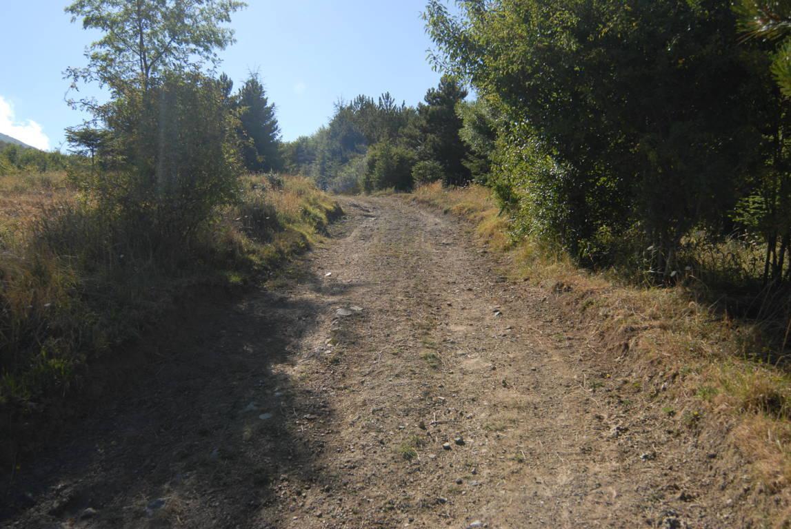
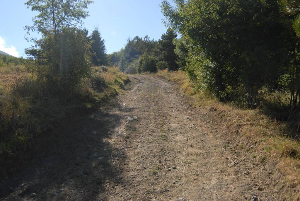
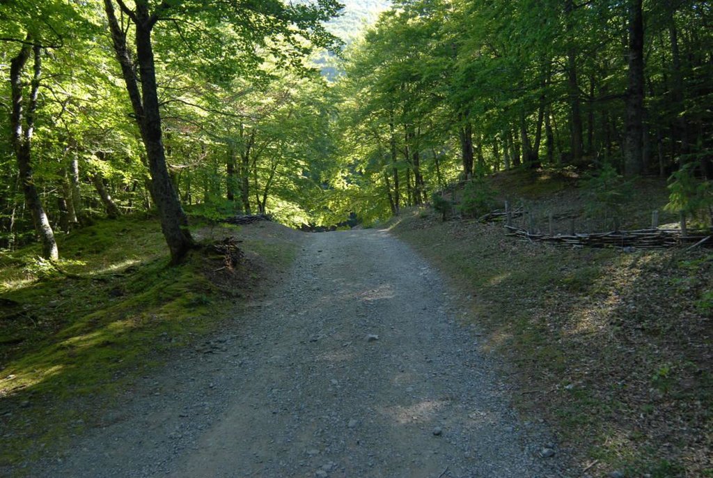
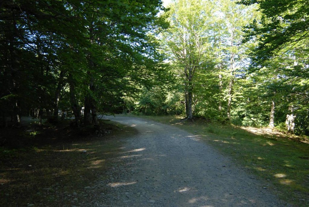
Firebreaks are stripes cleared of vegetation that divide a continuous forest in smaller patches to reduce spreading of wildfires and allow intervention.
2.2 Detailed description of the Technology
Description:
The technology consists of creating gaps of vegetation of about 5 to 7 meters, every 50 to 75 meters distance contourline large forested areas. These clear strips are connected to main roads having varying length in relation to the size of the area.
Purpose of the Technology: Fire breaks act as a barrier to stop or slow the progress of fires and allow firefighters to better position themselves to operate.
Establishment / maintenance activities and inputs: Clearing activities which must be carried out annually by specialized workers using minor devices (hand and hedge cutter).
Natural / human environment: This technology is applied mostly in publicly owned woods (or very large private woods). The network of these fire strips is rather dense as the number of flammable species increases. So it creates patches of 2500 to 5000 meters according to the type of species. The context of production is characterised by a medium level of mechanisation (only the most demanding operations are carried out using mechanical means), the production system is essentially mixed, a small part is destined for personal consumption whilst the bulk of production is destined for local markets. The property is predominantly privately owned but also includes some public land, especially in the case of pasture land. Most farms in the area are livestock farms whilst the agricultural component is destined exclusively for private consumption.
2.3 Photos of the Technology
2.5 Country/ region/ locations where the Technology has been applied and which are covered by this assessment
Country:
Italy
Region/ State/ Province:
Basilicata
Further specification of location:
Castelsaraceno
2.6 Date of implementation
If precise year is not known, indicate approximate date:
- more than 50 years ago (traditional)
2.7 Introduction of the Technology
Specify how the Technology was introduced:
- during experiments/ research
Comments (type of project, etc.):
The technique has been slowly experimented with over the years both in terms of size of firebreaks and distances between them.
3. Classification of the SLM Technology
3.2 Current land use type(s) where the Technology is applied

Forest/ woodlands
(Semi-)natural forests/ woodlands:
- Clear felling
Products and services:
- Fuelwood
- Grazing/ browsing
- Recreation/ tourism
Comments:
Major land use problems (compiler’s opinion): In some wooded areas, especially nearest the roads, there is an excessive amount of undergrowth (with some shrubs reaching a height in excess of two metres) which leaves the area vulnerable to the start and spread of forest fires.
Major land use problems (land users’ perception): The increase in shrubs has increased fire risk.
3.3 Further information about land use
Number of growing seasons per year:
- 1
Specify:
Longest growing period in days: 120Longest growing period from month to month: March to august
3.4 SLM group to which the Technology belongs
- cross-slope measure
- Firebreak
3.5 Spread of the Technology
Specify the spread of the Technology:
- evenly spread over an area
If the Technology is evenly spread over an area, indicate approximate area covered:
- 0.1-1 km2
3.6 SLM measures comprising the Technology

management measures
- M6: Waste management (recycling, re-use or reduce)
Comments:
Main measures: management measures
3.7 Main types of land degradation addressed by the Technology

biological degradation
- Bf: detrimental effects of fires
Comments:
Main type of degradation addressed: Bf: detrimental effects of fires
Secondary causes of degradation: other human induced causes (specify) (Often fires are started by actions of the local population), other natural causes (avalanches, volcanic eruptions, mud flows, highly susceptible natural resources, extreme topography, etc.) specify (spontaneous combustion, climate change (extreme hot pick),expansion of the forest in the region), depopulation and the abandonment of pastures
3.8 Prevention, reduction, or restoration of land degradation
Specify the goal of the Technology with regard to land degradation:
- prevent land degradation
Comments:
Main goals: prevention of land degradation
4. Technical specifications, implementation activities, inputs, and costs
4.2 Technical specifications/ explanations of technical drawing
Technical knowledge required for field staff / advisors: moderate
Main technical functions: control of fires
Change of land use practices / intensity level
4.3 General information regarding the calculation of inputs and costs
other/ national currency (specify):
euro
Indicate exchange rate from USD to local currency (if relevant): 1 USD =:
0.74
Indicate average wage cost of hired labour per day:
81.08
4.6 Maintenance/ recurrent activities
| Activity | Type of measure | Timing/ frequency | |
|---|---|---|---|
| 1. | Cutting vegetation with the help of device (hedge cutters, usually owned by the specialized workers who are doing the job, and their cost is included in the salary) The hectare is intended to mean the area of cleared vegetation which is usually 5-7metres wide. | Management | once per year |
4.7 Costs and inputs needed for maintenance/ recurrent activities (per year)
| Specify input | Unit | Quantity | Costs per Unit | Total costs per input | % of costs borne by land users | |
|---|---|---|---|---|---|---|
| Labour | Cutting vegetation with the help of device | ha | 1.0 | 1351.35 | 1351.35 | 100.0 |
| Total costs for maintenance of the Technology | 1351.35 | |||||
Comments:
Machinery/ tools: Hedge cutters
4.8 Most important factors affecting the costs
Describe the most determinate factors affecting the costs:
Manual labour (including fuel for hedge cutter).
5. Natural and human environment
5.1 Climate
Annual rainfall
- < 250 mm
- 251-500 mm
- 501-750 mm
- 751-1,000 mm
- 1,001-1,500 mm
- 1,501-2,000 mm
- 2,001-3,000 mm
- 3,001-4,000 mm
- > 4,000 mm
Specify average annual rainfall (if known), in mm:
1519.00
Specifications/ comments on rainfall:
68% in winter and 15% in summer
Agro-climatic zone
- sub-humid
Thermal climate class: temperate
5.2 Topography
Slopes on average:
- flat (0-2%)
- gentle (3-5%)
- moderate (6-10%)
- rolling (11-15%)
- hilly (16-30%)
- steep (31-60%)
- very steep (>60%)
Landforms:
- plateau/plains
- ridges
- mountain slopes
- hill slopes
- footslopes
- valley floors
Altitudinal zone:
- 0-100 m a.s.l.
- 101-500 m a.s.l.
- 501-1,000 m a.s.l.
- 1,001-1,500 m a.s.l.
- 1,501-2,000 m a.s.l.
- 2,001-2,500 m a.s.l.
- 2,501-3,000 m a.s.l.
- 3,001-4,000 m a.s.l.
- > 4,000 m a.s.l.
5.3 Soils
Soil depth on average:
- very shallow (0-20 cm)
- shallow (21-50 cm)
- moderately deep (51-80 cm)
- deep (81-120 cm)
- very deep (> 120 cm)
Soil texture (topsoil):
- fine/ heavy (clay)
Topsoil organic matter:
- medium (1-3%)
If available, attach full soil description or specify the available information, e.g. soil type, soil PH/ acidity, Cation Exchange Capacity, nitrogen, salinity etc.
Soil fertility is medium-low
Soil drainage/infiltration is good
Soil water storage capacity is medium
5.4 Water availability and quality
Ground water table:
5-50 m
Availability of surface water:
medium
Water quality (untreated):
good drinking water
Comments and further specifications on water quality and quantity:
Availability of surface water is medium (minimum during month of September and October)
5.5 Biodiversity
Species diversity:
- medium
5.6 Characteristics of land users applying the Technology
Market orientation of production system:
- commercial/ market
Off-farm income:
- 10-50% of all income
Relative level of wealth:
- average
Individuals or groups:
- individual/ household
Gender:
- men
Indicate other relevant characteristics of the land users:
Land users applying the Technology are mainly common / average land users
Difference in the involvement of women and men: active farmers are present only males; women are not actively involved in land management
Population density: 10-50 persons/km2
Annual population growth: negative; 2%
90% of the land users are average wealthy.
10% of the land users are poor.
Off-farm income specification: Most of the off farm income derives from public sector, i.e. Municipality, Mountain Community, Region and other public bodies. Very few farmer members run local shops or handcraft.
5.7 Average area of land owned or leased by land users applying the Technology
- < 0.5 ha
- 0.5-1 ha
- 1-2 ha
- 2-5 ha
- 5-15 ha
- 15-50 ha
- 50-100 ha
- 100-500 ha
- 500-1,000 ha
- 1,000-10,000 ha
- > 10,000 ha
Is this considered small-, medium- or large-scale (referring to local context)?
- small-scale
5.8 Land ownership, land use rights, and water use rights
Land ownership:
- communal/ village
- individual, titled
Land use rights:
- communal (organized)
- individual
5.9 Access to services and infrastructure
health:
- poor
- moderate
- good
education:
- poor
- moderate
- good
technical assistance:
- poor
- moderate
- good
employment (e.g. off-farm):
- poor
- moderate
- good
markets:
- poor
- moderate
- good
energy:
- poor
- moderate
- good
roads and transport:
- poor
- moderate
- good
drinking water and sanitation:
- poor
- moderate
- good
financial services:
- poor
- moderate
- good
6. Impacts and concluding statements
6.1 On-site impacts the Technology has shown
Socio-economic impacts
Production
wood production
risk of production failure
Socio-cultural impacts
Improved livelihoods and human well-being
Ecological impacts
Climate and disaster risk reduction
fire risk
Other ecological impacts
Hazard towards adverse events
6.2 Off-site impacts the Technology has shown
damage on neighbours' fields
damage on public/ private infrastructure
6.3 Exposure and sensitivity of the Technology to gradual climate change and climate-related extremes/ disasters (as perceived by land users)
Gradual climate change
Gradual climate change
| Season | Type of climatic change/ extreme | How does the Technology cope with it? | |
|---|---|---|---|
| annual temperature | increase | well |
Climate-related extremes (disasters)
Meteorological disasters
| How does the Technology cope with it? | |
|---|---|
| local rainstorm | well |
| local windstorm | well |
Climatological disasters
| How does the Technology cope with it? | |
|---|---|
| drought | well |
Hydrological disasters
| How does the Technology cope with it? | |
|---|---|
| general (river) flood | well |
Other climate-related consequences
Other climate-related consequences
| How does the Technology cope with it? | |
|---|---|
| reduced growing period | well |
6.4 Cost-benefit analysis
How do the benefits compare with the establishment costs (from land users’ perspective)?
Short-term returns:
slightly positive
Long-term returns:
slightly negative
How do the benefits compare with the maintenance/ recurrent costs (from land users' perspective)?
Short-term returns:
positive
Long-term returns:
positive
6.5 Adoption of the Technology
Of all those who have adopted the Technology, how many have did so spontaneously, i.e. without receiving any material incentives/ payments?
- 0-10%
Comments:
100% of land user families have adopted the Technology with external material support
There is a moderate trend towards spontaneous adoption of the Technology
6.7 Strengths/ advantages/ opportunities of the Technology
| Strengths/ advantages/ opportunities in the land user’s view |
|---|
|
the technique is an important tool in preventing the spread of fires, however, when winds are strong they can make little difference How can they be sustained / enhanced? some as before |
| Strengths/ advantages/ opportunities in the compiler’s or other key resource person’s view |
|---|
|
1) The creation of firebreaks is a very useful method to reduce the spread of fires. How can they be sustained / enhanced? Public funding is needed to ensure this method can continue. |
6.8 Weaknesses/ disadvantages/ risks of the Technology and ways of overcoming them
| Weaknesses/ disadvantages/ risks in the land user’s view | How can they be overcome? |
|---|---|
| Apart from the annual cost of clearing vegetation, it reduces the number of trees per hectare of wooded areas |
Links and modules
Expand all Collapse allLinks
No links
Modules
No modules


