Environmentally-friendly rural practices [Moldova, Republic of]
- Creation:
- Update:
- Compiler: Valentin Ciubotaru
- Editors: Valentin Ciubotaru, UNCCD PRAIS
- Reviewers: Farrukh Nazarmavloev, William Critchley, Rima Mekdaschi Studer
Practici rurale prietenoase mediului
technologies_1815 - Moldova, Republic of
View sections
Expand all Collapse all1. General information
1.2 Contact details of resource persons and institutions involved in the assessment and documentation of the Technology
Key resource person(s)
SLM specialist:
1.3 Conditions regarding the use of data documented through WOCAT
When were the data compiled (in the field)?
02/06/2014
The compiler and key resource person(s) accept the conditions regarding the use of data documented through WOCAT:
Yes
1.4 Declaration on sustainability of the described Technology
Is the Technology described here problematic with regard to land degradation, so that it cannot be declared a sustainable land management technology?
No
2. Description of the SLM Technology
2.1 Short description of the Technology
Definition of the Technology:
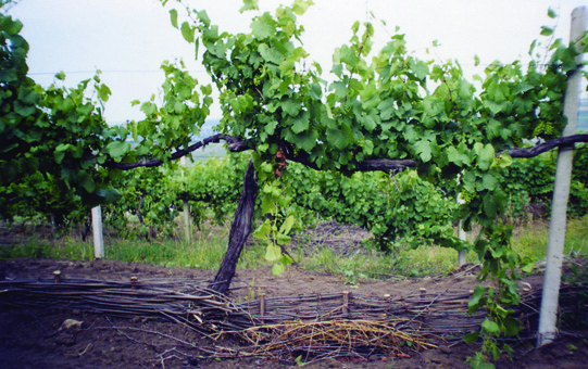
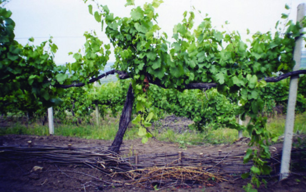
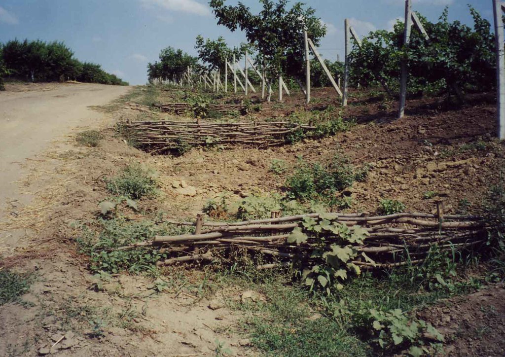
Various environmentally-friendly rural practices have been developed and applied in vineyards and orchards. These included contour tillage, strip cropping and buffer strips, as well as barriers to impede runoff made from straw and brushwood etc. There are also forest belts, channels for water retention and discharge, dams, and grassed waterways; trees are planted on land affected by landslides and soil erosion.
2.2 Detailed description of the Technology
Description:
Tartaul de Salcie belongs to the Pri-Danube steppe pedologic region: clay-sandy carbonated chernozem is predominant. Widespread erosion leads to compaction of upper horizons. There is a danger of soil alcalization if irrigated.The landscape is hilly, and very fragmented with a dense network of valleys. Almost 85% of the land is situated on slopes. The climate is moderately continental: the summers are warm and long, and the winters are mild and dry. Annual rainfall ranges around 500 millimetres; long dry spells are not unusual. The sources of income are crops, mainly grapes and walnuts for sale. Vegetables are also grown - for home consumption. People also have cattle and sheep, mainly for consumption. Plots are about 2 to 4 hectares per household, with title deeds and land maps to prove it. The main problem relates to registration and legalization of sale or inheritance of land which is bureaucratized and expensive. Incomes depend closely on the amount of precipitation, and also on market access and prices, but on average, per capita, it is 38 US dollars per month.
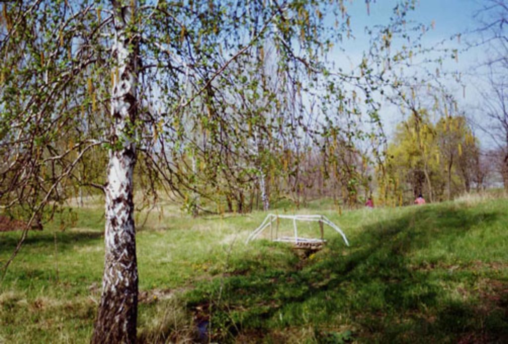
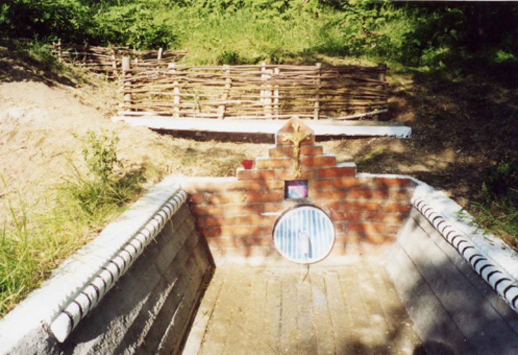
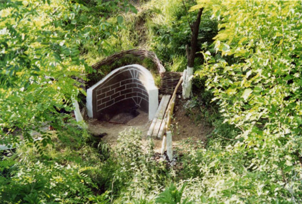
Various environmentally-friendly rural practices have been developed and applied in vineyards and orchards. These included contour tillage, strip cropping and buffer strips, as well as barriers to impede runoff made from straw and brushwood etc. Integrated plant protection is carried out, reducing soil and water pollution. There are also forest belts, and trees are planted on land affected by landslides and soil erosion. Cleaning of natural springs is carried out, and their protection is ensured. Forest species trees are planted around homes - and cleaning within around the village is practiced.
2.3 Photos of the Technology
2.4 Videos of the Technology
Comments, short description:
https://youtu.be/CGgCshNbVkg
Date:
02/07/2008
Location:
Tartaul de Salcie village Cahul district, Republic of Moldova
Name of videographer:
Viorica Cucereanu
2.5 Country/ region/ locations where the Technology has been applied and which are covered by this assessment
Country:
Moldova, Republic of
Further specification of location:
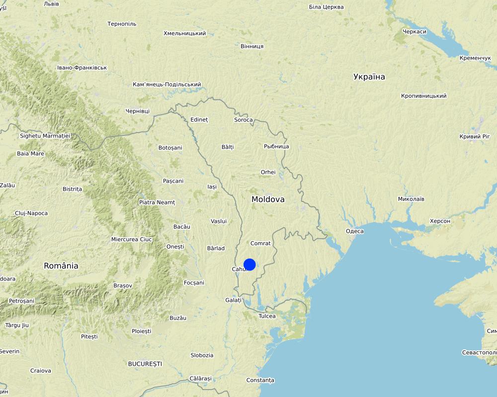
Tartaul de Salcie village, Cahul district, Republic of Moldova
Map
×2.6 Date of implementation
Indicate year of implementation:
2000
If precise year is not known, indicate approximate date:
- 10-50 years ago
2.7 Introduction of the Technology
Specify how the Technology was introduced:
- during experiments/ research
- through projects/ external interventions
3. Classification of the SLM Technology
3.1 Main purpose(s) of the Technology
- reduce, prevent, restore land degradation
- conserve ecosystem
- protect a watershed/ downstream areas – in combination with other Technologies
- preserve/ improve biodiversity
- reduce risk of disasters
- adapt to climate change/ extremes and its impacts
- mitigate climate change and its impacts
3.2 Current land use type(s) where the Technology is applied

Cropland
- Annual cropping
- Perennial (non-woody) cropping
- Tree and shrub cropping
Main crops (cash and food crops):
Wheat, maize, sunflower, vineyards, orchards

Forest/ woodlands
(Semi-)natural forests/ woodlands:
- Selective felling
- Dead wood/ prunings removal
- Non-wood forest use
Tree plantation, afforestation:
- Mixed varieties
Products and services:
- Fuelwood
- Fruits and nuts
- Grazing/ browsing
- Nature conservation/ protection
- Recreation/ tourism
3.3 Further information about land use
Water supply for the land on which the Technology is applied:
- rainfed
Number of growing seasons per year:
- 1
3.4 SLM group to which the Technology belongs
- agroforestry
- rotational systems (crop rotation, fallows, shifting cultivation)
- cross-slope measure
3.5 Spread of the Technology
Specify the spread of the Technology:
- evenly spread over an area
If the Technology is evenly spread over an area, indicate approximate area covered:
- 100-1,000 km2
3.6 SLM measures comprising the Technology

agronomic measures
- A1: Vegetation/ soil cover
- A2: Organic matter/ soil fertility
- A5: Seed management, improved varieties

vegetative measures
- V1: Tree and shrub cover
- V2: Grasses and perennial herbaceous plants

structural measures
- S3: Graded ditches, channels, waterways
- S5: Dams, pans, ponds
- S6: Walls, barriers, palisades, fences

management measures
- M3: Layout according to natural and human environment
- M6: Waste management (recycling, re-use or reduce)
Comments:
- Control of runoff
- Maintain/ increase soil fertility
- Increase/maintain water stored in soil
3.7 Main types of land degradation addressed by the Technology

soil erosion by water
- Wt: loss of topsoil/ surface erosion
- Wg: gully erosion/ gullying

soil erosion by wind
- Et: loss of topsoil

physical soil deterioration
- Pc: compaction
- Pk: slaking and crusting
- Ps: subsidence of organic soils, settling of soil

biological degradation
- Bc: reduction of vegetation cover
- Bh: loss of habitats
- Bq: quantity/ biomass decline
- Bs: quality and species composition/ diversity decline
- Bl: loss of soil life

water degradation
- Hs: change in quantity of surface water
3.8 Prevention, reduction, or restoration of land degradation
Specify the goal of the Technology with regard to land degradation:
- reduce land degradation
- restore/ rehabilitate severely degraded land
4. Technical specifications, implementation activities, inputs, and costs
4.4 Establishment activities
| Activity | Type of measure | Timing | |
|---|---|---|---|
| 1. | Development of environmentally friendly rural practices | Vegetative | After harvest of crops |
| 2. | Public awareness and education | Vegetative | In winter when farmers have time and during vegetative period - to show the results of the measures |
| 3. | Monitoring and evaluation | Vegetative | After rainfall and strong winds |
| 4. | Combine income generation with land management | Vegetative | During establishment and maintenance |
| 5. | Give up unproductive land use practices | Vegetative | When farmers are convinced about efficiency of tested practices |
| 6. | Development of environmentally friendly rural practices | Agronomic | After harvest of crops |
| 7. | Public awareness and education | Agronomic | In winter when farmers have time and during vegetative period - to show the results of the actions |
| 8. | Monitoring and evaluation | Agronomic | After rainfall and strong winds |
| 9. | Combine income generation with land management | Agronomic | During implementation |
| 10. | Give up unproductive land use practices | Agronomic | When farmers are convinced about efficiency of tested practices |
Comments:
Similar activities are performed for structural and management measures
4.5 Costs and inputs needed for establishment
If land user bore less than 100% of costs, indicate who covered the remaining costs:
The project Sustainable Agriculture financed by the Dutch Foundations CORDAID AND NOVIB
5. Natural and human environment
5.1 Climate
Annual rainfall
- < 250 mm
- 251-500 mm
- 501-750 mm
- 751-1,000 mm
- 1,001-1,500 mm
- 1,501-2,000 mm
- 2,001-3,000 mm
- 3,001-4,000 mm
- > 4,000 mm
Specify average annual rainfall (if known), in mm:
450.00
Indicate the name of the reference meteorological station considered:
Cahul
Agro-climatic zone
- sub-humid
Climate is moderately continental: the summers are warm and long, with temperatures averaging about 22°C, and the winters are relatively mild and dry, with January temperatures averaging -2°C. Annual rainfall, which ranges from around 500 millimeters; long dry spells are not unusual. The heaviest rainfall occurs in summer; heavy showers and thunderstorms are common
5.2 Topography
Slopes on average:
- flat (0-2%)
- gentle (3-5%)
- moderate (6-10%)
- rolling (11-15%)
- hilly (16-30%)
- steep (31-60%)
- very steep (>60%)
Landforms:
- plateau/plains
- ridges
- mountain slopes
- hill slopes
- footslopes
- valley floors
Altitudinal zone:
- 0-100 m a.s.l.
- 101-500 m a.s.l.
- 501-1,000 m a.s.l.
- 1,001-1,500 m a.s.l.
- 1,501-2,000 m a.s.l.
- 2,001-2,500 m a.s.l.
- 2,501-3,000 m a.s.l.
- 3,001-4,000 m a.s.l.
- > 4,000 m a.s.l.
Indicate if the Technology is specifically applied in:
- not relevant
Comments and further specifications on topography:
The landscape is hilly, very fragmented with a dense network of valleys. Almost 85% of the land is situated on slopes. About 60% of the land has a gradient from 2 to 6 degree, while 25% of land has an inclination exceeding 6 degrees. Water erosion processes are widespread and quite intense. The predominant length of the hillsides in Tartaul de Salcie is over 1000 m.
5.3 Soils
Soil depth on average:
- very shallow (0-20 cm)
- shallow (21-50 cm)
- moderately deep (51-80 cm)
- deep (81-120 cm)
- very deep (> 120 cm)
Soil texture (topsoil):
- coarse/ light (sandy)
Soil texture (> 20 cm below surface):
- coarse/ light (sandy)
Topsoil organic matter:
- medium (1-3%)
If available, attach full soil description or specify the available information, e.g. soil type, soil PH/ acidity, Cation Exchange Capacity, nitrogen, salinity etc.
Tartaul de Salcie belongs to the Pri-Danube steppe pedologic region. Clay-sandy carbonated chernozem is predominant on the territory of the village.The intensification of the erosion process leads to compaction of the upper horizons. The drainage porosity is high in the weakly and moderately eroded soils, and medium in heavily eroded soils. There is a large impact of erosion on penetrability. There is a danger of soil alkalization if irrigated
5.4 Water availability and quality
Ground water table:
5-50 m
Availability of surface water:
medium
Water quality (untreated):
poor drinking water (treatment required)
Is water salinity a problem?
Yes
Specify:
Water mineralization is high: 1 mg/l
Is flooding of the area occurring?
Yes
Regularity:
episodically
5.5 Biodiversity
Species diversity:
- low
Habitat diversity:
- low
5.6 Characteristics of land users applying the Technology
Sedentary or nomadic:
- Sedentary
Market orientation of production system:
- mixed (subsistence/ commercial
Off-farm income:
- 10-50% of all income
Relative level of wealth:
- poor
Individuals or groups:
- groups/ community
- employee (company, government)
Level of mechanization:
- animal traction
- mechanized/ motorized
Gender:
- women
- men
Indicate other relevant characteristics of the land users:
The sources of income are agricultural crops, mainly grapes and walnuts for sale, but also vegetables for home consumption. People also have cattle and sheep in their households, mainly for own consumption and some extra for sale.|
People in the community have land plots of about 2 to 4 hectares per household - which belongs to them - and they have title deeds and land maps to prove it. The main problem relates to registration and legalization of sale or inheritance of land which is bureaucratized and expensive. The principal landowner in the village is the association of shareholders “TarSalAgro”.
Income in the area depends much on the amount of precipitation and also on market access and prices, but on the average for the last 3 years the estimated income per capita per month was 38 US dollars.
5.7 Average area of land owned or leased by land users applying the Technology
- < 0.5 ha
- 0.5-1 ha
- 1-2 ha
- 2-5 ha
- 5-15 ha
- 15-50 ha
- 50-100 ha
- 100-500 ha
- 500-1,000 ha
- 1,000-10,000 ha
- > 10,000 ha
Is this considered small-, medium- or large-scale (referring to local context)?
- medium-scale
- large-scale
5.8 Land ownership, land use rights, and water use rights
Land ownership:
- company
- communal/ village
Land use rights:
- communal (organized)
- individual
Water use rights:
- communal (organized)
- individual
5.9 Access to services and infrastructure
health:
- poor
- moderate
- good
education:
- poor
- moderate
- good
technical assistance:
- poor
- moderate
- good
employment (e.g. off-farm):
- poor
- moderate
- good
markets:
- poor
- moderate
- good
energy:
- poor
- moderate
- good
roads and transport:
- poor
- moderate
- good
drinking water and sanitation:
- poor
- moderate
- good
financial services:
- poor
- moderate
- good
6. Impacts and concluding statements
6.1 On-site impacts the Technology has shown
Socio-economic impacts
Production
crop production
wood production
land management
Socio-cultural impacts
food security/ self-sufficiency
land use/ water rights
recreational opportunities
Comments/ specify:
The forest close to the village (22 ha) was transformed into a recreational site. A lake was built for recreation purposes. Natural springs in the forest were cleaned and arranged. Currently both the local population and the population from neighbouring villages use the forest for recreation.
community institutions
Comments/ specify:
Improved capacities of LPA and school
SLM/ land degradation knowledge
Comments/ specify:
SLM knowledge is improved not only among the local population, but also people in the from South region. Students from Comrat University visited several times to view the SLM practices in Tartaul de Salcie.
Ecological impacts
Water cycle/ runoff
surface runoff
Soil
soil moisture
soil cover
soil loss
Biodiversity: vegetation, animals
plant diversity
beneficial species
habitat diversity
pest/ disease control
6.2 Off-site impacts the Technology has shown
groundwater/ river pollution
buffering/ filtering capacity
wind transported sediments
damage on neighbours' fields
Comments regarding impact assessment:
While illegal cutting of trees still occurs, people started planting forest species of trees on all spare spaces in the village, which has improved the environment and compensates for earlier loss through tree cutting without replacement planting. |
Community cohesion has improved. People became less isolated through participation in meetings, training events, they exchange opinions more frequently and assist each other. |
Productivity is paramount, since it guarantees future income. For the soil to be productive for many years ahead, sustainable technologies were proposed and implemented. Thus, while the crops have not increased much, the replacement of mineral nutrients with manure diminished expenditures and needs. Changes included a cleaner community area and cleaner households, better use of existing resources, and more attention to hygiene.
6.3 Exposure and sensitivity of the Technology to gradual climate change and climate-related extremes/ disasters (as perceived by land users)
Comments:
Environmentally friendly rural practices implemented in Tartaul de Salcie improved soil properties, water quality, restored forests, planted forest belts, i.e. they create very good conditions for the development of agricultural biodiversity and wild biodiversity in farming landscapes. |
Environmentally friendly rural practices are one of the main sinks of carbon dioxide. Thus, they have a positively impact on climate change mitigation. |
Environmentally friendly rural practices are in harmony with nature and they positively impact on climate change adaptation.
6.4 Cost-benefit analysis
How do the benefits compare with the establishment costs (from land users’ perspective)?
Short-term returns:
neutral/ balanced
Long-term returns:
positive
How do the benefits compare with the maintenance/ recurrent costs (from land users' perspective)?
Short-term returns:
slightly positive
Long-term returns:
positive
6.5 Adoption of the Technology
- 1-10%
If available, quantify (no. of households and/ or area covered):
The area covered is over 1000 ha
Of all those who have adopted the Technology, how many have did so spontaneously, i.e. without receiving any material incentives/ payments?
- 10-50%
6.6 Adaptation
Has the Technology been modified recently to adapt to changing conditions?
No
6.7 Strengths/ advantages/ opportunities of the Technology
| Strengths/ advantages/ opportunities in the land user’s view |
|---|
| Reduce soil loss and runoff from the slopes |
| The project used local knowledge and people are happy that their ideas are implemented in their own village. |
| Almost all village the population was involved to some extent in the development and implementation of activities, and they are proud that their village has become better than others, and outsiders come and learn how to improve their own situation. |
| Strengths/ advantages/ opportunities in the compiler’s or other key resource person’s view |
|---|
| Show sincere interest in people's life and their problems. Seek expertise among wise village people and encourage them to share it. Accept people as they are and provide assistance for their growth |
| Teach people to save and plan. Advise them that wise investment always pays off. Teach them to invest more in things they treasure most (family, health, land, local forests, etc.). |
| Try out and experiment with new things on a small scale, so that failure does not affect income significantly. |
6.8 Weaknesses/ disadvantages/ risks of the Technology and ways of overcoming them
| Weaknesses/ disadvantages/ risks in the land user’s view | How can they be overcome? |
|---|---|
| Difficulty to cover maintenance costs after end of project | Possibility to apply for additional funding to National Environmental Fund and to motivate the private sector to cover better the respective expenses. |
| Lack of interest of new LPA to continue to implement the SLM practices on communal land. | Awareness building workshops with farmers who implement SLM practices. |
| Lack of substantial difference in profit. | Although there is a small difference in the short term, nevertheless the soil quality and water storage capacity will be improved, and as a result, the yields and profits will be increased in the long term. |
7. References and links
7.1 Methods/ sources of information
- field visits, field surveys
10
- compilation from reports and other existing documentation
4
7.2 References to available publications
Title, author, year, ISBN:
Making a Difference. Secretariat of the United Nations Convention to Combat Desertification (UNCCD)
Available from where? Costs?
http://www.recoveryplatform.org/assets/submissions/200909020934_recovery_from_desertification.pdf
Title, author, year, ISBN:
Elena Bivol, Valentin Ciubotaru. Farmer’s Book (Cartea fermierului)/ NGO BIOS, Chisinau, 2005, 264 p. ISBN: 978-9975-9901-4-1
Available from where? Costs?
NGO BIOS. 72/3 Columna str. # 3, Chisinau, MD-2001, Republic of Moldova
Links and modules
Expand all Collapse allLinks
No links
Modules
No modules


