Il Ngwesi Group Ranch Grazing with Holistic Management Principles [Kenya]
- Creation:
- Update:
- Compiler: Michael Herger
- Editor: –
- Reviewers: Rima Mekdaschi Studer, Alexandra Gavilano
technologies_2092 - Kenya
- Full summary as PDF
- Full summary as PDF for print
- Full summary in the browser
- Full summary (unformatted)
- Il Ngwesi Group Ranch Grazing with Holistic Management Principles: Sept. 4, 2019 (inactive)
- Il Ngwesi Group Ranch Grazing with Holistic Management Principles: Feb. 22, 2018 (inactive)
- Il Ngwesi Group Ranch Grazing with Holistic Management Principles: July 11, 2018 (inactive)
- Il Ngwesi Group Ranch Grazing with Holistic Management Principles: Sept. 3, 2018 (inactive)
- Il Ngwesi Group Ranch Grazing with Holistic Management Principles: Oct. 4, 2018 (inactive)
- Il Ngwesi Group Ranch Grazing with Holistic Management Principles: Nov. 2, 2021 (inactive)
- Il Ngwesi Group Ranch Grazing with Holistic Management Principles: Nov. 2, 2021 (public)
- Il Ngwesi Group Ranch Grazing with Holistic Management Principles: Feb. 1, 2018 (inactive)
View sections
Expand all Collapse all1. General information
1.2 Contact details of resource persons and institutions involved in the assessment and documentation of the Technology
Key resource person(s)
land user:
Leresi Patrick
+254721153572
ilngwesi@nrt-kenya.org
Il Ngwesi Group Ranch
Mukogodo Division, Laikipia North District, PO Box 263, 1042 Timau, Kenya
Kenya
1.3 Conditions regarding the use of data documented through WOCAT
When were the data compiled (in the field)?
22/01/2017
The compiler and key resource person(s) accept the conditions regarding the use of data documented through WOCAT:
Yes
1.4 Declaration on sustainability of the described Technology
Is the Technology described here problematic with regard to land degradation, so that it cannot be declared a sustainable land management technology?
No
Comments:
Yes and no, only time will tell here.
Grazing principles and management (with partly applied Holistic Managment) of Il Ngwesi Group Ranch are said to be exemplary for group ranches in the area. In evaluation processes since the introduction of the new principles and also in reports, they were rated as "best practice". Land recovery is according to these reports in full swing. However, in the field the picture looks partially different. The land is in large areas (still) heavily degraded. Data suggests that vegetation and soil is in a rather bad condition - many erosion features characterize the land. Nevertheless, according to land users, land coverage has significantly improved since the introduction of the new technologies.
2. Description of the SLM Technology
2.1 Short description of the Technology
Definition of the Technology:
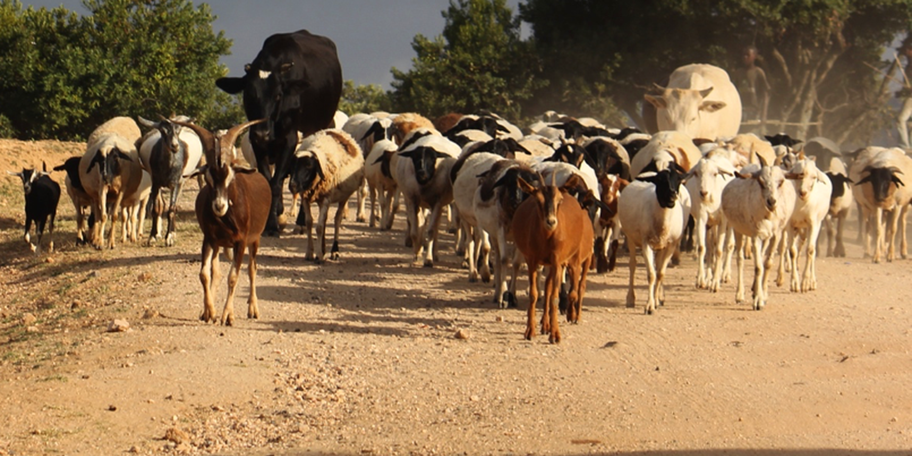
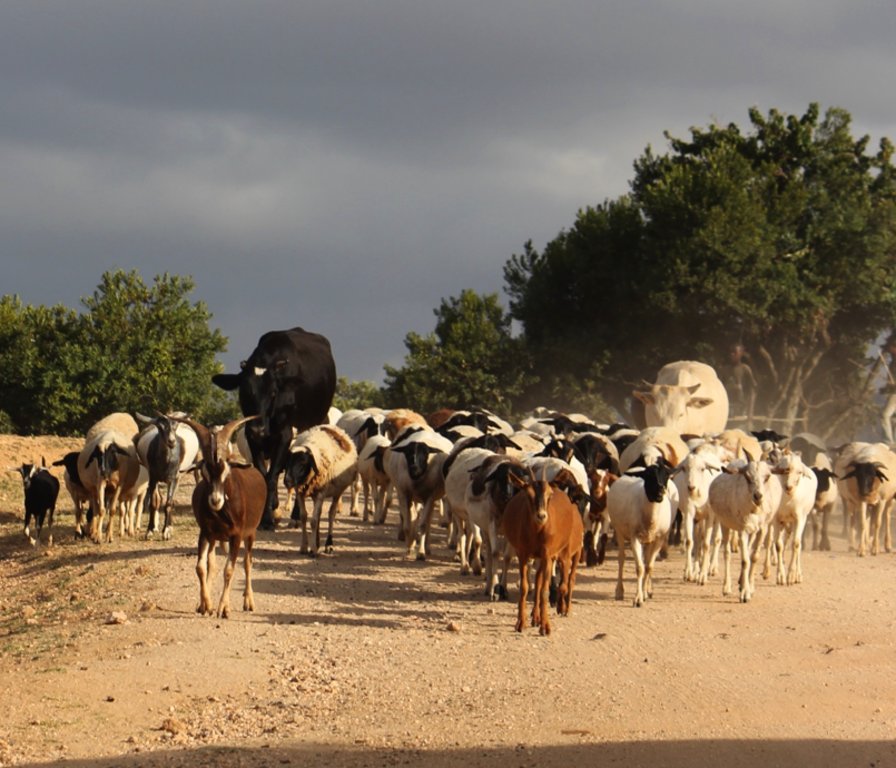
A group ranch belonging to the Masai (traditionally, nomad pastoralists) has applied "Holistic Management" grazing principles. The principles consist of separate, planned grazing in villages during the rains, then “bunching” and moving of all animals in herds during the dry season. Denuded land is recovered by a "Boma” technology: i.e. strategic corralling of animals overnight, and reseeding.
2.2 Detailed description of the Technology
Description:
On Il Ngwesi Masai Group Ranch, livestock production management is a combination of traditional livestock keeping and holistic grazing management principles which were introduced in 2007. Livestock production at Il Ngwesi is for subsistence and sales - and has very high cultural significance. 80% of the land is used for conservation, where wildlife and their habitat are protected. The vision is to integrate community development and sustainable environmental management.
Holistic Management (HM) was originally conceived by Allan Savory (1988), and is facilitated by the Laikipia Wildlife Forum. It integrates decision-making, planning, and livestock keeping. On the land, this means bunching of all livestock close together (in order to act as a "bulldozer" and break the soil to allow seeds, nutrients, and water to infiltrate) resulting in better plant growth. By moving the animals together from block to block, HM aims at managing high numbers of livestock while restoring degraded land. Instead of individual livestock-owning families herding and trekking their own animals, consolidated herds are now managed and moved together, and overseen by herders and supervisors. This allows intensive grazing in restricted areas while resting the remaining land - instead of continuous open grazing. However, Holistic Management principles are still a matter of controversy.
The group ranch land consists of a settlement and a conservation area. The conservation area is further subdivided into a small core zone, measuring 500 hectares and a larger buffer zone of 6,000 hectares. Within this buffer zone, pastoralists are permitted to graze livestock during the dry season.
Besides these two main grazing areas in their group ranch, they use additional grazing areas outside their territory such as pasture in forests. In one forest - Mukogodo - they have settled officially; in Ngare Ngare and on Mount Kenya, on the other hand, it is more of an informal agreement. In Il Ngwesi, HM principles are very strictly applied in the conservation area; elsewhere only partly or not at all. During the movements to the forest glades and Mount Kenya, HM principles are maintained as far as possible.
This documentation describes the combined grazing management system. During the rains, the grazing system is largely by traditional management: animals remain in and around villages managed individually by households. During the dry season, all livestock are bunched together and managed as one herd.
During the wet season, grazing at Il Ngwesi Group Ranch is organized by elders within their seven villages. HM principles are only partly applied. During the dry season, once all the grazing land is eaten, livestock are bunched together and managed by a few herders and overseers. The block system rotation starts. To seek new pasture and water, cattle and smallstock are led to forest glades, and then to the Il Ngwesi conservation area. As soon as the forest pasture is gone, they move on to the conservation area. Usually, this movement of livestock to forests and conservation area starts in February; then they return to the villages in April; and then back to the forests and conservation area until the next rains in November.
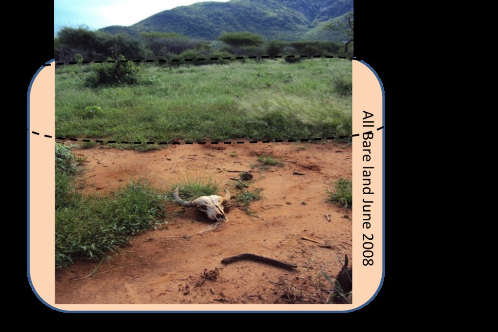
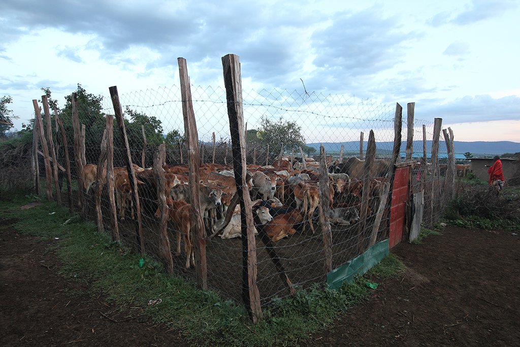
Whilst the livestock are bunched together, large bomas (corrals in Kiswahili) are constructed for overnight enclosure. Bomas are sited on bare land where dung accumulation and crust breaking by hooves helps rehabilitate land. Every year the boma sites are shifted slightly according to a plan. The total area that can be restored per year is almost 1% of the area of Il Ngwesi.
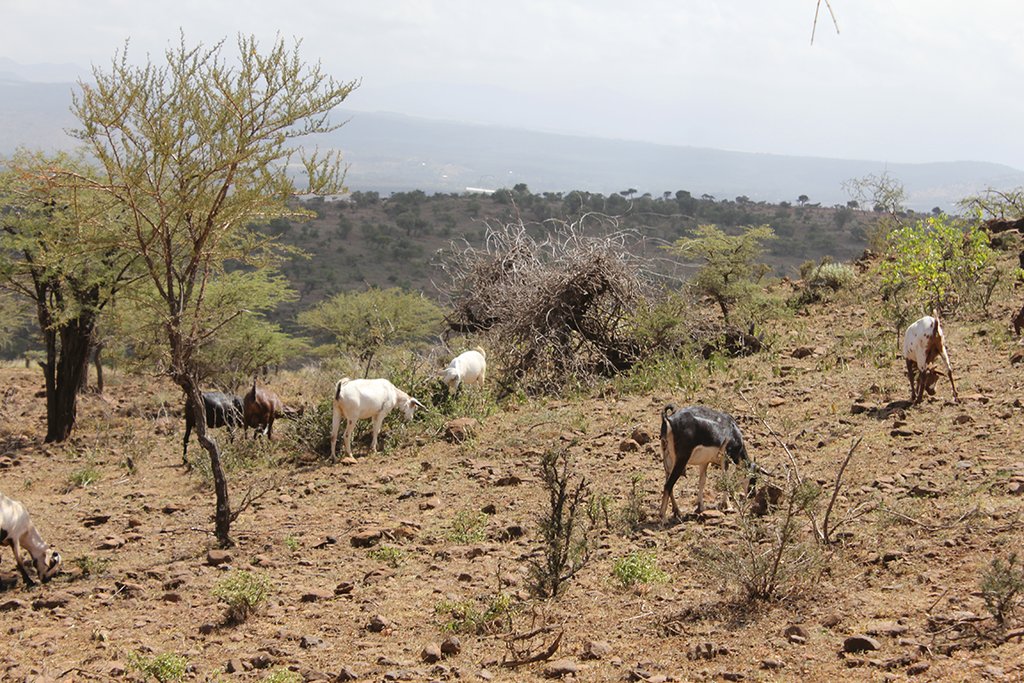
2.3 Photos of the Technology
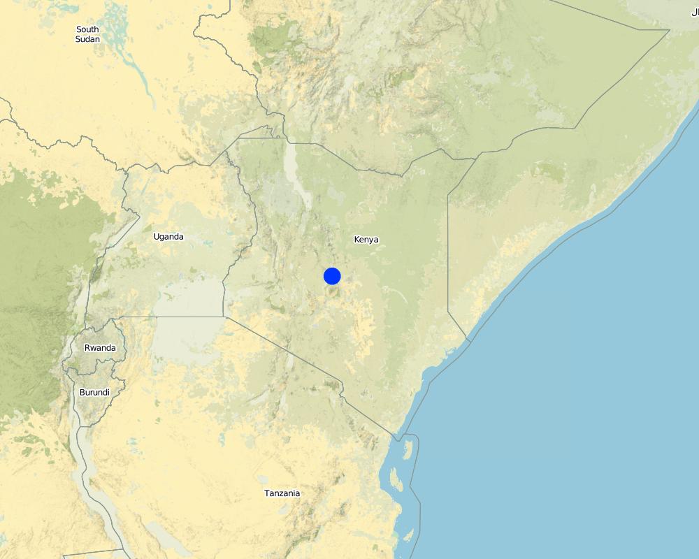
2.5 Country/ region/ locations where the Technology has been applied and which are covered by this assessment
Country:
Kenya
Region/ State/ Province:
Laikipia
Further specification of location:
Mukogodo Divison
Map
×2.6 Date of implementation
Indicate year of implementation:
2007
2.7 Introduction of the Technology
Specify how the Technology was introduced:
- as part of a traditional system (> 50 years)
- through projects/ external interventions
Comments (type of project, etc.):
Holistic Management approach by Allan Savory.
In Laikipia, it was introduced by Richard Hartfield, Laikipia Wildlife Forum and funded by Laikipia Wildlife Forum (LWF), Lewa Conservancy and Northern Rangeland Trust (NRT) (approximately 50% of all additional costs of Il Ngwesi since the implementation were covered by funding). Agreement with elders was reached first, then the community was trained.
3. Classification of the SLM Technology
3.1 Main purpose(s) of the Technology
- improve production
- reduce, prevent, restore land degradation
- conserve ecosystem
- preserve/ improve biodiversity
3.2 Current land use type(s) where the Technology is applied

Grazing land
Extensive grazing land:
- Semi-nomadism/ pastoralism
Main animal species and products:
Livestock: Cattle, goats, sheep, donkeys, camels
Meat and milk production (also blood) and as a bank/ value asset. Mainly subsistence and local production.
Livestock: 4’800 TLU; Stocking rate: 3.3 ha/TLU (calculated with the total affected land by livestock: 157km2)
Pressure on land including wildlife: 3.3 ha/TLU (stays the same, calculated with wildlife biomass density estimated by Georgiadis et al. 2007).
Livestock numbers:
Lower Il Ngwesi: 4000 cattle, 20'000 shoats, 50 donkeys, 100 camels.
Sanga: 700 cattle, 2000 shoats, 20 donkeys.
Mukogodo: 1500 cattle, 5000 shoats, 20 donkeys
Livestock fluctuations (per year): -10% sales, -5% loss due to drought/diseases, -5% slaughtered,
+30% natural breeding, new purchase and deaths are mutually offsetting.
Steers are for fattening on private ranches and during droughts other livestock can be moved to private ranches (up to 3000).
Wildlife: elephant, antelope/ gazelle (like gerenuk, impala, Thomson's gazelle, dik-dik), hares, predators and more.

Settlements, infrastructure
- Settlements, buildings
Remarks:
Villages, bomas, manyattas.
8'000 inhabitans.
Lodge for Tourism.
3.3 Further information about land use
Water supply for the land on which the Technology is applied:
- rainfed
Number of growing seasons per year:
- 2
Specify:
Short rains in November and December. Long rains in April and May. Rains from (October) November to December are usually better in this area. Rainfalls with strong local variations and changing regimes.
Livestock density (if relevant):
4’800 TLU; Stocking rate: 3.3 ha/TLU. Pressure on land: 3.3 ha/TLU
3.4 SLM group to which the Technology belongs
- pastoralism and grazing land management
- improved ground/ vegetation cover
3.5 Spread of the Technology
Specify the spread of the Technology:
- evenly spread over an area
If the Technology is evenly spread over an area, indicate approximate area covered:
- 10-100 km2
Comments:
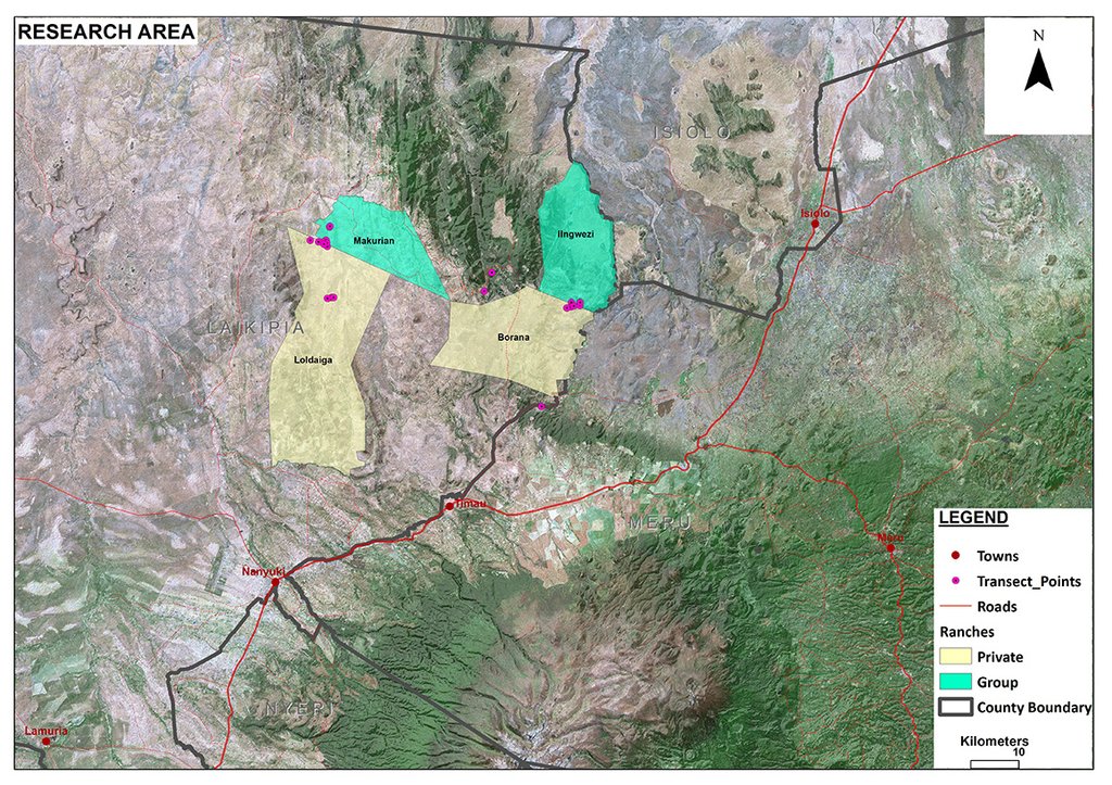
Il Ngwesi has an area size of 87 km2. However, the total affected land by livestock is 157km2. The technology is also applied on other ranches (mainly private ranches, see the documentation for neighboring "Borana") in Mukogodo division.
3.6 SLM measures comprising the Technology

management measures
- M2: Change of management/ intensity level
- M4: Major change in timing of activities
3.7 Main types of land degradation addressed by the Technology

soil erosion by water
- Wt: loss of topsoil/ surface erosion
- Wg: gully erosion/ gullying

soil erosion by wind
- Et: loss of topsoil

physical soil deterioration
- Pc: compaction
- Pk: slaking and crusting
- Pi: soil sealing

biological degradation
- Bc: reduction of vegetation cover
- Bh: loss of habitats
- Bq: quantity/ biomass decline
- Bs: quality and species composition/ diversity decline
- Bl: loss of soil life
Comments:
Across the grasslands and rangelands an increase in bare land and bush has been a clear trend all over Laikipia for many years, both on community-owned lands and private ranches. Major identified ecological problems (partly) caused by livestock production are: bare ground, low contents of soil organic carbon and plant-available nutrients, soil erosion (sealing, crusting, rills and gullies, water flow patterns, sheet erosion, pedestals), poor soil properties, undesirable species, and (increasing) woody and invasive species. However, Il Ngwesi is not affected by the invasive species Opuntia stricta. For more information on rangeland health see Herger (2018). The technology aims at improving vegetation cover of the land and thereby reducing further degradation and restoring degraded land.
3.8 Prevention, reduction, or restoration of land degradation
Specify the goal of the Technology with regard to land degradation:
- reduce land degradation
- restore/ rehabilitate severely degraded land
4. Technical specifications, implementation activities, inputs, and costs
4.1 Technical drawing of the Technology
4.2 Technical specifications/ explanations of technical drawing
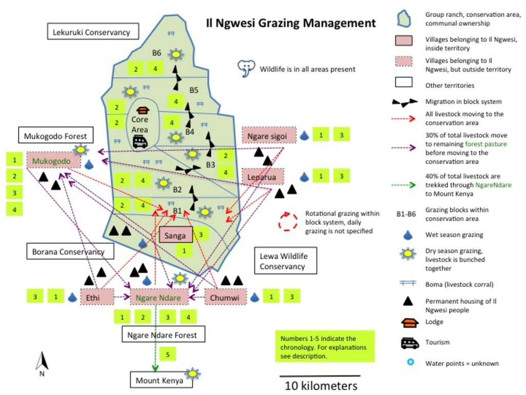
Grazing map of Il Ngwesi in Mukogodo Division
Grazing Principles:
- Rotational, planned grazing
- Bunching
- Resting periods for pasture
- Bomas for bare patches (night corrals)
Value Chain:
• Natural Breeding/buying (Ranches & individually)
• Grazing
o Settlement area (in red, during the wet season, until pasture is gone, organised by elders, bunching of all animals as soon as it gets dry)
o Mukogodo Forest / Ngare Ndare Forest (30% of total livestock, remainder to conservation area for grazing directly)
o Conservation area (6 blocks)
o Mukogodo Forest/Ngare Ndare Forest/Mount Kenya (Ngare Ndare Forest as corridor to Mount Kenya, about 40% of total livestock goes to Mount Kenya)
• Need-driven sales to local butcheries/NRT/Ranches
Il Ngwesi Masai also started to buy land outside their Group Ranch.
4.3 General information regarding the calculation of inputs and costs
Specify how costs and inputs were calculated:
- per Technology unit
Specify unit:
Herders, animals treatment. For the whole area affected by livestock (157 km2)
Specify currency used for cost calculations:
- US Dollars
Indicate average wage cost of hired labour per day:
USD 2.5
4.4 Establishment activities
| Activity | Type of measure | Timing | |
|---|---|---|---|
| 1. | Training of elders and community by project leaders | Management | |
| 2. | Grazing planning for bunched animals (livestock from all households) | Management | |
| 3. | Hiring herders, supervisors, watchmen etc | Management |
4.5 Costs and inputs needed for establishment
| Specify input | Unit | Quantity | Costs per Unit | Total costs per input | % of costs borne by land users | |
|---|---|---|---|---|---|---|
| Labour | Costs for establishment unknown |
Comments:
Trainings were funded by NRT, LWF and Lewa Conservancy. No figures on this.
4.6 Maintenance/ recurrent activities
| Activity | Type of measure | Timing/ frequency | |
|---|---|---|---|
| 1. | Herders, supervisors, watchmen etc | Management | |
| 2. | Animal treatments (vaccination, spraying, injections) | Agronomic | |
| 3. | Planning activites | Management | |
| 4. | Boma Management (mainly movement of Bomas) | Management |
4.7 Costs and inputs needed for maintenance/ recurrent activities (per year)
| Specify input | Unit | Quantity | Costs per Unit | Total costs per input | % of costs borne by land users | |
|---|---|---|---|---|---|---|
| Labour | Herders, watchmen | Person-days | 250.0 | 540.0 | 135000.0 | 100.0 |
| Labour | Supervisors | Person-days | 3.0 | 720.0 | 2160.0 | 100.0 |
| Labour | Planning activities, management | Person-days | 20.0 | 1500.0 | 30000.0 | 100.0 |
| Labour | Livestock-owning families (for wet season, no wages paid, livelihood) | Person-days | 8000.0 | 300.0 | 2400000.0 | |
| Construction material | Boma Movement | |||||
| Other | Animals treatments (spraying against ticks) | Per livestock unit | 5000.0 | 5.0 | 25000.0 | 100.0 |
| Other | Injections, vaccine | Per livestock unit | 5000.0 | 3.0 | 15000.0 | 100.0 |
| Total costs for maintenance of the Technology | 2607160.0 | |||||
If land user bore less than 100% of costs, indicate who covered the remaining costs:
Overall additional costs since introduction of new technology are estimated at 20% higher than before. 50% are covered by project funding (LWF, NRT, Lewa Conservancy)
Comments:
Costs per unit are multiplied by days.
According to the interviewed manager, total costs are only USD 18'000 (without herders). However, the listing of all costs results in much higher total costs. Total animal treatment costs for Makurian Group Ranch in comparison are USD 428'000 (labor USD 380'000, animal treatment USD 48'000, without livestock-owning families).
Also, people living in the area (population of 8'000 inhabitants) are involved in livestock keeping and are included here in calcuations as labor (for 3 months, wet season, 10% of total population).
Cost/benefit is currently negative for livestock keeping. Income due to livestock sales is roughly estimated USD 340'000 (price for cattle on average USD 400 per unit, sales around 500 p.a., price for goats and sheep each USD 40 per unit, sales around 2'000 p.a., slaughtered units (for subsistence use) cattle: 50, shoats: 1'000 - detailed figures available Herger 2018)
4.8 Most important factors affecting the costs
Describe the most determinate factors affecting the costs:
- Managing of one big herd, many supervisors needed.
- Movement of bomas
- Livestock-owning families (although they obviously don't receive any salary): this is simultaneously their livelihood and used for subsistence. But once all their livestock is bunched in a big herd, they lose their nutritional source (milk, blood) and livelihood (sometimes they keep back a few units for this reason).
5. Natural and human environment
5.1 Climate
Annual rainfall
- < 250 mm
- 251-500 mm
- 501-750 mm
- 751-1,000 mm
- 1,001-1,500 mm
- 1,501-2,000 mm
- 2,001-3,000 mm
- 3,001-4,000 mm
- > 4,000 mm
Specify average annual rainfall (if known), in mm:
500.00
Specifications/ comments on rainfall:
Rainfall gauge Borana HQ average from 2013-2016 (neighboring ranch). Strong local (and temporal) variation, changing rainfall regimes. Il Ngwesi is generally drier than Borana. Grazing areas are on different altitudes with different rainfall amounts. While Il Ngwesi Sanga (as one of the villages) is at almost 1700 m a.s.l. with similar rainfall like Borana HQ, Il Ngwesi Conservation area is at 1220 m a.s.l. with significantly lower precipitation (no rainfall gauge). Grazing glades in Mukgodo Forest are at 1850 m a.s.l. and in Ngare Ndare Forest at almost 2100 m a.s.l. (no rainfall measurements available, higher rainfall amounts) and varying heights with much higher precipitation on Mount Kenya (no defined areas).
Indicate the name of the reference meteorological station considered:
Rainfall gauge Borana HQ
Agro-climatic zone
- semi-arid
5.2 Topography
Slopes on average:
- flat (0-2%)
- gentle (3-5%)
- moderate (6-10%)
- rolling (11-15%)
- hilly (16-30%)
- steep (31-60%)
- very steep (>60%)
Landforms:
- plateau/plains
- ridges
- mountain slopes
- hill slopes
- footslopes
- valley floors
Altitudinal zone:
- 0-100 m a.s.l.
- 101-500 m a.s.l.
- 501-1,000 m a.s.l.
- 1,001-1,500 m a.s.l.
- 1,501-2,000 m a.s.l.
- 2,001-2,500 m a.s.l.
- 2,501-3,000 m a.s.l.
- 3,001-4,000 m a.s.l.
- > 4,000 m a.s.l.
Indicate if the Technology is specifically applied in:
- not relevant
Comments and further specifications on topography:
Hilly areas (e.g. Sanga village) and flat areas in lower altitude (conservation area).
5.3 Soils
Soil depth on average:
- very shallow (0-20 cm)
- shallow (21-50 cm)
- moderately deep (51-80 cm)
- deep (81-120 cm)
- very deep (> 120 cm)
Soil texture (topsoil):
- coarse/ light (sandy)
- fine/ heavy (clay)
Soil texture (> 20 cm below surface):
- coarse/ light (sandy)
- fine/ heavy (clay)
Topsoil organic matter:
- low (<1%)
If available, attach full soil description or specify the available information, e.g. soil type, soil PH/ acidity, Cation Exchange Capacity, nitrogen, salinity etc.
Red and brown sandy soils. Black cotton soil. Luvisol, Regosol, Vertisol
SOC 1.1-1.4 %
pH: 6.3
Clay: 12%
Silt: 53%
Sand: 35%
More information in Herger (2018)
5.4 Water availability and quality
Ground water table:
> 50 m
Availability of surface water:
medium
Water quality (untreated):
poor drinking water (treatment required)
Is water salinity a problem?
No
Is flooding of the area occurring?
No
Comments and further specifications on water quality and quantity:
Few springs, Ngare Ndare river, no boreholes. Source is Mount Kenya
5.5 Biodiversity
Species diversity:
- medium
Habitat diversity:
- medium
Comments and further specifications on biodiversity:
Grassed acacia bushland. Bare land up to 70% during the dry season. Loss of (native) vegetation. Invasive species coming in. Dominant grasses: Eragrostis species, Cynadon species, Hyparrhenia species, Kelenger species. Dominant shrubs: Solyneum inconum, Ipomea hildebranditi, Lyceum europaeum, Barleria acuthodies. Dominant trees: Acacia tortilis, Acacia mellifera, Acacia nilotica, Acacia etbaica, Boscia angustifolia. Detailed list of all species (also wildlife) available (see Herger 2018).
5.6 Characteristics of land users applying the Technology
Sedentary or nomadic:
- Semi-nomadic
Market orientation of production system:
- mixed (subsistence/ commercial
Off-farm income:
- less than 10% of all income
Relative level of wealth:
- poor
Individuals or groups:
- individual/ household
- groups/ community
Level of mechanization:
- manual work
Gender:
- women
- men
Age of land users:
- youth
- middle-aged
Indicate other relevant characteristics of the land users:
Masai people. 8'000 Masai living in Il Ngwesi. Traditional lifestyle. Livestock with very high cultural value. About 10% subsistence use, 90% is sold for local and national markets (mainly local).
Very little agriculture; tourism (award-winning eco-lodge in conservation area); people start to diversify. Schooling of children has a high importance today (e.g. smallstock is sold for school fees). Children and young warriors are traditionally herders, however, it is shifting towards hiring herders and sending children to school.
Have been historically "squeezed" from all sides into smaller areas for livestock keeping. Future of pastoralism is in question.
5.7 Average area of land owned or leased by land users applying the Technology
- < 0.5 ha
- 0.5-1 ha
- 1-2 ha
- 2-5 ha
- 5-15 ha
- 15-50 ha
- 50-100 ha
- 100-500 ha
- 500-1,000 ha
- 1,000-10,000 ha
- > 10,000 ha
Is this considered small-, medium- or large-scale (referring to local context)?
- small-scale
Comments:
Applies for one household. Herders on the other hand trek livestock over an area of more than 10'000 ha.
5.8 Land ownership, land use rights, and water use rights
Land ownership:
- communal/ village
Land use rights:
- communal (organized)
Water use rights:
- open access (unorganized)
5.9 Access to services and infrastructure
health:
- poor
- moderate
- good
education:
- poor
- moderate
- good
technical assistance:
- poor
- moderate
- good
employment (e.g. off-farm):
- poor
- moderate
- good
markets:
- poor
- moderate
- good
energy:
- poor
- moderate
- good
roads and transport:
- poor
- moderate
- good
drinking water and sanitation:
- poor
- moderate
- good
financial services:
- poor
- moderate
- good
6. Impacts and concluding statements
6.1 On-site impacts the Technology has shown
Socio-economic impacts
Production
fodder production
fodder quality
animal production
land management
Water availability and quality
drinking water availability
water availability for livestock
Income and costs
workload
Comments/ specify:
20-30% above normal (supervision, watchmen, moving big bomas). Previously, every household managed their livestock individually
Socio-cultural impacts
food security/ self-sufficiency
land use/ water rights
SLM/ land degradation knowledge
conflict mitigation
Comments/ specify:
External! Better land cover attracts invaders (Invasion from northern tribes), envy
situation of socially and economically disadvantaged groups
Comments/ specify:
Poorest livestock-owning families are better off now since their livestock are also bunched together with all the others. For instance, before they couldn't afford to trek their 5 cows to Mount Kenya for pasture, now their livestock are trekked with all the others - all have the same opportunities. Other households are complaining about this since they can't decide on their own anymore where they want to bring their livestock for grazing.
Ecological impacts
Water cycle/ runoff
water quantity
Comments/ specify:
less runoff, more water stored in the soil.
surface runoff
groundwater table/ aquifer
evaporation
Soil
soil moisture
soil cover
soil loss
soil crusting/ sealing
soil compaction
nutrient cycling/ recharge
soil organic matter/ below ground C
Biodiversity: vegetation, animals
Vegetation cover
plant diversity
invasive alien species
Comments/ specify:
Il Ngwesi is not affected by the huge invasion of the exotic cactus, Opuntia stricta. However, there are some other invasives like Lantana in the area, but not as problematic as Opuntia. According to land users, native vegetation cover has improved, which results in fewer invasive species.
Climate and disaster risk reduction
drought impacts
6.2 Off-site impacts the Technology has shown
water availability
Comments/ specify:
More stored in the soil. According to the land users, no measurements conducted.
Comments regarding impact assessment:
All listed impacts are as perceived by land users according to Patrick Leseri, Conservation Manager. In his opinion, vegetation cover has thanks to the new technologies improved. Planning activities significantly increased and therefore also socio-economic and ecological conditions improved. Results from a rangeland health assessment (only ecological conditions) show on the other hand partly heavily degraded ecological conditions (poor soil and vegetation, erosions features, inability of producing annual grasses after rains etc) (Herger 2018). Land users and experts are aware that the ecological conditions of this Group Ranch are still far from optimal, but do see good progress and exemplary management as well as slightly better conditions than on other Group Ranches.
6.3 Exposure and sensitivity of the Technology to gradual climate change and climate-related extremes/ disasters (as perceived by land users)
Gradual climate change
Gradual climate change
| Season | Type of climatic change/ extreme | How does the Technology cope with it? | |
|---|---|---|---|
| other gradual climate change | Greater variation of seasonal rainfall, higher intensity of rainfall events, change in rainfall regimes in general (see Schmocker 2013 and Imfeld 2016). | increase | well |
Climate-related extremes (disasters)
Climatological disasters
| How does the Technology cope with it? | |
|---|---|
| heatwave | well |
Comments:
Improved rangeland health, better internal organization, and cooperations make them less vulnerable to climate change impacts.
6.4 Cost-benefit analysis
How do the benefits compare with the establishment costs (from land users’ perspective)?
Short-term returns:
slightly negative
Long-term returns:
positive
How do the benefits compare with the maintenance/ recurrent costs (from land users' perspective)?
Short-term returns:
positive
Long-term returns:
positive
6.5 Adoption of the Technology
- 10-50%
If available, quantify (no. of households and/ or area covered):
50%
Of all those who have adopted the Technology, how many have did so spontaneously, i.e. without receiving any material incentives/ payments?
- 0-10%
6.6 Adaptation
Has the Technology been modified recently to adapt to changing conditions?
Yes
If yes, indicate to which changing conditions it was adapted:
- climatic change/ extremes
Specify adaptation of the Technology (design, material/ species, etc.):
Masai people have changed their livestock composition towards owning more smallstock (goats and sheep) than cattle. Goats are tolerant of drought, and as browsers, they don't need any grass. Also, they can be turned into money much quicker than a cow in times of need and because of their more rapid reproductive cycle. They can also recover number more quickly after livestock losses through drought
6.7 Strengths/ advantages/ opportunities of the Technology
| Strengths/ advantages/ opportunities in the land user’s view |
|---|
| Proper utilisation of pasture – controlled usage/grazing |
| Land recovery (more cover, more water, more fodder, less erosion) |
| Carrying capacity increased |
| Traditional knowledge is still used |
| More dialogue in community: brings everyone in the community together – they have a common point – everyone has the same interest |
| Improving breeds is easier (because all are bunched together) |
| Easy vaccination of all livestock at once |
| Approving cultural lifestyle of Masai: the higher the livestock numbers – the better for the land |
| Better for disadvantaged community members: for instance for those who could not afford to move their livestock to Mt Kenya on their own before |
| Strengths/ advantages/ opportunities in the compiler’s or other key resource person’s view |
|---|
| The listed advantages from Patrick Leseri, the land user, are for the most part shared share with the compiler's view. Improved planning of livestock production with planned grazing and long resting periods, improved dialogue in the community, and the named advantages of a big herd (like easy vaccination etc) are important advantages. Regarding Holistic Management (HM) principles, there remains uncertainty about land recovery. On the one hand, it is generally questionable to state as in HM: “the more animals the better” (as long as they are managed properly they can even recover degraded land), which seems dangerous in areas with such high livestock numbers and cultural value of livestock keeping - without scientific proof of the principles in similar ecological conditions. We have witnessed rather poor condition of the land, and the much-vaunted good land was difficult to find. Favourable descriptions might also be related to funding of the project. Results from a rangeland health assessment show (partly) heavily degraded ecological conditions (bare ground, poor soil and vegetation, erosion features, partly an inability of producing perennial and annual grasses after rains etc) (see Herger 2018). However, an evaluation of change over time is impossible to assess. Further monitoring is necessary. Land users and experts are aware that the ecological conditions of this Group Ranch are still far from optimal, but do see good progress and exemplary management as well as slightly better conditions than on other Group Ranches. However, the efforts towards good management and a sense of community was not difficult to notice. |
6.8 Weaknesses/ disadvantages/ risks of the Technology and ways of overcoming them
| Weaknesses/ disadvantages/ risks in the land user’s view | How can they be overcome? |
|---|---|
| Higher costs. Above 20% more than normal costs. NRT, Laikipia Wildlife Forum and Lewa conservancy as main funders for applying holisitc management principles. Since 2007 they covered about 50% of all costs.. | |
| More labour intensive. 20-30% above normal (supervision, watchmen, moving big bomas) | |
| Challenge to bring people together (and their livestock) and agree on a joint management | |
| Some families still prefer to manage their livestock on their own and make their own decisions. There are no individual decisions anymore: principles apply to everyone | |
| Breeding can also be a problem – those with good genetic material (better livestock) may lose and those with poor may win by mixing | |
| Conflicts among animals; bulls fight a lot. No separation of heifers, cows, steers and bulls | |
| Management of high numbers of big herds is a challenge | |
| Diseases are easily transmitted | |
| Once livestock is collected to big herds, individual families lose their nutritional basis (milk, blood). However, some also keep a few livestock units back. | |
| Sometimes trees are cut for bomas |
7. References and links
7.1 Methods/ sources of information
- field visits, field surveys
4 field visits with included "rangeland health assessment" in different parts of Il Ngwesi (mostly in Sanga village though) where I could see the condition of the land as well as several other visits of the area.
- interviews with land users
Several meetings with the grazing coordinator, conservation manager, chief, elders, and other resource people of Il Ngwesi over half a year.
- interviews with SLM specialists/ experts
Truman Young
Dan Rubenstein
Dino Martins
John Letai
Samali Letai
Peter Hetz
Dominic Maringa
Joseph Putunoi
Patrick Ekodere
- compilation from reports and other existing documentation
Scientific papers, LWF reports etc.
7.2 References to available publications
Title, author, year, ISBN:
Herger, M.B. (2018). Environmental Impacts of Red Meat Production. MSc Thesis. University of Bern.
Available from where? Costs?
University of Bern
Title, author, year, ISBN:
Modeling Seasonal and Annual Precipitation using long-term Climate Records and Topography. Master’s Thesis. Noemi Imfeld (2016).
Available from where? Costs?
University of Bern
Title, author, year, ISBN:
Savory, A (1988). Holistic Resource Management. Gilmour Publishing, Harare, Zimbabwe
Available from where? Costs?
Online
Links and modules
Expand all Collapse allLinks
No links
Modules
No modules


