The ancient agroforestry and agricultural biodiversity of crops on the basis of irrigated walnut orchard [Tajikistan]
- Creation:
- Update:
- Compiler: Gulniso Nekushoeva
- Editor: –
- Reviewers: David Streiff, Alexandra Gavilano
technologies_1113 - Tajikistan
- Full summary as PDF
- Full summary as PDF for print
- Full summary in the browser
- Full summary (unformatted)
- The ancient agroforestry and agricultural biodiversity of crops on the basis of irrigated walnut orchard: March 22, 2017 (inactive)
- The ancient agroforestry and agricultural biodiversity of crops on the basis of irrigated walnut orchard: July 31, 2017 (inactive)
- The ancient agroforestry and agricultural biodiversity of crops on the basis of irrigated walnut orchard: Aug. 19, 2019 (public)
View sections
Expand all Collapse all1. General information
1.2 Contact details of resource persons and institutions involved in the assessment and documentation of the Technology
SLM specialist:
SLM specialist:
land user:
Birindjov Hisain
Udov village, Teharv jamoat, Vanch
Tajikistan
Name of the institution(s) which facilitated the documentation/ evaluation of the Technology (if relevant)
Global Environment Facility Tajikistan (GEF) - TajikistanName of the institution(s) which facilitated the documentation/ evaluation of the Technology (if relevant)
UNEP (UNEP) - KenyaName of the institution(s) which facilitated the documentation/ evaluation of the Technology (if relevant)
Institute for Environment and Human Security, United Nations University (Institute for Environment and Human Security, United Nations University) - GermanyName of the institution(s) which facilitated the documentation/ evaluation of the Technology (if relevant)
Tajik Soil Insitute (Tajik Soil Institute) - TajikistanName of the institution(s) which facilitated the documentation/ evaluation of the Technology (if relevant)
CDE Centre for Development and Environment (CDE Centre for Development and Environment) - Switzerland1.3 Conditions regarding the use of data documented through WOCAT
When were the data compiled (in the field)?
27/06/2010
The compiler and key resource person(s) accept the conditions regarding the use of data documented through WOCAT:
Yes
2. Description of the SLM Technology
2.1 Short description of the Technology
Definition of the Technology:
Combining variety of agricultural crops and nut orchards in the same area leads to more efficient use of scarce irrigated land in arid land-poor mountain regions
2.2 Detailed description of the Technology
Description:
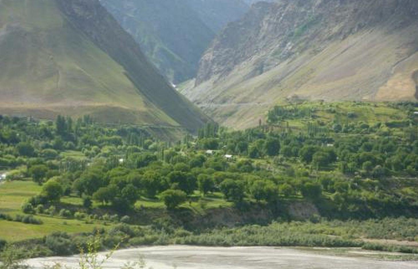
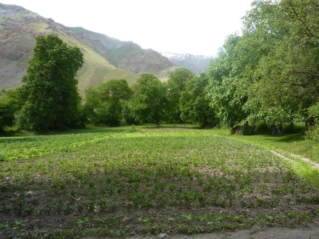
Technology on agroforestry: planting cereals, pulses, potatoes and perennial forage crops in the inter/row of irrigated walnut orchard and receiving yield of several crops from one and the plot. This technology is widespread in many arable lands along the narrow valley in Vanch district and very well adaptable to local conditions mainly thanks to irrigation. According to local people, it is quite an ancient technology and existed for more than 200 years. 1980-90s these land areas belonged to sovkhoz and in the wide inter-rows of walnut orchards people used to grow tobacco, which was the highly paid crop. Today people plant there necessary crops, and so, this old technology returned. These gardens are gorgeous and become a symbolic place of the region. Normally, walnut does not grow in this area as the amount of the precipitation in there is not enough.
Purpose of the Technology: Rational use of small areas of the most fertile irrigated land in the narrow mountainous valley in order to guarantee self-sufficiency of households with diverse products. (i.e. receiving diverse crops from the same place).
Establishment / maintenance activities and inputs: Judging by the way young orchards were planted on the natural moraine terraces on the slopes people there are trying to introduce exactly this technology. First, different types of fruit trees are planted 5-6 meters far from each other, but walnut trees are planted very far from each other. Life of fruit trees do not last as long as walnut trees, and therefore, fruit trees are later uprooted leaving the long-living walnut in that plot. This is, probably, the reason why the distance between walnut trees are so big.
Initial measures: territory is cleaned from stones, which are used for fencing to protect the area from animals; digging up main irrigation channel, and from it, smaller channels reaching all parts of the garden along which different fruit trees and walnut are planted; between the rows cereals, beans and perennial forage are planted.
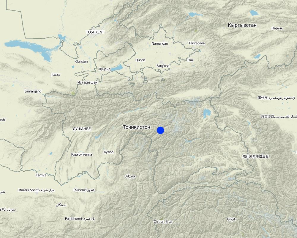
Natural / human environment: The garden is located in Udob village, Teharv jamoat. Heigh - 2115м. The area of arable plot is not big. Farming is impossible without irrigation because of the low rainfall.
Although walnut wood is valued as a good construction material, here people prefer to have walnuts. Vanch walnuts are famous for it taste and high yield. In cases, when a big walnut tree falls down, it can be profitably sold to local masters, who make a big wooden plates and spoons, which are widely used in the households and famous as a souvenirs. Even through at the beginning a household is able to receive only beans, potatoes, grains, fodder and do not receive any yield from fruit trees for 8-10 years (walnut trees give yield even later), many farmers still use this technology. This region is famous with its fruits (apples, mulberries etc.) and with high quality walnuts.
2.3 Photos of the Technology
2.5 Country/ region/ locations where the Technology has been applied and which are covered by this assessment
Country:
Tajikistan
Region/ State/ Province:
Tajikistan GBAO
Further specification of location:
Vanch Udob
Map
×2.6 Date of implementation
If precise year is not known, indicate approximate date:
- more than 50 years ago (traditional)
2.7 Introduction of the Technology
Specify how the Technology was introduced:
- as part of a traditional system (> 50 years)
Comments (type of project, etc.):
for more than 200 years local people use this technology
3. Classification of the SLM Technology
3.1 Main purpose(s) of the Technology
- improve production
3.2 Current land use type(s) where the Technology is applied

Cropland
- Annual cropping
- Perennial (non-woody) cropping
- Tree and shrub cropping

Mixed (crops/ grazing/ trees), incl. agroforestry
- Agro-silvopastoralism
Main products/ services:
Timber, fuelwood, grazing / browsing, nature conservation / protection
Comments:
Major land use problems (compiler’s opinion): lack of land suitable for agriculture because of the several reasons: the large part of the region occupied by the mountain ranges with steep slopes; it has arid climate with very little rainfall; agriculture is impossible without irrigation; very stony soil.
Major land use problems (land users’ perception): lack of irrigation water and land area
Nomadism: Yes
Forest products and services: timber, fuelwood, grazing / browsing, nature conservation / protection
Type of cropping system and major crops comments: These are all separate annual crops. But mostly, land use has a mixed character. At the beginning, (according to way young orchards are planted) various types of fruit trees are planted, and as they fall down (since they live less than walnut trees) only walnuts remains and combibed with annual or prennial crops.
Livestock is grazing on crop residues
Constraints of Difficulty of using due to lack of water
3.3 Further information about land use
Water supply for the land on which the Technology is applied:
- full irrigation
Comments:
Водопотребление: полностью орошаемое, полностью орошаемое
Number of growing seasons per year:
- 1
Specify:
Longest growing period in days: 90Longest growing period from month to month: May-SeptemberSecond longest growing period in days: 150
3.4 SLM group to which the Technology belongs
- agroforestry
3.5 Spread of the Technology
Specify the spread of the Technology:
- evenly spread over an area
If the Technology is evenly spread over an area, indicate approximate area covered:
- 1-10 km2
Comments:
technology is widely spread on the plains, but there is also potential for its further spreading on the moraine terraces on the slopes
3.6 SLM measures comprising the Technology

vegetative measures
- V1: Tree and shrub cover

structural measures
- S3: Graded ditches, channels, waterways
- S6: Walls, barriers, palisades, fences

management measures
- M1: Change of land use type
Comments:
Main measures: vegetative measures
Secondary measures: structural measures, management measures
Type of agronomic measures: mixed cropping / intercropping, cover cropping, legume inter-planting, manure / compost / residues, rotations / fallows, breaking compacted topsoil, breaking compacted subsoil
Type of vegetative measures: scattered / dispersed
3.7 Main types of land degradation addressed by the Technology

soil erosion by water
- Wt: loss of topsoil/ surface erosion

chemical soil deterioration
- Cn: fertility decline and reduced organic matter content (not caused by erosion)

biological degradation
- Bc: reduction of vegetation cover
- Bq: quantity/ biomass decline
- Bl: loss of soil life

water degradation
- Ha: aridification
Comments:
Main type of degradation addressed: Cn: fertility decline and reduced organic matter content, Bc: reduction of vegetation cover, Bq: quantity / biomass decline
Secondary types of degradation addressed: Wt: loss of topsoil / surface erosion, Bl: loss of soil life, Ha: aridification
Main causes of degradation: deforestation / removal of natural vegetation (incl. forest fires) (Lack of electricity after the collapse of the Soviet Union, economic crisis afterwards, and further provision of electricity for 2-3 hours per day only led to cutting down all trees in the area), over-exploitation of vegetation for domestic use, droughts (The high aridity, a small amount of precipitation. Farming is not possible without irrigation), other natural causes (avalanches, volcanic eruptions, mud flows, highly susceptible natural resources, extreme topography, etc.) specify (Large part of the area is occupied with steep high mountains with no vegetation on them and only narrow valley along the river is suitable for cultivation), population pressure (Because of the self-sufficiency needs the soil is under intensive usage (their size is limited) and it is becoming less productive), poverty / wealth (No means to purchase a sufficient amount of flour, vegetables, then, perennial fodder could be sown)
Secondary causes of degradation: soil management, overgrazing (Everyday shepherds graze too many livestock in semi-desert pastures with very scarce vegetation), land tenure (Land use used to be profit oriented: when these lands belonged to sovkhozes nobody thought of careful use of these lands. Instead of cereal and fruits, tobacco was planted (most profitable)), labour availability (Employment opportunities outsite agricultural sector are very few: schools, hospitals, leshoz, local state agency.), inputs and infrastructure: (roads, markets, distribution of water points, other, …) (no access to market, roads (particularly on the upper side of the river) are bad), education, access to knowledge and support services (Teachers' qualification is not high; and almost no teachers on main subjects.), war and conflicts (after crisis in the 1990 everybody is forced to move to entire self-sufficiency)
3.8 Prevention, reduction, or restoration of land degradation
Specify the goal of the Technology with regard to land degradation:
- restore/ rehabilitate severely degraded land
Comments:
Secondary goals: prevention of land degradation, mitigation / reduction of land degradation
4. Technical specifications, implementation activities, inputs, and costs
4.1 Technical drawing of the Technology
Author:
Nekushoeva Gulniso, Dushanbe, Tajikistan
4.2 Technical specifications/ explanations of technical drawing
agroforestry system - fields with grain, beans, potatoes and perennial forage crops in the old walnut orchard
Location: Tajikistan. MBAO, Wanch
Technical knowledge required for land users: moderate
Main technical functions: improvement of ground cover, stabilisation of soil (eg by tree roots against land slides), increase of biomass (quantity)
Secondary technical functions: control of dispersed runoff: retain / trap, increase of surface roughness, improvement of surface structure (crusting, sealing), improvement of topsoil structure (compaction), increase in organic matter, increase in nutrient availability (supply, recycling,…), increase / maintain water stored in soil, reduction in wind speed, promotion of vegetation species and varieties (quality, eg palatable fodder), spatial arrangement and diversification of land use
Fruit trees / shrubs species: walnut trees; apple trees; pears trees; cherries; apricots
Perennial crops species: part of the garden is by clover and alfalfa
Other species: potatoes, beans and grain
Construction material (stone): stone
Change of land use practices / intensity level
Waterway: Construction material (earth): earth
4.3 General information regarding the calculation of inputs and costs
other/ national currency (specify):
4.8
Indicate exchange rate from USD to local currency (if relevant): 1 USD =:
4.8
4.4 Establishment activities
| Activity | Type of measure | Timing | |
|---|---|---|---|
| 1. | Cleanig the garden from stones | Vegetative | до посадки |
| 2. | Ploughing inter-rows using bulls | Agronomic | весной |
| 3. | Digging holes for planting nut and fruit trees, etc. | Vegetative | before planting |
| 4. | Putting fertilizers to the planting holes | Vegetative | in spring |
| 5. | Purchase: Saplings of walnut and other fruit and planting saplings | Vegetative | in spring |
| 6. | Watering the planted saplings (walnut) | Vegetative | in summer and autumn |
| 7. | Digging up main irrigation canals and network of furter smaller canals in the whole area of the garden | Structural | |
| 8. | Fencing the garden with stony walls (using the stones collected from the garden) | Structural | before planting |
4.6 Maintenance/ recurrent activities
| Activity | Type of measure | Timing/ frequency | |
|---|---|---|---|
| 1. | Annual ploughing of inter-rows using bulls | Agronomic | |
| 2. | fertilizers | Agronomic | |
| 3. | planting grain and beans, annually | Agronomic | |
| 4. | planting potatoes and vegetables, annually | Agronomic | |
| 5. | watering | Agronomic | 4 t/m |
| 6. | agrotechnical work necessary for growing potatoes and vegetables, annually | Agronomic | |
| 7. | harvesting grain and beans | Agronomic | |
| 8. | collecting potatoes | Agronomic | |
| 9. | haymaking | Agronomic | |
| 10. | watering trees | Vegetative | 4 t/m |
| 11. | cutting trees (first after 3-4 years) | Vegetative | march |
| 12. | harvesting fruits after 5-6 years, walnuts- after 8-10 years | Vegetative | september, otober |
| 13. | in necessary, planting further in the garden | Vegetative | in spring |
| 14. | protecting from animals | Vegetative | spring, summer |
| 15. | cleaning and minor maintanance work on the main canal and fuerhter smaller canals (throughout the garden) | Structural | |
| 16. | fix destroyed parts of the fence around the garden (if needed) | Structural |
4.7 Costs and inputs needed for maintenance/ recurrent activities (per year)
Comments:
Machinery/ tools: manual work, ax, secateurs
4.8 Most important factors affecting the costs
Describe the most determinate factors affecting the costs:
far away from water, stony soil, slopy area
5. Natural and human environment
5.1 Climate
Annual rainfall
- < 250 mm
- 251-500 mm
- 501-750 mm
- 751-1,000 mm
- 1,001-1,500 mm
- 1,501-2,000 mm
- 2,001-3,000 mm
- 3,001-4,000 mm
- > 4,000 mm
Specifications/ comments on rainfall:
232-238mm rainfall, mainly in winter and spring
Agro-climatic zone
- arid
Thermal climate class: subtropics. 3-4 months below 18C
5.2 Topography
Slopes on average:
- flat (0-2%)
- gentle (3-5%)
- moderate (6-10%)
- rolling (11-15%)
- hilly (16-30%)
- steep (31-60%)
- very steep (>60%)
Landforms:
- plateau/plains
- ridges
- mountain slopes
- hill slopes
- footslopes
- valley floors
Altitudinal zone:
- 0-100 m a.s.l.
- 101-500 m a.s.l.
- 501-1,000 m a.s.l.
- 1,001-1,500 m a.s.l.
- 1,501-2,000 m a.s.l.
- 2,001-2,500 m a.s.l.
- 2,501-3,000 m a.s.l.
- 3,001-4,000 m a.s.l.
- > 4,000 m a.s.l.
Comments and further specifications on topography:
Altitudinal zone: 2115 m a.s.l.
Landforms: Plateau for flat and slopy areas and valley floors are widespread in Wanch for 200 or more years.
5.3 Soils
Soil depth on average:
- very shallow (0-20 cm)
- shallow (21-50 cm)
- moderately deep (51-80 cm)
- deep (81-120 cm)
- very deep (> 120 cm)
Soil texture (topsoil):
- medium (loamy, silty)
Topsoil organic matter:
- high (>3%)
- medium (1-3%)
If available, attach full soil description or specify the available information, e.g. soil type, soil PH/ acidity, Cation Exchange Capacity, nitrogen, salinity etc.
Soil texture: Medium loam with many stones, in the soil below 80 cm-1m
Soil fertility is low because little nutrients available to plants in natural soils and becomes medium after long-term application of organic fertilizers and the cultivation of beans and crop rotation.
Topsoil organic matter: Is high and almost 4% under irrigated natural grass and alfalfa in a walnut orchard and medium under the crops.
Soil drainage / infiltration is good due to the very stony soil
Soil water storage capacity is high in the irrigated area and very low in the natural soil.
5.4 Water availability and quality
Ground water table:
5-50 m
Availability of surface water:
medium
Water quality (untreated):
good drinking water
5.5 Biodiversity
Species diversity:
- high
Comments and further specifications on biodiversity:
High: Under trees and along the irrigation canals, there is a huge biodiversity of methophytics
Low: Agrobiodiversity (fruit and vegetables), lots of birds, various insects, soil fauna
5.6 Characteristics of land users applying the Technology
Market orientation of production system:
- subsistence (self-supply)
- mixed (subsistence/ commercial
Off-farm income:
- 10-50% of all income
Relative level of wealth:
- poor
- average
Individuals or groups:
- individual/ household
Level of mechanization:
- manual work
- animal traction
Gender:
- women
- men
Indicate other relevant characteristics of the land users:
Land users applying the Technology are mainly common / average land users
Population density: 10-50 persons/km2
Annual population growth: 2% - 3%
2% of the land users are very rich.
8% of the land users are rich.
50% of the land users are average wealthy.
30% of the land users are poor.
10% of the land users are poor.
Market orientation of production system: He provides his family with fruits, firewood, fodder. He sows wheat, but still buys flour if his yield is not enough or exchanges for cattle and sells surplus of fruits and nuts. Also if he has a surplus of potatoes or fruits (apples, mulberry), and nuts, he can exchange them to other products like butter, sugar, flour etc.
Level of mechanization: Manual labour includes watering, planting agricultural crops, cutting, harvesting whereby animal traction is used for annual plowing for annual grains, potatoes and vegetables.
5.7 Average area of land owned or leased by land users applying the Technology
- < 0.5 ha
- 0.5-1 ha
- 1-2 ha
- 2-5 ha
- 5-15 ha
- 15-50 ha
- 50-100 ha
- 100-500 ha
- 500-1,000 ha
- 1,000-10,000 ha
- > 10,000 ha
Is this considered small-, medium- or large-scale (referring to local context)?
- small-scale
Comments:
Average area of land owned or leased by land users applying the Technology: < 0.5 ha for woodland. Area of the natural forest if not large and largely flood: sea buckthorn and willow are mixed.
5.8 Land ownership, land use rights, and water use rights
Land ownership:
- state
Land use rights:
- communal (organized)
Water use rights:
- open access (unorganized)
Comments:
no payment for water
5.9 Access to services and infrastructure
health:
- poor
- moderate
- good
education:
- poor
- moderate
- good
technical assistance:
- poor
- moderate
- good
employment (e.g. off-farm):
- poor
- moderate
- good
markets:
- poor
- moderate
- good
energy:
- poor
- moderate
- good
roads and transport:
- poor
- moderate
- good
drinking water and sanitation:
- poor
- moderate
- good
6. Impacts and concluding statements
6.1 On-site impacts the Technology has shown
Socio-cultural impacts
Livelihood and human well-being
Comments/ specify:
Money, which was not spent for buying walnuts and fruits can be used to buy school clothes or school supplies for children and having sold the cattle farmer can pay for children's education at the universities
6.2 Off-site impacts the Technology has shown
wind transported sediments
6.3 Exposure and sensitivity of the Technology to gradual climate change and climate-related extremes/ disasters (as perceived by land users)
Gradual climate change
Gradual climate change
| Season | Type of climatic change/ extreme | How does the Technology cope with it? | |
|---|---|---|---|
| annual temperature | increase | not well |
Climate-related extremes (disasters)
Meteorological disasters
| How does the Technology cope with it? | |
|---|---|
| local rainstorm | well |
| local windstorm | well |
Climatological disasters
| How does the Technology cope with it? | |
|---|---|
| drought | not well |
Hydrological disasters
| How does the Technology cope with it? | |
|---|---|
| general (river) flood | well |
Other climate-related consequences
Other climate-related consequences
| How does the Technology cope with it? | |
|---|---|
| reduced growing period | not well |
| well |
6.4 Cost-benefit analysis
How do the benefits compare with the establishment costs (from land users’ perspective)?
Short-term returns:
positive
Long-term returns:
very positive
How do the benefits compare with the maintenance/ recurrent costs (from land users' perspective)?
Short-term returns:
neutral/ balanced
Long-term returns:
very positive
6.5 Adoption of the Technology
- single cases/ experimental
If available, quantify (no. of households and/ or area covered):
1 household
Of all those who have adopted the Technology, how many have did so spontaneously, i.e. without receiving any material incentives/ payments?
- 90-100%
Comments:
Comments on acceptance with external material support: when this technology was developed external support did not exist
There is a moderate trend towards spontaneous adoption of the Technology
Comments on adoption trend: new families. who received land in the slopy area, are trying to introduce this technology. Trees there are young and we can see how this technology is developing (but, at the beginning it is difficult to understand if it is exactly the same technology)
6.7 Strengths/ advantages/ opportunities of the Technology
| Strengths/ advantages/ opportunities in the land user’s view |
|---|
| Although the walnut trees are large, there is still anough sun for potato and wheat fields. |
| there is possibility to provide family with potatoes and fruits and generate income from selling the walnuts. |
| additional fodder: high quality grass for domestic animals |
| wood is valuable, kitches things are made out of them, which are useful in the houshold and famous as a souvenir. Thus, even if the tree dries up or falls dows because of the wind, it can be profitably sold. |
| saved money can be used for other needs of the family |
| Strengths/ advantages/ opportunities in the compiler’s or other key resource person’s view |
|---|
|
Over the years the benefit from this technology increases, as trees grow and give fruits. Vanch walnut are famous for its tastefullness and bring good income How can they be sustained / enhanced? Walnut trees live longer, some reaching 100 years |
| increased carbon sequestration from the air, as the total vegetative biomass increases |
|
these are the most fruitful lands and farmers are using them efficiently receiving a variety of products and wlnuts from one and same plot |
| soil productivity increases (due to annual usage of fertilizers) |
| These gardens are very beautiful and famous in the region |
Links and modules
Expand all Collapse allLinks
No links
Modules
No modules


