Rotational grazing supported by additional water points [Tajikistan]
- Creation:
- Update:
- Compiler: Sa'dy Odinashoev
- Editor: –
- Reviewers: Alexandra Gavilano, David Streiff, Deborah Niggli
Чаронидани даврави бо нуктахои обнуши ва чойхои дамгири
technologies_1519 - Tajikistan
- Full summary as PDF
- Full summary as PDF for print
- Full summary in the browser
- Full summary (unformatted)
- Rotational grazing supported by additional water points: Aug. 21, 2019 (inactive)
- Rotational grazing supported by additional water points: Nov. 2, 2021 (public)
- Rotational grazing supported by additional water points: Aug. 8, 2017 (inactive)
- Rotational grazing supported by additional water points: July 19, 2017 (inactive)
- Rotational grazing supported by additional water points: March 14, 2017 (inactive)
View sections
Expand all Collapse all1. General information
1.2 Contact details of resource persons and institutions involved in the assessment and documentation of the Technology
SLM specialist:
Name of project which facilitated the documentation/ evaluation of the Technology (if relevant)
Knowledge Management for Integrated Watershed Management and Disaster Risk Reduction (SDC / IWSM)Name of the institution(s) which facilitated the documentation/ evaluation of the Technology (if relevant)
CARITAS (Switzerland) - SwitzerlandName of the institution(s) which facilitated the documentation/ evaluation of the Technology (if relevant)
CDE Centre for Development and Environment (CDE Centre for Development and Environment) - Switzerland1.3 Conditions regarding the use of data documented through WOCAT
When were the data compiled (in the field)?
16/07/2010
The compiler and key resource person(s) accept the conditions regarding the use of data documented through WOCAT:
Yes
1.4 Declaration on sustainability of the described Technology
Is the Technology described here problematic with regard to land degradation, so that it cannot be declared a sustainable land management technology?
No
1.5 Reference to Questionnaire(s) on SLM Approaches
2. Description of the SLM Technology
2.1 Short description of the Technology
Definition of the Technology:
After the end of the Soviet era, an increased number of livestock with less grazing land available, has led to the deterioration of the pastures, including overgrazing, reduction of plant diversity, poor livestock health and soil erosion. To tackle the problem, Caritas Switzerland together with livestock committees at village level introduced rotational grazing supported by extra water points and rest places.
2.2 Detailed description of the Technology
Description:
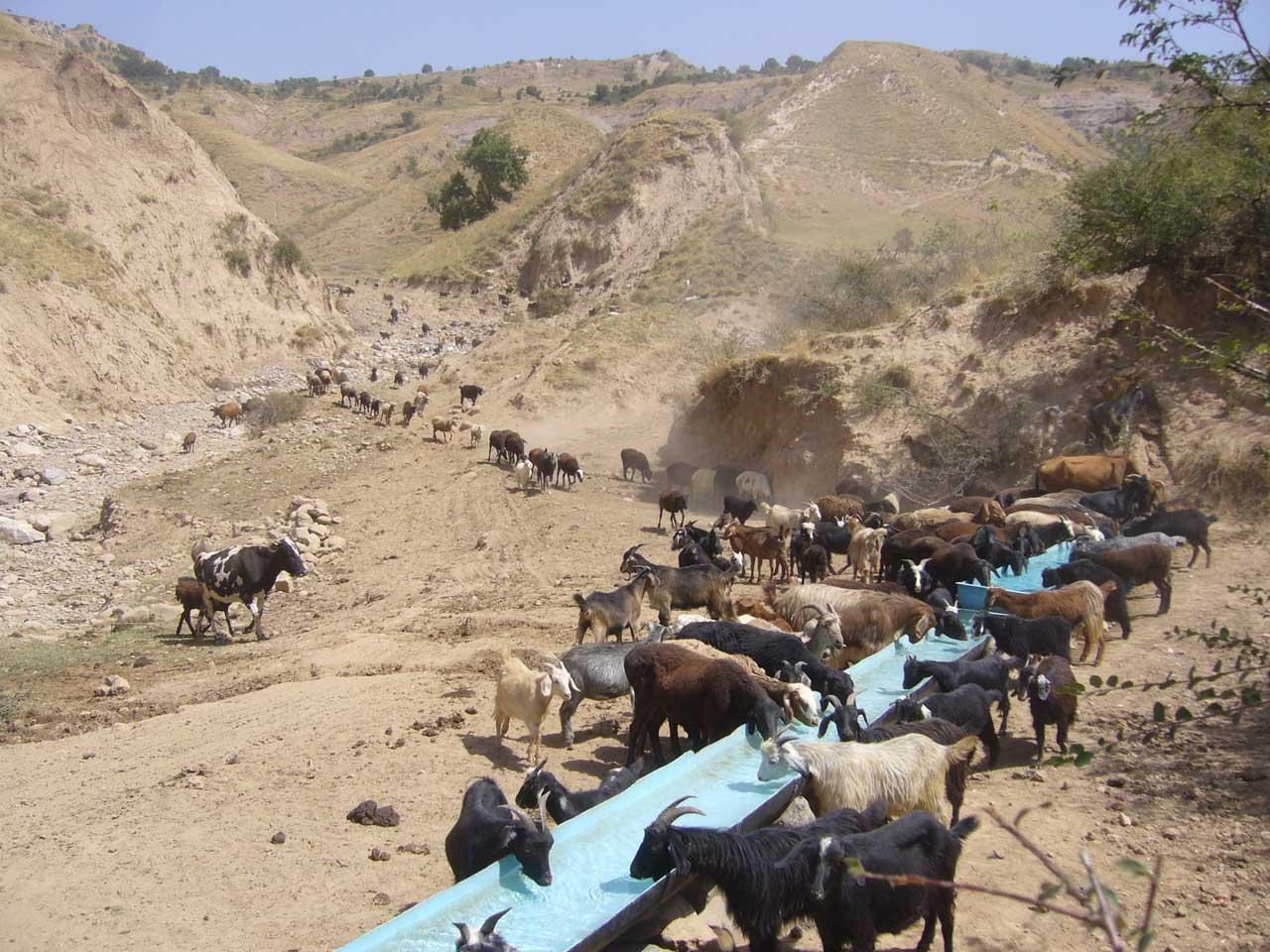
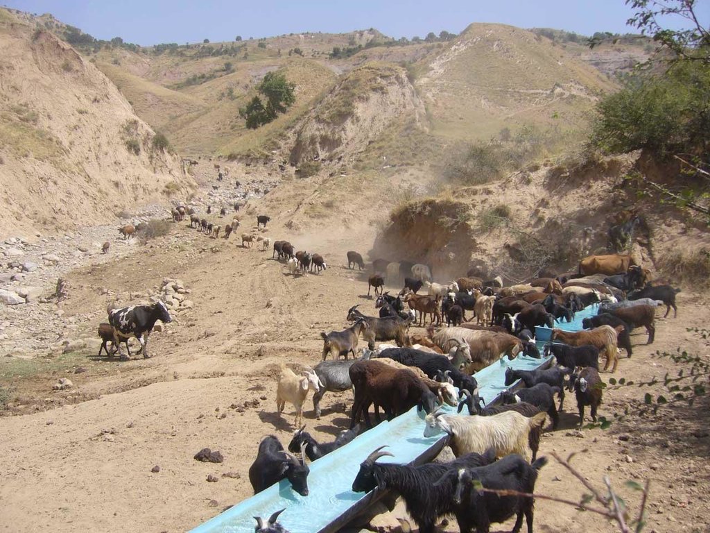
When in 2009 the project started in the two watersheds of Fayzabad and Gesh in Muminabad district, the communities had identified insufficient livestock water points in the pastures, and poor pasture management as top priorities concerning natural resource management in the watersheds. At that time, one of the biggest problems for livestock and herders was the difficult access to water when grazing the daily pastures above the villages. At lunch time, herds had to walk long distances (4-5 kilometers) and actually had to come back to the villages for drinking water. Climbing twice a day to the pasture costs the cattle a lot of energy leading to a yearly loss of up to 40-50 kg, according to a Caritas Switzerland study. One initial measure to improve the condition of the livestock was therefore to establish water points in the pastures. At first, water sources that supply water throughout the year were identified.
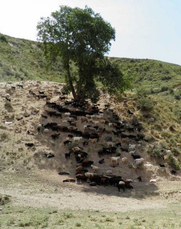
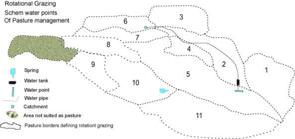
Purpose of the Technology: The water is now collected in a cement catchment, from where it is channelled through pipes to the drinking water points for animals. In some cases water tanks are placed above water points, to collect water and to distribute it to the water points. Additionally, rest places were found for the livestock, where they can have a rest in the shade after drinking water on hot summer days.
In conjunction to the establishment of water points, a rotational grazing scheme was introduced. The pasture land in the watershed was divided into ten parts and in each plot the animals were allowed to graze for five to eight days, assuring longer growing times for grass on specific pastures and thus increasing the quantity of grass and the quality of the pastures.
Establishment / maintenance activities and inputs: Livestock committees, consisting of five people, were organised. They took the lead in developing appropriate grazing schemes and discussing the location of the water points with the villagers. They are in charge of further maintenance of the water points, and the daily organisation of the rotational grazing. One of the five committee members is the shepherd. Every morning he accompanies the herd and checks the water points and the rest places. Once a month he collects one Somoni from each family to cover costs arising from this method of pasture management in the watershed.
Natural / human environment: The technology is implemented on pasture land where animal drinking water is readily available only in spring, and during the rest of the year the distances to water sources are long. Daily pastures in stony terrain with steep slopes and pastures situated higher up are difficult to reach. The livestock grazing on common grazing land are controlled by the head shepherd with the task of coordinating the different helpers and having overall responsibility for herding the livestock.
2.3 Photos of the Technology
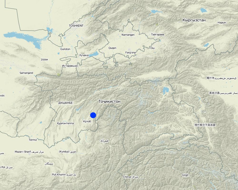
2.5 Country/ region/ locations where the Technology has been applied and which are covered by this assessment
Country:
Tajikistan
Region/ State/ Province:
Tajikistan, Khatlon
Further specification of location:
Muminabad
Map
×2.6 Date of implementation
If precise year is not known, indicate approximate date:
- less than 10 years ago (recently)
2.7 Introduction of the Technology
Specify how the Technology was introduced:
- through land users' innovation
3. Classification of the SLM Technology
3.1 Main purpose(s) of the Technology
- reduce, prevent, restore land degradation
3.2 Current land use type(s) where the Technology is applied

Grazing land
Extensive grazing land:
- Semi-nomadism/ pastoralism
- rotational grazing
Comments:
Major land use problems (compiler’s opinion): Animal trampling and little vegetation cover, wind erosion, water erosion.
Major land use problems (land users’ perception): Bad pastures, bad access to water points.
Semi-nomadism / pastoralism: rotational grazing
Grazingland comments: Healthy livestock go out to the summer pastures and cows that are used for milk stay in the village along with the sick animals.
Type of grazing system comments: Healthy livestock go out to the summer pastures and cows that are used for milk stay in the village along with the sick animals.
3.3 Further information about land use
Water supply for the land on which the Technology is applied:
- rainfed
Number of growing seasons per year:
- 1
Specify:
Longest growing period in days: 145Longest growing period from month to month: March-September
Livestock density (if relevant):
> 100 LU /km2
3.4 SLM group to which the Technology belongs
- pastoralism and grazing land management
- improved ground/ vegetation cover
3.5 Spread of the Technology
Specify the spread of the Technology:
- evenly spread over an area
If the Technology is evenly spread over an area, indicate approximate area covered:
- 100-1,000 km2
Comments:
Total area covered by the SLM Technology is 93.74 m2.
11 projects applied this technology, however, in the cost section of this case study costs are calculated for only one of these 11 projects (Faizabad watersheds)
3.6 SLM measures comprising the Technology

vegetative measures
- V1: Tree and shrub cover

management measures
- M2: Change of management/ intensity level
Comments:
Main measures: management measures
Secondary measures: vegetative measures
Type of vegetative measures: in blocks
3.7 Main types of land degradation addressed by the Technology

soil erosion by water
- Wt: loss of topsoil/ surface erosion

soil erosion by wind
- Et: loss of topsoil

chemical soil deterioration
- Cn: fertility decline and reduced organic matter content (not caused by erosion)

physical soil deterioration
- Pc: compaction

biological degradation
- Bc: reduction of vegetation cover

water degradation
- Ha: aridification
Comments:
Main type of degradation addressed: Wt: loss of topsoil / surface erosion, Et: loss of topsoil, Bc: reduction of vegetation cover
Secondary types of degradation addressed: Cn: fertility decline and reduced organic matter content, Pc: compaction, Ha: aridification
Main causes of degradation: overgrazing (bad management of pastures), population pressure (many animals in the pastures)
Secondary causes of degradation: inputs and infrastructure: (roads, markets, distribution of water points, other, …)
3.8 Prevention, reduction, or restoration of land degradation
Specify the goal of the Technology with regard to land degradation:
- prevent land degradation
Comments:
Main goals: prevention of land degradation
4. Technical specifications, implementation activities, inputs, and costs
4.1 Technical drawing of the Technology
4.2 Technical specifications/ explanations of technical drawing
Rotational grazing map for pasture management.
Location: Muminabad district. Muminabad, Khatlon, Tajikistan
Date: 2010-12-27
Technical knowledge required for field staff / advisors: high
Technical knowledge required for land users: moderate
Main technical functions: increase in organic matter, increase of infiltration
Secondary technical functions: improvement of ground cover
In blocks
Vegetative material: T : trees / shrubs
Number of plants per (ha): 200
Vertical interval within rows / strips / blocks (m): 5.00
Width within rows / strips / blocks (m): 6.00
Trees/ shrubs species: maple
Fruit trees / shrubs species: mulberry, wallnut
Slope (which determines the spacing indicated above): 80.00%
Change of land use practices / intensity level: from grazing land to rotational grazing land
Layout change according to natural and human environment: water points
4.3 General information regarding the calculation of inputs and costs
Specify currency used for cost calculations:
- US Dollars
Indicate average wage cost of hired labour per day:
6.00
4.4 Establishment activities
| Activity | Type of measure | Timing | |
|---|---|---|---|
| 1. | Planting trees to create rest places for livestock | Vegetative | spring |
| 2. | Planting trees to create rest places for livestock | Vegetative | |
| 3. | water points | Management | 2 months |
| 4. | construction of the pipeline from the spring to the water points | Management | 1 month |
| 5. | catchment device on the spring | Management | |
| 6. | catchment device on the spring | Management | |
| 7. | calculating carring capacity and number of days of grazing period on each plot | Management | |
| 8. | calculating carring capacity and number of days of grazing period on each plot | Management |
4.5 Costs and inputs needed for establishment
| Specify input | Unit | Quantity | Costs per Unit | Total costs per input | % of costs borne by land users | |
|---|---|---|---|---|---|---|
| Labour | Planting trees incl. seeds | Persons/day | 20.0 | 5.5 | 110.0 | 20.0 |
| Labour | Waterpoints construction labour | Persons/day | 160.0 | 5.5 | 880.0 | 100.0 |
| Labour | Pipeline Construction incl. Watertanks etc | pipeline | 1.0 | 6648.0 | 6648.0 | 30.0 |
| Equipment | Catchement device | device | 1.0 | 353.0 | 353.0 | 20.0 |
| Total costs for establishment of the Technology | 7991.0 | |||||
If land user bore less than 100% of costs, indicate who covered the remaining costs:
Caritas
4.6 Maintenance/ recurrent activities
| Activity | Type of measure | Timing/ frequency | |
|---|---|---|---|
| 1. | Protecting young trees with dead branches from thorny bushes | Vegetative | 2-3 years |
| 2. | Protecting young trees with dead branches from thorny bushes | Vegetative | |
| 3. | Watering of trees (done by sheperd) | Vegetative | 1-2 years |
| 4. | Watering of trees (done by sheperd) | Vegetative | |
| 5. | rotational grazing and checking the water catchment and distribution system (salary for shepherd) | Management | 8 months |
4.7 Costs and inputs needed for maintenance/ recurrent activities (per year)
| Specify input | Unit | Quantity | Costs per Unit | Total costs per input | % of costs borne by land users | |
|---|---|---|---|---|---|---|
| Labour | rotational grazing and checking the water catchment and distribution system | ha | 800.0 | 0.7975 | 638.0 | |
| Labour | Protecting young trees with dead branches from thorny bushes | Persons/day | 20.0 | 5.5 | 110.0 | |
| Total costs for maintenance of the Technology | 748.0 | |||||
Comments:
Machinery/ tools: spade, possible water tap, shovels, spades
The costs were calculated for infrastructure establishment, labour etc. applying to the whole area of 800 ha.
4.8 Most important factors affecting the costs
Describe the most determinate factors affecting the costs:
Distance to the water source, and the availability of high resolution satellite maps (the technology is cheaper if maps are available because the planning process gets facilitated).
5. Natural and human environment
5.1 Climate
Annual rainfall
- < 250 mm
- 251-500 mm
- 501-750 mm
- 751-1,000 mm
- 1,001-1,500 mm
- 1,501-2,000 mm
- 2,001-3,000 mm
- 3,001-4,000 mm
- > 4,000 mm
Agro-climatic zone
- sub-humid
Thermal climate class: temperate
5.2 Topography
Slopes on average:
- flat (0-2%)
- gentle (3-5%)
- moderate (6-10%)
- rolling (11-15%)
- hilly (16-30%)
- steep (31-60%)
- very steep (>60%)
Landforms:
- plateau/plains
- ridges
- mountain slopes
- hill slopes
- footslopes
- valley floors
Altitudinal zone:
- 0-100 m a.s.l.
- 101-500 m a.s.l.
- 501-1,000 m a.s.l.
- 1,001-1,500 m a.s.l.
- 1,501-2,000 m a.s.l.
- 2,001-2,500 m a.s.l.
- 2,501-3,000 m a.s.l.
- 3,001-4,000 m a.s.l.
- > 4,000 m a.s.l.
Comments and further specifications on topography:
Landforms occure also in ridges.
Slopes on average are also moderate sometimes.
5.3 Soils
Soil depth on average:
- very shallow (0-20 cm)
- shallow (21-50 cm)
- moderately deep (51-80 cm)
- deep (81-120 cm)
- very deep (> 120 cm)
Soil texture (topsoil):
- medium (loamy, silty)
Topsoil organic matter:
- high (>3%)
- medium (1-3%)
If available, attach full soil description or specify the available information, e.g. soil type, soil PH/ acidity, Cation Exchange Capacity, nitrogen, salinity etc.
Soil depth on average can somtimes be deep.
Soil fertility is low on spring pastures, medium where the animals are grazing and high on the top of the watershed.
Topsoil organic matter is on the top high and medium in the middle.
Soil drainage / infiltration is good on the top of the watershed and medium in the middle of the watershed.
Soil water storage capacity is high on the top, medium in the middle and very low on the bottom.
5.4 Water availability and quality
Ground water table:
5-50 m
Availability of surface water:
medium
Water quality (untreated):
good drinking water
Comments and further specifications on water quality and quantity:
Ground water table is everywhere 5-50 m
Water quality (untreated) is als sometime poor.
5.5 Biodiversity
Species diversity:
- medium
5.6 Characteristics of land users applying the Technology
Market orientation of production system:
- subsistence (self-supply)
Off-farm income:
- > 50% of all income
Relative level of wealth:
- very poor
- average
Individuals or groups:
- groups/ community
Gender:
- women
- men
Indicate other relevant characteristics of the land users:
Land users applying the Technology are mainly common / average land users
Difference in the involvement of women and men: The men do most of the work out in the fields, such as carrying water and walking to the fields.
Population density: < 10 persons/km2
Annual population growth: 1% - 2%
2% of the land users are poor.
Off-farm income specification: most families have remittances from Russia
5.7 Average area of land owned or leased by land users applying the Technology
- < 0.5 ha
- 0.5-1 ha
- 1-2 ha
- 2-5 ha
- 5-15 ha
- 15-50 ha
- 50-100 ha
- 100-500 ha
- 500-1,000 ha
- 1,000-10,000 ha
- > 10,000 ha
Is this considered small-, medium- or large-scale (referring to local context)?
- large-scale
Comments:
Common grazing land (500ha / 400 households)
5.8 Land ownership, land use rights, and water use rights
Land ownership:
- communal/ village
Land use rights:
- communal (organized)
Water use rights:
- communal (organized)
5.9 Access to services and infrastructure
health:
- poor
- moderate
- good
education:
- poor
- moderate
- good
technical assistance:
- poor
- moderate
- good
employment (e.g. off-farm):
- poor
- moderate
- good
markets:
- poor
- moderate
- good
energy:
- poor
- moderate
- good
roads and transport:
- poor
- moderate
- good
drinking water and sanitation:
- poor
- moderate
- good
financial services:
- poor
- moderate
- good
6. Impacts and concluding statements
6.1 On-site impacts the Technology has shown
Socio-economic impacts
Production
fodder production
Comments/ specify:
in the upper area more grass
fodder quality
Comments/ specify:
perenial plants
animal production
Comments/ specify:
milk, meat
Water availability and quality
drinking water availability
Comments/ specify:
No water available previously
drinking water quality
Comments/ specify:
No water available previously
irrigation water availability
Income and costs
expenses on agricultural inputs
Comments/ specify:
less money spent on vets
farm income
Comments/ specify:
more milk prduced
workload
Comments/ specify:
less walking for herders
Other socio-economic impacts
pasture area
Comments/ specify:
road to the new pastures
Water payments
Comments/ specify:
No payment previously
Socio-cultural impacts
cultural opportunities
community institutions
Comments/ specify:
livestock commitee have respect in the village
SLM/ land degradation knowledge
Comments/ specify:
villagers
conflict mitigation
Comments/ specify:
Previously a lot of conflict in this area, regular meeting have helped reduce these.
situation of socially and economically disadvantaged groups
Comments/ specify:
Empowerment of women and marginalised groups. Women are involved in the workshops
collaboration between different stakeholders
Comments/ specify:
watershed group in livestock committee in the village
Livelihood and human well-being
Ecological impacts
Water cycle/ runoff
water quantity
Comments/ specify:
water points
water quality
Comments/ specify:
filtering in the spring
surface runoff
evaporation
Soil
soil moisture
Comments/ specify:
more grass
soil cover
soil loss
Comments/ specify:
Cattle do not need to walk over soem areas
soil organic matter/ below ground C
Biodiversity: vegetation, animals
plant diversity
Comments/ specify:
due to better management
habitat diversity
Comments/ specify:
more plants
Climate and disaster risk reduction
emission of carbon and greenhouse gases
Comments/ specify:
grass
6.2 Off-site impacts the Technology has shown
downstream flooding
downstream siltation
wind transported sediments
damage on neighbours' fields
6.3 Exposure and sensitivity of the Technology to gradual climate change and climate-related extremes/ disasters (as perceived by land users)
Gradual climate change
Gradual climate change
| Season | Type of climatic change/ extreme | How does the Technology cope with it? | |
|---|---|---|---|
| annual temperature | increase | well |
Climate-related extremes (disasters)
Meteorological disasters
| How does the Technology cope with it? | |
|---|---|
| local rainstorm | well |
| local windstorm | well |
Climatological disasters
| How does the Technology cope with it? | |
|---|---|
| drought | well |
Hydrological disasters
| How does the Technology cope with it? | |
|---|---|
| general (river) flood | well |
Other climate-related consequences
Other climate-related consequences
| How does the Technology cope with it? | |
|---|---|
| reduced growing period | well |
Comments:
Increase in temperature --> install more water points
Increase or decrease in rainfall --> adapt the rotational grazing system
6.4 Cost-benefit analysis
How do the benefits compare with the establishment costs (from land users’ perspective)?
Short-term returns:
positive
Long-term returns:
positive
How do the benefits compare with the maintenance/ recurrent costs (from land users' perspective)?
Short-term returns:
positive
Long-term returns:
positive
6.5 Adoption of the Technology
- more than 50%
If available, quantify (no. of households and/ or area covered):
500 households in an area of 93.7 km^2 (10 persons/km^2)
Of all those who have adopted the Technology, how many have did so spontaneously, i.e. without receiving any material incentives/ payments?
- 10-50%
Comments:
80% of land user families have adopted the Technology with external material support
480 land user families have adopted the Technology with external material support
Comments on acceptance with external material support: nine other villages would like to adopt this technology
There is no trend towards spontaneous adoption of the Technology
6.7 Strengths/ advantages/ opportunities of the Technology
| Strengths/ advantages/ opportunities in the land user’s view |
|---|
|
More water points How can they be sustained / enhanced? Less risks for their animals |
| Strengths/ advantages/ opportunities in the compiler’s or other key resource person’s view |
|---|
| Rotational grazing to improve grass cover |
|
Better incomes for the farmer and at the same time pasture ressources are better managed How can they be sustained / enhanced? more meetings and workshops |
6.8 Weaknesses/ disadvantages/ risks of the Technology and ways of overcoming them
| Weaknesses/ disadvantages/ risks in the land user’s view | How can they be overcome? |
|---|---|
| difficult to work with maps | one day workshop |
| one person had to share their water with the rest of the village | organise meetings --> good communication, show the advantages to everybody |
| Weaknesses/ disadvantages/ risks in the compiler’s or other key resource person’s view | How can they be overcome? |
|---|---|
| One year for such a project is too short | project should be extended to 2-3 years as within three years the trees in the rest places will be well established |
| only one water point it is not enough to improve soil and water conservation | rotational grazing and rest places have to be implemented together with water points |
| young trees have to be protected | Using PET bottles or thorny bushes |
7. References and links
7.1 Methods/ sources of information
- field visits, field surveys
- interviews with land users
Links and modules
Expand all Collapse allLinks
No links
Modules
No modules


