Dedha grazing system as a natural resource management technology [Kenya]
- Creation:
- Update:
- Compiler: IBRAHIM JARSO
- Editor: –
- Reviewer: Rima Mekdaschi Studer
Jars Dedha
technologies_3403 - Kenya
- Full summary as PDF
- Full summary as PDF for print
- Full summary in the browser
- Full summary (unformatted)
- Dedha grazing system as a natural resource management technology: July 12, 2018 (inactive)
- Dedha grazing system as a natural resource management technology: May 8, 2019 (inactive)
- Dedha grazing system as a natural resource management technology: July 31, 2018 (inactive)
- Dedha grazing system as a natural resource management technology: Sept. 3, 2018 (inactive)
- Dedha grazing system as a natural resource management technology : May 13, 2018 (inactive)
- Dedha grazing system as a natural resource management technology: Nov. 2, 2021 (inactive)
- Dedha grazing system as a natural resource management technology: Nov. 2, 2021 (public)
- Dedha grazing system as a natural resource management technology : April 27, 2018 (inactive)
- Dedha grazing system as a natural resource management technology : April 27, 2018 (inactive)
- Dedha grazing system as a natural resource management technology : April 20, 2018 (inactive)
- Dedha grazing system as a natural resource management technology : March 19, 2018 (inactive)
View sections
Expand all Collapse all1. General information
1.2 Contact details of resource persons and institutions involved in the assessment and documentation of the Technology
Key resource person(s)
SLM specialist:
Name of project which facilitated the documentation/ evaluation of the Technology (if relevant)
Strengthening Adaptation and Resilience to Climate Change in Kenya Plus (StARCK+)1.3 Conditions regarding the use of data documented through WOCAT
When were the data compiled (in the field)?
17/11/2017
The compiler and key resource person(s) accept the conditions regarding the use of data documented through WOCAT:
Yes
1.4 Declaration on sustainability of the described Technology
Is the Technology described here problematic with regard to land degradation, so that it cannot be declared a sustainable land management technology?
No
Comments:
The technology is a sustainable land management practice that had been used for time immemorial by Boran pastoralists to manage land and land-based resources.
1.5 Reference to Questionnaire(s) on SLM Approaches
2. Description of the SLM Technology
2.1 Short description of the Technology
Definition of the Technology:
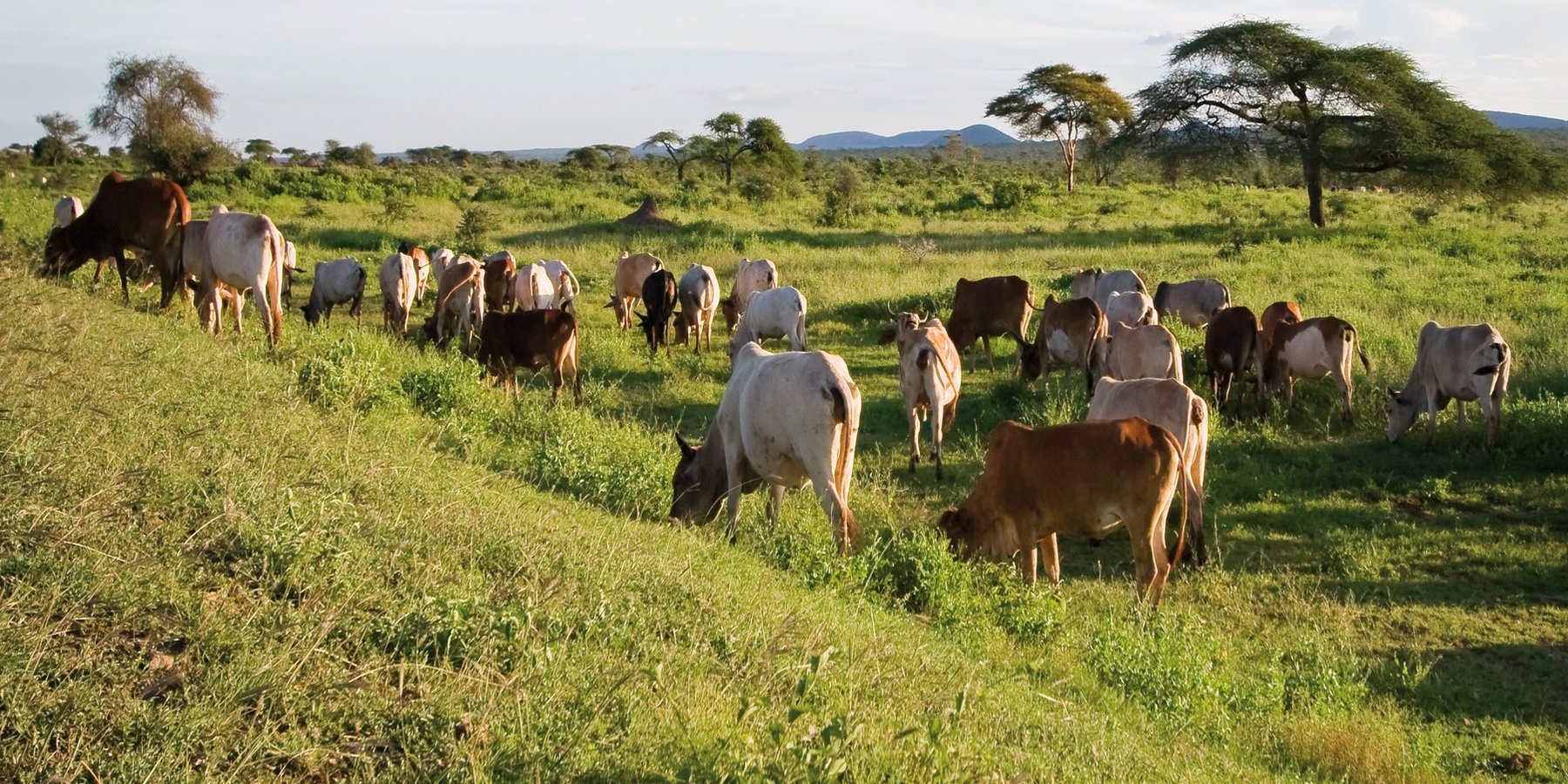
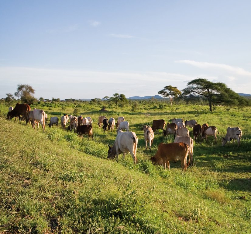
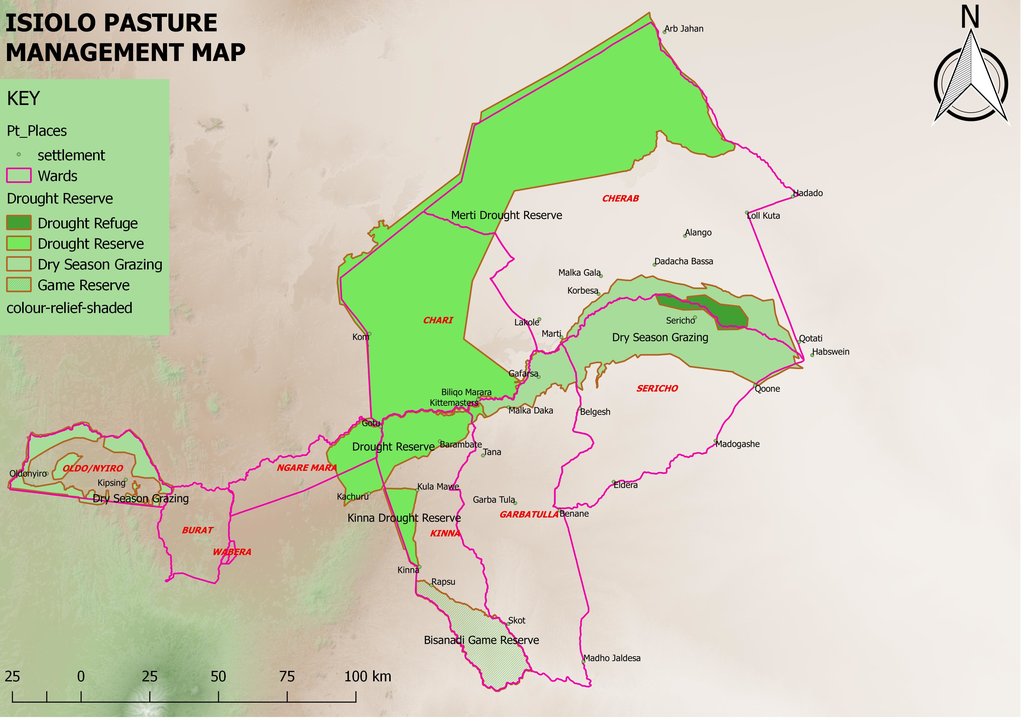
The Dedha grazing system is an ancient, traditional governance system for land and its resources practiced by Boran pastoralists. It carefully balances how pastoralists use rangeland resources. The basis of the technology is three grazing rangeland governance zones: wet season grazing, dry season grazing, and drought reserves. There is also water governance based on a traditional hierarchy of rights. Through this system, Boran pastoralists adapt to severe and recurrent droughts.
2.2 Detailed description of the Technology
Description:
This grazing system is applied in Isiolo County, Northern Kenya. The Waso rangelands are inhabited by Boran pastoralists with Somali, Samburu, Rendille and Turkana herders sharing cross-border resources through negotiation. The technology is based on the maintenance of a delicate balance between livestock numbers, the supply of water, and the amount/ quality of standing pasture within the vast grazing area which is water scarce and prone to extreme seasonal variations. Through its main tenet of governing grazing patterns (wet, dry season grazing area and drought reserve) planned use of pasture is decided in large pastoralists’ assemblies attended by elders from a particular “Dedha” (a grazing area, which administratively can be as big as two wards). This process is complicated by dry seasons and droughts of unknown length, with pressure from the community to open grazing reserves. Wrong decisions can spell the end of livelihoods for some families. An ability, which has been gradually eroded over time and by external factors which dont understand its enormous benefit but there is a project which is using an integrated approach to revive and empower this system.
The Jars a Dedha use water points to manage grazing. Different types of water sources need specific forms of management. The most intensive management occurs during droughts at deep wells and boreholes which require the most labour to operate and maintain, and are the most reliable sources of water. Due to the strategic importance of these resources, management falls to the Jarsa Dedha (council of elders). The use of shallow wells is tightly controlled by both the aba ella (the person who first dug it) and aba erega (the owner of the rotter ) working together. Aba ella is assigned first rights to water. If there is spare capacity then ‘second rights’ are decided by aba erega. Second rights would typically fall to those of a different clan, while ‘third rights’ might fall to a different ethnic group. The Borana customs and culture defines both access to certain wells but also the order of priority for watering animals.
In addition, in consultation with the Dedha council of elders, aba erega manages the use of dams and access to rivers. Generally, use of flowing river water is restricted to the dry season and access is limited to designated watering points. These are located some distance downriver from settlements to minimize disruption to inhabitants and to reduce contamination. Temporary water sources during and after the rains are not subject to control except when their use conflicts with restrictions on grazing areas. After watering their livestock, pastoralists traditionally fill their troughs for wildlife at night. This is intended to prevent wildlife from falling into wells - and to seek God’s blessings.
The high variability of rainfall in pastoral areas leads to similarly variable pasture availability. Therefore, management of grazing resources needs to balance maximizing productivity while ensuring survival. Long-term viability of the system depends on the maintenance of adaptive traits within local breeds, and both maintaining and managing resources strategically. Only within these broader goals is the concept of ‘maximizing productivity’ meaningful.
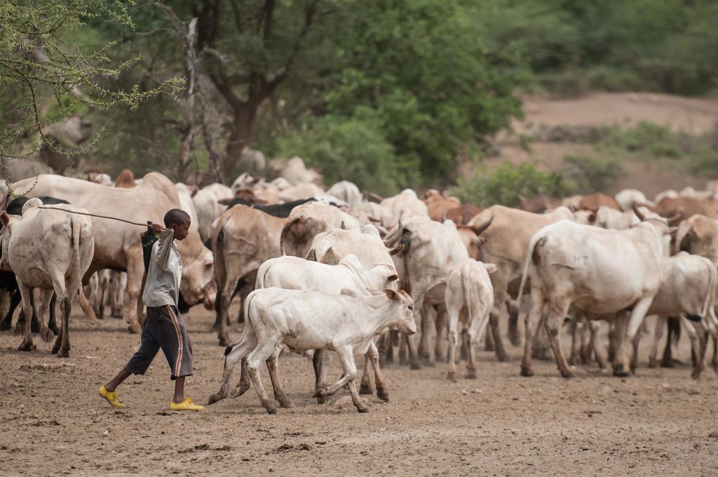
Mature livestock (gues) which are not lactating are moved to remote pastures. The gues, which make up the majority of community livestock, are herded by young unmarried men. By utilizing remote pastures, grazing resources closer to permanent water sources can be preserved for the dry season and droughts. Pasture within the vicinity of homesteads (maar qaae – literally ‘near grass’) is protected from grazing by non-lactating livestock (this is similar to kalo but a kalo reserve need not be next to the homestead ). This pasture is set aside for young animals (calves, lambs, and kids). Migrating livestock have predefined routes that maintain distance from maar qaae. The Dedha council of elders, therefore, controls settlement patterns to preserve key migratory routes. Movement of livestock between different Dedhas must be prearranged with the respective Dedha council of elders who assess spare capacity in terms of water and grazing.
The floodplain grazing area (chaafa) is crucial because it acts as a refuge for livestock during extreme drought. Grazing in chaafa is strictly prohibited during the wet season and one of the critical decisions for the Jarsa Dedha is when to open chaafa after rains have failed. Due to the relatively moist conditions in chaafa, there are additional challenges to animal and human health: namely trypanosomiasis, ticks, pneumonia, and malaria. Jarsa Dedha make decisions primarily concerning seasonal movements from wet to dry season grazing and also the opening of boreholes and chaafa. The overwhelming local consensus is that efficient resource use depends on the ability ofJarsa Dedha to enforce these regulations
2.3 Photos of the Technology
2.5 Country/ region/ locations where the Technology has been applied and which are covered by this assessment
Country:
Kenya
Region/ State/ Province:
Isiolo
Further specification of location:
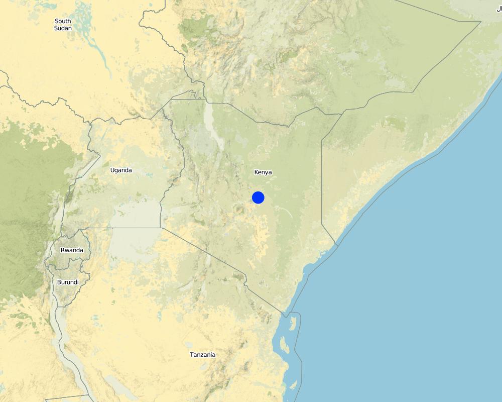
Kinna town, Kinna Ward, isiolo County
Comments:
Kinna Town, Kinna Ward, Garbatulla Sub County, Isiolo County
Map
×2.6 Date of implementation
If precise year is not known, indicate approximate date:
- more than 50 years ago (traditional)
2.7 Introduction of the Technology
Specify how the Technology was introduced:
- as part of a traditional system (> 50 years)
Comments (type of project, etc.):
It is inherited from generations before.
3. Classification of the SLM Technology
3.1 Main purpose(s) of the Technology
- reduce, prevent, restore land degradation
- conserve ecosystem
- protect a watershed/ downstream areas – in combination with other Technologies
- preserve/ improve biodiversity
- reduce risk of disasters
- adapt to climate change/ extremes and its impacts
- mitigate climate change and its impacts
- create beneficial economic impact
- create beneficial social impact
3.2 Current land use type(s) where the Technology is applied

Grazing land
Extensive grazing land:
- Nomadism
- Semi-nomadism/ pastoralism
Intensive grazing/ fodder production:
- Improved pastures
3.3 Further information about land use
Water supply for the land on which the Technology is applied:
- rainfed
Comments:
The pastoralists depend on attendant pasture after the rains which are bi-modal in Isiolo County (Long and Short rains).
Number of growing seasons per year:
- 2
Specify:
Grasses and shrubs which nourishes livestock grows during the rainy seasons
Livestock density (if relevant):
Isiolo county is endowed with a substantial livestock resource base that includes 198,500 cattle, 399,000 goats, 361,900 sheep and 39,100 camels
3.4 SLM group to which the Technology belongs
- pastoralism and grazing land management
3.5 Spread of the Technology
Specify the spread of the Technology:
- evenly spread over an area
If the Technology is evenly spread over an area, indicate approximate area covered:
- > 10,000 km2
Comments:
Isiolo County has area of 25,000Km2 but 80% of the area is used for Nomadic pastoralism.
3.6 SLM measures comprising the Technology

management measures
- M2: Change of management/ intensity level
- M3: Layout according to natural and human environment
- M4: Major change in timing of activities
3.7 Main types of land degradation addressed by the Technology

biological degradation
- Bc: reduction of vegetation cover
- Bh: loss of habitats
- Bf: detrimental effects of fires
- Bs: quality and species composition/ diversity decline

water degradation
- Ha: aridification
- Hs: change in quantity of surface water
- Hp: decline of surface water quality
- Hw: reduction of the buffering capacity of wetland areas
3.8 Prevention, reduction, or restoration of land degradation
Specify the goal of the Technology with regard to land degradation:
- prevent land degradation
- adapt to land degradation
4. Technical specifications, implementation activities, inputs, and costs
4.1 Technical drawing of the Technology
4.2 Technical specifications/ explanations of technical drawing
The technology is implemented in a vast area of rangelands in Isiolo County which covers around 20,000 km2 inhabited by Boran pastoralists under common management of Isiolo Jars Dedha (Council of elders). The rangelands are subdivided into around 14 arthas (localities) which are separately managed by artha elders and within which there are also ollas (homesteads) which the elders oversee. The elders manage key resources that are essential for pastoral livelihood. The resources are; prime pasture/grazing areas, water points e.g. streams, rivers, springs, shallow wells and pans, wildlife, forests, minerals, sand and other valuable stones e.g. gemstones (bojimine) and quarry, Trees and their products e.g. makuti, medicinal herbs, wild, fruits, resins, gum arabic.
4.3 General information regarding the calculation of inputs and costs
Specify how costs and inputs were calculated:
- per Technology area
Indicate size and area unit:
20,000km2
Indicate average wage cost of hired labour per day:
2,500 Kenya Shillings
4.4 Establishment activities
| Activity | Type of measure | Timing | |
|---|---|---|---|
| 1. | Dedha elders meetings | Management | All seasons |
| 2. | Surveillance of grazing areas | Management | Largely after the rains |
| 3. | Settling resource based disputes | Management | Largely during dry seasons and drought |
| 4. | Deciding on when to access reserved pasture lands | Vegetative | Dry seasons and drought reserves |
| 5. | Negotiations on access to pasture within and across borders | Vegetative | Drought and Long dry seasons |
4.6 Maintenance/ recurrent activities
| Activity | Type of measure | Timing/ frequency | |
|---|---|---|---|
| 1. | Meetings | Management | All seasons |
| 2. | Surveillance of grazing lands | Management | After the two rainy seasons |
4.8 Most important factors affecting the costs
Describe the most determinate factors affecting the costs:
This is a traditional technology of governing rangelands which was started and done voluntarily by the pastoralists. The costs considered are for subsistence of elders undertaking the meetings and discussions on range governance but the process still goes on even without the financial support as the actors involved do it for their own benefits.
5. Natural and human environment
5.1 Climate
Annual rainfall
- < 250 mm
- 251-500 mm
- 501-750 mm
- 751-1,000 mm
- 1,001-1,500 mm
- 1,501-2,000 mm
- 2,001-3,000 mm
- 3,001-4,000 mm
- > 4,000 mm
Specifications/ comments on rainfall:
The rains are bimodal (Long rains of March-April-May and Short rains of October-November-December). The rains are unpredictable, erratic and not evenly distributed but pastoralists move to take advantage of difference in pasture quality and quantity.
Indicate the name of the reference meteorological station considered:
Garbatulla automatic weather station
Agro-climatic zone
- semi-arid
- arid
5% of the area is Semi-arid and 95% is Arid.
5.2 Topography
Slopes on average:
- flat (0-2%)
- gentle (3-5%)
- moderate (6-10%)
- rolling (11-15%)
- hilly (16-30%)
- steep (31-60%)
- very steep (>60%)
Landforms:
- plateau/plains
- ridges
- mountain slopes
- hill slopes
- footslopes
- valley floors
Altitudinal zone:
- 0-100 m a.s.l.
- 101-500 m a.s.l.
- 501-1,000 m a.s.l.
- 1,001-1,500 m a.s.l.
- 1,501-2,000 m a.s.l.
- 2,001-2,500 m a.s.l.
- 2,501-3,000 m a.s.l.
- 3,001-4,000 m a.s.l.
- > 4,000 m a.s.l.
Indicate if the Technology is specifically applied in:
- not relevant
5.3 Soils
Soil depth on average:
- very shallow (0-20 cm)
- shallow (21-50 cm)
- moderately deep (51-80 cm)
- deep (81-120 cm)
- very deep (> 120 cm)
Soil texture (topsoil):
- coarse/ light (sandy)
- medium (loamy, silty)
Soil texture (> 20 cm below surface):
- coarse/ light (sandy)
- medium (loamy, silty)
Topsoil organic matter:
- medium (1-3%)
5.4 Water availability and quality
Ground water table:
> 50 m
Availability of surface water:
medium
Water quality (untreated):
good drinking water
Is water salinity a problem?
Yes
Specify:
Many boreholes dug in the area is saline
Is flooding of the area occurring?
Yes
Regularity:
episodically
Comments and further specifications on water quality and quantity:
The Ewaso Nyiro River floods every rainy seasons
5.5 Biodiversity
Species diversity:
- medium
Habitat diversity:
- medium
5.6 Characteristics of land users applying the Technology
Sedentary or nomadic:
- Semi-nomadic
- Nomadic
Market orientation of production system:
- subsistence (self-supply)
Off-farm income:
- less than 10% of all income
Relative level of wealth:
- very poor
- poor
Individuals or groups:
- individual/ household
- groups/ community
Level of mechanization:
- manual work
- animal traction
Gender:
- men
Age of land users:
- youth
- middle-aged
5.7 Average area of land owned or leased by land users applying the Technology
- < 0.5 ha
- 0.5-1 ha
- 1-2 ha
- 2-5 ha
- 5-15 ha
- 15-50 ha
- 50-100 ha
- 100-500 ha
- 500-1,000 ha
- 1,000-10,000 ha
- > 10,000 ha
Is this considered small-, medium- or large-scale (referring to local context)?
- large-scale
5.8 Land ownership, land use rights, and water use rights
Land ownership:
- communal/ village
Land use rights:
- communal (organized)
Water use rights:
- communal (organized)
5.9 Access to services and infrastructure
health:
- poor
- moderate
- good
education:
- poor
- moderate
- good
technical assistance:
- poor
- moderate
- good
employment (e.g. off-farm):
- poor
- moderate
- good
markets:
- poor
- moderate
- good
energy:
- poor
- moderate
- good
roads and transport:
- poor
- moderate
- good
drinking water and sanitation:
- poor
- moderate
- good
financial services:
- poor
- moderate
- good
6. Impacts and concluding statements
6.1 On-site impacts the Technology has shown
Socio-economic impacts
Production
animal production
Quantity before SLM:
0
Quantity after SLM:
2
land management
Quantity before SLM:
0
Quantity after SLM:
2
Water availability and quality
drinking water availability
Quantity before SLM:
0
Quantity after SLM:
1
water availability for livestock
Quantity before SLM:
0
Quantity after SLM:
2
Ecological impacts
Water cycle/ runoff
water quantity
Quantity before SLM:
0
Quantity after SLM:
2
harvesting/ collection of water
Quantity before SLM:
0
Quantity after SLM:
2
Biodiversity: vegetation, animals
Vegetation cover
Quantity before SLM:
0
Quantity after SLM:
2
invasive alien species
Quantity before SLM:
0
Quantity after SLM:
1
habitat diversity
Quantity before SLM:
0
Quantity after SLM:
2
Climate and disaster risk reduction
drought impacts
Quantity before SLM:
-2
Quantity after SLM:
2
micro-climate
Quantity before SLM:
0
Quantity after SLM:
2
6.2 Off-site impacts the Technology has shown
water availability
Quantity before SLM:
0
Quantity after SLM:
2
reliable and stable stream flows in dry season
Quantity before SLM:
0
Quantity after SLM:
2
6.3 Exposure and sensitivity of the Technology to gradual climate change and climate-related extremes/ disasters (as perceived by land users)
Gradual climate change
Gradual climate change
| Season | Type of climatic change/ extreme | How does the Technology cope with it? | |
|---|---|---|---|
| seasonal temperature | dry season | increase | very well |
| seasonal rainfall | dry season | decrease | very well |
Climate-related extremes (disasters)
Climatological disasters
| How does the Technology cope with it? | |
|---|---|
| drought | very well |
| land fire | well |
Hydrological disasters
| How does the Technology cope with it? | |
|---|---|
| general (river) flood | well |
| flash flood | moderately |
Biological disasters
| How does the Technology cope with it? | |
|---|---|
| epidemic diseases | moderately |
Other climate-related consequences
Other climate-related consequences
| How does the Technology cope with it? | |
|---|---|
| reduced growing period | very well |
6.4 Cost-benefit analysis
How do the benefits compare with the establishment costs (from land users’ perspective)?
Short-term returns:
slightly positive
Long-term returns:
positive
How do the benefits compare with the maintenance/ recurrent costs (from land users' perspective)?
Short-term returns:
slightly positive
Long-term returns:
slightly positive
6.5 Adoption of the Technology
- more than 50%
If available, quantify (no. of households and/ or area covered):
80% of Isiolo County (Around 24,500 Households)
Of all those who have adopted the Technology, how many have did so spontaneously, i.e. without receiving any material incentives/ payments?
- 90-100%
6.6 Adaptation
Has the Technology been modified recently to adapt to changing conditions?
Yes
If yes, indicate to which changing conditions it was adapted:
- climatic change/ extremes
Specify adaptation of the Technology (design, material/ species, etc.):
The grazing patterns were made more flexible and the rules made stricter.
6.7 Strengths/ advantages/ opportunities of the Technology
| Strengths/ advantages/ opportunities in the land user’s view |
|---|
| It is the cheapest and easiest way of managing the rangelands for now and for posterity. |
| It provides room for flexibility of decision making as seasonal variations occur. |
| Strengths/ advantages/ opportunities in the compiler’s or other key resource person’s view |
|---|
| It is conservative and less costly to implement in the vast rangelands with few incentives. |
| It is a legitimate system recognized by all pastoralist for management of their rangeland resources. |
| It can easily be adapted to govern any pastoral rangelands all over the world (Universal). |
6.8 Weaknesses/ disadvantages/ risks of the Technology and ways of overcoming them
| Weaknesses/ disadvantages/ risks in the land user’s view | How can they be overcome? |
|---|---|
| There is no law protecting it. | Government needs to establish a law that recognizes and protects this technology. |
| Rich pastoralists can forego local rules and corrupt the systems overseeing the grazing plans. | Ensuring accountability for decisions made. |
| Weaknesses/ disadvantages/ risks in the compiler’s or other key resource person’s view | How can they be overcome? |
|---|---|
| Cross-border pastoralists are not aware of the Technology and tend to undermine it. | Improve awareness of the technology among the cross-border pastoralists that also access Isiolo rangelands. |
7. References and links
7.1 Methods/ sources of information
- field visits, field surveys
2
- interviews with land users
6
- compilation from reports and other existing documentation
2
7.3 Links to relevant information which is available online
Title/ description:
Evolving customary institutions by patison and tari
URL:
pubs.iied.org/pdfs/10076IIED.pdf
Title/ description:
Strengthening Customary institutions the case of Isiolo County Northern Kenya by Caroline, Tari and Jarso
URL:
www.celep.info/wp-content/uploads/2015/11/Strengthening-local-institutions.pdf
Links and modules
Expand all Collapse allLinks
No links
Modules
No modules


