Rangelands resting [Tunisia]
- Creation:
- Update:
- Compiler: Mongi Ben Zaied
- Editor: –
- Reviewer: Deborah Niggli
G'del (Arabic)
technologies_1399 - Tunisia
View sections
Expand all Collapse all1. General information
1.2 Contact details of resource persons and institutions involved in the assessment and documentation of the Technology
Key resource person(s)
SLM specialist:
Sghaier Mongi
+216 75 633 005
Institut des Régions Arides IRA
4119 - medenine north tunisia
Tunisia
SLM specialist:
SLM specialist:
Khatteli Houcine
+216 75 633 005
Institut des Régions Arides IRA
4119 - medenine north tunisia
Tunisia
SLM specialist:
Mliki Salem
Office de l'elevage et des pâturages - OEP
30 Avenue Alain Savary, Tunis
Tunisia
Name of project which facilitated the documentation/ evaluation of the Technology (if relevant)
DESIRE (EU-DES!RE)Name of the institution(s) which facilitated the documentation/ evaluation of the Technology (if relevant)
Institut des Régions Arides de Médenine (Institut des Régions Arides de Médenine) - TunisiaName of the institution(s) which facilitated the documentation/ evaluation of the Technology (if relevant)
Office de l'élevage et des paturages (OEP) - Tunisia1.3 Conditions regarding the use of data documented through WOCAT
When were the data compiled (in the field)?
23/06/2011
The compiler and key resource person(s) accept the conditions regarding the use of data documented through WOCAT:
Yes
2. Description of the SLM Technology
2.1 Short description of the Technology
Definition of the Technology:
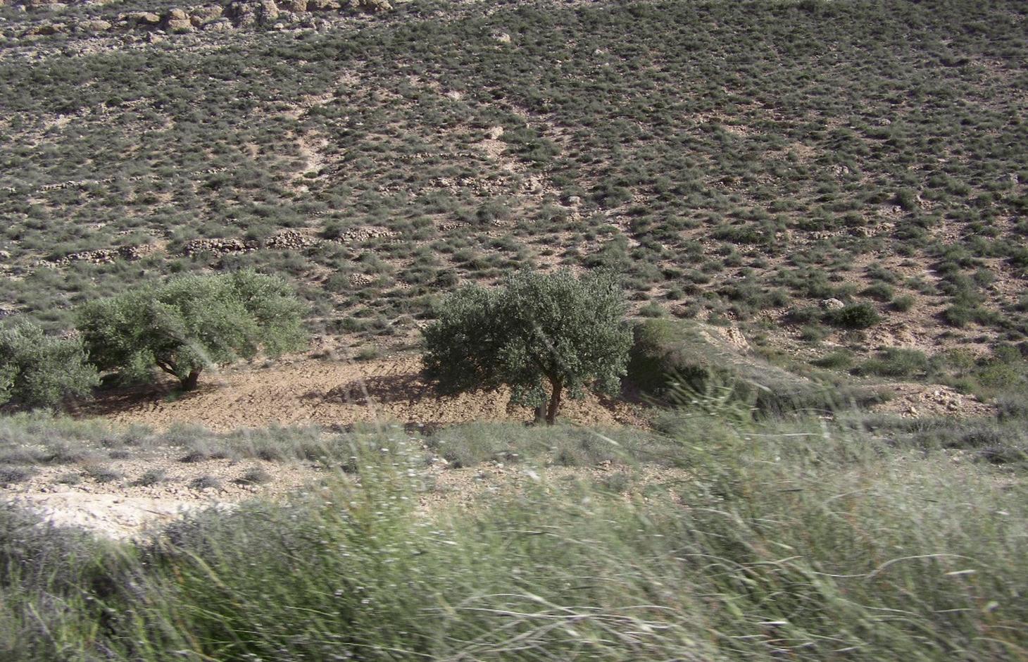
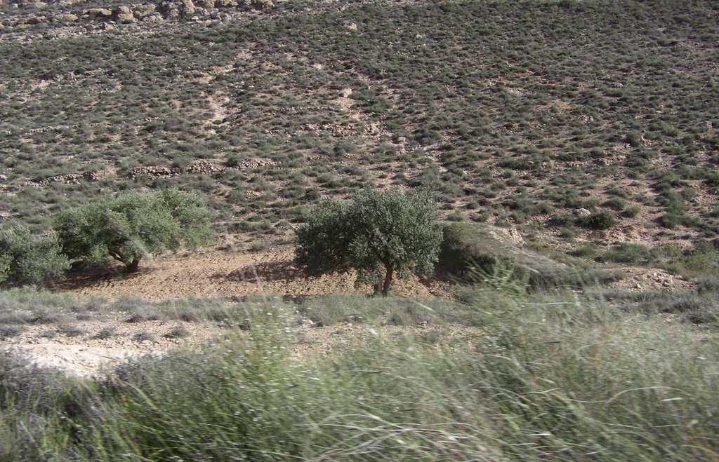
This technique is based on the principle of leaving the rangeland protected (by excluding grazing during 2-3 years) to allow the plant cover to recover.
2.2 Detailed description of the Technology
Description:
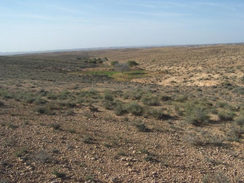
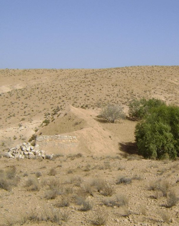
To tackle degradation and the negative effects of drought on rangelands, leaving the rangeland protected for rehabilitation is one of the common practices used for many decades by local people in arid areas of Tunisia. This technique is based on the principle of not allowing grazing for a period and thus resting the rangeland so that the plant cover can recover. The grazing-free period lasts commonly from 2 to 3 years depending on the ecosystem resilience (its capacity to recover) and climatic conditions. Owing to the high cost of fencing, an agreement between the administration and users is achieved regarding the boundaries (generally making use of natural ones such as a mountain chain, wadi, etc.). Users are totally committed to respect the protection of the site during the fixed period. In return, they receive a subsidy to compensate for the loss of production during this period. It is estimated at a quantity of barley equivalent to 70 US $ per hectare per year.
Purpose of the Technology: Applied in several types of improved land managements (rangeland improvement, dunes stabilization, national parks, etc.), this technique gives good results in terms of regeneration of vegetation in arid and even desert areas of Tunisia. However, the effectiveness of this technique varies according to several factors which determine the potential for regeneration of the treated area (rainfall, soil properties, level of degradation reached, etc.).
Establishment / maintenance activities and inputs: The resting period is recommended even in heavily overgrazed sites, but only if the vegetation still has its resilience capacity (indicated by the presence of some remnants of key and good range species) so that regeneration is possible. To have a fast, substantial and convincing impact, this technique should be applied in those rangelands that still contain relics of good pastoral species and where soil is more or less covered by sediments which allow good infiltration. These wind deposits are used as seed bed and act as mulch. In situations of extreme degradation, there is no point in applying this technique, since in these situations the soil seed stocks are often lacking and/or the soil has reached a very degraded and shallow state.
2.3 Photos of the Technology
2.5 Country/ region/ locations where the Technology has been applied and which are covered by this assessment
Country:
Tunisia
Region/ State/ Province:
Medenine
Further specification of location:
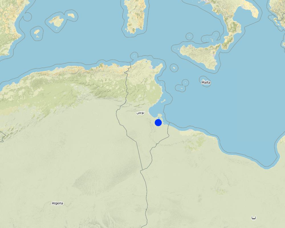
Béni Khédache - El Athmane
Map
×2.6 Date of implementation
If precise year is not known, indicate approximate date:
- more than 50 years ago (traditional)
2.7 Introduction of the Technology
Specify how the Technology was introduced:
- as part of a traditional system (> 50 years)
Comments (type of project, etc.):
The national strategy for rangeland improvement started in 1990.
3. Classification of the SLM Technology
3.2 Current land use type(s) where the Technology is applied

Grazing land
Extensive grazing land:
- Semi-nomadism/ pastoralism
Main animal species and products:
Main animal species: Goat and sheep
Comments:
Major land use problems (compiler’s opinion): degradation of plant cover, loss of plant diversity (mainly perennial species), abundance of unpalatable species, soil erosion.
Major land use problems (land users’ perception): low potential of rangelands, increase in feed costs,
Semi-nomadism / pastoralism: goat and sheep
3.3 Further information about land use
Water supply for the land on which the Technology is applied:
- rainfed
Number of growing seasons per year:
- 1
Specify:
Longest growing period in days: 240Longest growing period from month to month: Oct - May
Livestock density (if relevant):
> 100 LU /km2
3.4 SLM group to which the Technology belongs
- area closure (stop use, support restoration)
- rotational systems (crop rotation, fallows, shifting cultivation)
3.5 Spread of the Technology
Specify the spread of the Technology:
- evenly spread over an area
If the Technology is evenly spread over an area, indicate approximate area covered:
- 1-10 km2
3.6 SLM measures comprising the Technology

management measures
- M2: Change of management/ intensity level
Comments:
Main measures: management measures
3.7 Main types of land degradation addressed by the Technology

soil erosion by water
- Wt: loss of topsoil/ surface erosion

soil erosion by wind
- Et: loss of topsoil

biological degradation
- Bc: reduction of vegetation cover
- Bh: loss of habitats
- Bq: quantity/ biomass decline
- Bs: quality and species composition/ diversity decline
Comments:
Main type of degradation addressed: Bs: quality and species composition /diversity decline
Secondary types of degradation addressed: Wt: loss of topsoil / surface erosion, Et: loss of topsoil, Bc: reduction of vegetation cover, Bh: loss of habitats, Bq: quantity / biomass decline
Main causes of degradation: overgrazing (Free continous grazing), other human induced causes (specify) (tree and cereal crop expansion, fuel wood collection)
3.8 Prevention, reduction, or restoration of land degradation
Specify the goal of the Technology with regard to land degradation:
- prevent land degradation
- reduce land degradation
Comments:
Main goals: mitigation / reduction of land degradation
Secondary goals: prevention of land degradation
4. Technical specifications, implementation activities, inputs, and costs
4.1 Technical drawing of the Technology
4.2 Technical specifications/ explanations of technical drawing
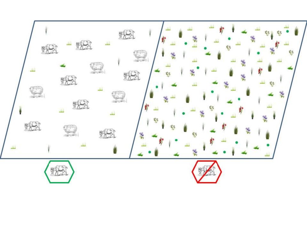
Overgrazed (left) and rested (right) rangelands
Date: 2011
Technical knowledge required for field staff / advisors: moderate
Technical knowledge required for land users: moderate
Main technical functions: improvement of ground cover
Secondary technical functions: control of dispersed runoff: impede / retard, increase in organic matter, increase of infiltration, increase of biomass (quantity), Increase of species richness (quality)
Major change in timing of activities: from herding to fencing (rotational grazing)
Control / change of species composition: rangeland resting
Other type of management: supplementary feeding resources
4.3 General information regarding the calculation of inputs and costs
other/ national currency (specify):
TND
Indicate exchange rate from USD to local currency (if relevant): 1 USD =:
1.3
Indicate average wage cost of hired labour per day:
10.00
4.4 Establishment activities
| Activity | Type of measure | Timing | |
|---|---|---|---|
| 1. | Agreement between the rangelands users and the National office of livestock and pasture (OEP) | Management | |
| 2. | Identification and delimitation of the rangelands to be left fallow. | Management |
4.5 Costs and inputs needed for establishment
| Specify input | Unit | Quantity | Costs per Unit | Total costs per input | % of costs borne by land users | |
|---|---|---|---|---|---|---|
| Other | delimitation rested rangelands | ha | 1.0 | 50.0 | 50.0 | 50.0 |
| Other | subsidies (animal feed barely) | ha | 1.0 | 30.0 | 30.0 | 100.0 |
| Total costs for establishment of the Technology | 80.0 | |||||
4.6 Maintenance/ recurrent activities
| Activity | Type of measure | Timing/ frequency | |
|---|---|---|---|
| 1. | Provide subsidies for the owners | Management | Annually |
| 2. | The owner has to guard the rested rangelands (otherwise subsidies can be suspended). | Management | |
| 3. | The owner has to guard the rested rangelands (otherwise subsidies can be suspended). | Management | Annually |
4.7 Costs and inputs needed for maintenance/ recurrent activities (per year)
| Specify input | Unit | Quantity | Costs per Unit | Total costs per input | % of costs borne by land users | |
|---|---|---|---|---|---|---|
| Other | subsidies (animal feed barely) | ha | 1.0 | 70.0 | 70.0 | 100.0 |
| Total costs for maintenance of the Technology | 70.0 | |||||
Comments:
The subsidies (barely) are fully provided by the government in the framework of the national strategy.
5. Natural and human environment
5.1 Climate
Annual rainfall
- < 250 mm
- 251-500 mm
- 501-750 mm
- 751-1,000 mm
- 1,001-1,500 mm
- 1,501-2,000 mm
- 2,001-3,000 mm
- 3,001-4,000 mm
- > 4,000 mm
Specifications/ comments on rainfall:
6 months of dry period
Agro-climatic zone
- arid
Thermal climate class: subtropics
5.2 Topography
Slopes on average:
- flat (0-2%)
- gentle (3-5%)
- moderate (6-10%)
- rolling (11-15%)
- hilly (16-30%)
- steep (31-60%)
- very steep (>60%)
Landforms:
- plateau/plains
- ridges
- mountain slopes
- hill slopes
- footslopes
- valley floors
Altitudinal zone:
- 0-100 m a.s.l.
- 101-500 m a.s.l.
- 501-1,000 m a.s.l.
- 1,001-1,500 m a.s.l.
- 1,501-2,000 m a.s.l.
- 2,001-2,500 m a.s.l.
- 2,501-3,000 m a.s.l.
- 3,001-4,000 m a.s.l.
- > 4,000 m a.s.l.
Comments and further specifications on topography:
Altitudinal zones: 101-500 m a.s.l. (Dahar plateau rangelands)
5.3 Soils
Soil depth on average:
- very shallow (0-20 cm)
- shallow (21-50 cm)
- moderately deep (51-80 cm)
- deep (81-120 cm)
- very deep (> 120 cm)
Soil texture (topsoil):
- coarse/ light (sandy)
- medium (loamy, silty)
Topsoil organic matter:
- low (<1%)
If available, attach full soil description or specify the available information, e.g. soil type, soil PH/ acidity, Cation Exchange Capacity, nitrogen, salinity etc.
Soil fertility is: very low
Soil drainage / infiltration is: medium
Soil water storage is: low
5.4 Water availability and quality
Ground water table:
> 50 m
Availability of surface water:
poor/ none
Water quality (untreated):
poor drinking water (treatment required)
Comments and further specifications on water quality and quantity:
Availability of surface water: Poor/none (surface water is limited by rainfall) or medium (in the mountain area)
5.5 Biodiversity
Species diversity:
- medium
Comments and further specifications on biodiversity:
Biodiversity is medium in the mountain areas and low in the others
5.6 Characteristics of land users applying the Technology
Market orientation of production system:
- mixed (subsistence/ commercial
Off-farm income:
- > 50% of all income
Relative level of wealth:
- poor
- average
Individuals or groups:
- individual/ household
Gender:
- men
Indicate other relevant characteristics of the land users:
Land users applying the Technology are mainly common / average land users
Difference in the involvement of women and men: Genrally, the outside house work is performed by men.
Population density: < 10 persons/km2
Annual population growth: < 0.5%
10% of the land users are rich and own 20% of the land.
70% of the land users are average wealthy and own 60% of the land.
20% of the land users are poor and own 20% of the land.
Off-farm income specification: Off-farm incomes come from migration, construction works, commerce, tourism sector, administration or informal activities.
5.7 Average area of land owned or leased by land users applying the Technology
- < 0.5 ha
- 0.5-1 ha
- 1-2 ha
- 2-5 ha
- 5-15 ha
- 15-50 ha
- 50-100 ha
- 100-500 ha
- 500-1,000 ha
- 1,000-10,000 ha
- > 10,000 ha
Is this considered small-, medium- or large-scale (referring to local context)?
- small-scale
5.8 Land ownership, land use rights, and water use rights
Land ownership:
- communal/ village
- individual, titled
Land use rights:
- communal (organized)
- individual
Water use rights:
- communal (organized)
- individual
5.9 Access to services and infrastructure
health:
- poor
- moderate
- good
education:
- poor
- moderate
- good
technical assistance:
- poor
- moderate
- good
employment (e.g. off-farm):
- poor
- moderate
- good
markets:
- poor
- moderate
- good
energy:
- poor
- moderate
- good
roads and transport:
- poor
- moderate
- good
drinking water and sanitation:
- poor
- moderate
- good
financial services:
- poor
- moderate
- good
6. Impacts and concluding statements
6.1 On-site impacts the Technology has shown
Socio-economic impacts
Production
fodder production
fodder quality
animal production
production area
Income and costs
farm income
Socio-cultural impacts
food security/ self-sufficiency
national institutions
SLM/ land degradation knowledge
conflict mitigation
Improved livelihoods and human well-being
Comments/ specify:
Combat the rural exodus and improve the income of agriculture (20%)
Ecological impacts
Soil
soil cover
soil loss
soil organic matter/ below ground C
Biodiversity: vegetation, animals
biomass/ above ground C
plant diversity
pest/ disease control
Comments/ specify:
increased niches for pests : negligible (0-5%)
6.2 Off-site impacts the Technology has shown
downstream flooding
wind transported sediments
damage on public/ private infrastructure
6.3 Exposure and sensitivity of the Technology to gradual climate change and climate-related extremes/ disasters (as perceived by land users)
Climate-related extremes (disasters)
Meteorological disasters
| How does the Technology cope with it? | |
|---|---|
| local windstorm | well |
Climatological disasters
| How does the Technology cope with it? | |
|---|---|
| drought | well |
Hydrological disasters
| How does the Technology cope with it? | |
|---|---|
| general (river) flood | well |
Comments:
Without human disturbance, natural vegetation is well adapted to drought.
6.4 Cost-benefit analysis
How do the benefits compare with the establishment costs (from land users’ perspective)?
Short-term returns:
positive
Long-term returns:
very positive
How do the benefits compare with the maintenance/ recurrent costs (from land users' perspective)?
Short-term returns:
positive
Long-term returns:
very positive
6.5 Adoption of the Technology
Of all those who have adopted the Technology, how many have did so spontaneously, i.e. without receiving any material incentives/ payments?
- 0-10%
Comments:
98% of land user families have adopted the Technology with external material support
2% of land user families have adopted the Technology without any external material support
There is a moderate trend towards spontaneous adoption of the Technology
6.7 Strengths/ advantages/ opportunities of the Technology
| Strengths/ advantages/ opportunities in the land user’s view |
|---|
|
Reduce the costs of supplementation of livestock How can they be sustained / enhanced? subsidies of the goverment |
| Strengths/ advantages/ opportunities in the compiler’s or other key resource person’s view |
|---|
|
Traditional technology - not expensive How can they be sustained / enhanced? by the participation of the land user's |
6.8 Weaknesses/ disadvantages/ risks of the Technology and ways of overcoming them
| Weaknesses/ disadvantages/ risks in the land user’s view | How can they be overcome? |
|---|---|
| Limitation of the grazing area | subsidies from the government and/or reduce animal numbers. |
| Weaknesses/ disadvantages/ risks in the compiler’s or other key resource person’s view | How can they be overcome? |
|---|---|
| Heavily based on government subsidies | alternative feed, rangeland seeding, etc. |
7. References and links
7.2 References to available publications
Title, author, year, ISBN:
Ouled Belgacem A., Papanastasis V. 1995. Impact of Grazing practices on rangeland vegetation of western Crete. Cah. Options Méditerr. ISSN: 1022-1379. vol.12: 209-212
Available from where? Costs?
IRA , CIHEAM
Title, author, year, ISBN:
Ouled Belgacem A., Chaieb M., Neffati M., Tiedeman J. 2006. Response of Stipa lagascae R. & Sch. to protection under arid condition of southern Tunisia. Pakistan Journal of Biological Science. 9(3):465-469.
Available from where? Costs?
IRA
Title, author, year, ISBN:
Ouled Belgacem, A., Ben Salem H., Bouaicha A., El Mourid Mohamed. 2008. Communal rangeland rest in arid area, a tool for facing animal feed costs and drought mitigation: the case of Chenini community, southern Tunisia. J. Bio. Sc., 8(4): 822-825.
Available from where? Costs?
IRA
Title, author, year, ISBN:
Ouled Belgacem A., Zaafouri M.S. 1996. Impact de la privatisation des terres de parcours collectives sur la végétation pastorale en zones désertiques Tunisienne. Option Médit. Serie A: Séminaires Méditerranéens, n° 32: 213-217.
Available from where? Costs?
IRA, CIHEAM
Links and modules
Expand all Collapse allLinks
No links
Modules
No modules


