Ngitili Dry-Season Fodder Reserves [Tanzania, United Republic of]
- Creation:
- Update:
- Compiler: Unknown User
- Editor: –
- Reviewers: David Streiff, Deborah Niggli
Ngitili
technologies_1351 - Tanzania, United Republic of
View sections
Expand all Collapse all1. General information
1.2 Contact details of resource persons and institutions involved in the assessment and documentation of the Technology
Key resource person(s)
SLM specialist:
Barrow Edmund
Name of project which facilitated the documentation/ evaluation of the Technology (if relevant)
Book project: SLM in Practice - Guidelines and Best Practices for Sub-Saharan Africa (SLM in Practice)1.3 Conditions regarding the use of data documented through WOCAT
The compiler and key resource person(s) accept the conditions regarding the use of data documented through WOCAT:
Yes
2. Description of the SLM Technology
2.1 Short description of the Technology
Definition of the Technology:
Ngitili are traditional enclosures for in-situ conservation and rehabilitation of vegetation, practiced by the Wasukuma agropastoralists in Shinyanga, Tanzania.
2.2 Detailed description of the Technology
Description:
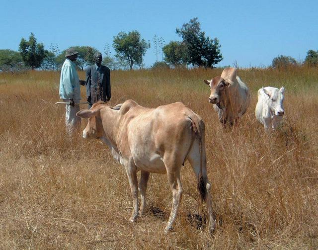
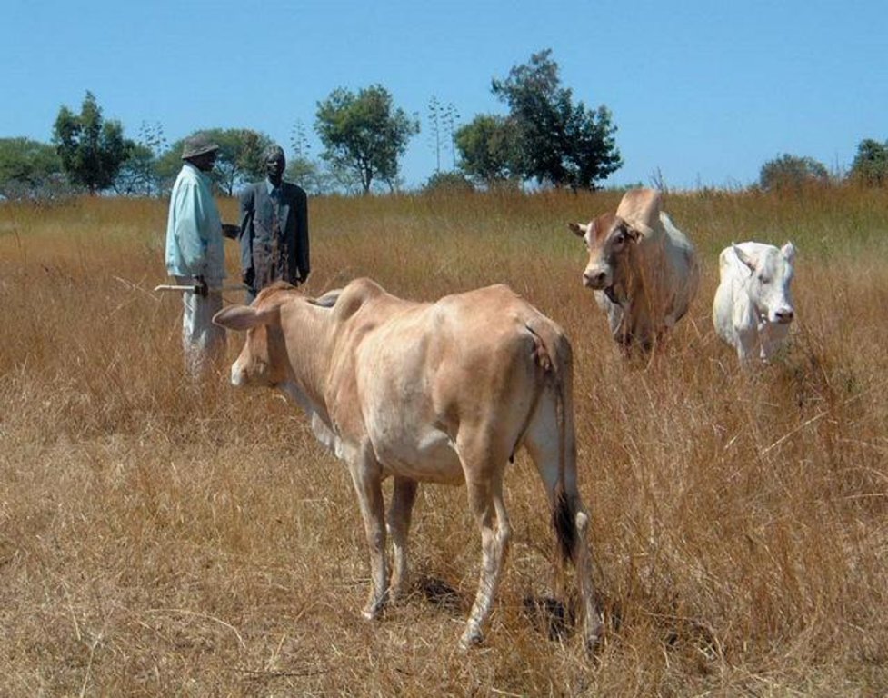
Shinyanga is a semiarid area characterized by shortage of fodder associated with problems of deforestation, fuelwood scarcity, food insecurity, declining soil fertility, severe soil erosion and unsecure land use rights. Ngitili is a dry-season fodder reserve, an indigenous practice which has been revived by a government programme from 1986-2001. For initial regeneration of the vegetation and rehabilitation of denuded land absolute exclusion of up to 5 years is needed. Then, areas of standing vegetation are enclosed seasonally from the onset of the rainy season till the peak / end of dry season, before they are opened up for grazing. Two distinct vegetation strata are identifiable, an upper stratum dominated by trees and shrubs (Acacia tortilis, A. nilotica, A. polyacantha and A. seyal) and a lower stratum of grasses, herbs and forbs. Structure and composition of the ngitili areas are closely influenced by location, age, management practices and intensity of use. The reserves are established on degraded land and around homesteads. Individual plots usually reach 2-5 ha in size, while communal ngitili cover 10-200 ha. Mostly, the boundaries are not rigidly marked, and physical barriers are not established. Local guards and community by-laws are used to protect and enforce the system. Ngitili alleviates dry season fodder shortages and prevents land degradation, through reducing soil erosion and deforestation. The reserves provide a wide range of woodland goods - such as timber, fodder, fuelwood, medicinal herbs, wild fruits and honey. They help to enhance livelihoods, provide a vital safety net during dry seasons and droughts and generate additional income of up to US$ 500-1,000 per year and household. Ngitili greatly reduced women’s labour, cutting the time spent on fuelwood collection by over 80%, and have a highly positive impact on biodiversity
2.3 Photos of the Technology
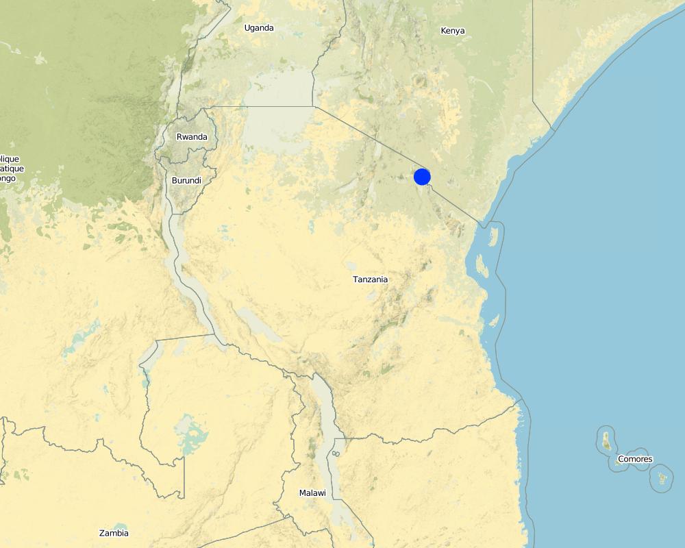
2.5 Country/ region/ locations where the Technology has been applied and which are covered by this assessment
Country:
Tanzania, United Republic of
Region/ State/ Province:
Shinyanga region
Map
×2.6 Date of implementation
If precise year is not known, indicate approximate date:
- more than 50 years ago (traditional)
2.7 Introduction of the Technology
Specify how the Technology was introduced:
- as part of a traditional system (> 50 years)
Comments (type of project, etc.):
an indigenous practice which has been revived by a government programme from 1986-2001
3. Classification of the SLM Technology
3.1 Main purpose(s) of the Technology
- reduce, prevent, restore land degradation
3.2 Current land use type(s) where the Technology is applied

Grazing land
Extensive grazing land:
- Semi-nomadism/ pastoralism
Comments:
Major land use problems (compiler’s opinion): shortage of fodder associated with problems of deforestation, fuelwood scarcity, food insecurity, declining soil fertility, severe soil erosion and unsecure land use rights
Semi-nomadism / pastoralism: Yes
Future (final) land use (after implementation of SLM Technology): Mixed: Ms: Silvo-pastoralism
If land use has changed due to the implementation of the Technology, indicate land use before implementation of the Technology:
Grazing land: Ge: Extensive grazing land
3.3 Further information about land use
Water supply for the land on which the Technology is applied:
- rainfed
Number of growing seasons per year:
- 1
3.4 SLM group to which the Technology belongs
- area closure (stop use, support restoration)
- pastoralism and grazing land management
3.5 Spread of the Technology
Specify the spread of the Technology:
- applied at specific points/ concentrated on a small area
Comments:
3000-5000 km2
3.6 SLM measures comprising the Technology

vegetative measures
- V1: Tree and shrub cover

management measures
- M4: Major change in timing of activities
Comments:
Type of vegetative measures: scattered / dispersed
3.7 Main types of land degradation addressed by the Technology

soil erosion by water
- Wt: loss of topsoil/ surface erosion

soil erosion by wind
- Et: loss of topsoil

chemical soil deterioration
- Cn: fertility decline and reduced organic matter content (not caused by erosion)

biological degradation
- Bc: reduction of vegetation cover
- Bq: quantity/ biomass decline
- Bs: quality and species composition/ diversity decline
Comments:
Main type of degradation addressed: Wt: loss of topsoil / surface erosion, Et: loss of topsoil, Cn: fertility decline and reduced organic matter content, Bc: reduction of vegetation cover, Bq: quantity / biomass decline, Bs: quality and species composition /diversity decline
3.8 Prevention, reduction, or restoration of land degradation
Specify the goal of the Technology with regard to land degradation:
- restore/ rehabilitate severely degraded land
4. Technical specifications, implementation activities, inputs, and costs
4.2 Technical specifications/ explanations of technical drawing
Technical knowledge required for field staff / advisors: low
Technical knowledge required for land users: low
Main technical functions: control of raindrop splash, improvement of ground cover, stabilisation of soil (eg by tree roots against land slides), increase in organic matter, increase in nutrient availability (supply, recycling,…), increase of biomass (quantity), promotion of vegetation species and varieties (quality, eg palatable fodder)
Secondary technical functions: increase of infiltration
Scattered / dispersed
Vegetative material: T : trees / shrubs
Trees/ shrubs species: Acacia tortilis, A. nilotica, A. polyacantha and A. seyal
Major change in timing of activities: For initial regeneration of the vegetation and rehabilitation of denuded land absolute exclusion of up to 5 years is needed. Then, areas of standing vegetation are enclosed seasonally from the onset o
4.4 Establishment activities
| Activity | Type of measure | Timing | |
|---|---|---|---|
| 1. | Demarcation and closure of sites usually on degraded land around homesteads | Vegetative | |
| 2. | Total enclosure during up to 5 years for initial regeneration of vegetation (if land is degraded) | Vegetative | |
| 3. | Temporary demarcation of paddocks for specific periods for rotational grazing within ngitili (controlled by experienced elders; based on utilization level and fodder availability) | Vegetative | |
| 4. | Controlled pruning and thinning (for firewood and poles) | Vegetative |
4.6 Maintenance/ recurrent activities
| Activity | Type of measure | Timing/ frequency | |
|---|---|---|---|
| 1. | Closure of ngitili area at onset of rainy season. No management during rainy season | Vegetative | |
| 2. | Open area for grazing in July or August, after the crop residues and fallow vegetation have been depleted | Vegetative | |
| 3. | Temporary demarcation of paddocks for specific periods for rotational grazing within ngitili (controlled by experienced elders; based on utilization level and fodder availability) | Vegetative | |
| 4. | Controlled pruning and thinning (for firewood and poles) | Vegetative |
5. Natural and human environment
5.1 Climate
Annual rainfall
- < 250 mm
- 251-500 mm
- 501-750 mm
- 751-1,000 mm
- 1,001-1,500 mm
- 1,501-2,000 mm
- 2,001-3,000 mm
- 3,001-4,000 mm
- > 4,000 mm
Agro-climatic zone
- semi-arid
Thermal climate class: tropics
Unimodal rainfall pattern
5.2 Topography
Slopes on average:
- flat (0-2%)
- gentle (3-5%)
- moderate (6-10%)
- rolling (11-15%)
- hilly (16-30%)
- steep (31-60%)
- very steep (>60%)
Landforms:
- plateau/plains
- ridges
- mountain slopes
- hill slopes
- footslopes
- valley floors
Altitudinal zone:
- 0-100 m a.s.l.
- 101-500 m a.s.l.
- 501-1,000 m a.s.l.
- 1,001-1,500 m a.s.l.
- 1,501-2,000 m a.s.l.
- 2,001-2,500 m a.s.l.
- 2,501-3,000 m a.s.l.
- 3,001-4,000 m a.s.l.
- > 4,000 m a.s.l.
5.3 Soils
If available, attach full soil description or specify the available information, e.g. soil type, soil PH/ acidity, Cation Exchange Capacity, nitrogen, salinity etc.
Soil texture (topsoil): Vertic soils are very extensive covering 47% of all soil types in the region
Soil drainage / infiltration is medium - poor
5.6 Characteristics of land users applying the Technology
Level of mechanization:
- manual work
5.8 Land ownership, land use rights, and water use rights
Land use rights:
- communal (organized)
- individual
Comments:
individual (cropland), individual/communal 50%/50% (grazing land)
Land ownership: communal / village, individual, not titled, individual, titled
6. Impacts and concluding statements
6.1 On-site impacts the Technology has shown
Socio-economic impacts
Production
fodder production
Comments/ specify:
dry season
animal production
wood production
Comments/ specify:
timber, fuelwood
non-wood forest production
Comments/ specify:
fruit, honey, medicines, edible insects
Income and costs
farm income
Comments/ specify:
from selling timber/fuelwood; to purchase agricultural inputs, manpower
workload
Comments/ specify:
collection of fuelwood / fodder by women
Socio-cultural impacts
food security/ self-sufficiency
health situation
diet diversification
housing
Comments/ specify:
thatched grass for roofs
education
Comments/ specify:
school fees payment due to income from ngitili
Income from communal ngitili used for village development
Comments/ specify:
schools, health centres
Ecological impacts
Water cycle/ runoff
water quantity
Comments/ specify:
increased water availability
Soil
soil cover
soil loss
nutrient cycling/ recharge
Biodiversity: vegetation, animals
animal diversity
Comments/ specify:
152 plant species; 145 bird species; also mammals returning
6.3 Exposure and sensitivity of the Technology to gradual climate change and climate-related extremes/ disasters (as perceived by land users)
Comments:
Increased tolerance to climatic extremes (e.g. prolonged dry spells and droughts)
6.4 Cost-benefit analysis
How do the benefits compare with the establishment costs (from land users’ perspective)?
Short-term returns:
slightly positive
Long-term returns:
very positive
How do the benefits compare with the maintenance/ recurrent costs (from land users' perspective)?
Short-term returns:
slightly positive
Long-term returns:
very positive
6.5 Adoption of the Technology
- more than 50%
Comments:
Comments on adoption trend: 300’000-500’000 ha of woodland restored 1986-2001 (most of Ngitilis are individual, but area-wise half-half), over 800 villages; 60-70% of all households have Ngitilis
6.7 Strengths/ advantages/ opportunities of the Technology
| Strengths/ advantages/ opportunities in the compiler’s or other key resource person’s view |
|---|
| Generates many production and ecological benefits at the same time |
6.8 Weaknesses/ disadvantages/ risks of the Technology and ways of overcoming them
| Weaknesses/ disadvantages/ risks in the land user’s view | How can they be overcome? |
|---|---|
| Damage to livestock and crops caused by growing wildlife populations | outweighed by the benefits gained from ngitili (in most areas) |
| Increased local inequity: benefit gap between richer and poorer house¬holds (who have no ngitilis); growing sales of ngitilis | local institutions have to enable people to hold on to land and maintain ngitilis; allow poorer households to benefit from communal ngitilis |
| Scarcity of land, growing pressure (rising human and livestock populations); conflicts over grazing rights | encourage villages to establish by-laws for protecting ngitilis |
| Insecurity of tenure impedes establishment of ngitilis (individual and communal) | increase local people’s and groups ownership and control over their resources; clearly acknowledge in national law the secure tenure of both private and communal ngitili |
| Productivity could still be improved | introduction of improved fodder grasses. Planting of fast growing fodder trees and/or shrubs |
7. References and links
7.2 References to available publications
Title, author, year, ISBN:
Kamwenda G.J. 2002. Ngitili agrosilvopastoral systems in the United Republic of Tanzania. Unasylva 211, Vol. 53, 2002.
Title, author, year, ISBN:
World Resource Institute. 2010. Regenerating Woodlands: Tanzania's HASHI Project. http://www.wri.org/publication/content/8108
Title, author, year, ISBN:
Equator initiative. 2010. Nomination Form Equator Initiative. http://www.equatorinitiative.org/knowledgebase/files/2002-0128_Nom_HASHI_Tanzania.pdf
Title, author, year, ISBN:
Blay D., E. Bonkoungou, S.A.O. Chamshama and B.Chikamai. 2004. Rehabilitation of Degraded Lands in Sub-Saharan Africa: Lessons Learned from Selected Case Studies. Forestry research network for Sub-Saharan Africa (fornessa)
Title, author, year, ISBN:
WRI (2005): World Resources 2005: The Wealth of the Poor—Managing Ecosystems to Fight Poverty. World Resources Institute (WRI) in collaboration with United Nations Development Programme, United Nations Environment Programme, and World Bank
Links and modules
Expand all Collapse allLinks
No links
Modules
No modules


