Afforestation with mangrove plants to protect land degradation [Bangladesh]
- Creation:
- Update:
- Compiler: Fazlay Arafat
- Editors: Mutasim Billah, Md. Arfanuzzaman
- Reviewers: Nicole Harari, Rima Mekdaschi Studer, Ursula Gaemperli
Upokuliyio Bonayon
technologies_4300 - Bangladesh
View sections
Expand all Collapse all1. General information
1.2 Contact details of resource persons and institutions involved in the assessment and documentation of the Technology
Key resource person(s)
land user:
Hossain Md. Kamal
Bangladesh Forest Department
Bangladesh
land user:
Hussain Md. Jobair
Bangladesh Forest Department
Bangladesh
Name of project which facilitated the documentation/ evaluation of the Technology (if relevant)
Decision Support for Mainstreaming and Scaling out Sustainable Land Management (GEF-FAO / DS-SLM)Name of the institution(s) which facilitated the documentation/ evaluation of the Technology (if relevant)
FAO Bangladesh (FAO Bangladesh) - BangladeshName of the institution(s) which facilitated the documentation/ evaluation of the Technology (if relevant)
Bangladesh Forest Department (Bangladesh Forest Department) - Bangladesh1.3 Conditions regarding the use of data documented through WOCAT
The compiler and key resource person(s) accept the conditions regarding the use of data documented through WOCAT:
Yes
1.4 Declaration on sustainability of the described Technology
Is the Technology described here problematic with regard to land degradation, so that it cannot be declared a sustainable land management technology?
No
2. Description of the SLM Technology
2.1 Short description of the Technology
Definition of the Technology:
Mangrove afforestation in newly accreted land along cooastal regions accelerates the process of land stabilization, creates new forest resources, and enriches biodiversity.
2.2 Detailed description of the Technology
Description:
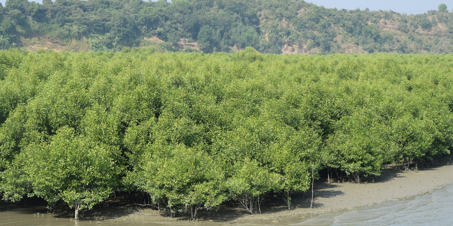
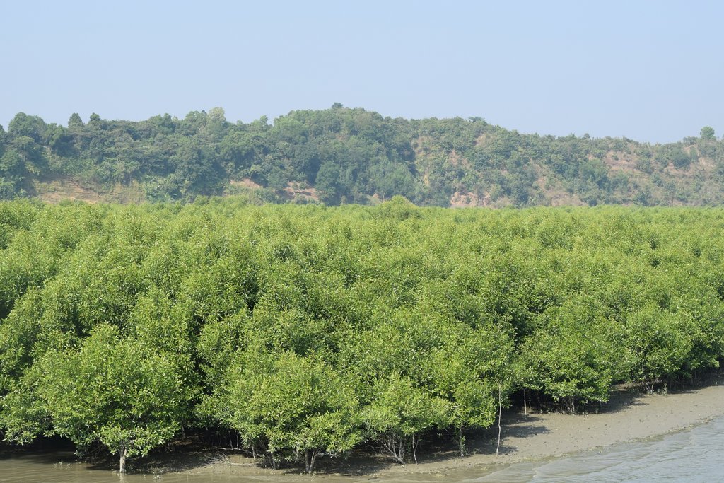
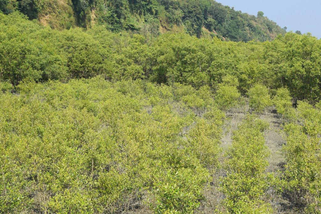
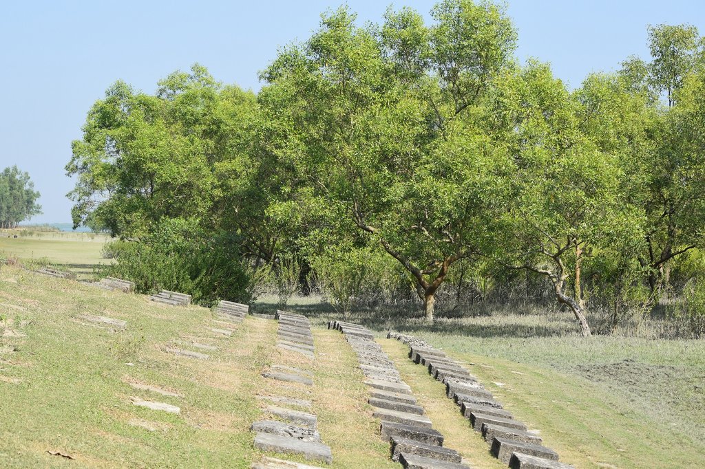
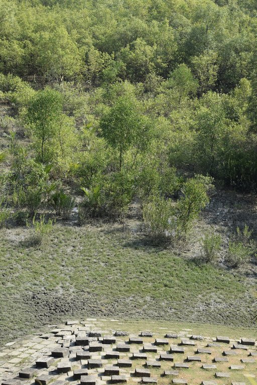
Maheshkhali is the only hilly island of Bangladesh and situated in northwest of Cox’s Bazar. This island has become a tourist destination for its mangrove plantation and ancient Adinath Temple situated at the hilltop. Historically the island had suffered from coastal erosion and structural measures like building blocks along the coast were implemented in some places to protect the Adinath hill from erosion. The Maheshkhali channel have deposited sediments in the near-shore zone and formed mud banks along the coast. This newly accreted land and other lands were used for mangrove plantations, which stabilized the land and provided protection against coastal erosion, storm damage, flooding, and siltation of adjacent seagrass beds. Mangrove plantations can provide a long-term and cost-effective solution to coastal erosion while at the same time improving the landscape aesthetically and increasing ecological habitats. Before the mangroves were planted, the existing shrub and tree vegetation along the coastline of Maheshkhali was scattered. The barren and exposed coastline is now converted to a green shelter-belt and protecting the soil. Bangladesh Forest Department is the land user and the mangrove plantation was carried out with the support from World Bank through "Forest Resource Management Plan (FRMP)" project in 1997. Later, some new plantation also carried out in 2016 on newly accreted land through "Climate Resilient Participatory Afforestation and Reforestation Project (CRPARP).
The mangrove plant species Baen (Avicennia officinalis) was used to create the plantation. Salinity in coastal regions increased as consequence of global warming and Avicennia officinalis is among the most salt tolerant species that prefer clay soil. The young tree forms a low, dense bushy crown. When it matures, it forms a columnar tree up to 15 m and may grow up to 30 m. The spreading root system of the plant also provides stability in shifting substrates. When planting mangroves, site selection and proper nursery management is crucial. Geo-morphological changes in coastal areas can be rapid and unpredictable, making it difficult to identify suitable sites correctly. Accreted land with grasses and crab burrows indicating a stable site, ideal for planting. The experience of field staff is a key factor in identifying suitable sites. Nursery management is carried out by forest department. Seed collection, site clearing, leveling and fencing, drainage arrangement, bed preparation, making overhead shed, poly-bag preparation, potting seeds, manuring, irrigation and weed control are the major activities of nursery management. Proper care of seedlings needs to be ensured while transporting from nursery to plantation site thorough boat. Gunny bags can be used to carry the seedlings while transporting. The spacing between each plant was 1.5m x 1.5m and 4444 seedlings/ha were planted in the visited site. Compost fertilizer was used both in nursery and while planting in pit. After planting, each seedling was tied up with a bamboo stick for support and to prevent from washing away in tides. The plantation activities were carried out by the staff of forest department. As mangrove afforestation is carried out in unstable environments, there is always a risk of losing some plantation during the time it takes for trees to reach maturity.
Coastal afforestation accelerates the process of land stabilization, and by creating new forest land it enriches biodiversity and natural resources. It also protects the lives and property of the coastal population against cyclones and tidal surges. The plantation develops suitable habitats for wildlife, fish and other estuarine and marine fauna. It produces timber for fuelwood and industrial uses. However, the local community people can only collect fuelwood and other non-timber forest products like honey, crabs and fishes from this plantation site. The mangrove plantation increased the aesthetic beauty of the area and also create employment opportunities for remote rural communities through eco-tourism.
2.3 Photos of the Technology
2.5 Country/ region/ locations where the Technology has been applied and which are covered by this assessment
Country:
Bangladesh
Region/ State/ Province:
Chittagong division
Further specification of location:
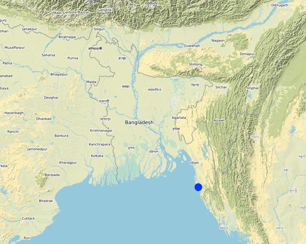
Moheskhali, Cox's Bazar
Specify the spread of the Technology:
- evenly spread over an area
If precise area is not known, indicate approximate area covered:
- 1-10 km2
Is/are the technology site(s) located in a permanently protected area?
No
Map
×2.6 Date of implementation
If precise year is not known, indicate approximate date:
- 10-50 years ago
2.7 Introduction of the Technology
Specify how the Technology was introduced:
- through projects/ external interventions
Comments (type of project, etc.):
Plantation was carried out from the support of World Bank project "Forest Resource Management Plan (FRMP) project in 1997" and "Climate Resilient Participatory Afforestation and Reforestation Project (CRPARP) in 2016"
3. Classification of the SLM Technology
3.1 Main purpose(s) of the Technology
- reduce, prevent, restore land degradation
- reduce risk of disasters
- create beneficial economic impact
- create beneficial social impact
3.2 Current land use type(s) where the Technology is applied
Land use mixed within the same land unit:
No

Forest/ woodlands
- Tree plantation, afforestation
Tree plantation, afforestation: Specify origin and composition of species:
- Monoculture local variety
- Mangrove plantation
- Avicennia officinalis
Are the trees specified above deciduous or evergreen?
- evergreen
Products and services:
- Timber
- Fuelwood
- Fruits and nuts
- Other forest products
- Nature conservation/ protection
- Recreation/ tourism
- Protection against natural hazards
Comments:
Due to the establishment of mangrove plantation, the degraded land is now covered with vegetation and protected from land degradation
3.3 Has land use changed due to the implementation of the Technology?
Has land use changed due to the implementation of the Technology?
- Yes (Please fill out the questions below with regard to the land use before implementation of the Technology)
Land use mixed within the same land unit:
No

Waterways, waterbodies, wetlands
- fellow accreted land
Main products/ services:
Fish and crabs
Comments:
The areas were inundated regularly by the tide and physical barriers were imposed to protect the land from degradation
3.4 Water supply
Water supply for the land on which the Technology is applied:
- rainfed
3.5 SLM group to which the Technology belongs
- forest plantation management
- windbreak/ shelterbelt
- ecosystem-based disaster risk reduction
3.6 SLM measures comprising the Technology

vegetative measures
- V1: Tree and shrub cover
Comments:
Plantation of mangrove species in newly accreted land to stabilize the soil to protect from land degradation
3.7 Main types of land degradation addressed by the Technology

soil erosion by water
- Wc: coastal erosion
3.8 Prevention, reduction, or restoration of land degradation
Specify the goal of the Technology with regard to land degradation:
- reduce land degradation
4. Technical specifications, implementation activities, inputs, and costs
4.1 Technical drawing of the Technology
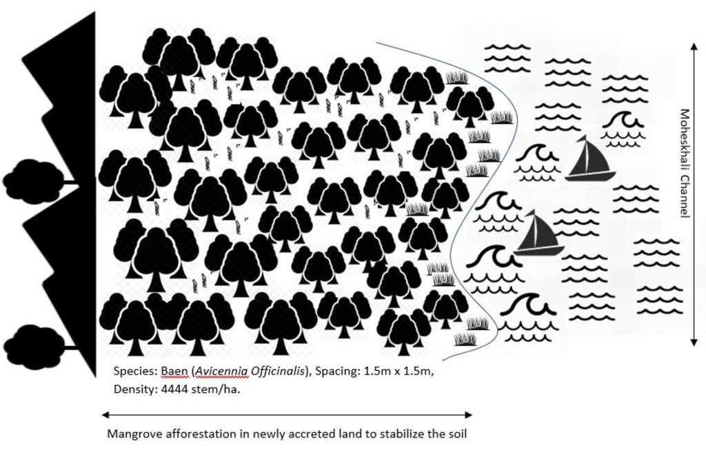
Technical specifications (related to technical drawing):
Planted species: Baen (Avicennia officinalis)
Soil condition: Accreted land with grasses indicated a stable site and suitable for planting Baen plant.
Spacing: 1.5m X 1.5m
Density: 4444 stem/ha.
Vacancy filling: 3 consecutive years after plantation
Author:
Md. Fazlay Arafat
Date:
21/04/2019
4.2 General information regarding the calculation of inputs and costs
Specify how costs and inputs were calculated:
- per Technology area
Indicate size and area unit:
1 ha
If using a local area unit, indicate conversion factor to one hectare (e.g. 1 ha = 2.47 acres): 1 ha =:
2.47 acres
other/ national currency (specify):
BDT
If relevant, indicate exchange rate from USD to local currency (e.g. 1 USD = 79.9 Brazilian Real): 1 USD =:
84.0
Indicate average wage cost of hired labour per day:
BDT 500
4.3 Establishment activities
| Activity | Timing (season) | |
|---|---|---|
| 1. | Nursery preparation (seed collection, site clearing, leveling and fencing, drainage arrangement, bed preparation, making overhead shed, poly-bag preparation, potting seeds, manuring, irrigation, weed control) | March-April |
| 2. | Survey plantation site and prepare site map | August |
| 3. | Transportation of seedlings | September-October |
| 4. | Plantation | September-October |
4.4 Costs and inputs needed for establishment
| Specify input | Unit | Quantity | Costs per Unit | Total costs per input | % of costs borne by land users | |
|---|---|---|---|---|---|---|
| Labour | Nursery preparation (seed collection, site clearing, leveling and fencing, drainage arrangement, bed preparation, making overhead shed, poly-bag preparation, potting seeds, manuring, irrigation, weed control) | person-days | 20.0 | 500.0 | 10000.0 | |
| Labour | Plantation site survey | person-days | 1.0 | 500.0 | 500.0 | |
| Labour | Transportation of seedlings | person-days | 4.0 | 500.0 | 2000.0 | |
| Labour | Plantation | person-days | 10.0 | 500.0 | 5000.0 | |
| Equipment | Boat rent for seedlings transportation | lump-sum | 1.0 | 2500.0 | 2500.0 | |
| Equipment | Poly bags | pieces | 4500.0 | 1.0 | 4500.0 | |
| Equipment | Rope for tying up seedlings with bamboo stick | lump-sum | 1.0 | 1500.0 | 1500.0 | |
| Equipment | Gunny bags (to carry seedlings to the plantation pit) | lump-sum | 1.0 | 400.0 | 400.0 | |
| Plant material | Bamboo sticks to support seedlings | pieces | 4500.0 | 2.0 | 9000.0 | |
| Fertilizers and biocides | Compost fertilizer (to apply in pit) | kg | 50.0 | 10.0 | 500.0 | |
| Total costs for establishment of the Technology | 35900.0 | |||||
| Total costs for establishment of the Technology in USD | 427.38 | |||||
Comments:
Bangladesh Forest Department is the land user and the costs was borne from the project "Forest Resource Management Plan (FRMP)"
4.5 Maintenance/ recurrent activities
| Activity | Timing/ frequency | |
|---|---|---|
| 1. | 1 year old plantation replanting nursery 40% ( 2 bed/ha) | March-April |
| 2. | 2 year old plantation replanting nursery 30% ( 2 bed/ha) | March-April |
| 3. | 3 year old plantation- replanting nursery 20% (1 bed/Ha.) | March-April |
| 4. | 1 year old plantation- replanting (VF) 40% (1777 seedling/Ha.) | September-October |
| 5. | 2 year old plantation- replanting (VF) 30% (1333 seedling/Ha.) | September-October |
| 6. | 3 year old plantation- replanting (VF) 20% (888 seedling/Ha.) | September-October |
4.6 Costs and inputs needed for maintenance/ recurrent activities (per year)
| Specify input | Unit | Quantity | Costs per Unit | Total costs per input | % of costs borne by land users | |
|---|---|---|---|---|---|---|
| Labour | Nursery work | person-day | 18.0 | 500.0 | 9000.0 | 100.0 |
| Labour | Replanting work | person-day | 10.0 | 500.0 | 5000.0 | 100.0 |
| Equipment | Boat rent for seedlings transportation | Lump-sum | 1.0 | 6000.0 | 6000.0 | 100.0 |
| Fertilizers and biocides | Compost fertilizer | kg | 25.0 | 10.0 | 250.0 | 100.0 |
| Total costs for maintenance of the Technology | 20250.0 | |||||
| Total costs for maintenance of the Technology in USD | 241.07 | |||||
Comments:
Bangladesh Forest Department is the land user and borne the maintenance cost of the technology
4.7 Most important factors affecting the costs
Describe the most determinate factors affecting the costs:
Labor cost
5. Natural and human environment
5.1 Climate
Annual rainfall
- < 250 mm
- 251-500 mm
- 501-750 mm
- 751-1,000 mm
- 1,001-1,500 mm
- 1,501-2,000 mm
- 2,001-3,000 mm
- 3,001-4,000 mm
- > 4,000 mm
Specify average annual rainfall (if known), in mm:
3700.00
Indicate the name of the reference meteorological station considered:
Cox's Bazar
Agro-climatic zone
- humid
Mean annual temperature is 25.6 °C
5.2 Topography
Slopes on average:
- flat (0-2%)
- gentle (3-5%)
- moderate (6-10%)
- rolling (11-15%)
- hilly (16-30%)
- steep (31-60%)
- very steep (>60%)
Landforms:
- plateau/plains
- ridges
- mountain slopes
- hill slopes
- footslopes
- valley floors
Altitudinal zone:
- 0-100 m a.s.l.
- 101-500 m a.s.l.
- 501-1,000 m a.s.l.
- 1,001-1,500 m a.s.l.
- 1,501-2,000 m a.s.l.
- 2,001-2,500 m a.s.l.
- 2,501-3,000 m a.s.l.
- 3,001-4,000 m a.s.l.
- > 4,000 m a.s.l.
Indicate if the Technology is specifically applied in:
- not relevant
5.3 Soils
Soil depth on average:
- very shallow (0-20 cm)
- shallow (21-50 cm)
- moderately deep (51-80 cm)
- deep (81-120 cm)
- very deep (> 120 cm)
Soil texture (topsoil):
- fine/ heavy (clay)
Soil texture (> 20 cm below surface):
- fine/ heavy (clay)
Topsoil organic matter:
- medium (1-3%)
5.4 Water availability and quality
Ground water table:
5-50 m
Availability of surface water:
excess
Water quality (untreated):
unusable
Water quality refers to:
surface water
Is water salinity a problem?
Yes
Specify:
Due to regular tidal inundation the soil become saline and only support to grow mangrove plant species
Is flooding of the area occurring?
Yes
Regularity:
episodically
5.5 Biodiversity
Species diversity:
- medium
Habitat diversity:
- low
5.6 Characteristics of land users applying the Technology
Sedentary or nomadic:
- Sedentary
Market orientation of production system:
- mixed (subsistence/ commercial)
Off-farm income:
- less than 10% of all income
Relative level of wealth:
- poor
Individuals or groups:
- employee (company, government)
Level of mechanization:
- manual work
Gender:
- women
- men
Age of land users:
- youth
- middle-aged
- elderly
5.7 Average area of land used by land users applying the Technology
- < 0.5 ha
- 0.5-1 ha
- 1-2 ha
- 2-5 ha
- 5-15 ha
- 15-50 ha
- 50-100 ha
- 100-500 ha
- 500-1,000 ha
- 1,000-10,000 ha
- > 10,000 ha
Is this considered small-, medium- or large-scale (referring to local context)?
- medium-scale
5.8 Land ownership, land use rights, and water use rights
Land ownership:
- state
Land use rights:
- open access (unorganized)
Water use rights:
- open access (unorganized)
Are land use rights based on a traditional legal system?
No
Specify:
Land use rights based on forest management type
5.9 Access to services and infrastructure
health:
- poor
- moderate
- good
education:
- poor
- moderate
- good
technical assistance:
- poor
- moderate
- good
employment (e.g. off-farm):
- poor
- moderate
- good
markets:
- poor
- moderate
- good
energy:
- poor
- moderate
- good
roads and transport:
- poor
- moderate
- good
drinking water and sanitation:
- poor
- moderate
- good
financial services:
- poor
- moderate
- good
6. Impacts and concluding statements
6.1 On-site impacts the Technology has shown
Socio-economic impacts
Production
wood production
forest/ woodland quality
non-wood forest production
Comments/ specify:
Honey, fish and crab production increased
risk of production failure
product diversity
Comments/ specify:
The mangrove plantation support production of timber, fuel wood, crabs, fruits for wildlife, honey, etc.
production area
land management
Income and costs
diversity of income sources
Comments/ specify:
Promote alternate income through ecotourism
Socio-cultural impacts
cultural opportunities
Comments/ specify:
The mangrove plantation saved one ancient temple (Adinath Mondir) of Hindu religion from destruction by land degradation.
recreational opportunities
Comments/ specify:
The mangrove forest now become a tourist place
SLM/ land degradation knowledge
Comments/ specify:
Forest department now replicating the practice in other degraded areas
Ecological impacts
Water cycle/ runoff
surface runoff
Comments/ specify:
surface runoff decreased due to canopy coverage and accretion of sediments in plantation site
Soil
soil accumulation
Comments/ specify:
soil accumulation increased as the plantation promote soil accretion during tides
nutrient cycling/ recharge
soil organic matter/ below ground C
Biodiversity: vegetation, animals
Vegetation cover
biomass/ above ground C
animal diversity
Comments/ specify:
the plantation site support habitats for birds and crabs
beneficial species
Comments/ specify:
Honey bee and various birds living here and add benefits in pollination and pest control
habitat diversity
Comments/ specify:
The plantation develops suitable habitats for wildlife and fish
Climate and disaster risk reduction
flood impacts
landslides/ debris flows
Comments/ specify:
The plantation protect the debris flows of Adinath hill from washed away in water. The Adinath hill is on the edge of coast and now protected from bank erosion.
impacts of cyclones, rain storms
emission of carbon and greenhouse gases
wind velocity
6.2 Off-site impacts the Technology has shown
buffering/ filtering capacity
Comments/ specify:
The plantation act as a buffer to reduce the saline water flow of high tide towards terrestrial land
impact of greenhouse gases
6.3 Exposure and sensitivity of the Technology to gradual climate change and climate-related extremes/ disasters (as perceived by land users)
Gradual climate change
Gradual climate change
| Season | increase or decrease | How does the Technology cope with it? | |
|---|---|---|---|
| annual temperature | increase | well | |
| seasonal rainfall | wet/ rainy season | increase | well |
| other gradual climate change | water salinity in coastal areas due to global warming | increase | well |
Climate-related extremes (disasters)
Meteorological disasters
| How does the Technology cope with it? | |
|---|---|
| tropical storm | moderately |
| local thunderstorm | well |
Hydrological disasters
| How does the Technology cope with it? | |
|---|---|
| storm surge/ coastal flood | well |
6.4 Cost-benefit analysis
How do the benefits compare with the establishment costs (from land users’ perspective)?
Short-term returns:
negative
Long-term returns:
positive
How do the benefits compare with the maintenance/ recurrent costs (from land users' perspective)?
Short-term returns:
negative
Long-term returns:
positive
6.5 Adoption of the Technology
- 1-10%
Comments:
Forest Department is the land user here
6.6 Adaptation
Has the Technology been modified recently to adapt to changing conditions?
No
6.7 Strengths/ advantages/ opportunities of the Technology
| Strengths/ advantages/ opportunities in the land user’s view |
|---|
| Protect the lives and property of the coastal population against cyclones and tidal surges. |
| Conserve and stabilize newly accreted lands and protect from land degradation |
| Produce fuel wood for local people |
| Strengths/ advantages/ opportunities in the compiler’s or other key resource person’s view |
|---|
| Develop ecotourism facility for local communities |
| Develop suitable habitats for wildlife, fish and other estuarine and marine fauna |
6.8 Weaknesses/ disadvantages/ risks of the Technology and ways of overcoming them
| Weaknesses/ disadvantages/ risks in the land user’s view | How can they be overcome? |
|---|---|
| Vulnerable to natural calamities specially in initial stage | Proper management and vacancy filling |
| Weaknesses/ disadvantages/ risks in the compiler’s or other key resource person’s view | How can they be overcome? |
|---|---|
| Risk of low production due to unstable environment for plantation | Proper monitoring and management of plantation |
7. References and links
7.1 Methods/ sources of information
- field visits, field surveys
number of field visits: 02
- interviews with land users
number of informants: 04
- interviews with SLM specialists/ experts
number of informants:02
When were the data compiled (in the field)?
16/01/2019
7.2 References to available publications
Title, author, year, ISBN:
Macintosh, D.J., Mahindapala, R., Markopoulos, M. (eds) (2012). Sharing Lessons on Mangrove Restoration. Bangkok, Thailand: Mangroves for the Future and Gland, Switzerland: IUCN. ISBN: 978-2-8317-1558-2
Available from where? Costs?
www.mangrovesforthefuture.org
7.3 Links to relevant online information
Title/ description:
Mangroves for the Future
URL:
www.mangrovesforthefuture.org
7.4 General comments
The WOCAT questionnaire covers all the aspect of this technology
Links and modules
Expand all Collapse allLinks
No links
Modules
No modules


