Water-conservation technology at cultivation of the cotton in south. K [Kazakhstan]
- Creation:
- Update:
- Compiler: Unknown User
- Editor: –
- Reviewers: David Streiff, Alexandra Gavilano
Watering through furrow
technologies_1091 - Kazakhstan
View sections
Expand all Collapse all1. General information
1.2 Contact details of resource persons and institutions involved in the assessment and documentation of the Technology
Key resource person(s)
SLM specialist:
Vyshepolsky Frank
Kazakhstan
SLM specialist:
Khe Tatyana
Kazakhstan
SLM specialist:
Mukhamedzhanov Khamit
Scientific Production Center for Water management
Kazakhstan
Name of the institution(s) which facilitated the documentation/ evaluation of the Technology (if relevant)
Ministry of Agriculture of Kazakhstan (MoA) - Eritrea1.3 Conditions regarding the use of data documented through WOCAT
The compiler and key resource person(s) accept the conditions regarding the use of data documented through WOCAT:
Yes
1.5 Reference to Questionnaire(s) on SLM Approaches (documented using WOCAT)

Watering through furrow [Kazakhstan]
Watering through furrow
- Compiler: Unknown User
2. Description of the SLM Technology
2.1 Short description of the Technology
Definition of the Technology:
The technology of watering through furrow reduces the settlement (recommended) sizes of irrigating norms up to 30% keeps soil fertility
2.2 Detailed description of the Technology
Description:
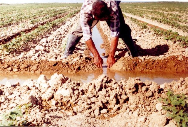
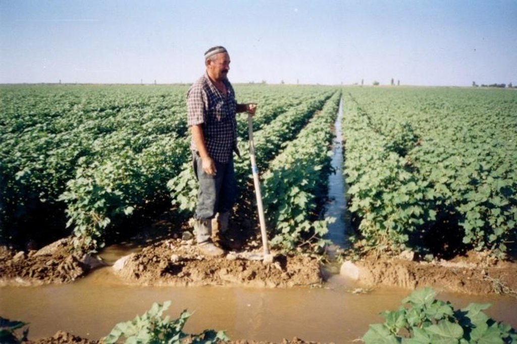
It is applied for watering on furrow at ploughed cultures.
It is intended for decrease in irrigating norms and preservation of fertility of soils.
The technology of watering through furrow
-Does not result in change of zone system of agriculture
-Provides pass of soil-cultivating technique on dry furrow therefore are reduced the rates of soil condensation
-Reduces technological losses of irrigating water to filtration shed from the irrigated grounds evaporation
-Reduces the sizes of irrigating norms (recommended) up to 30%
-Reduces loading to drainage system up to 30%
-Slows down the rates of development of erosive processes and keeps soil fertility
-Raises productivity of cultivated cultures at deficiency of water
-Improves ecological conditions due to reduction of drainage shed of water for limits of irrigated files
-Does not demand additional expenses for its introduction
2.3 Photos of the Technology
2.5 Country/ region/ locations where the Technology has been applied and which are covered by this assessment
Country:
Kazakhstan
Region/ State/ Province:
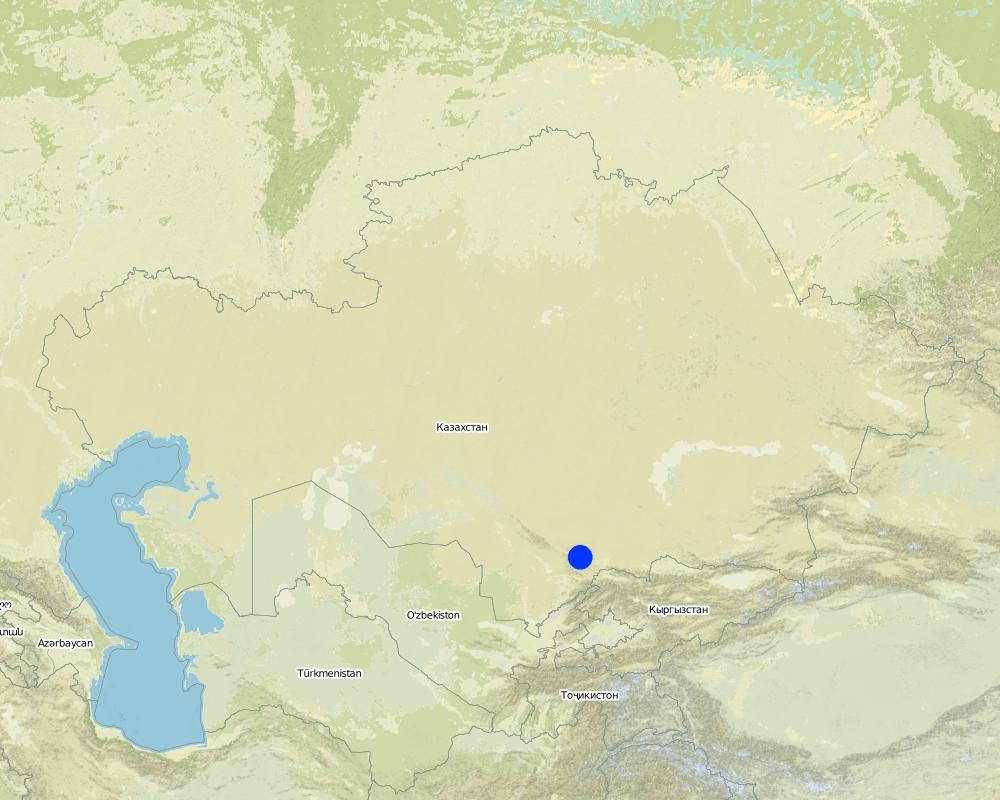
Southern Kazakhstan
Further specification of location:
Basin of Syrdarya
Specify the spread of the Technology:
- evenly spread over an area
If the Technology is evenly spread over an area, specify area covered (in km2):
40.0
If precise area is not known, indicate approximate area covered:
- 10-100 km2
Comments:
Total area covered by the SLM Technology is 40 km2.
Map
×2.6 Date of implementation
If precise year is not known, indicate approximate date:
- less than 10 years ago (recently)
2.7 Introduction of the Technology
Specify how the Technology was introduced:
- during experiments/ research
Comments (type of project, etc.):
Caused (provocative) waterings for reception of shoots at drying up of soil in a zone of an arrangement of seeds.
3. Classification of the SLM Technology
3.1 Main purpose(s) of the Technology
- Reduce amount of irrigation water
3.2 Current land use type(s) where the Technology is applied
Land use mixed within the same land unit:
Yes
Specify mixed land use (crops/ grazing/ trees):
- Agro-pastoralism (incl. integrated crop-livestock)

Cropland
- Annual cropping
Annual cropping - Specify crops:
- fibre crops - cotton
Number of growing seasons per year:
- 1
Specify:
Longest growing period in days: 150; Longest growing period from month to month: May - Sep

Grazing land
Comments:
Major land use problems (compiler’s opinion): Water resources management. Reduction of technological losses of irrigating water at its transportation from water-fence up to fields of an irrigation.
Major land use problems (land users’ perception): Technologies of the water-conservation, reduction of norms of entering of mineral fertilizers, increase in soil fertility. Normalization of water-submission on cultures and soil-meliorative conditions.
3.4 Water supply
Water supply for the land on which the Technology is applied:
- rainfed
Comments:
Also mixed rainfed - irrigated
3.5 SLM group to which the Technology belongs
- irrigation management (incl. water supply, drainage)
3.6 SLM measures comprising the Technology

agronomic measures
- A4: Subsurface treatment

structural measures
- S3: Graded ditches, channels, waterways
Comments:
Main measures: agronomic measures
Secondary measures: structural measures
Type of agronomic measures: soil conditioners (lime, gypsum), breaking compacted topsoil, pits, deep tillage / double digging
3.8 Prevention, reduction, or restoration of land degradation
Specify the goal of the Technology with regard to land degradation:
- reduce land degradation
- restore/ rehabilitate severely degraded land
4. Technical specifications, implementation activities, inputs, and costs
4.1 Technical drawing of the Technology
Technical specifications (related to technical drawing):
Technical knowledge required for field staff / advisors: moderate
Technical knowledge required for land users: moderate
Main technical functions: increase of infiltration, increase / maintain water stored in soil, water harvesting / increase water supply
Soil conditioners (lime, gypsum)
Material/ species: phospho-gypsum
Remarks: 4t/hec
Breaking compacted topsoil
Remarks: tillage through grooves
Pits
Remarks: breaking compacted soil
Deep tillage / double digging
Remarks: by cultivator
4.2 General information regarding the calculation of inputs and costs
Specify currency used for cost calculations:
- USD
Indicate average wage cost of hired labour per day:
0.50
4.4 Costs and inputs needed for establishment
| Specify input | Unit | Quantity | Costs per Unit | Total costs per input | % of costs borne by land users | |
|---|---|---|---|---|---|---|
| Labour | Labour | ha | 1.0 | 650.0 | 650.0 | |
| Equipment | Machine use | ha | 1.0 | 40.0 | 40.0 | |
| Construction material | Polyethylene film | ha | 1.0 | 55.0 | 55.0 | |
| Total costs for establishment of the Technology | 745.0 | |||||
| Total costs for establishment of the Technology in USD | 745.0 | |||||
Comments:
Duration of establishment phase: 12 month(s)
4.5 Maintenance/ recurrent activities
| Activity | Timing/ frequency | |
|---|---|---|
| 1. | tillage | between / weekly |
| 2. | entering of phospho-gypsum | watering / once a year in the autumn |
4.6 Costs and inputs needed for maintenance/ recurrent activities (per year)
| Specify input | Unit | Quantity | Costs per Unit | Total costs per input | % of costs borne by land users | |
|---|---|---|---|---|---|---|
| Labour | Tillage and appliyng phospho-gypsum | ha | 1.0 | 100.0 | 100.0 | |
| Construction material | Polyethylene film | ha | 1.0 | 25.0 | 25.0 | |
| Total costs for maintenance of the Technology | 125.0 | |||||
| Total costs for maintenance of the Technology in USD | 125.0 | |||||
If you are unable to break down the costs in the table above, give an estimation of the total costs of maintaining the Technology:
3.0
Comments:
For arrangement of 1 ha width of furrow makes 100 meters, quantity of furrow makes 50
4.7 Most important factors affecting the costs
Describe the most determinate factors affecting the costs:
Arrangement of furrows its cutting and reinforcing of the bottom of furrow
5. Natural and human environment
5.1 Climate
Annual rainfall
- < 250 mm
- 251-500 mm
- 501-750 mm
- 751-1,000 mm
- 1,001-1,500 mm
- 1,501-2,000 mm
- 2,001-3,000 mm
- 3,001-4,000 mm
- > 4,000 mm
Specify average annual rainfall (if known), in mm:
235.00
Agro-climatic zone
- arid
Growing pirriod 4-5 months
5.2 Topography
Slopes on average:
- flat (0-2%)
- gentle (3-5%)
- moderate (6-10%)
- rolling (11-15%)
- hilly (16-30%)
- steep (31-60%)
- very steep (>60%)
Landforms:
- plateau/plains
- ridges
- mountain slopes
- hill slopes
- footslopes
- valley floors
Altitudinal zone:
- 0-100 m a.s.l.
- 101-500 m a.s.l.
- 501-1,000 m a.s.l.
- 1,001-1,500 m a.s.l.
- 1,501-2,000 m a.s.l.
- 2,001-2,500 m a.s.l.
- 2,501-3,000 m a.s.l.
- 3,001-4,000 m a.s.l.
- > 4,000 m a.s.l.
Comments and further specifications on topography:
Landforms: Valley of the Syrdarya river . Foothill plains of a ridge of the Karatau
Slopes on average: Flat for valley landforms for foothill plains
5.3 Soils
Soil depth on average:
- very shallow (0-20 cm)
- shallow (21-50 cm)
- moderately deep (51-80 cm)
- deep (81-120 cm)
- very deep (> 120 cm)
Soil texture (topsoil):
- medium (loamy, silty)
- fine/ heavy (clay)
If available, attach full soil description or specify the available information, e.g. soil type, soil PH/ acidity, Cation Exchange Capacity, nitrogen, salinity etc.
Soil fertility is medium (Alluvial gray soils) - low
Soil drainage / infiltration is medium for alluvial meadow soils and poor for light gray soils
Soil water storage capacity is low for alluvial meadow soils and very low for light gray soils
5.6 Characteristics of land users applying the Technology
Market orientation of production system:
- mixed (subsistence/ commercial)
- commercial/ market
Off-farm income:
- 10-50% of all income
Level of mechanization:
- manual work
- mechanized/ motorized
Indicate other relevant characteristics of the land users:
Population density: 10-50 persons/km2
Annual population growth: < 0.5%
1% of the land users are rich and own 50% of the land.
19% of the land users are average wealthy and own 39% of the land.
60% of the land users are poor and own 10% of the land.
20% of the land users are poor and own 1% of the land.
Off-farm income specification: Due to pasturable live stock and cultivation of gourds
Market orientation of production system:Mixed for grain-crops, grasses and commercial orientation for cotton
Level of mechanization: Manual labour for ploughing, chasing and harvesting and mechanised for tillage interrow cultivation
5.7 Average area of land used by land users applying the Technology
- < 0.5 ha
- 0.5-1 ha
- 1-2 ha
- 2-5 ha
- 5-15 ha
- 15-50 ha
- 50-100 ha
- 100-500 ha
- 500-1,000 ha
- 1,000-10,000 ha
- > 10,000 ha
5.8 Land ownership, land use rights, and water use rights
Land ownership:
- individual, titled
Land use rights:
- communal (organized)
- leased
6. Impacts and concluding statements
6.1 On-site impacts the Technology has shown
Socio-economic impacts
Production
crop production
Income and costs
farm income
Other socio-economic impacts
expenses on water
Socio-cultural impacts
community institutions
national institutions
SLM/ land degradation knowledge
Ecological impacts
Soil
soil moisture
soil loss
Other ecological impacts
soil fertility
6.2 Off-site impacts the Technology has shown
downstream flooding
Comments/ specify:
The area of flooding at the end of a field is reduced 3-4 times
groundwater/ river pollution
Comments/ specify:
Dump of drainage waters is reduced up to 2 times
norms of entering of mineral fertilizers
Comments/ specify:
due to decrease of washing out nutrients
6.4 Cost-benefit analysis
How do the benefits compare with the establishment costs (from land users’ perspective)?
Short-term returns:
neutral/ balanced
Long-term returns:
positive
How do the benefits compare with the maintenance/ recurrent costs (from land users' perspective)?
Short-term returns:
slightly positive
Long-term returns:
very positive
6.5 Adoption of the Technology
- 11-50%
If available, quantify (no. of households and/ or area covered):
850 households in an area of 40km2 (10-50 persons per km2)
Comments:
30% of land user families have adopted the Technology without any external material support
850 land user families have adopted the Technology without any external material support
There is a little trend towards spontaneous adoption of the Technology
Comments on adoption trend: The existing system of water-subdivision does not provide for water consume on demand of farmers within the limits of allocated limit but establishes sequence of watering. At present water-subdivision the farmers who watering on furrows an create, additional stocks of a moisture and so the watering technology through furrows has not received universal application
6.7 Strengths/ advantages/ opportunities of the Technology
| Strengths/ advantages/ opportunities in the land user’s view |
|---|
| Improves working conditions of labours and work of soil-cultivating technics |
| Reduces the sizes of irrigating norms |
| Raises productivity of agriculture at deficiency of wate |
| Strengths/ advantages/ opportunities in the compiler’s or other key resource person’s view |
|---|
|
Reduces technological losses of irrigating water to filtration, evaporations, shed from fields of on irrigation. How can they be sustained / enhanced? Till progressive method od an irrigation drop, rain |
| Reduces intensity of soil condensation and development of denitrify processes |
| Reduces loading to drainage system and rates of pollution of water sources |
| Prevents degradation of the irrigated soils |
6.8 Weaknesses/ disadvantages/ risks of the Technology and ways of overcoming them
| Weaknesses/ disadvantages/ risks in the land user’s view | How can they be overcome? |
|---|---|
| Increase in expenses for interrow processing | Application of soil cultivating technics |
| Increase in quantity of watering | Reinforcing furrows by pipes |
| Weaknesses/ disadvantages/ risks in the compiler’s or other key resource person’s view | How can they be overcome? |
|---|---|
| Reduction of the interwatering period | By increase in volume of use of subsoil waters to subirrigation |
| Increase in interrow processing | Regime of subsoil water management |
| Increase in cost the current expenses at watering and interrow processing | Increase in productivity of cultivated cultures |
7. References and links
7.1 Methods/ sources of information
7.2 References to available publications
Title, author, year, ISBN:
Reports: Technology of an irrigation on the farm site in zone of Arys-Turkestan channal. 2000-2002 year.
Available from where? Costs?
SPC for Water management
Title, author, year, ISBN:
Recommendations on stabilization of agriculture in a zone of Arys-Turkestan channal
Links and modules
Expand all Collapse allLinks

Watering through furrow [Kazakhstan]
Watering through furrow
- Compiler: Unknown User
Modules
No modules


