Vegetative erosion control and cons. Crop. System [Thailand]
- Creation:
- Update:
- Compiler: Samran Sombatpanit
- Editor: –
- Reviewers: Fabian Ottiger, Alexandra Gavilano
Rabob karn pluek puet choeng anurak
technologies_999 - Thailand
View sections
Expand all Collapse all1. General information
1.2 Contact details of resource persons and institutions involved in the assessment and documentation of the Technology
SLM specialist:
Intapan Pitarg
Land development departement Regional Office 6
Thailand
SLM specialist:
Kanchanakul Nualsri
Department of Land Development
Thailand
SLM specialist:
Kanchanakul Vasuthep
Department of Land Development
Thailand
SLM specialist:
Boonchee Sawatdee
Thailand
Name of the institution(s) which facilitated the documentation/ evaluation of the Technology (if relevant)
Land Development Department (Land Development Department) - ThailandName of the institution(s) which facilitated the documentation/ evaluation of the Technology (if relevant)
World Association of Soil and Water Conservation (WASWC) - China1.3 Conditions regarding the use of data documented through WOCAT
The compiler and key resource person(s) accept the conditions regarding the use of data documented through WOCAT:
Yes
2. Description of the SLM Technology
2.1 Short description of the Technology
Definition of the Technology:
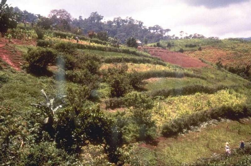
A conservation cropping system utilizing vegetative method for controlling erosion
2.2 Detailed description of the Technology
Description:
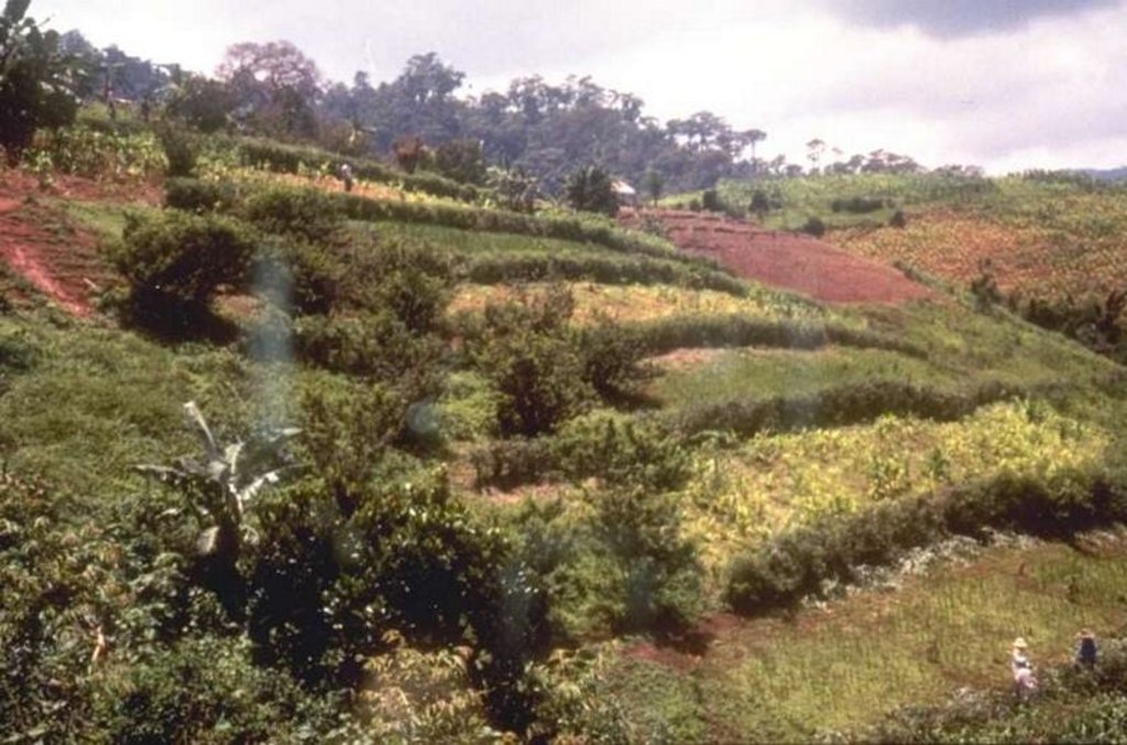
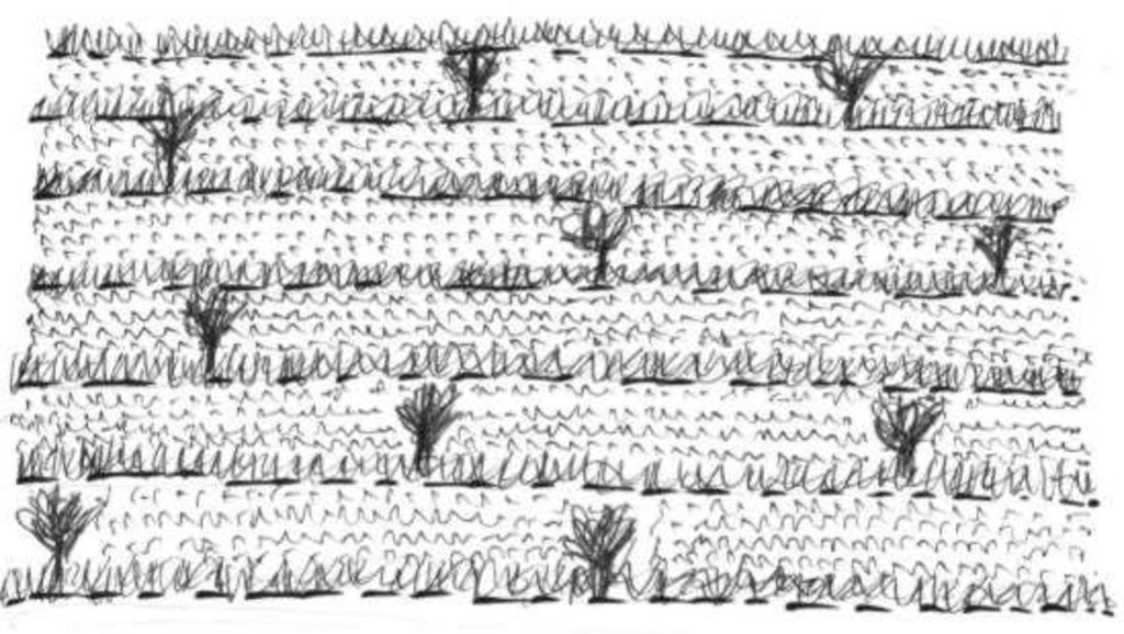
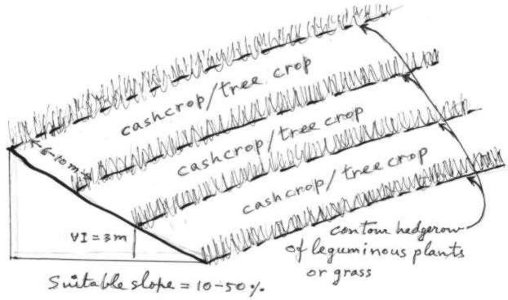
To make the contour hedgerow by grass and legunminous plants across the slope together with integrated cropping system, comprising of field crop, vegetables and bush-type crops and fruit trees. Other components include contour cultivation, incorporation of crop residues, soil amendments, reduced tillage, stressing on cropping more than once a year.
2.3 Photos of the Technology
2.5 Country/ region/ locations where the Technology has been applied and which are covered by this assessment
Country:
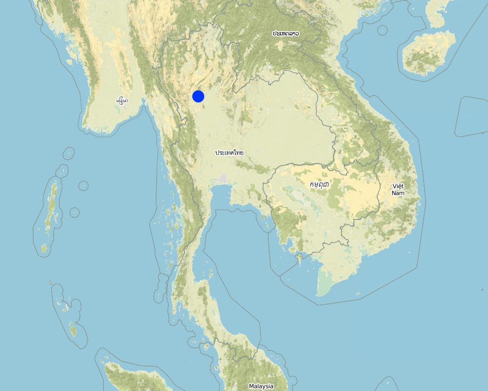
Thailand
Region/ State/ Province:
Upper North
Further specification of location:
Upper North
Specify the spread of the Technology:
- evenly spread over an area
If precise area is not known, indicate approximate area covered:
- 100-1,000 km2
Comments:
Total area covered by the SLM Technology is 1000 km2.
This technology is being implemented in several areas. The extent of mplemented areas is not exactly known at the this time but can be known in the future.
Map
×2.6 Date of implementation
If precise year is not known, indicate approximate date:
- less than 10 years ago (recently)
2.7 Introduction of the Technology
Specify how the Technology was introduced:
- through projects/ external interventions
Comments (type of project, etc.):
Alley cropping with leguminous hedgerow was introduced from IITA, Nigeria. Grass strip was introduced from Australia.
3. Classification of the SLM Technology
3.1 Main purpose(s) of the Technology
- reduce, prevent, restore land degradation
3.2 Current land use type(s) where the Technology is applied
Land use mixed within the same land unit:
Yes
Specify mixed land use (crops/ grazing/ trees):
- Agroforestry

Cropland
- Annual cropping
- Perennial (non-woody) cropping
- Tree and shrub cropping
Annual cropping - Specify crops:
- cereals - rice (upland)
- legumes and pulses - other
- corn
Tree and shrub cropping - Specify crops:
- mango, mangosteen, guava
- Lychee, Longan, Jack fruit
Number of growing seasons per year:
- 1
Specify:
Longest growing period in days: 180 Longest growing period from month to month: May - Oct

Grazing land

Forest/ woodlands
- Leucaena, cajanus, flemingo, tephrosia, glyricidia
Products and services:
- Timber
- Fruits and nuts
Comments:
Major land use problems (compiler’s opinion): 1. Farmers lack of technology about SWC and soil improvement. Farmers need support in credits and marketing. 3. Poveerty.
Major land use problems (land users’ perception): 1. Weed problems. 2. Soil fertility decline resulting in decreased crop yield. 3. Soil erosion. 4. Lack of labour.
3.4 Water supply
Water supply for the land on which the Technology is applied:
- rainfed
3.5 SLM group to which the Technology belongs
- minimal soil disturbance
- cross-slope measure
3.6 SLM measures comprising the Technology

agronomic measures
- A3: Soil surface treatment
A3: Differentiate tillage systems:
A 3.2: Reduced tillage (> 30% soil cover)
Comments:
Main measures: vegetative measures
Secondary measures: agronomic measures
Type of agronomic measures: mixed cropping / intercropping, mulching, green manure, minimum tillage, contour tillage
3.7 Main types of land degradation addressed by the Technology

soil erosion by water
- Wt: loss of topsoil/ surface erosion

chemical soil deterioration
- Cn: fertility decline and reduced organic matter content (not caused by erosion)

water degradation
- Ha: aridification
Comments:
Main type of degradation addressed: Wt: loss of topsoil / surface erosion
Secondary types of degradation addressed: Cn: fertility decline and reduced organic matter content, Ha: aridification
3.8 Prevention, reduction, or restoration of land degradation
Specify the goal of the Technology with regard to land degradation:
- prevent land degradation
4. Technical specifications, implementation activities, inputs, and costs
4.1 Technical drawing of the Technology
Technical specifications (related to technical drawing):
General dimension of the technology
Upper North
Date: 8/6/00
Technical knowledge required for field staff / advisors: high
Technical knowledge required for land users: high
Main technical functions: control of raindrop splash, control of dispersed runoff: impede / retard, reduction of slope length, improvement of ground cover, increase in organic matter, increase of infiltration, increase in soil fertility
Secondary technical functions: increase of surface roughness, increase / maintain water stored in soil, water harvesting / increase water supply, water spreading
Green manure
Material/ species: Leucaena leucocephala, Cajanus cajan
Remarks: From lopping branches of legumes
Vegetative measure: Contour
Vegetative material: T : trees / shrubs
Vertical interval between rows / strips / blocks (m): 3
Spacing between rows / strips / blocks (m): 5-12
Vegetative measure: Grass strip
Vegetative material: T : trees / shrubs
Vertical interval between rows / strips / blocks (m): 3
Spacing between rows / strips / blocks (m): 5-12
Vegetative measure: Vegetative material: T : trees / shrubs
Vegetative measure: Vegetative material: T : trees / shrubs
Trees/ shrubs species: Leucaena, cajanus, flemingo, tephrosia, glyricidia
Fruit trees / shrubs species: Mango, Jack fruit, Longan, Lychee, etc.
Grass species: Vetiver, ruzi, setaria, bahia, napier
Slope (which determines the spacing indicated above): 30.00%
If the original slope has changed as a result of the Technology, the slope today is (see figure below): 20.00%
Gradient along the rows / strips: 0.00%
Author:
Samran Sombatpanit, Bangkok, Thailand
4.2 General information regarding the calculation of inputs and costs
other/ national currency (specify):
Baht
If relevant, indicate exchange rate from USD to local currency (e.g. 1 USD = 79.9 Brazilian Real): 1 USD =:
37.0
Indicate average wage cost of hired labour per day:
2.70
4.3 Establishment activities
| Activity | Timing (season) | |
|---|---|---|
| 1. | Contour establishment | beforginning of rainy season |
| 2. | Establishing hedgerow area | beforginning of rainy season |
| 3. | Planting hedgerow plants | beforginning of rainy season |
4.4 Costs and inputs needed for establishment
| Specify input | Unit | Quantity | Costs per Unit | Total costs per input | % of costs borne by land users | |
|---|---|---|---|---|---|---|
| Labour | Labour | ha | 1.0 | 54.0 | 54.0 | |
| Equipment | Equipment - hour | ha | 1.0 | 5.4 | 5.4 | |
| Plant material | Seeds | ha | 1.0 | 6.0 | 6.0 | |
| Total costs for establishment of the Technology | 65.4 | |||||
| Total costs for establishment of the Technology in USD | 1.77 | |||||
Comments:
Duration of establishment phase: 12 month(s)
4.5 Maintenance/ recurrent activities
| Activity | Timing/ frequency | |
|---|---|---|
| 1. | Weeding | Before rainy season / Two times per crop |
| 2. | Land preparation | Before rainy season / Once a year |
| 3. | Crop planting | Before rainy season / Once a year |
| 4. | Fertilizer application | Before rainy season / Once per crop |
| 5. | Loppinging /mulching | as required /2-3 times per year |
4.6 Costs and inputs needed for maintenance/ recurrent activities (per year)
| Specify input | Unit | Quantity | Costs per Unit | Total costs per input | % of costs borne by land users | |
|---|---|---|---|---|---|---|
| Labour | Labour | ha | 1.0 | 64.8 | 64.8 | |
| Total costs for maintenance of the Technology | 64.8 | |||||
| Total costs for maintenance of the Technology in USD | 1.75 | |||||
Comments:
Machinery/ tools: Tractor, hand hoe, macheter
Calculation of the cost will involve only those related to SWC. The hedgerow area per ha is 1000 m2 which requires approximately one hour of tractor's work, the rental charge of which is 200 Baht per hour.
4.7 Most important factors affecting the costs
Describe the most determinate factors affecting the costs:
The cost depends very much on the degree of slope, which determines the number of hedgerows per specific area.
5. Natural and human environment
5.1 Climate
Annual rainfall
- < 250 mm
- 251-500 mm
- 501-750 mm
- 751-1,000 mm
- 1,001-1,500 mm
- 1,501-2,000 mm
- 2,001-3,000 mm
- 3,001-4,000 mm
- > 4,000 mm
Specifications/ comments on rainfall:
Annual rainfall: Also 1500-2000 mm (ranked 2) and 750-1000 mm (ranked 3)
Agro-climatic zone
- sub-humid
5.2 Topography
Slopes on average:
- flat (0-2%)
- gentle (3-5%)
- moderate (6-10%)
- rolling (11-15%)
- hilly (16-30%)
- steep (31-60%)
- very steep (>60%)
Landforms:
- plateau/plains
- ridges
- mountain slopes
- hill slopes
- footslopes
- valley floors
Altitudinal zone:
- 0-100 m a.s.l.
- 101-500 m a.s.l.
- 501-1,000 m a.s.l.
- 1,001-1,500 m a.s.l.
- 1,501-2,000 m a.s.l.
- 2,001-2,500 m a.s.l.
- 2,501-3,000 m a.s.l.
- 3,001-4,000 m a.s.l.
- > 4,000 m a.s.l.
Comments and further specifications on topography:
Altitudinal zone: Also 501-1000 m a.s.l. (ranked 2) and 1001-1500 m a.s.l. (ranked 3)
5.3 Soils
Soil depth on average:
- very shallow (0-20 cm)
- shallow (21-50 cm)
- moderately deep (51-80 cm)
- deep (81-120 cm)
- very deep (> 120 cm)
Soil texture (topsoil):
- medium (loamy, silty)
- fine/ heavy (clay)
Topsoil organic matter:
- medium (1-3%)
If available, attach full soil description or specify the available information, e.g. soil type, soil PH/ acidity, Cation Exchange Capacity, nitrogen, salinity etc.
Soil depth on average: Also deep (ranked 2)
Soil fertility: Medium
Soil drainage/infiltration: Good
Soil water storage capacity: Medium
5.6 Characteristics of land users applying the Technology
Market orientation of production system:
- subsistence (self-supply)
Off-farm income:
- 10-50% of all income
Relative level of wealth:
- very poor
- poor
Level of mechanization:
- manual work
Indicate other relevant characteristics of the land users:
Population density: 10-50 persons/km2
Annual population growth: 2% - 3%
10% of the land users are average wealthy and own 10% of the land.
10% of the land users are poor and own 10% of the land.
80% of the land users are poor and own 80% of the land.
Off-farm income specification: Poor land users used to work as labourers to earn extra income.
5.7 Average area of land used by land users applying the Technology
- < 0.5 ha
- 0.5-1 ha
- 1-2 ha
- 2-5 ha
- 5-15 ha
- 15-50 ha
- 50-100 ha
- 100-500 ha
- 500-1,000 ha
- 1,000-10,000 ha
- > 10,000 ha
5.8 Land ownership, land use rights, and water use rights
Land ownership:
- individual, not titled
- individual, titled
Land use rights:
- open access (unorganized)
- individual
6. Impacts and concluding statements
6.1 On-site impacts the Technology has shown
Socio-economic impacts
Production
crop production
Comments/ specify:
Timber trees & fruit trees
fodder quality
wood production
production area
Comments/ specify:
For establishing hedgerows
land management
Income and costs
farm income
economic disparities
workload
Other socio-economic impacts
Input constraints
Socio-cultural impacts
community institutions
national institutions
conflict mitigation
Ecological impacts
Water cycle/ runoff
surface runoff
Quantity before SLM:
20
Quantity after SLM:
10
excess water drainage
Soil
soil moisture
soil cover
soil loss
Quantity before SLM:
20
Quantity after SLM:
5
nutrient cycling/ recharge
Biodiversity: vegetation, animals
plant diversity
animal diversity
habitat diversity
6.2 Off-site impacts the Technology has shown
reliable and stable stream flows in dry season
downstream flooding
downstream siltation
groundwater/ river pollution
6.4 Cost-benefit analysis
How do the benefits compare with the establishment costs (from land users’ perspective)?
Short-term returns:
positive
Long-term returns:
very positive
How do the benefits compare with the maintenance/ recurrent costs (from land users' perspective)?
Short-term returns:
positive
Long-term returns:
very positive
6.5 Adoption of the Technology
If available, quantify (no. of households and/ or area covered):
15100, 100% area covered
Of all those who have adopted the Technology, how many did so spontaneously, i.e. without receiving any material incentives/ payments?
- 0-10%
Comments:
99% of land user families have adopted the Technology with external material support
15000 land user families have adopted the Technology with external material support
Comments on acceptance with external material support: estimates
1% of land user families have adopted the Technology without any external material support
100 land user families have adopted the Technology without any external material support
Comments on spontaneous adoption: estimates
There is a moderate trend towards spontaneous adoption of the Technology
Comments on adoption trend: Number of participating farmers increases according to the government's budget and work plan. The technology has been widely accepted all over the country and in many parts of the world.
6.7 Strengths/ advantages/ opportunities of the Technology
| Strengths/ advantages/ opportunities in the land user’s view |
|---|
| The technology can: 1. Improve soil fertility and productivity. |
| 2. Increase income |
| 3. Attain sustainable land use. |
| Strengths/ advantages/ opportunities in the compiler’s or other key resource person’s view |
|---|
|
The technology can: 1. Reduce soil loss/runoff How can they be sustained / enhanced? Try to integrate annual cash crops and fruit trees. |
| 2. Improve soil fertility |
| 3. Conserve soil moisture |
|
4. Increase yield/income 5. Preserve the environment |
|
6. Easily implemented by farmers 7. Requires low cost. |
6.8 Weaknesses/ disadvantages/ risks of the Technology and ways of overcoming them
| Weaknesses/ disadvantages/ risks in the land user’s view | How can they be overcome? |
|---|---|
| 1. Require more labour to create and maintain. | 1. Grow fast-growing tree species. |
| 2. Certain part of the land especially that occupied by the hedgerows cannot be used to grow crop. | 2. Hire more labourers from the increased income. |
| Weaknesses/ disadvantages/ risks in the compiler’s or other key resource person’s view | How can they be overcome? |
|---|---|
| It is more labour intensive than normal farming practices. | Good labour management |
7. References and links
7.1 Methods/ sources of information
7.2 References to available publications
Title, author, year, ISBN:
Sajjapongse, A., C. Anecksamphant and S. Boonchee, ASALAND management of Sloping Lands Network. Special Lecture, LDD Technical Meeting, February 15-18, 2000, Chiang Mai.. 2000.
Available from where? Costs?
Department of Land Development, Bangkok 10900, Thailand
Title, author, year, ISBN:
Other documents from IBSRAM and other development projects assisted by foreign countries. 1990-1999.
Links and modules
Expand all Collapse allLinks
No links
Modules
No modules


