Buffer Strip on Steep Sloping Cropland [Tajikistan]
- Creation:
- Update:
- Compiler: Erik Bühlmann
- Editor: –
- Reviewers: David Streiff, Alexandra Gavilano
technologies_1003 - Tajikistan
View sections
Expand all Collapse all1. General information
1.2 Contact details of resource persons and institutions involved in the assessment and documentation of the Technology
SLM specialist:
Name of the institution(s) which facilitated the documentation/ evaluation of the Technology (if relevant)
CDE Centre for Development and Environment (CDE Centre for Development and Environment) - SwitzerlandName of the institution(s) which facilitated the documentation/ evaluation of the Technology (if relevant)
NCCR North-South (NCCR North-South) - Kyrgyzstan1.3 Conditions regarding the use of data documented through WOCAT
The compiler and key resource person(s) accept the conditions regarding the use of data documented through WOCAT:
Yes
2. Description of the SLM Technology
2.1 Short description of the Technology
Definition of the Technology:
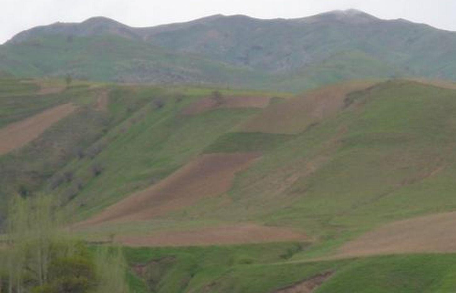
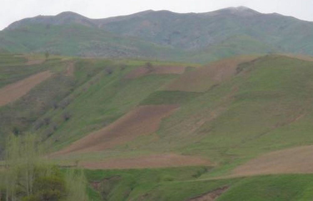
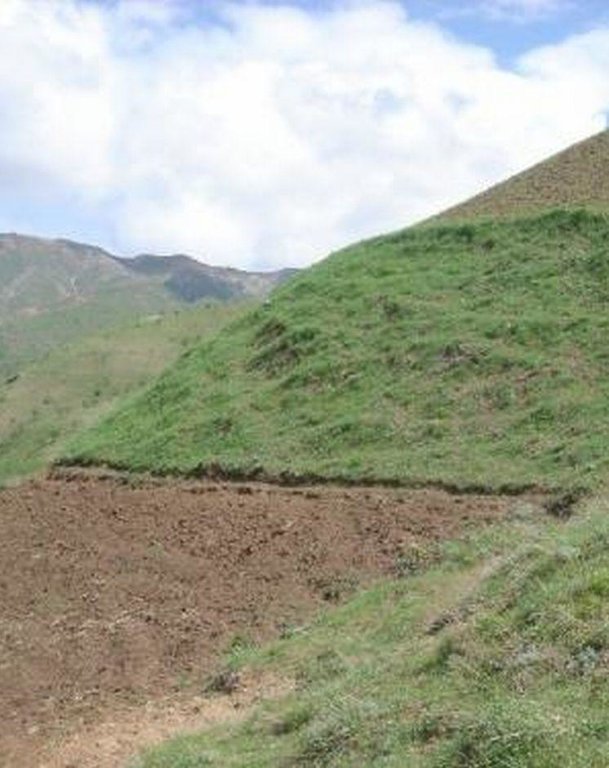
A buffer strip of grass is left uncultivated in the middle of an area of steep sloping cropland to help reduce soil erosion.
2.2 Detailed description of the Technology
Description:
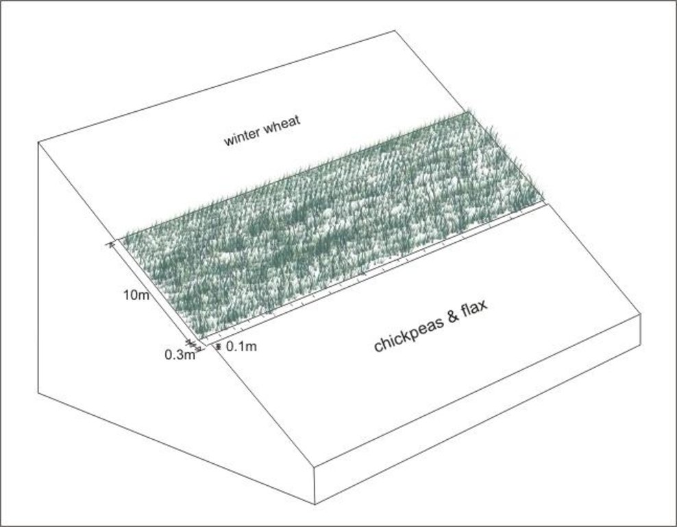
A grass strip, approximately 10m wide is left uncultivated across the upper part of the slope. This buffer strip is followed by an adjacent drainage ditch to enhance the technology’s capability of reducing run-on onto the field further down the slope. Neighbouring land users decided to implement the technology in order to reduce soil erosion on their cropland (wheat, chickpeas and flax), and to prevent disputes about land management practices. Upslope and downslope land users reported a significant reduction of observed rill development and fertility decline, emphasising that the benefits of the grass strip offset the area of crop land lost to it. The farmers paid equally for the lost cropland area.
Establishment / maintenance activities and inputs: Apart from the annual digging of the drainage ditch no establishment activities are required, since the grass strip was simply left uncultivated when the former pasture was turned into cropland. The drainage ditch needs to be cleared out of soil on a regular basis; the grass strip is cut for haymaking once during each growing season. The technology is neither cost nor labour intensive and is easy to implement. Farmers state the area lost to the grass growing as the only disadvantage. However, the grass strip alone does only reduce, not fully prevent soil erosion and should therefore be combined with other SWC technologies such as drainage ditches, terraces and/or agroforestry.
2.3 Photos of the Technology
2.5 Country/ region/ locations where the Technology has been applied and which are covered by this assessment
Country:
Tajikistan
Region/ State/ Province:
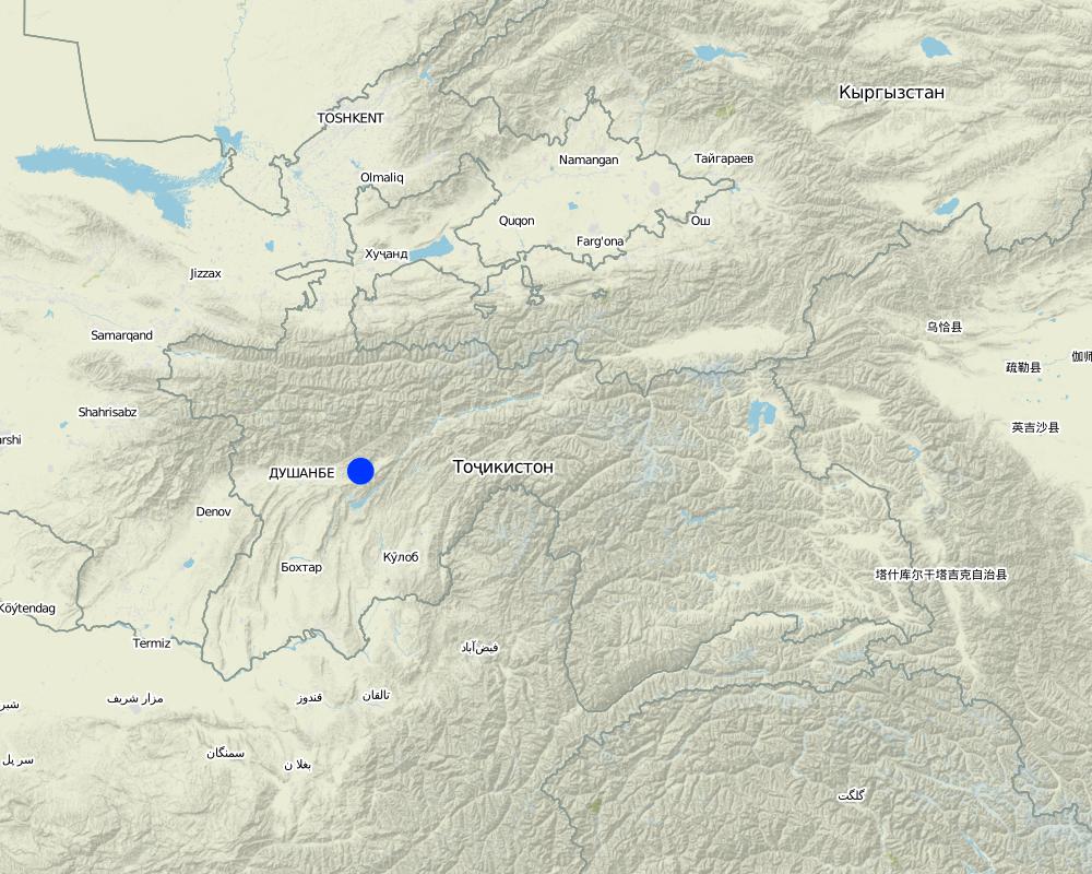
RRS
Further specification of location:
Faizabad
Specify the spread of the Technology:
- evenly spread over an area
If precise area is not known, indicate approximate area covered:
- < 0.1 km2 (10 ha)
Map
×2.7 Introduction of the Technology
Specify how the Technology was introduced:
- during experiments/ research
3. Classification of the SLM Technology
3.1 Main purpose(s) of the Technology
- reduce, prevent, restore land degradation
3.2 Current land use type(s) where the Technology is applied

Cropland
- Annual cropping
Annual cropping - Specify crops:
- legumes and pulses - peas
- fibre crops - flax, hemp, other
- cereals - wheat (spring)
Number of growing seasons per year:
- 1
Specify:
Longest growing period in days: 210Longest growing period from month to month: Mar - Aug
Comments:
Major land use problems (compiler’s opinion): severe water erosion (rills and gullies) and subsequent fertility decline
Major land use problems (land users’ perception): fertility decline, soil erosion and washing downslope of seeds before they can sprout.
Type of cropping system and major crops comments: winter wheat and sometimes chickpeas are sown in autumn because farmers lack time for land cultivation in spring, flax and also chickpeas are cultivated in spring
3.5 SLM group to which the Technology belongs
- improved ground/ vegetation cover
- cross-slope measure
3.6 SLM measures comprising the Technology

agronomic measures
- A1: Vegetation/ soil cover

vegetative measures
- V2: Grasses and perennial herbaceous plants
Comments:
Main measures: vegetative measures
Secondary measures: agronomic measures
Type of vegetative measures: aligned: -contour
3.7 Main types of land degradation addressed by the Technology

soil erosion by water
- Wt: loss of topsoil/ surface erosion
- Wg: gully erosion/ gullying

chemical soil deterioration
- Cn: fertility decline and reduced organic matter content (not caused by erosion)
Comments:
Main type of degradation addressed: Wt: loss of topsoil / surface erosion
Secondary types of degradation addressed: Wg: gully erosion / gullying, Cn: fertility decline and reduced organic matter content
3.8 Prevention, reduction, or restoration of land degradation
Specify the goal of the Technology with regard to land degradation:
- prevent land degradation
- reduce land degradation
Comments:
Main goals: mitigation / reduction of land degradation
Secondary goals: prevention of land degradation
4. Technical specifications, implementation activities, inputs, and costs
4.1 Technical drawing of the Technology
Technical specifications (related to technical drawing):
Grass strip with adjacent drainage ditch on an area of steep sloping cropland
Location: Karsang. Faizabad Rayon, RRS
Date: 16.07.2005
Technical knowledge required for field staff / advisors: low
Technical knowledge required for land users: low
Main technical functions: control of dispersed runoff: impede / retard, control of concentrated runoff: impede / retard, reduction of slope length
Secondary technical functions: control of concentrated runoff: drain / divert, improvement of ground cover, increase of infiltration, increase / maintain water stored in soil
Agronomic measure: drainage ditch
Remarks: width: 0.3m, depth: 0.1m, adjacent to grass strip
Aligned: -contour
Vegetative material: G : grass
Width within rows / strips / blocks (m): 10
Slope (which determines the spacing indicated above): 60%
Author:
Erik Bühlmann, Berne, Switzerland
4.2 General information regarding the calculation of inputs and costs
Specify currency used for cost calculations:
- USD
Indicate average wage cost of hired labour per day:
3.00
4.3 Establishment activities
| Activity | Timing (season) | |
|---|---|---|
| 1. | no establishment activities needed as grass strip is left uncultivated |
4.4 Costs and inputs needed for establishment
Comments:
Duration of establishment phase: 0 month(s)
4.5 Maintenance/ recurrent activities
| Activity | Timing/ frequency | |
|---|---|---|
| 1. | digging of drainage ditch | sowing of crop / annual |
| 2. | clearing of drainage ditch from washed in soil | rainy season / after every rainfall event |
| 3. | cutting of grass (haymaking) | summer /annual |
4.6 Costs and inputs needed for maintenance/ recurrent activities (per year)
| Specify input | Unit | Quantity | Costs per Unit | Total costs per input | % of costs borne by land users | |
|---|---|---|---|---|---|---|
| Labour | digging of drainage ditch | ha | 1.0 | 1.0 | 1.0 | |
| Labour | clearing of drainage ditch from washed in soil | ha | 1.0 | 3.0 | 3.0 | |
| Total costs for maintenance of the Technology | 4.0 | |||||
| Total costs for maintenance of the Technology in USD | 4.0 | |||||
Comments:
Machinery/ tools: tools: spade, sickle
costs per hectare (including adjacent land upslope and dowslope)
4.7 Most important factors affecting the costs
Describe the most determinate factors affecting the costs:
If the technology is not established at the point of the initial cultivation of the cropland, grass clods will need to be transplanted which considerably increases the establishment costs
5. Natural and human environment
5.1 Climate
Annual rainfall
- < 250 mm
- 251-500 mm
- 501-750 mm
- 751-1,000 mm
- 1,001-1,500 mm
- 1,501-2,000 mm
- 2,001-3,000 mm
- 3,001-4,000 mm
- > 4,000 mm
Agro-climatic zone
- sub-humid
- semi-arid
growing period 180-210 days
5.2 Topography
Slopes on average:
- flat (0-2%)
- gentle (3-5%)
- moderate (6-10%)
- rolling (11-15%)
- hilly (16-30%)
- steep (31-60%)
- very steep (>60%)
Landforms:
- plateau/plains
- ridges
- mountain slopes
- hill slopes
- footslopes
- valley floors
Altitudinal zone:
- 0-100 m a.s.l.
- 101-500 m a.s.l.
- 501-1,000 m a.s.l.
- 1,001-1,500 m a.s.l.
- 1,501-2,000 m a.s.l.
- 2,001-2,500 m a.s.l.
- 2,501-3,000 m a.s.l.
- 3,001-4,000 m a.s.l.
- > 4,000 m a.s.l.
5.3 Soils
Soil depth on average:
- very shallow (0-20 cm)
- shallow (21-50 cm)
- moderately deep (51-80 cm)
- deep (81-120 cm)
- very deep (> 120 cm)
Soil texture (topsoil):
- medium (loamy, silty)
- fine/ heavy (clay)
Topsoil organic matter:
- medium (1-3%)
- low (<1%)
If available, attach full soil description or specify the available information, e.g. soil type, soil PH/ acidity, Cation Exchange Capacity, nitrogen, salinity etc.
Soil fertility: medium - high
Soil drainage / infiltration: medium - good
5.6 Characteristics of land users applying the Technology
Market orientation of production system:
- subsistence (self-supply)
- mixed (subsistence/ commercial)
Off-farm income:
- > 50% of all income
Relative level of wealth:
- average
Level of mechanization:
- manual work
Indicate other relevant characteristics of the land users:
75% of the land users are average wealthy and own 70% of the land (since technology requires space, poor and very poor farmers will find it difficult to implement).
Off-farm income specification: In general, all farmers (including those applying SWC technologies) are highly dependent on off-farm income, which in most cases is earned in Russia either by themselves or by their relatives.
Level of mechanization: Steep slopes do not allow cultivation by tractor or animal traction
Market orientation of production system mixed (subsistence/ commercial): Only surpluses are sold or exchanged for other goods
5.7 Average area of land used by land users applying the Technology
- < 0.5 ha
- 0.5-1 ha
- 1-2 ha
- 2-5 ha
- 5-15 ha
- 15-50 ha
- 50-100 ha
- 100-500 ha
- 500-1,000 ha
- 1,000-10,000 ha
- > 10,000 ha
Comments:
Average area of land owned or leased by land users applying the Technology also 0.5-1 ha
5.8 Land ownership, land use rights, and water use rights
Land ownership:
- state
Land use rights:
- leased
6. Impacts and concluding statements
6.1 On-site impacts the Technology has shown
Socio-economic impacts
Production
crop production
production area
Comments/ specify:
loss of land for crop production
Income and costs
farm income
Socio-cultural impacts
community institutions
Ecological impacts
Soil
soil moisture
soil cover
soil loss
Comments/ specify:
prevented formation of large rills
Other ecological impacts
soil fertility
6.2 Off-site impacts the Technology has shown
downstream flooding
6.4 Cost-benefit analysis
How do the benefits compare with the establishment costs (from land users’ perspective)?
Short-term returns:
positive
Long-term returns:
positive
How do the benefits compare with the maintenance/ recurrent costs (from land users' perspective)?
Short-term returns:
positive
Long-term returns:
positive
6.5 Adoption of the Technology
- single cases/ experimental
If available, quantify (no. of households and/ or area covered):
Household 1
Of all those who have adopted the Technology, how many did so spontaneously, i.e. without receiving any material incentives/ payments?
- 91-100%
Comments:
100% of land user families have adopted the Technology without any external material support
1 land user families have adopted the Technology without any external material support
Comments on spontaneous adoption: estimates
There is no trend towards spontaneous adoption of the Technology
Comments on adoption trend: no other land users have adopted the technology so far
6.7 Strengths/ advantages/ opportunities of the Technology
| Strengths/ advantages/ opportunities in the land user’s view |
|---|
| protects his land from water erosion |
| prevents downslope washing of seeds before germination |
| no conflicts about land management with neighbours upslope |
| defines field boundaries |
| Strengths/ advantages/ opportunities in the compiler’s or other key resource person’s view |
|---|
|
effectively reduces formation of large rills on steep sloping cropland How can they be sustained / enhanced? substitution of drainage ditch with a permanent cut-off drain (graded) would enhance the technologies capability of reducing soil erosion |
| very little costs for establishment and maintainance |
| easy to implement, easy to maintain |
| helps to prevent disputes between neighbouring land users about land management practices |
6.8 Weaknesses/ disadvantages/ risks of the Technology and ways of overcoming them
| Weaknesses/ disadvantages/ risks in the land user’s view | How can they be overcome? |
|---|---|
| loss of cropland area only disadvantage |
| Weaknesses/ disadvantages/ risks in the compiler’s or other key resource person’s view | How can they be overcome? |
|---|---|
| does only reduce, not fully prevent soil erosion | combination with other SWC technologies, such as graded drainage ditches (TAJ10) |
| occupies a relatively large amount of space |
7. References and links
7.1 Methods/ sources of information
Links and modules
Expand all Collapse allLinks
No links
Modules
No modules


