Cistern [Tunisia]
- Creation:
- Update:
- Compiler: Mongi Ben Zaied
- Editor: –
- Reviewers: Fabian Ottiger, Alexandra Gavilano
Majen / Majel / fasquia (Ar)
technologies_1413 - Tunisia
View sections
Expand all Collapse all1. General information
1.2 Contact details of resource persons and institutions involved in the assessment and documentation of the Technology
Key resource person(s)
SLM specialist:
Sghaier Mongi
Institut des Régions Arides IRA
Tunisia
SLM specialist:
Chniter Mongi
Commissariats Régionaux au Développement Agricole CRDA
Tunisia
SLM specialist:
Name of the institution(s) which facilitated the documentation/ evaluation of the Technology (if relevant)
Institut des Régions Arides de Médenine (Institut des Régions Arides de Médenine) - TunisiaName of the institution(s) which facilitated the documentation/ evaluation of the Technology (if relevant)
Commissariats Régionaux au Développement Agricole (CRDA) - Tunisia1.3 Conditions regarding the use of data documented through WOCAT
The compiler and key resource person(s) accept the conditions regarding the use of data documented through WOCAT:
Yes
2. Description of the SLM Technology
2.1 Short description of the Technology
Definition of the Technology:
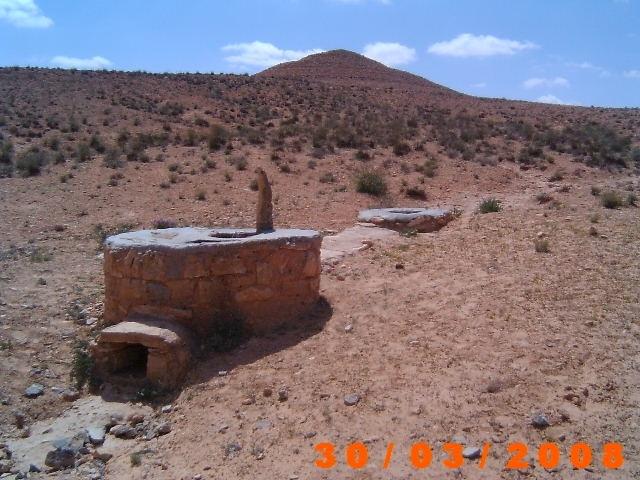
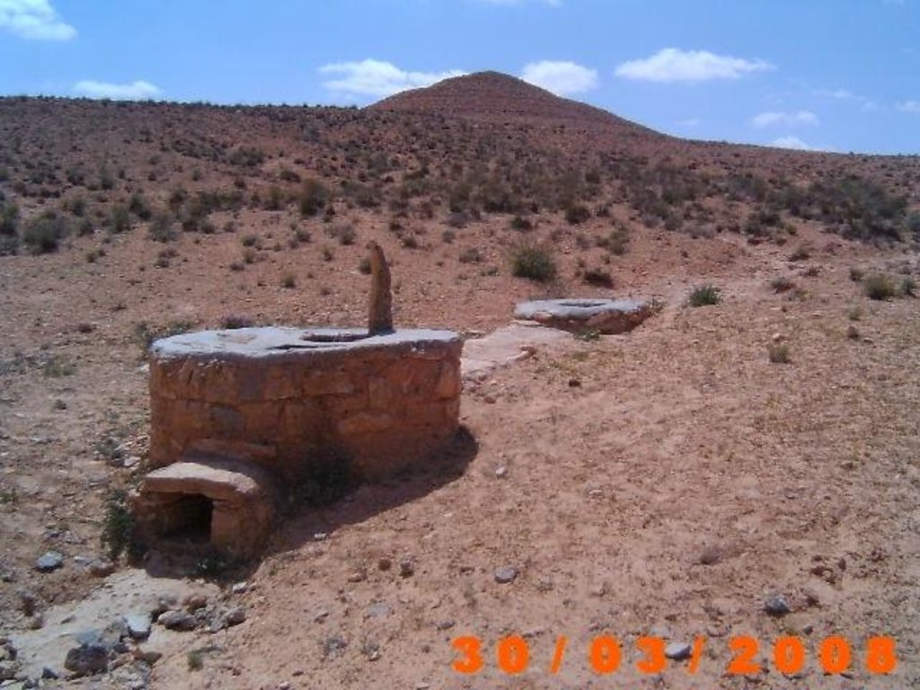
Cisterns are reservoirs used for storing rainfall and runoff water for multiple purposes: drinking, animal watering and supplemental irrigation.
2.2 Detailed description of the Technology
Description:
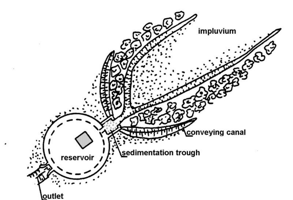
Cisterns were traditionally used to provide drinking water. In the cistern system, runoff water is collected and stored in stone-faced underground cisterns, of various sizes, called majel (private reservoirs) and fesquia (communal reservoirs). Basically, a cistern is a hole dug in the ground and lined with a gypsum or concrete coating, in order to avoid vertical and lateral infiltration. Each unit consists of three main parts: the impluvium, the sediment settlement basin, and the storage reservoir. The impluvium is a sloping piece of land delimited by a diversion channel (hammala).
Purpose of the Technology: It is estimated that a tank with a capacity of 35 m3 can meet the annual water needs of a family and its livestock (Ennabli, 1993).
Establishment / maintenance activities and inputs: In flat areas, where it is possible also to exploit floods via a diversion dyke, one also finds artificially paved runoff areas. A small basin before the entrance of the cistern allows the sedimentation of runoff loads. This improves the stored water quality and reduces maintenance costs. Big cisterns have, in addition to the storage compartment, a pumping reservoir from which water is drawn (Ouessar, 2007).
Natural / human environment: Small private and communal cisterns (5 to 200 m3) and big cisterns (up to 70,000 m3), mainly built during the Roman and Arab-Muslim eras, can be found throughout the water-deficient zone south of the 400-mm isohyet .
2.3 Photos of the Technology
2.5 Country/ region/ locations where the Technology has been applied and which are covered by this assessment
Country:
Tunisia
Region/ State/ Province:
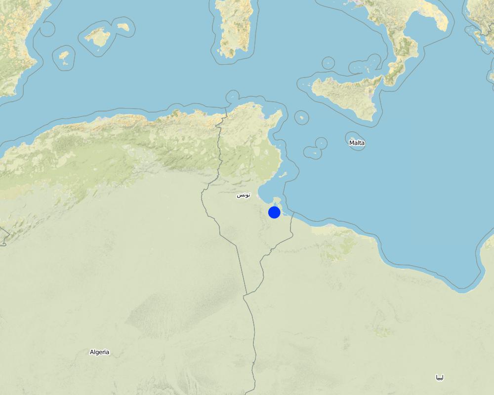
Medenine
Further specification of location:
Medenine nord
Specify the spread of the Technology:
- evenly spread over an area
If precise area is not known, indicate approximate area covered:
- 10-100 km2
Map
×2.6 Date of implementation
If precise year is not known, indicate approximate date:
- more than 50 years ago (traditional)
2.7 Introduction of the Technology
Specify how the Technology was introduced:
- as part of a traditional system (> 50 years)
3. Classification of the SLM Technology
3.2 Current land use type(s) where the Technology is applied
Land use mixed within the same land unit:
Yes
Specify mixed land use (crops/ grazing/ trees):
- Agroforestry

Cropland
Number of growing seasons per year:
- 1
Specify:
Longest growing period in days: 180Longest growing period from month to month: Oct - Apr

Grazing land

Other
Comments:
Major land use problems (compiler’s opinion): Runoff loss
Major land use problems (land users’ perception): Water loss
3.5 SLM group to which the Technology belongs
- water harvesting
3.6 SLM measures comprising the Technology

structural measures
- S11: Others
Comments:
Main measures: structural measures
3.7 Main types of land degradation addressed by the Technology

water degradation
- Ha: aridification
Comments:
Main type of degradation addressed: Ha: aridification
Main causes of degradation: droughts
3.8 Prevention, reduction, or restoration of land degradation
Specify the goal of the Technology with regard to land degradation:
- reduce land degradation
Comments:
Main goals: mitigation / reduction of land degradation
4. Technical specifications, implementation activities, inputs, and costs
4.1 Technical drawing of the Technology
Technical specifications (related to technical drawing):
Components of the cistern system.
south east Tunisia
Date: January 2009
Technical knowledge required for field staff / advisors: low
Technical knowledge required for land users: low
Main technical functions: water harvesting / increase water supply
Structural measure: Reservoir
Depth of ditches/pits/dams (m): 4-10
Width of ditches/pits/dams (m): 2-4
Construction material (stone): Stone
Construction material (concrete): coating
For water harvesting: the ratio between the area where the harvested water is applied and the total area from which water is collected is: 1:4
Author:
Ouessar M., Medenine, tunisia
4.2 General information regarding the calculation of inputs and costs
other/ national currency (specify):
TND
If relevant, indicate exchange rate from USD to local currency (e.g. 1 USD = 79.9 Brazilian Real): 1 USD =:
1.3
Indicate average wage cost of hired labour per day:
10.00
4.3 Establishment activities
| Activity | Timing (season) | |
|---|---|---|
| 1. | Pit digging | |
| 2. | Coating |
4.4 Costs and inputs needed for establishment
| Specify input | Unit | Quantity | Costs per Unit | Total costs per input | % of costs borne by land users | |
|---|---|---|---|---|---|---|
| Labour | Labour | ha | 1.0 | 250.0 | 250.0 | |
| Construction material | ha | 1.0 | 150.0 | 150.0 | ||
| Total costs for establishment of the Technology | 400.0 | |||||
| Total costs for establishment of the Technology in USD | 307.69 | |||||
Comments:
Duration of establishment phase: 1 month(s)
4.5 Maintenance/ recurrent activities
| Activity | Timing/ frequency | |
|---|---|---|
| 1. | Desilting | Yearly |
| 2. | Repairs | Each 3-5 years |
4.6 Costs and inputs needed for maintenance/ recurrent activities (per year)
| Specify input | Unit | Quantity | Costs per Unit | Total costs per input | % of costs borne by land users | |
|---|---|---|---|---|---|---|
| Labour | Labour | ha | 1.0 | 80.0 | 80.0 | |
| Construction material | ha | 1.0 | 50.0 | 50.0 | ||
| Total costs for maintenance of the Technology | 130.0 | |||||
| Total costs for maintenance of the Technology in USD | 100.0 | |||||
5. Natural and human environment
5.1 Climate
Annual rainfall
- < 250 mm
- 251-500 mm
- 501-750 mm
- 751-1,000 mm
- 1,001-1,500 mm
- 1,501-2,000 mm
- 2,001-3,000 mm
- 3,001-4,000 mm
- > 4,000 mm
Agro-climatic zone
- arid
Thermal climate class: subtropics
5.2 Topography
Slopes on average:
- flat (0-2%)
- gentle (3-5%)
- moderate (6-10%)
- rolling (11-15%)
- hilly (16-30%)
- steep (31-60%)
- very steep (>60%)
Landforms:
- plateau/plains
- ridges
- mountain slopes
- hill slopes
- footslopes
- valley floors
Altitudinal zone:
- 0-100 m a.s.l.
- 101-500 m a.s.l.
- 501-1,000 m a.s.l.
- 1,001-1,500 m a.s.l.
- 1,501-2,000 m a.s.l.
- 2,001-2,500 m a.s.l.
- 2,501-3,000 m a.s.l.
- 3,001-4,000 m a.s.l.
- > 4,000 m a.s.l.
5.4 Water availability and quality
Water quality (untreated):
good drinking water
5.6 Characteristics of land users applying the Technology
Off-farm income:
- > 50% of all income
Relative level of wealth:
- poor
- average
Individuals or groups:
- individual/ household
Gender:
- men
Indicate other relevant characteristics of the land users:
Land users applying the Technology are mainly common / average land users
Population density: 10-50 persons/km2
Annual population growth: 0.5% - 1%
10% of the land users are rich and own 15% of the land.
70% of the land users are average wealthy and own 75% of the land.
20% of the land users are poor and own 10% of the land.
5.7 Average area of land used by land users applying the Technology
- < 0.5 ha
- 0.5-1 ha
- 1-2 ha
- 2-5 ha
- 5-15 ha
- 15-50 ha
- 50-100 ha
- 100-500 ha
- 500-1,000 ha
- 1,000-10,000 ha
- > 10,000 ha
Is this considered small-, medium- or large-scale (referring to local context)?
- small-scale
5.8 Land ownership, land use rights, and water use rights
Land ownership:
- communal/ village
- individual, titled
Land use rights:
- communal (organized)
- individual
Water use rights:
- communal (organized)
- individual
5.9 Access to services and infrastructure
health:
- poor
- moderate
- good
education:
- poor
- moderate
- good
technical assistance:
- poor
- moderate
- good
employment (e.g. off-farm):
- poor
- moderate
- good
markets:
- poor
- moderate
- good
energy:
- poor
- moderate
- good
roads and transport:
- poor
- moderate
- good
drinking water and sanitation:
- poor
- moderate
- good
financial services:
- poor
- moderate
- good
6. Impacts and concluding statements
6.1 On-site impacts the Technology has shown
Socio-economic impacts
Production
animal production
Water availability and quality
drinking water availability
Socio-cultural impacts
SLM/ land degradation knowledge
conflict mitigation
Comments/ specify:
negligible (0-5%)
Improved livelihoods and human well-being
Ecological impacts
Water cycle/ runoff
water quantity
harvesting/ collection of water
Soil
soil cover
soil loss
Climate and disaster risk reduction
wind velocity
6.3 Exposure and sensitivity of the Technology to gradual climate change and climate-related extremes/ disasters (as perceived by land users)
Gradual climate change
Gradual climate change
| Season | increase or decrease | How does the Technology cope with it? | |
|---|---|---|---|
| annual temperature | increase | well |
Climate-related extremes (disasters)
Meteorological disasters
| How does the Technology cope with it? | |
|---|---|
| local rainstorm | well |
| local windstorm | well |
Climatological disasters
| How does the Technology cope with it? | |
|---|---|
| drought | not well |
Hydrological disasters
| How does the Technology cope with it? | |
|---|---|
| general (river) flood | well |
Other climate-related consequences
Other climate-related consequences
| How does the Technology cope with it? | |
|---|---|
| reduced growing period | well |
6.4 Cost-benefit analysis
How do the benefits compare with the establishment costs (from land users’ perspective)?
Short-term returns:
positive
Long-term returns:
positive
How do the benefits compare with the maintenance/ recurrent costs (from land users' perspective)?
Short-term returns:
positive
Long-term returns:
positive
6.5 Adoption of the Technology
Comments:
30% of land user families have adopted the Technology with external material support
70% of land user families have adopted the Technology without any external material support
There is a moderate trend towards spontaneous adoption of the Technology
6.7 Strengths/ advantages/ opportunities of the Technology
| Strengths/ advantages/ opportunities in the land user’s view |
|---|
| Availability of water for multiple purposes |
| Strengths/ advantages/ opportunities in the compiler’s or other key resource person’s view |
|---|
| Increased availability of water especially in remote areas |
6.8 Weaknesses/ disadvantages/ risks of the Technology and ways of overcoming them
| Weaknesses/ disadvantages/ risks in the compiler’s or other key resource person’s view | How can they be overcome? |
|---|---|
| Creation of degradation hot spots around animal watering points. | Multiplication of watering points. |
7. References and links
7.1 Methods/ sources of information
7.2 References to available publications
Title, author, year, ISBN:
Ben Mechlia, N., Ouessar, M. 2004. Water harvesting systems in Tunisia. In: Oweis, T., Hachum, A., Bruggeman, A. (eds). Indigenous water harvesting in West Asia and North Africa, , ICARDA, Aleppo, Syria, pp: 21-41.
Available from where? Costs?
IRA, ICARDA
Title, author, year, ISBN:
Chahbani, B. 2004. Technical innovations to optimize water harvesting, conservation and use for a sustainable development of rainfed agriculture in arid zones. Options Méditerranéennes, 60: 73-78.
Available from where? Costs?
IRA, CIHEAM
Title, author, year, ISBN:
El Amami, S. 1984. Les aménagements hydrauliques traditionnels en Tunisie. Centre de Recherche en Génie Rural (CRGR), Tunis, Tunisia. 69 pp.
Available from where? Costs?
IRA, CRGER
Title, author, year, ISBN:
Ennabli, N. 1993. Les aménagements hydrauliques et hydro-agricoles en Tunisie. Imprimerie Officielle de la République Tunisienne, Tunis, 255 pp.
Available from where? Costs?
IRA, INAT
Title, author, year, ISBN:
Ouessar M. 2007. Hydrological impacts of rainwater harvesting in wadi Oum Zessar watershed (Southern Tunisia). Ph.D. thesis, Faculty of Bioscience Engineering, Ghent University, Ghent, Belgium, 154 pp.
Available from where? Costs?
IRA
Links and modules
Expand all Collapse allLinks
No links
Modules
No modules


