Fertilizing and re-seeding degraded rangelands [Iceland]
- Creation:
- Update:
- Compiler: Thorunn Petursdottir
- Editor: –
- Reviewer: Jan Reichert
Hekluskogar area
technologies_1261 - Iceland
View sections
Expand all Collapse all1. General information
1.2 Contact details of resource persons and institutions involved in the assessment and documentation of the Technology
Name of project which facilitated the documentation/ evaluation of the Technology (if relevant)
Preventing and Remediating degradation of soils in Europe through Land Care (EU-RECARE )Name of the institution(s) which facilitated the documentation/ evaluation of the Technology (if relevant)
Soil Conservation Service of Iceland (Soil Conservation Service of Iceland) - Iceland1.3 Conditions regarding the use of data documented through WOCAT
The compiler and key resource person(s) accept the conditions regarding the use of data documented through WOCAT:
Yes
1.5 Reference to Questionnaire(s) on SLM Approaches (documented using WOCAT)
2. Description of the SLM Technology
2.1 Short description of the Technology
Definition of the Technology:
Rangeland restoration - Spreading small portions of inorganic fertilizer and seeds on degraded rangelands
2.2 Detailed description of the Technology
Description:
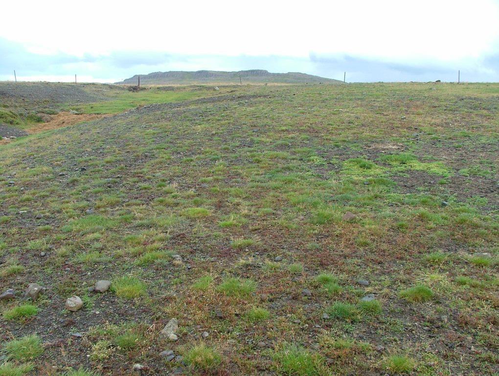
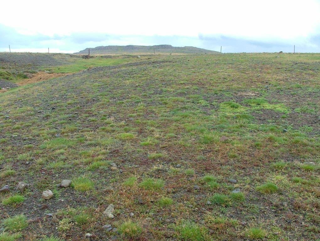
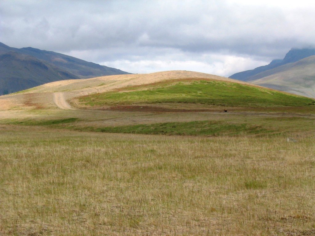
The concerning rangelands are severely degraded and parts of them have even lost their topsoil layer entirely. Nevertheless, in many cases some remnant vegetation patches are still in place and can serve as seed banks during the restoration process. In order to stabilize the surface (i.e. to reduce the effects of freeze-thaw processes), provide nutrients to the system, increase water availability and facilitate the distribution of native species within the degraded areas, tractors are used to fertilize and reseed the areas with grass species that later in the process will retreat as soon as the dispersal of native species increases. All implementations are based on the methods and tools used in ecological restoration, aiming at re-activating environmental and ecological processes and increasing the resilience of the ecosystems undergoing restoration. Minimum portions of fertilizer and seed are distributed over pre-selected areas, preferably close to the remaining vegetation "islands" in order to facilitate seed production and dispersal and provide safe sites for seed germination.
Purpose of the Technology: The purpose with the technology is to halt further land degradation and facilitate natural succession within the area undergoing restoration. In the long-term, it should substantially reduce wind and water erosion. It should also lead to increased biodiversity, enhanced water availability and accelerated carbon sequestration (in soil and vegetation). The overall restoration task is to increase the resilience of the ecosystems against natural hazards; such as volcanic activities.
Establishment / maintenance activities and inputs: In the first year, the areas are treated with a mixture of chemical fertilizer that fits the local soil condition and grass seed that are proofed to survive under harsh condition. A mixture of approx 200 kg/ha of fertilizer and around 10 kg/ha of grass seed (usually a mixture of Poa and Festuca species) is spread over the treated area. The year after the area is treated again, this time with fertilizer only (approx 100-150 kg/ha). Then the area is usually treated biannually for 4 to 6 years, based on the vegetational succession rate.
Natural / human environment: In the long-term, the technology is expected to substantially increase biomass production, re-build soil qualities, accelerate carbon sequestration and secure water availability within the rangeland and the adjacent ecosystems. The areas still grazed are expected to be more suitable for livestock grazing and the protected areas are expected to be of more recreational and aesthetic value. Increased vegetation cover will reduce and even halt the sand drift that still creates challenges for inhabitants in adjacent villages, on farmsteads and within the summerhouse clusters, scattered around the area. As the degraded rangeland is in the vicinity of an active volcano (Mt Hekla) the technology is also expected to increase ecosystem resilience against natural hazards like ash and pumice drift and reduce potential offsite damages caused by these materials.
2.3 Photos of the Technology
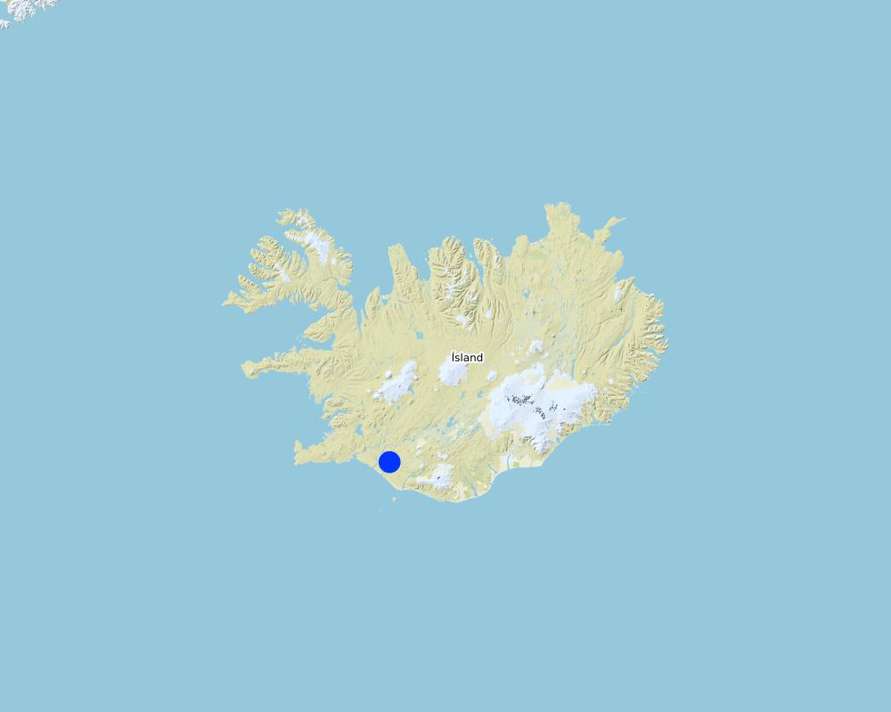
2.5 Country/ region/ locations where the Technology has been applied and which are covered by this assessment
Country:
Iceland
Region/ State/ Province:
Rangarthing Ytra
Further specification of location:
Rangarvellir
Comments:
Total area covered by the SLM Technology is 900 km2.
Map
×2.6 Date of implementation
If precise year is not known, indicate approximate date:
- more than 50 years ago (traditional)
2.7 Introduction of the Technology
Specify how the Technology was introduced:
- as part of a traditional system (> 50 years)
- through projects/ external interventions
- by the Soil Conservation Service (governmental institute)
3. Classification of the SLM Technology
3.1 Main purpose(s) of the Technology
- improve production
- reduce, prevent, restore land degradation
- preserve/ improve biodiversity
- reduce risk of disasters
- mitigate climate change and its impacts
3.2 Current land use type(s) where the Technology is applied
Land use mixed within the same land unit:
Yes
Specify mixed land use (crops/ grazing/ trees):
- Silvo-pastoralism

Grazing land
Extensive grazing:
- Semi-nomadic pastoralism
Animal type:
- horses
- sheep
Products and services:
- meat
- whool

Forest/ woodlands
Products and services:
- Grazing/ browsing
- Nature conservation/ protection
- Recreation/ tourism
- Protection against natural hazards

Unproductive land
Specify:
Wastelands / deserts / glaciers / swamps
Comments:
Major land use problems (compiler’s opinion): Vast parts of the area are heavily degraded due to unsustainable land use through the centuries in combination to harsh climate and frequent volcanic eruptions. The major land use problem are related to the fact that the concerned ecosystems collapsed long time ago and despite all restoration efforts implemented within the area for over 100 years, the systems are still highly dysfunctional. Their carrying capacity is limited and even light livestock grazing can keep further vegetational succession down. Passive restoration might take place where the livestock grazing has been excluded but in most cases some technologies are needed to "kickstart" the ecosystem and brake their negative resilience against changes.
Major land use problems (land users’ perception): They are fully aware that the ecosystems are in a poor condition and restoration is needed in order to push improvements forward. They acknowledge that grazing of collapsed ecosystems can maintain the dysfunctional of the systems and hinder ecological improvements. Nevertheless, in many cases they believe the harsh climate and volcanic activities are the main contributors to land degradation - that livestock grazing and the grazing carrying capacity of the rangeland are not fundamental issues in this context.
Types of other land: Wastelands / deserts / glaciers / swamps
Types of other land: Recreation
3.3 Has land use changed due to the implementation of the Technology?
Has land use changed due to the implementation of the Technology?
- Yes (Please fill out the questions below with regard to the land use before implementation of the Technology)

Grazing land
- Extensive grazing
Animal type:
- horses
- sheep
Products and services:
- meat
- whool

Unproductive land
Specify:
Wastelands / deserts / glaciers / swamps
3.4 Water supply
Water supply for the land on which the Technology is applied:
- rainfed
3.5 SLM group to which the Technology belongs
- improved ground/ vegetation cover
- ecosystem-based disaster risk reduction
3.6 SLM measures comprising the Technology

vegetative measures
- V2: Grasses and perennial herbaceous plants

structural measures
- S11: Others

management measures
- M2: Change of management/ intensity level
Comments:
Main measures: vegetative measures, management measures
Specification of other structural measures: fertilizing and seeding rather flat but gravel surface
Type of agronomic measures: retaining more vegetation cover, mineral (inorganic) fertilizers
Type of vegetative measures: scattered / dispersed
3.7 Main types of land degradation addressed by the Technology

soil erosion by water
- Wt: loss of topsoil/ surface erosion
- Wo: offsite degradation effects

soil erosion by wind
- Et: loss of topsoil

biological degradation
- Bc: reduction of vegetation cover

water degradation
- Hg: change in groundwater/aquifer level
Comments:
Main type of degradation addressed: Wt: loss of topsoil / surface erosion, Et: loss of topsoil, Bc: reduction of vegetation cover
Secondary types of degradation addressed: Wo: offsite degradation effects, Hg: change in groundwater / aquifer level
Main causes of degradation: deforestation / removal of natural vegetation (incl. forest fires) (in earlier centuries), over-exploitation of vegetation for domestic use (in earlier centuries), overgrazing (in earlier centuries), change in temperature, wind storms / dust storms, other natural causes (avalanches, volcanic eruptions, mud flows, highly susceptible natural resources, extreme topography, etc.) specify, poverty / wealth (in earlier centuries)
Secondary causes of degradation: soil management (in earlier centuries (from settlement in 874 onward)), floods, droughts, land tenure, governance / institutional (vague policies (especially in the last 50 years or so))
3.8 Prevention, reduction, or restoration of land degradation
Specify the goal of the Technology with regard to land degradation:
- reduce land degradation
- restore/ rehabilitate severely degraded land
Comments:
Main goals: prevention of land degradation, mitigation / reduction of land degradation, rehabilitation / reclamation of denuded land
4. Technical specifications, implementation activities, inputs, and costs
4.1 Technical drawing of the Technology
Technical specifications (related to technical drawing):
Technical knowledge required for field staff / advisors: moderate
Technical knowledge required for land users: moderate
Main technical functions: control of raindrop splash, control of dispersed runoff: retain / trap, control of dispersed runoff: impede / retard, control of concentrated runoff: retain / trap, control of concentrated runoff: impede / retard, control of concentrated runoff: drain / divert, improvement of ground cover, increase of surface roughness, improvement of surface structure (crusting, sealing), improvement of topsoil structure (compaction), stabilisation of soil (eg by tree roots against land slides), increase in organic matter, increase in nutrient availability (supply, recycling,…), increase of infiltration, increase / maintain water stored in soil, increase of groundwater level / recharge of groundwater, improvement of water quality, buffering / filtering water, sediment retention / trapping, sediment harvesting, increase of biomass (quantity), promotion of vegetation species and varieties (quality, eg palatable fodder)
Secondary technical functions: reduction of slope angle, reduction of slope length, improvement of subsoil structure (hardpan), water harvesting / increase water supply, reduction in wind speed, spatial arrangement and diversification of land use
Retaining more vegetation cover
Material/ species: grass seed (mixture of seed)
Quantity/ density: 10 kg/ha
Mineral (inorganic) fertilizers
Quantity/ density: 200 kg/ha
Scattered / dispersed
Vegetative material: G : grass
Trees/ shrubs species: Birch and some native willow species are expected to follow up as natural regeneration (secondary succession)
Change of land use type: Part of the areas was fenced off and is now protected from grazing
Change of land use practices / intensity level: During the last decades, the summer grazing period has been shortened substantially
4.2 General information regarding the calculation of inputs and costs
other/ national currency (specify):
ISK
If relevant, indicate exchange rate from USD to local currency (e.g. 1 USD = 79.9 Brazilian Real): 1 USD =:
113.0
4.3 Establishment activities
| Activity | Timing (season) | |
|---|---|---|
| 1. | Fertilizing and re-seeding | May/June |
4.4 Costs and inputs needed for establishment
| Specify input | Unit | Quantity | Costs per Unit | Total costs per input | % of costs borne by land users | |
|---|---|---|---|---|---|---|
| Labour | Fertilizing and re-seeding | ha | 1.0 | 66.0 | 66.0 | |
| Equipment | Machine use | ha | 1.0 | 44.0 | 44.0 | 100.0 |
| Plant material | Seeds (20kg) | ha | 1.0 | 137.0 | 137.0 | |
| Fertilizers and biocides | Fertilizer (200kg) | ha | 1.0 | 118.0 | 118.0 | |
| Total costs for establishment of the Technology | 365.0 | |||||
| Total costs for establishment of the Technology in USD | 3.23 | |||||
4.6 Costs and inputs needed for maintenance/ recurrent activities (per year)
| Specify input | Unit | Quantity | Costs per Unit | Total costs per input | % of costs borne by land users | |
|---|---|---|---|---|---|---|
| Labour | Labour | ha | 1.0 | 66.0 | 66.0 | |
| Equipment | Machine use | ha | 1.0 | 44.0 | 44.0 | 100.0 |
| Fertilizers and biocides | fertilizer | ha | 1.0 | 118.0 | 118.0 | |
| Total costs for maintenance of the Technology | 228.0 | |||||
| Total costs for maintenance of the Technology in USD | 2.02 | |||||
Comments:
The cost was estimated based on official estimation numbers from the SCSI
4.7 Most important factors affecting the costs
Describe the most determinate factors affecting the costs:
seeds, fertelizer, machinery, workers
5. Natural and human environment
5.1 Climate
Annual rainfall
- < 250 mm
- 251-500 mm
- 501-750 mm
- 751-1,000 mm
- 1,001-1,500 mm
- 1,501-2,000 mm
- 2,001-3,000 mm
- 3,001-4,000 mm
- > 4,000 mm
Agro-climatic zone
- sub-humid
- semi-arid
Thermal climate class: boreal
Thermal climate class: polar/arctic
5.2 Topography
Slopes on average:
- flat (0-2%)
- gentle (3-5%)
- moderate (6-10%)
- rolling (11-15%)
- hilly (16-30%)
- steep (31-60%)
- very steep (>60%)
Landforms:
- plateau/plains
- ridges
- mountain slopes
- hill slopes
- footslopes
- valley floors
Altitudinal zone:
- 0-100 m a.s.l.
- 101-500 m a.s.l.
- 501-1,000 m a.s.l.
- 1,001-1,500 m a.s.l.
- 1,501-2,000 m a.s.l.
- 2,001-2,500 m a.s.l.
- 2,501-3,000 m a.s.l.
- 3,001-4,000 m a.s.l.
- > 4,000 m a.s.l.
Indicate if the Technology is specifically applied in:
- not relevant
5.3 Soils
Soil depth on average:
- very shallow (0-20 cm)
- shallow (21-50 cm)
- moderately deep (51-80 cm)
- deep (81-120 cm)
- very deep (> 120 cm)
Soil texture (topsoil):
- coarse/ light (sandy)
Soil texture (> 20 cm below surface):
- coarse/ light (sandy)
Topsoil organic matter:
- low (<1%)
If available, attach full soil description or specify the available information, e.g. soil type, soil PH/ acidity, Cation Exchange Capacity, nitrogen, salinity etc.
Soil fertility is very low- low
Soil water storage capacity is very low-low
5.4 Water availability and quality
Ground water table:
< 5 m
Availability of surface water:
poor/ none
Water quality (untreated):
good drinking water
Water quality refers to:
ground water
Is water salinity a problem?
No
Is flooding of the area occurring?
No
5.5 Biodiversity
Species diversity:
- low
Habitat diversity:
- low
5.6 Characteristics of land users applying the Technology
Sedentary or nomadic:
- Sedentary
Market orientation of production system:
- subsistence (self-supply)
Off-farm income:
- 10-50% of all income
Individuals or groups:
- individual/ household
Level of mechanization:
- mechanized/ motorized
Gender:
- women
- men
Age of land users:
- middle-aged
Indicate other relevant characteristics of the land users:
Land users applying the Technology are mainly common / average land users
Population density: < 10 persons/km2
5.7 Average area of land used by land users applying the Technology
- < 0.5 ha
- 0.5-1 ha
- 1-2 ha
- 2-5 ha
- 5-15 ha
- 15-50 ha
- 50-100 ha
- 100-500 ha
- 500-1,000 ha
- 1,000-10,000 ha
- > 10,000 ha
Is this considered small-, medium- or large-scale (referring to local context)?
- medium-scale
5.8 Land ownership, land use rights, and water use rights
Land ownership:
- communal/ village
- individual, not titled
- governmental institutes
Land use rights:
- communal (organized)
- individual
Water use rights:
- open access (unorganized)
Are land use rights based on a traditional legal system?
Yes
5.9 Access to services and infrastructure
health:
- poor
- moderate
- good
education:
- poor
- moderate
- good
technical assistance:
- poor
- moderate
- good
employment (e.g. off-farm):
- poor
- moderate
- good
markets:
- poor
- moderate
- good
energy:
- poor
- moderate
- good
roads and transport:
- poor
- moderate
- good
drinking water and sanitation:
- poor
- moderate
- good
financial services:
- poor
- moderate
- good
6. Impacts and concluding statements
6.1 On-site impacts the Technology has shown
Socio-economic impacts
Production
animal production
Water availability and quality
water availability for livestock
water quality for livestock
Socio-cultural impacts
food security/ self-sufficiency
cultural opportunities
recreational opportunities
community institutions
national institutions
SLM/ land degradation knowledge
conflict mitigation
situation of socially and economically disadvantaged groups
Ecological impacts
Water cycle/ runoff
water quantity
water quality
surface runoff
excess water drainage
groundwater table/ aquifer
evaporation
Soil
soil moisture
soil cover
soil loss
soil crusting/ sealing
nutrient cycling/ recharge
soil organic matter/ below ground C
Biodiversity: vegetation, animals
biomass/ above ground C
plant diversity
animal diversity
habitat diversity
Climate and disaster risk reduction
emission of carbon and greenhouse gases
wind velocity
6.2 Off-site impacts the Technology has shown
water availability
downstream flooding
downstream siltation
buffering/ filtering capacity
wind transported sediments
damage on neighbours' fields
damage on public/ private infrastructure
6.3 Exposure and sensitivity of the Technology to gradual climate change and climate-related extremes/ disasters (as perceived by land users)
Gradual climate change
Gradual climate change
| Season | increase or decrease | How does the Technology cope with it? | |
|---|---|---|---|
| annual temperature | increase | not known |
Climate-related extremes (disasters)
Meteorological disasters
| How does the Technology cope with it? | |
|---|---|
| local rainstorm | well |
| local windstorm | well |
Climatological disasters
| How does the Technology cope with it? | |
|---|---|
| drought | not well |
Hydrological disasters
| How does the Technology cope with it? | |
|---|---|
| general (river) flood | well |
Other climate-related consequences
Other climate-related consequences
| How does the Technology cope with it? | |
|---|---|
| reduced growing period | not known |
| Cold spells combined with wind storms | not well |
6.4 Cost-benefit analysis
How do the benefits compare with the establishment costs (from land users’ perspective)?
Short-term returns:
slightly positive
Long-term returns:
positive
How do the benefits compare with the maintenance/ recurrent costs (from land users' perspective)?
Short-term returns:
slightly positive
Long-term returns:
positive
6.5 Adoption of the Technology
- > 50%
Of all those who have adopted the Technology, how many did so spontaneously, i.e. without receiving any material incentives/ payments?
- 11-50%
Comments:
There is a moderate trend towards spontaneous adoption of the Technology
6.6 Adaptation
Has the Technology been modified recently to adapt to changing conditions?
No
6.7 Strengths/ advantages/ opportunities of the Technology
| Strengths/ advantages/ opportunities in the land user’s view |
|---|
| increasing area for grazing |
| astetic view of landscape is increasing |
| Strengths/ advantages/ opportunities in the compiler’s or other key resource person’s view |
|---|
| It bases on the ecosystem approach - working with nature and re-establishing dysfunctional environmental and ecological processes with strong stakeholder involvement |
| Carbon sequestration is better after application. |
| reduces carbon loss (desert looses a lot of carbon) |
6.8 Weaknesses/ disadvantages/ risks of the Technology and ways of overcoming them
| Weaknesses/ disadvantages/ risks in the land user’s view | How can they be overcome? |
|---|---|
| expensive | |
| need a lot of fertelizer |
| Weaknesses/ disadvantages/ risks in the compiler’s or other key resource person’s view | How can they be overcome? |
|---|---|
| expensive | |
| need a lot of fetelizer |
7. References and links
7.1 Methods/ sources of information
- field visits, field surveys
- interviews with land users
- interviews with SLM specialists/ experts
- compilation from reports and other existing documentation
When were the data compiled (in the field)?
08/05/2015
7.3 Links to relevant online information
Title/ description:
Webpage Soil Conservation Service of Iceland
URL:
https://land.is/english/
Links and modules
Expand all Collapse allLinks
No links
Modules
No modules


