Weeded/ ploughed crop [Haiti]
- Creation:
- Update:
- Compiler: Joana Eichenberger
- Editors: Hanspeter Liniger, Jean Carls Dessin
- Reviewer: Hanspeter Liniger
Culture sarclée (engl.: weeded/ ploughed crop) or culture érosive (engl. erosive crop)
technologies_3224 - Haiti
View sections
Expand all Collapse all1. General information
1.2 Contact details of resource persons and institutions involved in the assessment and documentation of the Technology
Name of the institution(s) which facilitated the documentation/ evaluation of the Technology (if relevant)
Swiss Red Cross (Swiss Red Cross) - Switzerland1.3 Conditions regarding the use of data documented through WOCAT
The compiler and key resource person(s) accept the conditions regarding the use of data documented through WOCAT:
Yes
1.4 Declaration on sustainability of the described Technology
Is the Technology described here problematic with regard to land degradation, so that it cannot be declared a sustainable land management technology?
Yes
Comments:
This technique is not sustainable. It causes land degradation.
2. Description of the SLM Technology
2.1 Short description of the Technology
Definition of the Technology:
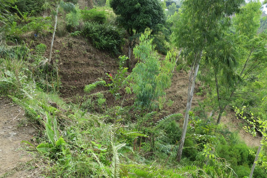
Some crops such as corn, beans or potatoes, require weeding especially if no herbicides are applied. Weed control is done by manual ploughing with pickaxes and hoes.
2.2 Detailed description of the Technology
Description:
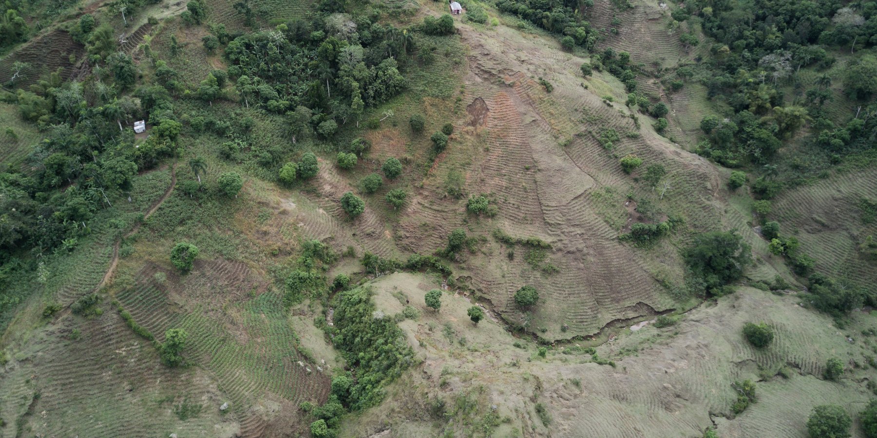
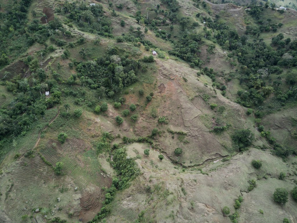
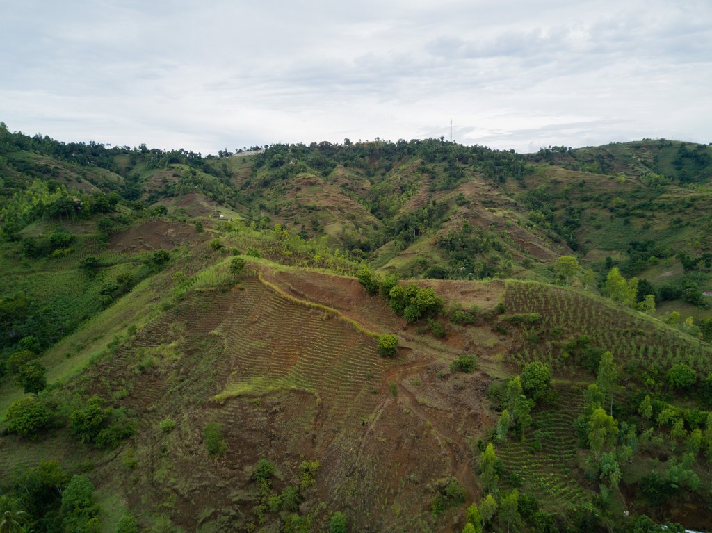
In Haiti, most agriculture takes place in mountainous or hilly areas, as 63% of the country’s surface comprises slopes with gradients of 20% or more. In the region of Léogâne, the vast majority of cultivated land is located on very steep, south-facing slopes where solar radiation is high. Land users typically do not have access to modern farming equipment. Slopes are too steep for animal traction; therefore, the soil is prepared manually with machetes, picks and hoes.
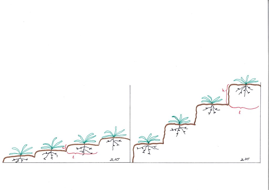
In Léogâne, pigeon peas, sweet potatoes, maize, beans and groundnuts are commonly cultivated crops. Since land users do not have access to herbicides, they weed manually. Before planting, land users carry out primary cultivation by breaking the soil with hoes or pickaxes. They then make ridges/ bunds along the contour lines. After planting, they must weed 1-3 times per season, depending on the crop. Once ploughed, the soil is loose and, early in the season before the crop canopy has developed, the land has little vegetation cover. These conditions make the soil extremely vulnerable to heavy rains, leading to surface runoff and thus degradation by water erosion. Accelerated floods containing massive sediment loads cause damage to roads, crops, and settlements downstream. By cultivating this way, land users degrade their natural resources of land, vegetation, soil, and water which provide the principal capital for Haiti’s subsistence-based, agrarian societies. Despite clear drawbacks, this technology is widely spread in Léogâne due to the benefit of quick returns. Haiti is highly food insecure, which is why its vulnerable population prefers fast production and easy technical application in preference to long-term benefits.
2.3 Photos of the Technology
2.5 Country/ region/ locations where the Technology has been applied and which are covered by this assessment
Country:
Haiti
Region/ State/ Province:
Département d'Ouest
Further specification of location:
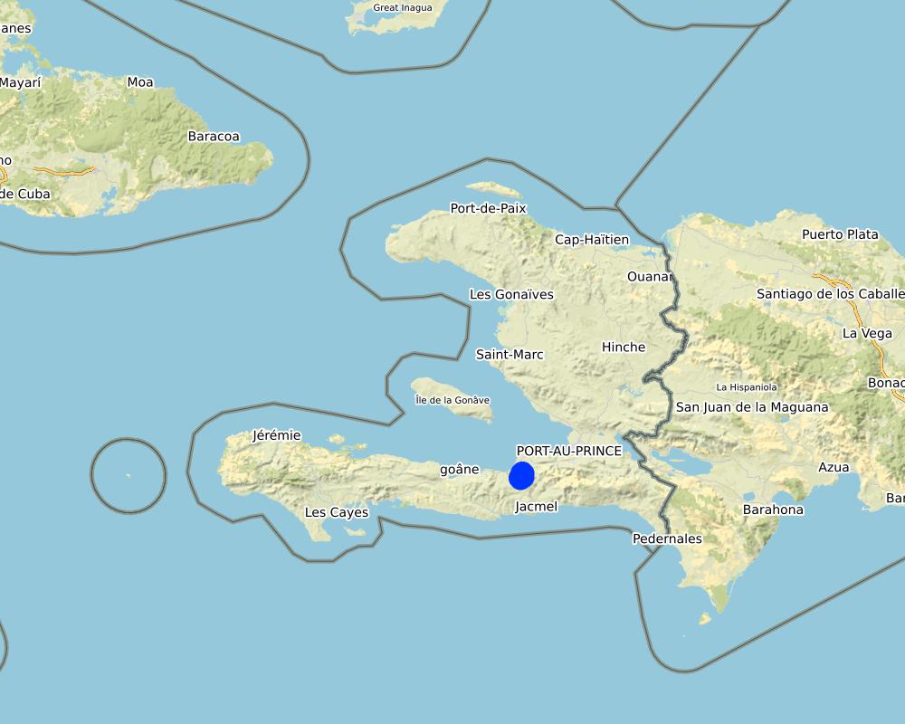
Léogâne
Specify the spread of the Technology:
- applied at specific points/ concentrated on a small area
Map
×2.6 Date of implementation
If precise year is not known, indicate approximate date:
- more than 50 years ago (traditional)
2.7 Introduction of the Technology
Specify how the Technology was introduced:
- as part of a traditional system (> 50 years)
3. Classification of the SLM Technology
3.1 Main purpose(s) of the Technology
- improve production
- adapt to steep slopes
3.2 Current land use type(s) where the Technology is applied
Land use mixed within the same land unit:
No

Cropland
- Annual cropping
- Perennial (non-woody) cropping
Annual cropping - Specify crops:
- cereals - maize
- legumes and pulses - beans
- oilseed crops - groundnuts
- root/tuber crops - sweet potatoes, yams, taro/cocoyam, other
- pigeon peas
Number of growing seasons per year:
- 2
Specify:
March-May/ June and October-November
Is intercropping practiced?
Yes
If yes, specify which crops are intercropped:
pigeon peas and sweet potatoes
3.3 Has land use changed due to the implementation of the Technology?
Has land use changed due to the implementation of the Technology?
- Yes (Please fill out the questions below with regard to the land use before implementation of the Technology)

Forest/ woodlands
- (Semi-)natural forests/ woodlands
Type of (semi-)natural forest:
- subtropical humid forest natural vegetation
- tropical rain forest natural vegetation
Are the trees specified above deciduous or evergreen?
- deciduous
Products and services:
- Fruits and nuts
- Other forest products
- Grazing/ browsing
- Nature conservation/ protection
- Protection against natural hazards
Comments:
In order to cultivate slopes with this technology, trees had to cut down.
3.4 Water supply
Water supply for the land on which the Technology is applied:
- rainfed
3.5 SLM group to which the Technology belongs
- none, as this is not a SLM technology
3.6 SLM measures comprising the Technology

management measures
- M1: Change of land use type

other measures
Specify:
This is not a SLM technology, but land operators try to plant on contour lines and make small terraces.
Comments:
M1: changements dans l'utilisation des terres, des forêts / arbustes aux terres cultivées
3.7 Main types of land degradation addressed by the Technology

soil erosion by water
- Wt: loss of topsoil/ surface erosion
- Wg: gully erosion/ gullying
- Wo: offsite degradation effects

biological degradation
- Bc: reduction of vegetation cover
- Bh: loss of habitats
- Bq: quantity/ biomass decline
- Bs: quality and species composition/ diversity decline
- Bl: loss of soil life

water degradation
- Ha: aridification
- Hs: change in quantity of surface water
- Hg: change in groundwater/aquifer level

other
Specify:
This technology does not address any degradation type, it causes them (Wt, Wg, Wo, Bc, Bh, Bq, Bs, Bl, Ha, Hs and Hg)
3.8 Prevention, reduction, or restoration of land degradation
Specify the goal of the Technology with regard to land degradation:
- not applicable
Comments:
This technology does not address any degradation type, it causes them
4. Technical specifications, implementation activities, inputs, and costs
4.1 Technical drawing of the Technology
Technical specifications (related to technical drawing):
The height (h) of the terraces depends on the depth of the topsoil and the slope. The steeper the slope, the greater the difference in the levels of the terraces (h). On mild slopes, the terraces are rather ridges. The width of terraces (l) is +/- 1m, this, however, depends on crop: peanuts need less space than corn or potatoes.
Author:
Joana Eichenberger
Date:
02/07/2018
4.2 General information regarding the calculation of inputs and costs
Specify how costs and inputs were calculated:
- per Technology area
Indicate size and area unit:
0.5ha
other/ national currency (specify):
HTG
If relevant, indicate exchange rate from USD to local currency (e.g. 1 USD = 79.9 Brazilian Real): 1 USD =:
62.0
Indicate average wage cost of hired labour per day:
200
4.3 Establishment activities
| Activity | Timing (season) | |
|---|---|---|
| 1. | Soil preparation | March / April (before the rainy season) |
| 2. | Ridging, construction of small terraces | March / April (before the rainy season) |
| 3. | Sowing | March / April (before the rainy season) |
4.4 Costs and inputs needed for establishment
| Specify input | Unit | Quantity | Costs per Unit | Total costs per input | % of costs borne by land users | |
|---|---|---|---|---|---|---|
| Labour | Labour | person-days | 30.0 | 200.0 | 6000.0 | 100.0 |
| Equipment | Hoe | pieces | 1.0 | 5.0 | 5.0 | 100.0 |
| Equipment | Pickaxe | pieces | 1.0 | 5.0 | 5.0 | 100.0 |
| Equipment | Machete | pieces | 1.0 | 5.0 | 5.0 | 100.0 |
| Plant material | Corn grains bought at the market | milk powder tin | 2.5 | 87.5 | 218.75 | 100.0 |
| Plant material | Beans bought at the market | milk powder tin | 12.0 | 350.0 | 4200.0 | 100.0 |
| Plant material | Peanuts bought at the market | milk powder tin | 12.0 | 125.0 | 1500.0 | 100.0 |
| Other | Coffee for labourers | cup | 30.0 | 25.0 | 750.0 | 100.0 |
| Total costs for establishment of the Technology | 12683.75 | |||||
| Total costs for establishment of the Technology in USD | 204.58 | |||||
Comments:
Labour: the land users are organized in so-called Konbits, a form of traditional organization of work built around a philosophy based on the bases of mutual aid and the living together of the peasants. The participants in a Konbit do not expect anything from the harvest to which they contributed. The process is completely altruistic, the organizer of the Konbit can offer something as compensation, but the essence of Konbit is the service. In Léogâne the organizer of the Konbit normally offers a cup of coffee per day worked.
The price of seed depends heavily on the time of year and on the type of seed. The use of urea as fertilizer is not controlled. In Fondwa, there are people who use it if they find any.
Land users have the necessary tools (the 5 HTGs are budgeted as compensation cost for using their own tools).
4.5 Maintenance/ recurrent activities
| Activity | Timing/ frequency | |
|---|---|---|
| 1. | Weeding | 1-3 during cultivation (March - June) |
Comments:
Between CRS agronomists, weeded/ ploughed culture is also known as a lazy culture, because it is not labour intense.
4.6 Costs and inputs needed for maintenance/ recurrent activities (per year)
| Specify input | Unit | Quantity | Costs per Unit | Total costs per input | % of costs borne by land users | |
|---|---|---|---|---|---|---|
| Labour | Labour (land users and family) | person-days | 15.0 | 200.0 | 3000.0 | 100.0 |
| Equipment | Hoe | pieces | 1.0 | 5.0 | 5.0 | |
| Equipment | Machete | pieces | 1.0 | 5.0 | 5.0 | |
| Total costs for maintenance of the Technology | 3010.0 | |||||
| Total costs for maintenance of the Technology in USD | 48.55 | |||||
Comments:
Land users have the necessary tools (the 5 HTGs are budgeted as compensation cost for using their own tools).
4.7 Most important factors affecting the costs
Describe the most determinate factors affecting the costs:
The price of seeds: If some seeds from the last harvest are kept, there is no need to buy many seeds the next season. The price of the seeds varies seasonally. At the time of the harvest prices are low, and in March (the beginning of the planting season) they are higher. By planting crops that regrow every season or trees with a long economic life, money can be saved on the cost of seeds.
If the land users take care of their tools, they can last up to 6 years.
5. Natural and human environment
5.1 Climate
Annual rainfall
- < 250 mm
- 251-500 mm
- 501-750 mm
- 751-1,000 mm
- 1,001-1,500 mm
- 1,501-2,000 mm
- 2,001-3,000 mm
- 3,001-4,000 mm
- > 4,000 mm
Specifications/ comments on rainfall:
The windward sides (north-facing slopes) receive more rain than the leeward sides.
Léogâne has a tropical climate with a rainy season ranging from April to November (with two peaks in April-May and August-October) and a dry season from the end of November to March. The relative decrease in rainfall in June and July is called the "mid-summer drought". Due to climate change, the rainy season tends to start later than it used to.
Agro-climatic zone
- sub-humid
Mean annual temperature: 25-27°C
5.2 Topography
Slopes on average:
- flat (0-2%)
- gentle (3-5%)
- moderate (6-10%)
- rolling (11-15%)
- hilly (16-30%)
- steep (31-60%)
- very steep (>60%)
Landforms:
- plateau/plains
- ridges
- mountain slopes
- hill slopes
- footslopes
- valley floors
Altitudinal zone:
- 0-100 m a.s.l.
- 101-500 m a.s.l.
- 501-1,000 m a.s.l.
- 1,001-1,500 m a.s.l.
- 1,501-2,000 m a.s.l.
- 2,001-2,500 m a.s.l.
- 2,501-3,000 m a.s.l.
- 3,001-4,000 m a.s.l.
- > 4,000 m a.s.l.
Indicate if the Technology is specifically applied in:
- not relevant
5.3 Soils
Soil depth on average:
- very shallow (0-20 cm)
- shallow (21-50 cm)
- moderately deep (51-80 cm)
- deep (81-120 cm)
- very deep (> 120 cm)
Soil texture (topsoil):
- coarse/ light (sandy)
- medium (loamy, silty)
Soil texture (> 20 cm below surface):
- coarse/ light (sandy)
- medium (loamy, silty)
Topsoil organic matter:
- low (<1%)
If available, attach full soil description or specify the available information, e.g. soil type, soil PH/ acidity, Cation Exchange Capacity, nitrogen, salinity etc.
Geology: Volcanic rocks (basalt, very disaggregated) and sedimentary rocks.
5.4 Water availability and quality
Ground water table:
5-50 m
Availability of surface water:
poor/ none
Water quality (untreated):
poor drinking water (treatment required)
Is water salinity a problem?
No
Is flooding of the area occurring?
No
5.5 Biodiversity
Species diversity:
- low
Habitat diversity:
- low
5.6 Characteristics of land users applying the Technology
Sedentary or nomadic:
- Sedentary
Market orientation of production system:
- mixed (subsistence/ commercial)
Off-farm income:
- less than 10% of all income
Relative level of wealth:
- poor
Individuals or groups:
- individual/ household
Level of mechanization:
- manual work
Gender:
- men
Age of land users:
- youth
- middle-aged
Indicate other relevant characteristics of the land users:
Age of land users: young - old
5.7 Average area of land used by land users applying the Technology
- < 0.5 ha
- 0.5-1 ha
- 1-2 ha
- 2-5 ha
- 5-15 ha
- 15-50 ha
- 50-100 ha
- 100-500 ha
- 500-1,000 ha
- 1,000-10,000 ha
- > 10,000 ha
Is this considered small-, medium- or large-scale (referring to local context)?
- small-scale
5.8 Land ownership, land use rights, and water use rights
Land ownership:
- individual, not titled
Land use rights:
- open access (unorganized)
- leased
Water use rights:
- open access (unorganized)
- communal (organized)
5.9 Access to services and infrastructure
health:
- poor
- moderate
- good
education:
- poor
- moderate
- good
technical assistance:
- poor
- moderate
- good
employment (e.g. off-farm):
- poor
- moderate
- good
markets:
- poor
- moderate
- good
energy:
- poor
- moderate
- good
roads and transport:
- poor
- moderate
- good
drinking water and sanitation:
- poor
- moderate
- good
financial services:
- poor
- moderate
- good
6. Impacts and concluding statements
6.1 On-site impacts the Technology has shown
Socio-economic impacts
Production
crop production
crop quality
risk of production failure
product diversity
production area
land management
Water availability and quality
drinking water availability
drinking water quality
Income and costs
expenses on agricultural inputs
farm income
Socio-cultural impacts
food security/ self-sufficiency
SLM/ land degradation knowledge
Ecological impacts
Water cycle/ runoff
water quantity
water quality
surface runoff
groundwater table/ aquifer
evaporation
Soil
soil moisture
soil cover
soil loss
soil accumulation
soil crusting/ sealing
soil organic matter/ below ground C
Biodiversity: vegetation, animals
Vegetation cover
biomass/ above ground C
plant diversity
beneficial species
habitat diversity
Climate and disaster risk reduction
flood impacts
landslides/ debris flows
drought impacts
impacts of cyclones, rain storms
micro-climate
6.2 Off-site impacts the Technology has shown
water availability
reliable and stable stream flows in dry season
downstream flooding
downstream siltation
groundwater/ river pollution
damage on neighbours' fields
6.3 Exposure and sensitivity of the Technology to gradual climate change and climate-related extremes/ disasters (as perceived by land users)
Gradual climate change
Gradual climate change
| Season | increase or decrease | How does the Technology cope with it? | |
|---|---|---|---|
| seasonal rainfall | not well at all |
Climate-related extremes (disasters)
Meteorological disasters
| How does the Technology cope with it? | |
|---|---|
| tropical storm | not well at all |
| local rainstorm | not well |
Climatological disasters
| How does the Technology cope with it? | |
|---|---|
| drought | not well at all |
Hydrological disasters
| How does the Technology cope with it? | |
|---|---|
| landslide | not well |
Comments:
Hard to say if seasonal precipitation increases or decreases. However, they vary more strongly than before.
6.4 Cost-benefit analysis
How do the benefits compare with the establishment costs (from land users’ perspective)?
Short-term returns:
very positive
Long-term returns:
very negative
How do the benefits compare with the maintenance/ recurrent costs (from land users' perspective)?
Short-term returns:
very positive
Long-term returns:
very negative
6.5 Adoption of the Technology
- > 50%
Of all those who have adopted the Technology, how many did so spontaneously, i.e. without receiving any material incentives/ payments?
- 91-100%
6.6 Adaptation
Has the Technology been modified recently to adapt to changing conditions?
No
6.7 Strengths/ advantages/ opportunities of the Technology
| Strengths/ advantages/ opportunities in the land user’s view |
|---|
| Fast production |
| Know-how available |
| Easily implementable |
| Strengths/ advantages/ opportunities in the compiler’s or other key resource person’s view |
|---|
| No advantages |
6.8 Weaknesses/ disadvantages/ risks of the Technology and ways of overcoming them
| Weaknesses/ disadvantages/ risks in the land user’s view | How can they be overcome? |
|---|---|
| Negative impacts on soil | Apply in combination with progressive terraces with vetiver grass hedges. |
| Weaknesses/ disadvantages/ risks in the compiler’s or other key resource person’s view | How can they be overcome? |
|---|---|
| Unsustainable: causes soil degradation and has harmful impacts on watersheds causing downstream flooding and siltation. | Promote benefits of progressive terraces with vetiver grass hedges among the land users. |
7. References and links
7.1 Methods/ sources of information
- field visits, field surveys
- interviews with SLM specialists/ experts
Jean Cars Dessin
- compilation from reports and other existing documentation
When were the data compiled (in the field)?
13/10/2017
7.2 References to available publications
Title, author, year, ISBN:
McLain, R. J., Stienbarger, D. M., & Sprumont, M. O. (1988). Land tenure and land use in southern Haiti: Case studies of the Les Anglais and Grande Ravine du Sud watersheds. Land Tenure Center, University of Wisconsin-Madison.
7.3 Links to relevant online information
Title/ description:
Ministère de l’Agriculture des Ressources Naturelles et du Développement Rural (2019): Programme National de Développement de l’Élevage pour la Réhabilitation de l’Environnement 2009-2014
URL:
http://agriculture.gouv.ht/view/01/IMG/pdf/Texte_elevage-environnement_MARNDR_20100-3.pdf
Links and modules
Expand all Collapse allLinks
No links
Modules
No modules


