Use of sediment retention fibre rolls (SRFR) and erosion blankets to stabilise slopes after fire [South Africa]
- Creation:
- Update:
- Compiler: Dirk Pretorius
- Editor: –
- Reviewers: William Critchley, Rima Mekdaschi Studer
Wood wool rolls/fibre rolls
technologies_6000 - South Africa
View sections
Expand all Collapse all1. General information
1.2 Contact details of resource persons and institutions involved in the assessment and documentation of the Technology
Key resource person(s)
SLM specialist:
Buckle Jacob
Hive Carbon
South Africa
Name of project which facilitated the documentation/ evaluation of the Technology (if relevant)
Working for Water Programme, South Africa (WfW)Name of the institution(s) which facilitated the documentation/ evaluation of the Technology (if relevant)
Department of Environmental Affairs South Africa (DEA) - South Africa1.3 Conditions regarding the use of data documented through WOCAT
The compiler and key resource person(s) accept the conditions regarding the use of data documented through WOCAT:
Yes
1.4 Declaration on sustainability of the described Technology
Is the Technology described here problematic with regard to land degradation, so that it cannot be declared a sustainable land management technology?
No
1.5 Reference to Questionnaire(s) on SLM Approaches (documented using WOCAT)
Working for Water [South Africa]
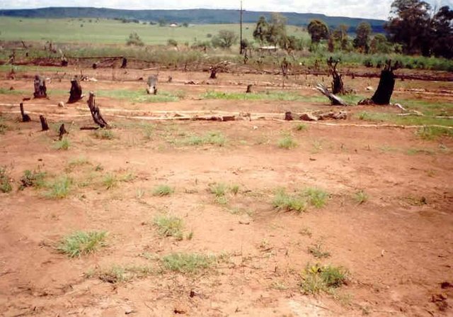
Government funded restoration/rehabilitation initiative as part of Working for Water project. Aim was to eradicate alien invasive.
- Compiler: Klaus Kellner
2. Description of the SLM Technology
2.1 Short description of the Technology
Definition of the Technology:
Sediment retention fibre rolls (SRFR) and erosion blankets were deployed to stabilise steep slopes after vegetation cover was destroyed by fire, near the town of Knysna in the Western Cape Province, South Africa
2.2 Detailed description of the Technology
Description:
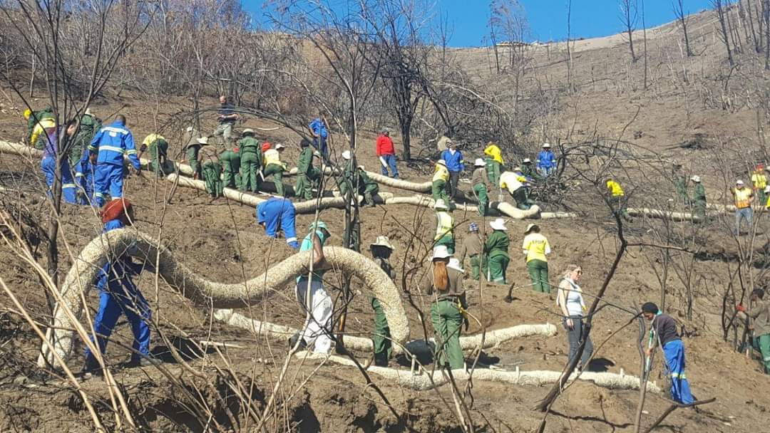
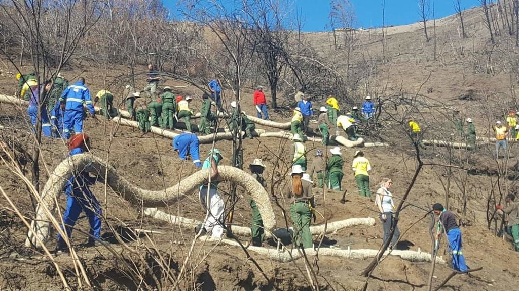
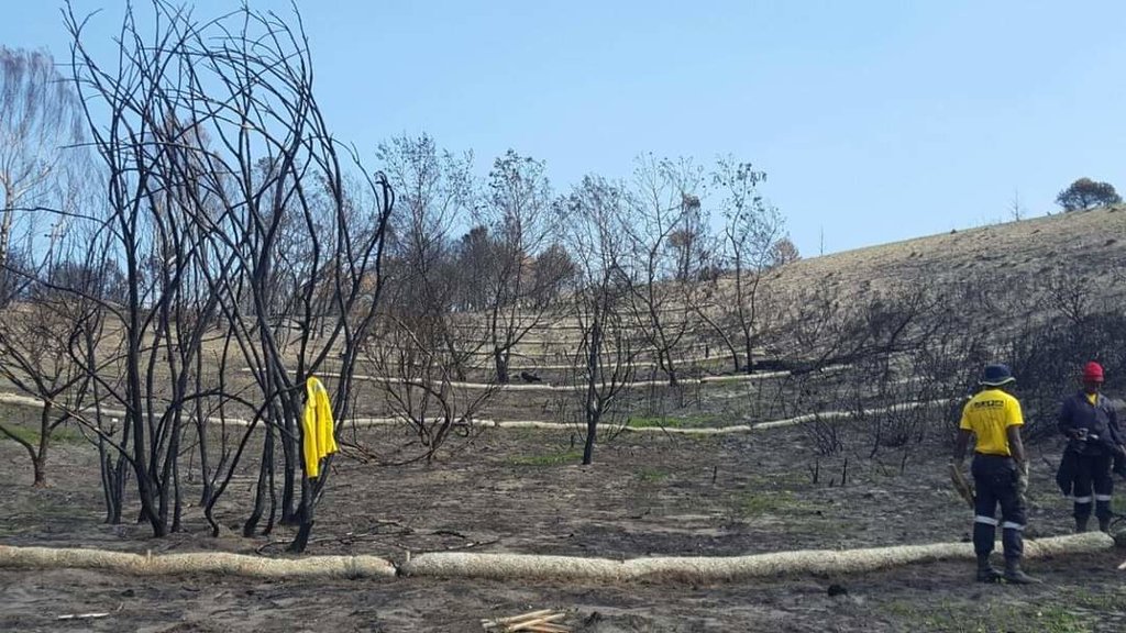
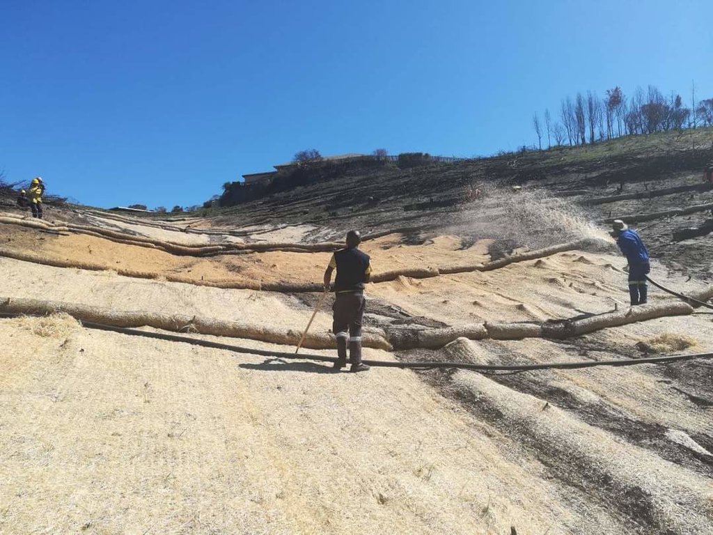
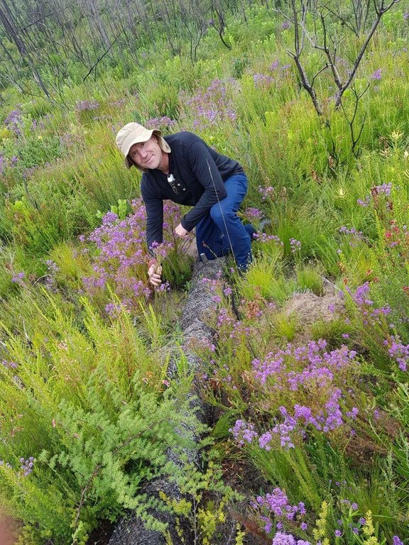
Sediment retention fibre rolls (SRFR) and erosion blankets were deployed near the town of Knysna in the Western Cape Province of South Africa to stabilise slopes after vegetation was destroyed by wildfires in 2017. The predominant geology is quartzite, shale, schist, conglomerate and dune sand. The soils of this area are generally acidic and nutrient-poor occurring, on moderate to steep slopes, ranging from 5 m to 1,220 m above sea level. The area receives summer and winter rainfall with an annual average of around 650 to 700 mm. The Knysna fires were the worst wildfire disaster in South African history (more than 21 000 ha were affected – destroying more than 800 buildings, 5000 ha of forest plantations and claiming the lives of seven people). Investigations reported that its severity was caused by a cocktail of factors, including drought, low atmospheric humidity, strong warm Bergwind conditions and abundant biomass. After the fires, the lack of vegetation cover on steep sandy slopes in the affected areas posed an immediate danger of erosion and landslides to downstream catchments, ravines and man-made infrastructure. Areas with high infestations of invasive alien plants required active re-establishment of indigenous plants and the removal of alien seedlings (popular and aspen) after germination. It is estimated that 53 km of wood fibre rolls (or "sausages") and 54 000 m² of erosion blankets (Woodwool fibre filled) have been installed on post-fire erosion mitigation projects. Furthermore hydroseeding was carried out with the annual grass "teff" (Eragrostis tef) to serve as an interim (annual grass) soil stabiliser. This will be replaced by indigenous plant growth in time. The project was implemented in the following stages:
1.Identification of priority areas where infrastructure was threatened (using GIS modelling)
2.Acquisition of restoration materials – SRFR and erosion blankets produced through secondary industries created through the removal of invasive alien plants (popular and aspen)
3.Training of local community members on implementation of restoration measures
4.Removal of all burnt woody material
5.Introduction of indigenous seed
6.Installation of erosion control blankets or hydroseeding (seeding using a slurry of seed and mulch)
7.Installation of SRFR
8.As part of maintenance, removal of invasive alien vegetation seedlings
2.3 Photos of the Technology
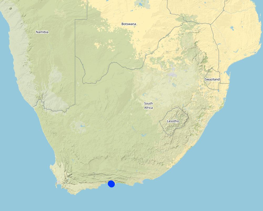
2.5 Country/ region/ locations where the Technology has been applied and which are covered by this assessment
Country:
South Africa
Region/ State/ Province:
Western Cape
Specify the spread of the Technology:
- evenly spread over an area
If precise area is not known, indicate approximate area covered:
- 10-100 km2
Is/are the technology site(s) located in a permanently protected area?
No
Map
×2.6 Date of implementation
Indicate year of implementation:
2018
2.7 Introduction of the Technology
Specify how the Technology was introduced:
- through projects/ external interventions
3. Classification of the SLM Technology
3.1 Main purpose(s) of the Technology
- reduce, prevent, restore land degradation
- conserve ecosystem
- protect a watershed/ downstream areas – in combination with other Technologies
- preserve/ improve biodiversity
- reduce risk of disasters
3.2 Current land use type(s) where the Technology is applied

Forest/ woodlands
- (Semi-)natural forests/ woodlands
(Semi-)natural forests/ woodlands: Specify management type:
- Non-wood forest use
Are the trees specified above deciduous or evergreen?
- evergreen
Products and services:
- Protection against natural hazards

Settlements, infrastructure
- Settlements, buildings

Waterways, waterbodies, wetlands
- Drainage lines, waterways
3.3 Has land use changed due to the implementation of the Technology?
Has land use changed due to the implementation of the Technology?
- No (Continue with question 3.4)
3.4 Water supply
Water supply for the land on which the Technology is applied:
- rainfed
3.5 SLM group to which the Technology belongs
- improved ground/ vegetation cover
- cross-slope measure
3.6 SLM measures comprising the Technology

vegetative measures
- V2: Grasses and perennial herbaceous plants

structural measures
- S6: Walls, barriers, palisades, fences
3.7 Main types of land degradation addressed by the Technology

soil erosion by water
- Wt: loss of topsoil/ surface erosion
- Wm: mass movements/ landslides

soil erosion by wind
- Eo: offsite degradation effects

water degradation
- Hp: decline of surface water quality
3.8 Prevention, reduction, or restoration of land degradation
Specify the goal of the Technology with regard to land degradation:
- prevent land degradation
- restore/ rehabilitate severely degraded land
4. Technical specifications, implementation activities, inputs, and costs
4.1 Technical drawing of the Technology
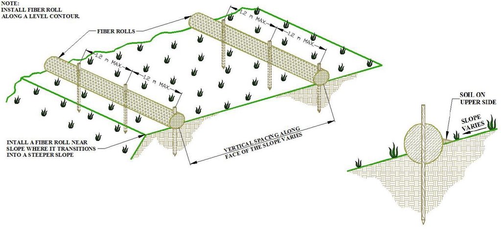
Technical specifications (related to technical drawing):
1.Prepare the area to be restored
2.Determine the spacing of the rolls as a function of soil type and slope
3.Installation of erosion rolls (6 m long) and blankets (2.5m x 50 m) must overlap
4.Use wooden stakes to secure the rolls and blankets – rolls (50cm) – 1.2 meter apart, blankets (30cm) – 1meter appart
Author:
Erosion Control Technology Council
Date:
09/11/2021
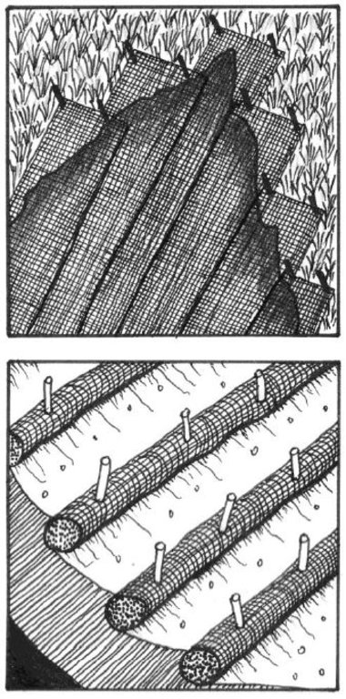
Technical specifications (related to technical drawing):
1. The first step in the installation of the erosion blankets on slopes is site preparation. Be sure the site is properly prepared before installing any blankets. The site should be fine graded to a smooth profile and relatively free from all weeds, clods, stones, roots, sticks, rivulets, gullies, crusting and caking. Fill any voids and make sure that the slope is compacted properly.
2. At the top of the slope dig an anchor trench 20 cm deep by 20 cm wide. The blankets will be anchored in this trench with staples.
3. Starting at the crest of the slope, roll the blankets down the slope in a controlled manner.
4. Seed the area to be vegetated (hydroseeding).
Author:
Erosion Control Technology Council
Date:
09/11/2021
4.2 General information regarding the calculation of inputs and costs
Specify how costs and inputs were calculated:
- per Technology unit
Specify unit:
ha
Specify dimensions of unit (if relevant):
1
other/ national currency (specify):
Rand
If relevant, indicate exchange rate from USD to local currency (e.g. 1 USD = 79.9 Brazilian Real): 1 USD =:
15.0
Indicate average wage cost of hired labour per day:
R180
4.3 Establishment activities
| Activity | Timing (season) | |
|---|---|---|
| 1. | Prepare area to be restored | After fires before onset of rainfall period |
| 2. | Installation of erosion rolls (6m Long) and erosion blankets (2.5 m by 50 m) - must overlap | After fires before onset of rainfall period |
| 3. | Hydroseeding | After installation of erosion rolls and blankets |
4.4 Costs and inputs needed for establishment
| Specify input | Unit | Quantity | Costs per Unit | Total costs per input | % of costs borne by land users | |
|---|---|---|---|---|---|---|
| Labour | Unskilled labour (including transport) | per day | 84.0 | 260.0 | 21840.0 | |
| Equipment | Spades, hammer, scissors, rakes, hand saw | per day | 5.0 | 20.0 | 100.0 | |
| Plant material | Grass seed mix | kg | 50.0 | 100.0 | 5000.0 | |
| Construction material | SRFB 10m interval including stakes | per meter | 1000.0 | 50.0 | 50000.0 | |
| Construction material | Erosion blankets | per square meter | 10000.0 | 13.0 | 130000.0 | |
| Construction material | 1.0 | |||||
| Other | Hydro seeding (including fiber, binding medium, seed and organic fertilizer) | per ha | 1.0 | 12000.0 | 12000.0 | |
| Total costs for establishment of the Technology | 218940.0 | |||||
| Total costs for establishment of the Technology in USD | 14596.0 | |||||
If land user bore less than 100% of costs, indicate who covered the remaining costs:
Government
4.5 Maintenance/ recurrent activities
| Activity | Timing/ frequency | |
|---|---|---|
| 1. | After floods the site must be inspected and restored if necessary | After floods |
| 2. | Remove invasive alien vegetation seedlings | After germination (during first 6 months) |
4.6 Costs and inputs needed for maintenance/ recurrent activities (per year)
| Specify input | Unit | Quantity | Costs per Unit | Total costs per input | % of costs borne by land users | |
|---|---|---|---|---|---|---|
| Labour | Restoration of site after flooding events | per day | 24.0 | 260.0 | 6240.0 | |
| Equipment | Tools to do restoration (same as installation) | per day | 3.0 | 30.0 | 90.0 | |
| Plant material | Removal of invasive alien vegetation | per day | 24.0 | 60.0 | 1440.0 | |
| Construction material | SRFR | per meter | 50.0 | 50.0 | 2500.0 | |
| Construction material | Erosion blankets (only pegs) | per square meter | 300.0 | 3.0 | 900.0 | |
| Total costs for maintenance of the Technology | 11170.0 | |||||
| Total costs for maintenance of the Technology in USD | 744.67 | |||||
4.7 Most important factors affecting the costs
Describe the most determinate factors affecting the costs:
Labour availability, availability of material, transport cost
5. Natural and human environment
5.1 Climate
Annual rainfall
- < 250 mm
- 251-500 mm
- 501-750 mm
- 751-1,000 mm
- 1,001-1,500 mm
- 1,501-2,000 mm
- 2,001-3,000 mm
- 3,001-4,000 mm
- > 4,000 mm
Agro-climatic zone
- semi-arid
5.2 Topography
Slopes on average:
- flat (0-2%)
- gentle (3-5%)
- moderate (6-10%)
- rolling (11-15%)
- hilly (16-30%)
- steep (31-60%)
- very steep (>60%)
Landforms:
- plateau/plains
- ridges
- mountain slopes
- hill slopes
- footslopes
- valley floors
Altitudinal zone:
- 0-100 m a.s.l.
- 101-500 m a.s.l.
- 501-1,000 m a.s.l.
- 1,001-1,500 m a.s.l.
- 1,501-2,000 m a.s.l.
- 2,001-2,500 m a.s.l.
- 2,501-3,000 m a.s.l.
- 3,001-4,000 m a.s.l.
- > 4,000 m a.s.l.
Indicate if the Technology is specifically applied in:
- not relevant
5.3 Soils
Soil depth on average:
- very shallow (0-20 cm)
- shallow (21-50 cm)
- moderately deep (51-80 cm)
- deep (81-120 cm)
- very deep (> 120 cm)
Soil texture (topsoil):
- coarse/ light (sandy)
Soil texture (> 20 cm below surface):
- medium (loamy, silty)
5.4 Water availability and quality
Ground water table:
< 5 m
Availability of surface water:
medium
Water quality (untreated):
poor drinking water (treatment required)
Water quality refers to:
surface water
Is water salinity a problem?
No
Is flooding of the area occurring?
No
5.5 Biodiversity
Species diversity:
- high
Habitat diversity:
- low
5.6 Characteristics of land users applying the Technology
Sedentary or nomadic:
- Sedentary
Market orientation of production system:
- commercial/ market
Off-farm income:
- > 50% of all income
Relative level of wealth:
- rich
Age of land users:
- middle-aged
5.7 Average area of land used by land users applying the Technology
- < 0.5 ha
- 0.5-1 ha
- 1-2 ha
- 2-5 ha
- 5-15 ha
- 15-50 ha
- 50-100 ha
- 100-500 ha
- 500-1,000 ha
- 1,000-10,000 ha
- > 10,000 ha
5.8 Land ownership, land use rights, and water use rights
Land ownership:
- state
- municipality owned
- municipality
Are land use rights based on a traditional legal system?
No
5.9 Access to services and infrastructure
health:
- poor
- moderate
- good
education:
- poor
- moderate
- good
technical assistance:
- poor
- moderate
- good
employment (e.g. off-farm):
- poor
- moderate
- good
markets:
- poor
- moderate
- good
energy:
- poor
- moderate
- good
roads and transport:
- poor
- moderate
- good
drinking water and sanitation:
- poor
- moderate
- good
financial services:
- poor
- moderate
- good
6. Impacts and concluding statements
6.1 On-site impacts the Technology has shown
Socio-economic impacts
Income and costs
diversity of income sources
Comments/ specify:
Restoration resulted in job creation for local communities
Socio-cultural impacts
recreational opportunities
Comments/ specify:
Improved ecotourism - land restored to natural state - hiking and cycling
Value of land for development
Comments/ specify:
Land without degradation more valuable for development
Ecological impacts
Water cycle/ runoff
surface runoff
Comments/ specify:
The introduction of structures and increased vegetation cover resulted in reduced runoff
excess water drainage
Comments/ specify:
The introduced technologies also improved excess water drainage and less flooding
Soil
soil cover
Comments/ specify:
Vegetation cover improved with the introduction of hydroseeding and retention of topsoil containing indigenous seed
soil loss
Comments/ specify:
Soil loss was reduced due to the introduction of the SRFR and improved vegetation cover
Biodiversity: vegetation, animals
Vegetation cover
Comments/ specify:
Vegetation cover improved due to the soil stabilisation and introduction of hydroseeding (annual grass protected soil until natural vegetation established)
biomass/ above ground C
Comments/ specify:
Improved biomass due to the improved vegetation cover and reduction of soil loss (topsoil with high C content)
invasive alien species
Comments/ specify:
Maintenance of the applied technology included the removal of alien species
habitat diversity
Comments/ specify:
The technology resulted in the reestablishment of the natural vegetation and improved biodiversity
Climate and disaster risk reduction
flood impacts
Comments/ specify:
One of the main reasons for the introduction of this innovative technology is the reduction in flood impacts due to the inclusion of structures as well as improved vegetation cover
landslides/ debris flows
Comments/ specify:
The added benefit of the technology is the reduction in the risk of landslides due to the inclusion of soil stabilising structures and improved vegetation cover
6.2 Off-site impacts the Technology has shown
downstream flooding
Comments/ specify:
The introduction of the technology resulted in improved drainage and therefore less downstream flooding
downstream siltation
Comments/ specify:
The introduction of sediment trapping structures as well as improved vegetation cover resulted in less downstream siltation
damage on public/ private infrastructure
Comments/ specify:
The risk of damage to infrastructure was reduced due to the decrease in risk of flooding and landslides
6.3 Exposure and sensitivity of the Technology to gradual climate change and climate-related extremes/ disasters (as perceived by land users)
Climate-related extremes (disasters)
Meteorological disasters
| How does the Technology cope with it? | |
|---|---|
| local rainstorm | moderately |
Climatological disasters
| How does the Technology cope with it? | |
|---|---|
| forest fire | not well at all |
6.4 Cost-benefit analysis
How do the benefits compare with the establishment costs (from land users’ perspective)?
Short-term returns:
positive
Long-term returns:
positive
How do the benefits compare with the maintenance/ recurrent costs (from land users' perspective)?
Short-term returns:
positive
Long-term returns:
positive
6.5 Adoption of the Technology
- single cases/ experimental
6.6 Adaptation
Has the Technology been modified recently to adapt to changing conditions?
No
6.7 Strengths/ advantages/ opportunities of the Technology
| Strengths/ advantages/ opportunities in the land user’s view |
|---|
| Very important technology to stabilise degraded landscapes |
| Technology helps to improve the habitat - biodiversity in the protected area |
| Technology helps to prevent landslides and down-stream siltation |
| Strengths/ advantages/ opportunities in the compiler’s or other key resource person’s view |
|---|
| Although fairly expensive to implement the technology helped to restore high value land in the Knysna area |
6.8 Weaknesses/ disadvantages/ risks of the Technology and ways of overcoming them
| Weaknesses/ disadvantages/ risks in the land user’s view | How can they be overcome? |
|---|---|
| Sensitive to fire | Construct fire breaks around areas of intervention |
| Sensitive to flooding | Better timing of intervention (avoid high rainfall periods) |
7. References and links
7.1 Methods/ sources of information
- field visits, field surveys
- interviews with SLM specialists/ experts
1
- compilation from reports and other existing documentation
1
When were the data compiled (in the field)?
27/09/2021
7.2 References to available publications
Title, author, year, ISBN:
Title, author, year, ISBN Caring for Natural Rangelands, Ken Coetzee, 978-1-86914-071-7
Available from where? Costs?
https://www.loot.co.za/product/ken-coetzee-caring-for-natural-rangelands/stkr-450-g690
7.3 Links to relevant online information
Title/ description:
KNYSNA FIRES: HOW SOON WE FORGET
URL:
https://www.scli.org.za/knysna-fires-soon-forget
Title/ description:
Sediment retention fiber rolls – general usage and installation guidelines April 2011
URL:
https://www.ectc.org
Links and modules
Expand all Collapse allLinks

Working for Water [South Africa]
Government funded restoration/rehabilitation initiative as part of Working for Water project. Aim was to eradicate alien invasive.
- Compiler: Klaus Kellner
Modules
No modules


