Landslide prevention using drainage trenches lined with fast growing trees. [Tajikistan]
- Creation:
- Update:
- Compiler: Giuseppe Bonati
- Editor: –
- Reviewers: Alexandra Gavilano, David Streiff, Joana Eichenberger
technologies_1457 - Tajikistan
- Full summary as PDF
- Full summary as PDF for print
- Full summary in the browser
- Full summary (unformatted)
- Landslide prevention using drainage trenches lined with fast growing trees.: March 16, 2017 (inactive)
- Landslide prevention using drainage trenches lined with fast growing trees.: July 21, 2017 (inactive)
- Landslide prevention using drainage trenches lined with fast growing trees.: Aug. 19, 2019 (inactive)
- Landslide prevention using drainage trenches lined with fast growing trees.: Nov. 2, 2021 (public)
View sections
Expand all Collapse all1. General information
1.2 Contact details of resource persons and institutions involved in the assessment and documentation of the Technology
SLM specialist:
Name of project which facilitated the documentation/ evaluation of the Technology (if relevant)
Pilot Program for Climate Resilience, Tajikistan (WB / PPCR)Name of the institution(s) which facilitated the documentation/ evaluation of the Technology (if relevant)
CESVI (CESVI) - Tajikistan1.3 Conditions regarding the use of data documented through WOCAT
The compiler and key resource person(s) accept the conditions regarding the use of data documented through WOCAT:
Yes
2. Description of the SLM Technology
2.1 Short description of the Technology
Definition of the Technology:
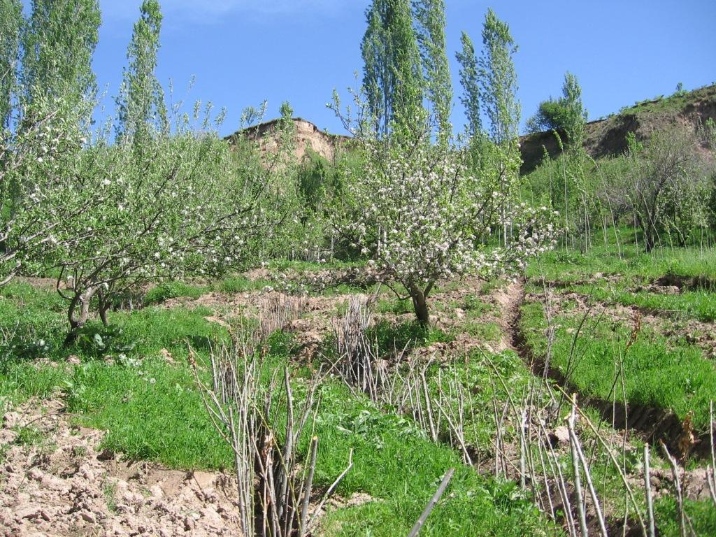
The construction of linear gravel bed ditches lined with local tree species, at angles across a hill slope to channel the surface water.
2.2 Detailed description of the Technology
Description:
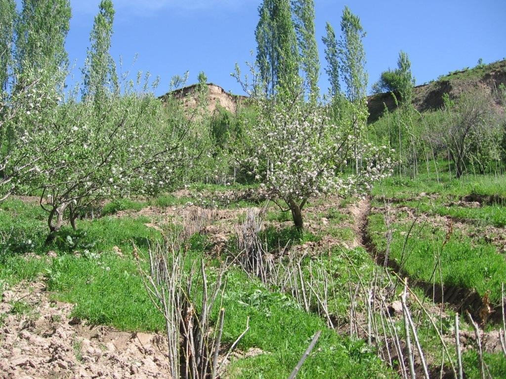
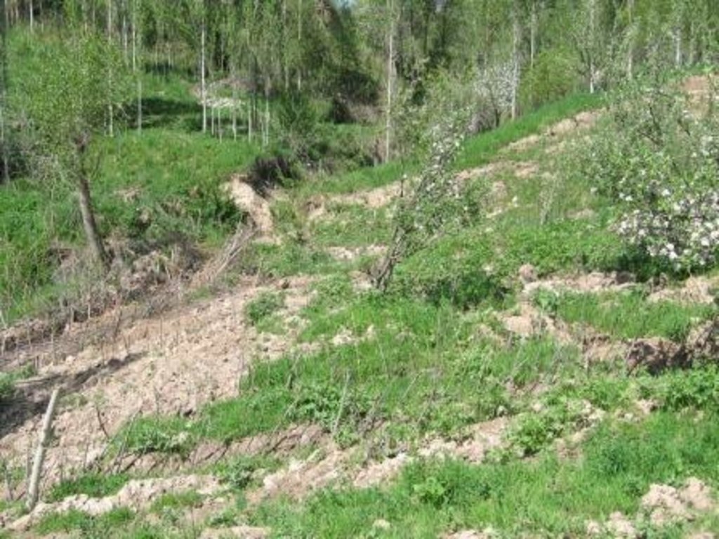
A series of 80m long ditches are constructed at angles of approximately 30 degrees, across a hill slope at the base of the watershed. This land is prone to waterlogging, therefore several ditches approximately 0.5m deep, with a gravel bed to prevent erosion, drain the excess surface water away to the main tributary of the watershed. The edge of the ditches are further lined with fast growing tree species such as willow and poplar for stabilisation and afforestation purposes.
Purpose of the Technology: The purpose of the ditches is two fold, firstly to channel the surface water to prevent waterlogging that had previously led to landslides and small mud flows. Secondly, to enable cultivation on land that was previously unusable.
Establishment / maintenance activities and inputs: The technology is very simple and cost effective. Initially there needs to be an assessment of the amount of surface water that runs over the slope, this will determine the number of ditches required. The ditches are marked out, running at approximately 30 degrees perpendicular to the slope. The ditches are dug to a depth of 0.5m (or deeper) and filled with a base layer of stone to prevent the bed of the ditch from being eroded. Once the ditch is established, preferably in the spring time, fast growing and naturally available cuttings from trees such as poplars and willows are planted alongside the edge of the ditch at 0.2m intervals. These will stabilise the ditch bank and as the trees become established some thinning out will be required due to their close proximity to each other.
Natural / human environment: The area used is a hillside slope, subject to substantial amounts of surface water run off due to its location at the base of the watershed. The region suffers from a lack of accessible irrigation water, especially during the hot summer months. This technology allows land to be brought into cultivation that has natural access to water and is able to sustain vegetation during the dry months.
2.3 Photos of the Technology
2.5 Country/ region/ locations where the Technology has been applied and which are covered by this assessment
Country:
Tajikistan
Region/ State/ Province:
Khatlon
Further specification of location:
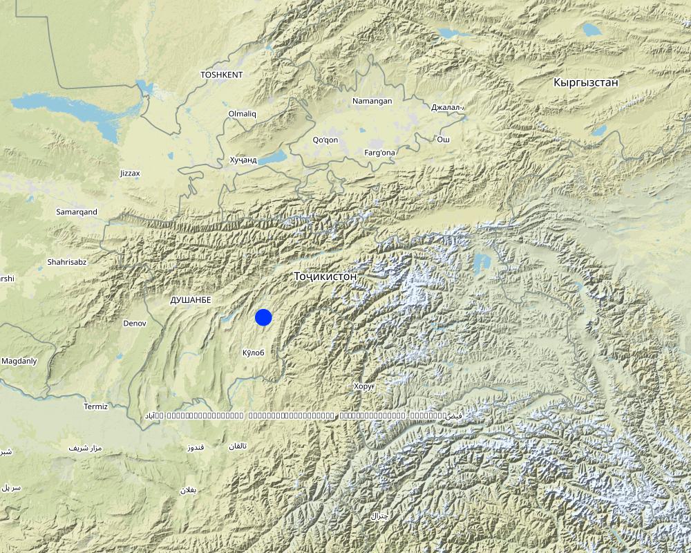
Khovaling
Specify the spread of the Technology:
- evenly spread over an area
If precise area is not known, indicate approximate area covered:
- 0.1-1 km2
Comments:
Total area covered by the SLM Technology is 0,1 km2.
Map
×2.6 Date of implementation
If precise year is not known, indicate approximate date:
- less than 10 years ago (recently)
2.7 Introduction of the Technology
Specify how the Technology was introduced:
- through land users' innovation
3. Classification of the SLM Technology
3.1 Main purpose(s) of the Technology
- reduce, prevent, restore land degradation
3.2 Current land use type(s) where the Technology is applied

Forest/ woodlands
- (Semi-)natural forests/ woodlands
(Semi-)natural forests/ woodlands: Specify management type:
- Selective felling
- willows, bed, poplar
Products and services:
- Timber
- Fuelwood
- Fruits and nuts
Comments:
Major land use problems (compiler’s opinion): Due to a lack of drainage in the existing soil, surface flow collects and becomes concentrated leading to top soil washing and gulleying. Animal paths across the slope exacerbate the erosion process.
Major land use problems (land users’ perception): In Soviet times the land was not used due to waterlogging, but the land had good potential to plant trees and produce an income.
Selective felling of (semi-) natural forests: Yes
Problems / comments regarding forest use: Collection of fruit; apple, pear and other trees that can be used for construction purposes. These can be cut after 15yrs to provide income.
Forest products and services: timber, fuelwood, fruits and nuts
Future (final) land use (after implementation of SLM Technology): Cropland: Ct: Tree and shrub cropping
3.3 Has land use changed due to the implementation of the Technology?
Has land use changed due to the implementation of the Technology?
- Yes (Please fill out the questions below with regard to the land use before implementation of the Technology)

Cropland
- Tree and shrub cropping

Forest/ woodlands
- (Semi-)natural forests/ woodlands
3.5 SLM group to which the Technology belongs
- cross-slope measure
- water diversion and drainage
3.6 SLM measures comprising the Technology

agronomic measures
- A1: Vegetation/ soil cover

vegetative measures
- V1: Tree and shrub cover

structural measures
- S3: Graded ditches, channels, waterways

management measures
- M7: Others
Comments:
Main measures: structural measures
Secondary measures: vegetative measures
Type of vegetative measures: aligned: -contour
3.7 Main types of land degradation addressed by the Technology

soil erosion by water
- Wt: loss of topsoil/ surface erosion
- Wm: mass movements/ landslides
Comments:
Main type of degradation addressed: Wt: loss of topsoil / surface erosion, Wm: mass movements / landslides
Main causes of degradation: overgrazing (The land is used for grazing and livestock migration.), Heavy / extreme rainfall (intensity/amounts) (Heavy rainfall events add to the degradation process.), other natural causes (avalanches, volcanic eruptions, mud flows, highly susceptible natural resources, extreme topography, etc.) specify (Topological situation at the base of the watershed means it is susceptible to mud flows and other natural disasters)
Secondary causes of degradation: inputs and infrastructure: (roads, markets, distribution of water points, other, …) (access to animal water points and pastures.)
3.8 Prevention, reduction, or restoration of land degradation
Specify the goal of the Technology with regard to land degradation:
- reduce land degradation
Comments:
Secondary goals: prevention of land degradation, rehabilitation / reclamation of denuded land
4. Technical specifications, implementation activities, inputs, and costs
4.1 Technical drawing of the Technology
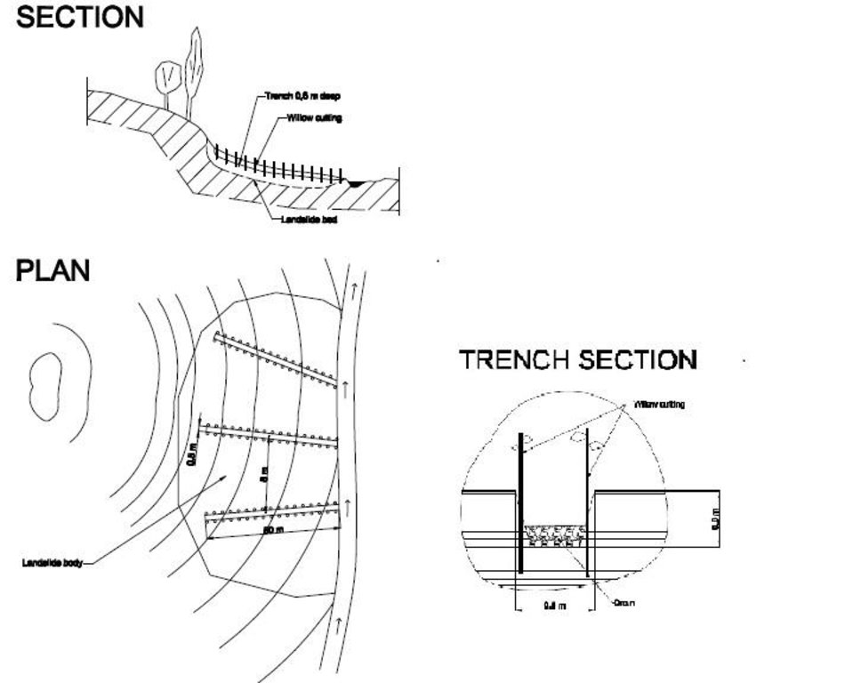
Technical specifications (related to technical drawing):
The drawing shows the layout of the trench and the lining with fast growing native trees.
Location: JONBKHAT. KHOVALING TAJIKISTAN
Date: 2011-04-30
Technical knowledge required for field staff / advisors: low (Simple technology.)
Technical knowledge required for land users: low
Main technical functions: control of concentrated runoff: drain / divert, stabilisation of soil (eg by tree roots against land slides)
Secondary technical functions: control of dispersed runoff: impede / retard, control of concentrated runoff: impede / retard, water spreading, improvement of water quality, buffering / filtering water, promotion of vegetation species and varieties (quality, eg palatable fodder)
Aligned: -contour
Vegetative material: T : trees / shrubs
Vertical interval within rows / strips / blocks (m): 0.2
Trees/ shrubs species: willows, bed, poplar are planted in 0.2m intervals along the ditch.
Diversion ditch/ drainage
Spacing between structures (m): 20
Depth of ditches/pits/dams (m): 0.6
Width of ditches/pits/dams (m): 0.5
Length of ditches/pits/dams (m): 80
Construction material (stone): stones were used to line the bed of the drainage ditch to reduce scouring.
Slope (which determines the spacing indicated above): 20%
If the original slope has changed as a result of the Technology, the slope today is: 18%
Vegetation is used for stabilisation of structures.
Author:
BONATI GIUSEPPE, C7O CESVI TAJIKISTAN
4.2 General information regarding the calculation of inputs and costs
other/ national currency (specify):
Tajik Somoni
If relevant, indicate exchange rate from USD to local currency (e.g. 1 USD = 79.9 Brazilian Real): 1 USD =:
4.5
Indicate average wage cost of hired labour per day:
5.50
4.3 Establishment activities
| Activity | Timing (season) | |
|---|---|---|
| 1. | Tree planting | Spring |
| 2. | Construction of the drainage ditches | spring |
4.4 Costs and inputs needed for establishment
| Specify input | Unit | Quantity | Costs per Unit | Total costs per input | % of costs borne by land users | |
|---|---|---|---|---|---|---|
| Labour | Planting trees | Persons/day | 3.0 | 25.0 | 75.0 | 100.0 |
| Labour | Building drainage ditches | Persons/day | 3.0 | 25.0 | 75.0 | 100.0 |
| Equipment | Tools | Pieces | 1.0 | 20.0 | 20.0 | 100.0 |
| Plant material | Tree seedlings | pieces | 800.0 | 1.0 | 800.0 | 100.0 |
| Construction material | Stone | cub m | 3.0 | 100.0 | 300.0 | 100.0 |
| Total costs for establishment of the Technology | 1270.0 | |||||
| Total costs for establishment of the Technology in USD | 282.22 | |||||
Comments:
Duration of establishment phase: 1 month(s)
4.5 Maintenance/ recurrent activities
| Activity | Timing/ frequency | |
|---|---|---|
| 1. | tree maintenance | spring |
| 2. | clearance of ditches | annual |
4.6 Costs and inputs needed for maintenance/ recurrent activities (per year)
| Specify input | Unit | Quantity | Costs per Unit | Total costs per input | % of costs borne by land users | |
|---|---|---|---|---|---|---|
| Labour | Tree maintenance | Persons/day | 2.0 | 25.0 | 50.0 | 100.0 |
| Labour | Clearing ditches | Persons/day | 1.0 | 25.0 | 25.0 | 100.0 |
| Total costs for maintenance of the Technology | 75.0 | |||||
| Total costs for maintenance of the Technology in USD | 16.67 | |||||
Comments:
Machinery/ tools: Shovel
The costs are calculated for an 80m trench based on 2010 prices in rural Tajikistan.
4.7 Most important factors affecting the costs
Describe the most determinate factors affecting the costs:
The cost of an 80m ditch is mainly determined by labour and seedlings. Labour can be provided by the land owner and seedlings for willows and poplars can be found locally and therefore are of no cost. The stone may occur naturally but there may be transport costs.
5. Natural and human environment
5.1 Climate
Annual rainfall
- < 250 mm
- 251-500 mm
- 501-750 mm
- 751-1,000 mm
- 1,001-1,500 mm
- 1,501-2,000 mm
- 2,001-3,000 mm
- 3,001-4,000 mm
- > 4,000 mm
Specifications/ comments on rainfall:
heavy rainfall in spring.
Agro-climatic zone
- semi-arid
Thermal climate class: temperate
5.2 Topography
Slopes on average:
- flat (0-2%)
- gentle (3-5%)
- moderate (6-10%)
- rolling (11-15%)
- hilly (16-30%)
- steep (31-60%)
- very steep (>60%)
Landforms:
- plateau/plains
- ridges
- mountain slopes
- hill slopes
- footslopes
- valley floors
Altitudinal zone:
- 0-100 m a.s.l.
- 101-500 m a.s.l.
- 501-1,000 m a.s.l.
- 1,001-1,500 m a.s.l.
- 1,501-2,000 m a.s.l.
- 2,001-2,500 m a.s.l.
- 2,501-3,000 m a.s.l.
- 3,001-4,000 m a.s.l.
- > 4,000 m a.s.l.
Comments and further specifications on topography:
Altitudinal zone: Just at the foot of the hill slopes.
5.3 Soils
Soil depth on average:
- very shallow (0-20 cm)
- shallow (21-50 cm)
- moderately deep (51-80 cm)
- deep (81-120 cm)
- very deep (> 120 cm)
Soil texture (topsoil):
- medium (loamy, silty)
Topsoil organic matter:
- medium (1-3%)
If available, attach full soil description or specify the available information, e.g. soil type, soil PH/ acidity, Cation Exchange Capacity, nitrogen, salinity etc.
Soil fertility is high because of loess soils
Soil drainage / infiltration is poor
Soil water storage capacity is low
5.4 Water availability and quality
Ground water table:
< 5 m
Availability of surface water:
good
Water quality (untreated):
poor drinking water (treatment required)
Comments and further specifications on water quality and quantity:
Availability of surface water: Also medium
5.5 Biodiversity
Species diversity:
- medium
5.6 Characteristics of land users applying the Technology
Market orientation of production system:
- subsistence (self-supply)
Off-farm income:
- less than 10% of all income
Individuals or groups:
- groups/ community
Gender:
- men
Indicate other relevant characteristics of the land users:
Land users applying the Technology are mainly common / average land users
Population density: 10-50 persons/km2
Annual population growth: 1% - 2%
90% of the land users are poor (low income rural families).
10% of the land users are poor.
5.7 Average area of land used by land users applying the Technology
- < 0.5 ha
- 0.5-1 ha
- 1-2 ha
- 2-5 ha
- 5-15 ha
- 15-50 ha
- 50-100 ha
- 100-500 ha
- 500-1,000 ha
- 1,000-10,000 ha
- > 10,000 ha
Is this considered small-, medium- or large-scale (referring to local context)?
- small-scale
5.8 Land ownership, land use rights, and water use rights
Land ownership:
- state
Land use rights:
- communal (organized)
Water use rights:
- open access (unorganized)
Comments:
Water user right refer to the water running over the land
5.9 Access to services and infrastructure
health:
- poor
- moderate
- good
education:
- poor
- moderate
- good
technical assistance:
- poor
- moderate
- good
employment (e.g. off-farm):
- poor
- moderate
- good
markets:
- poor
- moderate
- good
energy:
- poor
- moderate
- good
roads and transport:
- poor
- moderate
- good
drinking water and sanitation:
- poor
- moderate
- good
financial services:
- poor
- moderate
- good
6. Impacts and concluding statements
6.1 On-site impacts the Technology has shown
Socio-economic impacts
Production
crop production
Comments/ specify:
Fruit tree yields
wood production
Comments/ specify:
Fire wood and construction materials
production area
energy generation
Comments/ specify:
Generation of the wood for fuel
Income and costs
farm income
diversity of income sources
Socio-cultural impacts
SLM/ land degradation knowledge
Comments/ specify:
Better understanding of how to control erosion
Ecological impacts
Water cycle/ runoff
harvesting/ collection of water
surface runoff
excess water drainage
groundwater table/ aquifer
Soil
soil cover
soil loss
Climate and disaster risk reduction
landslides/ debris flows
6.2 Off-site impacts the Technology has shown
buffering/ filtering capacity
damage on neighbours' fields
6.3 Exposure and sensitivity of the Technology to gradual climate change and climate-related extremes/ disasters (as perceived by land users)
Gradual climate change
Gradual climate change
| Season | increase or decrease | How does the Technology cope with it? | |
|---|---|---|---|
| annual temperature | increase | well |
Climate-related extremes (disasters)
Meteorological disasters
| How does the Technology cope with it? | |
|---|---|
| local rainstorm | not well |
Climatological disasters
| How does the Technology cope with it? | |
|---|---|
| drought | not well |
Hydrological disasters
| How does the Technology cope with it? | |
|---|---|
| general (river) flood | not well |
6.4 Cost-benefit analysis
How do the benefits compare with the establishment costs (from land users’ perspective)?
Short-term returns:
slightly positive
Long-term returns:
very positive
How do the benefits compare with the maintenance/ recurrent costs (from land users' perspective)?
Short-term returns:
positive
Long-term returns:
very positive
6.5 Adoption of the Technology
- single cases/ experimental
If available, quantify (no. of households and/ or area covered):
1 household
Of all those who have adopted the Technology, how many did so spontaneously, i.e. without receiving any material incentives/ payments?
- 91-100%
Comments:
There is no trend towards spontaneous adoption of the Technology
6.7 Strengths/ advantages/ opportunities of the Technology
| Strengths/ advantages/ opportunities in the land user’s view |
|---|
| It is easy to build and cheap. |
| Strengths/ advantages/ opportunities in the compiler’s or other key resource person’s view |
|---|
|
It is a basic and easy technology that could be easily replicated, over larger areas. How can they be sustained / enhanced? Further training on the correct angles to build channels and dimensions |
|
The technogy is low cost and potentially quick to build. How can they be sustained / enhanced? It can be built on many different slopes types, angles and heights. |
|
It allows the land to be used for growing fruit trees and timber. There is the opportunity to sell the products. How can they be sustained / enhanced? Training could be provided on tree cultivation. |
6.8 Weaknesses/ disadvantages/ risks of the Technology and ways of overcoming them
| Weaknesses/ disadvantages/ risks in the compiler’s or other key resource person’s view | How can they be overcome? |
|---|---|
| The trench may be inefffective if there is a heavy deluge of surface water, and may in fact concentrate the surface water run off. | The trenches could be filled with gravel and rocks, and intertwined in a grid network, this is a common practice for railway embankements in Europe. The slope has to be shallow enough to prevent the gravel material being washed away. |
7. References and links
7.1 Methods/ sources of information
Links and modules
Expand all Collapse allLinks
No links
Modules
No modules


