Terraces with improved seed and fertilizer application [Afghanistan]
- Creation:
- Update:
- Compiler: Roziya Kirgizbekova
- Editor: Bettina Wolfgramm
- Reviewer: Rima Mekdaschi Studer
Palbandi bo tukhmihoi behbudyofta va kud
technologies_607 - Afghanistan
View sections
Expand all Collapse all1. General information
1.2 Contact details of resource persons and institutions involved in the assessment and documentation of the Technology
Key resource person(s)
land user:
Mohammad Azim Habibullah
Natural Resources Management Comittee (NRMC)
Sari Joy Village, Takhar Province
Afghanistan
SLM specialist:
SLM specialist:
Researcher:
Name of project which facilitated the documentation/ evaluation of the Technology (if relevant)
Potential and limitations for improved natural resource management (NRM) in mountain communities in the Rustaq district, Afghanistan (Rustaq NRM Study)Name of project which facilitated the documentation/ evaluation of the Technology (if relevant)
Livelihood Improvement Project Takhar, Afghanistan (LIPT)Name of the institution(s) which facilitated the documentation/ evaluation of the Technology (if relevant)
Terre des Hommes (Terre des Hommes) - SwitzerlandName of the institution(s) which facilitated the documentation/ evaluation of the Technology (if relevant)
Swiss Agency for Development and Cooperation (DEZA / COSUDE / DDC / SDC) - SwitzerlandName of the institution(s) which facilitated the documentation/ evaluation of the Technology (if relevant)
CDE Centre for Development and Environment (CDE Centre for Development and Environment) - SwitzerlandName of the institution(s) which facilitated the documentation/ evaluation of the Technology (if relevant)
Bern University of Applied Sciences, School of Agricultural, Forest and Food Sciences (HAFL) - Switzerland1.3 Conditions regarding the use of data documented through WOCAT
When were the data compiled (in the field)?
17/10/2016
The compiler and key resource person(s) accept the conditions regarding the use of data documented through WOCAT:
Yes
1.4 Declaration on sustainability of the described Technology
Is the Technology described here problematic with regard to land degradation, so that it cannot be declared a sustainable land management technology?
No
Comments:
SLM practices documented in the frame of the Rustaq NRM study were established only recently (1-3 years ago). It is too early for a final judgment on the sustainability of these technologies within the human and natural environment of Chokar watershed.
1.5 Reference to Questionnaire(s) on SLM Approaches
2. Description of the SLM Technology
2.1 Short description of the Technology
Definition of the Technology:
Terraces are established on mountain slopes used mainly for cropping wheat, with the purpose of soil protection from erosion, preserving runoff, sediments and nutrients on-site. Improved seeds and fertilizer are applied on the terraces for increasing crop yield, but also vegetation cover and biomass production, and thus prevent further land degradation.
2.2 Detailed description of the Technology
Description:
Project supported implementation of terraces with application of improved seeds and fertilizer has taken place in the villages Sari Joy, Jawaz Khana and Dashti Mirzai, located in Chokar watershed of Rustaq District in Northern Afghanistan. The Chokar watershed is a mountainous area situated between 600 - 2,500 m above sea level. The climate is semi-arid with harsh and cold weather in winter and hot and dry summers. The annual precipitation in average years is 580mm. Land degradation affects all forms of land use and includes low vegetation cover, heavy top soil erosion from water, and poor soil fertility. Unsustainable agricultural practices, over-exploitation and high pressure on the natural resources are adversely impacting on the socio-economic well-being of local communities as well as contributing to the risk for being adversely affected by drought as well as landslides and flash floods triggered by heavy rainfall.
The data used for the documentation of the technology is based on field research conducted in Chokar watershed, namely in the villages: Sari Joy, Jawaz Khana and Dashti Mirzai. These villages represent the upper, the middle and the lower zone of Chokar watershed, respectively. They differ considerably in access to services and infrastructure, but in general are poorly served. The communities depend mainly on land resources for sustaining their livelihoods. In a good year with high yields, wheat-self-sufficiency lasts about 5 months.
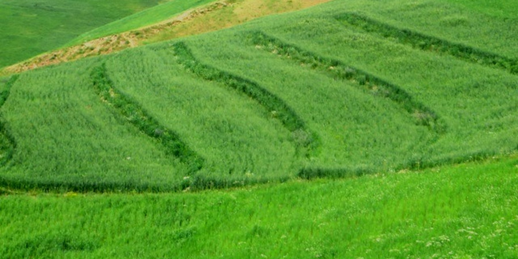
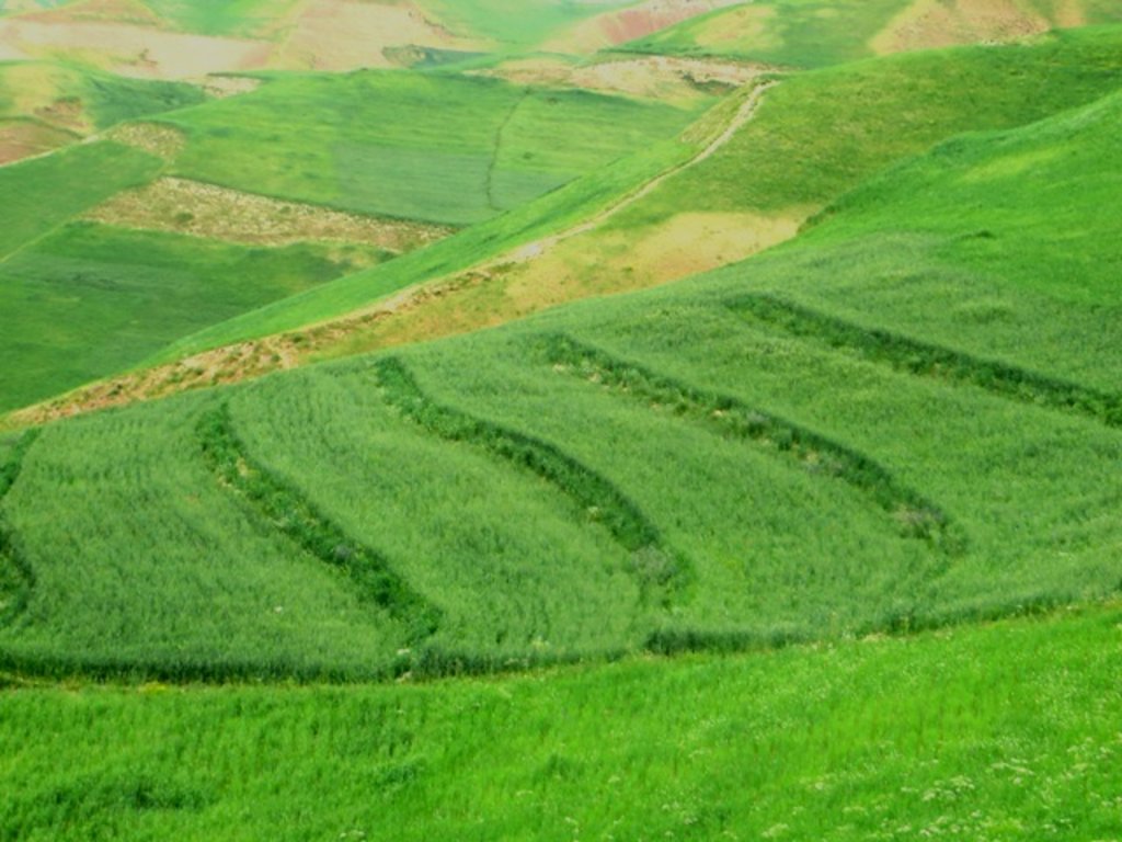
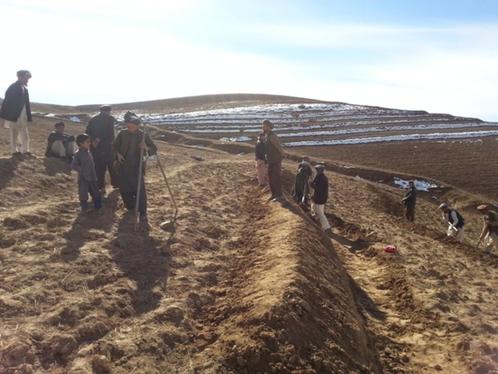
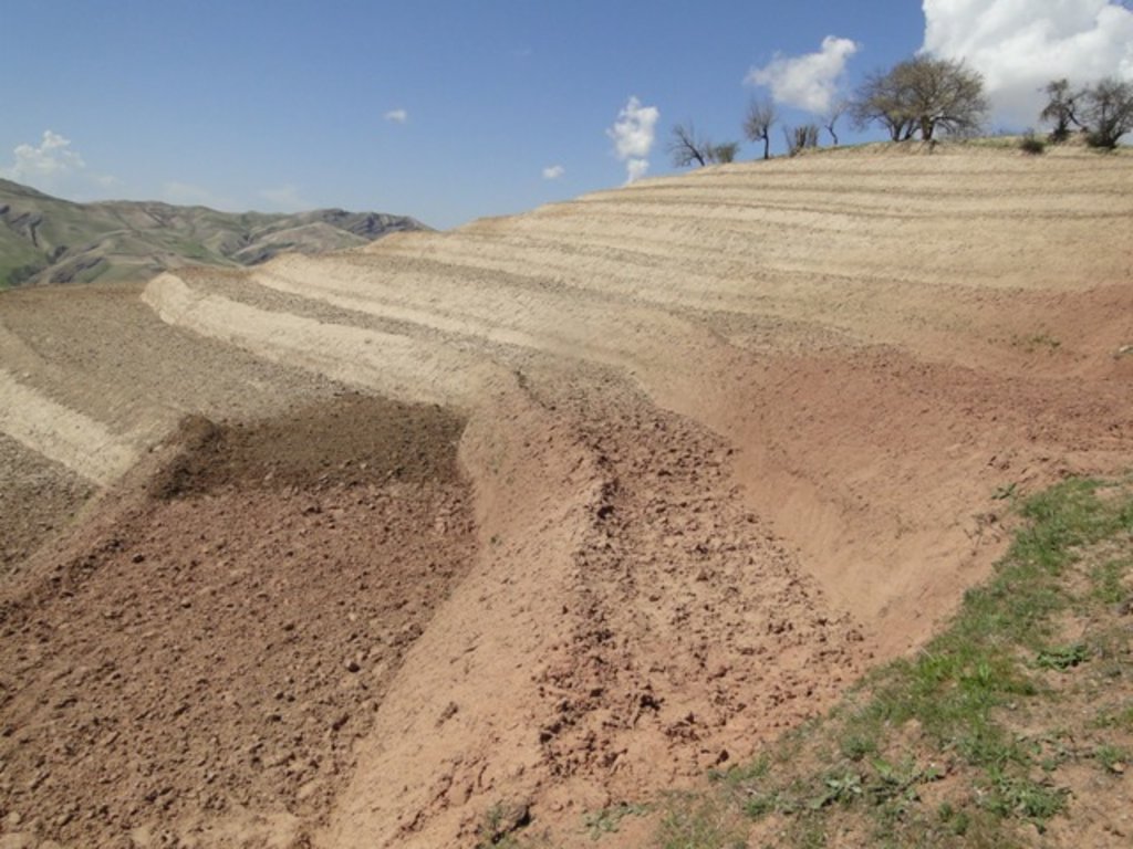
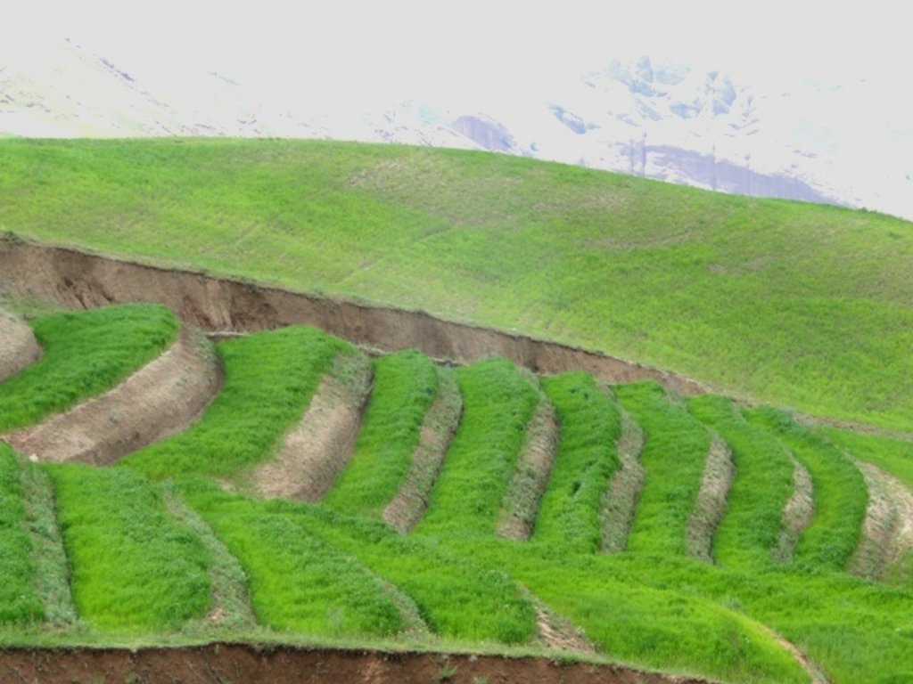
Since 2012 the Livelihood Improvement Project Takhar (LIPT) implemented by Terre des hommes (Tdh) Switzerland has initiated a range of NRM interventions. The project introduced terraces as sustainable land management practices on private plots, situated on rolling (11-15%) and hilly (16-30%) slopes to protect the land from soil erosion and prevent the loss of water and fertile topsoil, seeds and fertilizers. The average plot size for terrace implementation is 2 Jerib (0.4 hectares) with contour strips of 40m x 4m. The height of the risers is 1m-1,5 m. Terrace benches are built along the contour by moving the soil above the bench downwards. The leveled benches of the terrace are cultivated with wheat. The risers of the terrace are mostly used for growing fodder crops, mostly alfalfa, which also helps to stabilize the terrace. If medicinal herbs (ferula) are included they are cultivated along the bench contours .
Maintenance activities include small repair work on the riser by adding some amount of soil and re-sowing of alfalfa seeds on those spots.
The terraces allow application of improved seeds and fertilizers without them being washed off. The land-users report noticeable increase of wheat yield from the terraced plot with application of improved seeds and fertilizer compared to the non-terraced plot. An average plot of 0.2 ha on non-terraced hilly cropland used to give about 70 kg of wheat (350kg/ha). On terraces the yield has increased/ doubled to 140 kg on the same plot area (700kg/ha). The expectations regarding terraces remain high as over the time the land user hope their land will become more stable and improved soil moisture and fertility will have positive impact on the productivity as well. However, so far no cost-benefit assessment has been conducted allowing attribution of individual measure to the wheat increase.
Many land users are interested in the terrace technology due to a number of environmental and economic benefits expected, however the costs for building the terrace are considered high by an average local land user. They have to rely on external support in order to have sufficient resources for implementation. Women considered an advantage that during the establishment phase, men were paid by the project to work on their own land (or other villagers land) when building the terraces. Thus, there was no need for men to go for seasonal labour migration and they stayed at home.
2.3 Photos of the Technology
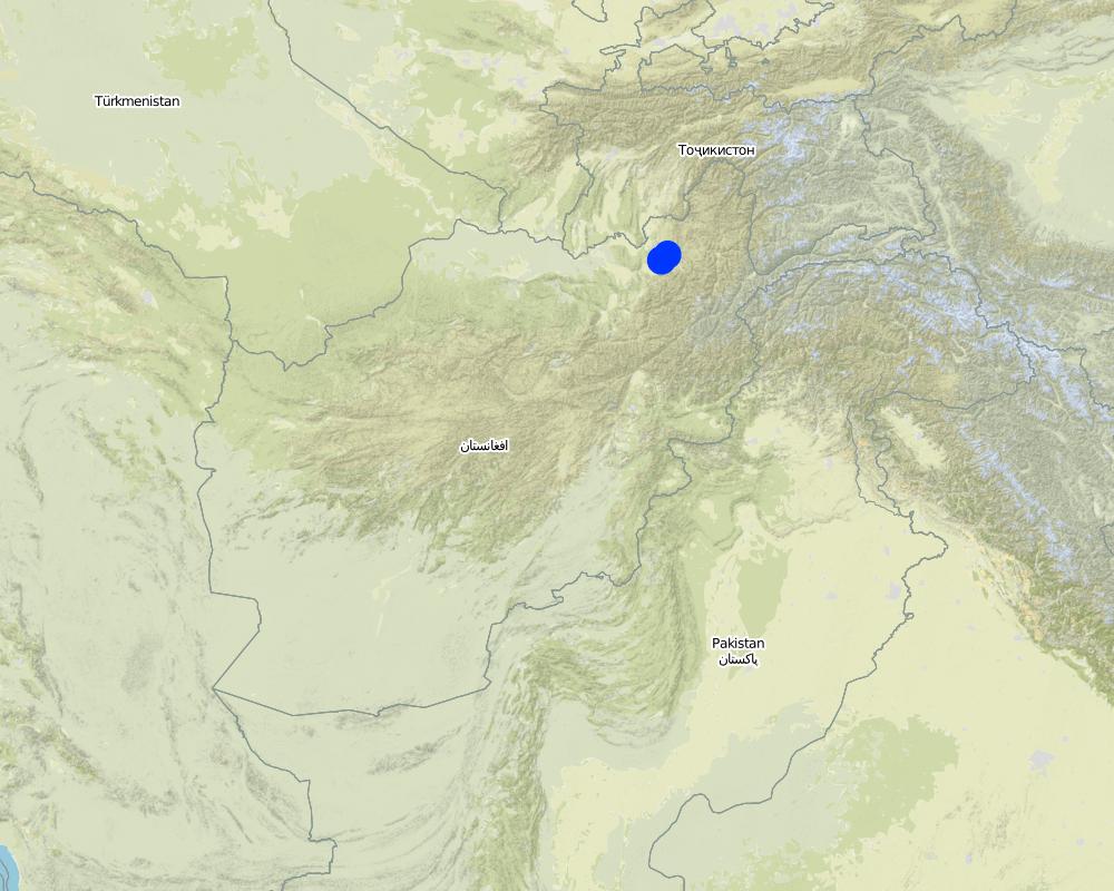
2.5 Country/ region/ locations where the Technology has been applied and which are covered by this assessment
Country:
Afghanistan
Region/ State/ Province:
Takhar Province, Rustaq District
Further specification of location:
Chokar Watershed: Sari Joy (upper watershed), Jawaz Khana (middle watershed), Dashti Mirzai (lower watershed)
Comments:
This documentation is based on the experiences of SLM impementers from Sari Joy (8 terraced plots), Jawaz Khana, (7 terraced plots), and Dashti Mirzai (11 terraced plots) as compiled during FGDs. The terraces located in Jawaz Khana have not been digitized yet. Additionally insights were gained through interviews in all three villages on farmers experiences and observations of terraced plots, with both SLM implementers (46) and observers (28).
Map
×2.6 Date of implementation
If precise year is not known, indicate approximate date:
- less than 10 years ago (recently)
2.7 Introduction of the Technology
Specify how the Technology was introduced:
- through projects/ external interventions
Comments (type of project, etc.):
Livelihood Improvement Project Takhar (LIPT) supported by Swiss Development Cooperation (SDC) from 2012-17
3. Classification of the SLM Technology
3.1 Main purpose(s) of the Technology
- improve production
- reduce, prevent, restore land degradation
3.2 Current land use type(s) where the Technology is applied

Cropland
- Annual cropping
- Perennial (non-woody) cropping
Main crops (cash and food crops):
Wheat, Alfalfa
If land use has changed due to the implementation of the Technology, indicate land use before implementation of the Technology:
Before implementation of the Technology, only annual crops were cultivated, with wheat as the main crop. Plots were ploughed along the countours mostly by animal traction. In recent years land users are starting to use tractors for ploughing, , where villages and plots are accessible by machinery.
3.3 Further information about land use
Water supply for the land on which the Technology is applied:
- rainfed
Number of growing seasons per year:
- 1
Specify:
May-July
3.4 SLM group to which the Technology belongs
- cross-slope measure
3.5 Spread of the Technology
Specify the spread of the Technology:
- evenly spread over an area
If the Technology is evenly spread over an area, indicate approximate area covered:
- 0.1-1 km2
3.6 SLM measures comprising the Technology

agronomic measures
- A2: Organic matter/ soil fertility

vegetative measures
- V2: Grasses and perennial herbaceous plants

structural measures
- S1: Terraces
Comments:
Agronomic measures: Terraces increase the economic viability of applying improved seeds and (chemical) fertilizer to badly nutrient depleted cropland.
Vegetative measures: Alfalfa is planted on the risers for stabilizing the terraces, and as an important contribution to fodder cropping.
Structural measures: The leveling of countour strips allows to harvest water and sediments.
3.7 Main types of land degradation addressed by the Technology

soil erosion by water
- Wt: loss of topsoil/ surface erosion
- Wg: gully erosion/ gullying
- Wo: offsite degradation effects

physical soil deterioration
- Pi: soil sealing

biological degradation
- Bc: reduction of vegetation cover
- Bq: quantity/ biomass decline

water degradation
3.8 Prevention, reduction, or restoration of land degradation
Specify the goal of the Technology with regard to land degradation:
- reduce land degradation
- restore/ rehabilitate severely degraded land
4. Technical specifications, implementation activities, inputs, and costs
4.1 Technical drawing of the Technology
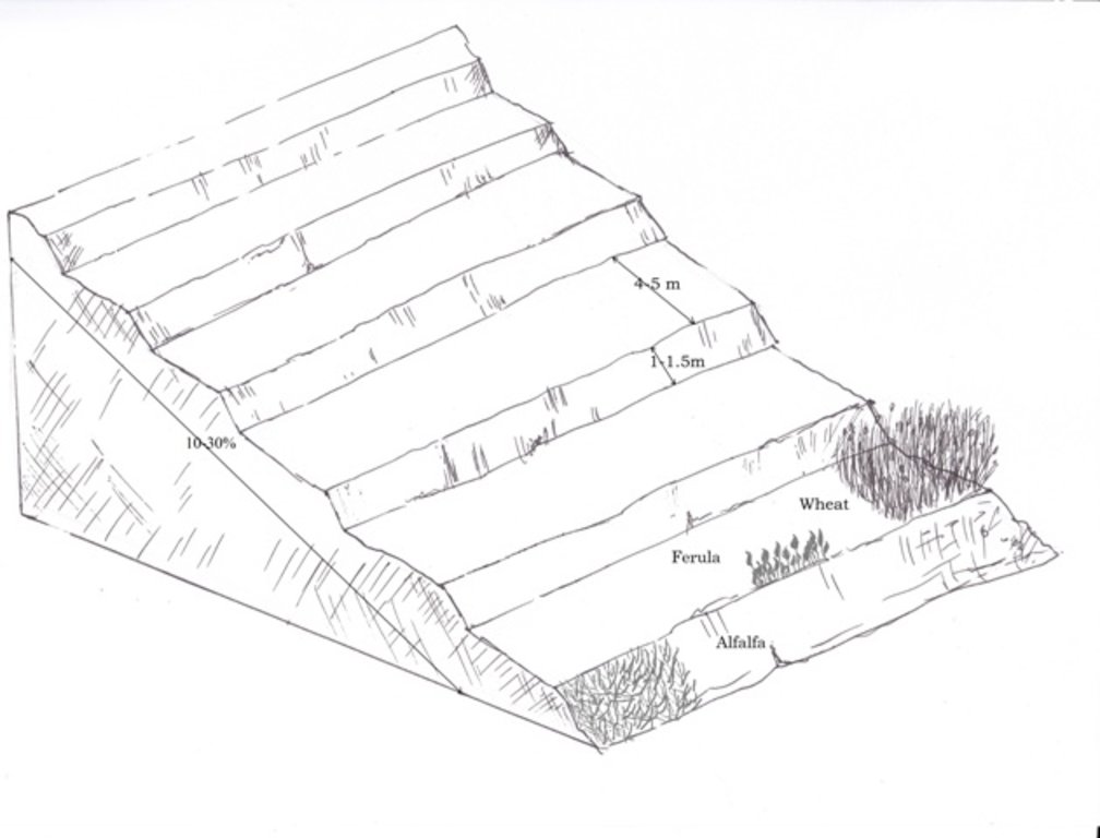
4.2 Technical specifications/ explanations of technical drawing
Terraces are established predominantly on a privately owned land in a mountainous landscape with varying steepness of slopes.
The average size of a plot is 2 Jerib, which is equal to 0.4 ha. The design of the terrace depends on the steepness of the slope. Mostly rolling (11-15%) and hilly (16-30%) slopes are used for building terraces.
Using an A-frame, the terrace is designed by dividing the slope into contour strips. Depending on the slope steepness, the terrace bench is around 4m wide and the the height of the risers is 1m-1,5 m. The terrace benches are built along the contour by moving the soil of upper bench to the lower bench. The leveled benches of the terrace are cultivated with wheat. The risers of the terrace are mostly used for growing fodder crops, such as alfalfa, which also helps to stabilize the terrace. If medicinal herbs are included, such as ferula, they are cultivated along the bench contours.
4.3 General information regarding the calculation of inputs and costs
Specify how costs and inputs were calculated:
- per Technology area
Indicate size and area unit:
1 ha
Specify currency used for cost calculations:
- US Dollars
Indicate exchange rate from USD to local currency (if relevant): 1 USD =:
67.0
Indicate average wage cost of hired labour per day:
5.2-5.3 USD
4.4 Establishment activities
| Activity | Type of measure | Timing | |
|---|---|---|---|
| 1. | Selection of the area for establishing a terrace (Men) | Management | Autumn |
| 2. | Designing of the terrace using A-frame, assisted by trained technician/project staff (Men) | Structural | End of autumn after rainy days |
| 3. | Leveling the soil with a shovel (Men) | Structural | Autumn/Winter |
| 4. | Sowing of alfalfa seeds on the risers (Men/women) | Vegetative | After 20 days of sowing wheat |
| 5. | Sowing of wheat seeds on benches (Men/Women) | Agronomic | Winter/Spring |
| 6. | Sowing of ferula along the contours (Men/women) | Vegetative | Winter/Spring |
4.5 Costs and inputs needed for establishment
| Specify input | Unit | Quantity | Costs per Unit | Total costs per input | % of costs borne by land users | |
|---|---|---|---|---|---|---|
| Labour | Designing of the terrace using A-frame | person-day | 10.0 | 9.0 | 90.0 | |
| Labour | Leveling the soil with a shovel | person-day | 150.0 | 5.3 | 795.0 | 51.0 |
| Labour | Sowing of wheat and alfalfa seeds | person-day | 10.0 | 5.3 | 53.0 | 51.0 |
| Labour | Sowing of ferula | person-day | 2.0 | 5.3 | 10.6 | 100.0 |
| Equipment | Pick axe | Pcs | 1.0 | 3.0 | 3.0 | 100.0 |
| Equipment | Pitchfork | Pcs | 1.0 | 5.3 | 5.3 | 100.0 |
| Equipment | Wheel barrow | Pcs | 1.0 | 38.0 | 38.0 | 100.0 |
| Equipment | Shovel | Pcs | 1.0 | 3.8 | 3.8 | |
| Equipment | Hoe | Pcs | 1.0 | 7.5 | 7.5 | |
| Equipment | A-Frame | Pcs | 1.0 | 6.0 | 6.0 | |
| Plant material | Wheat seeds | Kg | 140.0 | 0.42 | 58.8 | |
| Plant material | Alfalfa seeds | Kg | 17.5 | 0.42 | 7.35 | 100.0 |
| Plant material | Ferula seeds | Kg | 2.5 | 6.35 | 15.88 | 100.0 |
| Fertilizers and biocides | DAP | Kg | 125.0 | 0.9 | 112.5 | |
| Fertilizers and biocides | Urea | Kg | 125.0 | 0.45 | 56.25 | |
| Fertilizers and biocides | Herbicide | Liter | 50.0 | 0.25 | 12.5 | |
| Total costs for establishment of the Technology | 1275.48 | |||||
If land user bore less than 100% of costs, indicate who covered the remaining costs:
Livelihood Improvement Project Takhar (LIPT) implemented by Terre des Hommes (Tdh)
Comments:
Equipment provided by the project was re-used for the implemenation of different SLM practices on different plots. For completness equipment costs are fully accounted for.
Costs calculated for a Technology area of 1ha was only done for the purpose of the WOCAT documentation. In reality SLM plots are on average 0.4 ha or 2 jiribs. Costs were simply multiplied by 2.5. The actual costs for a 1ha plot might be slightly different.
4.6 Maintenance/ recurrent activities
| Activity | Type of measure | Timing/ frequency | |
|---|---|---|---|
| 1. | Ploughing the land with animal traction (Men) | Agronomic | Winter/Spring/Annually |
| 2. | Sowing of wheat seeds on benches (Men/Women) | Agronomic | Winter/Spring/Annually |
| 3. | Application of fertilizer (Men/Women) | Agronomic | Fall |
| 4. | Weeding (Women) | Agronomic | Summer |
| 5. | Harvesting wheat (Men and women together) | Agronomic | Summer/Fall |
| 6. | Harvesting alfalfa (Men and women together) | Agronomic | Summer/Fall |
| 7. | Collecting and delivering harvested wheat (Men and women) | Agronomic | Fall |
| 8. | Collecting and delivering harvested alfalfa (Men and women) | Agronomic | Fall |
| 9. | Repairing terrace risers with a shovel (Men) | Structural | Winter/Spring/After heavy rain or snow |
| 10. | Sowing alfalfa seeds on the repaired area (Men/Women) | Vegetative | Winter/Spring/When required |
4.7 Costs and inputs needed for maintenance/ recurrent activities (per year)
| Specify input | Unit | Quantity | Costs per Unit | Total costs per input | % of costs borne by land users | |
|---|---|---|---|---|---|---|
| Labour | Ploughing the land with animal traction | person day | 2.5 | 5.3 | 13.25 | 100.0 |
| Labour | Sowing of wheat seeds on benches | person day | 5.0 | 5.3 | 26.5 | 100.0 |
| Labour | Weeding and Fertilizer application | person day | 5.0 | 5.3 | 26.5 | 100.0 |
| Labour | Harvesting and delivering wheat and alfalfa | person day | 70.0 | 5.3 | 371.0 | 100.0 |
| Equipment | Sickle | Pcs | 1.0 | 100.0 | ||
| Plant material | Wheat seeds | Kg | 140.0 | 0.42 | 58.8 | 100.0 |
| Fertilizers and biocides | DAP | Kg | 125.0 | 0.9 | 112.5 | 100.0 |
| Fertilizers and biocides | Urea | Kg | 125.0 | 0.45 | 56.25 | 100.0 |
| Fertilizers and biocides | Herbicide | Liter | 50.0 | 0.25 | 12.5 | 100.0 |
| Total costs for maintenance of the Technology | 677.3 | |||||
If land user bore less than 100% of costs, indicate who covered the remaining costs:
Livelihood Improvement Project Takhar (LIPT) implemented by Terre des Hommes (Tdh)
Comments:
Costs calculated for a Technology area of 1ha was only done for the purpose of the WOCAT documentation. In reality SLM plots are on average 0.4 ha or 2 jiribs. Costs were simply multiplied by 2.5. The actual costs for a 1ha plot might be slightly different.
4.8 Most important factors affecting the costs
Describe the most determinate factors affecting the costs:
Due to the remoteness of the villages where the Technology has been implemented, all the inputs for establishment, such as agricultural equipment, plant material, fertilizers, etc., are purchased in Rustaq town. The expenses for traveling and delivering the inputs affect the establishment costs.
5. Natural and human environment
5.1 Climate
Annual rainfall
- < 250 mm
- 251-500 mm
- 501-750 mm
- 751-1,000 mm
- 1,001-1,500 mm
- 1,501-2,000 mm
- 2,001-3,000 mm
- 3,001-4,000 mm
- > 4,000 mm
Specify average annual rainfall (if known), in mm:
580.00
Specifications/ comments on rainfall:
Average annual precipitation for the area was calculated with 580 mm, with minimums in dry years (2000 and 2001) of 270 mm and maximums in wet years (2009/2010) of 830 mm. The absolute maximum rainfall was calculated for 1986 with 1024 mm. The data series covers the time from 1979 to 2014.
Indicate the name of the reference meteorological station considered:
Climate Forecast System Reanalysis (CFSR), http://rda.ucar.edu/pub/cfsr.html
Agro-climatic zone
- semi-arid
Specifications: Derived from the publically available dataset on length of growing period (LGP) (Fischer 2009 / IIASA-FAO). Internet link: http://tiles.arcgis.com/tiles/P8Cok4qAP1sTVE59/arcgis/rest/services/Length_of_growing_period/MapServer
5.2 Topography
Slopes on average:
- flat (0-2%)
- gentle (3-5%)
- moderate (6-10%)
- rolling (11-15%)
- hilly (16-30%)
- steep (31-60%)
- very steep (>60%)
Landforms:
- plateau/plains
- ridges
- mountain slopes
- hill slopes
- footslopes
- valley floors
Altitudinal zone:
- 0-100 m a.s.l.
- 101-500 m a.s.l.
- 501-1,000 m a.s.l.
- 1,001-1,500 m a.s.l.
- 1,501-2,000 m a.s.l.
- 2,001-2,500 m a.s.l.
- 2,501-3,000 m a.s.l.
- 3,001-4,000 m a.s.l.
- > 4,000 m a.s.l.
Comments and further specifications on topography:
The information was derived from two different sources:
- SLM implementers information provided in the Land User Protocol (LUP) during an FGD
- Elevation and slope statistics derived for terraced plots from ASTGTM. ASTGTM is the ASTER Global Digital Elevation Model V002 with a 30 m spatial resolution. More information on ASTGTM is available here: https://lpdaac.usgs.gov/node/1079. The data can be downloaded here: https://gdex.cr.usgs.gov/gdex/
5.3 Soils
Soil depth on average:
- very shallow (0-20 cm)
- shallow (21-50 cm)
- moderately deep (51-80 cm)
- deep (81-120 cm)
- very deep (> 120 cm)
Soil texture (topsoil):
- medium (loamy, silty)
Soil texture (> 20 cm below surface):
- medium (loamy, silty)
Topsoil organic matter:
- medium (1-3%)
- low (<1%)
If available, attach full soil description or specify the available information, e.g. soil type, soil PH/ acidity, Cation Exchange Capacity, nitrogen, salinity etc.
Local land users differentiate between the following soil types where terraces are implemented:
- Light soils: moderately deep; texture of topsoil medium (loamy, silty); low topsoil organic matter
- Dark soils: moderately deep; texture of topsoil medium (loamy, silty); medium topsoil organic matter
5.4 Water availability and quality
Availability of surface water:
medium
Water quality (untreated):
good drinking water
Is water salinity a problem?
No
Is flooding of the area occurring?
Yes
Regularity:
episodically
Comments and further specifications on water quality and quantity:
Floods occur mainly during the rainy seasons in spring and autumn. Availability of surface water differs for the three study villages Sari Joy, Jawaz Khana, and Dashti Mirzai. Sari Joy has sources and good surface water availability. Jawaz Khana has poor water availability as water has to be fetched from a lower laying stream. Dashti Mirzai has good water availability also from an irrigation channel.
5.5 Biodiversity
Species diversity:
- low
Habitat diversity:
- low
5.6 Characteristics of land users applying the Technology
Sedentary or nomadic:
- Sedentary
Market orientation of production system:
- subsistence (self-supply)
- mixed (subsistence/ commercial
Off-farm income:
- 10-50% of all income
- > 50% of all income
Relative level of wealth:
- average
- rich
Individuals or groups:
- individual/ household
Level of mechanization:
- manual work
- animal traction
Gender:
- women
- men
Age of land users:
- middle-aged
- elderly
5.7 Average area of land owned or leased by land users applying the Technology
- < 0.5 ha
- 0.5-1 ha
- 1-2 ha
- 2-5 ha
- 5-15 ha
- 15-50 ha
- 50-100 ha
- 100-500 ha
- 500-1,000 ha
- 1,000-10,000 ha
- > 10,000 ha
Is this considered small-, medium- or large-scale (referring to local context)?
- medium-scale
5.8 Land ownership, land use rights, and water use rights
Land ownership:
- individual, not titled
Land use rights:
- individual
Water use rights:
- communal (organized)
Comments:
Those who own land and use water for irrigation are obliged to pay for the water. The payment is made both in kind and in cash to the Mirob, the person in charge of distributing water in the community. The amount of the payment varies from village to village.
6. Impacts and concluding statements
6.1 On-site impacts the Technology has shown
Socio-economic impacts
Production
crop production
Quantity before SLM:
350 kg / ha
Quantity after SLM:
700 kg / ha
Comments/ specify:
The integration of measures including agronomic (improved seed and fertilizer) and structural (terraces to control water flow and loss of top soil, including nutrients and seeds) results in an increase of crop yield already in the first year. The effects cannot be attributed to one or the other measure specifically.
fodder production
Comments/ specify:
Alfalfa is planted on the risers.
product diversity
production area
Comments/ specify:
No change in total area for production, as the riser of the terraces are used for fodder production. However, there is some reduction of area available for annual crop production.
Socio-cultural impacts
food security/ self-sufficiency
Comments/ specify:
The yield of the main staple crop (wheat)has been reported to be double on terraced plots with application of improved seed and fertilizer. In addition, fodder crops, such as alfalfa grown on the risers, can be harvested.
SLM/ land degradation knowledge
Comments/ specify:
Technicians in the villages were trained in the use of A-frames. Implementers of terraces voiced that they themselves would not be able to replicated the designing of terraces.
situation of socially and economically disadvantaged groups
Comments/ specify:
Female headed households are not included. Technology is implemented on private land, therefore people without land are excluded. However, they have the opportunity to earn income as a hired worker for the SLM implementers.
Ecological impacts
Water cycle/ runoff
surface runoff
Soil
soil moisture
Comments/ specify:
in situ water harvesting
soil loss
Biodiversity: vegetation, animals
Vegetation cover
Comments/ specify:
Both an increase in vegetation cover during the growing season when most erosive rains are observed as well as permenant vegetation cover from perennial alfalfa plants can been observed.
biomass/ above ground C
6.2 Off-site impacts the Technology has shown
downstream flooding
downstream siltation
buffering/ filtering capacity
Comments regarding impact assessment:
These comments apply to 6.1 and 6.2:
- Socio-economic impacts: Based on the Land User Protocols: Individual SLM implementers were asked to rate the benefits for their Technology. They were asked to indicate production increase of crops; fodder; animals; wood; non-wood forest products; increase in product diversity; or production area. The most important increase they rated with 3, the second most with 2, others with 1 point. Averages of the points given by all SLM implementers are reflected here.
- Ecological impacts and off-site impacts: Based on the Land User Protocols: Individual SLM implementers were asked to rate the on-site and off-site impacts of the Technology on water; soil; and vegetation. They were asked to indicate the strength of impacts with three, two or one points. Averages of the points given by all implementers are reflected here.
6.3 Exposure and sensitivity of the Technology to gradual climate change and climate-related extremes/ disasters (as perceived by land users)
Climate-related extremes (disasters)
Meteorological disasters
| How does the Technology cope with it? | |
|---|---|
| local rainstorm | very well |
Climatological disasters
| How does the Technology cope with it? | |
|---|---|
| drought | well |
Comments:
Based on the multi-criteria matrix: SLM implementers from three villages were asked to jointly discuss and rate how much the SLM technology reduced the lands vulnerability to drought and local rainstorms. Only vulnerability to the most prevalent climate extremes (drought and local rainstorms) was discussed. SLM technologies were rated as reducing vulnerability poorly , well, or very well. The average points reflected here are from multi-criteria matrices compiled in three villages where the SLM technology had been implemented.
6.4 Cost-benefit analysis
Comments:
Costs: As larger parts of the establishment of the technology were covered by the project, farmers consideration of the total costs are likely underestimated.
Benefits: Two plots were terraced in 2012, and 5 plots in 2013. However, most terraces were implemented in 2014 (11 plots ) and 2015 (8 plots). The Rustaq NRM study was conducted in autumn 2016. 1-2 years of cultivating the terrace system is too short a period for providing evidence on short- and long-term returns.
6.5 Adoption of the Technology
- 1-10%
If available, quantify (no. of households and/ or area covered):
10.7 ha has been terraced within the 3 study villages with LIPT project support.
Of all those who have adopted the Technology, how many have did so spontaneously, i.e. without receiving any material incentives/ payments?
- 0-10%
Comments:
Based on the Land User Protocol: Individual SLM implementers were asked whether they received support for implementing the Technology. Each indicated the type of support he received from the proposed options: "Full Support 100%, Some Support, No Support 0%". 3 implementers claimed full project support, 22 claimed some support, and 1 implementer claimed no project support.
6.6 Adaptation
Has the Technology been modified recently to adapt to changing conditions?
Yes
If yes, indicate to which changing conditions it was adapted:
- changing markets
Specify adaptation of the Technology (design, material/ species, etc.):
Ferula is planted on the terrace in addition to wheat and alfalfa. The resin-like gum from the dried sap extracted from the stem and roots of Ferula is in high demand as a basic product for pharmaceuticals. Ferula can be sold to local merchants, who resell it to India, and is thus intercropped by some farmers on the terraces.
6.7 Strengths/ advantages/ opportunities of the Technology
| Strengths/ advantages/ opportunities in the land user’s view |
|---|
| Notable higher crop yields on the plots where improved seeds and fertilizer are applied on newly established terraces. Farmers have high expectations for the years to come and for yields of annual crops (such as wheat) to remain high. |
| Diversity of crops planted on terraces is valued by the land users. For example, cultivating wheat and alfalfa on the terraced plot provides household with the key crop and also fodder for the livestock and thereby contributes to securing food for the family and maintaining better health of their cattle. Additionally, some farmers have started intercropping Ferula, a medical herb and cash crop. |
| Farmers percieve soil quality on terraced plots with fertilizer application to improve. An improvement in soil fertility (which may relate first of all to the effects of fertilizer application) and increased soil moisture have been reported. Single statements also related to effectiveness of applying fertilizer on terraced plots, as here fertilizer is not washed away during rains. |
| Terraced plots are considered less vulnerable to the effects of rainstorms and dry spells, than non-terraced plots on slopes where annual crops are cultivated. |
| Women considered an advantage that during the establishment phase, men were paid by the project to work on their own land when building the terraces. Thus, there was no need for men to go for seasonal labour migration and they stayed at home. At the same time the terracing of the land is seen as an opportunity to improve the land resources on their families plots. An increase in women's workload related to bringing food to the field during establishment was considered to be acceptable, especially compared to the expected increase in yields. |
| Strengths/ advantages/ opportunities in the compiler’s or other key resource person’s view |
|---|
| The application of fertilizer on terraces is expected to show multiple effects: yields from these fertility depleted croplands can be increased. This includes an increase in biomass production, which may be used as green manure on the field or as animal feed or as straw. Further, vegetation cover during the growing period can be increased, which helps to protect the soil from erosive rains. |
| The project paid establishment of terraces on farmers' plots provided 20 days of employment per 2 jerib (0.4 ha) plot for farmers in their home villages. At the same time the terracing is a long-term investment into the land resources. Terracing provides an opportunity to decrease soil degradation and even to rehabilitate degraded lands. Application of improved seeds and fertilizer contribute in the establishment year to increased crop and fodder yields. |
6.8 Weaknesses/ disadvantages/ risks of the Technology and ways of overcoming them
| Weaknesses/ disadvantages/ risks in the land user’s view | How can they be overcome? |
|---|---|
|
The implementation costs are high and land users state that it is impossible for them to cover establishment costs on their own. |
|
| Farmers expectations partly exceeded the actual yield harvested from the terraces in the first years after the implementation. | |
| Both men and women from households that have implemened terraces state that during the establishment year the household experiences an increased workload, that is not well compatible with other on-going household / farm activities. | |
| The production area for annual crops only is slighty reduced. | So far not all farmers seem to use the production area fully. Intercropping with perennial plants is recommended in order to use the risers of the terraces for fodder production. Some farmers have started intercropping of Ferula as cash crop. |
| Sufficient own land is required. | How does the amount of cropland affect the innovation readiness of a farmer? A better understanding is required on farmers willingness to take a risk for investing in a new SLM technology, and especially terracing, and influencing factors. |
| Weaknesses/ disadvantages/ risks in the compiler’s or other key resource person’s view | How can they be overcome? |
|---|---|
| The technology requires technical knowledge for implementation and maintenance, which is key for successful adoption, replication and upscaling. The project trained technicians to support land users with the design of terraces. While the project aided implementation of terraces has improved the general knowledge and awareness of the land users on the benefits of SLM practices, most farmers will not be able to design terraces on their own. | |
|
Technically correct design of the terrace presents a challenge and might not be always achieved. Forward sloping terrace benches may lead to channeled runoff and have the risk of rills and gully formation. |
|
| There is an attribution gap regarding the increased wheat yields, especially with regard to individual contribution of the terraces, the application of improved seeds and the fertilizer, and the combined effects (role of terraces in making improved seed and fertilizer application effective). | A cost benefit analysis (CBA) needs to be conducted to determine short- and long-term returns of the SLM technology. On farm trials are necessary for assessing impacts of the different measures (agricultural, vegetative and structural measures) before-and-after, as well as with-without the SLM technology. |
| Terrace maintenance is crucial. If not maintained properly for a longer period of time, the damaged terrace can lead to further land degradation through channeled runoff, sever erosion and possible risks of disaster for the surrounding settlements on the slopes. | |
| The technology is established mainly by better-off households, which own more land than the average SLM implementer. |
7. References and links
7.1 Methods/ sources of information
- interviews with land users
Focus group discussions (FGD) were organized by the CDE team to collect information from SLM implementers. Total of 26 land users who have implemented terraces participated in the FGDs held in the three villages of Sari Joy, Jawaz Khana and Dashti Mirzai.
Interviews were conducted by the HAFL team to collect information from persons representing all the three study villages. Very detailed interviews were conducted with 74 persons interested in terrace implementation, of which 46 persons are from households that already have implemented terraces.
- interviews with SLM specialists/ experts
The technical staff of Tdh LIPT Project in Rustaq, responsible for the implementation of the technology were consulted on a number of occasions during the compilation of this material.
- compilation from reports and other existing documentation
Information provided in the reports of Tdh LIPT Project in Rustaq served as an initial source of information during the preparatory phase and also solidifying the description of the technology and area of implementation. Other background papers on Afghanistan were referred to for general information on agriculture and natural resource management in Afghanistan.
Links and modules
Expand all Collapse allLinks
No links
Modules
No modules


