Constructed wetland with tile drainage [Czech Republic]
- Creation:
- Update:
- Compiler: Petr Fučík
- Editor: –
- Reviewers: Rima Mekdaschi Studer, William Critchley
Umělý mokřad na drenáži
technologies_5939 - Czech Republic
View sections
Expand all Collapse all1. General information
1.2 Contact details of resource persons and institutions involved in the assessment and documentation of the Technology
Name of project which facilitated the documentation/ evaluation of the Technology (if relevant)
OPtimal strategies to retAIN and re-use water and nutrients in small agricultural catchments across different soil-climatic regions in Europe (OPTAIN)Name of project which facilitated the documentation/ evaluation of the Technology (if relevant)
Constructed wetlands on agricultural drainage systems for enhancement of landscape´s water residence time and improvement of water quality (TH02030376)Name of the institution(s) which facilitated the documentation/ evaluation of the Technology (if relevant)
Research Institute for Soil and Water Conservation (VUMOP) - Czech Republic1.3 Conditions regarding the use of data documented through WOCAT
The compiler and key resource person(s) accept the conditions regarding the use of data documented through WOCAT:
Yes
1.4 Declaration on sustainability of the described Technology
Is the Technology described here problematic with regard to land degradation, so that it cannot be declared a sustainable land management technology?
No
Comments:
The described constructed wetland is a sustainable land management technology.
2. Description of the SLM Technology
2.1 Short description of the Technology
Definition of the Technology:
A constructed wetland connected to tile drains that slows drainage flow, removes nitrogen and pesticides from drainage waters, and improves biodiversity. Formed from a substrate of matured birch chips and gravel, and is planted with reeds (Phalaris arundinacea) and reed manna grass (Glyceria maxima).
2.2 Detailed description of the Technology
Description:
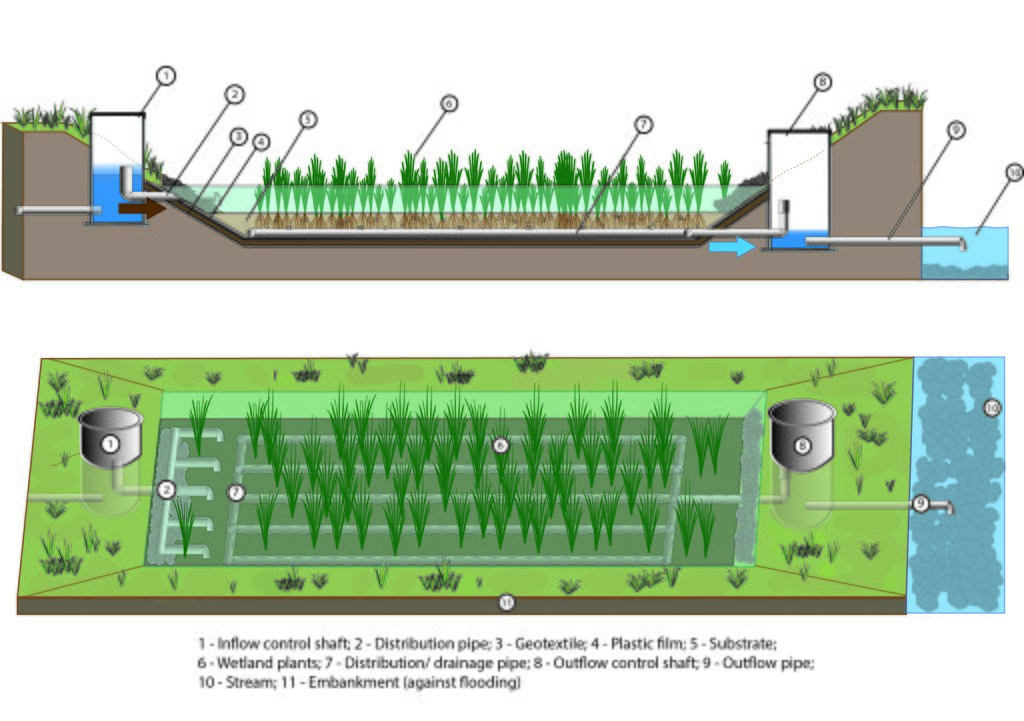
This type of constructed retention wetland is designed to act in a natural way. The objective is to improve water quality, slow down runoff – and support biodiversity. It combines the functions of retaining, and gradually releasing, water while remediating (i.e. cleaning) drainage waters with a focus on pollutant of nitrates and pesticides. The wetland is established in connection with or directly on tile drains and is designed to have both subsurface and surface flow. The substrate used in construction is a mixture of 6-month matured birch chips (4-30 mm length) and gravel (4–8 mm diameter) at a ratio of 1:10. The wetland is planted with reed canary grass (Phalaris arundinacea) and reed manna grass (Glyceria maxima). The wetland to catchment ratio (WCR) is between 2:1000 and 3:1000: thus, for example, a constructed wetland of 200m2 or 300m2 would be required to serve an area of 10 hectares.
The process of establishing such a wetland begins with identifying where this measure is required. The drainage system must be thoroughly located and then the correct site for the wetland identified. The wetland is then designed and planned – including costs and labour requirements and the amount of land taken out of production. Administration includes processing statements and permission from state offices and landowners.
2.3 Photos of the Technology
General remarks regarding photos:
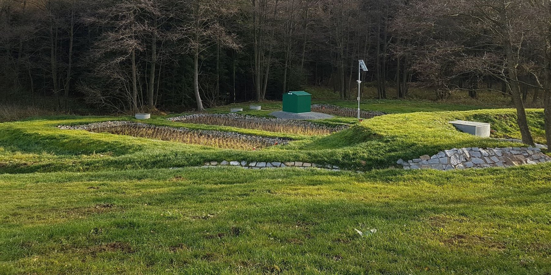
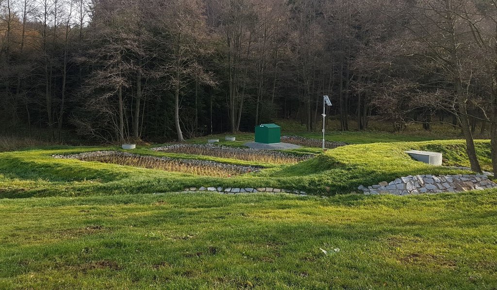
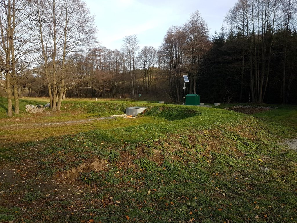
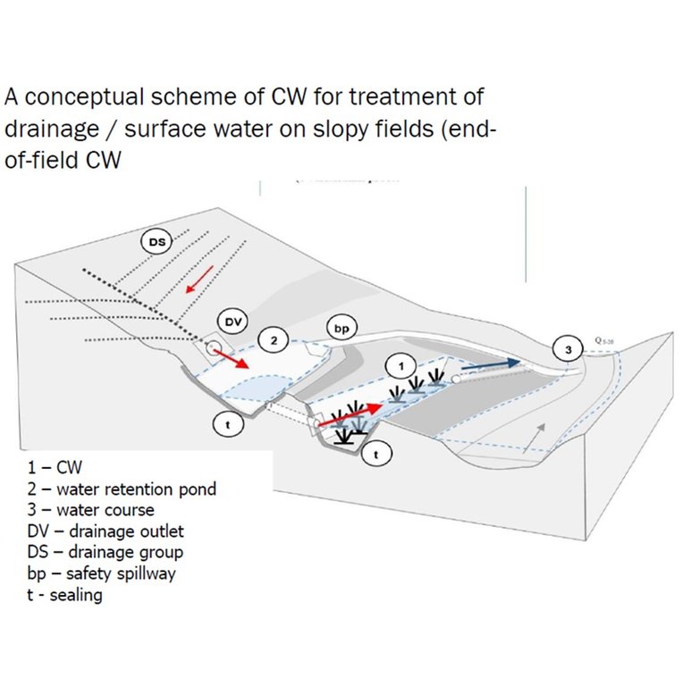
A retention pond is intended to capture high water flows and release it slowly to the wetland.
2.5 Country/ region/ locations where the Technology has been applied and which are covered by this assessment
Country:
Czech Republic
Region/ State/ Province:
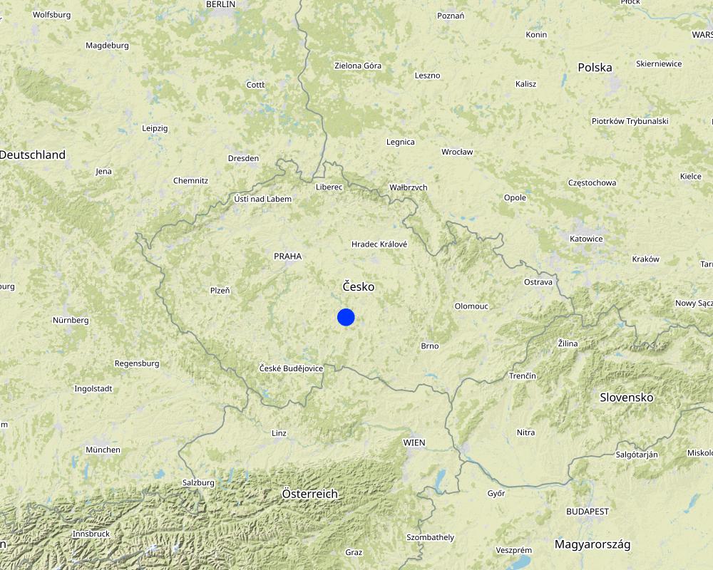
Czech Highlands (Vysočina)
Further specification of location:
Velký Rybník u Pelhřimova
Specify the spread of the Technology:
- applied at specific points/ concentrated on a small area
Is/are the technology site(s) located in a permanently protected area?
No
Comments:
Not in this specific case but it might be in some other cases.
Map
×2.6 Date of implementation
Indicate year of implementation:
2018
If precise year is not known, indicate approximate date:
- less than 10 years ago (recently)
2.7 Introduction of the Technology
Specify how the Technology was introduced:
- during experiments/ research
3. Classification of the SLM Technology
3.1 Main purpose(s) of the Technology
- conserve ecosystem
- protect a watershed/ downstream areas – in combination with other Technologies
- preserve/ improve biodiversity
- reduce risk of disasters
- adapt to climate change/ extremes and its impacts
3.2 Current land use type(s) where the Technology is applied
Land use mixed within the same land unit:
No

Waterways, waterbodies, wetlands
- Drainage lines, waterways
- Swamps, wetlands
Main products/ services:
The current land use might change; e.g. if there was a meadow / cropland and after implementation there is a wetland (i.e. water body or other surface)

Unproductive land
Specify:
CW on unproductive land below drained cropland.
Remarks:
CW on unproductive land below drained cropland.
3.3 Has land use changed due to the implementation of the Technology?
Has land use changed due to the implementation of the Technology?
- No (Continue with question 3.4)
Land use mixed within the same land unit:
No

Waterways, waterbodies, wetlands
- Drainage lines, waterways
- Swamps, wetlands
Main products/ services:
The current land use might change; e.g. if there was a meadow / cropland and after implementation there is a wetland (i.e. water body or other surface)

Unproductive land
Specify:
CW on unproductive land below drained cropland.
Remarks:
CW on unproductive land below drained cropland.
Comments:
The current land use might change; e.g. if there was a meadow / cropland before and after implementation there is a wetland (i.e. water body or other surface)
3.4 Water supply
Water supply for the land on which the Technology is applied:
- rainfed
Comments:
Drainage fed wetland
3.5 SLM group to which the Technology belongs
- water diversion and drainage
- surface water management (spring, river, lakes, sea)
- wetland protection/ management
3.6 SLM measures comprising the Technology

structural measures
- S3: Graded ditches, channels, waterways
- S4: Level ditches, pits
- S11: Others
3.7 Main types of land degradation addressed by the Technology

water degradation
- Hs: change in quantity of surface water
- Hp: decline of surface water quality
Comments:
Worsened drainage water quality (polluted by nitrates and pesticides). Accelerated (undue) subsurface runoff from farmland due to free-drainage.
3.8 Prevention, reduction, or restoration of land degradation
Specify the goal of the Technology with regard to land degradation:
- restore/ rehabilitate severely degraded land
4. Technical specifications, implementation activities, inputs, and costs
4.1 Technical drawing of the Technology
Technical specifications (related to technical drawing):
The retention drainage wetland is designed optionally with subsurface horizontal, vertical or combined flow. For nitrate and soluble pesticides, the horizontal flow is preferred (to support anoxic conditions and the denitrification), whereas for some other pollutants (amonia, phosphorus, sorbing pesticides), the vertical or a combined flow CW is better. Substrate could be various; we used a mixture of matured (6 months) 4-30 mm birch chips and 4–8 mm gravel (1:10), planted with reeds (Phalaris arundinacea) and reed manna grass (Glyceria maxima). The width is between 5–12 m; length 10–20 m; depth 80-120 cm. Water level is kept by the help of below, on or above the substrate surface. The plastic film is 10-20 mm thick.
Author:
Petr Fučík
Date:
17/03/2022
4.2 General information regarding the calculation of inputs and costs
Specify how costs and inputs were calculated:
- per Technology unit
Specify unit:
m2
Specify dimensions of unit (if relevant):
50 - 300
Specify currency used for cost calculations:
- USD
If relevant, indicate exchange rate from USD to local currency (e.g. 1 USD = 79.9 Brazilian Real): 1 USD =:
22.0
Indicate average wage cost of hired labour per day:
Around 1 500 USD per person per month; i.e. 75 USD/person/day
4.3 Establishment activities
| Activity | Timing (season) | |
|---|---|---|
| 1. | Identification of tile drainage (tiles, outlets). | anytime; project documentation, aerial images, field survey |
| 2. | Water sampling (discharge + water quality) + Curve Number method application. | 3-5x in several months. To get an overview of hydrochemical characteristics of the drainage and the volume of quick runoff |
| 3. | Identification of a proper location for a constructed wetland (CW) | anytime; based on soils, land use, old maps, land owner/user situation, morphology, etc |
| 4. | Assessment of CW hydraulic retention time (HRT) needed. | HRT is computed to enable removal of 50% of pollution load (e.g. NO3); based on average flow (m3/h), designed wetlad volume (m3) and substrate porosity (%) |
| 5. | Design the CW | preparation of the whole documentation |
| 6. | Administration and engineering of the CW | land owner issues, permissions, etc |
| 7. | Construction of the CW | best in drier conditions |
| 8. | Setting the plants | In central Europe - from April to September; at 0,5 - 1 m distance |
| 9. | Finalization of the CW | grassing the banks, ground works, etc |
Comments:
When designing the measures on land drainage at larger areas, there is a paper by Zajíček et al. (2022). How to Select a Location and a Design of Measures on Land Drainage – A Case Study from the Czech Republic. DOI: https://doi.org/10.12911/22998993/146270
4.4 Costs and inputs needed for establishment
If you are unable to break down the costs in the table above, give an estimation of the total costs of establishing the Technology:
48000.0
If land user bore less than 100% of costs, indicate who covered the remaining costs:
Municipality
Comments:
The cost for implementation of a CW is between 18 000 - 85 000 USD (48 000 on average), depending on the size, construction, equipment, etc.
4.5 Maintenance/ recurrent activities
| Activity | Timing/ frequency | |
|---|---|---|
| 1. | General Inspection | 4-6 times per year (every two or three months) |
| 2. | Removal / cleaning of sediment / cloggings | 1-2 times per year (every six or twelve months) |
| 3. | Removal of grass / biomass (if necessary) | 2-6 times per year (every twelve or three months) |
4.6 Costs and inputs needed for maintenance/ recurrent activities (per year)
If you are unable to break down the costs in the table above, give an estimation of the total costs of maintaining the Technology:
500.0
If land user bore less than 100% of costs, indicate who covered the remaining costs:
In our case research support; in practice could be Munucipality, Regional government, River Basin Management Authority
Comments:
The cost for maintenance/ recurrent activities of a CW is between 300 - 700 EUR per year (500 on average), depending on the size, construction, equipment, etc.
4.7 Most important factors affecting the costs
Describe the most determinate factors affecting the costs:
CW size, construction, equipment. Design of the whole CW - if designed as a more natural or rather a technical unit.
5. Natural and human environment
5.1 Climate
Annual rainfall
- < 250 mm
- 251-500 mm
- 501-750 mm
- 751-1,000 mm
- 1,001-1,500 mm
- 1,501-2,000 mm
- 2,001-3,000 mm
- 3,001-4,000 mm
- > 4,000 mm
Specify average annual rainfall (if known), in mm:
600.00
Specifications/ comments on rainfall:
For CW design; it is necessary is to have rainfall amounts with 2, 5,10, 20 and 00 year return periods to calculate direct runoff from adjacent (sloping) farmland to design the retention pond by CN method (or other).
Indicate the name of the reference meteorological station considered:
Pelhřimov
Agro-climatic zone
- sub-humid
The more often torrential rains are anticipated, the more attention is needed to pay the design of the retention pond located prior the CW.
5.2 Topography
Slopes on average:
- flat (0-2%)
- gentle (3-5%)
- moderate (6-10%)
- rolling (11-15%)
- hilly (16-30%)
- steep (31-60%)
- very steep (>60%)
Landforms:
- plateau/plains
- ridges
- mountain slopes
- hill slopes
- footslopes
- valley floors
Altitudinal zone:
- 0-100 m a.s.l.
- 101-500 m a.s.l.
- 501-1,000 m a.s.l.
- 1,001-1,500 m a.s.l.
- 1,501-2,000 m a.s.l.
- 2,001-2,500 m a.s.l.
- 2,501-3,000 m a.s.l.
- 3,001-4,000 m a.s.l.
- > 4,000 m a.s.l.
Indicate if the Technology is specifically applied in:
- concave situations
5.3 Soils
Soil depth on average:
- very shallow (0-20 cm)
- shallow (21-50 cm)
- moderately deep (51-80 cm)
- deep (81-120 cm)
- very deep (> 120 cm)
Soil texture (topsoil):
- medium (loamy, silty)
- fine/ heavy (clay)
Soil texture (> 20 cm below surface):
- medium (loamy, silty)
- fine/ heavy (clay)
Topsoil organic matter:
- medium (1-3%)
- low (<1%)
If available, attach full soil description or specify the available information, e.g. soil type, soil PH/ acidity, Cation Exchange Capacity, nitrogen, salinity etc.
Soil characteristics are not relevant, with an exception of the retention pond bottom and dam (best clay or low permeable soils).
5.4 Water availability and quality
Ground water table:
5-50 m
Availability of surface water:
medium
Water quality (untreated):
poor drinking water (treatment required)
Water quality refers to:
both ground and surface water
Is water salinity a problem?
No
Is flooding of the area occurring?
Yes
Regularity:
episodically
Comments and further specifications on water quality and quantity:
The more often torrential rains are anticipated, the more attention is needed to pay to the design of the retention pond located prior the CW.
5.5 Biodiversity
Species diversity:
- medium
Habitat diversity:
- medium
5.6 Characteristics of land users applying the Technology
Sedentary or nomadic:
- Sedentary
Market orientation of production system:
- mixed (subsistence/ commercial)
Off-farm income:
- less than 10% of all income
Relative level of wealth:
- average
Individuals or groups:
- cooperative
Level of mechanization:
- mechanized/ motorized
Gender:
- women
- men
Age of land users:
- youth
- middle-aged
- elderly
5.7 Average area of land used by land users applying the Technology
- < 0.5 ha
- 0.5-1 ha
- 1-2 ha
- 2-5 ha
- 5-15 ha
- 15-50 ha
- 50-100 ha
- 100-500 ha
- 500-1,000 ha
- 1,000-10,000 ha
- > 10,000 ha
Is this considered small-, medium- or large-scale (referring to local context)?
- small-scale
Comments:
One CW area is usually between 50 - 300 m2; 0,2-0,3% of the catchment (s.c. catchment/wetland ratio; CWR). The wetland to catchment ratio (WCR) is between 2:1000 and 3:1000: thus, for example, a constructed wetland of 200m2 or 300m2 would be required to serve an area of 10 hectares.
5.8 Land ownership, land use rights, and water use rights
Land ownership:
- communal/ village
- individual, not titled
Land use rights:
- communal (organized)
- leased
Water use rights:
- open access (unorganized)
- communal (organized)
Are land use rights based on a traditional legal system?
Yes
Specify:
land use / land owner might be different and must be taken into account (administrate)
5.9 Access to services and infrastructure
health:
- poor
- moderate
- good
education:
- poor
- moderate
- good
technical assistance:
- poor
- moderate
- good
employment (e.g. off-farm):
- poor
- moderate
- good
markets:
- poor
- moderate
- good
energy:
- poor
- moderate
- good
roads and transport:
- poor
- moderate
- good
drinking water and sanitation:
- poor
- moderate
- good
financial services:
- poor
- moderate
- good
6. Impacts and concluding statements
6.1 On-site impacts the Technology has shown
Socio-economic impacts
Production
land management
Comments/ specify:
A slightly more demanding land management - after implementation of the CW on land, where just grassland prior to the CW construction.
Water availability and quality
drinking water quality
Comments/ specify:
Improvement of water quality due to the implementation of CW; could apply for local drinking water resources.
Ecological impacts
Water cycle/ runoff
water quantity
Comments/ specify:
Enhancement of water residence time on agricultural land.
water quality
Comments/ specify:
Improvement of water quality due to the implementation of CW.
excess water drainage
Comments/ specify:
Retention of drainage water runoff from land.
Biodiversity: vegetation, animals
plant diversity
Comments/ specify:
Enhancement
6.2 Off-site impacts the Technology has shown
water availability
Comments/ specify:
Enhancement of available water in the vicinity of the wetland
groundwater/ river pollution
Comments/ specify:
Improvement of water quality in adjacent streams.
6.3 Exposure and sensitivity of the Technology to gradual climate change and climate-related extremes/ disasters (as perceived by land users)
Climate-related extremes (disasters)
Meteorological disasters
| How does the Technology cope with it? | |
|---|---|
| local rainstorm | well |
Hydrological disasters
| How does the Technology cope with it? | |
|---|---|
| flash flood | well |
Comments:
The design of a CW should consider to some extent also these risks - local rainstorms, soil erosion, etc. I.E. the technology must be designed and implemented with a regard to these phenomena; i.e. without loosing its effectiveness in such situations.
6.4 Cost-benefit analysis
How do the benefits compare with the establishment costs (from land users’ perspective)?
Short-term returns:
slightly negative
Long-term returns:
very positive
How do the benefits compare with the maintenance/ recurrent costs (from land users' perspective)?
Short-term returns:
slightly negative
Long-term returns:
neutral/ balanced
6.5 Adoption of the Technology
- single cases/ experimental
If available, quantify (no. of households and/ or area covered):
This particular technology was applied only at several sites. However, there are dozens of intensive constructed wetlands on land drainage around the world (USA, New Zealand, Denmark, etc)
Of all those who have adopted the Technology, how many did so spontaneously, i.e. without receiving any material incentives/ payments?
- 0-10%
6.6 Adaptation
Has the Technology been modified recently to adapt to changing conditions?
No
6.7 Strengths/ advantages/ opportunities of the Technology
| Strengths/ advantages/ opportunities in the land user’s view |
|---|
| Drainage water retention. Slowing down the loss of water from landscape. |
| Improvement water quality. Removal of reactive nitrogen and pesticides from drainage and related surface waters. |
| Enhancement of biodiversity. Promoting suitable sites for wetland flora and fauna. |
6.8 Weaknesses/ disadvantages/ risks of the Technology and ways of overcoming them
| Weaknesses/ disadvantages/ risks in the land user’s view | How can they be overcome? |
|---|---|
| Higher implementation costs. | Use as much local sources as possible. Work with the landscape, use old landsape patterns and experiences. |
7. References and links
7.1 Methods/ sources of information
- field visits, field surveys
At least one visit per a month during a four-year project
- compilation from reports and other existing documentation
Data and information taken prom project: Constructed wetlands on agricultural drainage systems for enhancement of landscape´s water residence time and improvement of water quality (2017 - 2020); no. TH02030376; provided by Technology Agency of the Czech Republic
When were the data compiled (in the field)?
31/12/2020
Comments:
End of the project
Methodology (in Czech with English abstract) - https://tinyurl.com/yckmn95m
Paper - https://tinyurl.com/yc5wwzsm
7.2 References to available publications
Title, author, year, ISBN:
FUČÍK, P., VYMAZAL, J., HNÁTKOVÁ, T., ŠEREŠ, M. (2018): A trial constructed wetland on agricultural drainage systems for enhancement of landscape´s water residence time and improvement of water quality. In konference 16th IWA International Conference Wetland Systems for Water Pollution Control (http://icws2018.webs.upv.es/conference/about-conference/ ), 29.9. - 4.10.2018, Valencie, Spain.
Title, author, year, ISBN:
VYMAZAL, J., SOCHACKI, A., FUČÍK, P., ŠEREŠ, M., KAPLICKÁ, M., HNÁTKOVÁ, T., CHEN, Z. (2020): Constructed wetlands with subsurface flow for nitrogen removal from tile drainage. Ecological Engineering 155 (2020) Article number 105943: 1-10. ISSN 0925-8574. https://doi.org/10.1016/j.ecoleng.2020.105943
Title, author, year, ISBN:
Fučík P., Vymazal, J., Šereš, M., Hejduk, T., Hnátková, T., Sochacki, A., Kulhavý, Z., Zajíček, A., Zhen, Z., Duffková, R., Kaplická, M., Sítková, V., Poláková, V., Kukačka, J. 2021. Constructed wetlands on land drainage – principles for design, placement and operation for enhancement of water residence time and improvement of water quality – A certified methodology. Prague. ISBN 978-80-88323-50-1 (print version), ISBN 978-80-88323-51-8 (online pdf). In Czech.
7.3 Links to relevant online information
Title/ description:
Constructed wetlands on agricultural drainage systems for enhancement of landscape´s water residence time and improvement of water quality
URL:
https://starfos.tacr.cz/en/project/TH02030376
7.4 General comments
This is the end.
Links and modules
Expand all Collapse allLinks
No links
Modules
No modules


