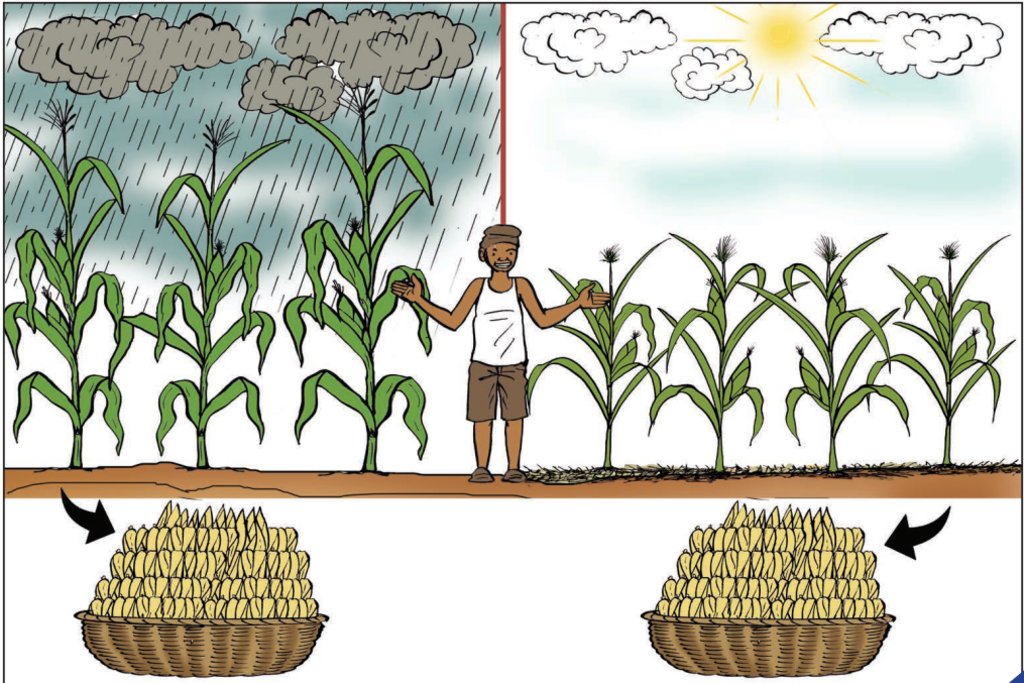
Semis étalés dans le temps [Benin]
- Creation:
- Update:
- Compiler: Gatien AGBOKOUN CHRISTOPHE
- Editors: Siagbé Golli, Abdoul Karim MIEN, DOSSOU-YOVO bernardin
- Reviewers: Sally Bunning, Rima Mekdaschi Studer
technologies_6683 - Benin
View sections
Expand all Collapse all1. General information
1.2 Contact details of resource persons and institutions involved in the assessment and documentation of the Technology
Key resource person(s)
SLM specialist:
DOSSOUMON Roland
INUDE ONG
Benin
WOROUWINNON BIO Karim
INUDE ONG
Benin
Name of project which facilitated the documentation/ evaluation of the Technology (if relevant)
Soil protection and rehabilitation for food security (ProSo(i)l)Name of the institution(s) which facilitated the documentation/ evaluation of the Technology (if relevant)
GIZ Bénin (GIZ Bénin) - Benin1.3 Conditions regarding the use of data documented through WOCAT
The compiler and key resource person(s) accept the conditions regarding the use of data documented through WOCAT:
Yes
1.4 Declaration on sustainability of the described Technology
Is the Technology described here problematic with regard to land degradation, so that it cannot be declared a sustainable land management technology?
No
2. Description of the SLM Technology
2.1 Short description of the Technology
Definition of the Technology:
La technique de semis étalés dans le temps consiste à mettre en place une culture sur plusieurs dates de semis pour limiter les risques liés aux poches de sécheresse et augmenter les chances de réussite pendant la période culturale.
2.2 Detailed description of the Technology
Description:
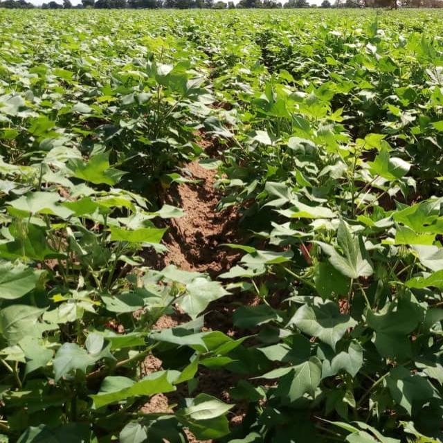
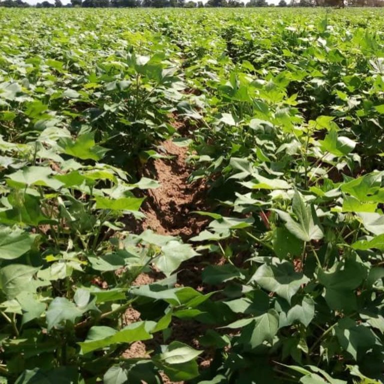
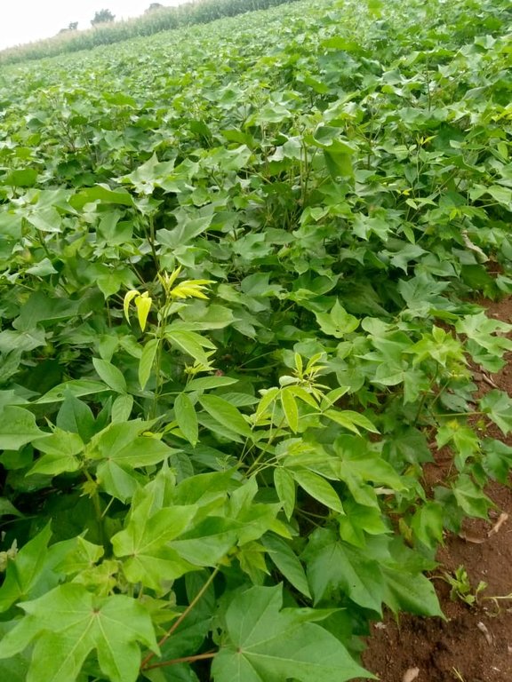
Le semis étalé dans le temps est une des mesures d'adaptation aux changements climatiques appliquée dans la commune de Banikoara. Les producteurs l'appliquent dans les champs de production vivrière (maïs) ou de rente (soja et coton).
C'est une technologie qui s’applique dans les conditions de cycle irrégulier des pluies, dans les zones où il est difficile de prévoir avec exactitude la pluviométrie. La technologie concerne toutes les spéculations. Ainsi, dans le cas du coton, le semis est fait en deux ou trois temps par au moins 3/4 des producteurs accompagnés. Pour le premier semis, le producteur sème une première portion de la superficie. S’il choisit de semer trois fois, il peut semer ½, ¼ et ¼ de sa parcelle.
Les différentes périodes choisies pour opérer les semis étalés dans le temps concernent le début des pluies, deux semaines à un mois après le début des pluies et un à deux mois après le début des pluies. De toutes ces périodes, les producteurs préfèrent majoritairement installer les cultures à partir de mi-mai jusqu’à la première décade du mois d’août (pour le soja).
Les objectifs de cette technologie sont de minimiser les risques de mauvaise récolte due à l’irrégularité des pluies et de réduire les périodes de pointe (de surcharge en travail).
Pour faciliter sa mise en place il faut (i) accepter le risque de perdre, en partie, de la semence, (ii) être prêt à saisir toute opportunité de pluie suffisante pour effectuer des semis précoces, (iii) combiner cette stratégie avec les mesures de semis sous couverture végétale du sol, (iv) rendre les informations météorologiques accessibles aux agriculteurs (radios rurales et autres canaux de technologies de l’information et de la communication dont la radio communautaire BANIGANSÉ FM de Banikoara dans le présent cas).
L’application des semis étalés dans le temps vient résoudre les pertes totales de germination des graines. Si une parcelle se perd et une autre parcelle réussi la densité totale sera moins. Il peut obtenir une densité acceptable. Cette technologie permet également de faciliter la répartition du travail en vue d’éviter le chevauchement des travaux champêtres au même moment. Ceci permet de mieux gérer la main d’œuvre de façon adéquate et d’espérer les récoltes à la fin du cycle de production des cultures.
Pour les exploitants des terres, cette technologie présente quelques risques. Les plus fréquents observés par les producteurs sont les pertes de germination sur une partie de son champ, de perte de récoltes voire les attaques des ravageurs dus au mauvais choix de période de semis selon le type de sol, selon la quantité de pluies tombées. Mais de toutes façons, ils arrivent à récolter et éviter ne serait-ce qu'une petite quantité ce qui n'était pas possible dans les cas où le semis était fait en même temps sur toute la superficie emblavée
2.3 Photos of the Technology
2.5 Country/ region/ locations where the Technology has been applied and which are covered by this assessment
Country:
Benin
Region/ State/ Province:
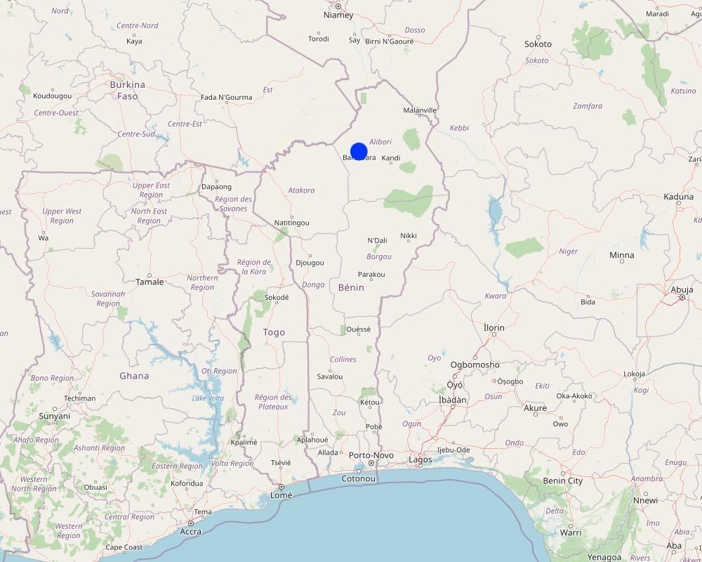
Alibori
Further specification of location:
Banikoara
Specify the spread of the Technology:
- evenly spread over an area
If the Technology is evenly spread over an area, specify area covered (in km2):
1.0
Is/are the technology site(s) located in a permanently protected area?
No
Map
×2.6 Date of implementation
Indicate year of implementation:
2016
2.7 Introduction of the Technology
Specify how the Technology was introduced:
- through projects/ external interventions
Comments (type of project, etc.):
ProSOL Bénin
3. Classification of the SLM Technology
3.1 Main purpose(s) of the Technology
- improve production
- reduce risk of disasters
- adapt to climate change/ extremes and its impacts
- mitigate climate change and its impacts
- create beneficial economic impact
3.2 Current land use type(s) where the Technology is applied
Land use mixed within the same land unit:
No

Cropland
- Annual cropping
Annual cropping - Specify crops:
- fibre crops - cotton
- cereals - maize
Number of growing seasons per year:
- 1
Is crop rotation practiced?
Yes
If yes, specify:
La rotation se fait entre le coton et le maïs
3.3 Has land use changed due to the implementation of the Technology?
Has land use changed due to the implementation of the Technology?
- Yes (Please fill out the questions below with regard to the land use before implementation of the Technology)
Land use mixed within the same land unit:
No

Cropland
- Annual cropping
Annual cropping - Specify crops:
- fibre crops - cotton
- cereals - maize
- legumes and pulses - soya
Is intercropping practiced?
No
Is crop rotation practiced?
Yes
If yes, specify:
La rotation se fait entre le coton, le maïs et le mil
3.4 Water supply
Water supply for the land on which the Technology is applied:
- rainfed
3.5 SLM group to which the Technology belongs
- Adaptation aux changements climatiques
3.6 SLM measures comprising the Technology

agronomic measures
- A1: Vegetation/ soil cover

management measures
- M1: Change of land use type
- M4: Major change in timing of activities
3.7 Main types of land degradation addressed by the Technology

biological degradation
- Bs: quality and species composition/ diversity decline
3.8 Prevention, reduction, or restoration of land degradation
Specify the goal of the Technology with regard to land degradation:
- not applicable
Comments:
Il s'agit d'une mesure d'adaptation aux changements climatiques
4. Technical specifications, implementation activities, inputs, and costs
4.1 Technical drawing of the Technology
Technical specifications (related to technical drawing):
Un producteur qui veut ensemencer 3 ha, peut étaler les semis dans le temps sur trois périodes :
Le premier semis : 1ha dès le début des pluies
Le deuxième semis : Un à deux mois après le début des pluies
Le troisième semis : Deux à trois mois après le début des pluies particulièrement pour le soja et pour certains producteurs pour les variétés de maïs à cycle court.
4.2 General information regarding the calculation of inputs and costs
Specify how costs and inputs were calculated:
- per Technology area
Indicate size and area unit:
1ha
other/ national currency (specify):
Franc CFA
If relevant, indicate exchange rate from USD to local currency (e.g. 1 USD = 79.9 Brazilian Real): 1 USD =:
615.0
Indicate average wage cost of hired labour per day:
2500
4.3 Establishment activities
| Activity | Timing (season) | |
|---|---|---|
| 1. | Préparation du sol / Défrichage | Mars - Avril |
| 2. | Labour | Mai |
| 3. | Semis | Mai-Juillet |
| 4. | Sarclo buttage | Juillet - Août |
4.4 Costs and inputs needed for establishment
| Specify input | Unit | Quantity | Costs per Unit | Total costs per input | % of costs borne by land users | |
|---|---|---|---|---|---|---|
| Labour | Préparation du sol / Défrichage | ha | 1.0 | 17000.0 | 17000.0 | 100.0 |
| Labour | Labour | ha | 1.0 | 30000.0 | 30000.0 | 100.0 |
| Labour | Semis | ha | 1.0 | 12000.0 | 12000.0 | 100.0 |
| Labour | Sarclo buttage | ha | 1.0 | 20000.0 | 20000.0 | 100.0 |
| Total costs for establishment of the Technology | 79000.0 | |||||
| Total costs for establishment of the Technology in USD | 128.46 | |||||
4.5 Maintenance/ recurrent activities
| Activity | Timing/ frequency | |
|---|---|---|
| 1. | Sarclo buttage | Juin-Juillet |
4.6 Costs and inputs needed for maintenance/ recurrent activities (per year)
| Specify input | Unit | Quantity | Costs per Unit | Total costs per input | % of costs borne by land users | |
|---|---|---|---|---|---|---|
| Labour | Sarclo buttage | ha | 1.0 | 15000.0 | 15000.0 | 100.0 |
| Total costs for maintenance of the Technology | 15000.0 | |||||
| Total costs for maintenance of the Technology in USD | 24.39 | |||||
4.7 Most important factors affecting the costs
Describe the most determinate factors affecting the costs:
Main d'oeuvre
5. Natural and human environment
5.1 Climate
Annual rainfall
- < 250 mm
- 251-500 mm
- 501-750 mm
- 751-1,000 mm
- 1,001-1,500 mm
- 1,501-2,000 mm
- 2,001-3,000 mm
- 3,001-4,000 mm
- > 4,000 mm
Specify average annual rainfall (if known), in mm:
850.00
Agro-climatic zone
- semi-arid
5.2 Topography
Slopes on average:
- flat (0-2%)
- gentle (3-5%)
- moderate (6-10%)
- rolling (11-15%)
- hilly (16-30%)
- steep (31-60%)
- very steep (>60%)
Landforms:
- plateau/plains
- ridges
- mountain slopes
- hill slopes
- footslopes
- valley floors
Altitudinal zone:
- 0-100 m a.s.l.
- 101-500 m a.s.l.
- 501-1,000 m a.s.l.
- 1,001-1,500 m a.s.l.
- 1,501-2,000 m a.s.l.
- 2,001-2,500 m a.s.l.
- 2,501-3,000 m a.s.l.
- 3,001-4,000 m a.s.l.
- > 4,000 m a.s.l.
Indicate if the Technology is specifically applied in:
- not relevant
5.3 Soils
Soil depth on average:
- very shallow (0-20 cm)
- shallow (21-50 cm)
- moderately deep (51-80 cm)
- deep (81-120 cm)
- very deep (> 120 cm)
Soil texture (topsoil):
- medium (loamy, silty)
- fine/ heavy (clay)
Soil texture (> 20 cm below surface):
- medium (loamy, silty)
- fine/ heavy (clay)
Topsoil organic matter:
- low (<1%)
5.4 Water availability and quality
Ground water table:
5-50 m
Availability of surface water:
good
Water quality (untreated):
poor drinking water (treatment required)
Water quality refers to:
ground water
Is water salinity a problem?
No
Is flooding of the area occurring?
No
5.5 Biodiversity
Species diversity:
- low
Habitat diversity:
- medium
5.6 Characteristics of land users applying the Technology
Sedentary or nomadic:
- Sedentary
Market orientation of production system:
- mixed (subsistence/ commercial)
Off-farm income:
- less than 10% of all income
Relative level of wealth:
- poor
- average
Individuals or groups:
- groups/ community
Level of mechanization:
- animal traction
- mechanized/ motorized
Gender:
- women
- men
Age of land users:
- youth
- middle-aged
5.7 Average area of land used by land users applying the Technology
- < 0.5 ha
- 0.5-1 ha
- 1-2 ha
- 2-5 ha
- 5-15 ha
- 15-50 ha
- 50-100 ha
- 100-500 ha
- 500-1,000 ha
- 1,000-10,000 ha
- > 10,000 ha
Is this considered small-, medium- or large-scale (referring to local context)?
- small-scale
- medium-scale
5.8 Land ownership, land use rights, and water use rights
Land ownership:
- communal/ village
Land use rights:
- communal (organized)
Water use rights:
- communal (organized)
Are land use rights based on a traditional legal system?
Yes
Specify:
Il y a des Chefs terre qui organisent l'accès à la terre
5.9 Access to services and infrastructure
health:
- poor
- moderate
- good
education:
- poor
- moderate
- good
technical assistance:
- poor
- moderate
- good
employment (e.g. off-farm):
- poor
- moderate
- good
markets:
- poor
- moderate
- good
energy:
- poor
- moderate
- good
roads and transport:
- poor
- moderate
- good
drinking water and sanitation:
- poor
- moderate
- good
financial services:
- poor
- moderate
- good
6. Impacts and concluding statements
6.1 On-site impacts the Technology has shown
Socio-economic impacts
Production
crop production
Comments/ specify:
Le semis étalé dans le temps limite les risques de perte
Income and costs
expenses on agricultural inputs
farm income
Socio-cultural impacts
food security/ self-sufficiency
recreational opportunities
SLM/ land degradation knowledge
6.3 Exposure and sensitivity of the Technology to gradual climate change and climate-related extremes/ disasters (as perceived by land users)
Gradual climate change
Gradual climate change
| Season | increase or decrease | How does the Technology cope with it? | |
|---|---|---|---|
| annual temperature | increase | well | |
| seasonal temperature | dry season | increase | well |
| annual rainfall | decrease | well | |
| seasonal rainfall | dry season | increase | well |
Climate-related extremes (disasters)
Climatological disasters
| How does the Technology cope with it? | |
|---|---|
| drought | well |
6.4 Cost-benefit analysis
How do the benefits compare with the establishment costs (from land users’ perspective)?
Short-term returns:
very positive
Long-term returns:
positive
How do the benefits compare with the maintenance/ recurrent costs (from land users' perspective)?
Short-term returns:
very positive
Long-term returns:
positive
6.5 Adoption of the Technology
- > 50%
Of all those who have adopted the Technology, how many did so spontaneously, i.e. without receiving any material incentives/ payments?
- 11-50%
6.6 Adaptation
Has the Technology been modified recently to adapt to changing conditions?
No
6.7 Strengths/ advantages/ opportunities of the Technology
| Strengths/ advantages/ opportunities in the land user’s view |
|---|
| Maturité à temps des produits agricoles |
| Opportunité saisie de pluie suffisante pour effectuer des semis précoces |
| Facilitation de la division du travail (évite l’encombrement des travaux) |
| Strengths/ advantages/ opportunities in the compiler’s or other key resource person’s view |
|---|
| Résilience aux aléas climatiques |
6.8 Weaknesses/ disadvantages/ risks of the Technology and ways of overcoming them
| Weaknesses/ disadvantages/ risks in the land user’s view | How can they be overcome? |
|---|---|
| Si une grande partie tombe dans une poche de sécheresse, cette culture est perdue | Rester rationnel dans le semis |
| Forte consommation des semences | Prélever en quantité suffisante les semences de bonne qualité (fort pouvoir germinatif) |
| Weaknesses/ disadvantages/ risks in the compiler’s or other key resource person’s view | How can they be overcome? |
|---|---|
| Difficultés de conservation des produits pour les cultures installées tôt | Utilisation des produits pour la subsistance, pour le marché |
7. References and links
7.1 Methods/ sources of information
- field visits, field surveys
1
- interviews with land users
1
- interviews with SLM specialists/ experts
2
- compilation from reports and other existing documentation
2
When were the data compiled (in the field)?
24/01/2023
7.2 References to available publications
Title, author, year, ISBN:
Deutsche Gesellschaft für Internationale Zusammenarbeit (GIZ) GmbH, 2018, Compendium de fiches techniques du formateur
Title, author, year, ISBN:
Idani M., Akindélé A. A., Medéou F. K., Ogouwalé E., 2013. Stratégies d’adaptations paysannes au changement climatique dans l’Arrondissement de Dassari (Bénin, Afrique de l’Ouest) XXVIème colloque de l’Association internationale de climatologie. PP 291-296.
Links and modules
Expand all Collapse allLinks
No links
Modules
No modules


