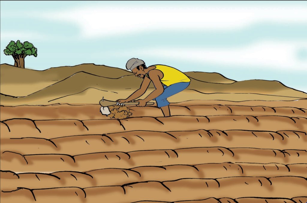
Contour ploughing and residue management [Benin]
- Creation:
- Update:
- Compiler: Gatien AGBOKOUN CHRISTOPHE
- Editors: Siagbé Golli, Abdoul Karim MIEN, DOSSOU-YOVO bernardin, Tchorouwé Ezéchiel N'YABA, Tabitha Nekesa, Ahmadou Gaye
- Reviewers: Sally Bunning, Rima Mekdaschi Studer, William Critchley
technologies_6682 - Benin
View sections
Expand all Collapse all1. General information
1.2 Contact details of resource persons and institutions involved in the assessment and documentation of the Technology
Key resource person(s)
land user:
GARBA Alassane
INUDE ONG
Benin
SLM specialist:
DOSSOUMON Roland
INUDE ONG
Benin
SLM specialist:
WOUEKPE Judicaël
INUDE ONG
Benin
Name of project which facilitated the documentation/ evaluation of the Technology (if relevant)
Soil protection and rehabilitation for food security (ProSo(i)l)Name of the institution(s) which facilitated the documentation/ evaluation of the Technology (if relevant)
GIZ Bénin (GIZ Bénin) - Benin1.3 Conditions regarding the use of data documented through WOCAT
The compiler and key resource person(s) accept the conditions regarding the use of data documented through WOCAT:
Yes
1.4 Declaration on sustainability of the described Technology
Is the Technology described here problematic with regard to land degradation, so that it cannot be declared a sustainable land management technology?
No
2. Description of the SLM Technology
2.1 Short description of the Technology
Definition of the Technology:
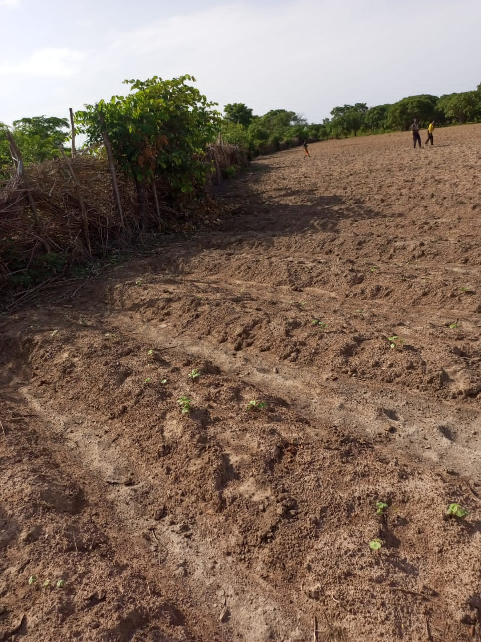
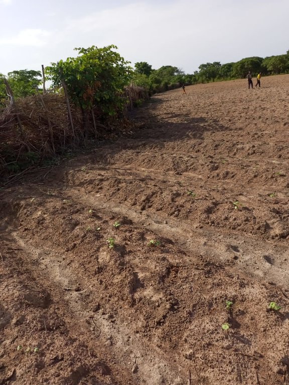
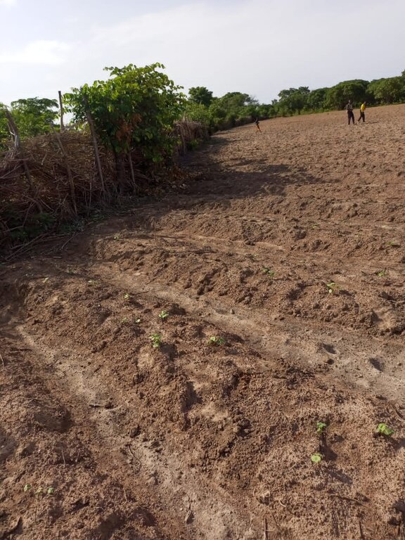
Contour ploughing is tillage across the slope designed to slow runoff and reduce the risk of soil erosion and degradation.
2.2 Detailed description of the Technology
Description:
Farmers apply contour ploughing on gently sloping lands with a uniform topography and steeply sloping lands in combination with other biological, physical or mechanical soil and water conservation techniques and erosion control systems. This approach is combined with seeding and cultivation of crop lines along the contour. The soil is tilled in a perpendicular direction to the slope and to the direction of water flow over the soil surface (i.e. across the slope/ along the contour) in order to:
- slow down runoff water to maximize infiltration of rainwater into the soil;
- reduce the amount of soil, nutrients and organic matter carried downstream by runoff; and
- promote optimum use of rainwater and nutrients by plants.
To further facilitate the penetration of water into the soil, producers make earth checks within furrows every 2 to 3 meters to prevent lateral water movement. This reduces the risk of water concentration and ridge breakage and improves drought resilience. The checks can be created manually with a hoe or mechanically. In the case of trailed or motorized cultivation, all that is required is to lift the plough at regular intervals.
In addition, on moderate slopes and in areas subject to heavy rainfall, structures such as stone barriers, bunds and terraces should be used. Furthermore, to optimize soil management, producers use plant residues as a means of returning nutrients and organic matter to the soil. To this end, they mulch the soil with harvest residues.
Thus, they combine contour ploughing with residue management, which has the following advantages, among others:
- reduced loss of organic matter and nutrients through runoff;
- increased amount of rainwater retained by the soil;
- soil aeration to facilitate rooting and water infiltration; and
- erosion control through reduced runoff.
2.3 Photos of the Technology
2.5 Country/ region/ locations where the Technology has been applied and which are covered by this assessment
Country:
Benin
Region/ State/ Province:
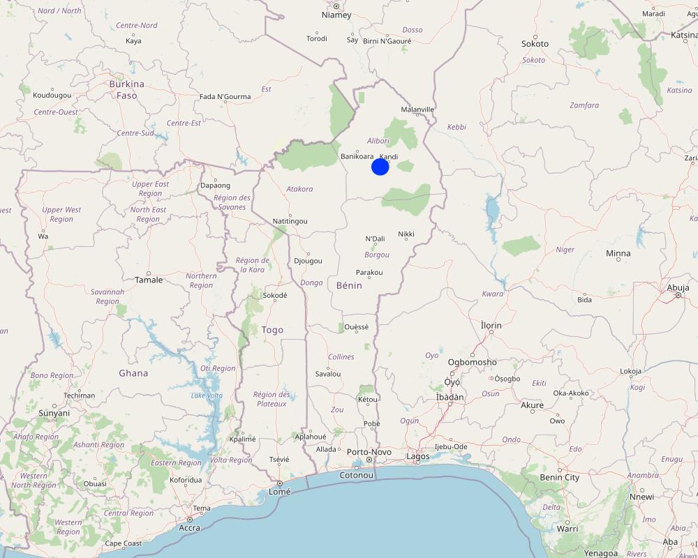
Alibori
Further specification of location:
Kandi
Specify the spread of the Technology:
- applied at specific points/ concentrated on a small area
Is/are the technology site(s) located in a permanently protected area?
No
Comments:
Contour lines should be traced and tracked to ensure perpendicularity to the slope.
Map
×2.6 Date of implementation
Indicate year of implementation:
2016
2.7 Introduction of the Technology
Specify how the Technology was introduced:
- through projects/ external interventions
Comments (type of project, etc.):
GIZ ProSOL
3. Classification of the SLM Technology
3.1 Main purpose(s) of the Technology
- improve production
- reduce, prevent, restore land degradation
- protect a watershed/ downstream areas – in combination with other Technologies
- adapt to climate change/ extremes and its impacts
- create beneficial economic impact
3.2 Current land use type(s) where the Technology is applied
Land use mixed within the same land unit:
No

Cropland
- Annual cropping
Annual cropping - Specify crops:
- cereals - maize
- cereals - millet
- cereals - sorghum
- fibre crops - cotton
- legumes and pulses - soya
Number of growing seasons per year:
- 1
Is intercropping practiced?
No
Is crop rotation practiced?
Yes
If yes, specify:
Maize, millet, and pigeon pea crops are rotated.
3.3 Has land use changed due to the implementation of the Technology?
Has land use changed due to the implementation of the Technology?
- Yes (Please fill out the questions below with regard to the land use before implementation of the Technology)
Land use mixed within the same land unit:
No

Cropland
- Annual cropping
Annual cropping - Specify crops:
- cereals - maize
- cereals - millet
Is intercropping practiced?
No
Is crop rotation practiced?
Yes
If yes, specify:
Maize, millet, and pigeon pea crop are rotated.
3.4 Water supply
Water supply for the land on which the Technology is applied:
- rainfed
3.5 SLM group to which the Technology belongs
- cross-slope measure
- ecosystem-based disaster risk reduction
3.6 SLM measures comprising the Technology

agronomic measures
- A3: Soil surface treatment
- A6: Residue management
A3: Differentiate tillage systems:
A 3.2: Reduced tillage (> 30% soil cover)
A6: Specify residue management:
A 6.4: retained

management measures
- M3: Layout according to natural and human environment
3.7 Main types of land degradation addressed by the Technology

soil erosion by water
- Wt: loss of topsoil/ surface erosion

water degradation
- Hs: change in quantity of surface water
3.8 Prevention, reduction, or restoration of land degradation
Specify the goal of the Technology with regard to land degradation:
- reduce land degradation
- adapt to land degradation
4. Technical specifications, implementation activities, inputs, and costs
4.1 Technical drawing of the Technology
Technical specifications (related to technical drawing):
-Establish contour lines at intervals along the slope using a water level.
-Use a plough or hoe drawn by draft animals, or a tractor, to form ridges perpendicular to the slope, aiming to mitigate erosion and enhance water infiltration.
-Plant seeds in rows across the slope, either manually or using a seeder, to mitigate erosion and optimize water utilization.
-Partition the ridges to enhance water infiltration using a hoe or plough, periodically lifting the plough.
-Retain crop residues on the soil surface to protect against erosion, enhance soil structure, and foster soil biodiversity.
-Apply a layer of crop residues on the soil to serve as natural mulch, regulate soil temperature, reduce evaporation, and minimize erosion.
-Utilize shredders or choppers to break down crop residues into smaller particles.
-Manage crops to manage weeds and maintain ground cover to prevent runoff from concentrating on plots.
-Implement crop rotation to diversify crop residue types, reduce disease and pest pressure, while enhancing soil fertility
4.2 General information regarding the calculation of inputs and costs
Specify how costs and inputs were calculated:
- per Technology area
Indicate size and area unit:
1ha
other/ national currency (specify):
CFA F
If relevant, indicate exchange rate from USD to local currency (e.g. 1 USD = 79.9 Brazilian Real): 1 USD =:
615.0
4.3 Establishment activities
| Activity | Timing (season) | |
|---|---|---|
| 1. | Clearing | April-May |
| 2. | Ploughing | May-June |
| 3. | Stem spreading | December-February |
4.4 Costs and inputs needed for establishment
| Specify input | Unit | Quantity | Costs per Unit | Total costs per input | % of costs borne by land users | |
|---|---|---|---|---|---|---|
| Labour | Clearing | ha | 1.0 | 17000.0 | 17000.0 | 100.0 |
| Labour | Ploughing | ha | 1.0 | 30000.0 | 30000.0 | 100.0 |
| Labour | Stem spreading | ha | 1.0 | 12000.0 | 12000.0 | 100.0 |
| Equipment | Daba | Unit | 1.0 | 4000.0 | 4000.0 | 100.0 |
| Equipment | Machete | Unit | 1.0 | 3000.0 | 3000.0 | 100.0 |
| Total costs for establishment of the Technology | 66000.0 | |||||
| Total costs for establishment of the Technology in USD | 107.32 | |||||
4.5 Maintenance/ recurrent activities
| Activity | Timing/ frequency | |
|---|---|---|
| 1. | Hoeing and ridging | July |
| 2. | Creation of firebreaks | December-January |
4.6 Costs and inputs needed for maintenance/ recurrent activities (per year)
| Specify input | Unit | Quantity | Costs per Unit | Total costs per input | % of costs borne by land users | |
|---|---|---|---|---|---|---|
| Labour | Hoeing and ridging | ha | 1.0 | 20000.0 | 20000.0 | 100.0 |
| Labour | Creation of firebreaks | ha | 1.0 | 5000.0 | 5000.0 | 100.0 |
| Total costs for maintenance of the Technology | 25000.0 | |||||
| Total costs for maintenance of the Technology in USD | 40.65 | |||||
Comments:
Firebreaks are built to prevent residues from being carried away by accidental bush fires.
4.7 Most important factors affecting the costs
Describe the most determinate factors affecting the costs:
Workers required for ploughing work, especially on moderate slopes.
5. Natural and human environment
5.1 Climate
Annual rainfall
- < 250 mm
- 251-500 mm
- 501-750 mm
- 751-1,000 mm
- 1,001-1,500 mm
- 1,501-2,000 mm
- 2,001-3,000 mm
- 3,001-4,000 mm
- > 4,000 mm
Specify average annual rainfall (if known), in mm:
1030.00
Agro-climatic zone
- semi-arid
5.2 Topography
Slopes on average:
- flat (0-2%)
- gentle (3-5%)
- moderate (6-10%)
- rolling (11-15%)
- hilly (16-30%)
- steep (31-60%)
- very steep (>60%)
Landforms:
- plateau/plains
- ridges
- mountain slopes
- hill slopes
- footslopes
- valley floors
Altitudinal zone:
- 0-100 m a.s.l.
- 101-500 m a.s.l.
- 501-1,000 m a.s.l.
- 1,001-1,500 m a.s.l.
- 1,501-2,000 m a.s.l.
- 2,001-2,500 m a.s.l.
- 2,501-3,000 m a.s.l.
- 3,001-4,000 m a.s.l.
- > 4,000 m a.s.l.
Indicate if the Technology is specifically applied in:
- convex situations
5.3 Soils
Soil depth on average:
- very shallow (0-20 cm)
- shallow (21-50 cm)
- moderately deep (51-80 cm)
- deep (81-120 cm)
- very deep (> 120 cm)
Soil texture (topsoil):
- coarse/ light (sandy)
- fine/ heavy (clay)
Soil texture (> 20 cm below surface):
- coarse/ light (sandy)
- fine/ heavy (clay)
Topsoil organic matter:
- low (<1%)
5.4 Water availability and quality
Ground water table:
5-50 m
Availability of surface water:
good
Water quality (untreated):
good drinking water
Water quality refers to:
ground water
Is water salinity a problem?
No
Is flooding of the area occurring?
No
5.5 Biodiversity
Species diversity:
- medium
Habitat diversity:
- medium
5.6 Characteristics of land users applying the Technology
Sedentary or nomadic:
- Sedentary
Market orientation of production system:
- mixed (subsistence/ commercial)
Off-farm income:
- less than 10% of all income
Relative level of wealth:
- poor
- average
Individuals or groups:
- individual/ household
- groups/ community
Level of mechanization:
- manual work
- animal traction
Gender:
- women
- men
Age of land users:
- youth
- middle-aged
5.7 Average area of land used by land users applying the Technology
- < 0.5 ha
- 0.5-1 ha
- 1-2 ha
- 2-5 ha
- 5-15 ha
- 15-50 ha
- 50-100 ha
- 100-500 ha
- 500-1,000 ha
- 1,000-10,000 ha
- > 10,000 ha
Is this considered small-, medium- or large-scale (referring to local context)?
- small-scale
- medium-scale
5.8 Land ownership, land use rights, and water use rights
Land ownership:
- communal/ village
- individual, not titled
Land use rights:
- communal (organized)
- individual
Water use rights:
- communal (organized)
Are land use rights based on a traditional legal system?
Yes
Specify:
The lands belong to families and are controlled by the patriarch.
5.9 Access to services and infrastructure
health:
- poor
- moderate
- good
education:
- poor
- moderate
- good
technical assistance:
- poor
- moderate
- good
employment (e.g. off-farm):
- poor
- moderate
- good
markets:
- poor
- moderate
- good
energy:
- poor
- moderate
- good
roads and transport:
- poor
- moderate
- good
drinking water and sanitation:
- poor
- moderate
- good
financial services:
- poor
- moderate
- good
6. Impacts and concluding statements
6.1 On-site impacts the Technology has shown
Socio-economic impacts
Production
crop production
risk of production failure
production area
Comments/ specify:
Enhanced management of sloping lands has led to expanded production areas.
land management
Income and costs
expenses on agricultural inputs
farm income
workload
Comments/ specify:
When the slope is steep and plowing is required in the opposite direction to the slope, workers sometimes charge more than the normal price.
Socio-cultural impacts
food security/ self-sufficiency
SLM/ land degradation knowledge
Ecological impacts
Water cycle/ runoff
water quantity
Comments/ specify:
Increases the quantity of rainwater retained by the soil.
surface runoff
Comments/ specify:
Slope-perpendicular plowing blocks the path of runoff water, forcing it to infiltrate the soil.
Soil
soil loss
Comments/ specify:
Limits erosion by slowing down runoff.
soil organic matter/ below ground C
Comments/ specify:
Reduces loss of organic matter through runoff
Biodiversity: vegetation, animals
Vegetation cover
biomass/ above ground C
6.3 Exposure and sensitivity of the Technology to gradual climate change and climate-related extremes/ disasters (as perceived by land users)
Gradual climate change
Gradual climate change
| Season | increase or decrease | How does the Technology cope with it? | |
|---|---|---|---|
| annual temperature | increase | well | |
| seasonal temperature | wet/ rainy season | decrease | well |
| annual rainfall | decrease | well | |
| seasonal rainfall | wet/ rainy season | decrease | well |
Climate-related extremes (disasters)
Climatological disasters
| How does the Technology cope with it? | |
|---|---|
| drought | well |
6.4 Cost-benefit analysis
How do the benefits compare with the establishment costs (from land users’ perspective)?
Short-term returns:
positive
Long-term returns:
positive
How do the benefits compare with the maintenance/ recurrent costs (from land users' perspective)?
Short-term returns:
positive
Long-term returns:
slightly positive
6.5 Adoption of the Technology
- > 50%
Of all those who have adopted the Technology, how many did so spontaneously, i.e. without receiving any material incentives/ payments?
- 91-100%
6.6 Adaptation
Has the Technology been modified recently to adapt to changing conditions?
No
6.7 Strengths/ advantages/ opportunities of the Technology
| Strengths/ advantages/ opportunities in the land user’s view |
|---|
| Increases the quantity of rainwater retained by the soil. |
| Retention of organic manure |
| Reduces the amount of organic matter lost through runoff |
| Strengths/ advantages/ opportunities in the compiler’s or other key resource person’s view |
|---|
| Retention of runoff water |
| Limitation of erosion by curbing runoff |
| Slowing down of the erosion process |
| Improvement of soil productivity |
6.8 Weaknesses/ disadvantages/ risks of the Technology and ways of overcoming them
| Weaknesses/ disadvantages/ risks in the land user’s view | How can they be overcome? |
|---|---|
| Difficulties in drawing level lines | Perform the ploughing in a way to cut off the path of the water and call in the technicians to determine the contour lines. |
| Increased plowing time | Further motivate workers by teaming them up with family workers where available. |
| Very slow soil restoration speed | Crop residues used as mulch or buried in the soil must be combined with other agronomic practices such as crop rotation, cover crops and recommended mineral fertilizers, depending on the crop, to restore soil fertility. |
| Weaknesses/ disadvantages/ risks in the compiler’s or other key resource person’s view | How can they be overcome? |
|---|---|
| Very slow soil restoration speed | Early use of mineral fertilizers |
| Considerable time consumption during ploughing | Seek the assistance of technicians to determine contour lines, since moderate slopes require greater ploughing effort. |
| Reluctance of workers to perform plowing on steep slopes | Incentivize laborers |
7. References and links
7.1 Methods/ sources of information
- field visits, field surveys
1
- interviews with land users
1
- interviews with SLM specialists/ experts
2
- compilation from reports and other existing documentation
5
When were the data compiled (in the field)?
23/01/2023
7.2 References to available publications
Title, author, year, ISBN:
Deutsche Gesellschaft für Internationale Zusammenarbeit (GIZ) GmbH, 2018, Compendium de fiches techniques du formateur
Title, author, year, ISBN:
Dugué P., Rodriguez L., Ouoba B. Sawadogo I. 1994, Techniques d’amélioration de la production agricole en zone soudano-sahélienne. CIRAD, INERA, CRPA, 207 p.
Title, author, year, ISBN:
Dupriez H., De Leener Ph., 1983, Agriculture tropicale en milieu paysan. Terre et Vie, L’Harmattan, ENDA. 282 p
Title, author, year, ISBN:
Fandohan S. 2012, Note d'orientation pour la sélection de mesure de Gestion Durable des Terres.
Title, author, year, ISBN:
MDR, 1992, Culture attelée et protection de l’environnement. Tome 5, Manuel de culture attelée. 62 p
Title, author, year, ISBN:
Manual on integrated soil mangement and conservation practices
Available from where? Costs?
https://www.fao.org/3/x4799e/x4799e.pdf
7.3 Links to relevant online information
Title/ description:
Plan Communal de Conservation de la Biodiversité du Système des Aires Protégées : Commune de Kandi : Commune de Kandi : Commune de Kandi
URL:
https://www.undp.org/sites/g/files/zskgke326/files/migration/bj/PCC_Kandi_relu_pdf.pdf
Links and modules
Expand all Collapse allLinks
No links
Modules
No modules


