Staggered Planting as a Climate Change Adaptation Strategy [Benin]
- Creation:
- Update:
- Compiler: Gatien AGBOKOUN CHRISTOPHE
- Editors: Siagbé Golli, Abdoul Karim MIEN, DOSSOU-YOVO bernardin, Tabitha Nekesa, Ahmadou Gaye
- Reviewers: Sally Bunning, Rima Mekdaschi Studer, William Critchley
technologies_6683 - Benin
View sections
Expand all Collapse all1. General information
1.2 Contact details of resource persons and institutions involved in the assessment and documentation of the Technology
Key resource person(s)
SLM specialist:
DOSSOUMON Roland
INUDE ONG
Benin
WOROUWINNON BIO Karim
INUDE ONG
Benin
Name of project which facilitated the documentation/ evaluation of the Technology (if relevant)
Soil protection and rehabilitation for food security (ProSo(i)l)Name of the institution(s) which facilitated the documentation/ evaluation of the Technology (if relevant)
GIZ Bénin (GIZ Bénin) - Benin1.3 Conditions regarding the use of data documented through WOCAT
The compiler and key resource person(s) accept the conditions regarding the use of data documented through WOCAT:
Yes
1.4 Declaration on sustainability of the described Technology
Is the Technology described here problematic with regard to land degradation, so that it cannot be declared a sustainable land management technology?
No
2. Description of the SLM Technology
2.1 Short description of the Technology
Definition of the Technology:
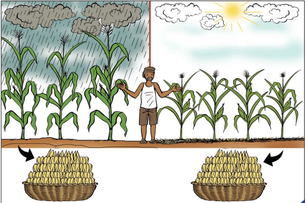
Staggered planting of crops successively over the season mitigates the risks associated with pockets of drought and increases the chances of successful harvests.
2.2 Detailed description of the Technology
Description:
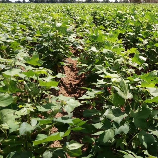
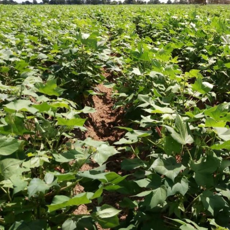
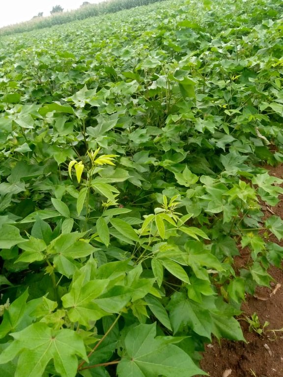
Staggered planting of both food and cash crops is a climate change adaptation approach implemented in the Banikoara commune. This technology is designed to minimize the risk of crop failure due to irregular rainfall, and to reduce peak periods (of work overload). It is a technology that can be applied in conditions of irregular rainfall cycles, in areas where it is difficult to predict rainfall accurately. The technology applies to all crop types. Applied to cotton, for example, seeding is carried out in two or three stages. If three stages are chosen, the distribution may be ½ of the total area planted initially, then a further ¼, and finally the last ¼. This staggered approach covers a period from two weeks to a month and one to two months after the initial rains. Most producers opt for planting crops between mid-May and the first ten days of August.
To facilitate its implementation, it is necessary to:
(i) accept the risk of losing part of the seed
(ii) be ready to seize any opportunity of adequate rainfall to perform early sowing
(iii) combine this strategy with cover seeding techniques
(iv) make meteorological information accessible to farmers (rural radio and other information and communication technology channels, including community radio BANIGANSÉ FM in Banikoara in this case).
The implementation of staggered sowing effectively addresses the issue of total seed germination losses. If part of the field is lost, the chances are that another is successful. Additionally, this technology streamlines the distribution of work, preventing overlapping field activities. This, in turn, facilitates efficient labour management.
Despite this overall risk-avoidance strategy, this technology presents a number of challenges. These include germination losses in specific sections of their fields, crop losses, and even pest attacks resulting from the selection of an inappropriate seeding period based on soil type and rainfall. Nevertheless, farmers still manage to avoid losses that might have occurred if seeding had been conducted simultaneously across the entire cultivated area.
2.3 Photos of the Technology
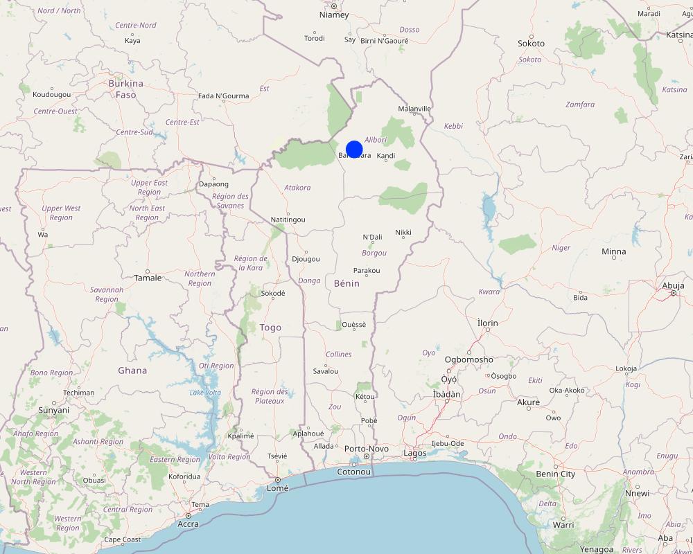
2.5 Country/ region/ locations where the Technology has been applied and which are covered by this assessment
Country:
Benin
Region/ State/ Province:
Alibori
Further specification of location:
Banikoara
Specify the spread of the Technology:
- evenly spread over an area
If the Technology is evenly spread over an area, specify area covered (in km2):
1.0
Is/are the technology site(s) located in a permanently protected area?
No
Map
×2.6 Date of implementation
Indicate year of implementation:
2016
2.7 Introduction of the Technology
Specify how the Technology was introduced:
- through projects/ external interventions
Comments (type of project, etc.):
ProSOL Bénin
3. Classification of the SLM Technology
3.1 Main purpose(s) of the Technology
- improve production
- reduce risk of disasters
- adapt to climate change/ extremes and its impacts
- mitigate climate change and its impacts
- create beneficial economic impact
3.2 Current land use type(s) where the Technology is applied
Land use mixed within the same land unit:
No

Cropland
- Annual cropping
Annual cropping - Specify crops:
- cereals - maize
- fibre crops - cotton
Number of growing seasons per year:
- 1
Is crop rotation practiced?
Yes
If yes, specify:
Cotton is rotated with maize.
3.3 Has land use changed due to the implementation of the Technology?
Has land use changed due to the implementation of the Technology?
- Yes (Please fill out the questions below with regard to the land use before implementation of the Technology)
Land use mixed within the same land unit:
No

Cropland
- Annual cropping
Annual cropping - Specify crops:
- cereals - maize
- fibre crops - cotton
- legumes and pulses - soya
Is intercropping practiced?
No
Is crop rotation practiced?
Yes
If yes, specify:
Cotton, maize and millet are grown in rotation.
3.4 Water supply
Water supply for the land on which the Technology is applied:
- rainfed
3.5 SLM group to which the Technology belongs
- Adaptation to climate change
3.6 SLM measures comprising the Technology

agronomic measures
- A1: Vegetation/ soil cover

management measures
- M1: Change of land use type
- M4: Major change in timing of activities
3.7 Main types of land degradation addressed by the Technology

biological degradation
- Bs: quality and species composition/ diversity decline
3.8 Prevention, reduction, or restoration of land degradation
Specify the goal of the Technology with regard to land degradation:
- not applicable
Comments:
This is a climate change adaptation strategy.
4. Technical specifications, implementation activities, inputs, and costs
4.1 Technical drawing of the Technology
Technical specifications (related to technical drawing):
A producer looking to sow seeds across a 3-hectare area can spread the planting over three periods:
- First seeding: 1 hectare as soon as the rains commence.
- Second seeding: one to two months after the onset of rainfall.
- Third seeding: two to three months after the beginning of the rains, especially for soybeans and, in the case of some producers, short-cycle maize varieties.
4.2 General information regarding the calculation of inputs and costs
Specify how costs and inputs were calculated:
- per Technology area
Indicate size and area unit:
1ha
other/ national currency (specify):
CFA F
If relevant, indicate exchange rate from USD to local currency (e.g. 1 USD = 79.9 Brazilian Real): 1 USD =:
615.0
Indicate average wage cost of hired labour per day:
2500
4.3 Establishment activities
| Activity | Timing (season) | |
|---|---|---|
| 1. | Land preparation / clearing | March-April |
| 2. | Ploughing | May |
| 3. | Seeding | May-July |
| 4. | Sarclo buttage | July-August |
4.4 Costs and inputs needed for establishment
| Specify input | Unit | Quantity | Costs per Unit | Total costs per input | % of costs borne by land users | |
|---|---|---|---|---|---|---|
| Labour | Land preparation / clearing | ha | 1.0 | 17000.0 | 17000.0 | 100.0 |
| Labour | Ploughing | ha | 1.0 | 30000.0 | 30000.0 | 100.0 |
| Labour | Seeding | ha | 1.0 | 12000.0 | 12000.0 | 100.0 |
| Labour | Hoeing and ridging | ha | 1.0 | 20000.0 | 20000.0 | 100.0 |
| Total costs for establishment of the Technology | 79000.0 | |||||
| Total costs for establishment of the Technology in USD | 128.46 | |||||
4.5 Maintenance/ recurrent activities
| Activity | Timing/ frequency | |
|---|---|---|
| 1. | Hoeing and ridging | June-July |
4.6 Costs and inputs needed for maintenance/ recurrent activities (per year)
| Specify input | Unit | Quantity | Costs per Unit | Total costs per input | % of costs borne by land users | |
|---|---|---|---|---|---|---|
| Labour | Hoeing and ridging | ha | 1.0 | 15000.0 | 15000.0 | 100.0 |
| Total costs for maintenance of the Technology | 15000.0 | |||||
| Total costs for maintenance of the Technology in USD | 24.39 | |||||
4.7 Most important factors affecting the costs
Describe the most determinate factors affecting the costs:
Labour
5. Natural and human environment
5.1 Climate
Annual rainfall
- < 250 mm
- 251-500 mm
- 501-750 mm
- 751-1,000 mm
- 1,001-1,500 mm
- 1,501-2,000 mm
- 2,001-3,000 mm
- 3,001-4,000 mm
- > 4,000 mm
Specify average annual rainfall (if known), in mm:
850.00
Agro-climatic zone
- semi-arid
5.2 Topography
Slopes on average:
- flat (0-2%)
- gentle (3-5%)
- moderate (6-10%)
- rolling (11-15%)
- hilly (16-30%)
- steep (31-60%)
- very steep (>60%)
Landforms:
- plateau/plains
- ridges
- mountain slopes
- hill slopes
- footslopes
- valley floors
Altitudinal zone:
- 0-100 m a.s.l.
- 101-500 m a.s.l.
- 501-1,000 m a.s.l.
- 1,001-1,500 m a.s.l.
- 1,501-2,000 m a.s.l.
- 2,001-2,500 m a.s.l.
- 2,501-3,000 m a.s.l.
- 3,001-4,000 m a.s.l.
- > 4,000 m a.s.l.
Indicate if the Technology is specifically applied in:
- not relevant
5.3 Soils
Soil depth on average:
- very shallow (0-20 cm)
- shallow (21-50 cm)
- moderately deep (51-80 cm)
- deep (81-120 cm)
- very deep (> 120 cm)
Soil texture (topsoil):
- medium (loamy, silty)
- fine/ heavy (clay)
Soil texture (> 20 cm below surface):
- medium (loamy, silty)
- fine/ heavy (clay)
Topsoil organic matter:
- low (<1%)
5.4 Water availability and quality
Ground water table:
5-50 m
Availability of surface water:
good
Water quality (untreated):
poor drinking water (treatment required)
Water quality refers to:
ground water
Is water salinity a problem?
No
Is flooding of the area occurring?
No
5.5 Biodiversity
Species diversity:
- low
Habitat diversity:
- medium
5.6 Characteristics of land users applying the Technology
Sedentary or nomadic:
- Sedentary
Market orientation of production system:
- mixed (subsistence/ commercial)
Off-farm income:
- less than 10% of all income
Relative level of wealth:
- poor
- average
Individuals or groups:
- groups/ community
Level of mechanization:
- animal traction
- mechanized/ motorized
Gender:
- women
- men
Age of land users:
- youth
- middle-aged
5.7 Average area of land used by land users applying the Technology
- < 0.5 ha
- 0.5-1 ha
- 1-2 ha
- 2-5 ha
- 5-15 ha
- 15-50 ha
- 50-100 ha
- 100-500 ha
- 500-1,000 ha
- 1,000-10,000 ha
- > 10,000 ha
Is this considered small-, medium- or large-scale (referring to local context)?
- small-scale
- medium-scale
5.8 Land ownership, land use rights, and water use rights
Land ownership:
- communal/ village
Land use rights:
- communal (organized)
Water use rights:
- communal (organized)
Are land use rights based on a traditional legal system?
Yes
Specify:
There are land chiefs responsible for organizing access to lands.
5.9 Access to services and infrastructure
health:
- poor
- moderate
- good
education:
- poor
- moderate
- good
technical assistance:
- poor
- moderate
- good
employment (e.g. off-farm):
- poor
- moderate
- good
markets:
- poor
- moderate
- good
energy:
- poor
- moderate
- good
roads and transport:
- poor
- moderate
- good
drinking water and sanitation:
- poor
- moderate
- good
financial services:
- poor
- moderate
- good
6. Impacts and concluding statements
6.1 On-site impacts the Technology has shown
Socio-economic impacts
Production
crop production
Comments/ specify:
Staggered seeding reduces the risk of crop loss.
Income and costs
expenses on agricultural inputs
farm income
Socio-cultural impacts
food security/ self-sufficiency
recreational opportunities
SLM/ land degradation knowledge
6.3 Exposure and sensitivity of the Technology to gradual climate change and climate-related extremes/ disasters (as perceived by land users)
Gradual climate change
Gradual climate change
| Season | increase or decrease | How does the Technology cope with it? | |
|---|---|---|---|
| annual temperature | increase | well | |
| seasonal temperature | dry season | increase | well |
| annual rainfall | decrease | well | |
| seasonal rainfall | dry season | increase | well |
Climate-related extremes (disasters)
Climatological disasters
| How does the Technology cope with it? | |
|---|---|
| drought | well |
6.4 Cost-benefit analysis
How do the benefits compare with the establishment costs (from land users’ perspective)?
Short-term returns:
very positive
Long-term returns:
positive
How do the benefits compare with the maintenance/ recurrent costs (from land users' perspective)?
Short-term returns:
very positive
Long-term returns:
positive
6.5 Adoption of the Technology
- > 50%
Of all those who have adopted the Technology, how many did so spontaneously, i.e. without receiving any material incentives/ payments?
- 11-50%
6.6 Adaptation
Has the Technology been modified recently to adapt to changing conditions?
No
6.7 Strengths/ advantages/ opportunities of the Technology
| Strengths/ advantages/ opportunities in the land user’s view |
|---|
| Timely maturation of agricultural produce |
| Opportunity to take advantage of adequate rainfall for early planting |
| Facilitated division of labor (avoids work overload) |
| Strengths/ advantages/ opportunities in the compiler’s or other key resource person’s view |
|---|
| Resilience to climatic hazards |
6.8 Weaknesses/ disadvantages/ risks of the Technology and ways of overcoming them
| Weaknesses/ disadvantages/ risks in the land user’s view | How can they be overcome? |
|---|---|
| If a substantial portion falls into a drought pocket, the crop is lost. | Maintain a rational approach to seeding |
| High seed consumption | Collect an adequate quantity of good quality seeds (high germination capacity) |
| Weaknesses/ disadvantages/ risks in the compiler’s or other key resource person’s view | How can they be overcome? |
|---|---|
| Difficulties in preserving products for crops planted early | Utilization of products for subsistence and for sale |
7. References and links
7.1 Methods/ sources of information
- field visits, field surveys
1
- interviews with land users
1
- interviews with SLM specialists/ experts
2
- compilation from reports and other existing documentation
2
When were the data compiled (in the field)?
24/01/2023
7.2 References to available publications
Title, author, year, ISBN:
Deutsche Gesellschaft für Internationale Zusammenarbeit (GIZ) GmbH, 2018, Compendium de fiches techniques du formateur
Title, author, year, ISBN:
Idani M., Akindélé A. A., Medéou F. K., Ogouwalé E., 2013. Stratégies d’adaptations paysannes au changement climatique dans l’Arrondissement de Dassari (Bénin, Afrique de l’Ouest) XXVIème colloque de l’Association internationale de climatologie. PP 291-296.
Links and modules
Expand all Collapse allLinks
No links
Modules
No modules


