Establishment of Grassed Strips [Burkina Faso]
- Creation:
- Update:
- Compiler: Moussa ABOU
- Editors: Brice Sosthène BAYALA, Siagbé Golli, Tabitha Nekesa, Ahmadou Gaye
- Reviewers: Sally Bunning, Rima Mekdaschi Studer, Joana Eichenberger, William Critchley
technologies_6708 - Burkina Faso
View sections
Expand all Collapse all1. General information
1.2 Contact details of resource persons and institutions involved in the assessment and documentation of the Technology
Key resource person(s)
land user:
BONKIAN Souleymane
Burkina Faso
Name of project which facilitated the documentation/ evaluation of the Technology (if relevant)
Soil protection and rehabilitation for food security (ProSo(i)l)Name of the institution(s) which facilitated the documentation/ evaluation of the Technology (if relevant)
Deutsche Gesellschaft für Internationale Zusammenarbeit (GIZ)1.3 Conditions regarding the use of data documented through WOCAT
The compiler and key resource person(s) accept the conditions regarding the use of data documented through WOCAT:
Yes
1.4 Declaration on sustainability of the described Technology
Is the Technology described here problematic with regard to land degradation, so that it cannot be declared a sustainable land management technology?
No
2. Description of the SLM Technology
2.1 Short description of the Technology
Definition of the Technology:
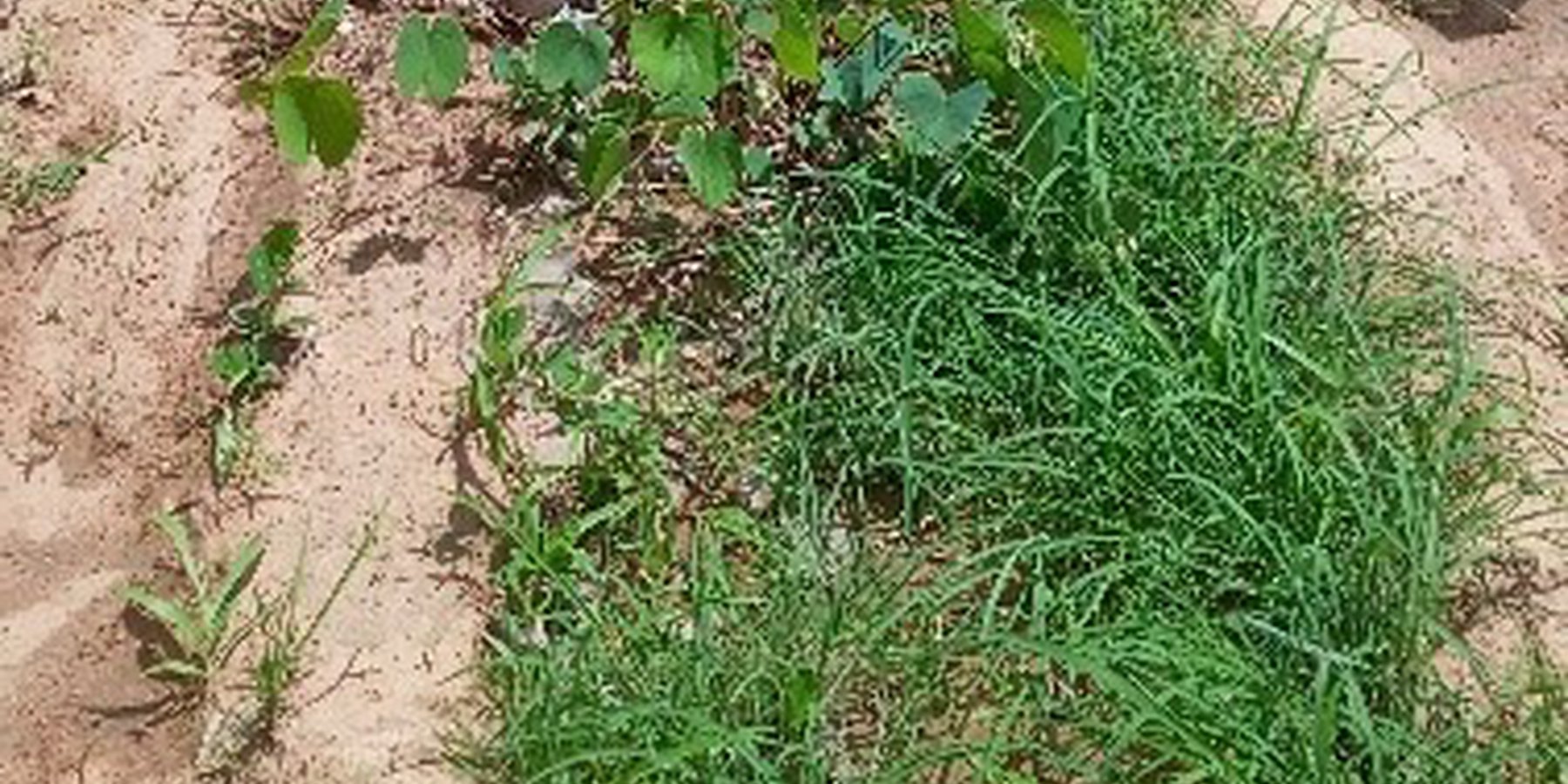
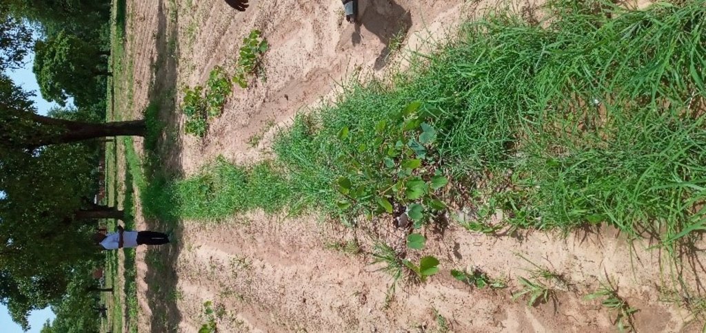
The process of creating grassed strips entails either planting or maintaining a vegetative strip (natural) with perennial species aligned along contour lines to reduce runoff and foster water infiltration into the soil.
2.2 Detailed description of the Technology
Description:
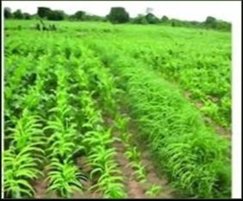
The plant species commonly used to create grassed strips in the Sahel in general and in Burkina Faso in particular include: Andropogon gayanus, A. ascinodis, Cymbopogon ascinodis, C. zizanioides or C. negritana (Vetiver). These species are found across both dry and wet areas, which means that the technology can be applied in several agroclimatic zones.
Grassed strips are biological barriers that control runoff and mitigate soil erosion on gently sloping land, while simultaneously providing farmers with fodder for livestock.
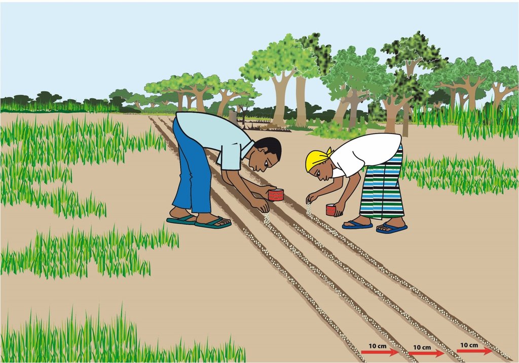
Where there is no natural, maintained strip, grass is planted along contour lines by direct sowing or transplanting. The number of rows per strip varies from 1 to 4. The strip must be fairly dense, with no gaps along its entire length. The spacing between two strips varies from 25 to 40 meters, depending on the slope and type of terrain. The main activities involved in creating grass strips are as follows:
Choosing the grass to be used:
The grass must have a root system strong enough to survive the dry season. It must also grow easily and quickly. For the purposes of this documentation, the grass used is Andropogon gayanus.
Layout:
Strips should be laid out perpendicular to the direction of runoff, following the contour lines.
Preparatory activities:
•Harvest Andropogon seeds in the dry season;
•Mix the seeds with damp sand for 12 to 24 hours;
•Stir the mixture to remove seed hairs.
Installation of grass strips:
•Determine contour lines on the ground and trace them with a pointed object (pickaxe, plough) so that you can locate them when planting.
• In July, sow the seeds in at least two rows, after preparing the soil (it is advisable to minimize ploughing), at the start of the rainy season at a rate of 6 kg/ha of seed. The number of rows per strip varies from one to four. Seeds are sown in staggered rows. Spacing is 10 cm between rows and 20-30 cm between plants in the same row.
The main inputs required to implement this technology include:
•Andropogon gayanus seeds;
•Sand
•Small tools (A-Frame or water tube level, pickaxe, shovel, cart, wheelbarrow, bucket, etc.).
Combined with organic soil improvers on the ground, or buried,to restore soil organic matter, this technology significantly impacts agricultural production. Land users claim that it offers a number of opportunities, as it helps reduce land degradation and is also a source of animal feed or can be used as biomass for composting or mulching.
2.3 Photos of the Technology
2.5 Country/ region/ locations where the Technology has been applied and which are covered by this assessment
Country:
Burkina Faso
Region/ State/ Province:
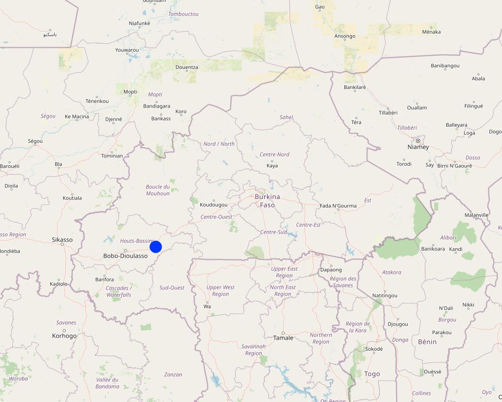
Hauts-Bassins region (Tuy province)
Further specification of location:
Koumbia (Commune of Koumbia)
Specify the spread of the Technology:
- applied at specific points/ concentrated on a small area
Is/are the technology site(s) located in a permanently protected area?
No
Map
×2.6 Date of implementation
Indicate year of implementation:
2017
If precise year is not known, indicate approximate date:
- less than 10 years ago (recently)
2.7 Introduction of the Technology
Specify how the Technology was introduced:
- through projects/ external interventions
Comments (type of project, etc.):
The technology was introduced by ProSol in the commune of Koumbia.
3. Classification of the SLM Technology
3.1 Main purpose(s) of the Technology
- improve production
- reduce, prevent, restore land degradation
- protect a watershed/ downstream areas – in combination with other Technologies
- create beneficial economic impact
3.2 Current land use type(s) where the Technology is applied
Land use mixed within the same land unit:
Yes
Specify mixed land use (crops/ grazing/ trees):
- Agroforestry

Cropland
- Annual cropping
- Perennial (non-woody) cropping
- Tree and shrub cropping
Annual cropping - Specify crops:
- cereals - maize
- cereals - sorghum
- fibre crops - cotton
- Andropogon gayanus
Tree and shrub cropping - Specify crops:
- grapes
- karite (sheanut)
Number of growing seasons per year:
- 1
Is crop rotation practiced?
Yes
If yes, specify:
Cotton, maize and sorghum
3.3 Has land use changed due to the implementation of the Technology?
Has land use changed due to the implementation of the Technology?
- No (Continue with question 3.4)
3.4 Water supply
Water supply for the land on which the Technology is applied:
- rainfed
3.5 SLM group to which the Technology belongs
- improved ground/ vegetation cover
- minimal soil disturbance
- cross-slope measure
3.6 SLM measures comprising the Technology

agronomic measures
- A1: Vegetation/ soil cover
- A3: Soil surface treatment
A3: Differentiate tillage systems:
A 3.3: Full tillage (< 30% soil cover)

vegetative measures
- V2: Grasses and perennial herbaceous plants
3.7 Main types of land degradation addressed by the Technology

soil erosion by water
- Wt: loss of topsoil/ surface erosion
- Wg: gully erosion/ gullying

soil erosion by wind
- Et: loss of topsoil
- Ed: deflation and deposition
3.8 Prevention, reduction, or restoration of land degradation
Specify the goal of the Technology with regard to land degradation:
- prevent land degradation
- reduce land degradation
4. Technical specifications, implementation activities, inputs, and costs
4.1 Technical drawing of the Technology
Technical specifications (related to technical drawing):
•A spacing of 10 cm between rows and 20-30 cm between seedlings on the same row;
•Spacing between two grassed strips varies from 25 to 40 m depending on the slope and type of terrain;
•The number of rows per strip varies from 1 to 4;
•Andropogon gayanus seed;
•A dose of 6 kg of seed per ha;
•Seeds are sown in staggered rows;
•A fairly dense strip, with no gaps along the entire row;
•The strip must follow the contour lines.
Author:
ProSol
Date:
2020
4.2 General information regarding the calculation of inputs and costs
Specify how costs and inputs were calculated:
- per Technology unit
Specify unit:
Linear meter
If relevant, indicate exchange rate from USD to local currency (e.g. 1 USD = 79.9 Brazilian Real): 1 USD =:
613.5
Indicate average wage cost of hired labour per day:
CFA F 2,000
4.3 Establishment activities
| Activity | Timing (season) | |
|---|---|---|
| 1. | Layout of contour lines | Dry season |
| 2. | Seed purchase | Dry season |
| 3. | Acquisition of small equipment | Dry season |
| 4. | Seeding | Rainy season |
| 5. | Monitoring of activities | Dry season/rainy season |
| 6. | Coordination of activities | Dry season/rainy season |
4.4 Costs and inputs needed for establishment
| Specify input | Unit | Quantity | Costs per Unit | Total costs per input | % of costs borne by land users | |
|---|---|---|---|---|---|---|
| Labour | Layout of contour lines | Linear meter | 1.0 | 4.5 | 4.5 | |
| Labour | Seeding | Linear meter | 1.0 | 15.0 | 15.0 | |
| Equipment | Cost of small equipment | Linear meter | 1.0 | 5.0 | 5.0 | |
| Plant material | Purchase of seeds | Linear meter | 1.0 | 666.67 | 666.67 | |
| Other | Monitoring costs | Linear meter | 1.0 | 10.0 | 10.0 | |
| Other | Coordination costs | Linear meter | 1.0 | 5.0 | 5.0 | |
| Total costs for establishment of the Technology | 706.17 | |||||
| Total costs for establishment of the Technology in USD | 1.15 | |||||
4.5 Maintenance/ recurrent activities
Comments:
Maintenance activities for this technology are minimal, primarily involving precautionary measures. This entails waiting until the fields have been ploughed and treated with herbicide before sowing Andropogon gayanus seeds. The implementation of this technology emphasizes raising awareness and engaging all relevant farmers in the process.
4.6 Costs and inputs needed for maintenance/ recurrent activities (per year)
Comments:
Not applicable
4.7 Most important factors affecting the costs
Describe the most determinate factors affecting the costs:
Seed and labour availability are the most significant factors affecting costs.
5. Natural and human environment
5.1 Climate
Annual rainfall
- < 250 mm
- 251-500 mm
- 501-750 mm
- 751-1,000 mm
- 1,001-1,500 mm
- 1,501-2,000 mm
- 2,001-3,000 mm
- 3,001-4,000 mm
- > 4,000 mm
Specify average annual rainfall (if known), in mm:
900.00
Specifications/ comments on rainfall:
The Hauts-Bassins region, where the commune of Koumbia is located, experiences a tropical North-Sudanese and South-Sudanese climate. This climate is characterized by two (02) main seasons: a wet season lasting 06 to 07 months (May to October/November) and a dry season lasting 05 to 06 months (November/December to April). Annual rainfall is relatively abundant, ranging from 800 to 1200 mm.
Indicate the name of the reference meteorological station considered:
Koumbia Rainfall Station
Agro-climatic zone
- sub-humid
Average temperatures vary between 24°c and 30°c, with a relatively small temperature range of 5°c.
5.2 Topography
Slopes on average:
- flat (0-2%)
- gentle (3-5%)
- moderate (6-10%)
- rolling (11-15%)
- hilly (16-30%)
- steep (31-60%)
- very steep (>60%)
Landforms:
- plateau/plains
- ridges
- mountain slopes
- hill slopes
- footslopes
- valley floors
Altitudinal zone:
- 0-100 m a.s.l.
- 101-500 m a.s.l.
- 501-1,000 m a.s.l.
- 1,001-1,500 m a.s.l.
- 1,501-2,000 m a.s.l.
- 2,001-2,500 m a.s.l.
- 2,501-3,000 m a.s.l.
- 3,001-4,000 m a.s.l.
- > 4,000 m a.s.l.
Indicate if the Technology is specifically applied in:
- not relevant
Comments and further specifications on topography:
The site under consideration is located at an altitude of 347 m.
5.3 Soils
Soil depth on average:
- very shallow (0-20 cm)
- shallow (21-50 cm)
- moderately deep (51-80 cm)
- deep (81-120 cm)
- very deep (> 120 cm)
Soil texture (topsoil):
- coarse/ light (sandy)
- fine/ heavy (clay)
Soil texture (> 20 cm below surface):
- coarse/ light (sandy)
- fine/ heavy (clay)
Topsoil organic matter:
- medium (1-3%)
If available, attach full soil description or specify the available information, e.g. soil type, soil PH/ acidity, Cation Exchange Capacity, nitrogen, salinity etc.
The soils are predominantly leached tropical ferruginous soils with varying degrees of sandiness in the uplands and clay soils with differing levels of hydromorphy (waterlogging) in the lowlands.
5.4 Water availability and quality
Ground water table:
5-50 m
Availability of surface water:
good
Water quality (untreated):
poor drinking water (treatment required)
Water quality refers to:
both ground and surface water
Is water salinity a problem?
No
Is flooding of the area occurring?
No
5.5 Biodiversity
Species diversity:
- medium
Habitat diversity:
- medium
5.6 Characteristics of land users applying the Technology
Sedentary or nomadic:
- Sedentary
Market orientation of production system:
- mixed (subsistence/ commercial)
Off-farm income:
- less than 10% of all income
Relative level of wealth:
- average
Individuals or groups:
- individual/ household
Level of mechanization:
- animal traction
Gender:
- men
Age of land users:
- middle-aged
5.7 Average area of land used by land users applying the Technology
- < 0.5 ha
- 0.5-1 ha
- 1-2 ha
- 2-5 ha
- 5-15 ha
- 15-50 ha
- 50-100 ha
- 100-500 ha
- 500-1,000 ha
- 1,000-10,000 ha
- > 10,000 ha
Is this considered small-, medium- or large-scale (referring to local context)?
- medium-scale
5.8 Land ownership, land use rights, and water use rights
Land ownership:
- individual, not titled
Land use rights:
- open access (unorganized)
Water use rights:
- open access (unorganized)
Are land use rights based on a traditional legal system?
Yes
Specify:
Due to the sacred nature of the land, custom dictates that its management must not be subject to speculation.
Comments:
According to information gathered from the literature and interviews, land in the village of Koumbia is most commonly accessed through inheritance and borrowing. Other access methods (borrowing, renting and buying) do not seem to be widespread or perceptible.
5.9 Access to services and infrastructure
health:
- poor
- moderate
- good
education:
- poor
- moderate
- good
technical assistance:
- poor
- moderate
- good
employment (e.g. off-farm):
- poor
- moderate
- good
markets:
- poor
- moderate
- good
energy:
- poor
- moderate
- good
roads and transport:
- poor
- moderate
- good
drinking water and sanitation:
- poor
- moderate
- good
financial services:
- poor
- moderate
- good
6. Impacts and concluding statements
6.1 On-site impacts the Technology has shown
Socio-economic impacts
Production
crop production
Quantity before SLM:
3 tons
Quantity after SLM:
3.5 tons
crop quality
fodder production
fodder quality
Income and costs
diversity of income sources
Socio-cultural impacts
food security/ self-sufficiency
SLM/ land degradation knowledge
Ecological impacts
Water cycle/ runoff
surface runoff
evaporation
Soil
soil moisture
soil cover
soil loss
Biodiversity: vegetation, animals
biomass/ above ground C
Climate and disaster risk reduction
flood impacts
drought impacts
wind velocity
6.2 Off-site impacts the Technology has shown
buffering/ filtering capacity
6.3 Exposure and sensitivity of the Technology to gradual climate change and climate-related extremes/ disasters (as perceived by land users)
Gradual climate change
Gradual climate change
| Season | increase or decrease | How does the Technology cope with it? | |
|---|---|---|---|
| annual temperature | increase | moderately | |
| annual rainfall | decrease | moderately |
Climate-related extremes (disasters)
Meteorological disasters
| How does the Technology cope with it? | |
|---|---|
| local thunderstorm | moderately |
6.4 Cost-benefit analysis
How do the benefits compare with the establishment costs (from land users’ perspective)?
Short-term returns:
slightly positive
Long-term returns:
very positive
How do the benefits compare with the maintenance/ recurrent costs (from land users' perspective)?
Short-term returns:
slightly positive
Long-term returns:
very positive
6.5 Adoption of the Technology
- 1-10%
Of all those who have adopted the Technology, how many did so spontaneously, i.e. without receiving any material incentives/ payments?
- 0-10%
6.6 Adaptation
Has the Technology been modified recently to adapt to changing conditions?
No
6.7 Strengths/ advantages/ opportunities of the Technology
| Strengths/ advantages/ opportunities in the land user’s view |
|---|
| Grassed strips can be used to treat small gullies and help feed animals. |
| Strengths/ advantages/ opportunities in the compiler’s or other key resource person’s view |
|---|
| Grassed strips not only help control water runoff and erosion, but also increase the availability of fodder for domestic use. |
6.8 Weaknesses/ disadvantages/ risks of the Technology and ways of overcoming them
| Weaknesses/ disadvantages/ risks in the land user’s view | How can they be overcome? |
|---|---|
| No phytosanitary products may be used when planting grass strips, as they destroy young shoots. | To remedy this difficulty, it is necessary to organise information and awareness-raising sessions for farmers. |
| Weaknesses/ disadvantages/ risks in the compiler’s or other key resource person’s view | How can they be overcome? |
|---|---|
| Establishing grassed strips requires access to seeds, manpower, and proficiency in the technique. | Farmers will need to be trained in seed production and grassed strip creation techniques. |
7. References and links
7.1 Methods/ sources of information
- field visits, field surveys
3
- interviews with land users
3
- interviews with SLM specialists/ experts
1
- compilation from reports and other existing documentation
7
When were the data compiled (in the field)?
01/20/2023
Comments:
The grassed strip could be integrated with other technologies such as revegetating water and soil conservation structures using herbaceous plants and minimum tillage.
7.2 References to available publications
Title, author, year, ISBN:
Recueil des pratiques agro-écologiques éprouvées et mises en œuvre au Burkina Faso, Centre National de la Recherche Scientifique et Technologique, 2020/Compendium of proven agro-ecological practices implemented in Burkina Faso, National Scientific and Technological Research Center, 2020
Available from where? Costs?
Available on the Internet
Title, author, year, ISBN:
Catalogue de fiches techniques des mesures d’amélioration de la fertilité des sols, Projet « Réhabilitation et protection des sols dégradés et renforcement des instances foncières locales dans les zones rurales du Burkina Faso » (ProSol), 2020/A catalog of data sheets on soil fertility improvement measures, under the project entitled "Rehabilitation and protection of degraded soils and strengthening of local land tenure bodies in the rural areas of Burkina Faso" (ProSol), 2020
Available from where? Costs?
Available at ProSol-Burkina Faso
Title, author, year, ISBN:
Catalogue des mesures CES/DRS promues par le ProSol, 2020/A catalog of WSC/SDR measures promoted by ProSol, 2020
Available from where? Costs?
Available at ProSol-Burkina Faso
Title, author, year, ISBN:
Diagnostic sur les sites d’extension de quatre (04) micros bassins versants au profit du ProSol, Projet « Réhabilitation et protection des sols dégradés et renforcement des instances foncières locales dans les zones rurales du Burkina Faso » (ProSol), 2020/A diagnostic assessment of the extension sites of four (04) micro-catchment areas for the ProSol project, "Rehabilitation and protection of degraded soils and strengthening of local land tenure bodies in the rural areas of Burkina Faso" (ProSol), 2020
Available from where? Costs?
Available at ProSol-Burkina Faso
Title, author, year, ISBN:
Étude sur l’analyse coûts-bénéfices et économiques des mesures CES/DRS promues par ProSol, Projet « Réhabilitation et protection des sols dégradés et renforcement des instances foncières locales dans les zones rurales du Burkina Faso » (ProSol), 2020/A study on the cost-benefit and economic analysis of the WSC/SDR measures promoted by ProSol, under the project entitled "Rehabilitation and protection of degraded soils and strengthening of local land tenure bodies in the rural areas of Burkina Faso" (ProSol), 2020
Available from where? Costs?
Available at ProSol-Burkina Faso
Title, author, year, ISBN:
Réalisation d’un diagnostic de l’état des ressources naturelles et de la gestion foncière dans les régions du Sud-Ouest et des Hauts-Bassins au Burkina Faso, Projet « Réhabilitation et protection des sols dégradés et renforcement des instances foncières locales dans les zones rurales du Burkina Faso » (ProSol), 2015/A diagnostic study of the state of natural resources and land tenure management in the South-West and Hauts-Bassins regions of Burkina Faso, under the project entitled "Rehabilitation and protection of degraded soils and strengthening of local land tenure bodies in the rural areas of Burkina Faso" (ProSol), 2015
Available from where? Costs?
Available at ProSol-Burkina Faso
Title, author, year, ISBN:
Catalogue de bonnes pratiques d’adaptation aux risques climatiques au Burkina Faso, UICN/ Ministère de l’Environnement et du Développement Durable, 2011/A catalog of good climate risk adaptation practices in Burkina Faso, IUCN/Ministry of the Environment and Sustainable Development, 2011
Available from where? Costs?
Available on the Internet
Links and modules
Expand all Collapse allLinks
No links
Modules
No modules


