Trashlines [Ethiopia]
- Creation:
- Update:
- Compiler: Daniel Danano Dale
- Editor: –
- Reviewer: Fabian Ottiger
technologies_974 - Ethiopia
View sections
Expand all Collapse all1. General information
1.3 Conditions regarding the use of data documented through WOCAT
When were the data compiled (in the field)?
10/10/2002
The compiler and key resource person(s) accept the conditions regarding the use of data documented through WOCAT:
Yes
2. Description of the SLM Technology
2.1 Short description of the Technology
Definition of the Technology:
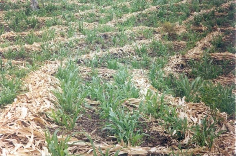
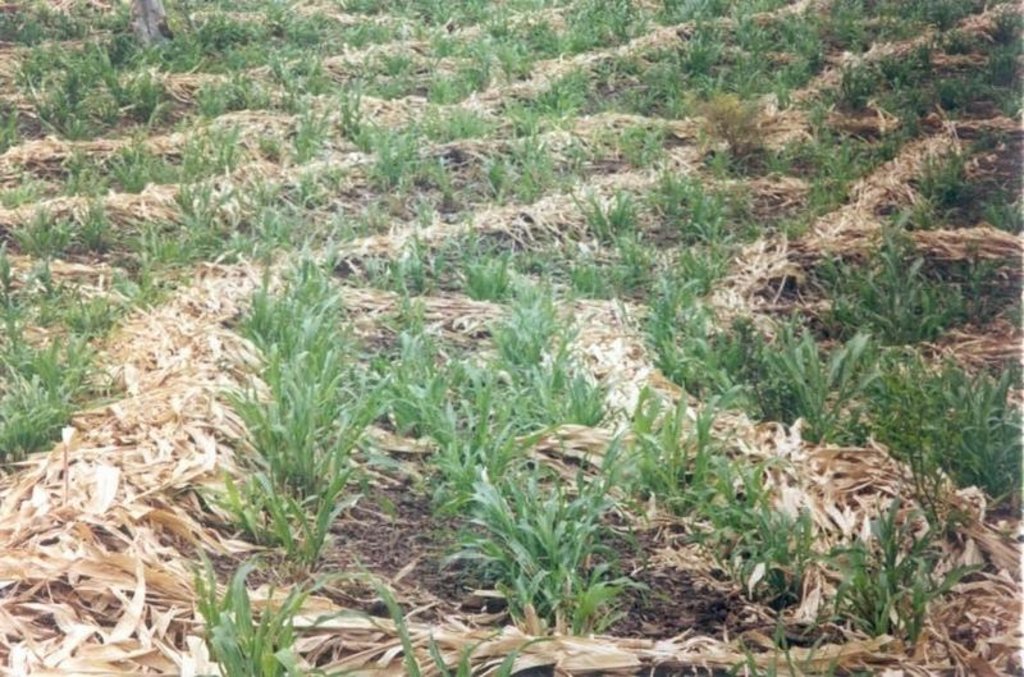
Trashlines are constructed as a barrier of runoff, soil erosion using maize, sorghum and teff straw/stalk
2.2 Detailed description of the Technology
Description:
Trashlines are formed of sorghum, maize or teff straw placed in to form a rectangular basin. The main lines are constructed along the contour. The technique is multi purposive I.e. water harvesting, soil trapping, physical obstraction and improve soil fertility. The estabilishment is made by collecting the straws and then spread it on contour lines. The environment in relation to the technique is low and erratic forms of rainfall, high evapotranspiration, availability of straw.
2.3 Photos of the Technology
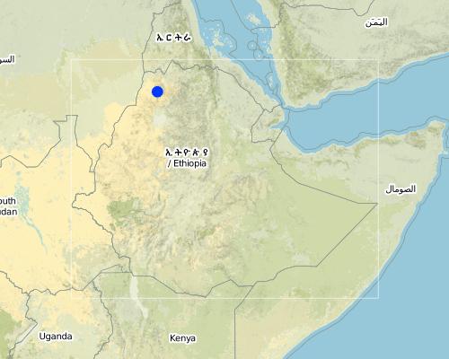
2.5 Country/ region/ locations where the Technology has been applied and which are covered by this assessment
Country:
Ethiopia
Region/ State/ Province:
Southern Nation & Nationalities Peoples Region
Map
×2.6 Date of implementation
If precise year is not known, indicate approximate date:
- more than 50 years ago (traditional)
2.7 Introduction of the Technology
Specify how the Technology was introduced:
- as part of a traditional system (> 50 years)
Comments (type of project, etc.):
It is traditional technique practiced since long time
3. Classification of the SLM Technology
3.2 Current land use type(s) where the Technology is applied

Cropland
- Annual cropping
Comments:
Major land use problems (compiler’s opinion): steep slope farming
Major land use problems (land users’ perception): Pest, disease and land shortage
Type of cropping system and major crops comments: Sorghum - Maize - Beans
3.3 Further information about land use
Water supply for the land on which the Technology is applied:
- rainfed
Comments:
Water supply: Also post-flooding
Number of growing seasons per year:
- 2
Specify:
Longest growing period in days: 135 Longest growing period from month to month: Feb - Jun Second longest growing period in days: 105Second longest growing period from month to month: Jul - Nov
3.4 SLM group to which the Technology belongs
- improved ground/ vegetation cover
- cross-slope measure
3.6 SLM measures comprising the Technology

agronomic measures
- A1: Vegetation/ soil cover
- A2: Organic matter/ soil fertility
Comments:
Main measures: agronomic measures
Type of agronomic measures: temporary trashlines, contour tillage
3.7 Main types of land degradation addressed by the Technology

soil erosion by water
- Wt: loss of topsoil/ surface erosion

chemical soil deterioration
- Cn: fertility decline and reduced organic matter content (not caused by erosion)

water degradation
- Ha: aridification
Comments:
Main type of degradation addressed: Wt: loss of topsoil / surface erosion
Secondary types of degradation addressed: Cn: fertility decline and reduced organic matter content, Ha: aridification
4. Technical specifications, implementation activities, inputs, and costs
4.2 Technical specifications/ explanations of technical drawing
Technical knowledge required for land users: high
Main technical functions: water harvesting / increase water supply
Secondary technical functions: increase / maintain water stored in soil
Temporary trashlines
Material/ species: Sorghum, Maize & Teff Straw/stalk
Remarks: Rectangular basin
If the original slope has changed as a result of the Technology, the slope today is (see figure below): 3.00%
Gradient along the rows / strips: 0.00%
Slope (which determines the spacing indicated above): 4%
If the original slope has changed as a result of the Technology, the slope today is: 3%
Lateral gradient along the structure: 1%
4.3 General information regarding the calculation of inputs and costs
other/ national currency (specify):
Ethiopian birr
Indicate exchange rate from USD to local currency (if relevant): 1 USD =:
8.5
4.6 Maintenance/ recurrent activities
| Activity | Type of measure | Timing/ frequency | |
|---|---|---|---|
| 1. | Collection of straw | Agronomic | Dry season / annual |
| 2. | Placing the straw on a line | Agronomic | Dry season / annual |
4.7 Costs and inputs needed for maintenance/ recurrent activities (per year)
Comments:
labour and tools
4.8 Most important factors affecting the costs
Describe the most determinate factors affecting the costs:
soil type
5. Natural and human environment
5.1 Climate
Annual rainfall
- < 250 mm
- 251-500 mm
- 501-750 mm
- 751-1,000 mm
- 1,001-1,500 mm
- 1,501-2,000 mm
- 2,001-3,000 mm
- 3,001-4,000 mm
- > 4,000 mm
Agro-climatic zone
- semi-arid
5.2 Topography
Slopes on average:
- flat (0-2%)
- gentle (3-5%)
- moderate (6-10%)
- rolling (11-15%)
- hilly (16-30%)
- steep (31-60%)
- very steep (>60%)
Landforms:
- plateau/plains
- ridges
- mountain slopes
- hill slopes
- footslopes
- valley floors
Altitudinal zone:
- 0-100 m a.s.l.
- 101-500 m a.s.l.
- 501-1,000 m a.s.l.
- 1,001-1,500 m a.s.l.
- 1,501-2,000 m a.s.l.
- 2,001-2,500 m a.s.l.
- 2,501-3,000 m a.s.l.
- 3,001-4,000 m a.s.l.
- > 4,000 m a.s.l.
5.3 Soils
Soil depth on average:
- very shallow (0-20 cm)
- shallow (21-50 cm)
- moderately deep (51-80 cm)
- deep (81-120 cm)
- very deep (> 120 cm)
Soil texture (topsoil):
- medium (loamy, silty)
Topsoil organic matter:
- medium (1-3%)
- low (<1%)
If available, attach full soil description or specify the available information, e.g. soil type, soil PH/ acidity, Cation Exchange Capacity, nitrogen, salinity etc.
Soil fertility is medium-low
Soil drainage/infiltration is good-medium
Soil water storage capacity is high-medium
5.6 Characteristics of land users applying the Technology
Relative level of wealth:
- poor
- average
Level of mechanization:
- manual work
Indicate other relevant characteristics of the land users:
Annual population growth: 2% - 3%
50% of the land users are average wealthy and own 65% of the land.
40% of the land users are poor and own 30% of the land.
10% of the land users are poor and own 5% of the land.
5.8 Land ownership, land use rights, and water use rights
Land ownership:
- state
Land use rights:
- individual
6. Impacts and concluding statements
6.4 Cost-benefit analysis
How do the benefits compare with the establishment costs (from land users’ perspective)?
Short-term returns:
positive
Long-term returns:
positive
How do the benefits compare with the maintenance/ recurrent costs (from land users' perspective)?
Short-term returns:
positive
Long-term returns:
positive
6.5 Adoption of the Technology
Of all those who have adopted the Technology, how many have did so spontaneously, i.e. without receiving any material incentives/ payments?
- 90-100%
Comments:
Comments on acceptance with external material support: estimates
100% of land user families have adopted the Technology without any external material support
Comments on spontaneous adoption: estimates
There is a moderate trend towards spontaneous adoption of the Technology
Links and modules
Expand all Collapse allLinks
No links
Modules
No modules


