Hedgerow technology [Nepal]
- Creation:
- Update:
- Compiler: Shreedip Sigdel
- Editor: –
- Reviewers: David Streiff, Alexandra Gavilano
Ghase har Prabadhi (Main Contributor: Gyanbandhu Sharma, LI-BIRD)
technologies_1685 - Nepal
View sections
Expand all Collapse all1. General information
1.2 Contact details of resource persons and institutions involved in the assessment and documentation of the Technology
SLM specialist:
Name of the institution(s) which facilitated the documentation/ evaluation of the Technology (if relevant)
Local Initiatives for Biodiversity, Research, and Development (LI-BIRD) - NepalName of the institution(s) which facilitated the documentation/ evaluation of the Technology (if relevant)
ICIMOD International Centre for Integrated Mountain Development (ICIMOD) - Nepal1.3 Conditions regarding the use of data documented through WOCAT
The compiler and key resource person(s) accept the conditions regarding the use of data documented through WOCAT:
Yes
1.5 Reference to Questionnaire(s) on SLM Approaches (documented using WOCAT)

Participatory hedgerow management [Nepal]
Hedgerow technology can be introduced through the joint participation of farmers, scientists, and related stakeholders. The whole community works together at all stages, including designing, planning, implementation, monitoring and evaluation, and scaling up.
- Compiler: Shreedip Sigdel
2. Description of the SLM Technology
2.1 Short description of the Technology
Definition of the Technology:
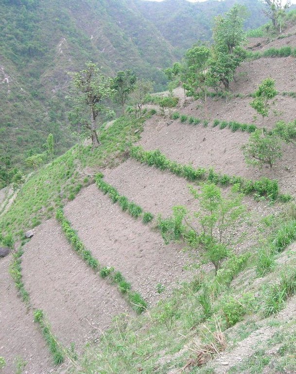
A technology that uses hedgerows to help establish terraces on sloping land; farmers learn improved methods to manage a cultivation practice that stabilizes the soil, enhances food production, and adds to on-farm cash income.
2.2 Detailed description of the Technology
Description:
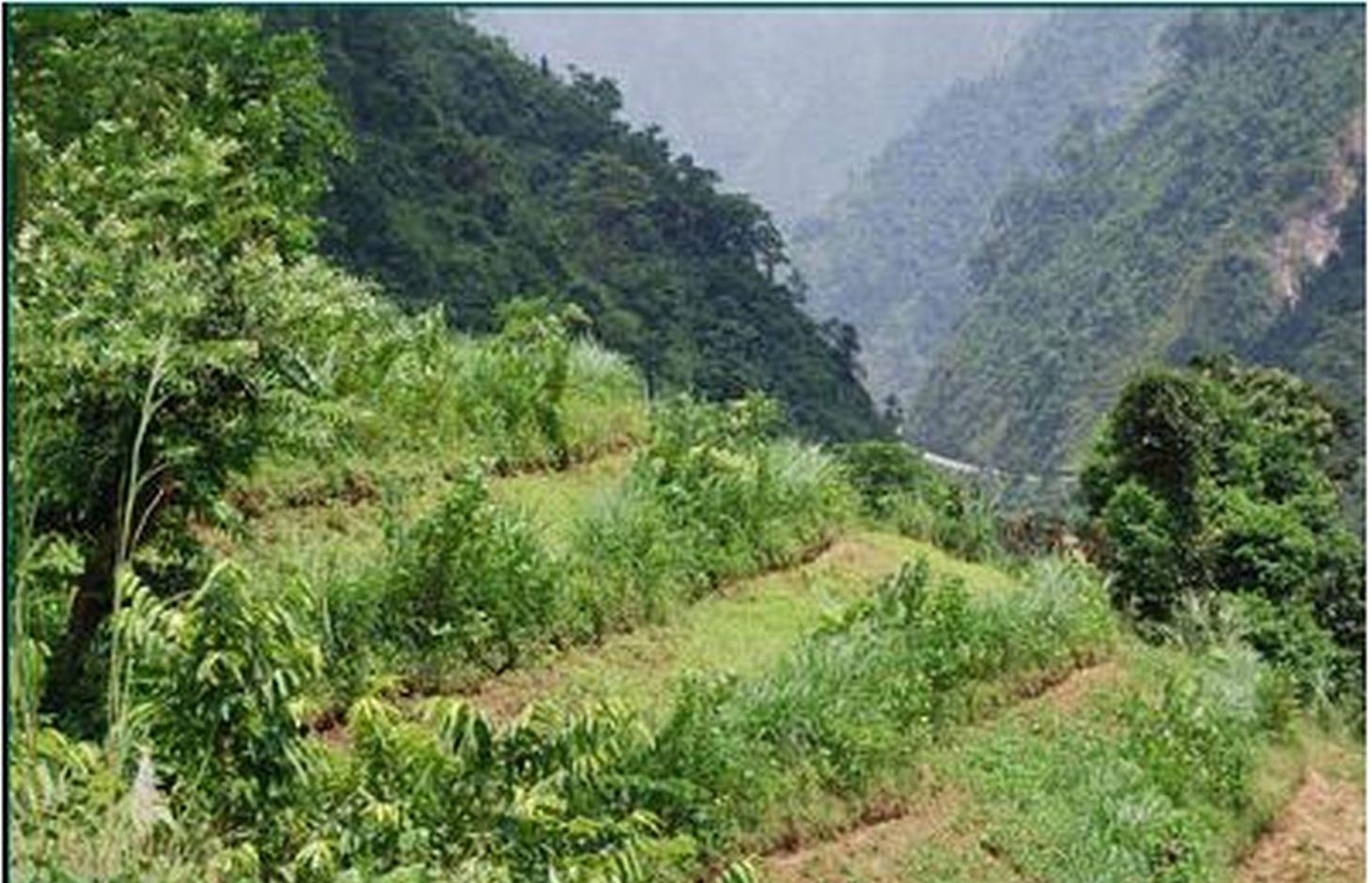
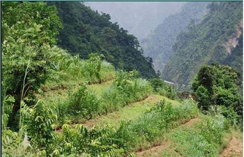
Hedgerow technology provides options and opportunities for farmers working on sloping land. These hedgerows are a soil conservation measure but they also help to generate additional biomass and fodder and/or income for marginal farmers; in addition, they offer the added benefit of helping to balance the ecosystem and to address climate change by encouraging biodiversity. This improved version of a local technology makes maximum use of indigenous knowledge and adds to it by making available the latest scientific knowledge.
Purpose of the Technology: Farmers have traditionally selected plants for hedgerow cultivation based on practical considerations such as the availability of seeds and seedlings, how well seeds germinate, how well the plants grow and how well they can be coppiced, their branching habit, the amount of biomass they can produce, and how much cash the crop can generate. They made these choices without the benefit of any external input or scientific knowledge, relying solely on what they have been able to observe locally over the years. The participatory technology development process aims to help farmers by providing them with scientific input to augment their traditional knowledge on the selection, plan, and design of hedgerows. Over a very short time, the farmers learn to make good use of the new information and start enjoying the benefits that the improved agriculture yields in terms of social, economic, and environmental benefits.
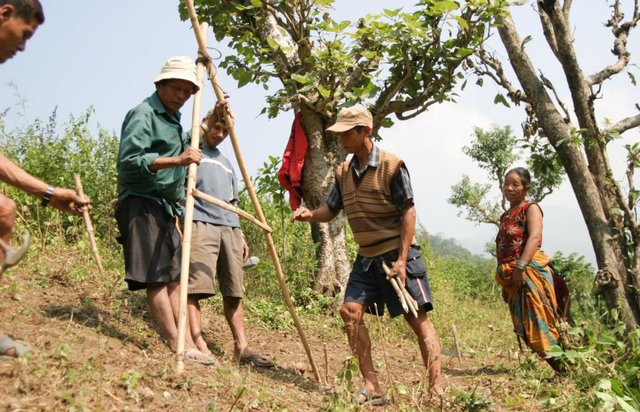
Establishment / maintenance activities and inputs: The following steps outline how hedgerows can be established on sloping land:
• A participatory designing and planning process is used to choose which sloping lands will be cultivated and to select which hedgerow species are to be planted. Trained manpower is recruited with the help of farmers and other related stakeholders.
• The necessary materials such as A-frames, seeds, and seedlings are prepared.
• The technology is implemented in the field by trained manpower.
• The hedgerow seedlings are regularly maintained.
• The land users participate in periodic monitoring and evaluation of the technology. They report on progress and provide feedback.
2.3 Photos of the Technology
2.5 Country/ region/ locations where the Technology has been applied and which are covered by this assessment
Country:
Nepal
Further specification of location:
Gorkha, Tanhun, Chitwan, Makwanpur, Nawalparasi, Dhading district
Specify the spread of the Technology:
- evenly spread over an area
If precise area is not known, indicate approximate area covered:
- 1-10 km2
2.7 Introduction of the Technology
Specify how the Technology was introduced:
- during experiments/ research
3. Classification of the SLM Technology
3.1 Main purpose(s) of the Technology
- reduce, prevent, restore land degradation
3.2 Current land use type(s) where the Technology is applied
Land use mixed within the same land unit:
Yes
Specify mixed land use (crops/ grazing/ trees):
- Agroforestry

Cropland
- Annual cropping
Number of growing seasons per year:
- 2

Forest/ woodlands
Comments:
Major land use problems (compiler’s opinion): Noticeable soil erosion, decreased soil fertility, diminished productivity, and lower moisture content in areas that have sloping lands and in areas where shifting cultivation is or was practised. Plots that had previously been farmed by the method of shifting cultivation, where plots are allowed to lie fallow for a number of years, are now cultivated annually. This land use change is worrying because shifting cultivation has traditionally been practised in areas where the quality of the soil is poor and cannot support annual crop production year on year.
3.4 Water supply
Water supply for the land on which the Technology is applied:
- rainfed
3.5 SLM group to which the Technology belongs
- cross-slope measure
3.6 SLM measures comprising the Technology

vegetative measures
- V1: Tree and shrub cover

management measures
- M1: Change of land use type
3.7 Main types of land degradation addressed by the Technology

soil erosion by water
- Wt: loss of topsoil/ surface erosion

chemical soil deterioration
- Cn: fertility decline and reduced organic matter content (not caused by erosion)
Comments:
Main causes of degradation: soil management, deforestation / removal of natural vegetation (incl. forest fires), Heavy / extreme rainfall (intensity/amounts), droughts
3.8 Prevention, reduction, or restoration of land degradation
Specify the goal of the Technology with regard to land degradation:
- prevent land degradation
4. Technical specifications, implementation activities, inputs, and costs
4.1 Technical drawing of the Technology
Technical specifications (related to technical drawing):
Hedgerow technology on sloping land; note that the hedgerows help to stabilize the land and to control soil erosion and runoff.
Technical knowledge required for field staff / advisors: moderate
Technical knowledge required for land users: moderate
Main technical functions: control of dispersed runoff: retain / trap, Prevent Soil erosion
Secondary technical functions: reduction of slope angle, stabilisation of soil (eg by tree roots against land slides), increase in nutrient availability (supply, recycling,…)
Author:
Bir Bahadur Tamang
4.2 General information regarding the calculation of inputs and costs
Specify how costs and inputs were calculated:
- per Technology area
Indicate size and area unit:
ha
Specify currency used for cost calculations:
- USD
Indicate average wage cost of hired labour per day:
2.7
4.3 Establishment activities
| Activity | Timing (season) | |
|---|---|---|
| 1. | The equipment that is needed for planting is collected and prepared; this can include such things as A-frames, spades, and sickles.• The hillside where the technology is to be implemented is first cleaned and groomed to make way for the new hedgerows.• Contour lines are demarcated.• The seeds and/or seedlings are planted along the contour lines. |
4.4 Costs and inputs needed for establishment
| Specify input | Unit | Quantity | Costs per Unit | Total costs per input | % of costs borne by land users | |
|---|---|---|---|---|---|---|
| Labour | Prepare and plant along the contour lines | persons/day/ha | 10.0 | 2.7 | 27.0 | 100.0 |
| Equipment | Tools | ha | 1.0 | 32.0 | 32.0 | 100.0 |
| Plant material | Seedlings | ha | 1.0 | 68.0 | 68.0 | 100.0 |
| Total costs for establishment of the Technology | 127.0 | |||||
| Total costs for establishment of the Technology in USD | 127.0 | |||||
4.5 Maintenance/ recurrent activities
| Activity | Timing/ frequency | |
|---|---|---|
| 1. | The hedgerows are weeded and cleaned to discourage unwantedplants and pests.• Enrichment planting• The hedgerows are pruned and the clippings are mulched.• Manuring |
4.6 Costs and inputs needed for maintenance/ recurrent activities (per year)
| Specify input | Unit | Quantity | Costs per Unit | Total costs per input | % of costs borne by land users | |
|---|---|---|---|---|---|---|
| Labour | Maintenance of hedgerows | persons/day/ha | 26.0 | 2.7 | 70.2 | 100.0 |
| Plant material | Seedlings | ha | 1.0 | 34.0 | 34.0 | 100.0 |
| Fertilizers and biocides | Compost / manure | ha | 1.0 | 20.0 | 20.0 | 100.0 |
| Total costs for maintenance of the Technology | 124.2 | |||||
| Total costs for maintenance of the Technology in USD | 124.2 | |||||
4.7 Most important factors affecting the costs
Describe the most determinate factors affecting the costs:
The cost of implementing this technology is dependent on the gradient of the slope (and other geographical features), the local cost of the seeds or seedlings, and the availability of labour.
The technology has a low to average cost for implementation. Locally available seeds and seedlings and locally trained manpower and resources are valuable low-cost inputs for implementation. The technology has a higher likelihood of adoption in some social and physiographic areas, especially where land users can integrate their own expertise with scientific knowledge. Many factors play a role in determining whether the technology is effective and sustainable and whether farmers are willing to adopt it; these include that if the technology is demand driven, it is more likely to be adopted, and if land users can use inexpensive local resources they are more likely to try it.
All costs and amounts are rough estimates by the technicians and authors
5. Natural and human environment
5.1 Climate
Annual rainfall
- < 250 mm
- 251-500 mm
- 501-750 mm
- 751-1,000 mm
- 1,001-1,500 mm
- 1,501-2,000 mm
- 2,001-3,000 mm
- 3,001-4,000 mm
- > 4,000 mm
Agro-climatic zone
- sub-humid
Thermal climate class: subtropics
5.2 Topography
Slopes on average:
- flat (0-2%)
- gentle (3-5%)
- moderate (6-10%)
- rolling (11-15%)
- hilly (16-30%)
- steep (31-60%)
- very steep (>60%)
Landforms:
- plateau/plains
- ridges
- mountain slopes
- hill slopes
- footslopes
- valley floors
Altitudinal zone:
- 0-100 m a.s.l.
- 101-500 m a.s.l.
- 501-1,000 m a.s.l.
- 1,001-1,500 m a.s.l.
- 1,501-2,000 m a.s.l.
- 2,001-2,500 m a.s.l.
- 2,501-3,000 m a.s.l.
- 3,001-4,000 m a.s.l.
- > 4,000 m a.s.l.
5.3 Soils
Soil depth on average:
- very shallow (0-20 cm)
- shallow (21-50 cm)
- moderately deep (51-80 cm)
- deep (81-120 cm)
- very deep (> 120 cm)
Soil texture (topsoil):
- coarse/ light (sandy)
Topsoil organic matter:
- medium (1-3%)
If available, attach full soil description or specify the available information, e.g. soil type, soil PH/ acidity, Cation Exchange Capacity, nitrogen, salinity etc.
Soil fertility is low
Soil drainage / infiltration is poor
Soil water storage capacity is low
5.4 Water availability and quality
Ground water table:
> 50 m
Availability of surface water:
poor/ none
Water quality (untreated):
unusable
5.5 Biodiversity
Species diversity:
- low
5.6 Characteristics of land users applying the Technology
Market orientation of production system:
- subsistence (self-supply)
Off-farm income:
- 10-50% of all income
Relative level of wealth:
- poor
Individuals or groups:
- individual/ household
Level of mechanization:
- manual work
- animal traction
Indicate other relevant characteristics of the land users:
Population density: 10-50 persons/km2
Annual population growth: 3% - 4%
5.7 Average area of land used by land users applying the Technology
- < 0.5 ha
- 0.5-1 ha
- 1-2 ha
- 2-5 ha
- 5-15 ha
- 15-50 ha
- 50-100 ha
- 100-500 ha
- 500-1,000 ha
- 1,000-10,000 ha
- > 10,000 ha
Is this considered small-, medium- or large-scale (referring to local context)?
- small-scale
5.8 Land ownership, land use rights, and water use rights
Land ownership:
- individual, titled
5.9 Access to services and infrastructure
health:
- poor
- moderate
- good
education:
- poor
- moderate
- good
technical assistance:
- poor
- moderate
- good
employment (e.g. off-farm):
- poor
- moderate
- good
markets:
- poor
- moderate
- good
energy:
- poor
- moderate
- good
roads and transport:
- poor
- moderate
- good
drinking water and sanitation:
- poor
- moderate
- good
financial services:
- poor
- moderate
- good
6. Impacts and concluding statements
6.1 On-site impacts the Technology has shown
Socio-economic impacts
Production
crop production
fodder production
product diversity
Water availability and quality
demand for irrigation water
Comments/ specify:
Reduce need for external agriculture inputs
Income and costs
expenses on agricultural inputs
diversity of income sources
Other socio-economic impacts
Initial cost
very steep slope (>30 degree)
time to become well established
Socio-cultural impacts
food security/ self-sufficiency
community institutions
SLM/ land degradation knowledge
Empowerment of the community
livelihood and human well-being
Comments/ specify:
The hedgerows provide fodder and forage for animals; selling or bartering fodder helps to diversify food sources for humans and can also be a significant source of income.
Ecological impacts
Water cycle/ runoff
surface runoff
Soil
soil moisture
soil organic matter/ below ground C
Biodiversity: vegetation, animals
biomass/ above ground C
plant diversity
pest/ disease control
Other ecological impacts
competition for water, sunlight and nutrients
6.2 Off-site impacts the Technology has shown
downstream siltation
buffering/ filtering capacity
6.3 Exposure and sensitivity of the Technology to gradual climate change and climate-related extremes/ disasters (as perceived by land users)
Climate-related extremes (disasters)
Meteorological disasters
| How does the Technology cope with it? | |
|---|---|
| local rainstorm | not well |
Climatological disasters
| How does the Technology cope with it? | |
|---|---|
| drought | well |
Comments:
Farmers selected species with deep root to adopt to climate extremes
6.4 Cost-benefit analysis
How do the benefits compare with the establishment costs (from land users’ perspective)?
Short-term returns:
positive
Long-term returns:
very positive
How do the benefits compare with the maintenance/ recurrent costs (from land users' perspective)?
Short-term returns:
positive
Long-term returns:
very positive
6.5 Adoption of the Technology
- 11-50%
If available, quantify (no. of households and/ or area covered):
450 households in an area of 1- 10 sq km (10 - 50 persons per sq km)
Of all those who have adopted the Technology, how many did so spontaneously, i.e. without receiving any material incentives/ payments?
- 91-100%
Comments:
25% of land user families have adopted the Technology without any external material support
450 land user families have adopted the Technology without any external material support
Comments on spontaneous adoption: One quarter of the total land users (about 450 families) in the areas studied adopted this technology voluntarily without any external support.
6.7 Strengths/ advantages/ opportunities of the Technology
| Strengths/ advantages/ opportunities in the compiler’s or other key resource person’s view |
|---|
|
Effective control of soil erosion on sloping land How can they be sustained / enhanced? This vegetative measure of planting along contour lines can be sustained in the long run by initially selecting species preferred by farmers and by continuing to maintain them |
|
Improved soil fertility How can they be sustained / enhanced? Hedgerows help to increase soil fertility because they trap water and sediment on the terraces; leguminous hedgerow plants fix nitrogen in the soil and when they are mulched their residues increase organic matter in the soil. |
|
Quality fodder and forage production How can they be sustained / enhanced? Hedgerows produce fodder and forage for livestock |
|
Bioterracing How can they be sustained / enhanced? When leguminous plants with deep roots are used in the hedgerows they help to anchor the edges and over time, as the soil accumulates, bioterraces are established. |
|
High adoption potential How can they be sustained / enhanced? This technology is simple to implement using only local resources and is assured of replication since it was demand driven |
6.8 Weaknesses/ disadvantages/ risks of the Technology and ways of overcoming them
| Weaknesses/ disadvantages/ risks in the compiler’s or other key resource person’s view | How can they be overcome? |
|---|---|
| Hedgerows are difficult to establish on steep slopes and in areas where the soil is dry and degraded | Increase moisture in the soil by mulching the hedges |
| Hedgerows take a long time to establish | Increase the amount of manure (compost, crop residue) added to the hedgerows and add more frequently. Increase the frequency of weeding and cleaning. |
| It is difficult to establish bio-terraces on steep land | Reduce the spacing between hedgerows and grow tree species. Remember that that this technology is not recommend for very steep slopes |
| High initial cost | Make maximum use of local resources and local labour |
| Hedgerows threatened by free grazing of animals | Control grazing in the area |
7. References and links
7.1 Methods/ sources of information
7.2 References to available publications
Title, author, year, ISBN:
Factors responsible for acceptance or rejection of SALT and other technological options suitable for shifting and sloping land cultivation areas, Technical Paper submitted to Hill Agriculture Research Project (HARP), Regmi, BR; et al. (2004),
Title, author, year, ISBN:
A resource book: Integrated hedgerow technology (in Nepali), Sharma, G; Regmi, BR; Tamang, BB; Shrestha, PK (2008)
Title, author, year, ISBN:
Manual on contour hedgerow inter-cropping technology, ICIMOD, 1999
Title, author, year, ISBN:
Impact of contour hedgerows: A case study, Focus on Godavari No 3. Kathmandu, Nepal: ICIMOD, Ya, T; Murray, AB (eds) (2004)
Links and modules
Expand all Collapse allLinks

Participatory hedgerow management [Nepal]
Hedgerow technology can be introduced through the joint participation of farmers, scientists, and related stakeholders. The whole community works together at all stages, including designing, planning, implementation, monitoring and evaluation, and scaling up.
- Compiler: Shreedip Sigdel
Modules
No modules


