Homestead Development [Ethiopia]
- Creation:
- Update:
- Compiler: Sewalem Salele
- Editor: –
- Reviewer: Tatenda Lemann
Yegaro zuriya temere den
technologies_4138 - Ethiopia
View sections
Expand all Collapse all1. General information
1.2 Contact details of resource persons and institutions involved in the assessment and documentation of the Technology
Key resource person(s)
land user:
Debebe Agmassu
Abagerima Kebele Association
Ethiopia
SLM specialist:
Name of project which facilitated the documentation/ evaluation of the Technology (if relevant)
Carbon Benefits Project (CBP)Name of project which facilitated the documentation/ evaluation of the Technology (if relevant)
Water and Land Resource Centre Project (WLRC)Name of the institution(s) which facilitated the documentation/ evaluation of the Technology (if relevant)
Bureau of Agriculture - Amhara Nation Regional State - Bahir Dar (amhboard) - EthiopiaName of the institution(s) which facilitated the documentation/ evaluation of the Technology (if relevant)
CDE Centre for Development and Environment (CDE Centre for Development and Environment) - SwitzerlandName of the institution(s) which facilitated the documentation/ evaluation of the Technology (if relevant)
Water and Land Resource Centre (WLRC) - Ethiopia1.3 Conditions regarding the use of data documented through WOCAT
The compiler and key resource person(s) accept the conditions regarding the use of data documented through WOCAT:
Yes
1.4 Declaration on sustainability of the described Technology
Is the Technology described here problematic with regard to land degradation, so that it cannot be declared a sustainable land management technology?
No
2. Description of the SLM Technology
2.1 Short description of the Technology
Definition of the Technology:
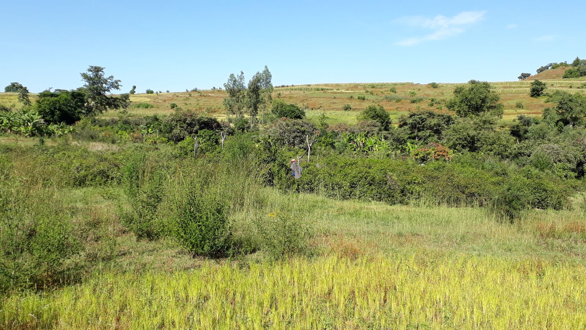
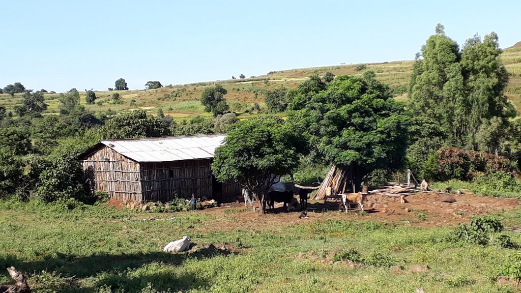
Homestead development is a diverse, dynamic and interesting horticultural area; it appears as an agroforestry plot in a cultivated landscape surrounding it, and it is more productive than single cropping, since harvesting is continuous over a great portion of the growing season and beyond.
2.2 Detailed description of the Technology
Description:
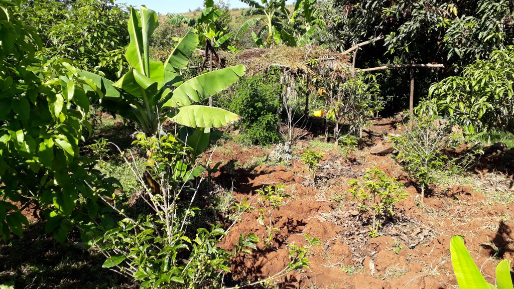
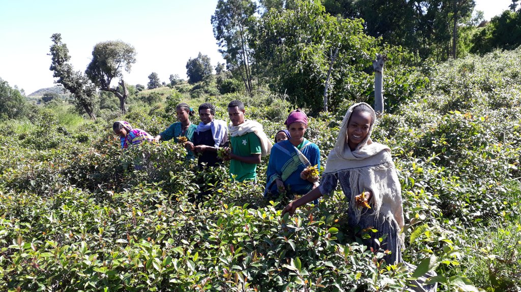
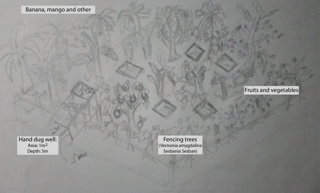
1. Homestead development is a horticultural area, usually around a homestead, and consisting of trees (mango, avocado), bushes (citrus fruits, coffee, gesho (hops), chat, banana), while ground crops (vegetables, maize) are grown at the same time and on the same parcel of land.
2. The technology applies the principle of intercropping, i.e. two or more plant species are grown in close proximity, providing multiple outputs and yields, while combined applications and shared inputs are possible.
3. Economically, homestead development helps to reduce poverty through increased production, improved human nutrition through diverse species. It also reduces deforestation and pressure on wood land by providing fuelwood.
4. In order to make the land suitable for homestead development, market-oriented seeds or seedlings must be available, thus a nursery for seedling provision. farm equipment, adequate water (hand-dug well), and sufficient work power are preconditions.
5. Homestead development as a technology is both economic and environmental, as the agroforestry setup also serves for conservation of natural resources.
6. Land users like additional outputs from their small plots of land, including the variety of fruits and vegetables, the recreational area around their homes, and the availability of water in hand-dug wells that are needed for irrigation.
7. Nevertheless, land are aware that homestead development gardens need continuous follow-up and management, as well as intensive labour inputs.
2.3 Photos of the Technology
General remarks regarding photos:
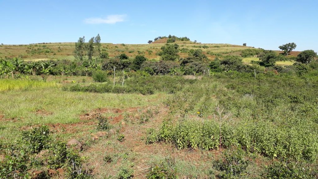
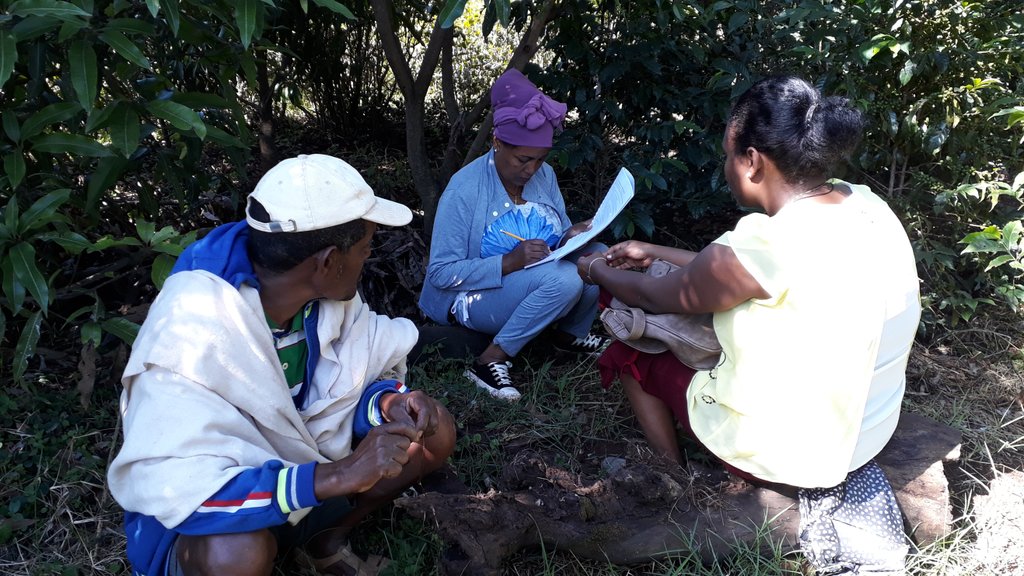
The photos were all taken during field work on 24 October 2018, while several technologies were assessed by different compilers. In the Abagerima area a full watershed was developed in 2013 by the Water and Land Resource Centre, Addis Ababa University and Centre for Development and Environment (CDE), University of Bern, funded by Swiss Development Cooperation and its Ethiopian partners.
2.5 Country/ region/ locations where the Technology has been applied and which are covered by this assessment
Country:
Ethiopia
Region/ State/ Province:
Amhara Regional State
Further specification of location:
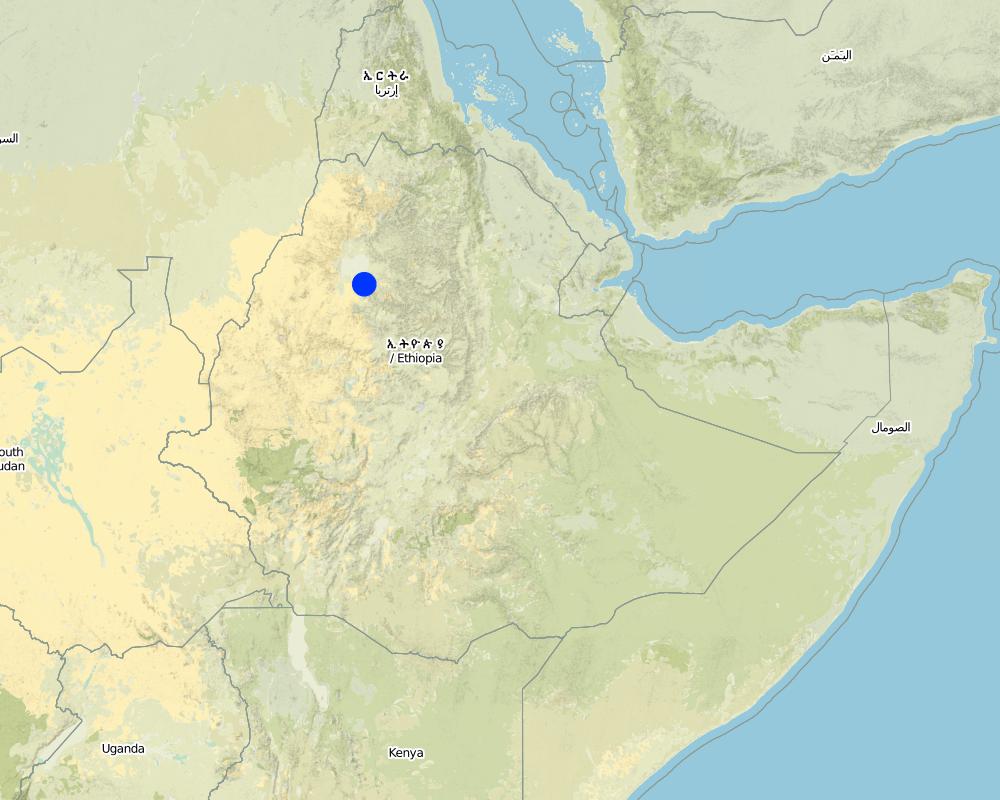
Abagerima Watershed, Laguna Village near Bahir Dar, the regional capital of Amhara Region, Ethiopia
Specify the spread of the Technology:
- applied at specific points/ concentrated on a small area
Is/are the technology site(s) located in a permanently protected area?
No
Map
×2.6 Date of implementation
Indicate year of implementation:
2013
If precise year is not known, indicate approximate date:
- less than 10 years ago (recently)
2.7 Introduction of the Technology
Specify how the Technology was introduced:
- through land users' innovation
3. Classification of the SLM Technology
3.1 Main purpose(s) of the Technology
- improve production
- reduce, prevent, restore land degradation
- conserve ecosystem
- preserve/ improve biodiversity
- create beneficial economic impact
- create beneficial social impact
3.2 Current land use type(s) where the Technology is applied
Land use mixed within the same land unit:
Yes
Specify mixed land use (crops/ grazing/ trees):
- Agroforestry

Cropland
- Annual cropping
- Perennial (non-woody) cropping
- Tree and shrub cropping
Annual cropping - Specify crops:
- cereals - maize
- cereals - oats
- root/tuber crops - potatoes
- vegetables - leafy vegetables (salads, cabbage, spinach, other)
- vegetables - root vegetables (carrots, onions, beet, other)
Annual cropping system:
Maize/sorghum/millet intercropped with legume
Perennial (non-woody) cropping - Specify crops:
- banana/plantain/abaca
Tree and shrub cropping - Specify crops:
- avocado
- citrus
- coffee, shade grown
- mango, mangosteen, guava
- Gesho (hops), Chat
Number of growing seasons per year:
- 1
Is intercropping practiced?
Yes
If yes, specify which crops are intercropped:
Two or more plant species are grown in close proximity, providing multiple outputs and yields, while combined applications and shared inputs are possible
Is crop rotation practiced?
Yes
If yes, specify:
varying

Forest/ woodlands
- Tree plantation, afforestation
Tree plantation, afforestation: Specify origin and composition of species:
- Mixed varieties
- Sesbania Sesban; Vernonia amygdalina
Are the trees specified above deciduous or evergreen?
- evergreen
Products and services:
- Fuelwood
- Grazing/ browsing
Comments:
Previous to the homestead development, the area was used for keeping livestock near the house, with some eucalyptus tees planted for construction and fuel wood. If the homestead garden is larger, it was previously also used for cultivating crops, and as grazing area.
3.3 Has land use changed due to the implementation of the Technology?
Has land use changed due to the implementation of the Technology?
- Yes (Please fill out the questions below with regard to the land use before implementation of the Technology)
Land use mixed within the same land unit:
Yes
Specify mixed land use (crops/ grazing/ trees):
- Agroforestry

Cropland
- Annual cropping
Annual cropping - Specify crops:
- cereals - maize
- cereals - wheat (winter)
- root/tuber crops - potatoes
- Teff
Annual cropping system:
Fallow - wheat/barley/oats/upland rice
Is intercropping practiced?
Yes
If yes, specify which crops are intercropped:
maze /sorghum/millet inter-cropped with legume
Is crop rotation practiced?
Yes
If yes, specify:
Consecutive (rotational) cropping with occasional fallow

Grazing land
Extensive grazing:
- Ranching
Animal type:
- cattle - dairy
- cattle - non-dairy working
- horses
- mules and asses
- sheep
Is integrated crop-livestock management practiced?
Yes
If yes, specify:
Livestock is used as ploughing animals, donkesy and horses as carryin animals, sheep and goats for meat.
Products and services:
- meat
- transport/ draught
Comments:
The homestead area was transformed from the above land uses to horticulture, while the 'old' land use system prevails in the surrounding area.
3.4 Water supply
Water supply for the land on which the Technology is applied:
- mixed rainfed-irrigated
Comments:
For irrigation small hand-dug wells are constructed, up to a depth of about 5 metres, while the water level is usually quite near the surface during the rainy season.
3.5 SLM group to which the Technology belongs
- agroforestry
- home gardens
3.6 SLM measures comprising the Technology

vegetative measures
- V2: Grasses and perennial herbaceous plants
- V4: Replacement or removal of alien/ invasive species

management measures
- M1: Change of land use type
- M2: Change of management/ intensity level
3.7 Main types of land degradation addressed by the Technology

soil erosion by water
- Wt: loss of topsoil/ surface erosion
- Wg: gully erosion/ gullying

biological degradation
- Bc: reduction of vegetation cover
- Bh: loss of habitats
- Bq: quantity/ biomass decline
- Bs: quality and species composition/ diversity decline

water degradation
- Hg: change in groundwater/aquifer level
3.8 Prevention, reduction, or restoration of land degradation
Specify the goal of the Technology with regard to land degradation:
- prevent land degradation
- reduce land degradation
4. Technical specifications, implementation activities, inputs, and costs
4.1 Technical drawing of the Technology
Technical specifications (related to technical drawing):
The slope gradient of the Homestead Development area is less than 3%, and trees, bushes and garden products are planted very close to each other, so that passing through becomes difficult in places.
Author:
Sewalem Salele
Date:
24/10/2018
4.2 General information regarding the calculation of inputs and costs
Specify how costs and inputs were calculated:
- per Technology area
Indicate size and area unit:
0.81 hectares
If using a local area unit, indicate conversion factor to one hectare (e.g. 1 ha = 2.47 acres): 1 ha =:
Other homestead development areas can be larger, the largest in Abagerima Watershed being 2.3 ha.
Specify currency used for cost calculations:
- USD
If relevant, indicate exchange rate from USD to local currency (e.g. 1 USD = 79.9 Brazilian Real): 1 USD =:
1.0
Indicate average wage cost of hired labour per day:
5
4.3 Establishment activities
| Activity | Timing (season) | |
|---|---|---|
| 1. | preparation of shallow wells | during dry season (to get deepest ground water) |
| 2. | improved fruit, vegetable and fodder seed(ling)s | during seed(ling) planting time |
| 3. | establishment of nursery site in the garden | after crop harvesting |
| 4. | preparation of the farm for plantation | after harvesting annual crop |
| 5. | planting of seedlings | July to August during main rainy season |
| 6. | continuous follow up and management practice performed | throughout the year |
4.4 Costs and inputs needed for establishment
| Specify input | Unit | Quantity | Costs per Unit | Total costs per input | % of costs borne by land users | |
|---|---|---|---|---|---|---|
| Labour | shallow well preparation (3 wells) | person-days | 27.0 | 5.0 | 135.0 | 70.0 |
| Labour | farm preparation (first year) | person-days | 12.0 | 5.0 | 60.0 | 100.0 |
| Equipment | farming tools (first year) | pieces | 6.0 | 4.0 | 24.0 | 60.0 |
| Plant material | improved seed(ling)s | kg | 5.0 | 3.0 | 15.0 | 50.0 |
| Fertilizers and biocides | compost (first year) | m3 | 6.0 | 5.0 | 30.0 | 100.0 |
| Fertilizers and biocides | pesticides (first year) | litre | 2.0 | 2.0 | 4.0 | 100.0 |
| Construction material | stones (first year) | m3 | 6.0 | 5.0 | 30.0 | 100.0 |
| Total costs for establishment of the Technology | 298.0 | |||||
| Total costs for establishment of the Technology in USD | 298.0 | |||||
If land user bore less than 100% of costs, indicate who covered the remaining costs:
Remaining costs were covered by the Agricultural Office
Comments:
The labor cost for garden work is more expensive because it is difficult, strenuous, intensive and the working hours are longer.
The costs are mostly covered by the owner.
4.5 Maintenance/ recurrent activities
| Activity | Timing/ frequency | |
|---|---|---|
| 1. | shallow well maintenance | once a year |
| 2. | farm preparation (expansion) | throughout year |
| 3. | weeding and plowing | throughout the year |
4.6 Costs and inputs needed for maintenance/ recurrent activities (per year)
| Specify input | Unit | Quantity | Costs per Unit | Total costs per input | % of costs borne by land users | |
|---|---|---|---|---|---|---|
| Labour | shallow well maintenance | person-days | 5.0 | 5.0 | 25.0 | 100.0 |
| Labour | farm preparation | person-days | 11.0 | 5.0 | 55.0 | 100.0 |
| Labour | weeding and plowing | person-days | 15.0 | 5.0 | 75.0 | 100.0 |
| Plant material | improved seed(ling)s | kg | 2.0 | 4.0 | 8.0 | 50.0 |
| Fertilizers and biocides | compost | m3 | 7.0 | 5.0 | 35.0 | 100.0 |
| Fertilizers and biocides | pesticides | litre | 2.0 | 3.0 | 6.0 | 100.0 |
| Total costs for maintenance of the Technology | 204.0 | |||||
| Total costs for maintenance of the Technology in USD | 204.0 | |||||
If land user bore less than 100% of costs, indicate who covered the remaining costs:
Remaining costs were covered by the Agricultural Office
4.7 Most important factors affecting the costs
Describe the most determinate factors affecting the costs:
Inflation rate fluctuations
5. Natural and human environment
5.1 Climate
Annual rainfall
- < 250 mm
- 251-500 mm
- 501-750 mm
- 751-1,000 mm
- 1,001-1,500 mm
- 1,501-2,000 mm
- 2,001-3,000 mm
- 3,001-4,000 mm
- > 4,000 mm
Specifications/ comments on rainfall:
One rainy season between April and October, with a peak in July and August and occasional rains also in the dry season.
Indicate the name of the reference meteorological station considered:
Abagerima meteorological station
Agro-climatic zone
- sub-humid
5.2 Topography
Slopes on average:
- flat (0-2%)
- gentle (3-5%)
- moderate (6-10%)
- rolling (11-15%)
- hilly (16-30%)
- steep (31-60%)
- very steep (>60%)
Landforms:
- plateau/plains
- ridges
- mountain slopes
- hill slopes
- footslopes
- valley floors
Altitudinal zone:
- 0-100 m a.s.l.
- 101-500 m a.s.l.
- 501-1,000 m a.s.l.
- 1,001-1,500 m a.s.l.
- 1,501-2,000 m a.s.l.
- 2,001-2,500 m a.s.l.
- 2,501-3,000 m a.s.l.
- 3,001-4,000 m a.s.l.
- > 4,000 m a.s.l.
Indicate if the Technology is specifically applied in:
- concave situations
5.3 Soils
Soil depth on average:
- very shallow (0-20 cm)
- shallow (21-50 cm)
- moderately deep (51-80 cm)
- deep (81-120 cm)
- very deep (> 120 cm)
Soil texture (topsoil):
- medium (loamy, silty)
Soil texture (> 20 cm below surface):
- medium (loamy, silty)
Topsoil organic matter:
- medium (1-3%)
5.4 Water availability and quality
Ground water table:
< 5 m
Availability of surface water:
medium
Water quality (untreated):
poor drinking water (treatment required)
Water quality refers to:
both ground and surface water
Is water salinity a problem?
No
Is flooding of the area occurring?
No
Comments and further specifications on water quality and quantity:
A major source of pollution are sediments resulting from soil erosion on cultivated land, and excess runoff from overgrazed areas.
5.5 Biodiversity
Species diversity:
- high
Habitat diversity:
- medium
5.6 Characteristics of land users applying the Technology
Sedentary or nomadic:
- Sedentary
Market orientation of production system:
- mixed (subsistence/ commercial)
Off-farm income:
- less than 10% of all income
Relative level of wealth:
- average
- rich
Individuals or groups:
- individual/ household
Level of mechanization:
- manual work
- animal traction
Gender:
- women
- men
Age of land users:
- middle-aged
- elderly
Indicate other relevant characteristics of the land users:
Rent in and rent out in cultural norms
5.7 Average area of land used by land users applying the Technology
- < 0.5 ha
- 0.5-1 ha
- 1-2 ha
- 2-5 ha
- 5-15 ha
- 15-50 ha
- 50-100 ha
- 100-500 ha
- 500-1,000 ha
- 1,000-10,000 ha
- > 10,000 ha
Is this considered small-, medium- or large-scale (referring to local context)?
- small-scale
5.8 Land ownership, land use rights, and water use rights
Land ownership:
- state
Land use rights:
- communal (organized)
- individual
Water use rights:
- open access (unorganized)
- individual
Are land use rights based on a traditional legal system?
Yes
Specify:
Yezota (ownership right)
5.9 Access to services and infrastructure
health:
- poor
- moderate
- good
education:
- poor
- moderate
- good
technical assistance:
- poor
- moderate
- good
employment (e.g. off-farm):
- poor
- moderate
- good
markets:
- poor
- moderate
- good
energy:
- poor
- moderate
- good
roads and transport:
- poor
- moderate
- good
drinking water and sanitation:
- poor
- moderate
- good
financial services:
- poor
- moderate
- good
6. Impacts and concluding statements
6.1 On-site impacts the Technology has shown
Socio-economic impacts
Production
crop production
crop quality
fodder production
fodder quality
animal production
wood production
forest/ woodland quality
non-wood forest production
product diversity
production area
land management
energy generation
Water availability and quality
drinking water availability
drinking water quality
water availability for livestock
water quality for livestock
irrigation water availability
irrigation water quality
demand for irrigation water
Income and costs
farm income
diversity of income sources
economic disparities
workload
Socio-cultural impacts
food security/ self-sufficiency
health situation
land use/ water rights
cultural opportunities
recreational opportunities
community institutions
national institutions
SLM/ land degradation knowledge
conflict mitigation
situation of socially and economically disadvantaged groups
Ecological impacts
Water cycle/ runoff
water quantity
water quality
harvesting/ collection of water
surface runoff
excess water drainage
groundwater table/ aquifer
Comments/ specify:
This may worsen when more homestead development areas are established around homes
evaporation
Comments/ specify:
This includes evapotranspiration
Soil
soil moisture
soil cover
soil loss
soil accumulation
soil crusting/ sealing
soil compaction
nutrient cycling/ recharge
salinity
soil organic matter/ below ground C
acidity
Biodiversity: vegetation, animals
Vegetation cover
biomass/ above ground C
plant diversity
invasive alien species
animal diversity
beneficial species
habitat diversity
pest/ disease control
Climate and disaster risk reduction
flood impacts
landslides/ debris flows
drought impacts
impacts of cyclones, rain storms
emission of carbon and greenhouse gases
fire risk
wind velocity
micro-climate
6.2 Off-site impacts the Technology has shown
water availability
reliable and stable stream flows in dry season
downstream flooding
downstream siltation
groundwater/ river pollution
buffering/ filtering capacity
wind transported sediments
damage on neighbours' fields
damage on public/ private infrastructure
impact of greenhouse gases
6.3 Exposure and sensitivity of the Technology to gradual climate change and climate-related extremes/ disasters (as perceived by land users)
Gradual climate change
Gradual climate change
| Season | increase or decrease | How does the Technology cope with it? | |
|---|---|---|---|
| annual temperature | increase | very well | |
| seasonal temperature | winter | increase | very well |
| annual rainfall | increase | very well | |
| seasonal rainfall | wet/ rainy season | very well |
Climate-related extremes (disasters)
Meteorological disasters
| How does the Technology cope with it? | |
|---|---|
| local rainstorm | very well |
| local thunderstorm | very well |
Biological disasters
| How does the Technology cope with it? | |
|---|---|
| epidemic diseases | very well |
| insect/ worm infestation | very well |
6.4 Cost-benefit analysis
How do the benefits compare with the establishment costs (from land users’ perspective)?
Short-term returns:
slightly negative
Long-term returns:
very positive
How do the benefits compare with the maintenance/ recurrent costs (from land users' perspective)?
Short-term returns:
slightly negative
Long-term returns:
positive
6.5 Adoption of the Technology
- 11-50%
Of all those who have adopted the Technology, how many did so spontaneously, i.e. without receiving any material incentives/ payments?
- 0-10%
6.6 Adaptation
Has the Technology been modified recently to adapt to changing conditions?
No
6.7 Strengths/ advantages/ opportunities of the Technology
| Strengths/ advantages/ opportunities in the land user’s view |
|---|
| It helps fulfilling home consumption needs without incurring additional cost. |
| The water availability for irrigation has increased due to hand-dug wells. |
| It helps income diversification (from different fruits, vegetables and other crops such as chat) |
| Strengths/ advantages/ opportunities in the compiler’s or other key resource person’s view |
|---|
| Increase of water table due to soil and water conservation on the land above the technology. |
| Creation of a conducive environment for the area. |
| Improvement of soil and water conservation practices. |
6.8 Weaknesses/ disadvantages/ risks of the Technology and ways of overcoming them
| Weaknesses/ disadvantages/ risks in the land user’s view | How can they be overcome? |
|---|---|
| labor intensive, need continuous follow-up | use of family labour (female and children) |
| lack of research output to get more production from small parcel of land | improve link between farmers and researchers |
| lack of modern market linkages | create a market linkage before harvesting time |
| Weaknesses/ disadvantages/ risks in the compiler’s or other key resource person’s view | How can they be overcome? |
|---|---|
| General lack of special attention for small scale farmers | Government should improve extension system for innovative small scale farmers |
7. References and links
7.1 Methods/ sources of information
- field visits, field surveys
Observations were performed in the area, and pictures taken
- interviews with land users
Interviews were held with land users
- interviews with SLM specialists/ experts
Interviews were held with SLM expertes at Kebele level
- compilation from reports and other existing documentation
Secondary data like rainfall and temperature was taken from a station within the Abagerima Watershed
When were the data compiled (in the field)?
24/10/2018
7.2 References to available publications
Title, author, year, ISBN:
primary data
Available from where? Costs?
obtained from land users
7.3 Links to relevant online information
Title/ description:
Homestead development
7.4 General comments
The questionnaire is transparent and easy to understand even for a first-time user.
Links and modules
Expand all Collapse allLinks
No links
Modules
No modules


