Shallow tillage (15-20cm) [Tunisia]
- Creation:
- Update:
- Compiler: Wiem Haouari
- Editor: –
- Reviewers: William Critchley, Rima Mekdaschi Studer, Camilla Steinboeck
In arabic حراثة خفيفة (بعمق 15-20 سم)،
technologies_7348 - Tunisia
View sections
Expand all Collapse all1. General information
1.2 Contact details of resource persons and institutions involved in the assessment and documentation of the Technology
Key resource person(s)
SLM specialist:
Mohamed Raouf Brahimi Mohamed Raouf
Groupement de développement agricole Oasis centre Gabes
Tunisia
Name of project which facilitated the documentation/ evaluation of the Technology (if relevant)
Groupement de développement agricole Oasis centre Gabes (GDA Oasis centre Gabes 2024)Name of the institution(s) which facilitated the documentation/ evaluation of the Technology (if relevant)
FAO Tunisia (FAO Tunisia)1.3 Conditions regarding the use of data documented through WOCAT
The compiler and key resource person(s) accept the conditions regarding the use of data documented through WOCAT:
Yes
1.4 Declaration on sustainability of the described Technology
Is the Technology described here problematic with regard to land degradation, so that it cannot be declared a sustainable land management technology?
No
2. Description of the SLM Technology
2.1 Short description of the Technology
Definition of the Technology:
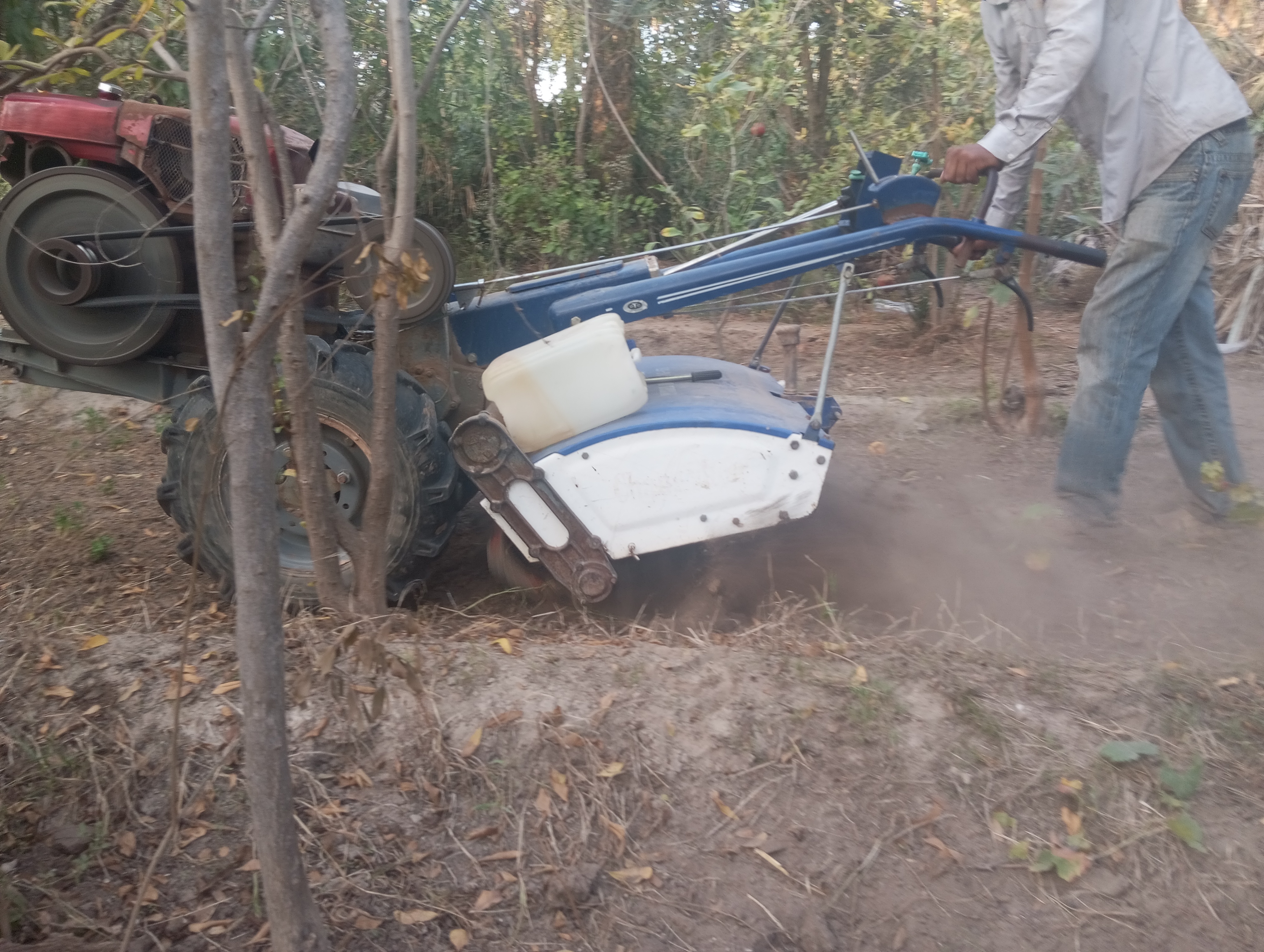
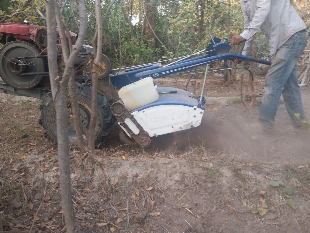
Shallow tillage involves disturbing the upper layer of soil without deep ploughing. It aims to provide a good seedbed, incorporate manure, control weeds, and enhance water infiltration while minimizing soil erosion and compaction. A machine tiller has recently replaced animal traction for this purpose.
2.2 Detailed description of the Technology
Description:
Shallow tillage (15-20cm deep) involves disturbing the upper layer of soil and avoids deep ploughing. It aims to provide a good seedbed, while incorporating manure, controlling weeds, and enhancing water infiltration. Soil erosion is minimised, compaction is reduced and because deeper layers are not disturbed, less soil organic matter is oxidised.
Shallow tillage - sometimes called “superficial” or “light” tillage – disturbs only the topsoil and brings several benefits. These include:
* Soil Structure Preservation: Maintains the underlying soil structure, reducing the risk of compaction and erosion.
* Moisture Conservation: Helps retain soil moisture by reducing evaporation from deeper layers.
* Reduced Erosion: Minimizes soil erosion by maintaining residues.
* Increased Microbial Activity: Promotes beneficial microbial activity in the topsoil, enhancing soil health.
* Nutrient Management: Allows for targeted application of fertilizers and amendments, as it primarily affects the upper soil layer.
* Time and Labour Efficiency: Generally, requires less time and fewer resources compared to deep tillage methods.
Smallholders in Gabes, South-East Tunisia practice shallow tillage and were interviewed to gain extra insights into this technology. They were welcoming and happy to share their knowledge while gaining information about enhancing their own production systems.
These smallholders farm in “The Oasis of Gabes” where there is a specific design of multi-storey agroforestry with trees, shrubs and vegetable crops. This requires specific agronomic practices. One of these practices is shallow tillage. A machine tiller has recently replaced animal traction for this purpose. They would prefer a no-till technique, however this would be more costly because it requires extra manure and soil cover by mulching or sand backfill. This may be possible for another category of farmers.
2.3 Photos of the Technology
General remarks regarding photos:
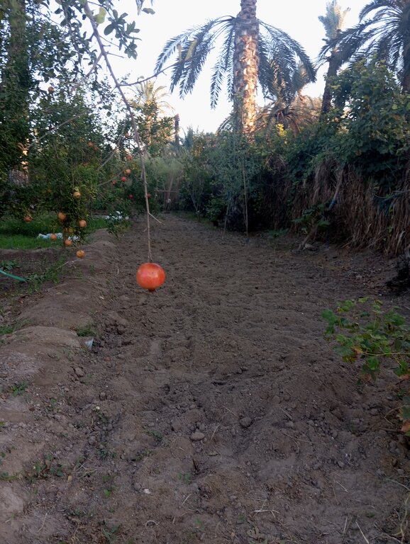
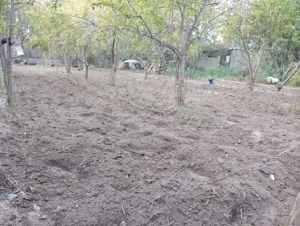
Photos show the state of the land freshly tilled and ready for autumn plantation
2.4 Videos of the Technology
Comments, short description:
In a very specific ecosystem in the world (Littoral oasis of Gabes), small-scale farmers are thriving to keep this unique countryside system and make profit from their lands. They are adapting sustainable small tillage technique in order to keep sustainably productive land. This video is showing a small cultivator that is lightly tilling the land in order to bury manure, eliminate weeds and prepare the land for plantation.
Date:
07/11/2024
Location:
Gabes (South east Tunisia)
Name of videographer:
Wiem Haouari
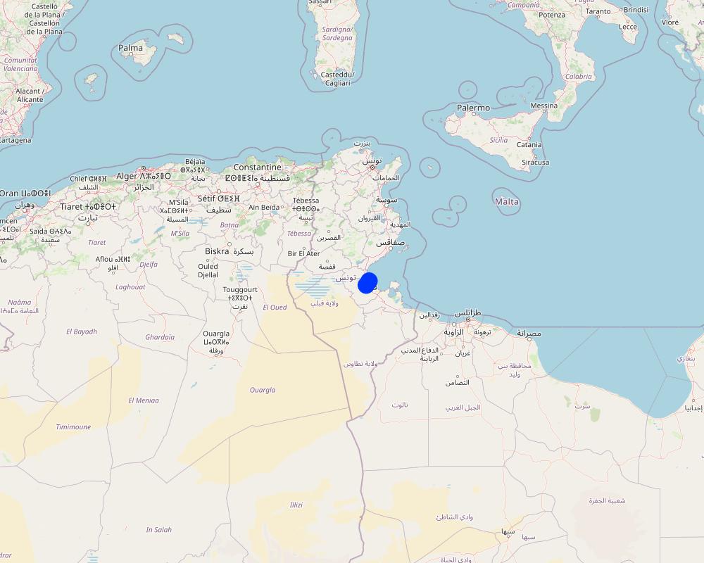
2.5 Country/ region/ locations where the Technology has been applied and which are covered by this assessment
Country:
Tunisia
Region/ State/ Province:
Gabes
Further specification of location:
Gabes
Specify the spread of the Technology:
- evenly spread over an area
If precise area is not known, indicate approximate area covered:
- < 0.1 km2 (10 ha)
Is/are the technology site(s) located in a permanently protected area?
No
Comments:
The technology is implemented in a very specific ecosystem (Littoral oasis Gabes), The interventions are really limited. Farmers are keeping traditional agricultural practices (irrigation by submersion for instance) in order to keep the typical cultivation of the oasis.
Map
×2.6 Date of implementation
If precise year is not known, indicate approximate date:
- more than 50 years ago (traditional)
2.7 Introduction of the Technology
Specify how the Technology was introduced:
- as part of a traditional system (> 50 years)
Comments (type of project, etc.):
This technique has been practiced for decades. What has changed are the tools used for tillage. For example, previously a tiller was pulled by a domestic animal (a cow, a horse, a donkey...etc.)
3. Classification of the SLM Technology
3.1 Main purpose(s) of the Technology
- improve production
- reduce, prevent, restore land degradation
- preserve/ improve biodiversity
- adapt to climate change/ extremes and its impacts
- create beneficial economic impact
3.2 Current land use type(s) where the Technology is applied
Land use mixed within the same land unit:
Yes
Specify mixed land use (crops/ grazing/ trees):
- Agro-pastoralism (incl. integrated crop-livestock)

Cropland
- Perennial (non-woody) cropping
- Tree and shrub cropping
Perennial (non-woody) cropping - Specify crops:
- medicinal, aromatic, pesticidal plants - perennial
- Lawsonia inermis (commonly named Henna)
Number of growing seasons per year:
- 2
Specify:
alfaalfa (medicago sativa) is a perennial cultivated in the Lands described
Is intercropping practiced?
Yes
If yes, specify which crops are intercropped:
barley-alfalafa
Is crop rotation practiced?
Yes
If yes, specify:
fabacae

Waterways, waterbodies, wetlands
Main products/ services:
Drainage, it is the main traditional canalisation to drain excessive irrigation water from the oasis.

Unproductive land
Specify:
Because of the raise of salinity amount ,lands are in degradation and many of them become unproductive
3.3 Has land use changed due to the implementation of the Technology?
Has land use changed due to the implementation of the Technology?
- No (Continue with question 3.4)

Cropland
3.4 Water supply
Water supply for the land on which the Technology is applied:
- mixed rainfed-irrigated
Comments:
There is a lack of water and risk of drought in the south eastern region. We are working with farmers on recovering rainwater .
3.5 SLM group to which the Technology belongs
- improved ground/ vegetation cover
- minimal soil disturbance
- integrated soil fertility management
3.6 SLM measures comprising the Technology

agronomic measures
- A1: Vegetation/ soil cover
- A2: Organic matter/ soil fertility
- A3: Soil surface treatment
A3: Differentiate tillage systems:
A 3.2: Reduced tillage (> 30% soil cover)
Comments:
Some farmers are using mulching for soil coverage and protection from weeds.
3.7 Main types of land degradation addressed by the Technology

soil erosion by water
- Wt: loss of topsoil/ surface erosion
- Wm: mass movements/ landslides

soil erosion by wind
- Et: loss of topsoil

chemical soil deterioration
- Cn: fertility decline and reduced organic matter content (not caused by erosion)
- Cp: soil pollution
- Cs: salinization/ alkalinization

physical soil deterioration
- Pc: compaction
- Ps: subsidence of organic soils, settling of soil

biological degradation
- Bc: reduction of vegetation cover
- Bh: loss of habitats
- Bl: loss of soil life

water degradation
- Ha: aridification
- Hs: change in quantity of surface water
- Hp: decline of surface water quality
Comments:
The studied lands are situated in Gabes, south east of Tunisia. The region is characterised by a semi arid climate, Soil is exposed to winds . We have to mention that the area is polluted compared to other regions in the country. This has badly affected the cropping systems and created an unbalanced ecological system. The polluted atmosphere has contributed to less rainfall.
3.8 Prevention, reduction, or restoration of land degradation
Specify the goal of the Technology with regard to land degradation:
- reduce land degradation
- adapt to land degradation
Comments:
The majority of farmers are looking for adaptation techniques. Climate change has created climatic aberrations such as a rise in temperature, a decrease of the minimum number of hours of cold that are necessary for dormancy of seeds and trees. By necessity, current agronomic practices of farmers have changed in order to improve the cropping system.
4. Technical specifications, implementation activities, inputs, and costs
4.1 Technical drawing of the Technology
Technical specifications (related to technical drawing):
The figure is showing the main components of the rotavator. It is the mechanised tool used by oasian farmers. This type of tillage is the only one adapted to oasian ecosystem and small spaces. The boarders of every cultivated interculture space is bordered by trees, shrubs or palm trees.
Author:
Wiem Haouari
Date:
17/10/2024
4.2 General information regarding the calculation of inputs and costs
Specify how costs and inputs were calculated:
- per Technology area
Indicate size and area unit:
are
If using a local area unit, indicate conversion factor to one hectare (e.g. 1 ha = 2.47 acres): 1 ha =:
1are = 100square meter
other/ national currency (specify):
TND
If relevant, indicate exchange rate from USD to local currency (e.g. 1 USD = 79.9 Brazilian Real): 1 USD =:
3.07
Indicate average wage cost of hired labour per day:
30-40
4.4 Costs and inputs needed for establishment
If you are unable to break down the costs in the table above, give an estimation of the total costs of establishing the Technology:
150.0
4.5 Maintenance/ recurrent activities
| Activity | Timing/ frequency | |
|---|---|---|
| 1. | Exposing the soil to the sun to kill pathogens | July-August |
| 2. | Keeping the soil dry and more stable | the mid final August |
| 3. | Contracting with labour and machinery | August |
| 4. | Making the minimum tillage (it depends on the surface) | September-October |
| 5. | Tillage | Twice a year |
4.6 Costs and inputs needed for maintenance/ recurrent activities (per year)
If you are unable to break down the costs in the table above, give an estimation of the total costs of maintaining the Technology:
350.0
4.7 Most important factors affecting the costs
Describe the most determinate factors affecting the costs:
The most important factors affecting the costs are: the need to keep more moisture in the soil, good aeration for roots, improvement of soil texture and increase in organic matter.
5. Natural and human environment
5.1 Climate
Annual rainfall
- < 250 mm
- 251-500 mm
- 501-750 mm
- 751-1,000 mm
- 1,001-1,500 mm
- 1,501-2,000 mm
- 2,001-3,000 mm
- 3,001-4,000 mm
- > 4,000 mm
Specify average annual rainfall (if known), in mm:
159.00
Specifications/ comments on rainfall:
Gabès has dry periods in January, February, March, April, May, June, July, August, September, November and December.
On average, October is the wettest month with 26 mm of precipitation.
On average, July is the driest month with 0 mm of precipitation.
A wet day is one with at least 0.04 inches of liquid or liquid-equivalent precipitation. The chance of wet days in Gabès varies throughout the year.
Indicate the name of the reference meteorological station considered:
Institut national de métérologie
Agro-climatic zone
- semi-arid
In Gabès, the summers are hot, muggy, arid, and clear and the winters are cool, dry, windy, and mostly clear. Over the course of the year, the temperature typically varies from 46°F to 91°F and is rarely below 40°F or above 99°F.
A wet day is one with at least 0.04 inches of liquid or liquid-equivalent precipitation. The chance of wet days in Gabès varies throughout the year.
5.2 Topography
Slopes on average:
- flat (0-2%)
- gentle (3-5%)
- moderate (6-10%)
- rolling (11-15%)
- hilly (16-30%)
- steep (31-60%)
- very steep (>60%)
Landforms:
- plateau/plains
- ridges
- mountain slopes
- hill slopes
- footslopes
- valley floors
Altitudinal zone:
- 0-100 m a.s.l.
- 101-500 m a.s.l.
- 501-1,000 m a.s.l.
- 1,001-1,500 m a.s.l.
- 1,501-2,000 m a.s.l.
- 2,001-2,500 m a.s.l.
- 2,501-3,000 m a.s.l.
- 3,001-4,000 m a.s.l.
- > 4,000 m a.s.l.
Indicate if the Technology is specifically applied in:
- not relevant
5.3 Soils
Soil depth on average:
- very shallow (0-20 cm)
- shallow (21-50 cm)
- moderately deep (51-80 cm)
- deep (81-120 cm)
- very deep (> 120 cm)
Soil texture (topsoil):
- coarse/ light (sandy)
Soil texture (> 20 cm below surface):
- coarse/ light (sandy)
Topsoil organic matter:
- medium (1-3%)
5.4 Water availability and quality
Ground water table:
5-50 m
Availability of surface water:
poor/ none
Water quality (untreated):
good drinking water
Water quality refers to:
surface water
Is water salinity a problem?
Yes
Specify:
The average of salinity water is 3.5-5.7 g/L
Is flooding of the area occurring?
No
5.5 Biodiversity
Species diversity:
- medium
Habitat diversity:
- medium
Comments and further specifications on biodiversity:
Referring to scientific studies and indicators used to measure biodiversity in the oasis, we find out that many species have migrated, become extinct or are threatened by extinction. This can be explained for several reasons such as: excessive urbanisation in rural areas and polluted ecosystem, etc.
5.6 Characteristics of land users applying the Technology
Sedentary or nomadic:
- Sedentary
Market orientation of production system:
- mixed (subsistence/ commercial)
Off-farm income:
- 10-50% of all income
Relative level of wealth:
- average
Individuals or groups:
- individual/ household
Level of mechanization:
- manual work
- animal traction
Gender:
- women
- men
Age of land users:
- youth
- middle-aged
- elderly
5.7 Average area of land used by land users applying the Technology
- < 0.5 ha
- 0.5-1 ha
- 1-2 ha
- 2-5 ha
- 5-15 ha
- 15-50 ha
- 50-100 ha
- 100-500 ha
- 500-1,000 ha
- 1,000-10,000 ha
- > 10,000 ha
Is this considered small-, medium- or large-scale (referring to local context)?
- small-scale
Comments:
Soil degradation has been accelerated by pollution, erosion and construction work. These actions disturb soil and leave it vulnerable to wind and water erosion. This has damaged land revenues and crop quality.
5.8 Land ownership, land use rights, and water use rights
Land ownership:
- individual, not titled
- individual, titled
Land use rights:
- communal (organized)
- individual
Water use rights:
- communal (organized)
Are land use rights based on a traditional legal system?
Yes
5.9 Access to services and infrastructure
health:
- poor
- moderate
- good
technical assistance:
- poor
- moderate
- good
employment (e.g. off-farm):
- poor
- moderate
- good
markets:
- poor
- moderate
- good
energy:
- poor
- moderate
- good
roads and transport:
- poor
- moderate
- good
drinking water and sanitation:
- poor
- moderate
- good
financial services:
- poor
- moderate
- good
6. Impacts and concluding statements
6.1 On-site impacts the Technology has shown
Socio-economic impacts
Production
crop production
Comments/ specify:
The farmer adopts rotation in crop systems, we can't then make a comparison for different yield of diffrent crops
crop quality
Comments/ specify:
Farmers notice less pest attacks and better sweetness in vegetable tasting.
fodder production
Comments/ specify:
Farmers noticed better revenues in producing the main fodder specie of the Oasis, namely alfafa (Medicago sativa).
fodder quality
Comments/ specify:
The leaves were developed generously and there was more concentration of chlorophyll in leaves. We assumed this to higher concentration of soil nitrogen and phosphorus held in the soil.
animal production
Comments/ specify:
As there is abundance of weed intercrops, animals are taking enough fodder from grazing.
Water availability and quality
water availability for livestock
Comments/ specify:
The technology doesn't have a direct impact on water availability for livestock
Socio-cultural impacts
food security/ self-sufficiency
Comments/ specify:
Better self supply and self sufficiency
land use/ water rights
Comments/ specify:
By constraint of water irrigation availabilitynthe technique has allowed the soil to maintain water for longer period than before.
cultural opportunities
Comments/ specify:
By using animal tillage, farmers have a myth that it is a sign of fortune for good agricultural season.
SLM/ land degradation knowledge
Comments/ specify:
Farmers need more direct contact with SLM specialists and agriculture engineers. The indicators mentioned before could be enhanced if combined by other synchronised measures.
Ecological impacts
Soil
soil moisture
Comments/ specify:
We noticed better retaining of water in the soil
soil cover
Comments/ specify:
Farmers are more aware about the importance of covered soil in order to avoid water and wind erosion.
soil loss
Comments/ specify:
By keeping the soil covered,soil loss has decreased.
soil accumulation
soil crusting/ sealing
Comments/ specify:
The intervention to make tillage is minimum and there is a recovery of the lost soil,that's why
6.2 Off-site impacts the Technology has shown
reliable and stable stream flows in dry season
Comments/ specify:
The management of water resource referring to water availability is assured by the groupement de développement agricole Gabes centre
6.3 Exposure and sensitivity of the Technology to gradual climate change and climate-related extremes/ disasters (as perceived by land users)
Gradual climate change
Gradual climate change
| Season | increase or decrease | How does the Technology cope with it? | |
|---|---|---|---|
| annual temperature | increase | moderately | |
| seasonal temperature | summer | increase | moderately |
| annual rainfall | decrease | moderately |
Climate-related extremes (disasters)
Meteorological disasters
| How does the Technology cope with it? | |
|---|---|
| tropical storm | not well |
| local sandstorm/ duststorm | moderately |
| local windstorm | well |
Climatological disasters
| How does the Technology cope with it? | |
|---|---|
| heatwave | not well |
| extreme winter conditions | not well at all |
| drought | well |
Biological disasters
| How does the Technology cope with it? | |
|---|---|
| epidemic diseases | well |
| insect/ worm infestation | well |
Other climate-related consequences
Other climate-related consequences
| How does the Technology cope with it? | |
|---|---|
| sea level rise | not known |
6.4 Cost-benefit analysis
How do the benefits compare with the establishment costs (from land users’ perspective)?
Short-term returns:
slightly positive
Long-term returns:
very positive
How do the benefits compare with the maintenance/ recurrent costs (from land users' perspective)?
Short-term returns:
slightly positive
Long-term returns:
very positive
6.5 Adoption of the Technology
- 11-50%
If available, quantify (no. of households and/ or area covered):
120
Of all those who have adopted the Technology, how many did so spontaneously, i.e. without receiving any material incentives/ payments?
- 51-90%
6.6 Adaptation
Has the Technology been modified recently to adapt to changing conditions?
Yes
If yes, indicate to which changing conditions it was adapted:
- climatic change/ extremes
Specify adaptation of the Technology (design, material/ species, etc.):
The technology was adapted through design and material - specifically the type of machine use for tillage.
6.7 Strengths/ advantages/ opportunities of the Technology
| Strengths/ advantages/ opportunities in the land user’s view |
|---|
| The technology has several virtues for Oasis ecosystem. Since it is a specific agriculture system, it requires constant interventions and various techniques. The technology allow farmers to care about their lands sustainably. |
| The technique is not costly affecting the farmer |
| The technique is adapted to the oasian ecosystem and the bioeconomy circumstances. |
| Strengths/ advantages/ opportunities in the compiler’s or other key resource person’s view |
|---|
| The technique is not costly. Agriculture costs affect the decision of farmers in this area |
| It is a revenue incoming for cultivator owners |
| The timing adapted by farmers to till is very important. The technique enhances the manure and incorporation of fallen leaves. This enhances the amount and stability of organic material in the soil. |
6.8 Weaknesses/ disadvantages/ risks of the Technology and ways of overcoming them
| Weaknesses/ disadvantages/ risks in the compiler’s or other key resource person’s view | How can they be overcome? |
|---|---|
| It is a limited technique because of small plots of land | expanding the cultivated area |
| it requires physical effort | encouraging precision mechanisation |
7. References and links
7.1 Methods/ sources of information
- field visits, field surveys
10 informants were interviewed (choice was based on availability and their openness to the survey)
- interviews with land users
5 land users (choice was based on availability and their openness to the survey)
- compilation from reports and other existing documentation
I referred to research studies and documents (4 documents). Specially to describe better the irrigation system .
When were the data compiled (in the field)?
21/08/2024
7.2 References to available publications
Title, author, year, ISBN:
https://www.laboasis.org/oasis-traditional-water-systems/
7.3 Links to relevant online information
Title/ description:
Les eaux de drainage de l'oasis de gabes
URL:
https://www.eyrolles.com/Litterature/Livre/les-eaux-de-drainage-de-l-oasis-de-gabes-9783841663160/
7.4 General comments
Le groupement de développement agricole oasis centre Gabes is encouraging these kind of initiatives in order to develop water and natural resource management for the benefit of small scale farmers. Thanks for his willingness to accept this initiative when I suggested it .Thanks to WOCAT and University of Bern for this insightful platform and distinguished team. It is such a pleasure to contribute to such a global initiative and present the method worldwide.
I have a remark. Farmers are more interactive when I interviewed them one to one in their lands. I suggest that WOCAT platform editors might give more columns to fill each farmers data so that the survey might be statistically be effective and correct.
Links and modules
Expand all Collapse allLinks
No links
Modules
No modules


