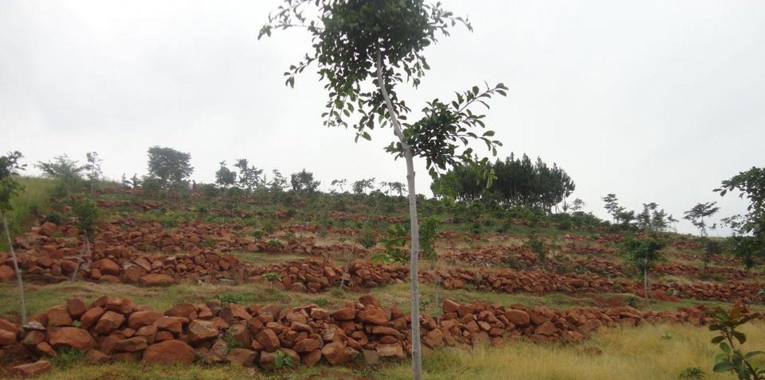
Stone lines established on a steep slope (upper section facing the Kagera River watershed) (Charles L Malingu (Kagera TAMP, Kabale))
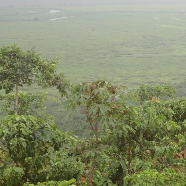
Most of the traditional cropland in Rakai District is fairly flat. However, there are many hectares of very steep, stony, wind-swept slopes facing the Kagera River Valley and Lake Victoria. These slopes have been degraded for a long time because when it rains the runoff is very fast and carries away soil and crops. The swampy Kagera river flood plains below the slopes are fertile because of the deposits of top soil carried from the slopes. Over the last 3 years, farmers have changed from the traditional farming practice where cultivation was done with little or no protection of soil and water movement on the steep slopes to using stone lines along a contour. The stone lines are arranged along the contour to act as a barrier that slows down the speed of water and soil, improve infiltration, mitigate land slides and trap sediment thereby reducing the extent of erosion.
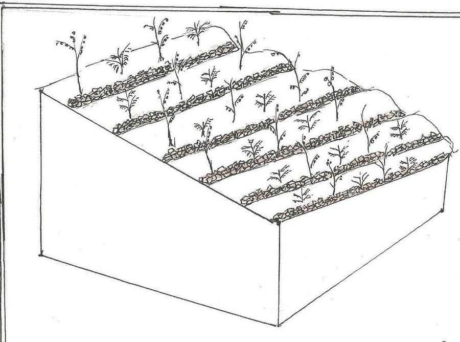
Purpose of the Technology: The technical objective of stone lines is to minimize water and soil movement down the slope and, over time, enable the building of a terrace from the accumulation of soil on the upper side of the barrier.
Establishment / maintenance activities and inputs: The stones are arranged along the contour, guided by a rope. The contour is determined using an A-Frame. The other tools required to establish stone lines are hand hoes, pick axes, and pangas. Establishment requires a lot of labor by which the following activities are accomplished: (i) stones exposed by decades of runoff on hillsides are dug up, collected and placed along contours in a field 200 m by 300 m. The width of each stone line is 0.4 m to 0.6 m and 0.5 m high. The length is dependent on the size of the field across the slope. The spacing from one line to another is 8 m to 12 m, depending on the steepness of the slope. (ii) The exposed sandy loam top soil is very dry and dusty even in the rainy season. Digging with hand hoes loosens the soil. (iii) Following the contour, circular pits of 0.45 m diameter and 0.3 m depth are dug 1.50 m apart, in the middle of every 2 stone lines. In these holes, robusta coffee seedlings are planted. (iv) Beans may be planted throughout the field as a cover crop. The farmer field school (FFS) approach is used because many farmers participate together in completing the establishment tasks. The stone lines are maintained by ensuring that stones which move off the main line are put back and the weeds which grow among the stones are removed to avoid competition with the main crops.
Natural / human environment: There is no known threat to stone lines once they have been established. The runoff cannot gather enough speed between the lines to sweep the stones away because of the short distance. The main offsite benefit is that sediment deposits and water runoff do not destroy crops in the valley below and the Kagera River is protected from silting.
Lieu: Rakai District, Uganda, Ouganda
Nbr de sites de la Technologie analysés:
Diffusion de la Technologie:
Dans des zones protégées en permanence ?:
Date de mise en oeuvre: il y a moins de 10 ans (récemment)
Type d'introduction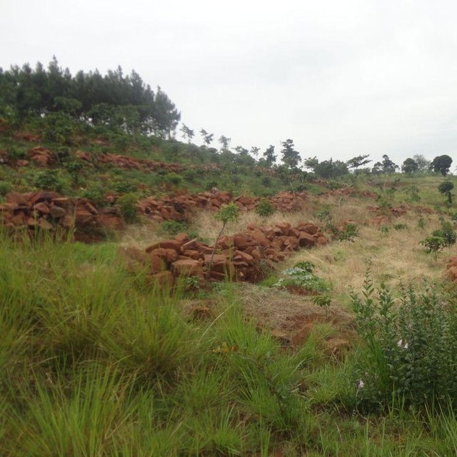


| Spécifiez les intrants | Unité | Quantité | Coûts par unité (UGX) | Coût total par intrant (UGX) | % des coût supporté par les exploitants des terres |
| Main d'œuvre | |||||
| Labour | ha | 1,0 | 1200,0 | 1200,0 | 100,0 |
| Equipements | |||||
| Tools | ha | 1,0 | 60,0 | 60,0 | 100,0 |
| Coût total de mise en place de la Technologie | 1'260.0 | ||||
| Coût total de mise en place de la Technologie en dollars américains (USD) | 0.5 | ||||
| Spécifiez les intrants | Unité | Quantité | Coûts par unité (UGX) | Coût total par intrant (UGX) | % des coût supporté par les exploitants des terres |
| Main d'œuvre | |||||
| Labour | ha | 1,0 | 120,0 | 120,0 | 100,0 |
| Coût total d'entretien de la Technologie | 120.0 | ||||
| Coût total d'entretien de la Technologie en dollars américains (USD) | 0.05 | ||||
The hard labor is a challenge to women and children who play a major role in cultivation
There is more arable land, reducing pressure on land and generally improving productivity.
May harbor weeds and crop pests


