traditional cut-off drain [Ethiopie]
- Création :
- Mise à jour :
- Compilateur : Sabina Erny
- Rédacteur : –
- Examinateur : Fabian Ottiger
boy (amharic), traditional ditch
technologies_1467 - Ethiopie
Voir les sections
Développer tout Réduire tout1. Informations générales
1.2 Coordonnées des personnes-ressources et des institutions impliquées dans l'évaluation et la documentation de la Technologie
Nom du ou des institutions qui ont facilité la documentation/ l'évaluation de la Technologie (si pertinent)
Department of Geography, University of Basel (Department of Geography, University of Basel) - Suisse1.3 Conditions relatives à l'utilisation par WOCAT des données documentées
Quand les données ont-elles été compilées (sur le terrain)?
05/09/2003
Le compilateur et la(les) personne(s) ressource(s) acceptent les conditions relatives à l'utilisation par WOCAT des données documentées:
Oui
2. Description de la Technologie de GDT
2.1 Courte description de la Technologie
Définition de la Technologie:
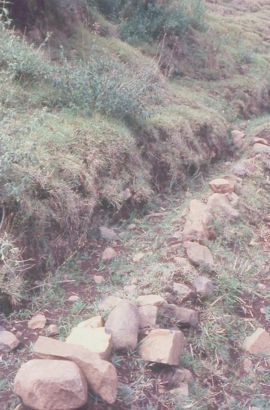
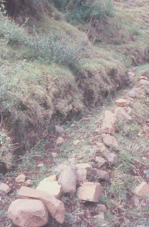
graded ditch out of soil and stones to protect the fields below from water runoff
2.2 Description détaillée de la Technologie
Description:
The ditch is digged into the steep land, into the soil. The lowert side is usually layn out with sontes to raise the soil wall and to stabilize the ditch so the water won't break through.
Purpose of the Technology: protect the field below from water runoff
Establishment / maintenance activities and inputs: by farmers on a individual basis, both establishment and maintenance is entirely up to the farmers.
Natural / human environment: steep, cultivated slope
2.3 Photos de la Technologie
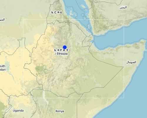
2.5 Pays/ région/ lieux où la Technologie a été appliquée et qui sont couverts par cette évaluation
Pays:
Ethiopie
Région/ Etat/ Province:
South Wello
Map
×2.6 Date de mise en œuvre de la Technologie
Si l'année précise est inconnue, indiquez la date approximative: :
- il y a plus de 50 ans (technologie traditionnelle)
2.7 Introduction de la Technologie
Spécifiez comment la Technologie a été introduite: :
- dans le cadre d'un système traditionnel (> 50 ans)
Commentaires (type de projet, etc.) :
it is local, indigenous
3. Classification de la Technologie de GDT
3.1 Principal(aux) objectif(s) de la Technologie
- protéger un bassin versant/ des zones situées en aval - en combinaison avec d'autres technologies
3.2 Type(s) actuel(s) d'utilisation des terres, là où la Technologie est appliquée

Terres cultivées
- Cultures annuelles
Commentaires:
Major land use problems (compiler’s opinion): erosion, decline of soil fertility and yield decline
other major SWC specialist: shortage of grazing land and of forage
Major land use problems (land users’ perception): erosion, runoff, drought, climate
Type of cropping system and major crops comments: barley/wheat/emmer wheat - beans or teff - maize - barley/wheat/emmer wheat - beans or teff - maize
3.3 Informations complémentaires sur l'utilisation des terres
Approvisionnement en eau des terres sur lesquelles est appliquée la Technologie:
- pluvial
Nombre de période de croissance par an: :
- 2
Précisez:
Longest growing period in days: 150 Longest growing period from month to month: Jul - Nov Second longest growing period in days: 150 Second longest growing period from month to month: Jan - May
3.4 Groupe de GDT auquel appartient la Technologie
- mesures en travers de la pente
3.5 Diffusion de la Technologie
Spécifiez la diffusion de la Technologie:
- répartie uniformément sur une zone
Si la Technologie est uniformément répartie sur une zone, indiquez la superficie couverte approximative:
- 0,1-1 km2
3.6 Mesures de GDT constituant la Technologie

structures physiques
- S3: Fossés étagés, canaux, voies d'eau
Commentaires:
Main measures: structural measures
3.7 Principaux types de dégradation des terres traités par la Technologie

érosion hydrique des sols
- Wt: perte de la couche superficielle des sols (couche arable)/ érosion de surface
Commentaires:
Main type of degradation addressed: Wt: loss of topsoil / surface erosion
4. Spécifications techniques, activités, intrants et coûts de mise en œuvre
4.1 Dessin technique de la Technologie
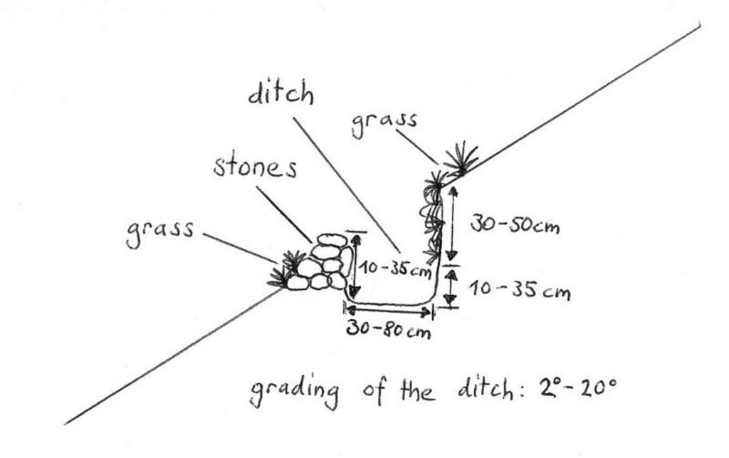
4.2 Spécification/ explications techniques du dessin technique
drawing showing a traditional ditch, Maybar, Ethiopia
Location: Maybar. Wello
Technical knowledge required for field staff / advisors: moderate
Technical knowledge required for land users: low
Main technical functions: control of dispersed runoff: retain / trap, control of dispersed runoff: impede / retard
Construction material (earth): the ditch is digged out and the earth is the used to build the walls a little bit higher and ist is
Construction material (stone): to lay out the earth wall on the lower side
Slope (which determines the spacing indicated above): 50%
Lateral gradient along the structure: 25%
4.4 Activités de mise en place/ d'établissement
| Activité | Type de mesures | Calendrier | |
|---|---|---|---|
| 1. | it grows itself | Végétale | |
| 2. | dig out the ditch | Structurel | |
| 3. | lay out the ditch with stones | Structurel |
4.6 Activités d'entretien/ récurrentes
| Activité | Type de mesures | Calendrier/ fréquence | |
|---|---|---|---|
| 1. | clean the ditch from sediments | Structurel | best before rain season/whenever needed, necessary |
| 2. | add new stones, maybe fix holes | Structurel | best before rain season/wheneever needed, necessar |
4.7 Coûts et intrants nécessaires aux activités d'entretien/ récurrentes (par an)
Commentaires:
the farmers do this themselves, it is part of their annual work
4.8 Facteurs les plus importants affectant les coûts
Décrivez les facteurs les plus importants affectant les coûts :
soil depth and soil type affects the time it takes to dig out the ditch
5. Environnement naturel et humain
5.1 Climat
Précipitations annuelles
- < 250 mm
- 251-500 mm
- 501-750 mm
- 751-1000 mm
- 1001-1500 mm
- 1501-2000 mm
- 2001-3000 mm
- 3001-4000 mm
- > 4000 mm
Spécifiez la pluviométrie moyenne annuelle (si connue), en mm:
1067,00
Zone agro-climatique
- subhumide
Moist dega
5.2 Topographie
Pentes moyennes:
- plat (0-2 %)
- faible (3-5%)
- modéré (6-10%)
- onduleux (11-15%)
- vallonné (16-30%)
- raide (31-60%)
- très raide (>60%)
Reliefs:
- plateaux/ plaines
- crêtes
- flancs/ pentes de montagne
- flancs/ pentes de colline
- piémonts/ glacis (bas de pente)
- fonds de vallée/bas-fonds
Zones altitudinales:
- 0-100 m
- 101-500 m
- 501-1000 m
- 1001-1500 m
- 1501-2000 m
- 2001-2500 m
- 2501-3000 m
- 3001-4000 m
- > 4000 m
Commentaires et précisions supplémentaires sur la topographie:
Landforms: Hill slopes (quite steep)
5.3 Sols
Profondeur moyenne du sol:
- très superficiel (0-20 cm)
- superficiel (21-50 cm)
- modérément profond (51-80 cm)
- profond (81-120 cm)
- très profond (>120 cm)
Texture du sol (de la couche arable):
- fin/ lourd (argile)
Matière organique de la couche arable:
- abondant (>3%)
- moyen (1-3%)
Si disponible, joignez une description complète du sol ou précisez les informations disponibles, par ex., type de sol, pH/ acidité du sol, capacité d'échange cationique, azote, salinité, etc.
Soil fertility: Medium (ranked 1) and low (ranked 2)
Soil drainage/infiltration: Medium
Soil water storage capacity: Low (ranked 1) and medium (ranked 2)
5.6 Caractéristiques des exploitants des terres appliquant la Technologie
Revenus hors exploitation:
- 10-50% de tous les revenus
Niveau relatif de richesse:
- riche
Niveau de mécanisation:
- travail manuel
- traction animale
Indiquez toute autre caractéristique pertinente des exploitants des terres:
Population density: 100-200 persons/km2
10% of the land users are rich and own 38% of the land (only rough estimates).
58% of the land users are average wealthy and own 36% of the land (only rough estimates).
32% of the land users are poor and own 26% of the land (only rough estimates).
Level of mechanization: Animal traction (ranked 1, ploughing with oxen) and manual work (ranked 2, hacking)
Off-farm income specification: farmers employ others for ploughing, so they can go to the market
5.8 Propriété foncière, droits d’utilisation des terres et de l'eau
Propriété foncière:
- état
- leased, individual
- leased, individual
6. Impacts et conclusions
6.4 Analyse coûts-bénéfices
Quels sont les bénéfices comparativement aux coûts de mise en place (du point de vue des exploitants des terres)?
Rentabilité à court terme:
légèrement négative
Rentabilité à long terme:
positive
Quels sont les bénéfices comparativement aux coûts d'entretien récurrents (du point de vue des exploitants des terres)?
Rentabilité à court terme:
légèrement positive
Rentabilité à long terme:
positive
6.5 Adoption de la Technologie
Si disponible, quantifiez (nombre de ménages et/ou superficie couverte):
200
Parmi tous ceux qui ont adopté la Technologie, combien d'entre eux l'ont fait spontanément, à savoir sans recevoir aucune incitation matérielle ou aucun paiement?
- 90-100%
Commentaires:
Comments on acceptance with external material support: survey results
100% of land user families have adopted the Technology without any external material support
200 land user families have adopted the Technology without any external material support
Comments on spontaneous adoption: survey results
There is no trend towards spontaneous adoption of the Technology
Comments on adoption trend: the ditches are the same; the farmers still build them the same way.
7. Références et liens
7.2 Références des publications disponibles
Titre, auteur, année, ISBN:
Biological soil conservation techniques for Maybar area, Ethiopia. Kassaye Goshu. 1997.
Disponible à partir d'où? Coût?
CDE, Bern
Titre, auteur, année, ISBN:
Classification of the Environment Conditions. H.-J. Krüger. 2003.
Disponible à partir d'où? Coût?
CDE, Bern
Titre, auteur, année, ISBN:
Area of Maybar, Wello, Ethiopia: Long-term Monitoring of the Agricultural Environment 1981-1994
Disponible à partir d'où? Coût?
CDE, Bern
Titre, auteur, année, ISBN:
The Use, Maintenance and Development of Soil and Water Conservation Measures by Small-Scale Farming Householfs in Different Agro-Climatic Zones of Northern Shewa and Southern Wello, Ethiopia.Yohannes Gebre Michael. 1999.
Disponible à partir d'où? Coût?
CDE, Bern
Liens et modules
Développer tout Réduire toutLiens
Aucun lien
Modules
Aucun module trouvé


