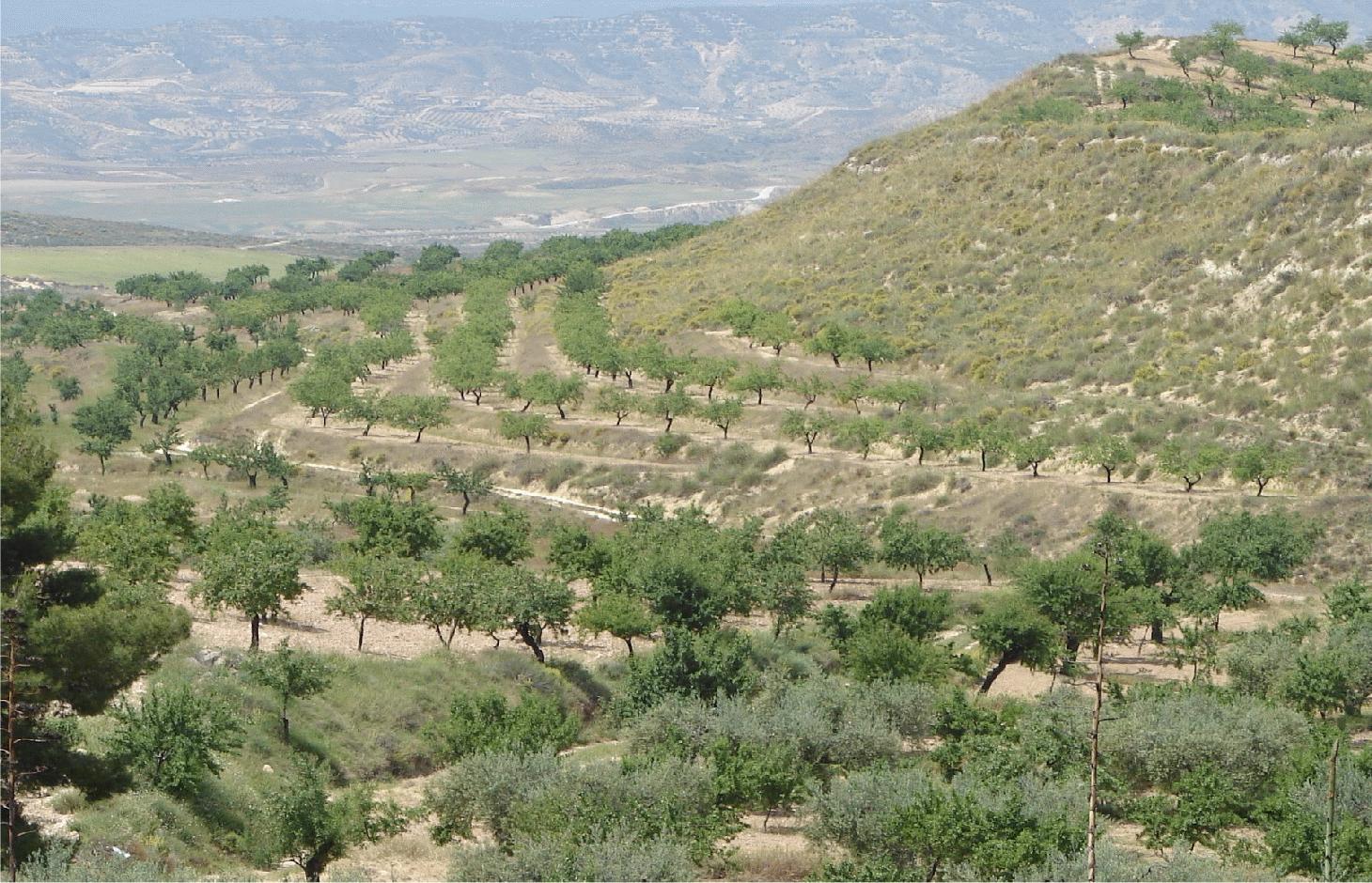
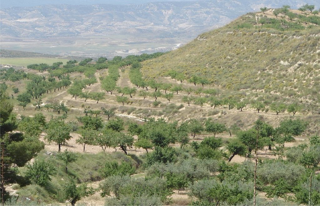
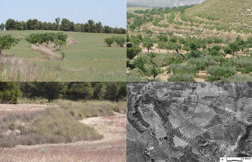
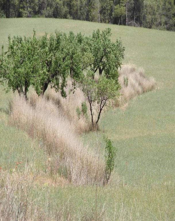
Vegetated earth-banked terraces [Espagne]
- Création :
- Mise à jour :
- Compilateur : Joris De Vente
- Rédacteur : –
- Examinateur : Fabian Ottiger
Terrazas de tierra vegetadas (Spanish)
technologies_1516 - Espagne
Voir les sections
Développer tout Réduire tout1. Informations générales
1.2 Coordonnées des personnes-ressources et des institutions impliquées dans l'évaluation et la documentation de la Technologie
Spécialiste GDT:
Spécialiste GDT:
López Carratala Jorge
+34.950.281045
carratala@cebas.csic.es
Consejo Superior de Investigaciones Científicas, Estación Experimental de Zonas Áridas (EEZA-CSIC)
General Segura 1, 04001; Almeria; Spain
Espagne
Nom du ou des institutions qui ont facilité la documentation/ l'évaluation de la Technologie (si pertinent)
EEZA-CSIC (EEZA-CSIC) - Espagne1.3 Conditions relatives à l'utilisation par WOCAT des données documentées
Quand les données ont-elles été compilées (sur le terrain)?
05/04/2011
Le compilateur et la(les) personne(s) ressource(s) acceptent les conditions relatives à l'utilisation par WOCAT des données documentées:
Oui
2. Description de la Technologie de GDT
2.1 Courte description de la Technologie
Définition de la Technologie:
Earth-banked terraces in cereal and almond cropland covered with drought-resistant shrubs.
2.2 Description détaillée de la Technologie
Description:
Earth-banked terraces are constructed by carefully removing a superficial soil layer (~10-20 cm) from one part of a field, concentrating it on the lower end of that field in order to reduce slope gradient and length. Another terrace is created directly downslope to form a cascade of terraces. Terrace risers have to be of restricted height (~50-150 cm) to prevent steep and unstable terraces. Stones from the fields can be used to reinforce the terrace ridge. After terrace construction, fields should be gently sloping (<3%) in the direction of the main slope. The distance between terraces must be enough to allow tractor movement during normal cultivation activities and it depends also on the slope gradient. The steeper the slope, the shorter is the distance between terraces. Terraces reduce the formation of gullies and retain water from upslope. The terraces are made with locally available machinery (tractor, small bulldozer). The terrace ridges are optimal locations to plant olives, almonds or fruit trees. Moreover, to be most effective, the terrace ridges are vegetated with shrubs adapted to semi-arid conditions and with a good surface cover (>~30%) throughout the year (e.g. Stipa tenacisima, Rosmarinus officinalis, Thymus vulgaris, Ulex parviflorus, Rhamnus lycioides, Pistacia lentiscus). Natural regeneration of vegetation is allowed without limitation on the terrace ridges, so no herbicide application or burning are carried out to remove weeds. Where possible, regeneration should be stimulated by planting the same adapted species in at least 25% of the terrace ridge. Optionally, in the other 75% of the terrace ridge, cereals or other leguminous species can be sown, but should not be harvested or used for grazing.
Purpose of the Technology: This technology reduces flooding, damage to infrastructure and siltation of water reservoirs, while maintaining (or slightly increasing) crop productivity. This is achieved by reducing runoff, soil erosion and hydraulic connectivity through a decreased slope gradient and an increased vegetation cover. The terrace ridge functions as a sink for runoff within fields and reduces runoff velocity. The vegetation leads to increased soil organic matter content below plants, producing an improved soil structure and a higher infiltration capacity. The use of stones from the fields to reinforce the terraces is optional, but facilitates crop production in the fields and makes the ridges more resistant to higher runoff velocities. The technology requires an initial investment in the construction of the terraces. Terraces can best be located on thalwegs and on areas where gully formation is often observed. Maintenance consists of filling up possible bank gullies developed in the terraces after important rainfall events and, if needed, substitute decayed shrubs with new ones.
Natural / human environment: The technology is generally applied on soils of shallow to medium depth (20 – 60 cm), and slopes are gentle to moderate (5-15%). The climate is semi-arid with a mean annual rainfall around 300 mm. Droughts, peaking in summer commonly last for more than 4-5 months. Annual potential evapotranspiration rates larger than 1000 mm are common. The production system is highly mechanized and market-oriented but depends strongly on agricultural subsidies. All cropland is privately-owned.
2.3 Photos de la Technologie
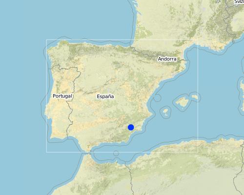
2.5 Pays/ région/ lieux où la Technologie a été appliquée et qui sont couverts par cette évaluation
Pays:
Espagne
Région/ Etat/ Province:
Murcia
Autres spécifications du lieu:
Guadalentin catchment
Map
×2.6 Date de mise en œuvre de la Technologie
Si l'année précise est inconnue, indiquez la date approximative: :
- il y a plus de 50 ans (technologie traditionnelle)
2.7 Introduction de la Technologie
Spécifiez comment la Technologie a été introduite: :
- dans le cadre d'un système traditionnel (> 50 ans)
Commentaires (type de projet, etc.) :
Most of the earthen terraces are already much older than 50 years. Recently, the regional administration is promoting clearly defined vegetated strips with minimum dimensions in order to apply for subsidies.
3. Classification de la Technologie de GDT
3.2 Type(s) actuel(s) d'utilisation des terres, là où la Technologie est appliquée

Terres cultivées
- Cultures annuelles

Mixte (cultures/ pâturages/ arbres), incluant l'agroforesterie
- Agroforesterie
Commentaires:
Major land use problems (compiler’s opinion): A lack of water availability seriously limits the production potential of the soil and results in a low vegetation/crop cover. The relatively high soil erosion rates cause various off-site related problems (i.e. flooding, reservoir siltation) and on-site problems (i.e. gully formation and loss of soil depth).
Major land use problems (land users’ perception): Lack of water for irrigation of crops limiting the crop types that can be planted as well as the crop yield of dryland farming.
3.3 Informations complémentaires sur l'utilisation des terres
Nombre de période de croissance par an: :
- 1
Précisez:
Longest growing period in days: 220Longest growing period from month to month: November to June
3.4 Groupe de GDT auquel appartient la Technologie
- Amélioration de la couverture végétale/ du sol
- mesures en travers de la pente
3.5 Diffusion de la Technologie
Spécifiez la diffusion de la Technologie:
- répartie uniformément sur une zone
Si la Technologie est uniformément répartie sur une zone, indiquez la superficie couverte approximative:
- 10-100 km2
Commentaires:
The exact area is not known, but the technology is widely applied throughout the province of Murcia and the district of the upper Guadalentin.
3.6 Mesures de GDT constituant la Technologie

pratiques végétales
- V1: Couverture d’arbres et d’arbustes
- V2: Herbes et plantes herbacées pérennes

structures physiques
- S1: Terrasses
Commentaires:
Main measures: vegetative measures, structural measures
Type of vegetative measures: aligned: -contour
3.7 Principaux types de dégradation des terres traités par la Technologie

érosion hydrique des sols
- Wt: perte de la couche superficielle des sols (couche arable)/ érosion de surface
- Wg: ravinement/ érosion en ravines
- Wo: effets hors-site de la dégradation

dégradation hydrique
- Ha: aridification
Commentaires:
Main type of degradation addressed: Wt: loss of topsoil / surface erosion, Wg: gully erosion / gullying, Wo: offsite degradation effects
Secondary types of degradation addressed: Ha: aridification
Main causes of degradation: crop management (annual, perennial, tree/shrub) (Almond and cereal fields often have a relatively low surface cover by vegetation during long periods of the year, leaving the soil unprotected against raindrop impact and rill or gully formation), disturbance of water cycle (infiltration / runoff) (Reduced infiltration capacity causing runoff and soil erosion), other human induced causes (specify) (Cropping of relatively steep slopes sensitive to erosion because of slope gradient), governance / institutional (spatial planning of land use results in formation of too large fields without field boundaries)
Secondary causes of degradation: Heavy / extreme rainfall (intensity/amounts) (High intensity erosive rainfall is common), droughts (Dry periods and dry years require higher water availability)
3.8 Prévention, réduction de la dégradation ou réhabilitation des terres dégradées
Spécifiez l'objectif de la Technologie au regard de la dégradation des terres:
- prévenir la dégradation des terres
- réduire la dégradation des terres
Commentaires:
Main goals: prevention of land degradation, mitigation / reduction of land degradation
4. Spécifications techniques, activités, intrants et coûts de mise en œuvre
4.1 Dessin technique de la Technologie
4.2 Spécification/ explications techniques du dessin technique
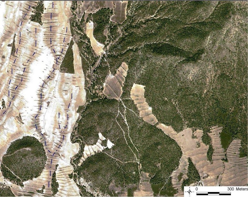
Quickbird satellite image showing the concentration of terraces along natural drainage lines (thalwegs) where runoff concentrates. Drainage lines are indicated with dotted lines.
Location: Torrealvillla. Murcia
Date: Satellite image 2003
Technical knowledge required for field staff / advisors: moderate (Design of the terraces and selection of the location requires some technical knowledge.)
Technical knowledge required for land users: low (Practical implementation of the terraces does not require a high level of knowledge)
Main technical functions: control of dispersed runoff: retain / trap, control of dispersed runoff: impede / retard, control of concentrated runoff: retain / trap, control of concentrated runoff: impede / retard, reduction of slope angle, increase of infiltration, increase / maintain water stored in soil
Secondary technical functions: reduction of slope length, improvement of ground cover, stabilisation of soil (eg by tree roots against land slides), increase in organic matter, water harvesting / increase water supply, sediment retention / trapping, sediment harvesting, spatial arrangement and diversification of land use
Aligned: -contour
Vegetative material: F : fruit trees / shrubs
Number of plants per (ha): 42
Vertical interval between rows / strips / blocks (m): 1
Spacing between rows / strips / blocks (m): 30-100
Vertical interval within rows / strips / blocks (m): 0.5-7
Width within rows / strips / blocks (m): 2
Vegetative measure: alligned: contour
Vegetative material: G : grass
Number of plants per (ha): >30% cover
Vertical interval between rows / strips / blocks (m): 1
Spacing between rows / strips / blocks (m): 30-100
Vertical interval within rows / strips / blocks (m): 0.5
Width within rows / strips / blocks (m): 2
Vegetative measure: Vegetative material: G : grass
Vegetative measure: Vegetative material: G : grass
Vegetative measure: Vegetative material: G : grass
Fruit trees / shrubs species: natural regeneration of shrubs with possible additional plantation of almond trees and/or woody shru
Grass species: Natural regeneration assisted by seeding of legiminous species and cereals
Slope (which determines the spacing indicated above): 10.00%
Terrace: forward sloping
Vertical interval between structures (m): 1
Spacing between structures (m): 30-100
Height of bunds/banks/others (m): 0.5-1.5
Width of bunds/banks/others (m): 2
Length of bunds/banks/others (m): 50-200
Construction material (stone): Only when many stones are present in the fields
Slope (which determines the spacing indicated above): 5-15%
If the original slope has changed as a result of the Technology, the slope today is: <3%
Lateral gradient along the structure: 0%
Vegetation is used for stabilisation of structures.
4.3 Informations générales sur le calcul des intrants et des coûts
autre/ monnaie nationale (précisez):
EURO
Indiquer le taux de change du dollars en monnaie locale (si pertinent): 1 USD= :
0,63
Indiquez le coût salarial moyen de la main d'œuvre par jour:
79.00
4.4 Activités de mise en place/ d'établissement
| Activité | Type de mesures | Calendrier | |
|---|---|---|---|
| 1. | Plantation of shrubs and cereals or Leguminous species (optional) | Végétale | Autumn - winter |
| 2. | Construction of terraces | Structurel | autumn or winter |
4.5 Coûts et intrants nécessaires à la mise en place
| Spécifiez les intrants | Unité | Quantité | Coûts par unité | Coût total par intrant | % des coût supporté par les exploitants des terres | |
|---|---|---|---|---|---|---|
| Main d'œuvre | Labour | ha | 1,0 | 270,0 | 270,0 | 10,0 |
| Equipements | Machine use | ha | 1,0 | 428,0 | 428,0 | 12,0 |
| Matériel végétal | shrub seedlings and seeds | ha | 1,0 | 218,0 | 218,0 | 10,0 |
| Coût total de mise en place de la Technologie | 916,0 | |||||
Commentaires:
Duration of establishment phase: 12 month(s)
4.6 Activités d'entretien/ récurrentes
| Activité | Type de mesures | Calendrier/ fréquence | |
|---|---|---|---|
| 1. | Replace died shrubs (optional) | Végétale | autumn-winter |
| 2. | Filling up bank gullies in terraces | Structurel | twice a year or after heavy rainstorms |
4.7 Coûts et intrants nécessaires aux activités d'entretien/ récurrentes (par an)
| Spécifiez les intrants | Unité | Quantité | Coûts par unité | Coût total par intrant | % des coût supporté par les exploitants des terres | |
|---|---|---|---|---|---|---|
| Main d'œuvre | Labour | ha | 1,0 | 28,0 | 28,0 | 10,0 |
| Equipements | Machine use | ha | 1,0 | 24,0 | 24,0 | 10,0 |
| Matériel végétal | Shrub seedlings and seeds | ha | 1,0 | 22,0 | 22,0 | 10,0 |
| Coût total d'entretien de la Technologie | 74,0 | |||||
Commentaires:
Machinery/ tools: For initial construction a large tractor or small bulldozer is required. For maintanance a normal tractor can be used.
The costs were indicated assuming a distance between terraces of 50 meter, meaning two terraces of 100 meter long per hectare. Prices are for spring 2008. Subsidies are foreseen for the installation of the vegetated terraces and for maintenance during at least 4 years if all requirements are fullfilled that are described in the regional development programme.
4.8 Facteurs les plus importants affectant les coûts
Décrivez les facteurs les plus importants affectant les coûts :
Price of fuel and labour are the most important determinants of the costs.
5. Environnement naturel et humain
5.1 Climat
Précipitations annuelles
- < 250 mm
- 251-500 mm
- 501-750 mm
- 751-1000 mm
- 1001-1500 mm
- 1501-2000 mm
- 2001-3000 mm
- 3001-4000 mm
- > 4000 mm
Spécifiez la pluviométrie moyenne annuelle (si connue), en mm:
300,00
Spécifications/ commentaires sur les précipitations:
Dry period in summer during 3-4 months (June – August/September)
Zone agro-climatique
- semi-aride
Thermal climate class: subtropics
Thermal climate class: temperate. The higher parts are generally somewhat colder
5.2 Topographie
Pentes moyennes:
- plat (0-2 %)
- faible (3-5%)
- modéré (6-10%)
- onduleux (11-15%)
- vallonné (16-30%)
- raide (31-60%)
- très raide (>60%)
Reliefs:
- plateaux/ plaines
- crêtes
- flancs/ pentes de montagne
- flancs/ pentes de colline
- piémonts/ glacis (bas de pente)
- fonds de vallée/bas-fonds
Zones altitudinales:
- 0-100 m
- 101-500 m
- 501-1000 m
- 1001-1500 m
- 1501-2000 m
- 2001-2500 m
- 2501-3000 m
- 3001-4000 m
- > 4000 m
Indiquez si la Technologie est spécifiquement appliquée dans des:
- situations concaves
Commentaires et précisions supplémentaires sur la topographie:
Landforms: Hill slopes-footslopes (mostly on concave slope segments)
5.3 Sols
Profondeur moyenne du sol:
- très superficiel (0-20 cm)
- superficiel (21-50 cm)
- modérément profond (51-80 cm)
- profond (81-120 cm)
- très profond (>120 cm)
Texture du sol (de la couche arable):
- moyen (limoneux)
- fin/ lourd (argile)
Matière organique de la couche arable:
- moyen (1-3%)
- faible (<1%)
5.4 Disponibilité et qualité de l'eau
Profondeur estimée de l’eau dans le sol:
5-50 m
Disponibilité de l’eau de surface:
faible/ absente
Qualité de l’eau (non traitée):
uniquement pour usage agricole (irrigation)
Commentaires et précisions supplémentaires sur la qualité et la quantité d'eau:
Ground water table: >50m (There is a lowering of groundwater table due to overexploitation for irrigation purposes)
Availability of surface water: Poor/none (excess: sporadically there are flash floods during extreme rainfall events)
Water quality (untreated): For agricultural use only (irrigation) (groundwater)
5.5 Biodiversité
Diversité des espèces:
- faible
5.6 Caractéristiques des exploitants des terres appliquant la Technologie
Revenus hors exploitation:
- > 50% de tous les revenus
Niveau relatif de richesse:
- moyen
Individus ou groupes:
- individu/ ménage
Genre:
- hommes
Indiquez toute autre caractéristique pertinente des exploitants des terres:
Land users applying the Technology are mainly common / average land users
Difference in the involvement of women and men: Traditionally most agriculture is done by men in this region.
Population density: 10-50 persons/km2
Annual population growth: < 0.5%
15% of the land users are rich and own 20% of the land.
80% of the land users are average wealthy and own 75% of the land.
5% of the land users are poor and own 5% of the land.
Off-farm income specification: There is no difference in the ones who apply the technology and those who don’t. Most farmers do have an off-farm income for example from hunting, work in a factory, or office.
5.7 Superficie moyenne des terres détenues ou louées par les exploitants appliquant la Technologie
- < 0,5 ha
- 0,5-1 ha
- 1-2 ha
- 2-5 ha
- 5-15 ha
- 15-50 ha
- 50-100 ha
- 100-500 ha
- 500-1 000 ha
- 1 000-10 000 ha
- > 10 000 ha
Cette superficie est-elle considérée comme de petite, moyenne ou grande dimension (en se référant au contexte local)?
- moyenne dimension
5.8 Propriété foncière, droits d’utilisation des terres et de l'eau
Propriété foncière:
- individu, avec titre de propriété
Droits d’utilisation des terres:
- individuel
Droits d’utilisation de l’eau:
- individuel
Commentaires:
All cropland is privately owned. Some shrubland or forest is state property. Water use is organised by permits to water extraction from aquifers on individual basis. Water rights are provided and controlled by the Water authority of the Segura river basin (CHS).
5.9 Accès aux services et aux infrastructures
santé:
- pauvre
- modéré
- bonne
éducation:
- pauvre
- modéré
- bonne
assistance technique:
- pauvre
- modéré
- bonne
emploi (par ex. hors exploitation):
- pauvre
- modéré
- bonne
marchés:
- pauvre
- modéré
- bonne
énergie:
- pauvre
- modéré
- bonne
routes et transports:
- pauvre
- modéré
- bonne
eau potable et assainissement:
- pauvre
- modéré
- bonne
services financiers:
- pauvre
- modéré
- bonne
6. Impacts et conclusions
6.1 Impacts sur site que la Technologie a montrés
Impacts socio-économiques
Production
production agricole
Commentaires/ spécifiez:
Depending on local conditions yield may be the same or increase slightly
gestion des terres
Commentaires/ spécifiez:
Field paths become shorter, so more tractor movement is required (not more kilometres!)
Revenus et coûts
dépenses pour les intrants agricoles
Commentaires/ spécifiez:
Implementation of terraces is considered relatively expensive
revenus agricoles
Commentaires/ spécifiez:
Depends on crop yield.
charge de travail
Commentaires/ spécifiez:
Less damage to fields due to less gully formation
Impacts socioculturels
connaissances sur la GDT/ dégradation des terres
apaisement des conflits
Commentaires/ spécifiez:
Less damage to neighbours fields by gullies and flooding
Improved livelihoods and human well-being
Commentaires/ spécifiez:
There is less damage to fields and to infrastructure due to gully formation and flooding.
Impacts écologiques
Cycle de l'eau/ ruissellement
récolte/ collecte de l'eau
Commentaires/ spécifiez:
On the long term higher infiltration capacity of the soil
ruissellement de surface
nappes phréatiques/ aquifères
Sols
humidité du sol
couverture du sol
Commentaires/ spécifiez:
Vegetation on the terraces increases vegetation cover
perte en sol
matière organique du sol/ au dessous du sol C
Commentaires/ spécifiez:
Provided by the vegetation on the terraces
Biodiversité: végétale, animale
biomasse/ au dessus du sol C
Commentaires/ spécifiez:
Provided by the vegetation on the terraces
diversité végétale
diversité animale
Commentaires/ spécifiez:
Terraces provide corridors connecting fields and provide shelter
espèces bénéfiques
diversité des habitats
6.2 Impacts hors site que la Technologie a montrés
inondations en aval
envasement en aval
capacité tampon/de filtration
dommages sur les champs voisins
dommages sur les infrastructures publiques/ privées
6.3 Exposition et sensibilité de la Technologie aux changements progressifs et aux évènements extrêmes/catastrophes liés au climat (telles que perçues par les exploitants des terres)
Changements climatiques progressifs
Changements climatiques progressifs
| Saison | Type de changements/ extrêmes climatiques | Comment la Technologie fait-elle face à cela? | |
|---|---|---|---|
| températures annuelles | augmente | pas bien |
Commentaires:
The crop type is sensitive to changes in water availability under the semi arid conditions
6.4 Analyse coûts-bénéfices
Quels sont les bénéfices comparativement aux coûts de mise en place (du point de vue des exploitants des terres)?
Rentabilité à court terme:
négative
Rentabilité à long terme:
neutre / équilibrée
Quels sont les bénéfices comparativement aux coûts d'entretien récurrents (du point de vue des exploitants des terres)?
Rentabilité à court terme:
neutre / équilibrée
Rentabilité à long terme:
légèrement positive
Commentaires:
Implementation of the terraces is relatively expensive. Additionally planting of shrubs is also relatively expensive and requires a subsidy. Once installed, maintenance is not expensive and pays off because of less damage to fields and infrastructure.
6.5 Adoption de la Technologie
Parmi tous ceux qui ont adopté la Technologie, combien d'entre eux l'ont fait spontanément, à savoir sans recevoir aucune incitation matérielle ou aucun paiement?
- 10-50%
Commentaires:
80% of land user families have adopted the Technology with external material support
Comments on acceptance with external material support: Terraces are traditionally widespread in the region. Most of them were installed without external support. Nowadays there are subsidies for construction and maintenance of vegetated strips and terraces.
20% of land user families have adopted the Technology without any external material support
There is no trend towards spontaneous adoption of the Technology
Comments on adoption trend: There is acceptance, but it is not growing. In some parts terraces are removed to make larger fields, and some new ones are also constructed. Recently installed subsidies may change this
6.7 Points forts/ avantages/ possibilités de la Technologie
| Points forts/ avantages/ possibilités du point de vue de l'exploitant des terres |
|---|
|
The terraces prevent gully formation and damage to the fields and to their neighbours How can they be sustained / enhanced? maintenance is needed and should be promoted. |
| Points forts/ avantages/ possibilités du point de vue du compilateur ou d'une autre personne ressource clé |
|---|
|
This technology is very effective at reducing surface runoff and erosion by reducing slope gradients and connectivity. In addition, it has a water harvesting effect. So it reduces on-site and off-site erosion problems and potentially increases water retention in the fields. How can they be sustained / enhanced? The technology can be enhanced by providing more info and publicity so that existing terraces are maintained. |
6.8 Faiblesses/ inconvénients/ risques de la Technologie et moyens de les surmonter
| Faiblesses/ inconvénients/ risques du point de vue de l’exploitant des terres | Comment peuvent-ils être surmontés? |
|---|---|
| It is considered relatively expensive to implement and particularly the optional planting of woody species is considered complicated in dry years | Subsidies for terrace construction and planting of woody species as well as cooperation between farmers to reduce costs of maintenance when subsidies stop. |
| Faiblesses/ inconvénients/ risques du point de vue du compilateur ou d'une autre personne ressource clé | Comment peuvent-ils être surmontés? |
|---|---|
| The technology does not significantly improve farm income and has a significant implementation cost. | Provide information on all the advantages that include many costs for society (including floods, reservoir siltation etc.). The subsidy for implementation already solves the problem of implementation costs. |
7. Références et liens
7.2 Références des publications disponibles
Titre, auteur, année, ISBN:
Garcia-Fayos, P. and Gasque, M., 2002. Consequences of a severe drought on spatial patterns of woody plants in a two-phase mosaic steppe of Stipa tenacissima L. Journal of Arid Environments, 52(2): 199-208.
Disponible à partir d'où? Coût?
internet
Titre, auteur, année, ISBN:
Hooke, J.M., 2006. Human impacts on fluvial systems in the Mediterranean region. Geomorphology, 79(3-4): 311-335.
Disponible à partir d'où? Coût?
internet
Titre, auteur, année, ISBN:
Kirkby, M.J., Bracken, L.J. and Shannon, J., 2005. The influence of rainfall distribution and morphological factors on runoff delivery from dryland catchments in SE Spain. CATENA, 62(2-3): 136-156.
Disponible à partir d'où? Coût?
internet
7.3 Liens vers les informations pertinentes disponibles en ligne
Titre/ description:
CARM 2008. Programa de Desarrollo Rural de la Región de Murcia 2007-2013 Tomo I. 508pp
URL:
http://www.carm.es/neweb2/servlet/integra.servlets.ControlPublico?IDCONTENIDO=4689&IDTIPO=100&RASTRO=c431$m1219
Liens et modules
Développer tout Réduire toutLiens
Aucun lien
Modules
Aucun module trouvé


