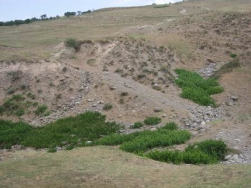
Degraded communal pasture Chukurak [Tadjikistan]
- Création :
- Mise à jour :
- Compilateur : Malgorzata Conder
- Rédacteur : –
- Examinateur : Fabian Ottiger
technologies_1548 - Tadjikistan
Voir les sections
Développer tout Réduire tout1. Informations générales
1.2 Coordonnées des personnes-ressources et des institutions impliquées dans l'évaluation et la documentation de la Technologie
Nom du ou des institutions qui ont facilité la documentation/ l'évaluation de la Technologie (si pertinent)
NCCR North-South (NCCR North-South) - KirghizistanNom du ou des institutions qui ont facilité la documentation/ l'évaluation de la Technologie (si pertinent)
CDE Centre for Development and Environment (CDE Centre for Development and Environment) - Suisse1.3 Conditions relatives à l'utilisation par WOCAT des données documentées
Quand les données ont-elles été compilées (sur le terrain)?
27/07/2012
Le compilateur et la(les) personne(s) ressource(s) acceptent les conditions relatives à l'utilisation par WOCAT des données documentées:
Oui
2. Description de la Technologie de GDT
2.1 Courte description de la Technologie
Définition de la Technologie:
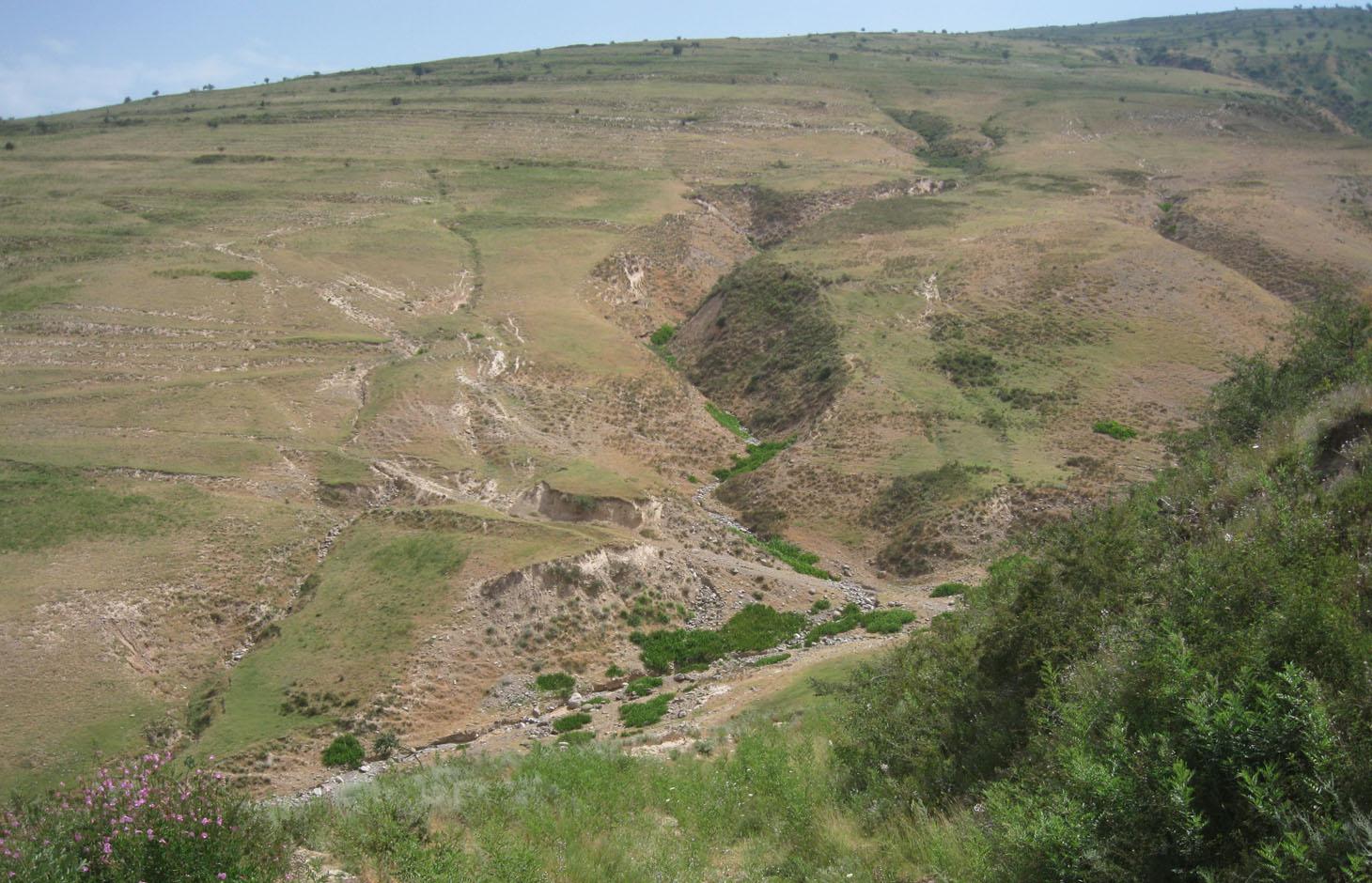
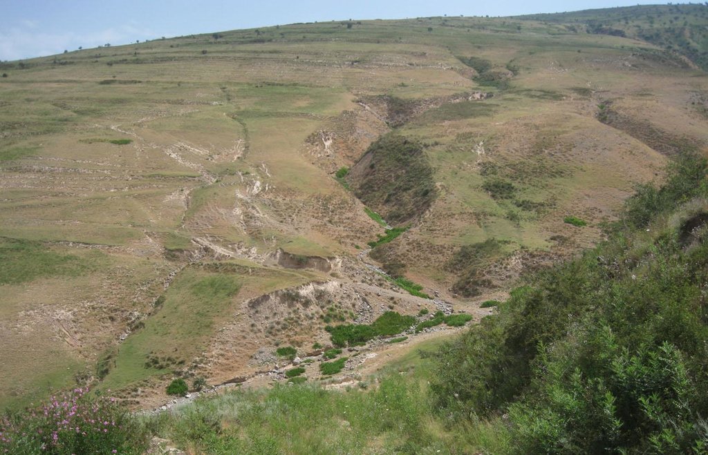
Degraded communal pastureland without grazing management and sufficient waterpoints
2.2 Description détaillée de la Technologie
Description:
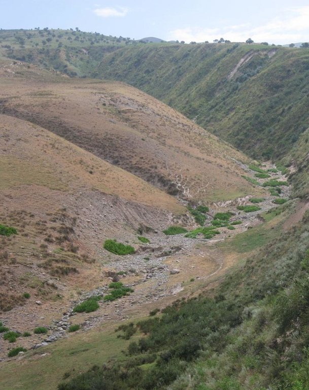
A communal pastureland of 150 -200 hectares is located at the foothill and the riverbank. Around 60 households let their livestock of totally 100 cows and some 400 sheep and goats graze there. The livestock is divided into three groups. Each group is meant to graze at different places in the pastureland. As there is no water point higher up in the pasture area, livestock graze near the village where a water point is installed. Due to this the riverbed, which is already poor in vegetation, is totally overgrazed. Every family is looking after a herd for a day every two month.
Purpose of the Technology: The aim is to install more water points higher up in the pastureland to decrease pressure on soil and vegetation cover by improving rotation within the pastureland. The whole land is overgrazed and livestock numbers are increasing, which is why controlled pasture management could be expected to decrease the degradation process. Nevertheless, more vegetation would be available for feeding livestock and the journey to the next water point shortened thus saving the heard’s energy. As nobody feels responsible for the pasture, nobody is responsible for pasture. No controlled grazing or rotation plan exists at Jamoat level. The farmers do not organise which parts have been grazed and could be grazed next. The livestock owners pay very small rent so they do not value the pastureland and no money is available to implement projects (like installing water points).
Establishment / maintenance activities and inputs: Each of the 60 households is paying 10-12 Somoni per year for grazing their cattle on the communal grazing land. Rent is paid per household not per amount of livestock. The total amount of pasture fees collect in Chukurak village is 600-700 Somoni per year. Neither establishment costs, nor investment or maintenance activities are done.
Natural / human environment: Pastureland extends from the village in the valley, to the foothills. Half of the grazing area is on the riverbed and fan with very poor vegetation cover. The foothills show a high percentage of overgrazed, trampled, eroded area. Except for the water point near the village, no water and shady points exist for resting livestock. Three small water sources existed before, two of them where covered by the floods in spring of the current year. The other source produces a negligible amount of drinking water. 60 households graze their livestock, which totals 100 cows and 400 small livestock. Every household is responsible to graze the herd one day every two month. Except that, no management exists between the families and Jamoat.
2.3 Photos de la Technologie
2.5 Pays/ région/ lieux où la Technologie a été appliquée et qui sont couverts par cette évaluation
Pays:
Tadjikistan
Région/ Etat/ Province:
Khatlon, Tajikistan
Autres spécifications du lieu:
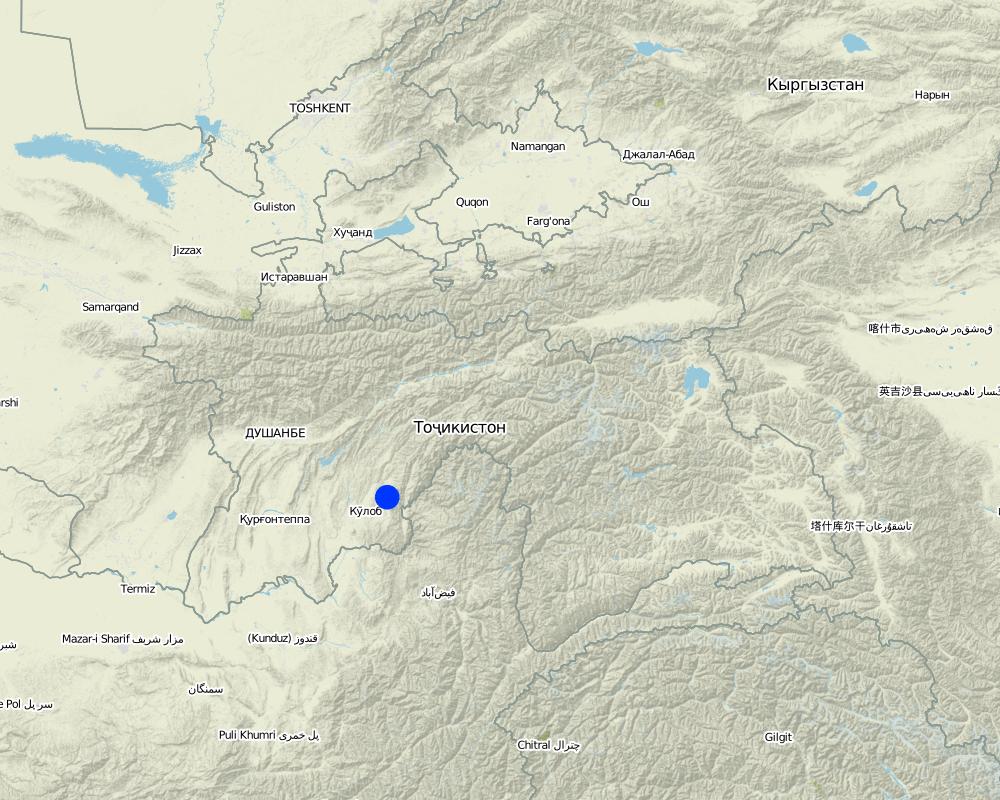
Muminabad
Map
×2.7 Introduction de la Technologie
Commentaires (type de projet, etc.) :
No technology is developed, 2.3.2 is hypothetical
3. Classification de la Technologie de GDT
3.1 Principal(aux) objectif(s) de la Technologie
- réduire, prévenir, restaurer les terres dégradées
- conserver/ améliorer la biodiversité
3.2 Type(s) actuel(s) d'utilisation des terres, là où la Technologie est appliquée

Pâturages
Pâturage extensif:
- Semi-nomadisme/ pastoralisme
Principales espèces animales et principaux produits:
Main animal species: Cow, sheep, goat
Commentaires:
Major land use problems (compiler’s opinion): Overgrazing, soil compaction, soil and gully erosion, increasing vegetation cover and hence lower resilience for disaster risks
Major land use problems (land users’ perception): Decreasing vegetation cover, increasing disaster risk, decreasing flood and drought resilience, rill and gully formation
No water acces in the upper part of the pastureland
Semi-nomadism / pastoralism: cow, sheep, goat
Grazingland comments: semi-nomadism within an delimited communal area, intensive pastoralism due to overgrazing
Area is of some 200 ha, but livestock is mostly in lower part of the area because of no available water in the higher zone
Type of grazing system comments: semi-nomadism within an delimited communal area, intensive pastoralism due to overgrazing
Area is of some 200 ha, but livestock is mostly in lower part of the area because of no available water in the higher zone
3.3 Informations complémentaires sur l'utilisation des terres
Approvisionnement en eau des terres sur lesquelles est appliquée la Technologie:
- pluvial
Nombre de période de croissance par an: :
- 1
Précisez:
Longest growing period in days: 180 Longest growing period from month to month: March-Sept
Densité d'élevage/ chargement (si pertinent):
> 100 LU /km2
3.4 Groupe de GDT auquel appartient la Technologie
- pastoralisme et gestion des pâturages
- Rotational grazing
3.5 Diffusion de la Technologie
Spécifiez la diffusion de la Technologie:
- répartie uniformément sur une zone
Si la Technologie est uniformément répartie sur une zone, indiquez la superficie couverte approximative:
- 1-10 km2
Commentaires:
Total area covered by the SLM Technology is 2 km2.
Between 150 - 200 ha
3.6 Mesures de GDT constituant la Technologie

modes de gestion
3.7 Principaux types de dégradation des terres traités par la Technologie
4. Spécifications techniques, activités, intrants et coûts de mise en œuvre
4.1 Dessin technique de la Technologie
4.2 Spécification/ explications techniques du dessin technique
Bare vegetation cover, no trees, soil erosion, trampled paths, rill building, no waterpoints are all calling for pasture management among the villages.
Location: Above Sarmaydon village, Chukurak watershed. Muminabad, Khatlon, Tajikistan
Technical knowledge required for field staff / advisors: moderate (For managed and controlled grazing)
Technical knowledge required for land users: low
Technical knowledge required for Ingineers: high (Waterpoint installation)
Main technical functions: improvement of ground cover, increase of infiltration, water harvesting / increase water supply
Secondary technical functions: control of dispersed runoff: impede / retard, control of concentrated runoff: impede / retard, improvement of surface structure (crusting, sealing), improvement of topsoil structure (compaction), stabilisation of soil (eg by tree roots against land slides), increase in organic matter, increase in nutrient availability (supply, recycling,…), increase / maintain water stored in soil, sediment retention / trapping, sediment harvesting
4.3 Informations générales sur le calcul des intrants et des coûts
autre/ monnaie nationale (précisez):
Somoni
Indiquer le taux de change du dollars en monnaie locale (si pertinent): 1 USD= :
4,83
Indiquez le coût salarial moyen de la main d'œuvre par jour:
5.00
4.8 Facteurs les plus importants affectant les coûts
Décrivez les facteurs les plus importants affectant les coûts :
Rehabilitation labour (regarding structural measures for DDR for riverbed stabilisation or trees planting) is more cost intensive than preventive measures as pasture management.
5. Environnement naturel et humain
5.1 Climat
Précipitations annuelles
- < 250 mm
- 251-500 mm
- 501-750 mm
- 751-1000 mm
- 1001-1500 mm
- 1501-2000 mm
- 2001-3000 mm
- 3001-4000 mm
- > 4000 mm
Spécifications/ commentaires sur les précipitations:
Totally 800 mm: 700mm in winter-spring, July-Sept dry season
Zone agro-climatique
- subhumide
Thermal climate class: temperate, LPG from end of March until September
5.2 Topographie
Pentes moyennes:
- plat (0-2 %)
- faible (3-5%)
- modéré (6-10%)
- onduleux (11-15%)
- vallonné (16-30%)
- raide (31-60%)
- très raide (>60%)
Reliefs:
- plateaux/ plaines
- crêtes
- flancs/ pentes de montagne
- flancs/ pentes de colline
- piémonts/ glacis (bas de pente)
- fonds de vallée/bas-fonds
Zones altitudinales:
- 0-100 m
- 101-500 m
- 501-1000 m
- 1001-1500 m
- 1501-2000 m
- 2001-2500 m
- 2501-3000 m
- 3001-4000 m
- > 4000 m
Commentaires et précisions supplémentaires sur la topographie:
Landforms: Footslopes (ranked 1, possible Technologies: riverbed protection, gabions, rotational grazing ) and hill slopes (ranked 2, possible Technologies: rotational grazing, trees planting)
Slopes on average: Hilly (ranked 1, hills between 18 and 28%), rolling (ranked 2, fan) and moderate (ranked 3, fan near settlements)
5.3 Sols
Profondeur moyenne du sol:
- très superficiel (0-20 cm)
- superficiel (21-50 cm)
- modérément profond (51-80 cm)
- profond (81-120 cm)
- très profond (>120 cm)
Texture du sol (de la couche arable):
- grossier/ léger (sablonneux)
Matière organique de la couche arable:
- faible (<1%)
Si disponible, joignez une description complète du sol ou précisez les informations disponibles, par ex., type de sol, pH/ acidité du sol, capacité d'échange cationique, azote, salinité, etc.
Soil fertility: Low
Soil drainage/infiltration: Poor
Soil water storage capacity: Very low
5.4 Disponibilité et qualité de l'eau
Profondeur estimée de l’eau dans le sol:
> 50 m
Disponibilité de l’eau de surface:
faible/ absente
Qualité de l’eau (non traitée):
eau inutilisable
Commentaires et précisions supplémentaires sur la qualité et la quantité d'eau:
Availability of surface water: Poor/none (in spring timemore water available)
5.5 Biodiversité
Diversité des espèces:
- faible
5.6 Caractéristiques des exploitants des terres appliquant la Technologie
Orientation du système de production:
- subsistance (auto-approvisionnement)
Revenus hors exploitation:
- moins de 10% de tous les revenus
Niveau relatif de richesse:
- moyen
Individus ou groupes:
- groupe/ communauté
Genre:
- hommes
Indiquez toute autre caractéristique pertinente des exploitants des terres:
Land users applying the Technology are mainly common / average land users
Population density: 100-200 persons/km2
Annual population growth: 1% - 2%
5.7 Superficie moyenne des terres détenues ou louées par les exploitants appliquant la Technologie
- < 0,5 ha
- 0,5-1 ha
- 1-2 ha
- 2-5 ha
- 5-15 ha
- 15-50 ha
- 50-100 ha
- 100-500 ha
- 500-1 000 ha
- 1 000-10 000 ha
- > 10 000 ha
Cette superficie est-elle considérée comme de petite, moyenne ou grande dimension (en se référant au contexte local)?
- petite dimension
Commentaires:
Around 3 ha, if 7.7 pers/household counted. In total 2350 ha pasture
5.8 Propriété foncière, droits d’utilisation des terres et de l'eau
Propriété foncière:
- communauté/ village
Droits d’utilisation des terres:
- loué
Droits d’utilisation de l’eau:
- communautaire (organisé)
Commentaires:
Land ownership is based on Land user certificates
5.9 Accès aux services et aux infrastructures
santé:
- pauvre
- modéré
- bonne
éducation:
- pauvre
- modéré
- bonne
assistance technique:
- pauvre
- modéré
- bonne
emploi (par ex. hors exploitation):
- pauvre
- modéré
- bonne
marchés:
- pauvre
- modéré
- bonne
énergie:
- pauvre
- modéré
- bonne
routes et transports:
- pauvre
- modéré
- bonne
eau potable et assainissement:
- pauvre
- modéré
- bonne
services financiers:
- pauvre
- modéré
- bonne
6. Impacts et conclusions
6.1 Impacts sur site que la Technologie a montrés
Impacts socio-économiques
Production
production animale
Commentaires/ spécifiez:
less forage available for livestock due to reduce vegetation cover
production de bois
Commentaires/ spécifiez:
important clear-cutting in the past
gestion des terres
Commentaires/ spécifiez:
no organizational task without pasture management
Disponibilité et qualité de l'eau
disponibilité de l'eau pour l'élevage
Commentaires/ spécifiez:
lack of water points for livestock
qualité de l'eau pour l'élevage
Commentaires/ spécifiez:
lack of water points for livestock
Revenus et coûts
dépenses pour les intrants agricoles
Commentaires/ spécifiez:
more fodder has to be bought, because grazing is insufficient
revenus agricoles
Commentaires/ spécifiez:
Less forage for livestock
charge de travail
Commentaires/ spécifiez:
no organizational task without pasture management
Impacts socioculturels
sécurité alimentaire/ autosuffisance
Commentaires/ spécifiez:
More difficult to feed livestock
Improved livelihoods and human well-being
Impacts écologiques
Cycle de l'eau/ ruissellement
ruissellement de surface
nappes phréatiques/ aquifères
Sols
humidité du sol
couverture du sol
encroûtement/ battance du sol
compaction du sol
matière organique du sol/ au dessous du sol C
Réduction des risques de catastrophe et des risques climatiques
vitesse du vent
6.2 Impacts hors site que la Technologie a montrés
inondations en aval
capacité tampon/de filtration
dommages sur les infrastructures publiques/ privées
6.3 Exposition et sensibilité de la Technologie aux changements progressifs et aux évènements extrêmes/catastrophes liés au climat (telles que perçues par les exploitants des terres)
Changements climatiques progressifs
Changements climatiques progressifs
| Saison | Type de changements/ extrêmes climatiques | Comment la Technologie fait-elle face à cela? | |
|---|---|---|---|
| températures annuelles | augmente | bien |
Extrêmes climatiques (catastrophes)
Catastrophes météorologiques
| Comment la Technologie fait-elle face à cela? | |
|---|---|
| pluie torrentielle locale | pas bien |
Catastrophes climatiques
| Comment la Technologie fait-elle face à cela? | |
|---|---|
| sécheresse | pas bien |
Catastrophes hydrologiques
| Comment la Technologie fait-elle face à cela? | |
|---|---|
| inondation générale (rivière) | pas bien |
Commentaires:
Improved vegetation cover, improved infiltration, slope stabilization and natural disaster resilience
Install water points higher up, rotate within the grazing land and less energy needed by livestock, which leads also to less overgrazing
6.7 Points forts/ avantages/ possibilités de la Technologie
| Points forts/ avantages/ possibilités du point de vue du compilateur ou d'une autre personne ressource clé |
|---|
|
Establish rotational grazing, which would not be expensive and does not require further equipment except of organizational tasks. How can they be sustained / enhanced? Empower communication and decision-making between the farmers by regular meetings or round tables on community level |
6.8 Faiblesses/ inconvénients/ risques de la Technologie et moyens de les surmonter
| Faiblesses/ inconvénients/ risques du point de vue du compilateur ou d'une autre personne ressource clé | Comment peuvent-ils être surmontés? |
|---|---|
| Importance of rotational grazing depends on Jamoat and farmers level | Strengthen communication between Jamoat and Farmer through consultancy, meetings etc. Farmers, as tenants, should also get a voice. |
| Pastureland rent is too cheap and it is not valued. There is no incentive to change, because nobody feels responsible for that area. | Increase the rent and discuss communally where the money should be spent (e.g. for water points). |
| Pasture management does not show benefits immediately, which makes it difficult to evidence good management. | Awareness raising and increasing knowledge of the short and long-term benefits. |
| Installation of water points is crucial, but very costly and hard work. | Awareness rising and find alternatives of investing in livestock. |
| Livestock number should decrease, but it is socioeconomically very important and demands a lot of time to change this attitude. |
Liens et modules
Développer tout Réduire toutLiens
Aucun lien
Modules
Aucun module trouvé


